Embed Size (px)
Citation preview

Geography 5 Photo Album
By Kevin glazer

OVERVIEW
• Trip One Photos
• Trip Two Photos
• In Transit Photos

Trip One Photo
Kevin Glazer
This is an image of Mormon Rocks. Mormon Rocks were created by movements from the San Andreas Fault. They are named Mormon Rocks because this site was a landmark for early Mormon settlers.

Trip One Photo
Kevin Glazer
This is a close up image of Mormon Rocks. In the image we are able to se that the rocks are made out of sandstone. The sandstone was formed from water that used to flow through the Cajon Pass area in Southern California. Geologist are able to see past events of history through the different layer of sandstone.

Trip One Photo
Kevin Glazer
This photo is showing a dry stream bed that used to flow through Mormon Rocks. This stream and its water levels can be seen through different layers of Mormon Rock.

Trip One Photo
Kevin Glazer
This is a photo of cinder Hill. It is a basaltic cinder cone type of volcanoe.

Trip One Photo
Kevin Glazer
This is an image of the lava flow at Cinder Hill. The lava flow is made up of stone and rock that becomes so hot it turns into liquid.
Trip One Photo
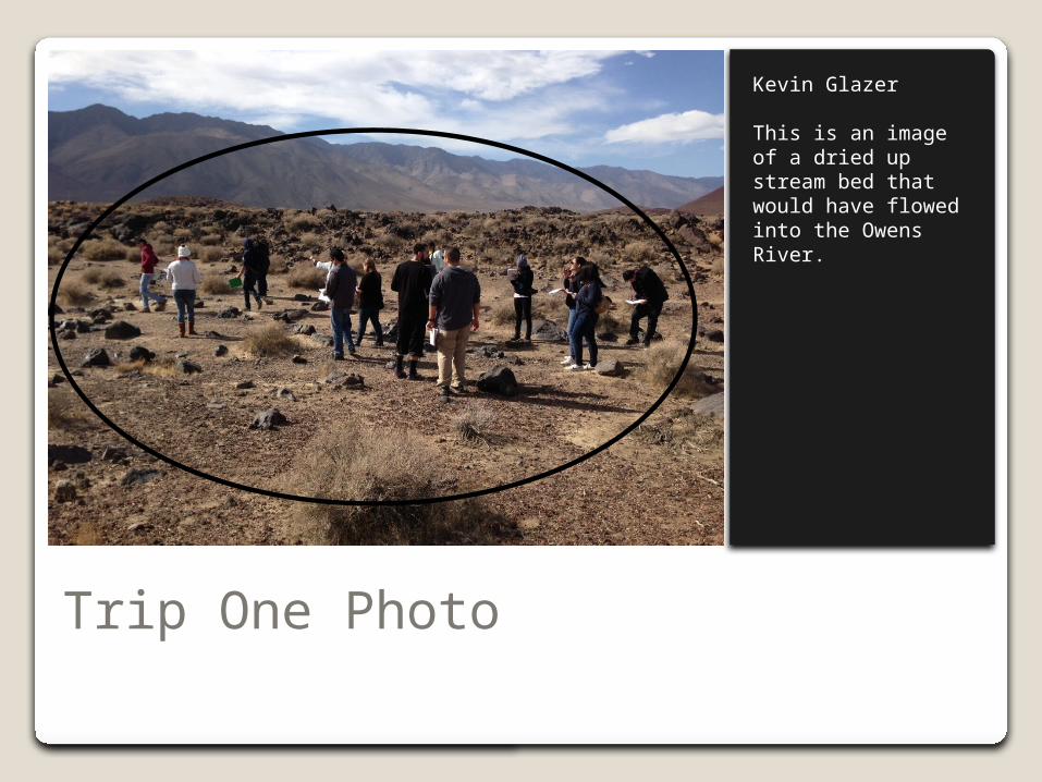
Kevin Glazer
This is an image of a dried up stream bed that would have flowed into the Owens River.

Trip One Photo
Kevin Glazer
This is an image of fossil falls. They were formed by snow melt from glaciers mixing with lava flow.

Trip One Photo
Kevin Glazer
This is an image of a metate hole. They were created by debris spinning in the mixture of the lava flow and stream bed.

Trip One Photo
Kevin Glazer
This is an image of obsidian flakes. Thousands of years ago Native Americans would use this obsidian which was created from volcanic ash to make arrow heads.

Trip One Photo
Kevin Glazer
This is an image of a petroglyph. It was created thousands of years ago from Native Americans who used to populate this area. It is a form of early artwork.

Trip One Photo
Kevin Glazer
This is an image of a house ring. A house ring is what is left of the Native Americans homes from thousands of years ago.

Trip Two Photos Begin

Trip Two Photo
Kevin Glazer
This photo is of Mt. Whitney. The Elevation of Mt. Whitney is 14,505 ft.

Trip Two Photo
Kevin Glazer
In this image the big circle is highlighting the Inyo-White Mountains. The smaller circle is highlighting some alluvial fans.
Trip Two Photo
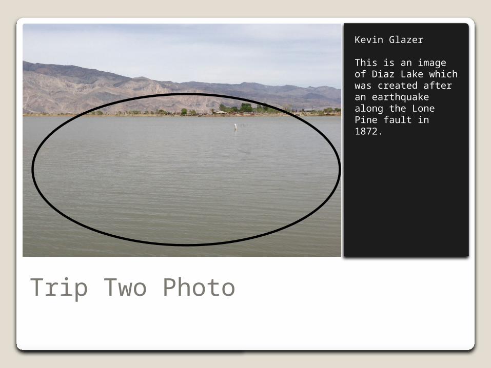
Kevin Glazer
This is an image of Diaz Lake which was created after an earthquake along the Lone Pine fault in 1872.

Trip Two Photo
Kevin Glazer
The Lone Pine fault was the product of a huge earthquake in 1872. 29 individuals were killed and Diaz Lake was formed.

Trip Two Photo
Kevin Glazer
The Keoughs Hot Springs are heated by underground volcanic activity.

Trip Two Photo
Kevin Glazer
This is an image of the Mammoth rest area. The dead forest was created by bark beetles.
Trip Two Photo
Kevin Glazer
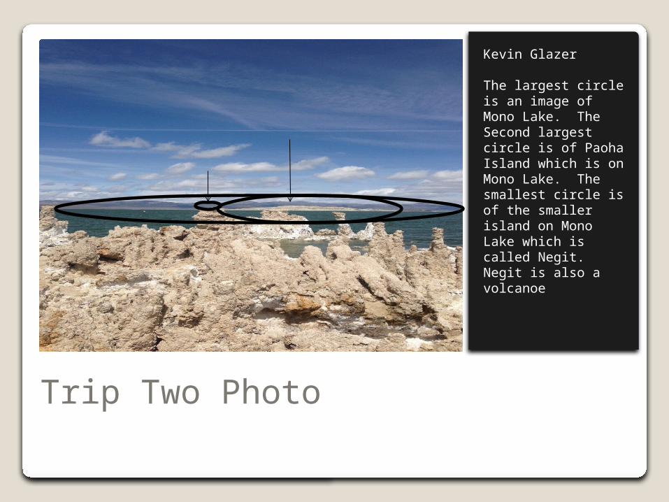
The largest circle is an image of Mono Lake. The Second largest circle is of Paoha Island which is on Mono Lake. The smallest circle is of the smaller island on Mono Lake which is called Negit. Negit is also a volcanoe

Trip Two Photo
Kevin Glazer
Mono Lake is the oldest lake in North America. The arrows are pointing to the former shorelines of Mono Lake. The lake was diminished greatly by the city of Los Angeles after they extended the aqueduct from Owens Lake to Mono Lake.

Trip Two Photo
Kevin Glazer
This is an image of a tufa formation. It is formed by freshwater mixing with the salt water producing calcium.

Trip Two Photo
Kevin Glazer
The large circle is highlighting Grant Lake. The two smaller circles are highlighting the mormaines.

Trip Two Photo
Kevin Glazer
Silver Lake and the frozen waterfall.

Trip Two Photo
Kevin Glazer
Convict lake. The two arrows at the top are pointing out the two lateral moraines while the bottom arrow is pointing out the terminal moraine. The rectangle is showing the oldest rock formations of the Sierras.
Trip Two Photo
Kevin Glazer
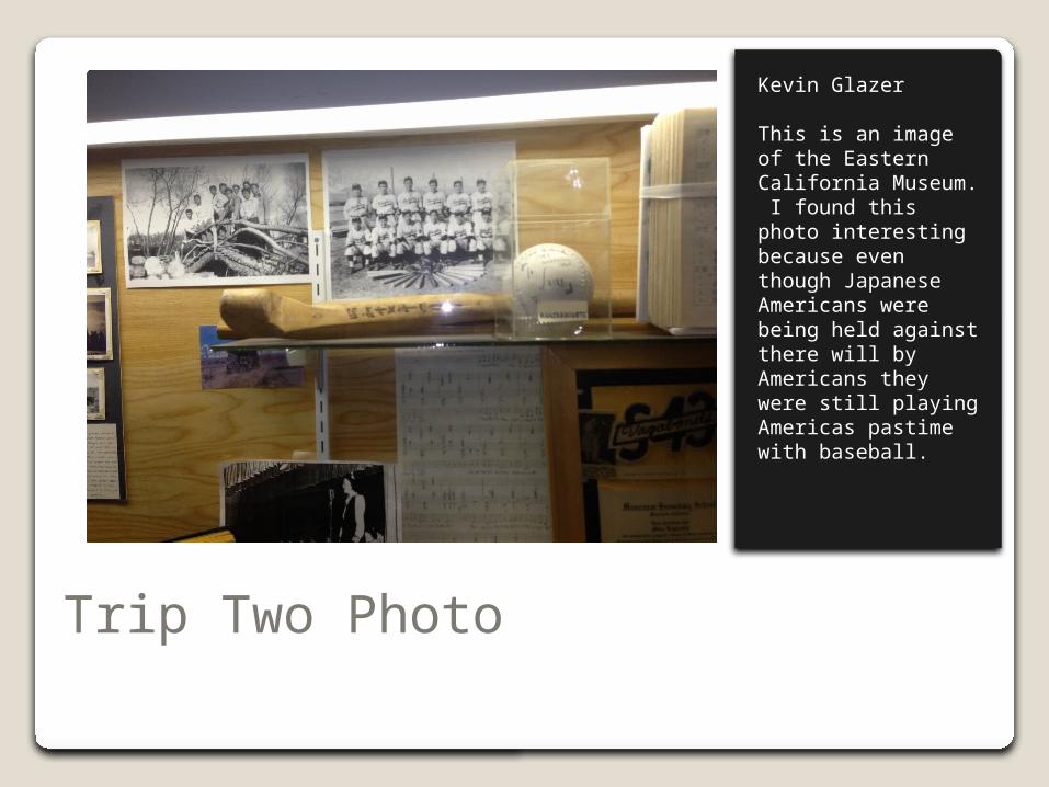
This is an image of the Eastern California Museum. I found this photo interesting because even though Japanese Americans were being held against there will by Americans they were still playing Americas pastime with baseball.

Trip Two Photo
Kevin Glazer
This is an image of a guard shack at Manzanar. Manzanar was a holding place for Japanese Americans during WW2.

In Transit Photos

In Transit Photo
Kevin Glazer
This is an image of

In Transit Photo
Kevin Glazer
Doppler Tower

In Transit Photo
Kevin Glazer
Mine tailings

In Transit Photo
Kevin Glazer
Garlock Fault is the second largest fault in Southern California.
In Transit Photo
Kevin Glazer
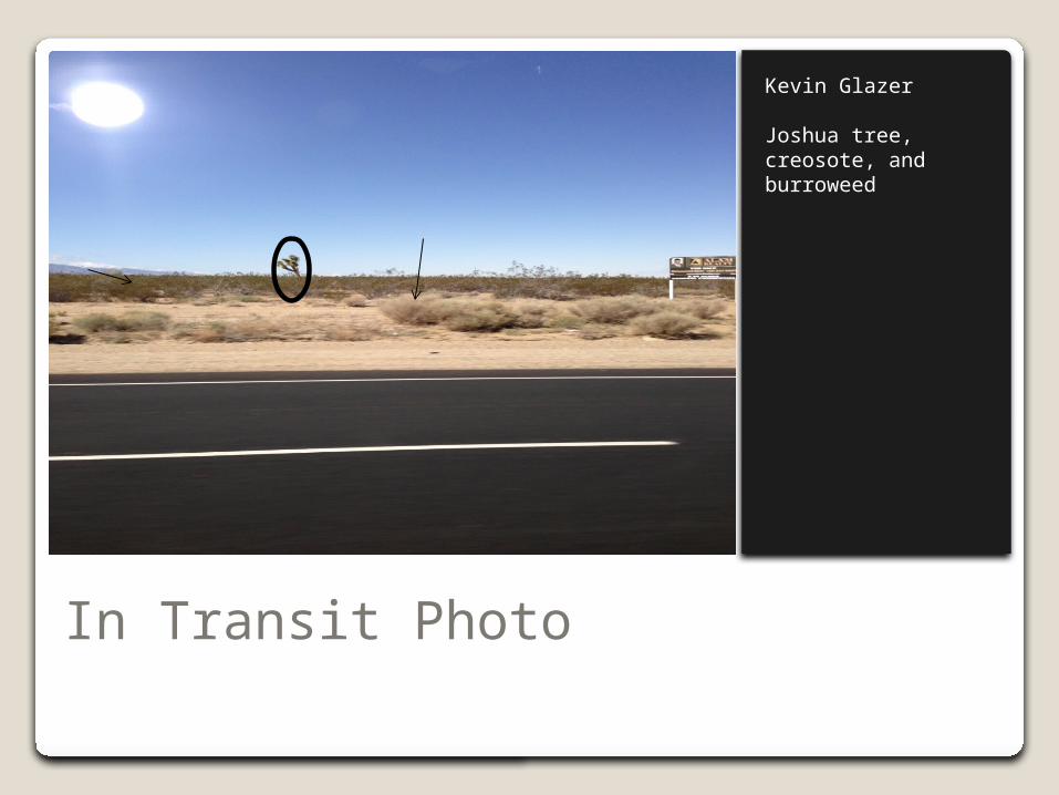
Joshua tree, creosote, and burroweed

In Transit Photo
Kevin Glazer
Los Angeles Aqueduct