Embed Size (px)
Citation preview

Geography
Basic vocabulary
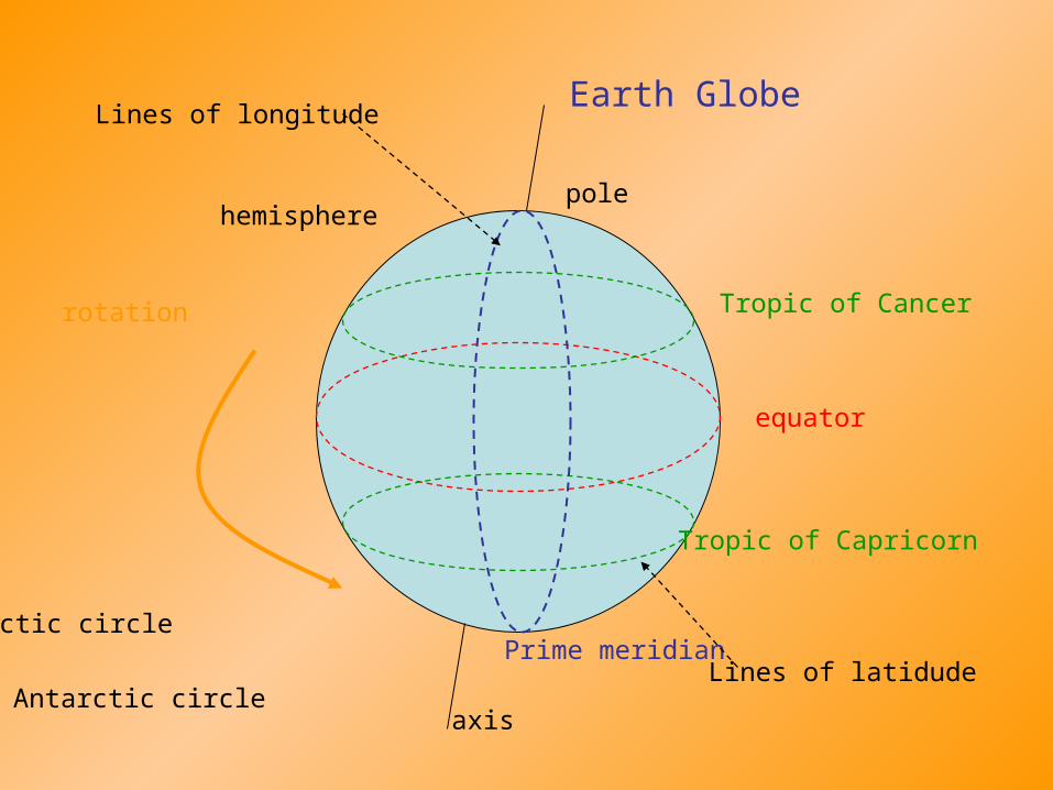
Earth Globe
axis
equator
hemispherepole
Tropic of Cancer
Tropic of Capricorn
Prime meridian
rotation
Arctic circle
Antarctic circle
Lines of longitude
Lines of latidude

earth´s crust
magma
surface

Cardinal points
North
South
EastWest
compassGPS
navigation
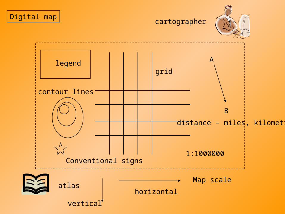
Digital map
legendgrid
Conventional signs
cartographer
Map scale
1:1000000
atlas
A
B
distance – miles, kilometres
contour lines
vertical
horizontal
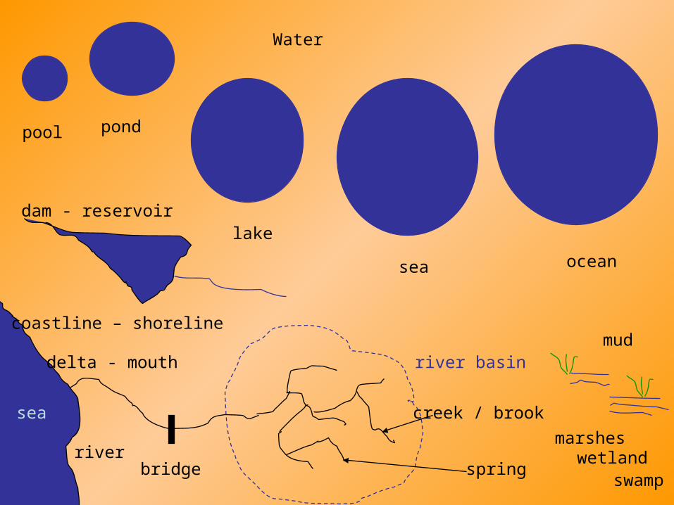
Water
pond
lake
sea ocean
creek / brook
river
river basin
spring
sea
bridge
coastline – shoreline
marshes
delta - mouth
dam - reservoir
mud
wetland
pool
swamp
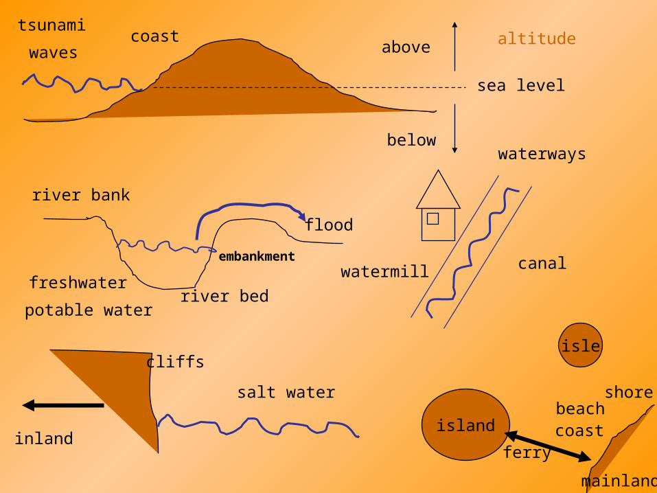
sea level
coast
below
waves above
river bed
river bank
flood
canal
cliffs
island
isle
mainland
coast
shorebeach
waterways
watermill
tsunami
freshwater
salt water
potable water
embankment
ferryinland
altitude
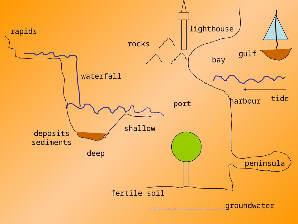
waterfall
bay
harbour
gulf
port
deep
shallow
rapids
groundwater
lighthouse
rocks
peninsula
tide
depositssediments
fertile soil

mountainspeak - summithighland - upland
active/extinct volcano
valley floor
mountain range
eruption
lava
cave
ruins, remains of
canyon
coniferous
deciduous
mixed forest - woodsfoodpath
erosion
lowland - flat
hills - hilly
mountain slope
national park
woodland
crater
horizon
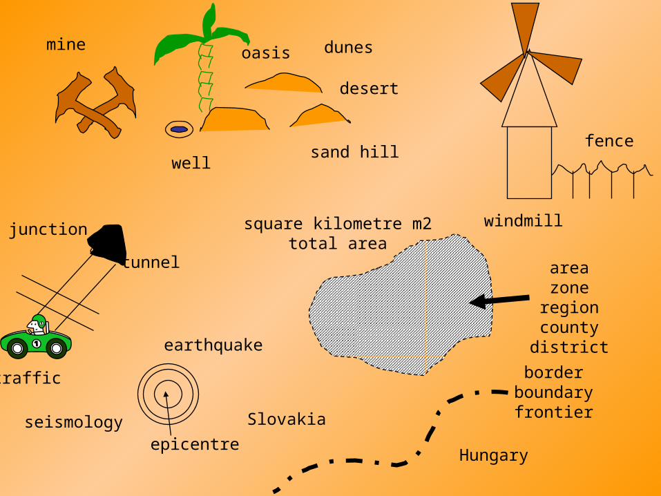
mine
desert
dunesoasis
well
windmill
tunnel
sand hill
areazone
regioncountydistrict
square kilometre m2total area
earthquake
seismology
fence
Slovakia
Hungary
borderboundaryfrontier
junction
traffic
epicentre
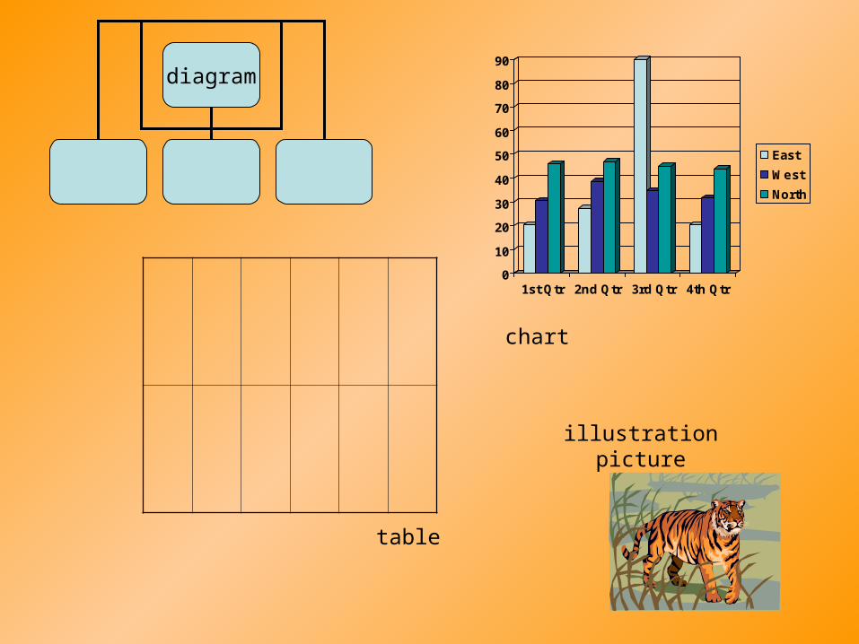
diagram
0
10
20
30
40
50
60
70
80
90
1st Qtr 2nd Qtr 3rd Qtr 4th Qtr
East
West
North
chart
table
illustrationpicture
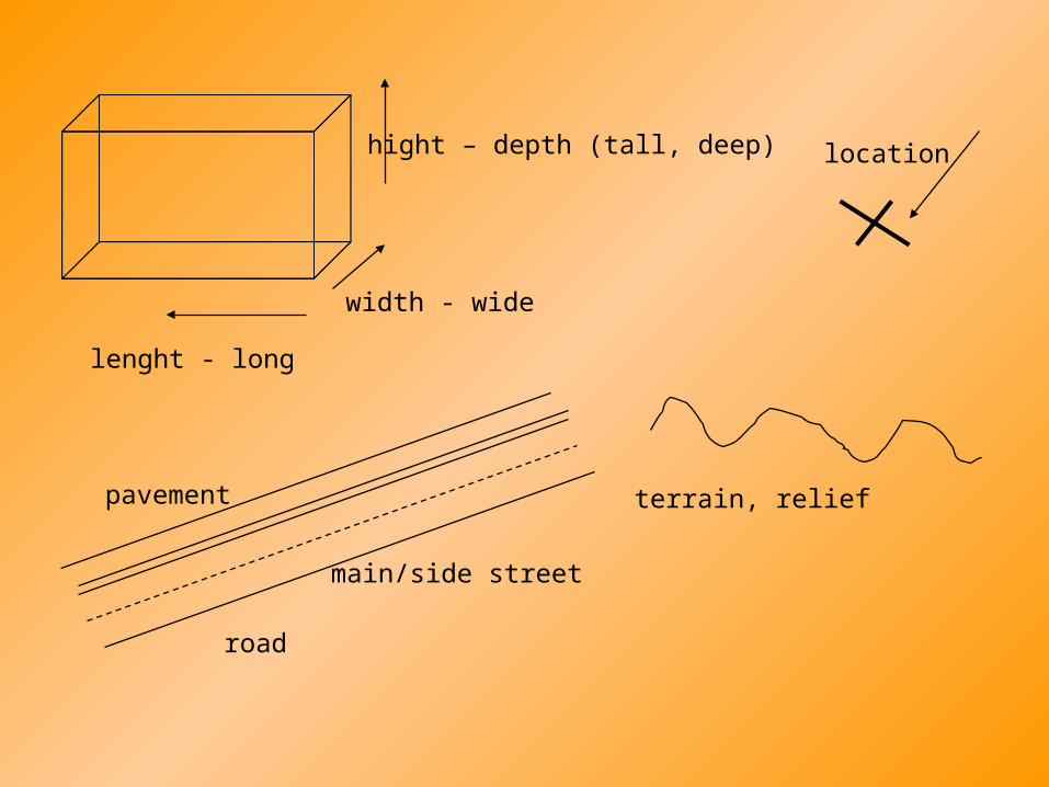
lenght - long
width - wide
hight – depth (tall, deep) location
pavement
road
main/side street
terrain, relief

cape
glacier
geyser
iceberg
fjordlagoon
strait
estuary
cove

This is the End my Friend