Embed Size (px)
Citation preview

General Certificate of EducationAdvanced Subsidiary ExaminationJanuary 2010
Geography GEOG1Unit 1 Physical and Human Geography
Thursday X January 2011 9.00 am to 10.30 am
For this paper you must have:• an Ordnance Survey Map Extract (enclosed).
Time allowedl 1 hour 30 minutes
Instructionsl Use black ink or black ball-point pen.l Fill in the boxes at the top of this page.l Answer all questions.l You must answer the questions in the spaces provided. Do not write
outside the box around each page or on blank pages.l Do all rough work in this book. Cross through any work you do not want
to be marked.
Informationl The marks for questions are shown in brackets.l The maximum mark for this paper is XX. Three of these marks are for the Quality of Written Communication.l You will be marked on your ability to: – use good English – organise information clearly – use specialist vocabulary where appropriate.
Advicel You are advised to spend about 30 minutes answering Section 1.
Centre Number Candidate Number
Surname
Other Names
Candidate Signature
GEOG1M/J12345 6/(JaN11GEOG101)
General Certificate of Secondary EducationFoundation TierJune 2010
Geography 40352F(Specification B)Paper 2: Hostile World FThursday 17 June 2010 1.30 pm to 2.30 pm
For this paper you must have:• the insert (enclosed).You may use a calculator.
Time allowed• 1 hour
Instructions• Use black ink or black ball-point pen. You may use pencil for maps,
diagrams and graphs.• Fill in the boxes at the top of this page.• Answer either Section A or Section B.• You must answer the questions in the spaces provided. Do not write
outside the box around each page or on blank pages.• Do all rough work in this book. Cross through any work you do not want
to be marked.• Use your case studies to support your answers where appropriate.
Information• The marks for questions are shown in brackets.• The maximum mark for this paper is 50.• You are reminded of the need for good English and clear presentation in
your answers. Where applicable, questions should be answered in continuous prose. Quality of Written Communication will be assessed in all answers.
Centre Number Candidate Number
Surname
Other Names
Candidate Signature
40352FM/40352F 6/6/6/(JUN1040352F01)
For Examiner’s Use
Examiner’s Initials
Question Mark
1
2
3
4
5
6
TOTAL

2 Do not write outside the
box
M/40352F(2)(02)
Section A – Living with Natural Hazards
Answer either Section A or Section B.
Use your case studies to support your answers where appropriate.
Total for this question: 19 marks
1 (a) Study Figure 1. Figure 1 shows the percentage of earthquakes that occurred in states of the USA (1974–2008).
Figure 1
0
20
40
60
10
30
50
Alaska
Califor
nia
Hawaii
Nevad
a
Washin
gton
Idaho
Wyo
ming
Montan
aUtah
Oregon
Others
State
Percentage
1 (a) (i) Complete Figure 1. Use the information below.
California = 24%(1 mark)
1 (a) (ii) What percentage of the earthquakes occurred in Hawaii?
Circle the correct answer.
5% 7% 15%(1 mark)

3 Do not write outside the
box
M/40352F
Turn over
s
(3)(03)
1 (b) Study Figure 2, on the insert. Figure 2 shows information about earthquakes and volcanic eruptions in Alaska, USA.
1 (b) (i) Using Figure 2, complete the paragraph below which describes the distribution of earthquakes and volcanoes in Alaska.
Choose the three correct words from the list below.
wide northwest islands
narrow southwest lakes
Many of the earthquakes and volcanoes are found on and around the
.................................. in the .................................. of Alaska. Most earthquakes and
volcanoes lie in a long .................................. belt, running from Anchorage out into the
Bering Sea.(3 marks)
1 (b) (ii) Using Figure 2, give two effects of the Alaskan volcanic eruptions.
1 .........................................................................................................................................
............................................................................................................................................
2 .........................................................................................................................................
............................................................................................................................................(2 marks)
Question 1 continues on the next page

4 Do not write outside the
box
M/40352F(4)(04)
1 (b) (iii) Explain why either earthquakes or volcanic eruptions occur in Alaska.
Use Figure 2 and your own knowledge.
............................................................................................................................................
............................................................................................................................................
............................................................................................................................................
............................................................................................................................................
............................................................................................................................................
............................................................................................................................................
............................................................................................................................................
............................................................................................................................................
............................................................................................................................................
............................................................................................................................................(5 marks)
Extra space ........................................................................................................................
............................................................................................................................................
............................................................................................................................................
............................................................................................................................................
............................................................................................................................................
1 (c) Describe ways in which the damaging effects of either earthquakes or volcanic eruptions may be reduced.
............................................................................................................................................
............................................................................................................................................
............................................................................................................................................
............................................................................................................................................
............................................................................................................................................
............................................................................................................................................
............................................................................................................................................

5 Do not write outside the
box
M/40352F
Turn over
s
(5)
19
(05)
............................................................................................................................................
............................................................................................................................................
............................................................................................................................................(5 marks)
Extra space ........................................................................................................................
............................................................................................................................................
............................................................................................................................................
............................................................................................................................................
............................................................................................................................................
1 (d) People continue to live in areas at risk from earthquakes.
Which two of the following statements help to explain this?
Tick the two correct boxes.
People cannot afford to move away.
People will have plenty of time to evacuate if an earthquake strikes. Many buildings are designed to absorb shockwaves.
People believe that their lives are in danger.
(2 marks)
Turn over for the next question

6 Do not write outside the
box
M/40352F(6)(06)
Total for this question: 19 marks
2 (a) Study Figure 3.
Figure 3
Equator
Tropic ofCancer
Tropic ofCapricorn
A
B
C D
E
In which two areas (A, B, C, D and E) are tropical storms common?
Tick the two correct boxes.
A
B
C
D
E
(2 marks)

7 Do not write outside the
box
M/40352F
Turn over
s
(7)(07)
2 (b) Study Figure 4, on the insert. Figure 4 shows the path of a tropical storm.
The statements below show the life cycle of a tropical storm.
The letters A, B, C and D on Figure 4 show four stages in that life cycle.
Write the correct letter next to each statement.
Statement Letter
with sea surface temperatures over 27 °C, warm air rises and starts to spinthunderstorms begin to form
when the tropical storm moves over land, it loses its source of energy and weakenswhen the tropical storm moves over the ocean, it picks up more warm moist air and it grows in size
(3 marks)
Question 2 continues on the next page

8 Do not write outside the
box
M/40352F(8)(08)
2 (c) Study Figure 5, a map to show the predicted path of a tropical storm (Hurricane Katrina) in 2005.
Figure 5
FL
GAAL
MS
LATX
OK
KS
NE IA
MO
AR
SC
NC
VAWV
PA
NY
NJOH
KY
TN
MI
Mexico
Cuba
IN
IL
WI
100 W
25 N
30 N
35 N
40 N
95 W 90 W 85 W 80 W 75 W
NEKSOKTXIA
MOARLAWIILTNMSMI
State names
Key
NebraskaKansasOklahomaTexasIowaMissouriArkansasLouisianaWisconsinIllinoisTennesseeMississippiMichigan
Position of the hurricaneon 26 August 2005
Predicted positions andwind speeds
Wind speedmore than 117 kphWind speed63 – 117 kphWind speedless than 63 kph
3 day predicted path
INKYALOHWVVANCSCGAFLNYPANJ
IndianaKentuckyAlabamaOhioWest VirginiaVirginiaNorth CarolinaSouth CarolinaGeorgiaFloridaNew YorkPennsylvaniaNew Jersey
0 400 km
N
5 day predicted path
New Orleans
2 (c) (i) Complete the sentences below.
Circle the correct answer in each set of brackets.
At 11 pm on 26 August 2005, the centre of Hurricane Katrina was to the
[ north / south / east ] of Cuba, at latitude [ 14 / 24 / 34 ] degrees north. The longitude
was 83 degrees west. In the three days after 26 August, the centre of Hurricane Katrina
could pass over [ Mississippi (MS) / Tennessee (TN) / Kansas (KS) ].(3 marks)

9 Do not write outside the
box
M/40352F
Turn over
s
(9)(09)
2 (c) (ii) What is expected to happen to the wind strength when the tropical storm reaches Ohio (OH)?
............................................................................................................................................
............................................................................................................................................(1 mark)
2 (c) (iii) Do you think that the people living in Texas (TX) should evacuate their homes?
Give a reason(s) for your answer.
Yes No
............................................................................................................................................
............................................................................................................................................
............................................................................................................................................
............................................................................................................................................(2 marks)
2 (d) Study Figure 6, some methods of preparing for a tropical storm.
Figure 6
• Listen to the radio• Protect your home• Have a family action plan• Get an emergency kit
Suggest how two of these methods help people prepare for a tropical storm.
Chosen method .................................................................................................................
...........................................................................................................................................
............................................................................................................................................
Chosen method .................................................................................................................
...........................................................................................................................................
............................................................................................................................................(2 marks)
Question 2 continues on the next page

10 Do not write outside the
box
M/40352F(10)(10)
2 (e) Study Figure 7. Figure 7 shows information about changes to the number of tropical storms.
Figure 7
The views of two scientists
Changes to the number of tropical storms
Changes in the percentages of severe tropical storms, 1975 – 1989 and 1990 – 2004
0
South Indian Ocean1990 – 2004North Indian Ocean
Southwestern Pacific Ocean
North Atlantic Ocean
West Pacific Ocean
East Pacific Ocean10 20
Percentage
Key
30 40 50
1975 – 1989
Computer models predict that in 70 years’ time, there will be fewer tropical storms.
Records of tropical storms before 1900 are unreliable.
1900 1915 1935 1955Year
Pacific Ocean
1975 1995
Aboveaveragenumber oftropicalstorms
Key
Belowaveragenumber oftropicalstorms
Atlantic Ocean
11 Do not write outside the
box
M/40352F
Turn over
s
(11)(11)
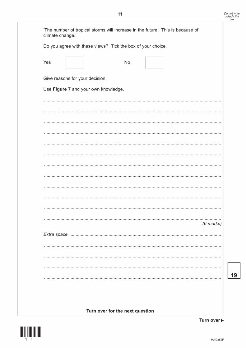
‘The number of tropical storms will increase in the future. This is because of climate change.’
Do you agree with these views? Tick the box of your choice.
Yes No
Give reasons for your decision.
Use Figure 7 and your own knowledge.
............................................................................................................................................
............................................................................................................................................
............................................................................................................................................
............................................................................................................................................
............................................................................................................................................
............................................................................................................................................
............................................................................................................................................
............................................................................................................................................
............................................................................................................................................
............................................................................................................................................
............................................................................................................................................
............................................................................................................................................(6 marks)
Extra space ........................................................................................................................
............................................................................................................................................
............................................................................................................................................
............................................................................................................................................
............................................................................................................................................
Turn over for the next question
19

12 Do not write outside the
box
M/40352F(12)
Total for this question: 12 marks
3 (a) Study Figure 8, information about wildfires, vegetation and climate in Australia.
Figure 8
Tropic ofCapricorn
1
Areas of wildfires, 1997 – 2007State boundary
Prevailing winddirection duringthe wildfire season
Desert
Grassland
Dry grassland
Other vegetation
1States:
Western Australia2 Northern Territory3 Queensland
5 New South Wales6 Victoria7 Tasmania
4 South Australia
2X
4
Key Key
Graph A Graph B
3
5
6
7
N N
0 300 600 km 0 300 600 km
0 J F M A M J J A S O N D
50
100
150
200
250
300
Precipitation(mm)
Temperature(°C)
350
0
5
10
15
20
25
30
35
400
450
40
45
0 J F M A M J J A S O N D
50
100
150
200
250
300
Precipitation(mm)
Temperature(°C)
350
0
5
10
15
20
25
30
35
400
450
40
45

13 Do not write outside the
box
M/40352F
Turn over
s
(13)
3 (a) (i) Study Figure 8.
Which of the graphs (A or B) shows the climate at the place marked X on the map?
Tick the correct box.
Graph A
Graph B
(1 mark)
3 (a) (ii) Which of the following is a state in Australia where wildfires are common?
Tick the correct box.
South Australia
Northern Territory
Tasmania
(1 mark)
3 (a) (iii) Use Figure 8 to decide which two of the following statements are correct.
Tick the two correct boxes.
All areas of wildfires are above the Tropic of Capricorn.
Most wildfires occur in northern Australia.
Most wildfires occur in southern Australia.
Tasmania has few wildfires.
(2 marks)
Question 3 continues on the next page

14 Do not write outside the
box
M/40352F(14)
3 (a) (iv) With the help of Figure 8, suggest why place X is at risk from wildfires.
............................................................................................................................................
............................................................................................................................................
............................................................................................................................................
............................................................................................................................................
............................................................................................................................................
............................................................................................................................................
............................................................................................................................................
............................................................................................................................................(4 marks)
3 (b) Study Figure 9, information about wildfires in western USA.
Figure 9
1990 1995 20000
100
200
50
150
250
300
1985Year
Lengthof wildfireseason(numberof days)
2005
Year
WildfiresTemperatureKey:
1990 1995 20000
100
5014
15
16150
1985
Number ofwildfires
Spring – summertemperatures
(°C)
2005

15 Do not write outside the
box
M/40352F
Turn over
s
(15)
12
3 (b) (i) What was the length of the wildfire season in 2005?
Circle the correct answer.
150 days 200 days 250 days(1 mark)
3 (b) (ii) Suggest the connection between spring – summer temperatures and the number of wildfires.
............................................................................................................................................
............................................................................................................................................(1 mark)
3 (c) The cost of damage from wildfires is increasing.
Give two reasons why.
1 .........................................................................................................................................
............................................................................................................................................
2 .........................................................................................................................................
............................................................................................................................................(2 marks)
End of Section A

16 Do not write outside the
box
M/40352F(16)
Section B – The Challenge of Extreme Environments
Answer either Section A or Section B.
Use your case studies to support your answers where appropriate.
Total for this question: 19 marks
4 (a) Study Figure 10, a climate graph for Prudhoe Bay in Alaska.
Figure 10
A J A0
5
15
25
10
20
30
–35
–25
–15
–5
5
–30
–20
–10
0
10
15
20
25
FMonth
Precipitation(mm)
Temperature(°C)
O DM M JJ S N

17 Do not write outside the
box
M/40352F
Turn over
s
(17)
4 (a) (i) Complete Figure 10. Use the information below.
April precipitation = 2.5 mm(1 mark)
4 (a) (ii) What was the average temperature in March?
Circle the correct answer.
–26°C 0°C 6°C(1 mark)
Question 4 continues on the next page

18 Do not write outside the
box
M/40352F(18)
4 (b) Study Figure 11, on the insert, which shows information about Alaska.
4 (b) (i) The paragraph below gives information about the oil industry in Alaska.
Complete the paragraph by choosing the three correct words from the list.
tanker Anchorage south
pipeline Prudhoe Bay north
The main oil fields are in the area close to .................................. . The oil is
transported by .................................. to Valdez, which lies 1242 kilometres to
the .................................. .(3 marks)
4 (b) (ii) Describe the effects of the oil industry on the people and the environment of Alaska.
Use Figure 11 and your own knowledge.
............................................................................................................................................
............................................................................................................................................
............................................................................................................................................
............................................................................................................................................
............................................................................................................................................
............................................................................................................................................
............................................................................................................................................
............................................................................................................................................
............................................................................................................................................
............................................................................................................................................(5 marks)
Extra space ........................................................................................................................
............................................................................................................................................
............................................................................................................................................
............................................................................................................................................
............................................................................................................................................

19 Do not write outside the
box
M/40352F
Turn over
s
(19)
4 (c) Study Figure 12 on the insert.
Give two threats to the environment of Antarctica.
1 .........................................................................................................................................
............................................................................................................................................
2 .........................................................................................................................................
............................................................................................................................................(2 marks)
4 (d) Which two of the following statements are reasons why people should protect a cold environment such as Antarctica?
Tick the two correct boxes.
Very few people live in Antarctica.
Antarctica is valuable for scientific research.
Antarctica contains few species of land animals.
Antarctica is the last great wilderness left on earth.
(2 marks)
Question 4 continues on the next page

20 Do not write outside the
box
M/40352F(20)
4 (e) People can have damaging effects on cold environments.
Describe ways in which the damaging effects may be reduced.
............................................................................................................................................
............................................................................................................................................
............................................................................................................................................
............................................................................................................................................
............................................................................................................................................
............................................................................................................................................
............................................................................................................................................
............................................................................................................................................
............................................................................................................................................
............................................................................................................................................(5 marks)
Extra space ........................................................................................................................
............................................................................................................................................
............................................................................................................................................
............................................................................................................................................
............................................................................................................................................ 19

21 Do not write outside the
box
M/40352F
Turn over
s
(21)
Total for this question: 19 marks
5 (a) Study Figure 13.
Figure 13
Equator
Tropic ofCancer
Tropic ofCapricorn
A
B
C
D
E
In which two areas (A, B, C, D and E) are tropical rainforests found?
Tick the two correct boxes.
A
B
C
D
E
(2 marks)
Question 5 continues on the next page

22 Do not write outside the
box
M/40352F(22)
5 (b) Study Figure 14 which shows the daily pattern of weather in an area of tropical rainforest.
Figure 14
A B
D C
The statements below show the daily pattern of weather in an area of tropical rainforest.
Write the correct letter (A, B, C or D) next to each statement.
Statement Letter
Towering black clouds form. Thunderstorms bring heavy rainfall.At 9 am, temperatures are as high as 25 °C. The air near the ground heats up.More and more hot air rises and cools. It condenses and forms thick cloud.The sun is directly overhead and temperatures are over 30 °C. The hot air rises in convection currents.
(3 marks)

23 Do not write outside the
box
M/40352F
Turn over
s
(23)
5 (c) Study Figure 15, on the insert, information about deforestation in Borneo, an island in south east Asia.
5 (c) (i) Complete the sentences below.
Circle the correct answer in each set of brackets.
In 1950 [ all / none / most ] of Borneo was covered with tropical rainforest.
By 1985 most of the [ north coast / east coast / central region ] had been deforested.(2 marks)
5 (c) (ii) What percentage of Borneo had been deforested by 2005?
....................................... %(1 mark)
5 (c) (iii) What is expected to happen to the amount of tropical rainforest in Borneo by 2020?
............................................................................................................................................
............................................................................................................................................(1 mark)
5 (c) (iv) Deforestation has taken place on the steep slopes to the north of the area shown as X on Figure 15.
Suggest how this deforestation might affect area X.
............................................................................................................................................
............................................................................................................................................
............................................................................................................................................
............................................................................................................................................(2 marks)
Question 5 continues on the next page

24 Do not write outside the
box
M/40352F(24)
5 (d) Study Figure 16, some methods of reducing problems in the tropical rainforest environment.
Figure 16
• Reforestation• Conservation schemes• Ecotourism• Ethical shopping
Choose two of the methods shown in Figure 16.
For each method, suggest one way it might help to reduce problems in the tropical rainforest environment.
Chosen method .................................................................................................................
............................................................................................................................................
............................................................................................................................................
Chosen method .................................................................................................................
............................................................................................................................................
............................................................................................................................................(2 marks)

25 Do not write outside the
box
M/40352F
Turn over
s
(25)
Question 5 continues on the next page
DO NOT WrITE ON THIS PAGEANSWEr IN THE SPACES PrOvIDED

26 Do not write outside the
box
M/40352F(26)
5 (e) Study Figure 17 which shows information about deforestation and development in a region of Borneo.
Figure 17
The habitat of many rarespecies, including orang-utan,
is being destroyed.
We are the Penan people.We are being driven from
our homes in the rainforest.
86% of the cleared landis used to grow a singlecrop – oil palm. This isgrown on government
run farms.
We have no choice.We need land to growfood for our families.
We have made moneyby selling timber abroad.
In 1990, 21% ofhouseholds lived in poverty,
by 2002 it was 7%.
In 1990 the GNI was$1900 per person, by2002 it was $7500.

27 Do not write outside the
box
M/40352F
Turn over
s
(27)
‘Tropical rainforest environments should be protected at any cost.’
Do you agree with this view? Tick the box of your choice.
Yes No
Give reasons for your decision.
Use Figure 17 and your own knowledge.
............................................................................................................................................
............................................................................................................................................
............................................................................................................................................
............................................................................................................................................
............................................................................................................................................
............................................................................................................................................
............................................................................................................................................
............................................................................................................................................
............................................................................................................................................
............................................................................................................................................
............................................................................................................................................
............................................................................................................................................(6 marks)
Extra space ........................................................................................................................
............................................................................................................................................
............................................................................................................................................
............................................................................................................................................
............................................................................................................................................
Turn over for the next question
19

28 Do not write outside the
box
M/40352F(28)
Total for this question: 12 marks
6 (a) Study Figure 18 which shows some areas of the world at risk from desertification.
Figure 18
Equator
Tropic ofCancer
Asia
Europe
Australasia
Antarctica
PacificOcean
PacificOcean
AtlanticOcean
IndianOcean
SouthAmerica
NorthAmerica
Tropic ofCapricorn
Graph A
0J
Graph B
F M A M J J A S O N D
Temperature(°C)
Precipitation(mm)
50100150200250300350
05101520253035
0J F M A M J J A S O N D
Temperature(°C)
Precipitation(mm)
50100150200250300350
05101520253035
KeyVery high riskHigh riskHot desert
Africa
Sahara

29 Do not write outside the
box
M/40352F
Turn over
s
(29)
6 (a) (i) Which of the graphs in Figure 18 (A or B) shows the climate at the place shown as X?
Tick the correct box.
Graph A
Graph B
(1 mark)
6 (a) (ii) Which continent has the greatest area with a very high risk of desertification?
............................................................................................................................................(1 mark)
6 (a) (iii) Use Figure 18 to decide which two of the following statements are correct.
Tick the two correct boxes.
There are no areas in Europe with a very high risk of desertification.
Many areas with a very high risk of desertification are between the Tropics.
There are no areas in South America with a high risk of desertification.
Many areas on the fringe of the Sahara desert have a very high risk of desertification.
(2 marks)
Question 6 continues on the next page
30 Do not write outside the
box
M/40352F(30)
12
6 (b) Study Figure 19, on the insert, which shows information about desertification in Africa.
6 (b) (i) What percentage of dryland used for agriculture has been affected by desertification?
Circle the correct answer.
73% 75% 80%(1 mark)
6 (b) (ii) Suggest the connection between population density and desertification.
............................................................................................................................................
............................................................................................................................................(1 mark)
6 (b) (iii) Many places in Africa have a very high risk of desertification.
Suggest two reasons why.
Use Figure 19 to help you.
1 .........................................................................................................................................
............................................................................................................................................
............................................................................................................................................
............................................................................................................................................
2 .........................................................................................................................................
............................................................................................................................................
............................................................................................................................................
............................................................................................................................................(4 marks)
6 (c) Suggest two changes in climate that may increase the risk of desertification.
1 .........................................................................................................................................
............................................................................................................................................
2 .........................................................................................................................................
............................................................................................................................................(2 marks)
END OF QUESTIONS

31 Do not write outside the
box
M/40352F(31)
There are no questions printed on this page
DO NOT WrITE ON THIS PAGEANSWEr IN THE SPACES PrOvIDED

32 Do not write outside the
box
M/40352F(32)
There are no questions printed on this page
DO NOT WrITE ON THIS PAGEANSWEr IN THE SPACES PrOvIDED
ACKNOWLEDGEMENT OF COPYRIGHT-HOLDERS AND PUBLISHERS
Permission to reproduce all copyright material has been applied for. In some cases, efforts to contact copyright-holders have been unsuccessful and AQA will be happy to rectify any omissions of acknowledgements in future papers if notified.
Figure 1: US Geological Survey, Earthquake Hazards Program.Figure 5: NOAA, National Weather Service, National Hurricane Centre, Katrina Graphics Archive.Figure 7: US Geological Survey. Department of the Interior/USGS. Science 2005, Changes in Tropical Cyclone Number, Duration and Intensity in a Warming Environment.Figure 8: Reprinted with permission from Encyclopaedia Brittanica, copyright 2009 by Encyclopaedia Brittanica Inc.Figure 9: From SCIENCE 313:940 (2006). Reprinted with permission from AAAS.Figure 18: www.countrywatch.com
Copyright © 2010 AQA and its licensors. All rights reserved.