Embed Size (px)
Citation preview

GEOGRAPHYRESOURCES2021All resources are available through the GTAV Online Shop
VCE GEOGRAPHY
2nd Edition
Changing the Land
UNIT
3
UNIT
4
VCE GEOGRAPHY
2nd Edition
Human Population
VCE GEOGRAPHY
2nd Edition
UNIT
2 Tourism
Preparing for the Units 3 and 4 exam
STUDY GUIDE
gtav
VCE GEOGRAPHYREVISION
We can see patterns at different levels – local, national, regional and global.
Photograph: © D.A.ST. Arteamwww.gtav.asn.au
scalegtav
Where are people and things located on the Earth’s surface? How do people manage space?
Photograph: © skyepics.com.auwww.gtav.asn.au
spacegtav
People rely on, use and change the physical and human environment.
Photograph: © Gary Bell / oceanwideimages.comwww.gtav.asn.au
environmentgtav
Places and people are connected to each other.
Photograph: © Idris Ahmed / Alamywww.gtav.asn.au
interconnectiongtav
… is the ways that the places and features are connected with each other, and the consequences of these interconnections.
Photograph: © Debora Atuy
interconnectiongtav
www.gtav.asn.au
… is the physical and biological world that supports and enriches human and other life.
Photograph: © Sarawut Intarob / prime.500px.comwww.gtav.asn.au
environmentgtav
… is an area on the Earth’s surface which is identified by, and has meaning for, people.
Photograph: © Picture Alliance / Photoshot
placegtav
www.gtav.asn.au
... is about investigating how environments and spatial patterns change over time, in the short and long term.
Photograph: © Gina Harringtonwww.gtav.asn.au
changegtav
G E O G R A P H YC A R E E R S
2021/2022 EDITION
Explore your next step
EXPLORER
Map
Ne
ver get lost with Ne
ver get lost with
GEOGRAPHY
Whe
re w
ould you be without GEOGRAPHY
? tell you where to
go
GE
OGRAPHERS
What
’s wrong with my
LATITUDE?
protect our plane
t
GEOGRAPHERS
Wha
t will you discover in W
hat w
ill you discover in
GEOGRAPHY?
EXPLORER
Map
Ne
ver get lost with Ne
ver get lost with
GEOGRAPHY
Whe
re w
ould you be without GEOGRAPHY
? tell you where to
go
GE
OGRAPHERS
What
’s wrong with my
LATITUDE?
protect our plane
t
GEOGRAPHERS
Wha
t will you discover in W
hat w
ill you discover in
GEOGRAPHY?
EXPLORER
Map
Ne
ver get lost with Ne
ver get lost with
GEOGRAPHY
Whe
re w
ould you be without GEOGRAPHY
? tell you where to
go
GE
OGRAPHERS
What
’s wrong with my
LATITUDE?
protect our plane
t
GEOGRAPHERS
Wha
t will you discover in W
hat w
ill you discover in
GEOGRAPHY?
EXPLORER
Map
Ne
ver get lost with Ne
ver get lost with
GEOGRAPHY
Whe
re w
ould you be without GEOGRAPHY
? tell you where to
go
GE
OGRAPHERS
What
’s wrong with my
LATITUDE?
protect our plane
t
GEOGRAPHERS
Wha
t will you discover in W
hat w
ill you discover in
GEOGRAPHY?
© GTAV© GTAV
© GTAV
© GTAV
© GTAV© GTAV
© GTAV© GTAV
© GTAV
© GTAV
© GTAV
© GTAV
© GTAV© GTAV
© GTAV© GTAV
© GTAV© GTAV
© GTAV
© GTAV
© GTAV
© GTAV
© GTAV© GTAV
Committed to excellence in geographical education in Victoria 2
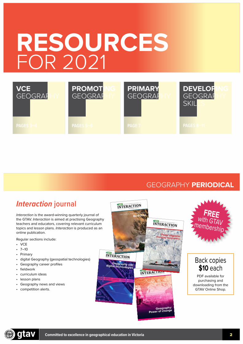
RESOURCESFOR 2021
Interaction journalInteraction is the award-winning quarterly journal of the GTAV. Interaction is aimed at practising Geography teachers and educators, covering relevant curriculum topics and lesson plans. Interaction is produced as an online publication.
Regular sections include:• VCE• 7–10• Primary• digital Geography (geospatial technologies)• Geography career profiles• fieldwork• curriculum ideas• lesson plans• Geography news and views• competition alerts.
Back copies$10 each
PDF available for purchasing and
downloading from the GTAV Online Shop.
FREE with GTAV membership
GEOGRAPHY PERIODICAL
PROMOTING GEOGRAPHY
PAGES 5–6
VCE GEOGRAPHY
PAGES 3–4
PRIMARY GEOGRAPHY
PAGE 7
DEVELOPING GEOGRAPHY SKILLS
PAGES 8–11
Committed to excellence in geographical education in Victoria 3
VCEGEOGRAPHY
UNIT
4
VCE GEOGRAPHY
2nd Edition
Human Population
UNIT
1
VCE GEOGRAPHY
Hazards and Disasters
2nd Edition
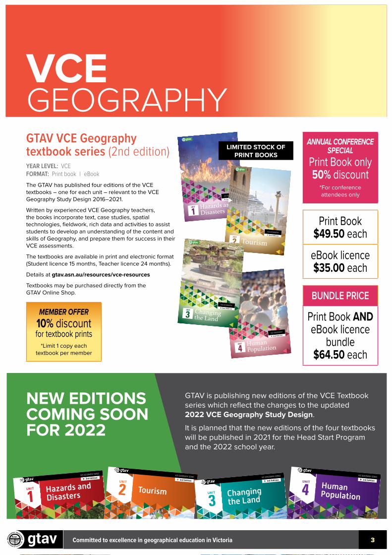
GTAV VCE Geography textbook series (2nd edition)YEAR LEVEL: VCE FORMAT: Print book | eBookThe GTAV has published four editions of the VCE textbooks – one for each unit – relevant to the VCE Geography Study Design 2016–2021.
Written by experienced VCE Geography teachers, the books incorporate text, case studies, spatial technologies, fieldwork, rich data and activities to assist students to develop an understanding of the content and skills of Geography, and prepare them for success in their VCE assessments.
The textbooks are available in print and electronic format (Student licence 15 months, Teacher licence 24 months).
Details at gtav.asn.au/resources/vce-resources
Textbooks may be purchased directly from the GTAV Online Shop.
VCE GEOGRAPHY2nd EditionUNIT
2 Tourism
ANNUAL CONFERENCE SPECIAL
Print Book only 50% discount
*For conference attendees only
Print Book $49.50 each
eBook licence $35.00 each
BUNDLE PRICE
Print Book AND eBook licence
bundle $64.50 each
MEMBER OFFER10% discountfor textbook prints
*Limit 1 copy each textbook per member
VCE GEOGRAPHY2nd EditionChanging the Land
UNIT
3
LIMITED STOCK OF PRINT BOOKS
NEW EDITIONS COMING SOON FOR 2022
GTAV is publishing new editions of the VCE Textbook series which reflect the changes to the updated 2022 VCE Geography Study Design.
It is planned that the new editions of the four textbooks will be published in 2021 for the Head Start Program and the 2022 school year.
Hazards andDisasters
UNIT
13rd Edition
VCE GEOGRAPHY SERIES
TourismUNIT
23rd Edition
VCE GEOGRAPHY SERIES
Changingthe Land
UNIT
3
3rd EditionVCE GEOGRAPHY SERIES
Human Population
UNIT
43rd Edition
VCE GEOGRAPHY SERIES
Committed to excellence in geographical education in Victoria 3

Committed to excellence in geographical education in Victoria 4
VCE GEOGRAPHY
Preparing for the Units 3 and 4 exam: VCE Geography Revision Study GuideYEAR LEVEL: VCE FORMAT: Print book For VCE students to use throughout the year. Includes:• revision and consolidation of key skills and knowledge• graphic organisers for written summaries• comprehensive revision questions based on unseen data.
Great practice for VCAA exam.
130pp including tear-out colour section.
This book may be purchased directly from the GTAV Online Shop.
Preparing for the Units 3 and 4 exam
STUDY GUIDE
gtav
VCE GEOGRAPHYREVISION
ISBN: 978-1-876703-38-7
$29.95 each
NEW GTAV Trial Exam (2021)YEAR LEVEL: VCE FORMAT: Print pack | PDF pack
AVAILABLE JUNE 2021
The GTAV Trial Exam supports teachers and students of VCE Geography.• Provide students with the best opportunity to address the key
knowledge and skills specified by VCAA in the Study Design under exam conditions.
• Written by highly-experienced VCE Geography teachers who have presented at GTAV VCE conferences and workshops and include authors of the very successful GTAV VCE textbook series.
• The exam incorporates a full colour data book of a variety of data types – maps, graphs, photographs, tables and text extracts.
Pre-order the 2021 Trial Exam pack via the GTAV Online Shop.
GTAV Trial Exam (past packs)YEAR LEVEL: VCE FORMAT: PDF packAll earlier trial exams can be purchased as PDF packs from the GTAV Online Shop.
Available for purchasing and downloading are: 2020, 2019, 2018, 2017 and 2016 trial exams.
MEMBER PRICEPrint pack
$85PDF pack
$50
MEMBER PRICE
PDF pack$35
Changing the land
5
Copyright © Geography Teachers’ Association of Victoria, Inc. 2020
Figure 2. Population living on degraded land by region (year 2015)
9
LAND DEGRADATION, POVERTY AND INEQUALITY | BRIEFING NOTE
Population living on degraded land by region (year 2015)
6%
44%
14%
36%
6%
28%
31%
35%
5%
26%
23%
46%
6%
43%30%
21%
9%
61%
16%
14%
120
100
80
60
40
20
0
2,0001,8001,6001,4001,2001,000800600400200
0
700
600
500
400
300
200
100
0
400350300250200
150
100
50
0
14
12
10
8
6
4
2
0
200
150
100
50
0North Amerrica
Asia
Africa
Latin America and the Caribbean
Oceania
Europe
Mill
ions
Mill
ions
Mill
ions
Mill
ions
Mill
ions
Mill
ions
1%
30%
53%
16%
96.1
1,745.3
620.7
355.2
12.6
183.7
43.316.1
17.4
536.6
343.7
93.7
4.8
6.4
182.7
197.8
40.8
0.4
Source: Own estimates based on spatially-explicit maps of land degradation [5], population [17], rural areas [18], and drylands [19] at global and
regional levels.
Bar graph legend
Pie chart legend
Total population on degraded land
Share of population on arid drylands (%)
Rural population on degraded land Rural population on degraded drylands
Share of population on semi-arid drylands (%)Share of population on dry-humid drylands (%)Share of population on hyper-arid drylands (%)
Figure 7
SOURCE: ©2019 United Nations Convention to Combat Desertification (UNCCD)
Human population
7
Copyright © Geography Teachers’ Association of Victoria, Inc. 2020
Southern Ocean
Arctic Ocean
OceanAtlantic
Indian Ocean
Pacific Ocean
Equator
Tropicof Cancer
Tropicof Capricorn
2000 km0
Equatorial Scale
0.900= >
0.900= <
0.850–0.8990.800–0.849
0.750–0.7990.700–0.7490.650–0.699
0.600–0.6490.550–0.5990.500–0.549
0.450–0.4990.400–0.449
No data
Human Development Index (HDI) 2018
TRIAL EXAM 2020Fig 61st proof 14-04-2020
Final 20-04-2020
Figure 5. World map of Human Development Index (HDI)
SOURCE: Map created from data from United Nations Development Programme (UNDP)Figure 6. Births per 1,000 Population (2019)
SOURCE: Map created from data from Population Reference Bureau (PBR) 2019
Southern Ocean
Arctic Ocean
OceanAtlantic
Indian Ocean
Pacific Ocean
Equator
Tropicof Cancer
Tropicof Capricorn
2000 km0
Equatorial Scale
6–13 14–19 20–27 28–35 36–47No data
Births per 1 000 Population (2019)
TRIAL EXAM 2020Fig 71st proof 14-04-2020
Final no changes
Human population
6
Copyright © Geography Teachers’ Association of Victoria, Inc. 2020
Figure 3. Demographic Overview: Cambodia
Figure 4. Human Development Index (HDI)
SOURCE: ©US Census Bureau
SOURCE: United Nations Development Programme (UNDP)
LIMITED PRINT STOCK AVAILABLE
Committed to excellence in geographical education in Victoria 5
PROMOTINGGEOGRAPHY
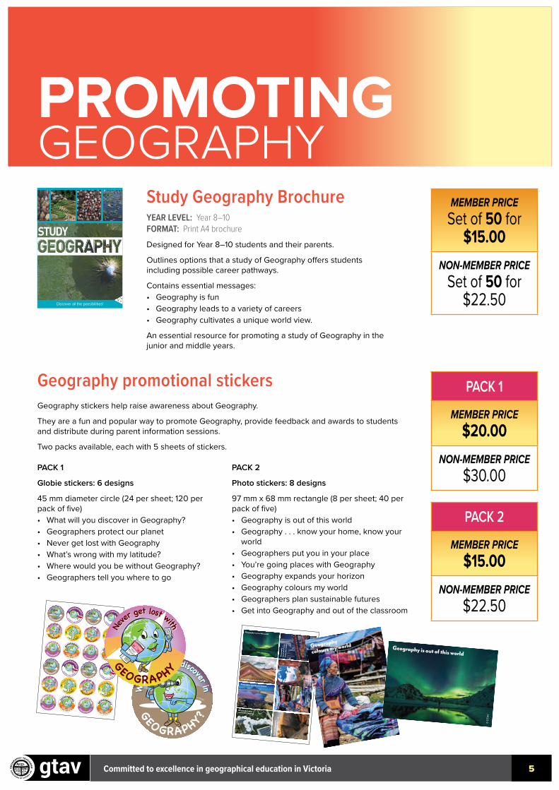
Study Geography BrochureYEAR LEVEL: Year 8–10 FORMAT: Print A4 brochureDesigned for Year 8–10 students and their parents.
Outlines options that a study of Geography offers students including possible career pathways.
Contains essential messages:• Geography is fun• Geography leads to a variety of careers• Geography cultivates a unique world view.
An essential resource for promoting a study of Geography in the junior and middle years.
Geography promotional stickersGeography stickers help raise awareness about Geography.
They are a fun and popular way to promote Geography, provide feedback and awards to students and distribute during parent information sessions.
Two packs available, each with 5 sheets of stickers.
PACK 1
Globie stickers: 6 designs
45 mm diameter circle (24 per sheet; 120 per pack of five)• What will you discover in Geography?• Geographers protect our planet• Never get lost with Geography• What’s wrong with my latitude?• Where would you be without Geography?• Geographers tell you where to go
PACK 2
Photo stickers: 8 designs
97 mm x 68 mm rectangle (8 per sheet; 40 per pack of five)• Geography is out of this world• Geography . . . know your home, know your
world• Geographers put you in your place• You’re going places with Geography• Geography expands your horizon• Geography colours my world• Geographers plan sustainable futures• Get into Geography and out of the classroom
study
Discover all the possibilities!
Mou
nt T
aran
aki,
New
Zea
land
: C
NES
20
04
to 2
011
, Dis
trib
utio
n Ai
rbus
DS
igor
stev
anov
ic/S
hutte
rsto
ck
MEMBER PRICESet of 50 for
$15.00NON-MEMBER PRICE
Set of 50 for $22.50
PACK 1
MEMBER PRICE$20.00
NON-MEMBER PRICE$30.00
PACK 2
MEMBER PRICE$15.00
NON-MEMBER PRICE$22.50
EXPLORER
Map
Never
get lost with
Never
get lost with
GEOGRAPHY
Whe
re
would you be without
GEOGRAPHY
? tell you where to g
o
GE
OGRAPHERS
What
’s wrong with my
LATITUDE?
protect our planet
GEOGRAPHERSW
hat w
ill you discover in
What w
ill you discover in GEOGRAPHY?
EXPLORER
Map
Never
get lost with
Never
get lost with
GEOGRAPHY
Whe
re
would you be without
GEOGRAPHY
? tell you where to g
o
GE
OGRAPHERS
What
’s wrong with my
LATITUDE?
protect our planet
GEOGRAPHERSW
hat w
ill you discover in
What w
ill you discover in GEOGRAPHY?
EXPLORER
Map
Never
get lost with
Never
get lost with
GEOGRAPHY
Whe
re
would you be without
GEOGRAPHY
? tell you where to g
o
GE
OGRAPHERS
What
’s wrong with my
LATITUDE?
protect our planet
GEOGRAPHERSW
hat w
ill you discover in
What w
ill you discover in GEOGRAPHY?
EXPLORER
Map
Never
get lost with
Never
get lost with
GEOGRAPHY
Whe
re
would you be without
GEOGRAPHY
? tell you where to g
o
GE
OGRAPHERS
What
’s wrong with my
LATITUDE?
protect our planet
GEOGRAPHERSW
hat w
ill you discover in
What w
ill you discover in GEOGRAPHY?
© GTAV
© GTAV
© GTAV
© GTAV
© GTAV
© GTAV
© GTAV
© GTAV
© GTAV
© GTAV
© GTAV
© GTAV
© GTAV
© GTAV
© GTAV
© GTAV
© GTAV
© GTAV
© GTAV
© GTAV
© GTAV
© GTAV
© GTAV
© GTAV
© G
TAV
© GTAV
© GTAV
© G
TAV
© G
TAV
© G
TAV
© GTAV
© GTAV
Geographers put you in your place
Geography expands your horizon
Geo
grap
hy . .
. kn
ow yo
ur h
ome,
kn
ow yo
ur w
orld
Geography is out of this world
You
’re g
oing
pla
ces
with
Geo
grap
hy
Geo
grap
hy
colo
urs m
y wor
ld
Get
into
Geo
grap
hy
and
out o
f the
clas
sroo
m
Geographers plan sustainable futures
© GTAV
© G
TAV
© G
TAV
© GTAV
© GTAV
© GTAV
© G
TAV
© G
TAV
Geographers put you in your place
Geography expands your horizon
Geography . . .
know your home,
know your world
Geography is out of this w
orld
You’re going places
with Geography
Geography
colours my world
Get into Geography
and out of the classroom
Geographers plan
sustainable futures
EXPLORER
Map
Ne
ver get lost with Ne
ver get lost with
GEOGRAPHY
Whe
re w
ould you be without GEOGRAPHY
? tell you where to
go
GE
OGRAPHERS
What
’s wrong with my
LATITUDE?
protect our plane
t
GEOGRAPHERS
Wha
t will you discover in W
hat w
ill you discover in
GEOGRAPHY?
EXPLORER
Map
Ne
ver get lost with Ne
ver get lost with
GEOGRAPHY
Whe
re w
ould you be without GEOGRAPHY
? tell you where to
go
GE
OGRAPHERS
What
’s wrong with my
LATITUDE?
protect our plane
t
GEOGRAPHERS
Wha
t will you discover in W
hat w
ill you discover in
GEOGRAPHY?
EXPLORER
Map
Ne
ver get lost with Ne
ver get lost with
GEOGRAPHY
Whe
re w
ould you be without GEOGRAPHY
? tell you where to
go
GE
OGRAPHERS
What
’s wrong with my
LATITUDE?
protect our plane
t
GEOGRAPHERS
Wha
t will you discover in W
hat w
ill you discover in
GEOGRAPHY?
EXPLORER
Map
Ne
ver get lost with Ne
ver get lost with
GEOGRAPHY
Whe
re w
ould you be without GEOGRAPHY
? tell you where to
go
GE
OGRAPHERS
What
’s wrong with my
LATITUDE?
protect our plane
t
GEOGRAPHERS
Wha
t will you discover in W
hat w
ill you discover in
GEOGRAPHY?
© GTAV© GTAV
© GTAV
© GTAV
© GTAV© GTAV
© GTAV© GTAV
© GTAV
© GTAV
© GTAV
© GTAV
© GTAV© GTAV
© GTAV© GTAV
© GTAV© GTAV
© GTAV
© GTAV
© GTAV
© GTAV
© GTAV© GTAV
EXPLORER
Map
Ne
ver get lost with Ne
ver get lost with
GEOGRAPHY
Whe
re w
ould you be without GEOGRAPHY
? tell you where to
go
GE
OGRAPHERS
What
’s wrong with my
LATITUDE?
protect our plane
t
GEOGRAPHERS
Wha
t will you discover in W
hat w
ill you discover in
GEOGRAPHY?
EXPLORER
Map
Ne
ver get lost with Ne
ver get lost with
GEOGRAPHY
Whe
re w
ould you be without GEOGRAPHY
? tell you where to
go
GE
OGRAPHERS
What
’s wrong with my
LATITUDE?
protect our plane
t
GEOGRAPHERS
Wha
t will you discover in W
hat w
ill you discover in
GEOGRAPHY?
EXPLORER
Map
Ne
ver get lost with Ne
ver get lost with
GEOGRAPHY
Whe
re w
ould you be without GEOGRAPHY
? tell you where to
go
GE
OGRAPHERS
What
’s wrong with my
LATITUDE?
protect our plane
t
GEOGRAPHERS
Wha
t will you discover in W
hat w
ill you discover in
GEOGRAPHY?
EXPLORER
Map
Ne
ver get lost with Ne
ver get lost with
GEOGRAPHY
Whe
re w
ould you be without GEOGRAPHY
? tell you where to
go
GE
OGRAPHERS
What
’s wrong with my
LATITUDE?
protect our plane
t
GEOGRAPHERS
Wha
t will you discover in W
hat w
ill you discover in
GEOGRAPHY?
© GTAV© GTAV
© GTAV
© GTAV
© GTAV© GTAV
© GTAV© GTAV
© GTAV
© GTAV
© GTAV
© GTAV
© GTAV© GTAV
© GTAV© GTAV
© GTAV© GTAV
© GTAV
© GTAV
© GTAV
© GTAV
© GTAV© GTAV
© G
TAV
© GTAV
© GTAV
© G
TAV
© G
TAV
© G
TAV
© GTAV
© GTAV
Geographers put you in your place
Geography expands your horizon
Geo
grap
hy . .
. kn
ow yo
ur h
ome,
kn
ow yo
ur w
orld
Geography is out of this world
You
’re g
oing
pla
ces
with
Geo
grap
hy
Geo
grap
hy
colo
urs m
y wor
ld
Get
into
Geo
grap
hy
and
out o
f the
clas
sroo
m
Geographers plan sustainable futures
Committed to excellence in geographical education in Victoria 6
PROMOTING GEOGRAPHY
Surveying
Meteorology
Local &Regional
Development
Planning
EmergencyServices
Forest Science
Social Service &Welfare
StrategicPlanning
TransportPlanning
RealEstateAid
Geology
MiningHazard
Assessment
ClimateChange
Assessment
RegionalPlanning
ConservationOceanography
UrbanPlanning
EnvironmentalSciencesGeographical
InformationSystems (GIS)
Hydrology
Defence
TownPlanning
Climatology
Diplomatic Service
EnvironmentAssessment
Teaching &Education
Architecture
EngineeringRemoteSensing
LandDegradation
InternationalDevelopment
NaturalResource
ManagementDisaster
Management
Mapping
ResourceManagement
SocialPlanning
Tourism &Ecotourism
Land Development
Geomorphology
Agriculture
PropertyManagement
WildlifeManagement
MarketResearch
MarineBiologist
Where can Geography take you and your career?
Branching out with
GEOGRAPHY
A geographic lens allows you to look at the world in multiple ways.
Geographers are highly employable and have diverse careers paths.
There has never been a more exciting time to study Geography.
For more details about Geography careers go to:
www.gtav.asn.au
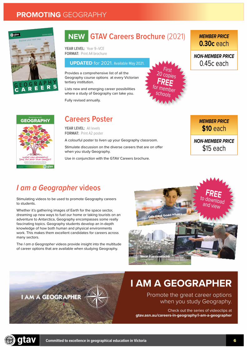
Careers PosterYEAR LEVEL: All levelsFORMAT: Print A2 posterA colourful poster to liven up your Geography classroom.
Stimulate discussion on the diverse careers that are on offer when you study Geography.
Use in conjunction with the GTAV Careers brochure.
NEW GTAV Careers Brochure (2021)YEAR LEVEL: Year 9–VCE FORMAT: Print A4 brochure
UPDATED for 2021. Available May 2021.
Provides a comprehensive list of all the Geography course options at every Victorian tertiary institution.
Lists new and emerging career possibilities where a study of Geography can take you.
Fully revised annually.
G E O G R A P H YC A R E E R S
2021/2022 EDITION
Explore your next stepMEMBER PRICE0.30c each
NON-MEMBER PRICE0.45c each
MEMBER PRICE$10 each
NON-MEMBER PRICE$15 each
First 20 copies FREE for member schools
I AM A GEOGRAPHERPromote the great career options
when you study Geography.Check out the series of videoclips at
gtav.asn.au/careers-in-geography/i-am-a-geographer
I am a Geographer videos Stimulating videos to be used to promote Geography careers to students.
Whether it’s gathering images of Earth for the space sector, dreaming up new ways to fuel our home or taking tourists on an adventure to Antarctica, Geography encompasses some really fascinating topics. Geography students develop an in-depth knowledge of how both human and physical environments work. This makes them excellent candidates for careers across many sectors.
The I am a Geographer videos provide insight into the multitude of career options that are available when studying Geography.
FREE to download and view
Committed to excellence in geographical education in Victoria
XXXGEOGRAPHY
7
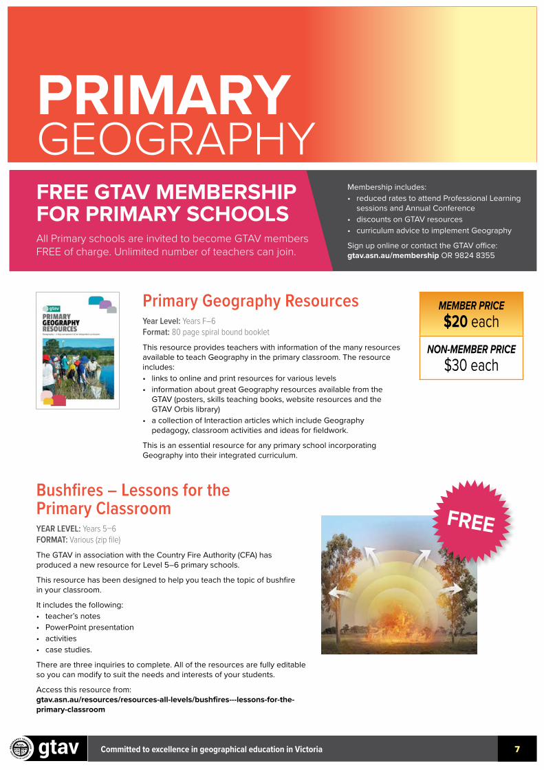
Primary Geography Resources Year Level: Years F–6Format: 80 page spiral bound bookletThis resource provides teachers with information of the many resources available to teach Geography in the primary classroom. The resource includes:• links to online and print resources for various levels• information about great Geography resources available from the
GTAV (posters, skills teaching books, website resources and the GTAV Orbis library)
• a collection of Interaction articles which include Geography pedagogy, classroom activities and ideas for fieldwork.
This is an essential resource for any primary school incorporating Geography into their integrated curriculum.
Bushfires – Lessons for the Primary Classroom YEAR LEVEL: Years 5–6FORMAT: Various (zip file)The GTAV in association with the Country Fire Authority (CFA) has produced a new resource for Level 5–6 primary schools.
This resource has been designed to help you teach the topic of bushfire in your classroom.
It includes the following:• teacher’s notes• PowerPoint presentation• activities• case studies.
There are three inquiries to complete. All of the resources are fully editable so you can modify to suit the needs and interests of your students.
Access this resource from: gtav.asn.au/resources/resources-all-levels/bushfires---lessons-for-the-primary-classroom
MEMBER PRICE$20 each
NON-MEMBER PRICE$30 each
FREE GTAV MEMBERSHIP FOR PRIMARY SCHOOLS All Primary schools are invited to become GTAV members FREE of charge. Unlimited number of teachers can join.
Membership includes:• reduced rates to attend Professional Learning
sessions and Annual Conference• discounts on GTAV resources• curriculum advice to implement Geography
Sign up online or contact the GTAV office: gtav.asn.au/membership OR 9824 8355
PRIMARYGEOGRAPHY
46 Interaction, Vol 48, No 1
conveying the messages of the Fire Danger Rating. The short clip can be used to initiate class discussion around the following:
• Have students seen one of the signs on the side of the road indicating the FDR (Fire Danger Rating) for a particular day?
• Have they heard/seen on News Broadcast that FDR (Fire Danger Rating) for the following day and any associated warnings?
• Does their family (or someone they know) have an FDR (Fire Danger Rating) trigger to leave their house and property during bushfire season?
• What would their own FDR (Fire Danger Rating) trigger be?
All three inquiries can be downloaded as Zip Files at gtav.asn.au/resources/resources-all-levels/bushfires---lessons-for-the-primary-classroom
Kelli Ashton has been a Geography teacher for the past 20 years and is currently Head of the Geography Department at Luther College. Her passion is fostering a love of Geography for her students and an enduring fascination of the world around them and their place within it. Kelli is an accomplished author and presenter on Geography education.
References• createdigital.org.au/australian-bushfires-a-timeline-
of-whats-happened-so-far/ Accessed 21 January 2020
• Bushfires – A Geography resource for Australian Students, Country Fire Authority and Geography Teachers’ Association of Victoria Inc., 2012.
• Fire ready kit, Country Fire Authority, updated 2018.
• Strathewen Primary School – Survive and Thrive youtube.com/watch?v=5Uh2tPJpUG0
AcknowledgementsFieldwork activity is adapted from Overall fuel hazard assessment guide © 2010. Reproduced by permission of Forest, Fire and Regions | Department of Environment, Land, Water and Planning.
Primary ResourceBushfires – Lessons for the Primary ClassroomThe GTAV in association with the Country Fire Authority (CFA) has produced a new resource for Level 5–6 primary schools.
This resource has been designed to help you teach the topic of bushfire in your classroom. It includes the following:
• teacher’s notes
• PowerPoint presentation
• activities
• case studies.
There are three inquiries to complete. All of the resources are fully editable so you can modify to suit the needs and interests of your students. Download the Zip-files at:www.gtav.asn.au/resources/resources-all-levels/bushfires---lessons-for-the-primary-classroom
Prim
ary
/ Mid
dle
Year
s
FREE
Committed to excellence in geographical education in Victoria 8
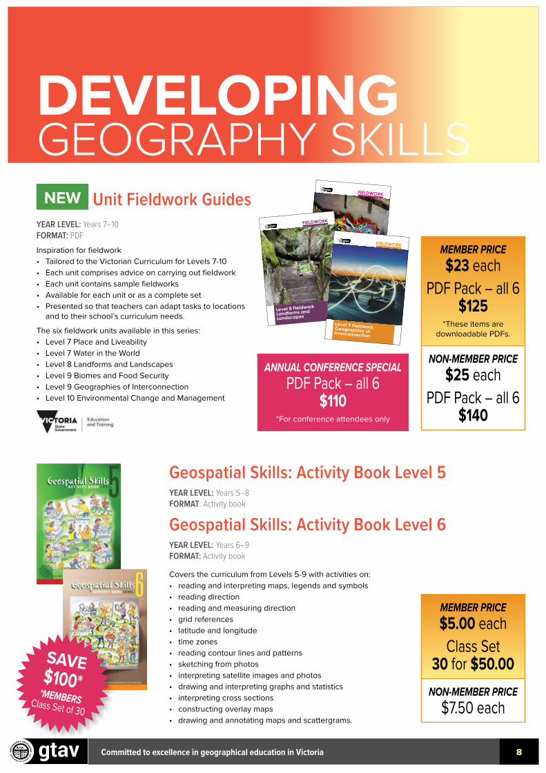
DEVELOPINGGEOGRAPHY SKILLSNEW Unit Fieldwork Guides
YEAR LEVEL: Years 7–10FORMAT: PDFInspiration for fieldwork• Tailored to the Victorian Curriculum for Levels 7-10• Each unit comprises advice on carrying out fieldwork• Each unit contains sample fieldworks• Available for each unit or as a complete set• Presented so that teachers can adapt tasks to locations
and to their school’s curriculum needs.
The six fieldwork units available in this series:• Level 7 Place and Liveability• Level 7 Water in the World• Level 8 Landforms and Landscapes• Level 9 Biomes and Food Security• Level 9 Geographies of Interconnection• Level 10 Environmental Change and Management
Geospatial Skills: Activity Book Level 5 YEAR LEVEL: Years 5–8FORMAT: Activity book
Geospatial Skills: Activity Book Level 6 YEAR LEVEL: Years 6–9FORMAT: Activity book
Level 7 FieldworkPlace and Liveability
FIELDWORK
Level 7 FieldworkWater in the World
FIELDWORKFIELDWORK
Level 8 Fieldwork Landforms and Landscapes
FIELDWORK
Level 9 Fieldwork Biomes and Food Security
FIELDWORK
Level 9 Fieldwork Geographies of Interconnection
FIELDWORK
Level 10 Fieldwork Environmental Change and Management
FIELDWORK GUIDESLooking for inspiration for fieldwork?Units have been developed which are a thorough guide as to how to prepare and carry out
fieldwork. Examples of fieldwork units for Levels 7–10 are included in each guide, with practical
activities. These make fieldwork achievable for every teacher, whether out-of-field or an
experienced provider of fieldwork. These are presented so that teachers can adapt tasks to
locations and to their school’s curriculum needs. The six fieldwork guides in this series:• Year 7 Place and Liveability• Year 7 Water in the World• Year 8 Landforms and Landscapes• Year 9 Biomes and Food Security• Year 9 Geographies of Interconnection • Year 10 Environmental Change and ManagementAll units are aligned to the Victorian Curriculum.
The GTAV Fieldwork Series are supported by the Victorian Government through the
Department of Education and Training Strategic Partnership Program.
GTAV Members $23.00 per booklet or $125 for the full set
Covers the curriculum from Levels 5-9 with activities on:• reading and interpreting maps, legends and symbols• reading direction• reading and measuring direction• grid references• latitude and longitude• time zones• reading contour lines and patterns• sketching from photos• interpreting satellite images and photos• drawing and interpreting graphs and statistics• interpreting cross sections• constructing overlay maps• drawing and annotating maps and scattergrams.
MEMBER PRICE$5.00 each
Class Set 30 for $50.00
NON-MEMBER PRICE$7.50 each
MEMBER PRICE$23 each
PDF Pack – all 6 $125
*These items are downloadable PDFs.
NON-MEMBER PRICE$25 each
PDF Pack – all 6 $140
SAVE $100**MEMBERS Class Set of 30
ANNUAL CONFERENCE SPECIALPDF Pack – all 6
$110*For conference attendees only
Level 7 Fieldwork
Place and Liveability
FIELDWORK
Level 7 Fieldwork
Water in the World
FIELDWORKFIELDWORK
Level 8 Fieldwork
Landforms and
Landscapes
FIELDWORK
Level 9 Fieldwork
Biomes and
Food Security
FIELDWORK
Level 9 Fieldwork
Geographies of
Interconnection
FIELDWORK
Level 10 Fieldwork
Environmental Change
and Management
FIELDWORK GUIDESLooking for inspiration for fieldwork?
Units have been developed which are a thorough guide as to how to prepare and carry out
fieldwork. Examples of fieldwork units for Levels 7–10 are included in each guide, with practical
activities. These make fieldwork achievable for every teacher, whether out-of-field or an
experienced provider of fieldwork. These are presented so that teachers can adapt tasks to
locations and to their school’s curriculum needs. The six fieldwork guides in this series:
• Year 7 Place and Liveability
• Year 7 Water in the World
• Year 8 Landforms and Landscapes
• Year 9 Biomes and Food Security
• Year 9 Geographies of Interconnection
• Year 10 Environmental Change and Management
All units are aligned to the Victorian Curriculum.
The GTAV Fieldwork Series are supported by the Victorian Government through the
Department of Education and Training Strategic Partnership Program.
GTAV Members
$23.00 per booklet or
$125 for the full set
Level 7 FieldworkPlace and Liveability
FIELDWORK
Level 7 FieldworkWater in the World
FIELDWORKFIELDWORK
Level 8 Fieldwork Landforms and Landscapes
FIELDWORK
Level 9 Fieldwork Biomes and Food Security
FIELDWORK
Level 9 Fieldwork Geographies of Interconnection
FIELDWORK
Level 10 Fieldwork Environmental Change and Management
FIELDWORK GUIDESLooking for inspiration for fieldwork?Units have been developed which are a thorough guide as to how to prepare and carry out
fieldwork. Examples of fieldwork units for Levels 7–10 are included in each guide, with practical
activities. These make fieldwork achievable for every teacher, whether out-of-field or an
experienced provider of fieldwork. These are presented so that teachers can adapt tasks to
locations and to their school’s curriculum needs. The six fieldwork guides in this series:• Year 7 Place and Liveability• Year 7 Water in the World• Year 8 Landforms and Landscapes• Year 9 Biomes and Food Security• Year 9 Geographies of Interconnection • Year 10 Environmental Change and ManagementAll units are aligned to the Victorian Curriculum.
The GTAV Fieldwork Series are supported by the Victorian Government through the
Department of Education and Training Strategic Partnership Program.
GTAV Members $23.00 per booklet or $125 for the full set

Committed to excellence in geographical education in Victoria 9
DEVELOPING GEOGRAPHY SKILLS
Foodprint Melbourne YEAR LEVEL: Year 9FORMAT: Worksheets, videos and GIS maps.The Foodprint Melbourne resource is developed by the University of Melbourne and the GTAV for Year 9 Geography: Biomes and food security.
Worksheets, videos and GIS maps enable students to explore the different types of foods growing in different regions of Melbourne’s foodbowl.
The resource pack:• enables students to learn about their own local food growing area, Melbourne’s
foodbowl• develops an understanding that Melbourne’s city fringe farmland is an important
source of food for the city, particularly for fresh foods, such as vegetables.
You can access the resources via the GTAV website or download: research.unimelb.edu.au/foodprint-melbourne/school-resources/year-9-geography
FREE
Spatial Connect YEAR LEVEL: Years 7–11FORMAT: Downloadable PDF filesSpatial Connect is a series of seven resources which enable students to explore spatial technology applications related to the secondary Geography and Science curriculum.
Builds skills in the application of spatial technology, mapping and the use of big data within the context of contemporary issues.
Includes resources and student activities linked to real-world knowledge sources.
Topics include:• Place and liveability in Ballarat – Level 7• Environment management in rural catchments – Level 10• Exploring Victoria’s biodiversity – Level 9/10• Flooding in rural Victoria (Hazards and disasters) – VCE Unit 1• Sports and recreation spatial – Level 9/10• Visualising Victoria’s Groundwater – Level 9/10
Download the resource at spatialconnect.org.au
Spatial Connect is a project undertaken by Federation University Australia’s Centre for eResearch and Digital Innovation (CeRDI) in partnership with the GTAV.
AURIN GIS classroom resources Australian Urban Research Infrastructure Network (AURIN) and the GTAV have collaborated to produce classroom resources using data sets from the Aurin GIS map portal.
The GTAV map learning exercises allow students to work with and manipulate data sets.
Topics include:• Investigating liveability: Level 7• Geographies of interconnections: Level 9• Investigating transport and the environment: Level 10• Investigating wellbeing: Level 10
Access these resources from: aurin.org.au/gtav/
gtav
i
Visualising Victoria’s Groundwater
Sport and Recreation Spatial
SPATIAL CONNECTAn activity based project
LEVEL 9
gtav
iNatural Resource Management
Environmental
management in
rural catchments
SPATIAL CONNECTAn activity based project
LEVEL 9
gtav
i
Historic Urban Landscapes (HUL), Ballarat
Place and liveability in Ballarat – Historic Urban Landscapes (HUL)
SPATIAL CONNECTAn activity based project
LEVEL 7
gtav
iCongrangamite Flood Portal
Flooding in rural Victoria
Hazards and Disasters
SPATIAL CONNECTAn activity based project
VCE UNIT 1
FREE
FREE
Committed to excellence in geographical education in Victoria 10
DEVELOPING GEOGRAPHY SKILLS
Geography Skills Unlocked (Revised edition)An exciting new skills book for students.
Provides Geoskills and GeoInquiry activities that scaffold student learning.
A wealth of stimulus material including a diverse range of maps, graphs, aerial photographs, satellite images, diagram and photographs.
Published by the Australian Geography Teachers Association (AGTA).
Geography Literacy UnlockedWritten for secondary Geography students seeking to improve their literacy skills.
Includes a focus on written, visual and oral literacy.
Descriptions of the principal text types used in Geography, supported by annotated examples.
Guidance for writers quoting, paraphrasing, summarising and referencing the work of others.
Published by the Australian Geography Teachers Association (AGTA).
Geography Fieldwork UnlockedFeatures 35 inquiry-based fieldwork activities
Guide to developing and presenting fieldwork
Nine fieldwork activities for primary students (F–6)
Twenty-five fieldwork activities for secondary students (7–10).
$39.95 each
$29.95 each
$59.95 each
AGTA GEOSKILLS TEACHER PACKAvailable for pre-service teachers
All three Unlocked titles for $115.00 – save $15
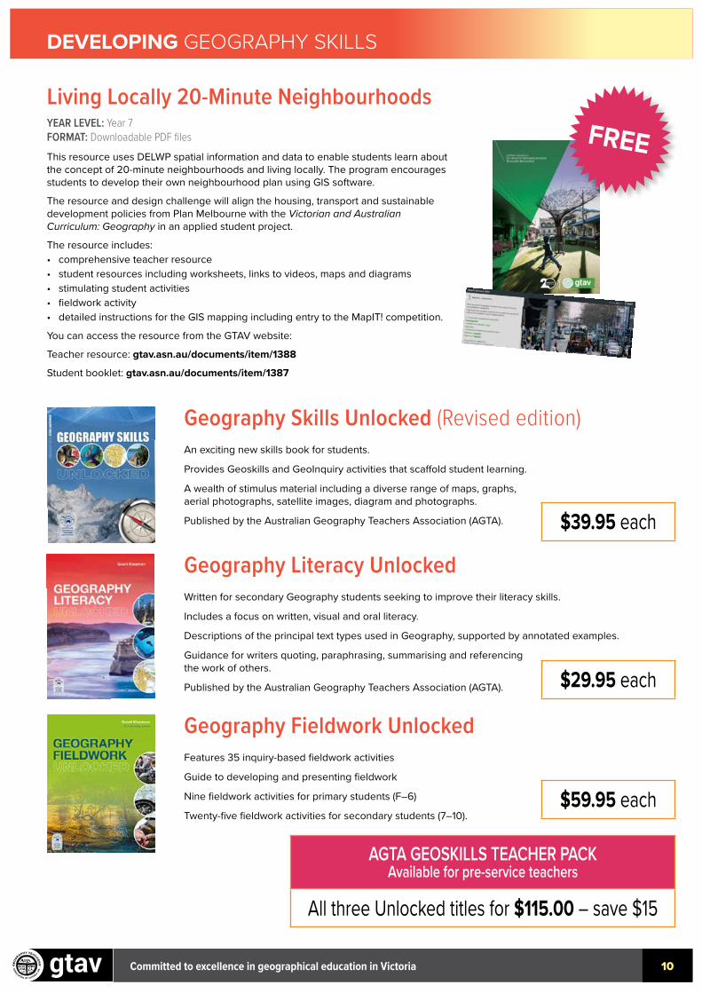
Living Locally 20-Minute Neighbourhoods YEAR LEVEL: Year 7FORMAT: Downloadable PDF filesThis resource uses DELWP spatial information and data to enable students learn about the concept of 20-minute neighbourhoods and living locally. The program encourages students to develop their own neighbourhood plan using GIS software.
The resource and design challenge will align the housing, transport and sustainable development policies from Plan Melbourne with the Victorian and Australian Curriculum: Geography in an applied student project.
The resource includes:• comprehensive teacher resource• student resources including worksheets, links to videos, maps and diagrams• stimulating student activities• fieldwork activity• detailed instructions for the GIS mapping including entry to the MapIT! competition.
You can access the resource from the GTAV website:
Teacher resource: gtav.asn.au/documents/item/1388
Student booklet: gtav.asn.au/documents/item/1387
FREE
Committed to excellence in geographical education in Victoria 11
DEVELOPING GEOGRAPHY SKILLS
GTAV professional learning online courses are ideal for teachers who wish to upgrade their personal skill set, for out of-field teachers or for teachers wishing to improve their skills in a certain area. Support is available from the Education Officer during these courses.
The following online courses are now available:• Geography skills• Geography fieldwork• Geography concepts• Spatial technology.
Teachers may choose to complete ANY or ALL four modules.
You can complete a module at any time that suits you and in any order.
A certificate will be provided on completion of each module assessment.
Each module in this course is expected to take approximately 14–20 hours.
Further information: gtav-ecourses.asn.au
GTAV ONLINE Certificate of Geography Competency
MEMBER PRICE$200 per module
NON-MEMBER PRICE$250 per module
AVAILABLE NOW
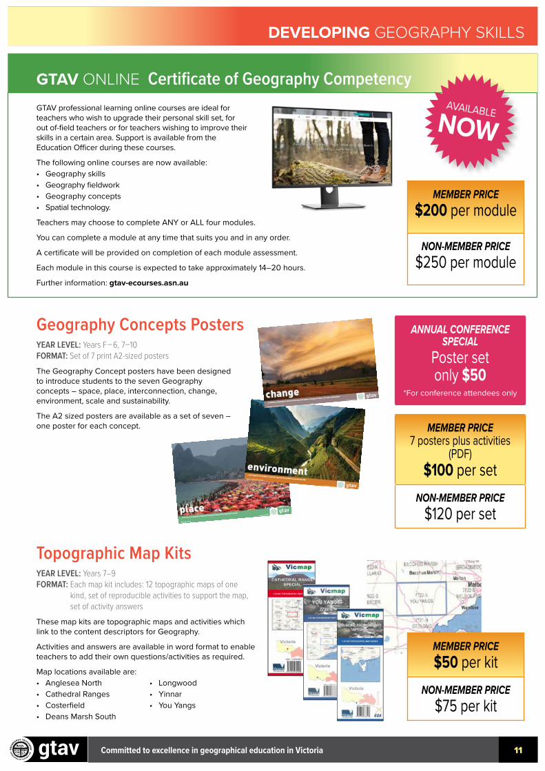
Topographic Map Kits YEAR LEVEL: Years 7–9 FORMAT: Each map kit includes: 12 topographic maps of one
kind, set of reproducible activities to support the map, set of activity answers
These map kits are topographic maps and activities which link to the content descriptors for Geography.
Activities and answers are available in word format to enable teachers to add their own questions/activities as required.
Map locations available are:• Anglesea North• Cathedral Ranges• Costerfield• Deans Marsh South
• Longwood• Yinnar• You Yangs
MEMBER PRICE$50 per kit
NON-MEMBER PRICE$75 per kit
Geography Concepts Posters YEAR LEVEL: Years F–6, 7–10FORMAT: Set of 7 print A2-sized postersThe Geography Concept posters have been designed to introduce students to the seven Geography concepts – space, place, interconnection, change, environment, scale and sustainability.
The A2 sized posters are available as a set of seven – one poster for each concept.
ANNUAL CONFERENCE SPECIAL
Poster set only $50
*For conference attendees only
MEMBER PRICE7 posters plus activities
(PDF) $100 per set
NON-MEMBER PRICE$120 per set