Embed Size (px)
Citation preview
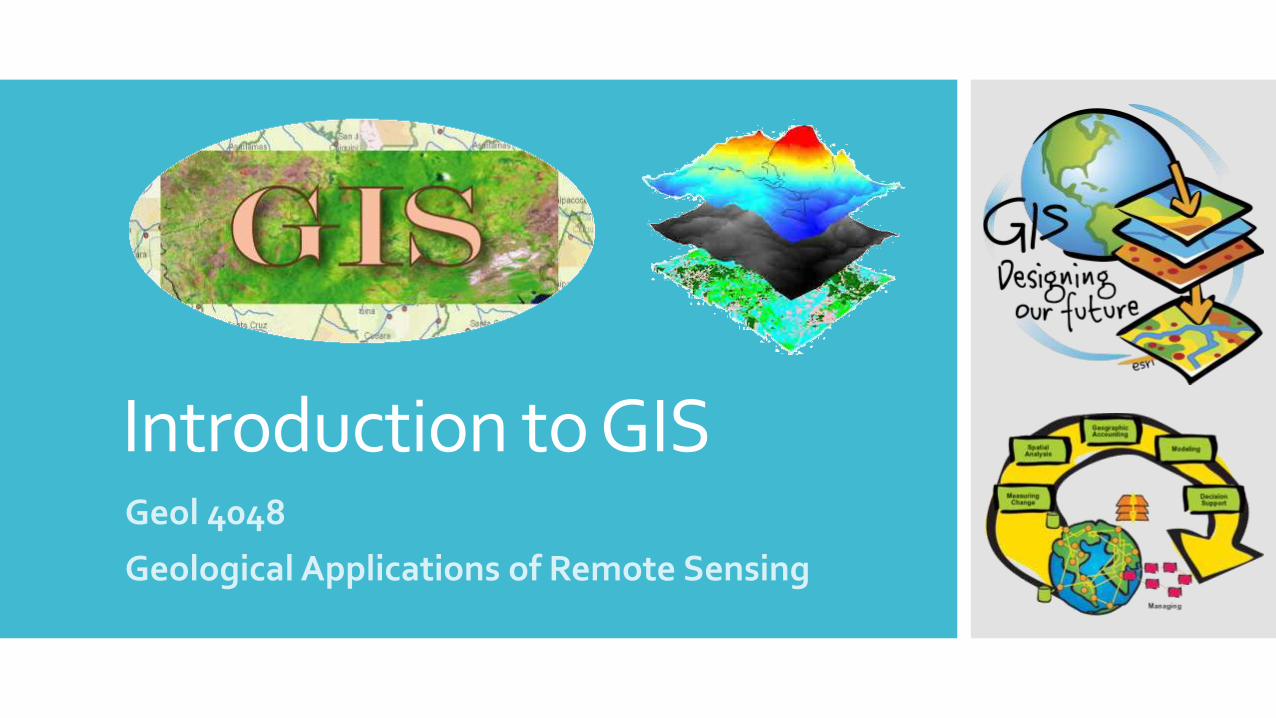
Introduction to GISGeol 4048
Geological Applications of Remote Sensing

GIS History:
Before Computers
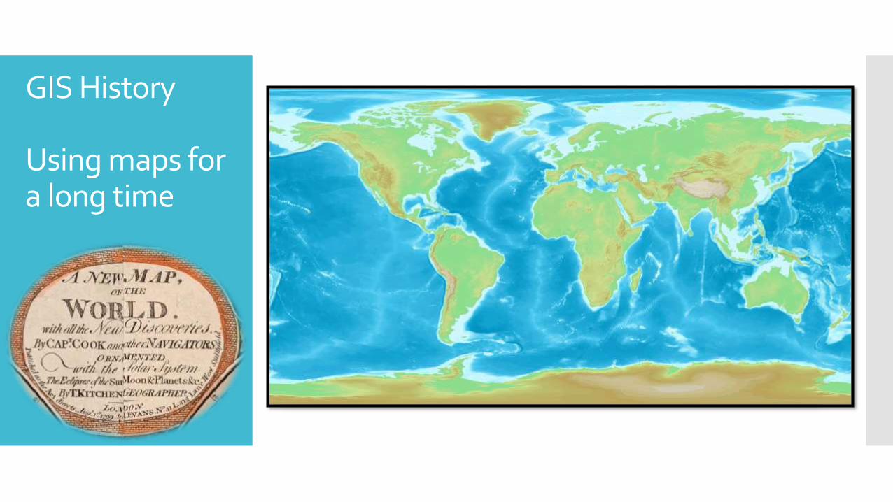
GIS History
Using maps for a long time

Dr. Roger F. Tomlinson
“Father of GIS”
He was an English geographer and the primary originator of modern computerized geographic information systems (GIS), and he has been acknowledged as the "father of GIS.“
He was born in 17 November 1933 and died in 9 February 2014.
After his military service, Dr. Tomlinson attended the University of Nottingham and Acadia University for two separate undergraduate degrees in geography and geology, respectively.
He received a Masters degree in geography from McGill University where he specialized in the glacial geomorphology of Labrador.
His Doctoral thesis at University College London was titled: The application of electronic computing methods and techniques to the storage, compilation, and assessment of mapped data.
Dr. Tomlinson's early career included serving as an assistant professor at Acadia, working as the manager of the computer mapping division at Spartan Air Services in Ottawa, Ontario (following his studies at McGill), and work with the Government of Canada first as a consultant and later as a director of regional planning systems with the Department of Forestry and Rural Development.
It was during his tenure with the federal government in the 1960s that Dr. Tomlinson initiated, planned and directed the development of the Canada Geographic Information System, the first computerized GIS in the world.
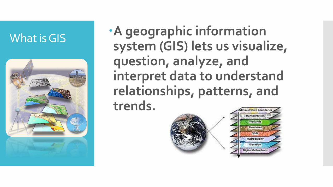
What is GISA geographic information system (GIS) lets us visualize, question, analyze, and interpret data to understand relationships, patterns, and trends.
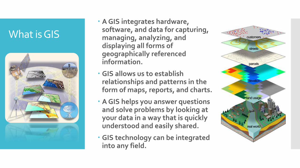
What is GIS A GIS integrates hardware,
software, and data for capturing, managing, analyzing, and displaying all forms of geographically referenced information.
GIS allows us to establish relationships and patterns in the form of maps, reports, and charts.
A GIS helps you answer questions and solve problems by looking at your data in a way that is quickly understood and easily shared.
GIS technology can be integrated into any field.
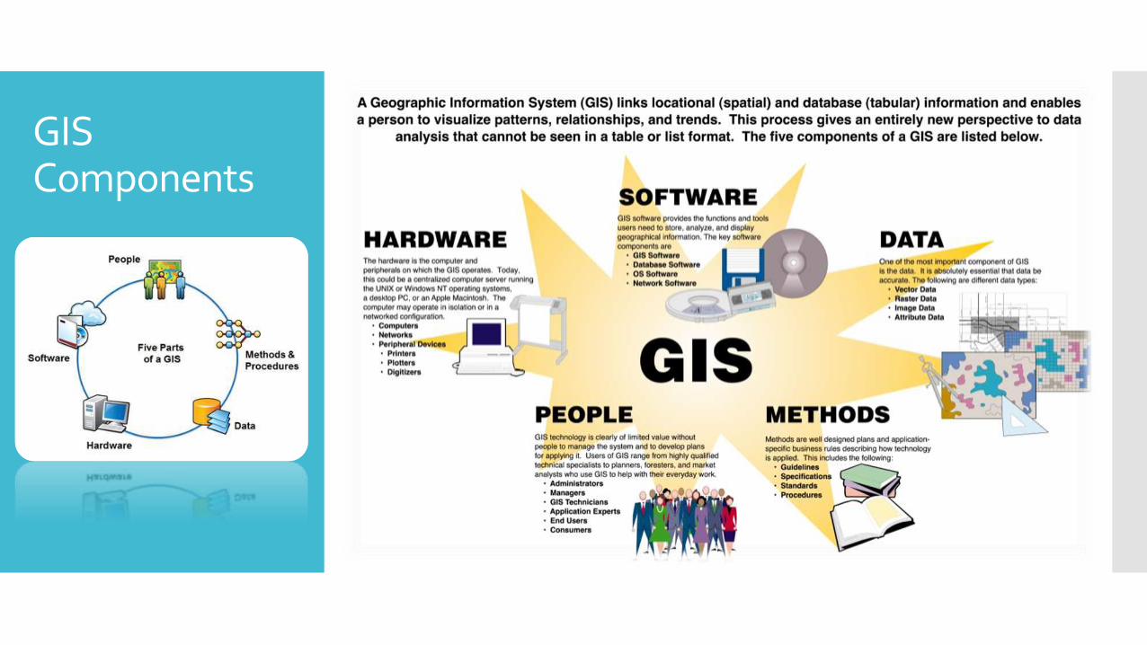
GIS Components
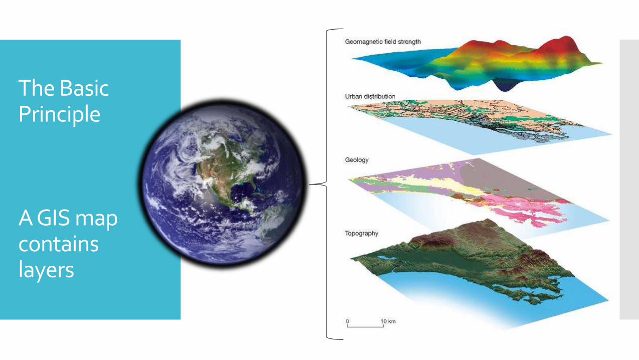
The Basic Principle
A GIS map contains layers

Layers may contain features or surfaces
A layers that contains many of the same types of things, like coal
basins, transmission lines, states, and lakes, is called a feature.
A layer that is not a collection of geographic objects and is considered a single, continuous expanse that change from one location to
another like bathymetry and elevation, is called a surface.
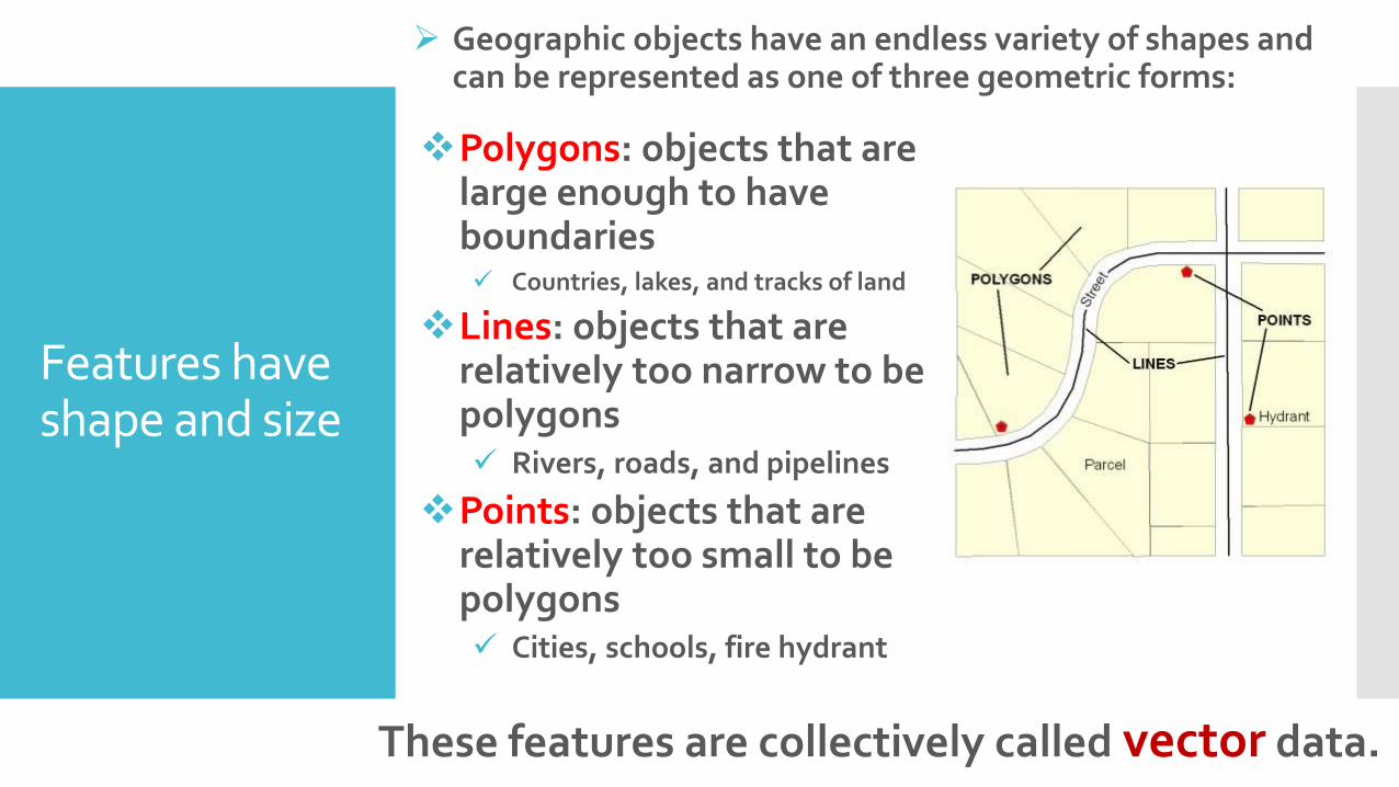
Features have shape and size
Polygons: objects that are large enough to have boundaries Countries, lakes, and tracks of land
Lines: objects that are relatively too narrow to be polygons Rivers, roads, and pipelines
Points: objects that are relatively too small to be polygons Cities, schools, fire hydrant
These features are collectively called vector data.
Geographic objects have an endless variety of shapes and can be represented as one of three geometric forms:
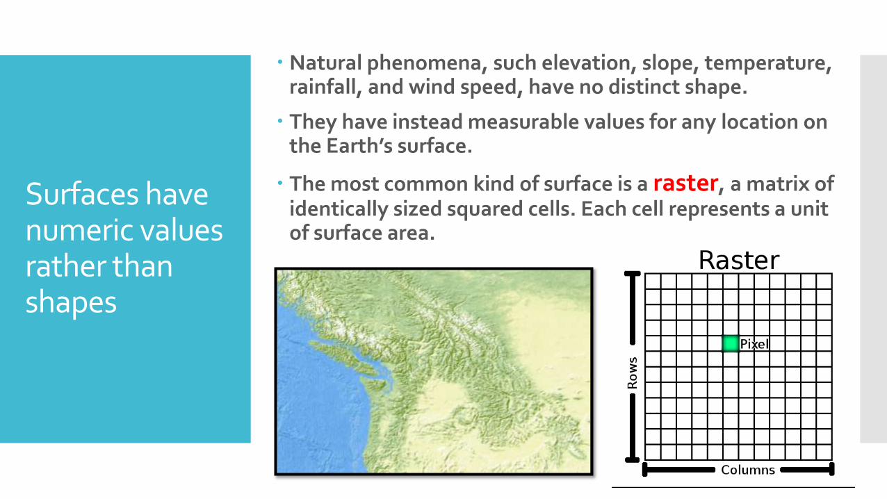
Surfaces have numeric values rather than shapes
Natural phenomena, such elevation, slope, temperature, rainfall, and wind speed, have no distinct shape.
They have instead measurable values for any location on the Earth’s surface.
The most common kind of surface is a raster, a matrix of identically sized squared cells. Each cell represents a unit of surface area.

Vector vs.Raster
Which is the best format?
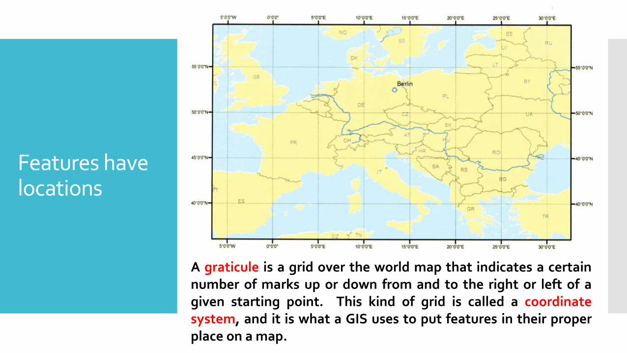
Features have locations
A graticule is a grid over the world map that indicates a certainnumber of marks up or down from and to the right or left of agiven starting point. This kind of grid is called a coordinatesystem, and it is what a GIS uses to put features in their properplace on a map.

Features can be displayed at different sizes Scale, commonly expressed as a ratio, is the
relationship between the size of the features on a map and the size of the corresponding places in the world.

Features are linked to information
Attribute table

Features have spatial relationships
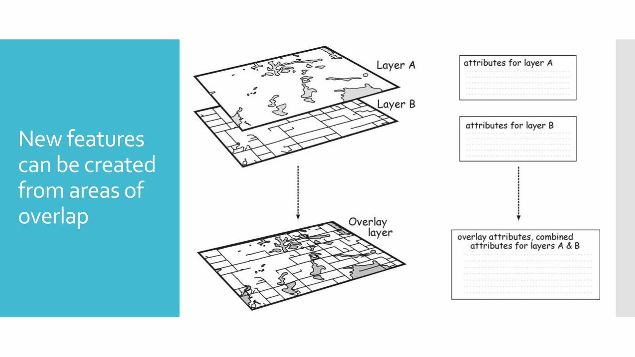
New features can be created from areas of overlap
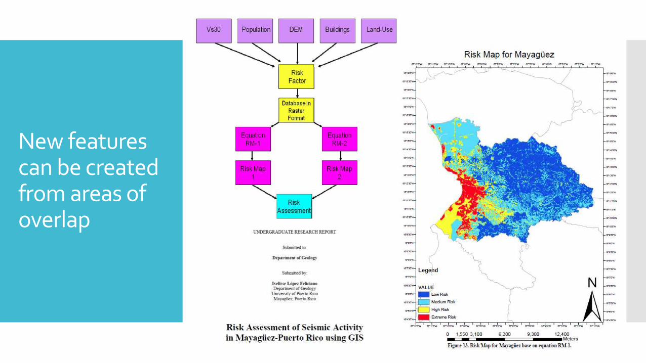
New features can be created from areas of overlap
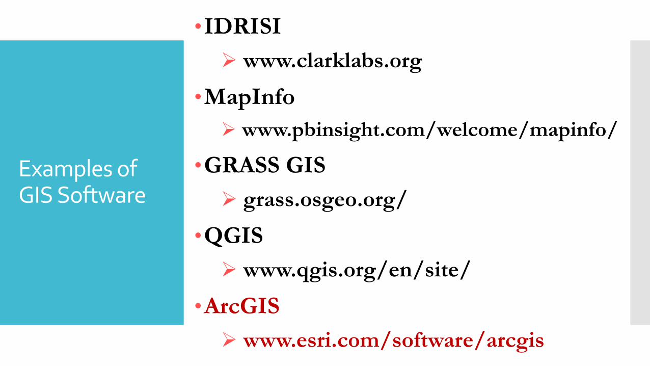
Examples of GIS Software
•IDRISI
www.clarklabs.org
•MapInfo
www.pbinsight.com/welcome/mapinfo/
•GRASS GIS
grass.osgeo.org/
•QGIS
www.qgis.org/en/site/
•ArcGIS
www.esri.com/software/arcgis
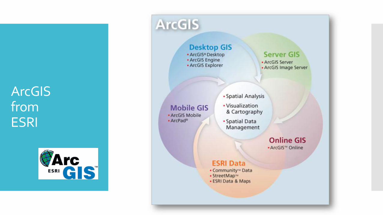
ArcGISfromESRI
History of ESRI
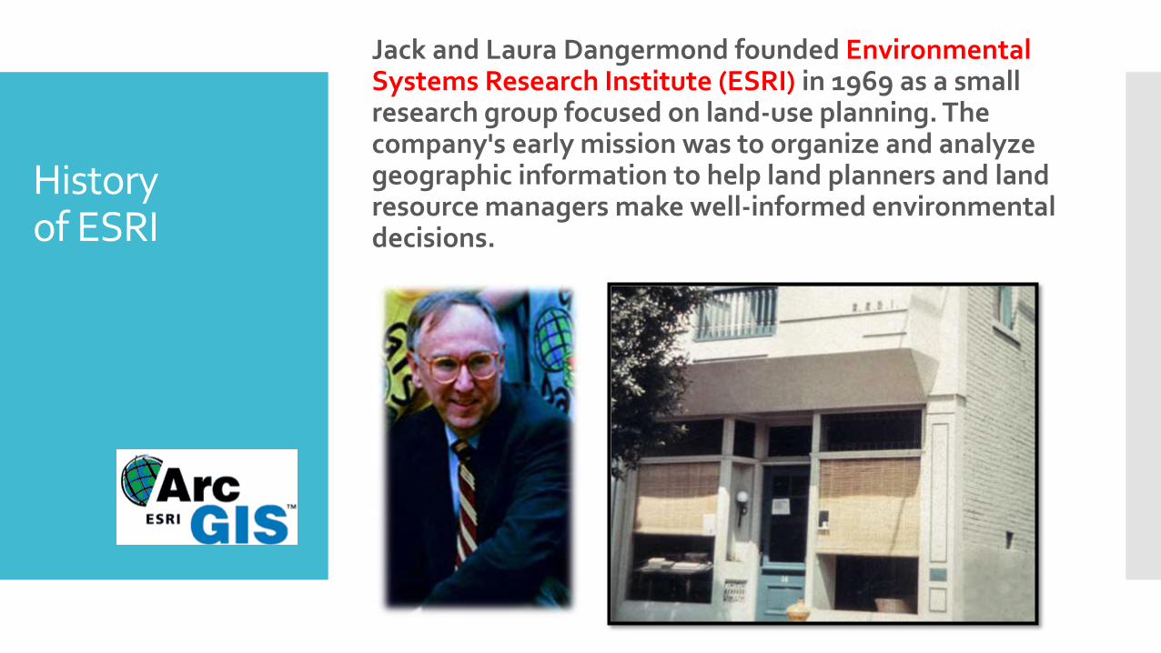
Jack and Laura Dangermond founded Environmental Systems Research Institute (ESRI) in 1969 as a small research group focused on land-use planning. The company's early mission was to organize and analyze geographic information to help land planners and land resource managers make well-informed environmental decisions.

History of ESRI
1982
Esri enters the software business with ARC/INFO.

History of ESRI
1986
Esri releases PC ARC/INFO in response to the proliferation of IBM PCs.
History of ESRI
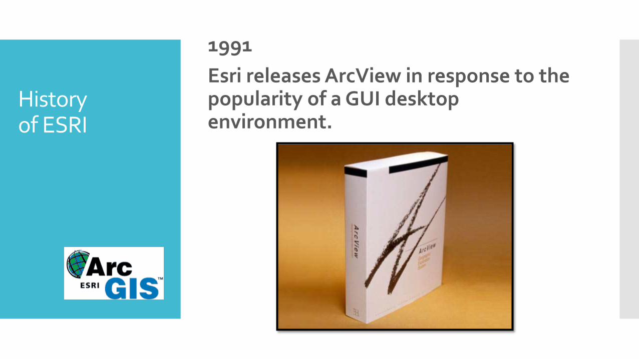
1991
Esri releases ArcView in response to the popularity of a GUI desktop environment.

History of ESRI
2004
ArcGIS 9 builds on desktop success and adds a development framework and server platform.

History of ESRI
2012
ArcGIS 10.1 debuts, enabling users to deliver any GIS resource as a web service, putting geographic information in the hands of more people.

History of ESRI
2014

History of ESRI
2015-2016

ArcGISDesktop
ArcGIS Desktop
ArcReader
(Free)
ArcView
(Basic)
ArcMap
Spatial Analyst
3D Analyst
Others
ArcCatalog ArcGlobe ArcScene
ArcEditor
(Standard)
ArcInfo
(Advanced)

ArcMap

ArcCatalog

ArcToolbox

ArcGISMobile
The increasing portability of GPS receivers has enable laptops, PDAs, and cellular phones to link precise, real-time, locational information to a GIS.
o Enter new data as it directly observed
o Verify or update information already in the system
o Valuable for registering digital images or satellite imagery
o Provides immediate on-site access to spatial data in the field

ArcGISServer

Online GIS
www.arcgis.com/features/

Any question?