Embed Size (px)
Citation preview
Geology and Paleoenvironmental Reconstruction of the Debert/Belmont
Site
TABLE OF CONTENTS
SUMMARY 3
INTRODUCTION 4
METHODS 6
RESULTS 8
Surface geological units and landforms 8 Weathered bedrock (regolith) 8 Glacial till 10 Glaciofluvial deposits and landforms 11 Allerød paleosol 12 Massive and laminated sand 15 Holocene sedimentation 19
RELATIONSHIP OF SURFICIAL UNITS WITH ARTIFACTS AND TIMING OF THE DEBERT SITE 20
DEGLACIATION, SEA-LEVEL AND PALEOENVIRONMENTS OF THE MINAS BASIN/BAY OF FUNDY 22
REFERENCES 26
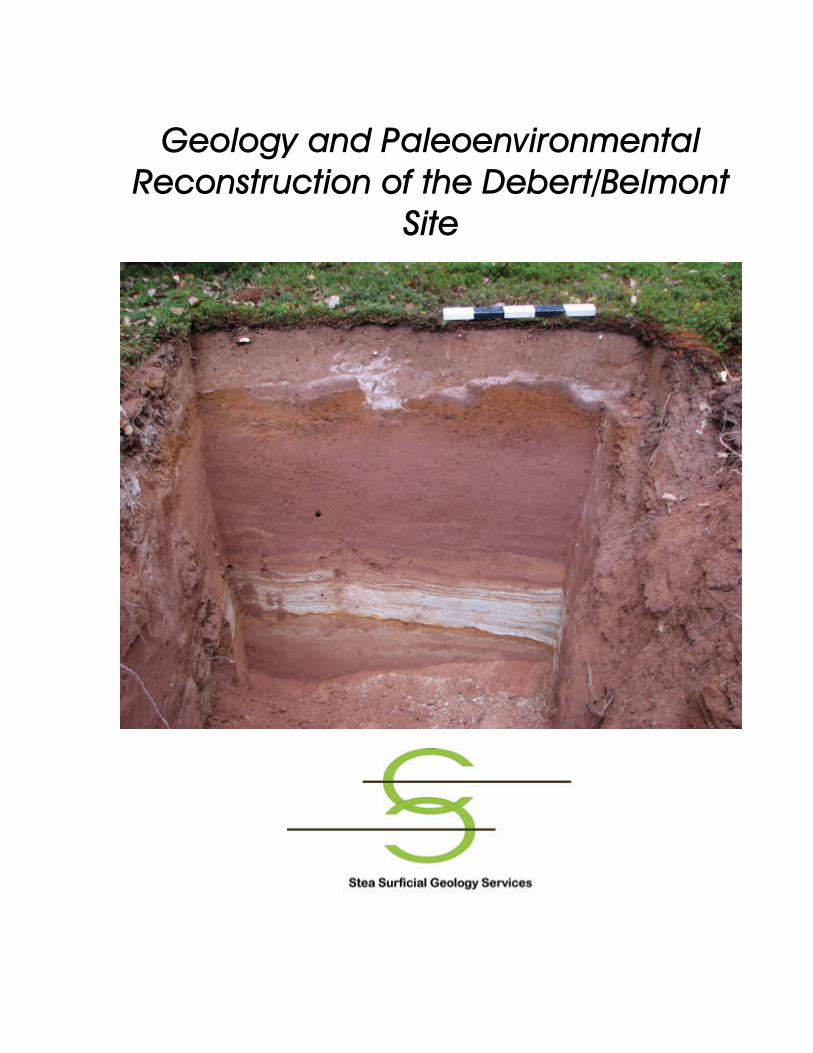
APPENDIX 1 31 Geology map of the Debert/Belmont site Back Pocket Front cover photo- Type section at 12-20 near the main Debert site showing modern and buried soils (photo courtesy of Scott Buchanan). The field work conducted by the author that forms the basis for this report was supported by the Nova Scotia Department of Natural Resources and the Confederacy of Mainland Mi’kmaq. The author would like to acknowledge the able and enthusiastic field assistance of Sharon Farrell and Nick Stea. Ideas presented in the report were formulated with the benefit of stimulating discussions with Leah Rosenmeier, Gordon Brewster and Scott Buchanan. Author address: RUDOLF (RALPH) STEA Ph. D. P. Geol. 851 Herring Cove Road, Halifax, Nova Scotia, Canada, B3R 1Z1: (H) (902) 479-3748; (W) (902) 497-5094; E-Mail: RALPHSTEA@ hfx.eastlink.ca
3
Summary
The Debert/Belmont archaeological site is the oldest site of human habitation in eastern Canada. This report provides a detailed look at the geology of the site, the relationships of sediments, landforms and artifacts, and the interpretation of the past environments of human habitation. The DB site features many different types of glacial and periglacial deposits and landforms although the deposits consist largely of poorly-sorted sand, derived from erosion of underlying Triassic sandstone bedrock. The oldest deposit is a regolith, produced by weathering of the sandstone bedrock. Overlying regolith are deposits of sandy and silty glacial till, with boulders of Cobequid Highland origin strewn on the surface. After deposition of till by a glacier at or near its maximum extent during the last ice age, a series of proglacial outwash deltas were formed as the glacier retreated up the Bay of Fundy to the edge of the Cobequid Highlands. The last of these deltas is located just to the east of the Debert site. Climatic warming during the Allerød Interstadial at the end of the last ice age 16,000 to 12,800 years ago dissipated virtually all the glaciers. In the Truro region and elsewhere in Nova Scotia bogs were established on the deglaciated landscape, and soils began to develop in periglacial conditions. Spruce trees and perhaps late-ice age fauna migrated up the Minas Basin, as the climate warmed and sea-levels fell to about 30m below present. At the Debert/Belmont site a bleached sand unit, 1 m below the present soil, is interpreted as a soil formed during this time of regional warmth. A dramatic and sudden change of climate during the Younger Dryas event 12, 800 -12,000 years ago caused the readvance of glaciers throughout eastern Canada and northwest Europe. Although a glacier did not override the DB site, it filled the Minas Basin. Small lakes or ponds were dammed up between the Cobequid Highlands and this reinvigorated glacier. Silty-clay and laminated sand deposits filled the ice marginal lakes and were deposited over previous Allerød soils. Overlying the laminated sands is a massive sand deposit formed by rapid melting of snow and ice perhaps at the onset of warming that ended the Younger Dryas. Artifacts and spruce charcoal at the DB site are associated with the massive sand and interpreted as Younger Dryas in age based on stratigraphy and radiocarbon dates. Radiocarbon dates from the main Debert site are not compatible with more recent dates obtained on buried soils and lakes elsewhere in Nova Scotia which show a gap in data during the Younger Dryas. Pollen in the charcoal at Debert suggest an abundant wood supply, but during that time pollen studies elsewhere show that the area was either under ice or treeless tundra. These paradoxes can be resolved if we consider the hypothesis that artifacts and charcoal were transported together with the massive sand from older Allerød Interstadial soils on adjacent topographic highs and deposited into the low-lying sites at Debert and Belmont.

4
Figure 1. Location and regional surfical geology of the Debert/Belmont site.
Introduction
This report summarizes geological mapping by the author at the Debert and Belmont archaeological sites and their environs (Fig. 1) over several field seasons starting in 1991 and ending in 2006. The Debert archaeological site is the oldest site of human habitation in eastern Canada, a campsite with fluted points dating back to the end of the last ice age,13,000 years ago (MacDonald, 1968). The sites have provided much data toward the interpretation of human occupation known as the Clovis Period in the northeast (Bonnichsen et al., 1991). Clovis

5
technology represents a brief period of adaptation to the hunting of Rancholabrean land mammal fauna just before their extinction in the Late-glacial (Haynes, 2002). In the early 1960’s, a multi-disciplinary team of scientists was put together with the goal of deciphering the geology and paleoenvironmental history of the site (MacDonald, 1968). The sedimentology and stratigraphy of sediments associated with the artifacts were studied and regional Quaternary geology was assessed. The discovery of periglacial frost features in nearby gravel deposits, peat deposits under glacial till, and changes in lake pollen prompted the group to advance the concept of climatic cooling and a glacial readvance around the time of the Debert occupation (e.g. Borns, 1966). In subsequent years, however, the idea was discredited (e.g. Davis and Jacobson, 1985) in part because of the correlation with the so-called Valders glacial re- advance of the mid-continent whose age was later reassigned a thousand years earlier (Acomb, et al., 1982). Initial work in the area by the author had begun in 1991 at the request of Steven Davis of the Archaeology Department of St. Mary’s University who was conducting a site examination of newly found artifacts at the Belmont site, near the original site at Debert (Fig. 1). Field work in the last two years was initiated as a response to the development of a management plan for the Debert and Belmont sites, initiated by the Confederacy of Mainland Mi’kmaq and the Heritage Division of the Nova Scotia Department of Tourism, Culture and Heritage. R. J. Mott of the Geological Survey of Canada and colleagues (1986) published work on a distinct mineral sediment layer at the base of Maritime lakes and buried soils that indicated a severe change in climate at about the same time as the Debert site. Their work effectively revived the moribund concept of drastic climatic cooling in the North Atlantic areas starting around 13,000 years ago and lasting 800 years. They correlated the climatic fluctuation not with a mid-continent glacial readvance but with a warm/cold European climatic fluctuation termed the Allerød/Younger Dryas (Mangerud et al., 1974) whose ages were identical to the Canadian records. Furthermore the sediments found overlying buried peat and soils formed during the warm Allerød interstadial were interpreted as a result of glacial advance in keeping with Borns (1966) original interpretation (Grant, 1989; Stea and Mott; 1989). Stratigraphic sites with buried Allerød soils near Debert/Belmont were found to have both glacial till and glacial lake deposits overlying the soil/peat layer (Stea and Mott, 1989; Mott and Stea, 1994; Stea and Mott, 1998, 2005). Although these emerging data were shedding light on paleoenvironments of the late-glacial in Maritime Canada there were conflicts with older interpretations of the Debert site including the timing of occupation (e.g. Davis 1991; Bonnichsen et al., 1991) and the interpreted paleoclimate and paleoenvironments based on the sedimentology of post Allerød deposits (Stea and Mott, 1989; 2005).
The key problems of the Debert archaeological site from a geological perspective can be summarized as follows:

6
1. What is the origin of the surface (surficial) materials, landforms and soils at Debert? The interpretation of the sediment hosting the artifacts has profound implications for the reconstruction of paleoenvironments.
2. What are the stratigraphic relationships between the surface materials, soil units and the artifacts at the Debert-Belmont site?
3. What is the timing of first occupation in relation to the Younger Dryas; a rapid, even catastrophic global cooling occurring at the end of the last glaciation (12500 CAL yrs.; 10,800 14C yrs)?
4. How do geological units that span the Younger Dryas event found in stratigraphic sections throughout Nova Scotia relate to geological units found at the Debert-Belmont site?
5. What is the nature and timing of natural and manmade disturbances of the Postglacial soil sequences that would affect the zone of artifacts at Debert/Belmont?
Methods
In 2005 regional mapping was conducted in the Minas Basin study area (Fig. 1) to help resolve questions of the deglaciation history and correlations with the late-glacial stratigraphic sites that span the Debert occupation. In 2006 a detailed augering program at the Debert-Belmont site was completed (Fig. 2; Map 1) for the purpose of establishing a 3 dimensional stratigraphic model of the site and environs. Regional mapping in 2005 was conducted using road and shoreline traverses. Detailed mapping in 2006 utilized an eighty meter grid over the site. Hand augering at each grid node was done with a Edelman Auger. Detailed stratigraphic notes were taken and the materials were sifted for artifacts. Samples were taken for grain size analyses and radiocarbon dating. Type sections defined in the auger survey were later re-excavated with a backhoe to further augment stratigraphic analysis. The goals of this detailed survey were to:
1. Establish the nature, thickness and continuity of geological units and their relationships to topography and landforms.
2. Search for dateable materials to establish the age of geological units. 3. Determine the genesis of the geological units at Debert-Belmont.
The stratigraphic data was collected and input into a geographic information system and a geological mapping software package for the creation of site maps, stratigraphic logs, and fence diagrams (Appendix 1). In this report the author will use the radiocarbon chronology rather than the calibrated chronology although calibrated years are available in the table of radiocarbon dates (Table 1). The reasons are twofold: Dates in publications prior to 2000 are invariably in radiocarbon years and calibrating all dates is difficult, time consuming and beyond the scope of this report. The calibration process presents a wide range of ages due to variations of 14C production in the atmosphere (Stuiver and Reimer, 1993). The consistency of stratigraphy and of radiocarbon

7
Figure 2. Detailed surficial geology of the Debert-Belmont site.
8
dates, however, suggests that the onset and termination of the Younger Dryas event was regionally synchronous and coeval.
Results
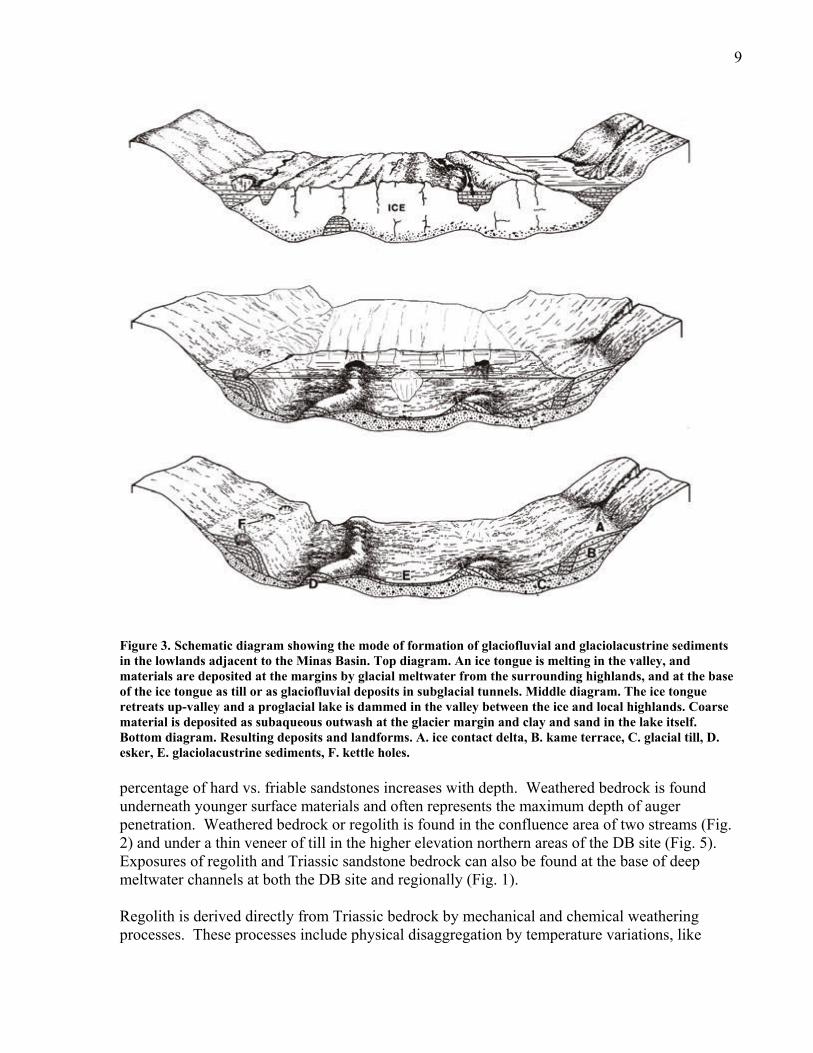
Surface geological units and landforms In the Debert/Belmont study area almost all of the sediment was formed by glaciers, either directly as glacial till or indirectly by glacier meltwater (glaciofluvial and glaciolacustrine deposits). During the last glaciation, glaciers advanced, and eroded bedrock and previously existing glacial sediments forming an unsorted mixture of clay, silt, sand and boulders known as glacial till (Dreimanis, 1989). As the glaciers retreated glaciofluvial deposits were deposited under, on or adjacent to the retreating glaciers (Brodzikowski, and Van Loon, 1987). Glaciofluvial deposits that formed in the proximity of glacier ice are called ice contact stratified drift or more commonly kames and eskers (Fig. 3). These sediments often form irregular hills (kames) or sinuous ridges (eskers) reflecting the ice environments in which they were deposited (Fig. 3). Sediments deposited in front of the retreating glaciers often in glacial lakes are called outwash fans or valley train deposits. Outwash fans are gently sloping, fan-shaped plains consisting of coarse gravel at the head (closest to former ice sheet) and finer sand deposits at the outer edge. Valley trains are belts of outwash confined to valleys, sometimes pitted with kettle holes. It is sometimes difficult to distinguish between low relief, ice contact stratified drift and outwash. Outwash can be deposited at the margin of a calving glacier or into a body of water, either a lake or ocean (Fig. 3). Fine-grained sediments deposited in glacial lakes are termed glaciolacustrine sediments (Fig. 3). These sediments form a major part of the Quaternary basin fill of lowland regions in Nova Scotia and can exceed thicknesses of 50m in some areas (Stea et al., 2006). Former glacial-lake bottom basins are characterized by flat to slightly-rolling topography covered with sand/silt and clay. Shorelines of the former glacial lakes can be marked by terraces and often glaciofluvial-delta deposits (Ashley, 1995). Linear meltwater channels and sand and gravel deposits can terminate into the former lakes. The discussion of the surface deposits and landforms will largely focus on the detailed map area of the archaeological site (Fig. 2) but occasionally references will be made to sections found in the surrounding region (Fig. 1), particularly radiocarbon-dated sites. The Debert Belmont study area will be termed the DB site. Weathered bedrock (regolith) The oldest and lowest geological unit found at the DB site is a loose textured material derived directly from Triassic sandstone (Fig. 2; Map 1). This unit consists of a fine to coarse sand with various sized cobbles and boulders of angular friable and hard sandstone (Fig. 4). The
9
Figure 3. Schematic diagram showing the mode of formation of glaciofluvial and glaciolacustrine sediments in the lowlands adjacent to the Minas Basin. Top diagram. An ice tongue is melting in the valley, and materials are deposited at the margins by glacial meltwater from the surrounding highlands, and at the base of the ice tongue as till or as glaciofluvial deposits in subglacial tunnels. Middle diagram. The ice tongue retreats up-valley and a proglacial lake is dammed in the valley between the ice and local highlands. Coarse material is deposited as subaqueous outwash at the glacier margin and clay and sand in the lake itself. Bottom diagram. Resulting deposits and landforms. A. ice contact delta, B. kame terrace, C. glacial till, D. esker, E. glaciolacustrine sediments, F. kettle holes. percentage of hard vs. friable sandstones increases with depth. Weathered bedrock is found underneath younger surface materials and often represents the maximum depth of auger penetration. Weathered bedrock or regolith is found in the confluence area of two streams (Fig. 2) and under a thin veneer of till in the higher elevation northern areas of the DB site (Fig. 5). Exposures of regolith and Triassic sandstone bedrock can also be found at the base of deep meltwater channels at both the DB site and regionally (Fig. 1). Regolith is derived directly from Triassic bedrock by mechanical and chemical weathering processes. These processes include physical disaggregation by temperature variations, like

10
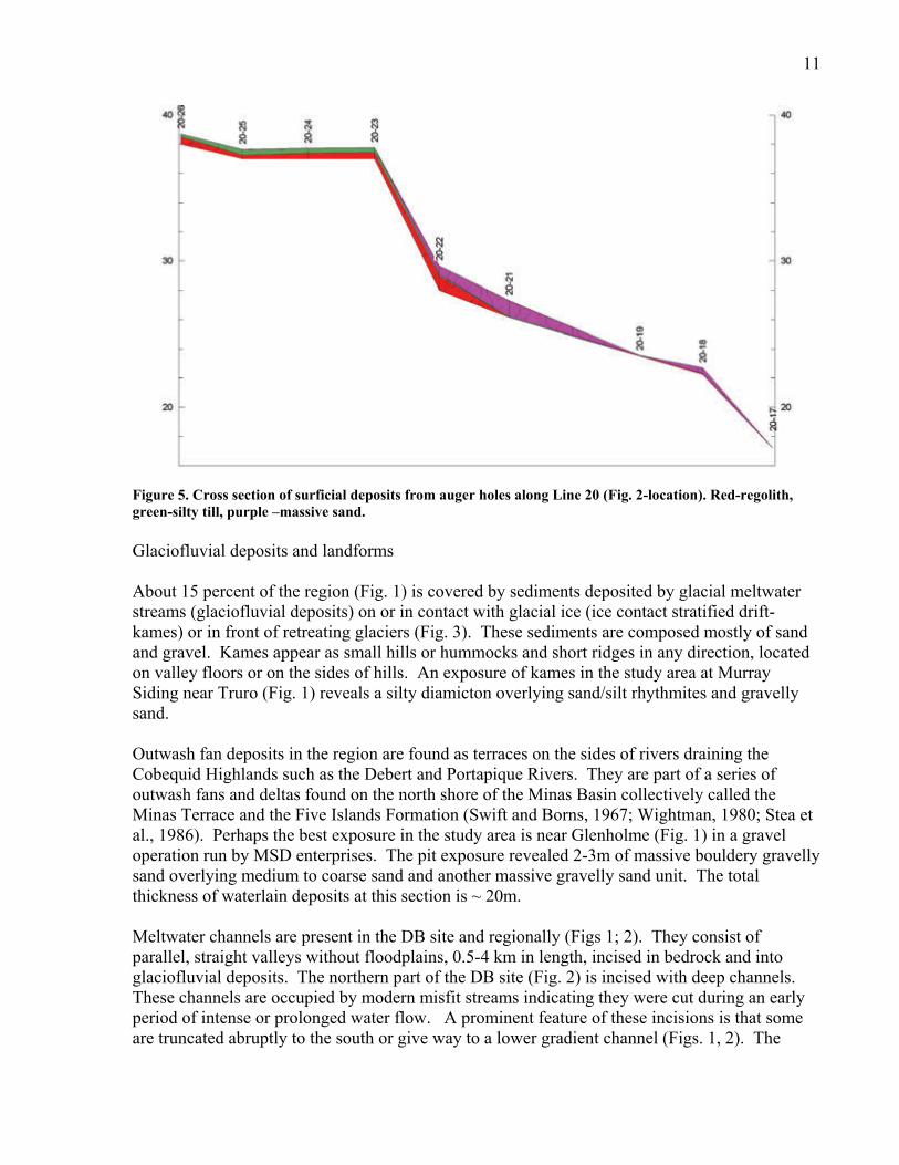
Figure 4. Regolith of Triassic sandstone consisting of sand and pebbles. freeze/thaw expansion and contraction. Disaggregating bedrock is also accomplished by chemical reactions such as oxidation and hydrolysis. Rock weathering may have largely been completed prior to the last glaciation (O’Beirne-Ryan and Zentilli, 2003). It is important to note that the red Triassic sandstone of the Wolfville Formation is at least in part of wind-blown origin (Hubert and Mertz, 1984). Reworking or recycling of this sandstone by glaciers and streams can produce sediment with some characteristics of wind-blown sand including pebble ventifacts as described in MacDonald (1968). Glacial till Glacial till directly overlies bedrock in many auger cores and in sections throughout the study areas. Two types of till are found in this region, a sandy, moderately compact till with a matrix of silty fine to medium sand, and a silty, highly compact till with clay and silt percentages exceeding 30%. At one locality (4-14; Fig. 2; Appendix 1) a sandy till facies overlies silty till, hence the sandy unit is younger. Each till sheet is associated with surface erratic boulders of diabase, diorite and granite derived from the Cobequid Highlands to the north. Sandy tills are looser, and may have been deposited through melt-out. These till facies may be a part of one glacial depositional sequence as a lodgment/meltout coupling (Dreimanis, 1989) or they could be tills related to separate ice advances. Further evidence/analysis is required to reject or accept these hypotheses. Pebbles found in this sediment can be striated (etched with scratches) and exhibit bullet or flat-iron shapes characteristic of glacial erosion (Kruger, 1984). In the higher elevation areas of the DB site (Figs. 2, 5) and in the Minas Basin area regionally till (Figs, 1; 6) till is a thin veneer over regolith/bedrock. In lower elevations of the Minas Basin study region the deposits can be defined as a till plain (Goldthwait, 1989), or a slightly to strongly rolling plain, averaging 5m and attaining thicknesses of 30m. The surface till unit has been termed the Eatonville Till (Stea and Finck, 1988).
11
Figure 5. Cross section of surficial deposits from auger holes along Line 20 (Fig. 2-location). Red-regolith, green-silty till, purple –massive sand. Glaciofluvial deposits and landforms About 15 percent of the region (Fig. 1) is covered by sediments deposited by glacial meltwater streams (glaciofluvial deposits) on or in contact with glacial ice (ice contact stratified drift-kames) or in front of retreating glaciers (Fig. 3). These sediments are composed mostly of sand and gravel. Kames appear as small hills or hummocks and short ridges in any direction, located on valley floors or on the sides of hills. An exposure of kames in the study area at Murray Siding near Truro (Fig. 1) reveals a silty diamicton overlying sand/silt rhythmites and gravelly sand. Outwash fan deposits in the region are found as terraces on the sides of rivers draining the Cobequid Highlands such as the Debert and Portapique Rivers. They are part of a series of outwash fans and deltas found on the north shore of the Minas Basin collectively called the Minas Terrace and the Five Islands Formation (Swift and Borns, 1967; Wightman, 1980; Stea et al., 1986). Perhaps the best exposure in the study area is near Glenholme (Fig. 1) in a gravel operation run by MSD enterprises. The pit exposure revealed 2-3m of massive bouldery gravelly sand overlying medium to coarse sand and another massive gravelly sand unit. The total thickness of waterlain deposits at this section is ~ 20m. Meltwater channels are present in the DB site and regionally (Figs 1; 2). They consist of parallel, straight valleys without floodplains, 0.5-4 km in length, incised in bedrock and into glaciofluvial deposits. The northern part of the DB site (Fig. 2) is incised with deep channels. These channels are occupied by modern misfit streams indicating they were cut during an early period of intense or prolonged water flow. A prominent feature of these incisions is that some are truncated abruptly to the south or give way to a lower gradient channel (Figs. 1, 2). The

12
Figure 6. Silty till overlying Triassic bedrock at stop 100/05 (Fig.1 location). Bedrock/till contact at the top of the pick handle. Note the paucity of pebbles/cobbles in till.
cause of this abrupt transition is uncertain, but one explanation is that a higher base level was prevalent, perhaps the surface of a glacier or glacial-marginal lake which occupied the lower regions. These features would therefore be analogous to lateral meltwater channels, common in alpine glaciated terrains fed by spring glacier melt in the higher areas (Dyke, 1993). Evidence for a lateral meltwater origin can be found just east of the map area where the channels end near a lateral moraine on the side of the valley. Allerød paleosol There are several localities in the region (Figs. 1, 7) where buried soil and peat is found resting directly on glacial till, outwash and glacial lake sediments of the last major glaciation (Stea and Mott, 1989; 2005). This in an important marker horizon because it is well dated (Table 1) and records not only the timing of deglaciation but the onset of cooling and glacier re-advances during the Younger Dryas. These peaty soils are thin and wispy in the areas north of the Minas Basin and thicker in the southern areas (Figs. 7, 8). The reason for thinner soils in the northern regions is that glaciers persisted longest in these areas (Stea and Mott, 2005). Radiocarbon dating of the southern sites show that 600-700 radiocarbon years elapsed during the formation of the southern soils, and during that time local plant communities changed from herb tundra to open spruce woodland (Mott 1994; Miller and Elias, 2000). The buried peaty soils have several unusual characteristics including a whitish laminated horizon (A?) on top of massive peat that appears to have been partly transported and deposited by water. This bleached horizon is best developed at a reference section at Lismore, Nova Scotia (Stea and Mott, 1989; Figs. 7, 8), where it is overlain by a massive reddish-brown silty-clay unit (Fig. 8).

13
Figure 7. Location of radiocarbon-dated buried soils and lake cores. Site location names and radiocarbon data from labeled sites are found on Table 1. At auger site 12-20 (Figs. 2, 8) a whitish, weathered, laminated sand was found under reddish brown massive sand and silty clay. This bleached zone overlies an iron-cemented layer and another reddish brown sand unit. In situ organic material, however, was not found in the horizon. The top surface of the unit exhibits involutions indicative of periglacial processes. The similarity of stratigraphy with other buried Allerød paleosols, and the presence of involutions, suggests that the weathered unit represents a period of ice free conditions, rather than a diagenetic feature such as a redox boundary related to water table fluctuations. The bleached

14
Table 1. Radiocarbon ages in the study area (Fig. 6) including buried Allerød paleosols and basal lake core samples in the area with calendar year conversions. *Gyttja=lake mud. These dates are considered to be too old by as much as 2000 radiocarbon years (Stea and Mott, 1998)
Pleistocene age dates Site number (Fig. 6)
Site name
Radiocarbon age4C ka BP
2σ
Lab No.
Material
Calibrated age cal BP (2σ)
1 Pipeline 232/99
10 800
100
(GSC-6419)
wood
12 624-13 129
2 Pipeline 253/99
11 100
110
(GSC-6566)
peat
12 867-13 426
3 Silver Lake (base) 11350 60 (BETA-1400) wood 13109 - 13323 4 Tupper Lake (base) 12800 200 (GSC-5049) gyttja* 14249 - 15692 5 Blomidon (top) 10600 90 (GSC-4969) peat 12355 - 12833 6 Blomidon (bottom) 11700 110 (GSC-4968) peat 13322 - 13771
7 Shubenacadie (top) 10800 100 (GSC-3981) peat 12630 - 12951
8 Shubenacadie (bottom) 11400 100 (GSC-4337) peat 13089 - 13444
9 Brookfield 10800 80 (TO-3970) wood 12689 - 12910
10 Truro (bottom) 11440 80 (TO-3880) wood 13146 - 13441 11 Brookside (top) 11100 100 (GSC-2930) peat 12872 - 13187 12 Brookside (bottom) 11700 100 (GSC-3849) peat 13337 - 13760 13 Little Dyke Lake (base) 11560 90 (BETA-54888) wood 13243 - 13633 14 Frog Lake (base) 10725 95 (SI- gyttja* 12580 - 12893 15 Folly Bog (base) 10764 101 (P-951) gyttja* 12599 - 12926 16 Wentworth 10700 100 (GSC-4929) wood 12558 - 12877 17 Wigmore Lake (base) 11400 140 (GSC-5567) gyttjja* 12988 - 13569 18 Sutherland Lake 10100 110 (GSC-5571) gyttja* 11270 - 12060 19 Leak Lake (base) 12260 90 (TO-3971) wood 13883 - 14648
20 Leak Lake (base) 15900 1200 (GSC-2880) gyttja* 16002 - 21971
21 Gilbert Lake (base) 11360 80 (TO-807) wood 13095 - 13374 22 Welton lake (base) 9790 110 (GSC-4434) gyttja* 10774 - 11416 23 Spencers Island delta 14,300--12600 (BETA 12859) marine shells* 13885 - 16676 24 Lower Cove (top) 11100 120 (GSC-3924) peat 12859 - 13211 25 Lower Cove (bottom) 11800 110 (GSC-3915) peat 13396 - 13878
26 Debert site 11026-10466 Av-10600
47
(P-943,739,741,966, 967,970,971,972,973,974,975,977)
charcoal 12570 - 12801
Holocene age dates
27 North River gravel terrace series 2160 60 (BETA-206845) wood 1990-2330
27 “same location” 470 50 (BETA-209642) wood 460-550

15
horizon and overlying silty clay were sampled and tested for pollen content but produced no result (R. J. Mott, pers. comm., 2006). The correlation of the bleached sand at 12-20 with the dated peat beds is important because the massive and laminated sand which overly the inferred paleosols are associated with artifacts only a few hundred metres away at the main Debert site (MacDonald, 1968). Massive and laminated sand A surface sand deposit found at the DB site is perhaps most relevant to this study as it is associated with artifacts (MacDonald, 1968). The stratigraphy of this deposit called the massive or structureless sand is best demonstrated at the type section 12-20 (Figs. 2, 8) and at backhoe excavations at the Belmont site (1-3, 1-28; 1-43; Figs. 2; 9). At the surface it is a poorly sorted, loose-textured, silty, fine to medium massive sand with granules and a few pebbles. The sediment has a wide range of grain sizes. Pebble content is variable, by definition, low or absent. The massive sand overlies a bedded sand unit at many localities including the man Debert site. The laminated sand features normally-graded beds of coarse to medium/fine sand or coarse-medium sand and finer strata of silt/clay. At the Belmont site backhoe excavations in 1991 revealed graded beds of coarse to fine sand laminae that are generally 1-3 cm thick (Fig. 9). Both the massive and laminated sand deposits are positively skewed, with a substantial "tail" of fine-grained material (Fig. 10). At Belmont the sand deposit appears to lap onto the till ridges and pinches out near the crests where there are a distinct scarps cut into the till (Figs. 2, 11). A slight break in slope can also be seen at other regions where the sand is in contact with adjacent till slopes. At site 12-20 (Fig. 8) the laminated sand facies consists of coarse sand and silt/clay laminae. These laminated sands overlie a massive layer of silty clay. Swift et al., (1966) interpreted the laminated sand as a periglacial eolian deposits based on the apparent layering and a median grain size in the fine sand range. They noted three characteristics of the laminated sand that did not fit a wind-blown origin:
1. The sand has a silt/clay content of 8%, 2. The sand does not have characteristic dune bedding. 3. The sand is not associated with dune landforms.
Collinson (1978) for example, states: “Wind is an efficient sorter of sediment because of its low density and viscosity and because it can only move sand-sized particles. Coarser grains move less readily and finer material goes into suspension to be transported longer distances and often out of the basin". Cold climate “niveo-eolian “ cover sand deposits in Europe, however, tend to be parallel laminated, normally graded and may also be negatively skewed (contain fine-grained materials). They also show conformable relations with (fluvio) glacial deposits, evidence for snow meltwater reworking and associated structures or forms of permafrost origin (Kosters, 1988; Bateman et al., 2000).

16
Figure 8. Photos of buried Allerød soil/peat horizons near the Debert -Belmont site and in other areas of Nova Scotia. A. Onslow-Truro site (Location 10-Fig. 7) B. Pipeline buried organics (Location-2-Fig. 7) C. Lismore, Nova Scotia (Stea and Mott, 1989) Note the bleached horizon and red silty clay at the base of the trowel. D: Site 12-20 (Fig. 2): Unit 1-red sand, Unit 2-bleached sand-silt, Unit 3-red silty clay, Unit 4-laminated sand, Unit 5 massive sand, Unit 6- Holocene soil.

17
Figure 9. Stratigraphy of 1991 backhoe sections (Locations-Fig. 2). BG-bouldery gravel, Sm-massive sand, Sgl- sand graded, laminated. (a) location of grain size sample (Fig. 10). The presence of a silt/clay beds at the base of the sand deposit and interfingering silt/clay with sand at the reference section (12-20) and elsewhere suggests at least initially the sediments were deposited in a small lake or pond. Furthermore, the deposits are not found in elevations above 35m or regionally, suggesting a local base-level control incongruous with a wind-blown origin. A lake or pond hypothesis requires a either a bedrock or morainal sill or the presence of a glacier in lower elevations to trap water because sea-level at the time was 20-30m lower (Shaw et al., 2002). Since there is no evidence of any former obstruction to downhill water flow a glacier dam is the most likely. In the Shubenacadie Valley lacustrine clay deposits and sand sheets overlying Allerød paleosols are widespread (Fig. 7), and are restricted to elevations below 30m. A till-covered paleosol found at the Onslow turnoff in Truro (Figs. 7, 8) attests to the presence of a glacier in the Minas Basin which dammed the present river outlet and backed up water throughout the valley to the south (Stea and Mott, 1989; 1998). Presumably this glacier would have also created dams in the rivers and streams draining into the Minas Basin from the north. On the south-facing slope of the Salmon River Valley at Brookside, just east of Debert, clay and diamicton deposits overly a peat dated 11 ka (Fig. 7; Mott et al., 1986). From regional mapping it would appear that the glacial lakes on the north side of the Minas Basin were not contiguous or extensive as those in the Shubenacadie Valley, perhaps occupying isolated sites in a narrow corridor between the Cobequid Highlands and a low-profile glacier in the Minas Basin.

18
Figure 10. Grain size data from 1991 backhoe sections (1-3, 1-28, 1-43; Fig. 9). The transition from the lower laminated sand to the upper massive sand facies at the type section (12-20) and elsewhere is abrupt. MacDonald (1968) interprets the massive sand as a result of soil and animal bioturbation and the main Debert site was substantially modified by human activity prior to site excavation. In our survey the massive sand was found below a well developed Holocene soil horizon at the reference section 12-20 and other auger sections recorded throughout the DB site and environs (Fig. 2). The massive sand, like the laminated sand below, appears to have elevation control, and is not found regionally. This restricted distribution favors a lake or pond origin, and to explain a lack of bedding, deposition may have occurred as a turbid underflow or slump in a near-shore shallow-water setting during a period of enhanced meltwater or overland sheet flow (Ashley, 1995). The lack of a pebble or cobble fraction in this case can be explained by post-glacial weathering of glacial till containing friable Triassic sandstone clasts, the main source area lithology. The similarity in grain size or the massive and laminated sand (Fig. 10) implies a similar origin. Combined glacial or periglacial processes including snow or ice melt-out and snow and wind-blown sand (niveo fluvial, niveo eolian), cannot be entirely ruled out.

19
Figure 11. Photo (stereo-pair) of a meltwater channel scarp at the Belmont site taken in 1991. Looking SW. Artifacts are located on the surface of the higher regions above the scarp, and within sand deposits which fill in the lower lying areas below the scarp Holocene sedimentation Holocene sediments were deposited during the last 10,000 years after the final retreat of glaciers. These consist of valley slope colluvium, marine bar and estuary, river (alluvial and deltaic) and organic (bog, fen) environments (Fig. 1). Colluvial deposits are found on steep valley slopes and consist of a variable mixture of weathered rock talus, slumped till, sheetwash and organic horizons produced by mass wasting. Marine landforms in the region include barrier bars and spits whose coarse gravel and sand are derived from erosion and longshore drift from moraine/drumlin and rock headlands. The most extensive marine deposits consist of tidal channels and flats filled with red silty clay deposits and adjacent salt marsh areas with a variable cover of peat and muck. Streams within the DB area are generally misfit (small considering the size of the channel). The channels containing these ephemeral streams are steep and deep in the higher elevation northern and are terraced in the southern area. Sand and mud within the modern stream channel undoubtedly represents recent stream deposition. The late-glacial massive and laminated sands are found on higher terraces in the southern part of the map area, implying that modern streams had subsequently cut down through these deposits. A wide meltwater channel in the DB site (Fig. 2), however, is filled with the sand deposits and terminates at the base level of the former ice marginal lake. Thick, coarse gravel deposits are found in the southern part of the DB site in a terrace several meters above the present Chiganois River (Figs. 1, 2). Similar terraced gravel deposits are found along most of the south-flowing rivers that drain into the Minas Basin and Salmon River. West of Debert, these terraces are demonstrably Pleistocene in age because kettle lakes on the terrace surfaces have basal ages of 11.5 ka (Figs. 1; 7; Table 1). Along the north shore of the Minas Basin west of Debert these elevated terraced deposits are the remnants of glaciomarine deltas formed when sea-level was 10-40m above present (Swift and Borns, 1967; Wightman, 1980; Stea and Wightman, 1987). Shells recovered from bottomset beds of one of these deltas on the westernmost part of the Chignecto Peninsula, were radiocarbon dated between 14 and 12ka (Stea and Wightman, 1987; Fig. 7; Table 1).

20
Figure 12. Wood and black organic material (dark grey) within a Holocene gravel terrace 5m above the North River (Fig. 1)
It was assumed that elevated, terraced gravels in the eastern Minas Basin at Debert, the DB site) and at North River near Truro (Figs. 1, 2) would also be Pleistocene in age (e.g. Hennigar, 1972). Large wood fragments were found in a gravel pit at about 2m depth below the surface of a high terrace 5.4 meters above the present North River. Surprisingly, these logs provided Holocene radiocarbon ages of 2160±60 yrs BP (Beta-208645) and 470±50 yrs BP (Beta- 209642; Table 1). It was thought that elevated gravels implied deposition during higher sea-levels and therefore an older (Pleistocene) age for the deposits. It is clear from the Holocene ages, however, that the elevated gravel deposits east of Debert must represent events of rapid, perhaps catastrophic flow and sediment aggradation at the end of the Holocene. It is also not clear where the Pleistocene terraces end and the Holocene terraces begin.
Relationship of surficial units with artifacts and timing of the Debert site
MacDonald states unequivocally (1968, p. 6) that the massive (“structureless”) sand unit is of “primary interest because it alone contains artifactual remains”. Correlation of artifacts and the surface massive sand deposit are clear from the stratigraphic diagrams presented in his memoir (MacDonald, 1968, p. 17). At the Belmont site, excavated by Dr. Stephen Davis in 1991 artifacts were also found to be located well within a massive sand unit as mapped by the author (Site 1-28, Fig. 2) close to the pinch out of these deposits along a till scarp (S. Davis, pers. comm., 2006). Artifacts were also found on the surface of the till in the higher areas of the Belmont site. An important question is whether the artifacts at the main Debert site are contained wholly within soil-modified horizons or are also found within unaltered or unmodified portions of the massive sand below recognized soil horizons (Brewster, et al., 1996; see Brewster this volume).

21
Figure 13. Upper graph: radiocarbon dates from the Minas Basin-Bay of Fundy region (Fig. 7; Table 1) Lower graph: radiocarbon dates from the Debert/Belmont site. Dashed line= average of Debert dates. vertical axis=no. of dates. If the laminated sands do not contain artifacts, then it would seem unlikely that the artifacts were derived or reworked from a directly underlying soil horizon or stratigraphic equivalent. This assertion is based on the correlation established between the laminated sand described by MacDonald and his colleagues and the laminated sand at reference section 12-20 overlying what is interpreted as an equivalent of radiocarbon-dated Allerød paleosols in Nova Scotia (Fig. 8). Dating of the sand deposits at site 12-20 using luminescence methodology may be necessary to verify this correlation. Several authors have previously suggested that the radiocarbon dates at the Debert site are too young. Stea and Mott (1989) using paleoclimate data and evidence for a glacier readvance during the Younger Dryas Chronozone suggested initial occupation of the site during the previous Allerød warm period. Davis (1991) proposed that pre-treatment of the charcoal in the

22
Debert samples was insufficient to remove humic acid contaminants, that would give anomalously younger ages. Bonnichsen et al (1991) also supported an older age for occupation, but suggested that the dated charcoal was not from in situ hearths but from Younger Dryas forest fires and associated tree-throw ground disturbance. Pollen data from nearby lakes, however, imply that during the Younger Dryas local environments had reverted to treeless shrub tundra conditions (Mott et al., 1986; Mayle et al, 1993; Miller and Elias, 2000). MacDonald (1968, p. 118) provided pollen data on the hearth charcoal and found that the charcoal and associated pollen consisted of spruce wood, and indicated an abundance of wood in the local environment. These charcoal pollen data are not compatible with what is known about biota during the Younger Dryas so it would suggest that the dates are in error. A histogram of radiocarbon dates, both regionally and at the Debert site (Fig. 13), illustrates that the radiocarbon dates at the site are incompatible with regional data. A compilation of local lake core and buried peat data show a gap in radiocarbon data during the Younger Dryas. This gap is a result of the deposition of inorganic sediment during the Younger Dryas both in lakes and overlying buried Allerød soils. The Debert data contain older dates that span the previous warm period, but overlap into the period of no data in the regional radiocarbon data set. These data strongly suggest that the younger Debert dates are in error, and as Davis (1991) pointed out, this may be due to the presence of humic acid (modern rootlet?) contaminants. If we accept the hypothesis that the dates are younger than occupation and that the artifacts (and charcoal) are associated with fluvially transported massive sand then it is possible that the dated charcoal and the artifacts were reworked from late Allerød Interstadial soils upslope. For example, artifacts present on the till topographic high at Belmont may have been transported downslope and deposited with massive sands in the low-lying areas below erosional scarps (Figs. 2; 11). This would also imply that the associated charcoal is not an in situ feature. Occupation during the Younger Dryas Chronozone in Nova Scotia presents another problem. Stea and Mott (2005) presented data to infer a glacier readvance during the YD, and suggested that small low-latitude and low elevation ice caps that persisted in the area during the Allerød warm period were rejuvenated by a marked increase in snowfall. Mass balance considerations require that a local glacier near sea-level can only be rejuvenated if a portion of that snowfall is retained over the summer months. The scenario of a series of summerless years does not bode well for maintaining a viable camp site, at least in the long term.
Deglaciation, sea-level and paleoenvironments of the Minas Basin/Bay of Fundy What follows is a summary of the deglaciation and sea-level history of the region based on previous work and the new data presented for the DB site. The DB area has a sedimentary record that largely reflects the period of ice retreat at the end of the Pleistocene and tidal amplification/fluvial aggradation during the Holocene. The sequence of events during deglaciation is summarized in Figure. 14. Ice retreat out of the Minas Basin area is first recorded at the Spencer’s Island delta and Leak Lake near Parrsboro Nova Scotia (Figs, 7, 14). A series of ice margins were established along

23
the north shore of the Minas Basin and in regions to the north. The oldest margin is marked by sediments of the Five Islands Formation encompassing glaciofluvial and glaciomarine sediments that form raised and terraced outwash plains and deltas (Swift and Borns, 1967; Wightman, 1980; Stea et al., 1986; Fig. 7). AMS radiocarbon ages on the Spencer’s Island delta range from 14.3 to 12.6 ka and record the duration of deposition of a diamicton under the deltaic deposits and of the delta itself (Stea and Wightman, 1987). Leak Lake is a kettle lake within the Parrsboro outwash delta plain (Fig. 7). A lake core provided a basal AMS wood age of 12.3 ka from which Stea and Mott (1998) .estimated ice free conditions starting at ~13 ka. Little Dyke Lake, at the head of the Minas Basin, is a kettle lake in outwash that produced a basal age of 11.6 ka (Frappier, 1996; Fig. 7; Table 1). The lag in time of nearly 1000 radiocarbon years reflects the slow eastward ice retreat into the Minas Basin. This lag in ice removal is also responsible for an eastward decline in marine limits in the Minas Basin. As areas in the basin were freed of ice, marine deposits were formed at progressively lower sea-levels, because of rapid isostatic recovery under the deflating local ice caps (Stea, 2004). RSL continued to fall rapidly during the late-glacial period and by 11 ka was below present in the Minas Basin (Shaw, et al., 2002). At 13 ka glaciers were still active over southern Nova Scotia. As ice retreated eastward and northward into the Minas Basin, the western Annapolis valley and parts of the Chignecto Peninsula were inundated as oceans invaded isostatically depressed landscapes. After 12.9 ka a couple of short-lived glacier advances occurred. Hickox (1962) inferred a glacier readvance in the central Annapolis Valley from a kame superimposed on a delta at Margaretsville, Nova Scotia. This readvance, termed the Chignecto Phase is dated between 13.5-13 ka and is roughly correlative with the Port Huron event of the mid-continent and the “oldest” Dryas in Europe (Stea et al., 2004). Following the retreat from the Chignecto Phase ice margin, a series of glacial lakes developed in the valleys that drain into the Bay of Fundy including the eastern Annapolis and Shubenacadie Valleys (Purdy, 1954; Paradis et al., 2006). There is also evidence for a short-lived re-advance in the regions north of Parrsboro dated about 12.3-11.8 ka (Shulie Lake Phase-Stea et al., 1986; Stea et al., 2004) correlative with the “older”Dryas (Mangerud et al., 1974). During the eastward retreat of the Minas Basin glacier the Shubenacadie River outlet must have been blocked the lower valley as thick, lake clay deposits are found throughout the valley (Fig. 14). These sediments were deposited in Glacial Lake Shubenacadie (1) encompassing much of the Shubenacadie Valley below 30m elevation and forming sometime between 12.5 and 11.7 ka. This lake lasted for a few hundred years (based on varve counts at Brookfield; site 9, Fig. 7). Glacial Lake Shubenacadie 1 had southern outlets to the Atlantic through the Lake William-Lake Charles-MicMac Lake system, present site of the Shubenacadie Canal (Stea and Mott, 1989) and the Gibraltar outlet on the Musquodoboit River (Fig. 15). While the northern part of the Minas Basin became ice free glaciers still remained on the south side as no record of marine submergence exists. Once the ice corridor blocking the Shubenacadie outlet was breached after 11.7 ka, the lake would have rapidly drained. Truro, at the head of the Minas Basin, became ice free just before 11.4 ka. Along the Atlantic coast a lowstand shoreline at -65m developed at 11.6 ka while in the northern Gulf of Maine a few hundred years later the lowstand formed at 11 ka (Stea et al., 1994; Barnhardt et al., 1995). This

24
Figure 11. Deglaciation of the Minas Basin region and formation of glacial lakes (purple). Ocean-dark blue. Former land areas (green) shoreline can be traced to the Fundy coast where it appears to be tilted upwards to -35m (Fader et al., 1977). Amos (1978), on the other hand, suggested that the Minas Basin was never lower than present, but he described an erosional surface at -20m on glaciomarine muds that may be related to a lowstand of sea-level. The role of differential uplift in the abandonment of outlets in this region is considered to be minimal as the retreating ice front was parallel to the Shubenacadie Valley outlets (Fig. 14) and much of the uplift had already occurred (Stea et al., 1994). By 11ka Nova Scotia was almost completely free of ice. Former glacial lakes drained as their Minas Basin outlets became ice free. Small ice caps of unknown size and thickness persisted in the Cobequid Highlands and in PEI because lakes in these areas have no record before 10 ka. (Anderson, 1985; Stea and Mott, 1998). Caribou and other large land mammals may have migrated to the Minas Basin area by this time through the Bay of Fundy lowstand corridor. Low shrub and herbaceous vegetation were the first to occupy suitable sites on the coastal landscape, usually low, wet areas that offered some protection from the weather or where soils were more suitable for plants to colonize (Mott and Stea, 1994). Trees began to migrate into the southern Nova Scotia, around 12 ka (Mott, 1994; Miller, 1995; Miller and Elias, 2001). Spruce, sometimes preceded by poplar/aspen trees, in the form of open woodlands occupied suitable sites south of Truro and westward along the Minas Basin coast. By 11 ka the tree line lay somewhere in northern mainland Nova Scotia, but had not reached Cape Breton Island (Miller and Elias, 2001). The Allerød Interstadial period affecting both Northern Europe and Eastern North America from 12 to 11 ka achieved almost present day levels of warmth (Lowe and Walker, 1998).

25
Figure 12. Extent (dark blue) and outlets of Glacial Lake Shubenacadie. At 10.8 ka an abrupt and dramatic climatic cooling termed the Younger Dryas Stadial (Mangerud et al., 1974) lasting several hundred years transformed the landscape and its vegetation cover (Mott et al., 1986; Mayle et al., 1993). Small glaciers were reactivated and produced ice dams that flooded lowland areas, sites of former peat bogs (Stea and Mott, 1989; Grant, 1989). Lake and bog basins were inundated by clays and silts, emanating from glaciers or from permanent snowpacks, leaving a distinct marker horizon. The presence of a unique snow-bed pollen taxon (Empetrum) was noted in the mineral layer of lakes in Newfoundland (Wolfe and Butler, 1994). The marked decrease in diatoms during the Younger Dryas was interpreted as a response to

26
permanent ice cover (Wilson et al., 1993). In Nova Scotia, spruce trees were decimated if not completely eliminated at some sites. Shrub birch communities reverted to willow dominance, and herbaceous taxa increased or dominated at some sites (Mott, 1994). On land, stratigraphic sections record the advance of local glaciers into the Minas Basin and the re-damming of former glacial lakes (Stea and Mott, 2005). A glacier probably extended to the mouth of the Minas Basin where it was constricted against the North Mountain. During this time Glacial Lake Shubenacadie 2 briefly formed in the Shubenacadie valley. A lake (Glacial Lake Glooscap) formed in the Wolfville area and south coast of the Minas Basin dammed up by the YD glacier and the North Mountain (Stea and Mott, 2005). Evidence for this lake is documented in (Stea et al., 1992) where they describe a sandy shoreline deposit near Blomidon overlying Allerød peat on a terrace on the North Mountain (location, 5, 6-Fig. 7, Table 1). Recent mapping by Paradis et al., (2006) has further documented glacial lake sand and clay deposits below 25m around the Minas Basin (including the Blomidon site) in the Wolfville area. Marine submergence can be ruled out based on the Younger Dryas age of the Blomidon sand. During the Holocene several periods of catastrophic flooding are indicated in the North and Salmon River Valleys. Terraced gravel deposits contain large wood logs with Holocene ages. These deposits are as much as 6m above present river levels in the North River valley implying flows with significant water depths. It is a distinct possibility that parts of the drainage basin were dammed up to create this significant flooding. One possibility is the creation of temporary ice dams and another is blockage of parts of the basin by landslides triggered by earthquakes.
References
Acomb, L. J; Mickelson, D. M; Evenson, E. B., 1982. Till stratigraphy and late glacial events in the Lake Michigan Lobe of eastern Wisconsin;, Geological Society of America Bulletin, vol.93, no.4, pp.289-296, Apr 1982. Amos, C.L., 1978. The post glacial evolution of the Minas Basin, Nova Scotia. A sedimentological interpretation; Journal of Sedimentary Petrology, v. 48, pp 965-982. Anderson, T. W., 1985. Late-Quaternary pollen records from eastern Ontario, Quebec, and Atlantic Canada; in Pollen Records of Late Quaternary North American Sediments, M Bryant and R. G. Holloway, eds. AASP Foundation, p. 281-326. Ashley, G. M., 1995: Glaciolacustrine environments; Chapter 13 in: Modern Glacial Environments: Processes, Dynamics and Sediments. Menzies, J. (ed.) Butterworth-Heineman Press, p. 417-247. Barnhardt, W. A., Gehrels, W. R., Belknap, D. F., and Kelley, J. T., 1995. Late Quaternary relative sea-level change in the western Gulf of Maine: Evidence for a migrating glacial forebulge; Geology, v. 23: p. 317-320.

27
Bateman, M. D., Murton, J. B. and Crowe, W. 2000.: Late Devensian and Holocene depositional environments associated with the cover sand around Caistor, north Lincolnshire, UK. Boreas, v. 29, p. 1–15. Bonnichsen, R, Keenleyside, D., Turnmire, K., 1991. Paleoindian Patterns in Maine and the Maritimes; in Prehistoric Archaeology in the Maritime Provinces: Past and Present Research, . Deal, M. and Blair S., eds. pp. 1-36. New Brunswick Archaeological Services: Fredericton. Borns, H. W., 1966. The geography of paleo-Indian occupation in Nova Scotia; Quaternaria, v. 8, p. 49-57. Brewster, G.R., Davis, S.A., Frappier, M., Mott, R., and Stea, R., 1996. Preliminary report on the Debert-Belmont Palaeo-Indian project. In Powell, S.T., ed. Archaeology in Nova Scotia 1991. Nova Scotia Museum Curatorial Report No. 81. pp. 81-88. Nova Scotia Museum, Halifax Brodzikowski, K., and Van Loon, A. J., 1987; A systematic classification of glacial and periglacial environments, facies and deposits, Earth Science Reviews, V. 24, p. 287-381. Collinson, J. D., 1978; Deserts; Chapter 5 in Sedimentary Environments and Facies, Reading, H. G., ed., Elsevier, NY. P. 80-95. Davis, R. B., and Jacobson, G. L. Jr. 1985: Late glacial and early Holocene Landscapes in northern New England and adjacent areas of Canada; Quaternary Research, v. 23, no. 3, p. 341-368 Davis, S. A. 1991. Two concentrations of palaeo-indian occupation in the far northeast; Revisita de Arquelogia Americana 3: 31-55. Dreimanis, A. 1989. Genetic classification of tills; in Genetic Classification of Glacigenic Deposits, eds Goldthwait R. P. and Matsch, C. l. p. 17-84, Balkema, Rotterdam. Dyke, A.S., 1993. Landscapes of cold-central Late Wisconsinan ice caps, Arctic Canada; Progress in Physical Geography, v. 17(2), p. 223-247. Fader, G. B., King, L. H., and MacLean, B., 1977. Surficial Geology of the Eastern Gulf of Maine and Bay of Fundy, Geological Survey of Canada, Paper 76-17, 23 p. Frappier, M. G., 1996. Late-glacial, fine resolution pollen and texture analyses of Little Dyke Lake sediments, central Nova Scotia, M. A. thesis, Department of Geography, University of Ottawa, 131 p. Goldthwait, R.P., 1989. Classification of glacial morphologic features; in Genetic Classification of Glacigenic Deposits. Goldthwait. R. P. and Matsch, C. L., (eds), p. 267-278; Balkema Rotterdam. Grant, D. R., 1989. Quaternary Geology of the Atlantic Appalachian region of Canada; Chapter 5; in Quaternary Geology of Canada and Adjacent Greenland, R. J. Fulton, (ed.); Geological

28
Survey of Canada, Geology of Canada no. 1 (also Geological Society of America, The Geology of North America, v. K-1) 393-440. Haynes, G., 2002. The catastrophic extinction of North American mammoths. World Archaeology v. 33 (3), p. 391–416. Hennigar, T. W 1972: Hydrogeology of the Truro area, Nova Scotia; Nova Scotia Nova Scotia Department of Mines, Report 72-1, 127 p. Hickox, C. F., Jr., 1962. Pleistocene geology of the central Annapolis Valley, Nova Scotia; Nova Scotia Department of Mines, Memoir 5, 36 p. Hubert, J. F; and Mertz, K. A., Jr., 1984. Eolian sandstones in Upper Triassic-Lower Jurassic red beds of the Fundy Basin, Nova Scotia ; Journal of Sedimentary Petrology, vol.54, no.3, pp.798-810. Koster, E. A. 1988: Ancient and Modern cold-climate aeolian sand deposition: a review. Journal of Quaternary Science v. 3, p. 69–83. Kruger, J. 1984: Clasts with stoss lee form in lodgement tills: a discussion; Journal of Glaciology, v. 30, p. 241 243. Lowe, J. J., and Walker, M. J. C., 1998: Reconstructing Quaternary Environments; Longman Press, 446 p. MacDonald, G. F.,1968: Debert, a palaeo indian site in central Nova Scotia; Anthropology Papers, National Museum of Canada, no. 16, 207 p. Mangerud, J., Andersen, S. T., Berglund, B. E. and Donner, J. J., 1974. Quaternary Stratigraphy of Norden, a proposal for terminology and classification; Boreas, v. 3, p. 109 128 Mayle, F. E., Levesque, A. J. and Cwynar, L. C., 1993: Accelerator mass spectrometer ages for the Younger Dryas event in Atlantic Canada; Quaternary Research, v. 39: p.355-360. Miller, R. F., 1995. Late-glacial Coleoptera and the paleoclimate at Hirtles, Nova Scotia; Atlantic Geology, 31: 95-101. Miller, R. F. and Elias, S.A.: 2000: Late glacial climate in the Maritimes Region, Canada, reconstructed from mutual climatic range analysis of fossil Coleoptera. Boreas v., 29, p. 79 88. Mott, R. J., 1994. Wisconsinan Late-glacial environmental change in Nova Scotia: a regional synthesis: Journal of Quaternary Science, 9: 155-160. Mott, R.J., Grant, D.R.G., Stea, R.R. and Occhietti, S.1986: Late-glacial climatic oscillation in Atlantic Canada equivalent to the Allerød-Younger Dryas event; Nature, vol.323, no. 6085, p.247-250.

29
Mott, R. J., Matthews, J. V. Jr., Grant, D.R., and Beke, G.J., 1986: A late glacial buried organic profile near Brookside, Nova Scotia; in Current Research, Part B, Geological Survey of Canada, Paper 86-1B, p.289-294. Mott, R. J. and Stea R. R., 1994. Late-Glacial (Allerød/Younger Dryas) buried organic deposits, Nova Scotia, Canada; Quaternary Science Reviews, v. 12:, p. 645-657. O'Beirne-Ryan, A. M.; and Zentilli, M., 2003. Paleoweathered surfaces on granitoids of southern Nova Scotia; paleoenvironmental implications of saprolites; Canadian Journal of Earth Sciences, v. 40, no.6, p.805-817. Paradis, S. J.; Bolduc, A. M; and Stea, R. R. 2006. Paleogeography of the Annapolis Valley - A complex glacial history. Joint Annual Meeting of the Geological Association of Canada and the Mineralogical Association of Canada. University of Quebec in Montreal (UQAM) May 14-17, 2006. Purdy, C. A. 1951: Pleistocene geology of the Kentville area, Nova Scotia; M.Sc. thesis, Acadia University, Wolfville, Nova Scotia; Nova Scotia Department of Mines and Energy, Thesis 299, 51 p. Shaw, J., Gareau, P. and Courtney, R. C., 2002: Palaeogeography of Atlantic Canada 13-0 kyr.; Quaternary Science Reviews v. 21, p.1861-1878. Stea, R R. 2004: The Appalachian Glacier Complex in Maritime Canada. In Ehlers, J. & Gibbard, P.L.(eds.), Quaternary Glaciations Extent and Chronology: Part II North America , 213-232, Elsevier, Amsterdam. Stea R. R, Feetham, M., Pullan, S. E., Ostrom, W., Baechler, L.and. Ryan, R. J., 2006, Geology and Economic Potential of the Glacial Clay and Sand Deposits of Inverness County, Southwest Cape Breton Island, Nova Scotia Department of Natural Resources Mineral Resources Branch, Economic Geology Series ME 2006-1, 110p, 2 maps. Stea, R. R., Boyd, R., Fader, G. B. J., Courtney, R. C., Scott, D. B.., and Pecore, S. S., 1994. Morphology and seismic stratigraphy of the inner continental shelf off Nova Scotia, Canada: Evidence for a -65 m lowstand between 11,650 and 11,250 14C yr B.P.; Marine Geology, 117: 135-154. Stea R.R., and Finck, P. W., 1988, Quaternary geology of northern mainland Nova Scotia, sheets 10 and 11; Nova Scotia Department of Mines and Energy, Maps 88-13 and 88-14, scale 1:100,000. Stea, R. R., Finck, P. W. and Wightman, D. M., 1986. Quaternary geology and till geochemistry of the western part of Cumberland County, Nova Scotia (sheet 9); Geological Survey of Canada, Paper 85 17, 58 p.

30
Stea R. R,. Forbes D. L,. Mott R. J, 1992. Quaternary geology and coastal evolution of Nova Scotia; , Geological Association of Canada, Field Trip Guidebook, no. A6, 131 pages. Stea R. R., and Mott, R. J., 1989. Deglaciation environments and evidence for glaciers of Younger Dryas age in Nova Scotia, Canada; Boreas, 18: 169-187. Stea R. R. & Mott, R. J. 1998. Deglaciation of Nova Scotia; stratigraphy and chronology of lake sediment cores and buried organic sections; Géographie physique et Quaternaire v. 41, p. 279-290. Stea, R.R. and Mott, R.J., 2005. Younger Dryas glacial advance in the southern Gulf of St. Lawrence, Canada: analogue for ice inception? Boreas, v. 34(3), p. 345-362. Stea, R.R.; Mott, R.J.; Gosse, J.; and Fastook, J. 2004. Late-glacial ice advances in Maritime Canada. Atlantic Geoscience Society. 2004 Colloquium and Annual General Meeting, Moncton, New Brunswick. Stea, R.R. and Wightman,D. M. 1987. Age of the Five Islands Formation, Nova Scotia, and the deglaciation of the Bay of Fundy. Quaternary Research, v. 27, p. 211-219. Stuiver, M., and Reimer, P. J., 1993, Extended 14C database and revised CALIB radiocarbon calibration program, Radiocarbon v. 35:p. 215-230 Swift, D. J. P. and Borns, H. W., Jr., 1967. A raised fluviomarine outwash terrace, north shore of the Minas Basin, Nova Scotia; Journal of Geology, v. 75, no. 6, p. 693 710. Swift, D. J. P.; Byers, D. S.; and Krinsley, D., 1966. A periglacial eolian sand at Debert, northern Nova Scotia; a preliminary report: Maritime Sediments, v.2, no.1, p.25-30, Wightman, D. M., 1980: Late Pleistocene glaciofluvial and glaciomarine sediments on the north side of the Minas Basin, Nova Scotia; Ph.D. thesis, Dalhousie University, Halifax, Nova Scotia, 426 p. Wightman, D. M. and Cooke, H. B. S., 1978: Post-glacial emergence in Atlantic Canada; Geoscience Canada, v. 5, p. 61-65. Wilson, S. E., Walker, I. R., Mott, R. J., and Smol, J. P., 1993. Climatic and limnological changes associated with the Younger Dryas in Atlantic Canada; Climate Dynamics, 8: 177-187. Wolfe, A. P., and Butler, D. L., 1994. Late-glacial and early Holocene environments at pine Hill Pond, Newfoundland Canada: Evidence from pollen and diatoms; Boreas, v. 23: 53-65.

Appendix 1
Figure 16 . Auger drill locations and transect numbers, Debert/Belmont site.
Debert/Belmont Project: Database Description and Geologic
Sections In order to study the surface materials at the Debert Belmont archaeological site, a systematic hand auger coring program with site spacing of 80m was conducted. The auger used is an Edelman (Dutch) auger capable of producing 5cm diameter core to depths of 2 m in cohesive sediment. The stratigraphic data was collected and input into a geographic information system (ARCVIEW GIS) and a geological mapping software package (ROCKWORKS) that will allow

32
for the creation of individual stratigraphic logs for the site, cross-sections and 3/D stratigraphic models for the Debert-Belmont site. This report accompanies the database and provides a description of the raw data from the survey along with plots of the geological data for general use by the project team.
(1) Database description
Site Number: Sampling location on a grid. First number rows to east-second columns to
north Surface Unit: Geological unit exposed at the surface (below solum) Northing/easting: NAD 83 UTM coordinates of sample spot SEDlog: Field notes from auger survey with depths/descriptions (link to text files in sections directory) Solum-Regolith: Elevations above mean sea level of the top of the individual geological units. TD: Elevation of the bottom of auger hole Sampleno: Samples taken and depths Photos: Photos taken and depths Filename Link to directory with photos (2006 photos) Paleosol Sections with buried soils
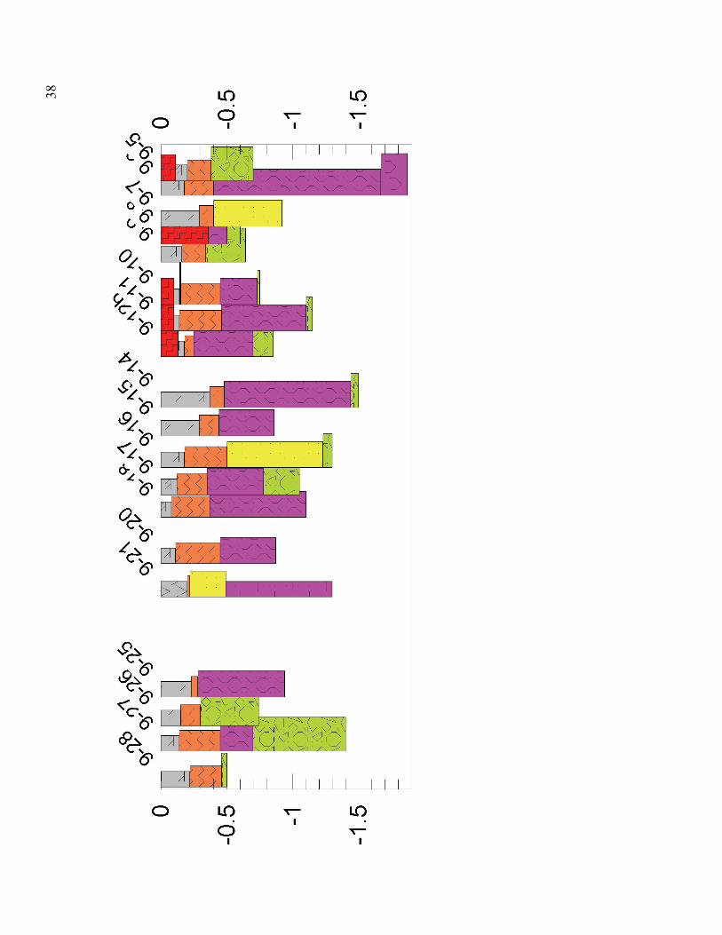
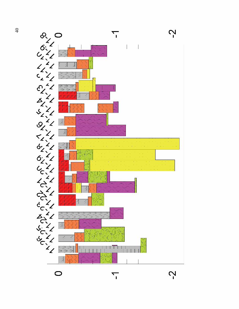
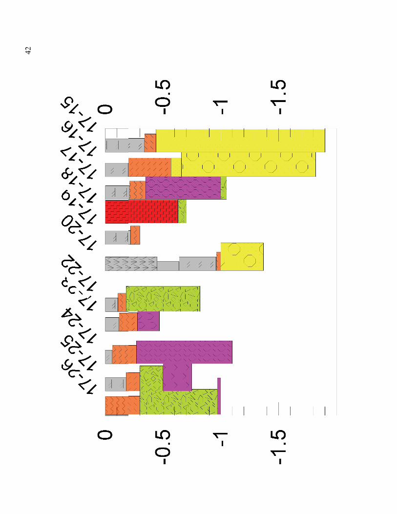
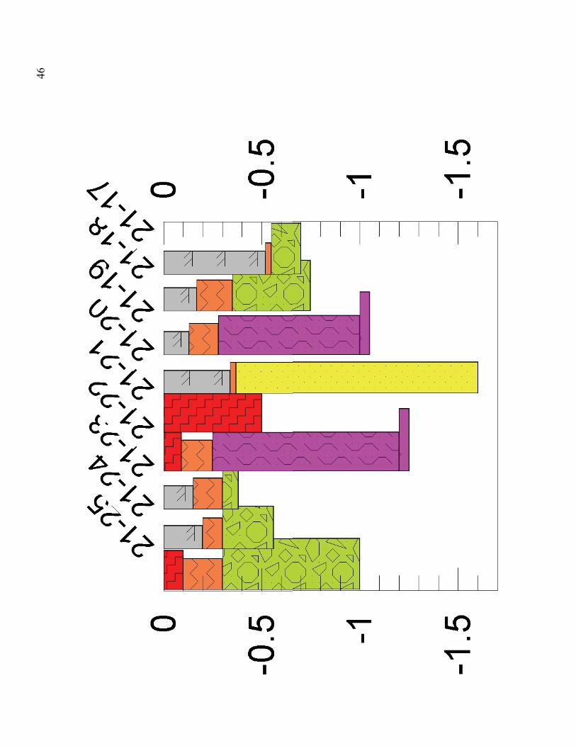
(1) Strip Logs: What follows is a series of ROCKWARE plots of the raw geological data (strip logs) from the Debert auger survey, interpreted geological sections and 3/D geological models. The purpose of this data release is to aid the ongoing archaeological survey . Strip logs are lithology plots of auger drill holes for each geological transect covering the Debert study area (Fig. 16). The north and south drill holes of each transect are shown on Fig. 16. The lithology plots represent detailed descriptions of the sediment encountered in the auger holes. The legend describing sediment types in shown on the next page. Important Note: Poorly sorted sand=massive sand in report.

33

34

35

36

37
38

39
40

41
42

43

44

45
46

47

48

49
50

51
Data summary-Geological Sections
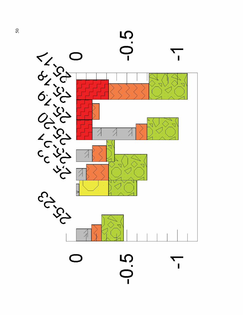
The following diagrams represent geological cross sections of the transect lines shown in Fig. 16, interpreted from the lithological data shown previously. The sections are plotted in relation to surface elevation (metres above mean sea level. The following legend represents the geological units encountered in the survey in the correct time sequence from oldest (bottom) to the youngest (top) The units are described in some detail in the field guide to the Debert site. The solum is omitted from the sections. Regolith thicknesses have been increased to fill out the logs.

52

53

54

55

56

57

58

59

60

61

62

63

64

65

66

67

68

69
Data summaries: (3) 3/D stratigraphic models
The following two block diagrams are a 3/D rendering of topographic and geological data for the study area. The two blocks represent the data from the Debert and Belmont sites. The regions covered are shown on the overlying bitmap.