Embed Size (px)
Citation preview
Geophysical Classification for Munitions Response
Quality Assurance Project Plan Template(GCMR‐QAPP)
Presented by: Jordan AdelsonDirector, Navy Laboratory Quality and Accreditation Office (LQAO)
Presented to: NAOC General Membership MeetingNovember 2014
1
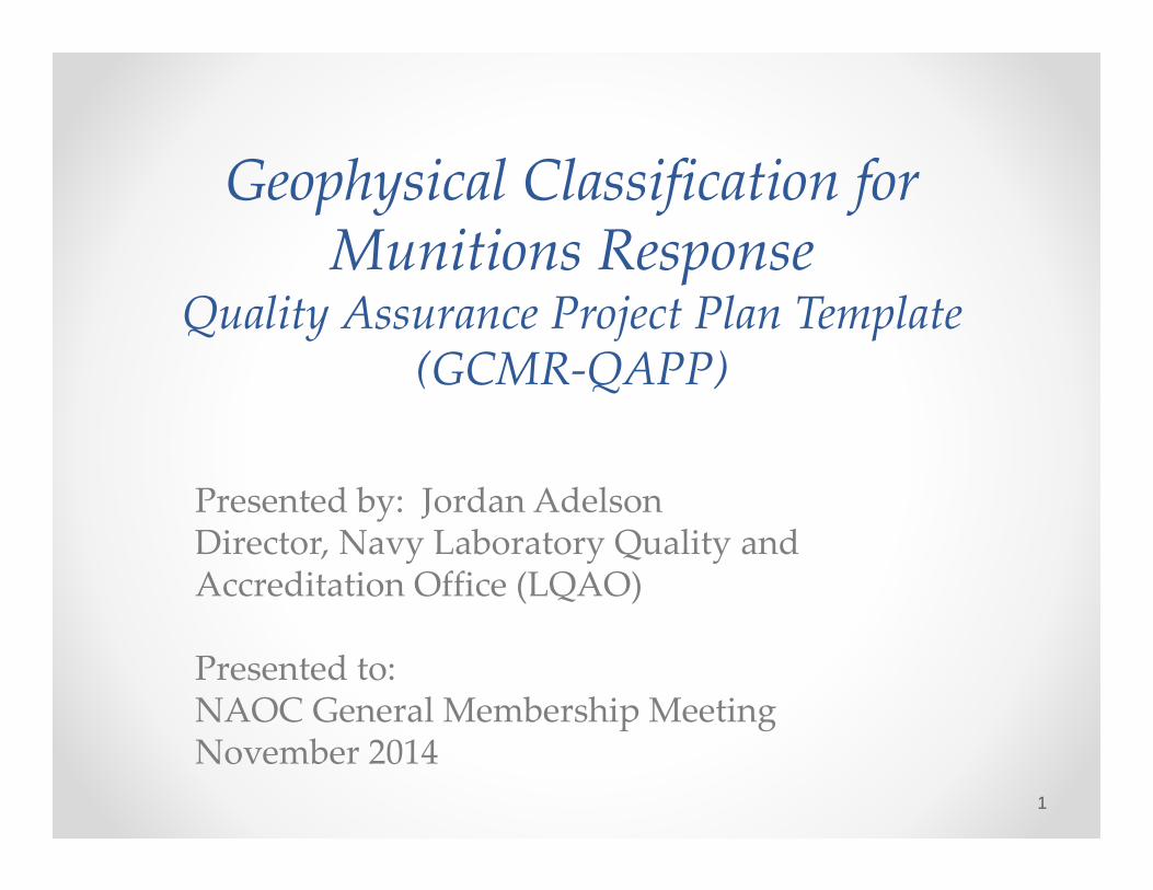
Overview• DoD Environmental Data Quality Workgroup (EDQW)
• Intergovernmental Data Quality Task Force (IDQTF)
• Genesis of the UFP‐QAPP and Systematic Planning
• Key QAPP worksheets• Beta draft feedback• Path forward
2
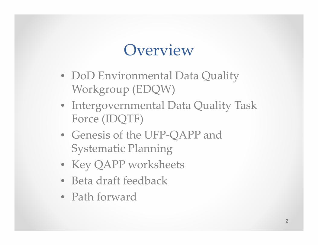
Mission: Develop and recommend coordinated DoD positions and policy on environmental sampling and laboratory testing issues, to:• Promote the generation of environmental data of
known and documented quality• Reduce unnecessary duplication and program
costs• Ensure compliance with established standards• Promote better use of environmental resources• Improve overall performance
EDQWEstablished 1996
3
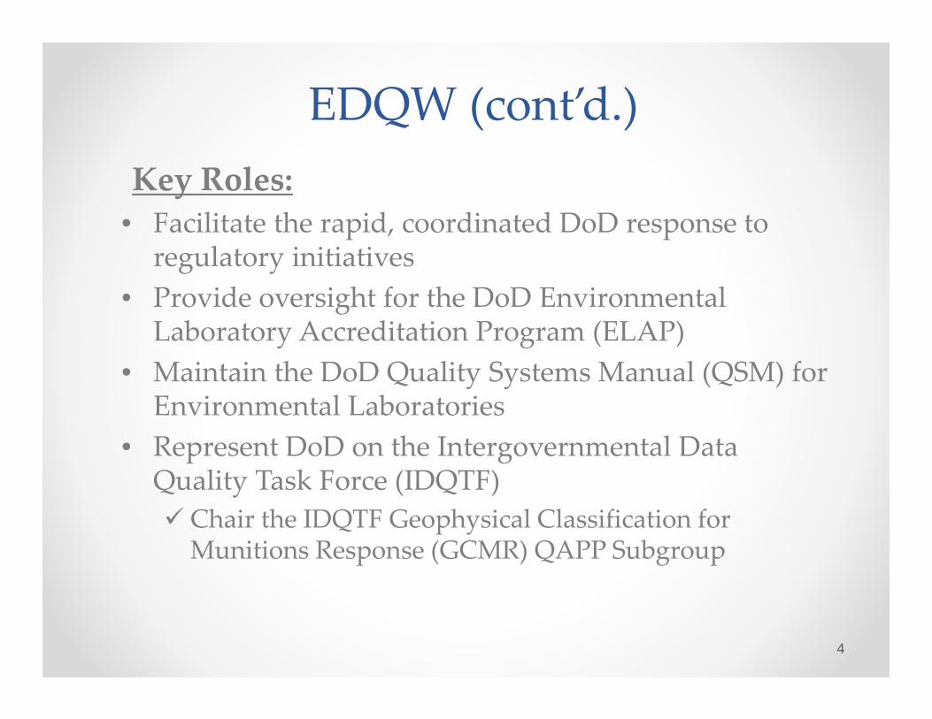
EDQW (cont’d.)Key Roles:
• Facilitate the rapid, coordinated DoD response to regulatory initiatives
• Provide oversight for the DoD Environmental Laboratory Accreditation Program (ELAP)
• Maintain the DoD Quality Systems Manual (QSM) for Environmental Laboratories
• Represent DoD on the Intergovernmental Data Quality Task Force (IDQTF) Chair the IDQTF Geophysical Classification for Munitions Response (GCMR) QAPP Subgroup
4
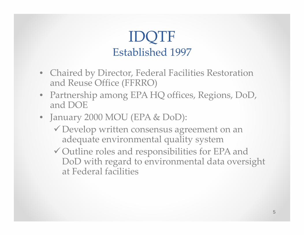
IDQTFEstablished 1997
• Chaired by Director, Federal Facilities Restoration and Reuse Office (FFRRO)
• Partnership among EPA HQ offices, Regions, DoD, and DOE
• January 2000 MOU (EPA & DoD):Develop written consensus agreement on an adequate environmental quality system
Outline roles and responsibilities for EPA and DoD with regard to environmental data oversight at Federal facilities
5

IDQTFKey Products
• Uniform Federal Policy for Environmental Quality Systems (UFP‐QS) V.2 March 2005 – Uniform criteria for harmonizing quality system requirements across Federal agencies (ANSI/ASQ E4 Part A)
• Uniform Federal Policy for Quality Assurance Project Plans(UFP‐QAPP) March 2005 – Project‐level guidance for implementing a systematic planning process for environmental data collection (ANSI/ASQ E4 Part B)
• Federal Roles and Responsibilities GuidanceMarch 2005 –Specifies Federal Agency responsibilities for data quality oversight
6

Significance of the UFP‐QAPPIn its ninth year of implementation
• Unifies QAPP guidance across all EPA offices, EPA regions, and DoD Components.
• Formally endorsed by EPA/OSWER/FFRRO and the EPA/OEI/Quality Staff as meeting EPA/QA‐G5
• Training and outreach activities conducted throughout EPA, DoD, and states
• Streamlines the preparation, review, and approval of QAPPs
• Combines work plan, field sampling plan, sampling & analysis plan into one document
Optimized from 37 to 28 worksheets in 2012
7

Geophysical Classification Subgroup Assignment
Develop and implement a quality system based on national and international standards for the performance of Geophysical Classification at DoD Munitions Response Sites
• Develop a Quality Assurance Project Plan template using the Uniform Federal Policy for Quality Assurance Project Plans (UFP‐QAPP)
Implements ANSI/ASQ E4• Develop quality systems documentation for the 3rd‐party accreditation of organizations performing geophysical classification
Implements ISO/IEC 170258
Geophysical Classification for Munitions Response(GCMR) QAPP Highlights
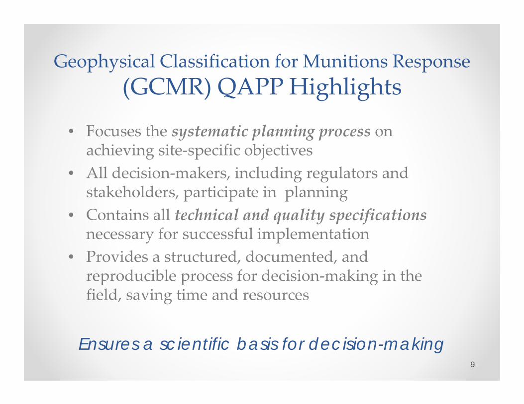
• Focuses the systematic planning process on achieving site‐specific objectives
• All decision‐makers, including regulators and stakeholders, participate in planning
• Contains all technical and quality specificationsnecessary for successful implementation
• Provides a structured, documented, and reproducible process for decision‐making in the field, saving time and resources
Ensures a scientific basis for decision-making9

GCMR QAPP: Key Worksheets
WS #11: Data Quality Objectives (DQOs)WS #12: Measurement Performance Criteria (MPCs)WS #17: Sample DesignWS #22: Equipment Testing, Inspection, and Quality Control (QC)WS #37: Data Usability Assessment (DUA)
10

WS #11: Data Quality Objectives (DQOs)
Developed and documented by the project team (DoD, contractor & stakeholders) using EPA’s 7‐step DQO process:1. State the problem2. Identify the goals of data collection3. Identify information inputs4. Define the boundaries of the project5. Develop the data collection and analysis approach6. Specify project‐specific measurement performance
criteria (WS 12)7. Develop the Geophysical Classification design (WS 17)
11
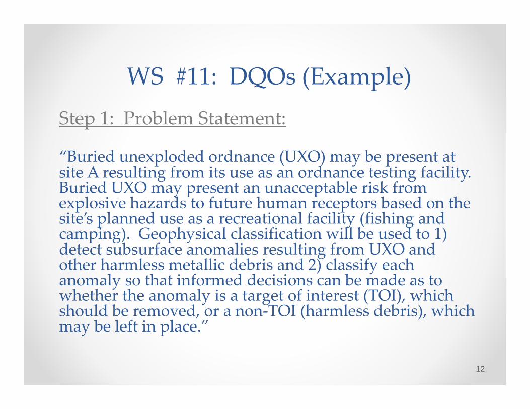
WS #11: DQOs (Example)Step 1: Problem Statement:
“Buried unexploded ordnance (UXO) may be present at site A resulting from its use as an ordnance testing facility. Buried UXO may present an unacceptable risk from explosive hazards to future human receptors based on the site’s planned use as a recreational facility (fishing and camping). Geophysical classification will be used to 1) detect subsurface anomalies resulting from UXO and other harmless metallic debris and 2) classify each anomaly so that informed decisions can be made as to whether the anomaly is a target of interest (TOI), which should be removed, or a non‐TOI (harmless debris), which may be left in place.”
12
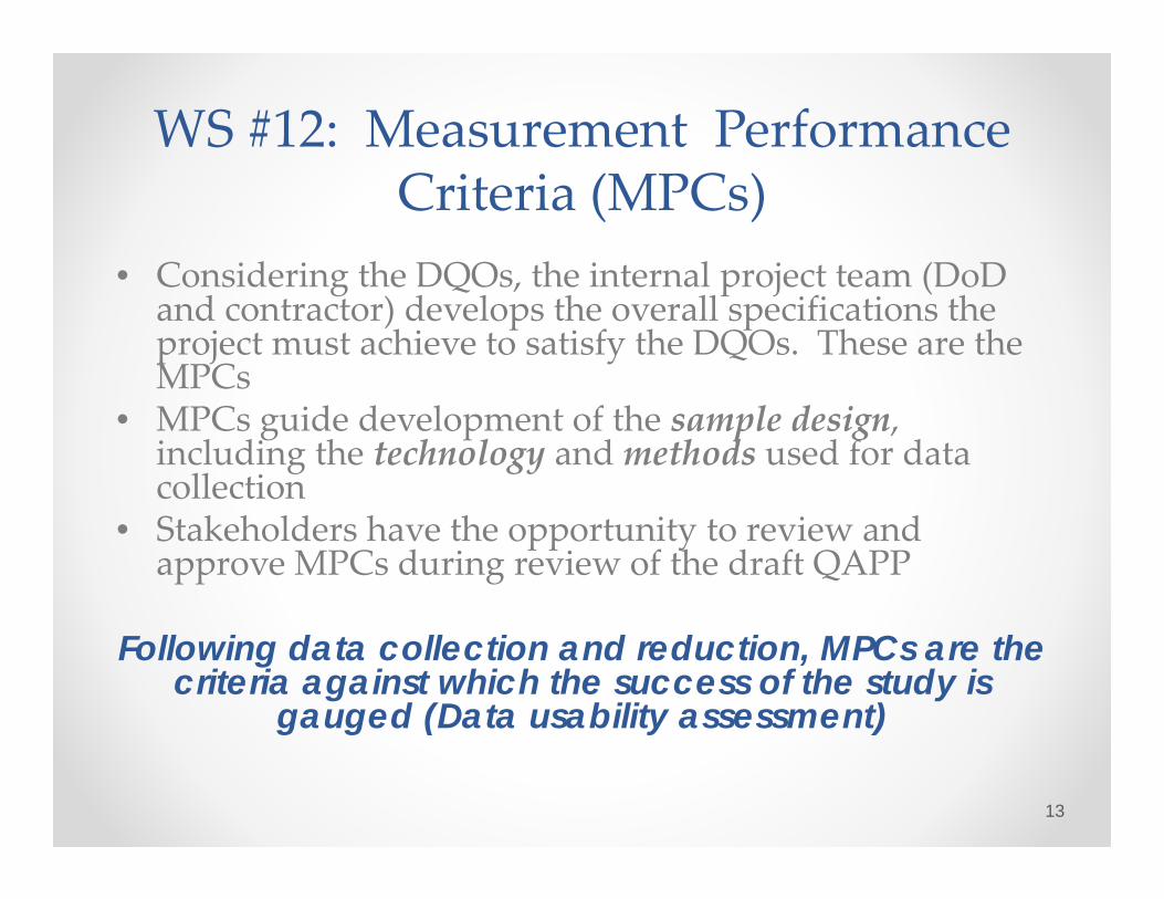
WS #12: Measurement Performance Criteria (MPCs)
• Considering the DQOs, the internal project team (DoD and contractor) develops the overall specifications the project must achieve to satisfy the DQOs. These are the MPCs
• MPCs guide development of the sample design, including the technology and methods used for data collection
• Stakeholders have the opportunity to review and approve MPCs during review of the draft QAPP
Following data collection and reduction, MPCs are the criteria against which the success of the study is
gauged (Data usability assessment)
13
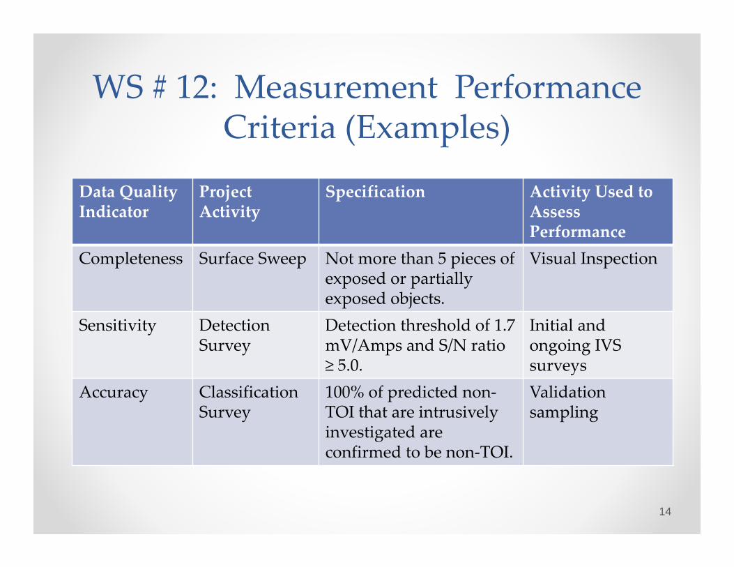
WS # 12: Measurement Performance Criteria (Examples)
Data Quality Indicator
Project Activity
Specification Activity Used to Assess Performance
Completeness Surface Sweep Not more than 5 pieces of exposed or partially exposed objects.
Visual Inspection
Sensitivity Detection Survey
Detection threshold of 1.7 mV/Amps and S/N ratio ≥ 5.0.
Initial and ongoing IVS surveys
Accuracy Classification Survey
100% of predicted non‐TOI that are intrusively investigated are confirmed to be non‐TOI.
Validation sampling
14

WS #17: Sample Design
MPCs are used to select the technology and develop the sample design, which is described and justified in WS #17• Describes the project work flow• Includes or references detailed procedures (SOPs,
maps)• Describes decision‐making process (“decision tree”)• Includes procedures to handle contingencies in the
event field conditions are different than expected
15

Work Flow DiagramPreliminary Tasks
16
Site PreparationSeeding
IVS Construction
OutputsQC Seed PlanIVS Plan
Inputs
DFW
1 a
nd 2
Surface Sweep Tech MemoSeeding Report and MapIVS Tech Memo
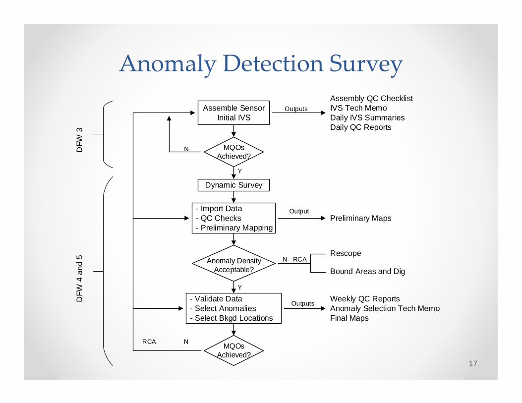
Anomaly Detection Survey
17
Assemble SensorInitial IVS
Outputs
DFW
3
MQOs Achieved?
- Import Data - QC Checks - Preliminary Mapping
Anomaly Density Acceptable?
- Validate Data - Select Anomalies - Select Bkgd Locations
MQOs Achieved?
DFW
4 a
nd 5
Output
Outputs
N
RCA N
N RCARescope
Bound Areas and Dig
Weekly QC ReportsAnomaly Selection Tech MemoFinal Maps
Preliminary Maps
Assembly QC ChecklistIVS Tech MemoDaily IVS SummariesDaily QC Reports
Y
Y
Dynamic Survey

Cued Data Collection
18
Assemble SensorInitial IVS
Outputs
DFW
6
MQOs Achieved?
Preprocess Data - Data Conversion - Data Validation
MQOs Achieved?
DFW
7 a
nd 8
Outputs
N
Weekly QC ReportsDatabase (raw data & metadata
Assembly QC ChecklistIVS Tech MemoDaily IVS SummariesDaily QC Reports
Y
Y
Process Data
N
Collect DataField Inversion
MQOs Achieved?
Y
Y
N

Cued Data Analysis
19
Process Data - Bkgd Correction - Feature Estimation - Data Validation
Output
DFW
9
MQOs Achieved?
- Classify Anomalies - Make Dig/No Dig Decisions
All QC Seeds on Dig List?
DFW
10
Outputs
N
Revised Validation PlanFeature Space PlotsTOI/Non-TOI SpreadsheetLibrary Match ResultsFigures/MapsDig List
Database (inversion results)
Y
Y
RCA N
All Validation Seeds on List?
RCA N YIntrusive Investigation
Intrusive Investigation
20
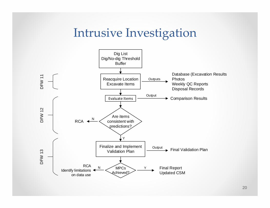
Dig ListDig/No-dig Threshold
Buffer
Outputs
DFW
11
Finalize and Implement Validation Plan
MPCs Achieved?
DFW
12
OutputComparison Results
Database (Excavation ResultsPhotosWeekly QC ReportsDisposal Records
Y
Evaluate Items
Are items consistent with
predictions?
Y
N
Reacquire LocationExcavate Items
RCA
NRCAIdentify limitations
on data use
Final ReportUpdated CSM
Output Final Validation Plan
DFW
13

WS 22: Equipment Testing, Inspection, & Quality Control (QC)
• Based on the selected technology, the project team develops specifications for each step of the process (measurement quality objectives or MQOs) necessary to satisfy the MPCs.
• Worksheet 22 describes the frequency and acceptance criteria for each MQO. It also describes the action that must be taken to correct the data collection process if the MQO fails.
• For geophysical classification projects, corrective action (if necessary) is implemented at each step, in the field, before proceeding to the next step
21
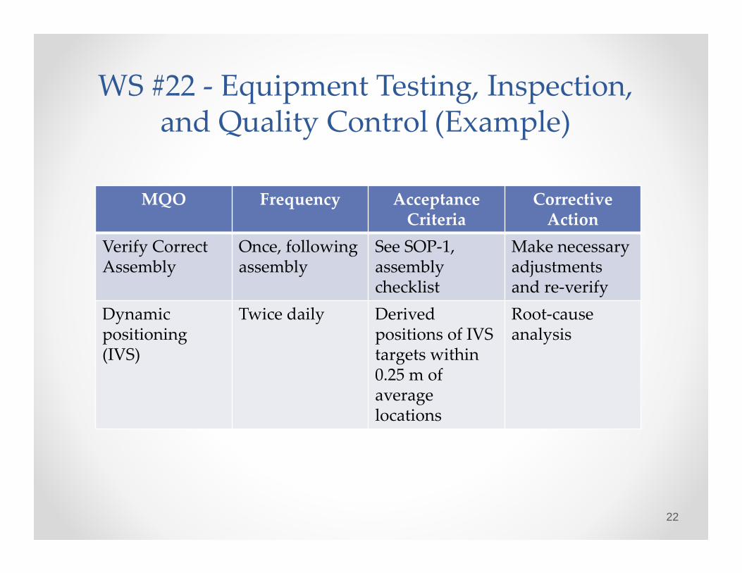
WS #22 ‐ Equipment Testing, Inspection, and Quality Control (Example)
MQO Frequency Acceptance Criteria
Corrective Action
Verify CorrectAssembly
Once, following assembly
See SOP‐1, assembly checklist
Make necessary adjustments and re‐verify
Dynamic positioning(IVS)
Twice daily Derivedpositions of IVS targets within 0.25 m of average locations
Root‐cause analysis
22
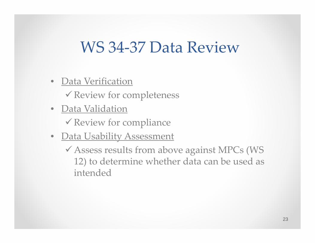
WS 34‐37 Data Review
• Data VerificationReview for completeness
• Data ValidationReview for compliance
• Data Usability AssessmentAssess results from above against MPCs (WS 12) to determine whether data can be used as intended
23

Beta‐Draft GCMR‐QAPP Feedback
24
153
181
16
DoDNAOCRegulators
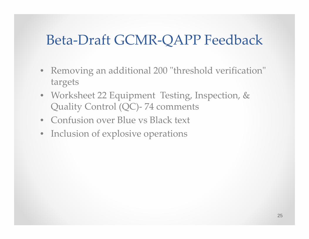
Beta‐Draft GCMR‐QAPP Feedback
• Removing an additional 200 ʺthreshold verificationʺ targets
• Worksheet 22 Equipment Testing, Inspection, & Quality Control (QC)‐ 74 comments
• Confusion over Blue vs Black text• Inclusion of explosive operations
25

Next Steps
1st qtr FY15 Incorporate stakeholder comments on beta draft GCMR QAPP template
2nd qtr FY15 Select beta test site2nd qtr FY15 Develop project‐specific QAPP based
on updated template3rd qtr FY15 Conduct beta test, and revise
template4th qtr FY15 Conduct formal DoD, EPA review and
finalize template
26

Conclusions
• The GCMR‐QAPP template facilitates a systematic planning process
• Objectives and data quality requirements are determined up‐front and documented in the QAPP
• The GCMR‐QAPP template is a win‐win for planning, review, and documentation
The bottom line: Confidence in decision-making, expedited cleanups, environmental
protection, and wise resource allocation
27