Embed Size (px)
Citation preview
Geoprocessingfor Digital Soil Survey
Caryl RadatzUSDA Natural Resources
Conservation ServiceColumbia, Missouri
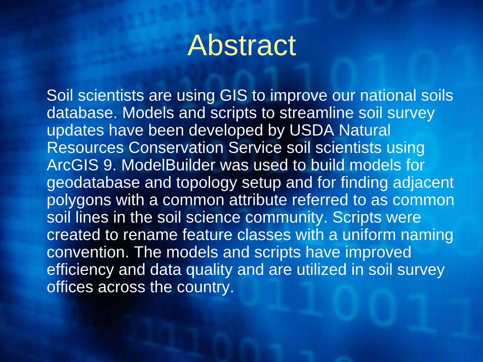
AbstractSoil scientists are using GIS to improve our national soils database. Models and scripts to streamline soil survey updates have been developed by USDA Natural Resources Conservation Service soil scientists using ArcGIS 9. ModelBuilder was used to build models for geodatabase and topology setup and for finding adjacent polygons with a common attribute referred to as common soil lines in the soil science community. Scripts were created to rename feature classes with a uniform naming convention. The models and scripts have improved efficiency and data quality and are utilized in soil survey offices across the country.
Smithsonian Museum of Natural History
Digital Soil Survey
• Most NRCS soil survey offices have access to ArcGIS 9.0 or 9.1, ArcInfoVersion, on high-end personal computers.
• Many of the soil scientists and support staff have been trained to use this software for soil survey by completing the Digital Soil Survey Mapping and Updating course offered through the NRCS National Employee Development Center.
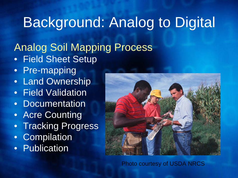
Background: Analog to DigitalAnalog Soil Mapping Process• Field Sheet Setup• Pre-mapping• Land Ownership• Field Validation• Documentation• Acre Counting• Tracking Progress• Compilation• Publication
Photo courtesy of USDA NRCS
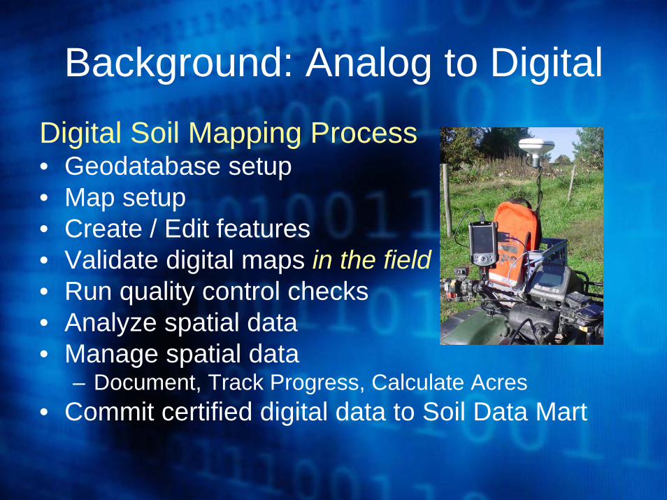
Digital Soil Mapping Process• Geodatabase setup • Map setup• Create / Edit features• Validate digital maps in the field• Run quality control checks• Analyze spatial data• Manage spatial data
– Document, Track Progress, Calculate Acres• Commit certified digital data to Soil Data Mart
Background: Analog to Digital
Geoprocessing with ModelBuilder
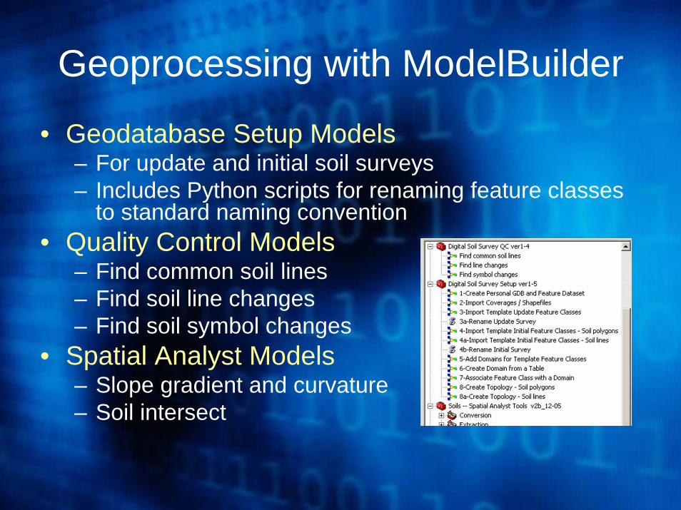
• Geodatabase Setup Models– For update and initial soil surveys– Includes Python scripts for renaming feature classes
to standard naming convention• Quality Control Models
– Find common soil lines– Find soil line changes– Find soil symbol changes
• Spatial Analyst Models– Slope gradient and curvature– Soil intersect
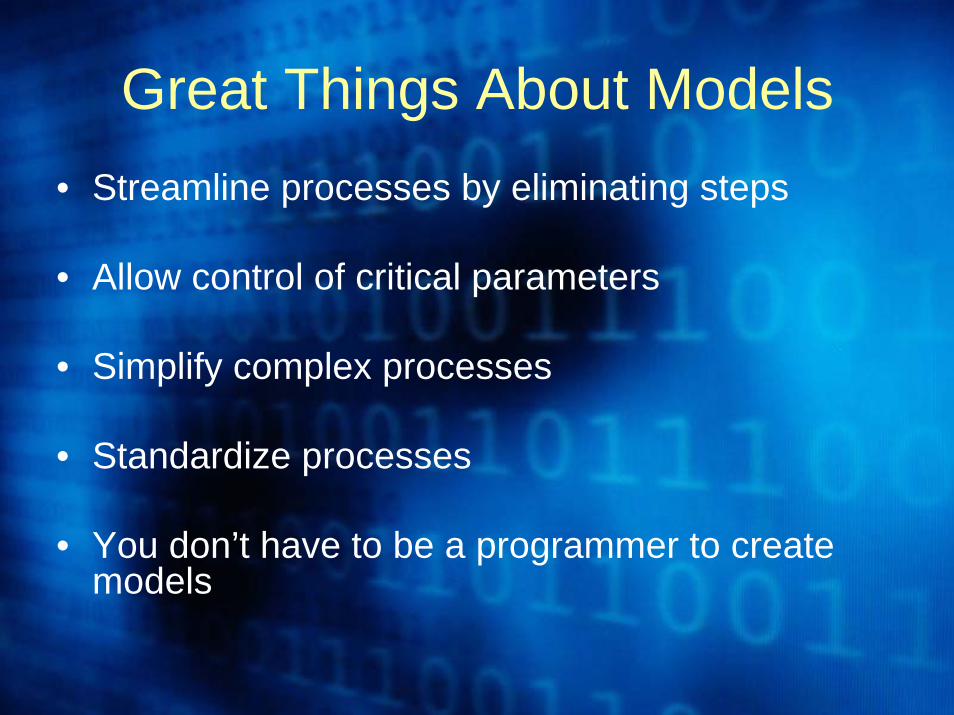
Great Things About Models• Streamline processes by eliminating steps
• Allow control of critical parameters
• Simplify complex processes
• Standardize processes
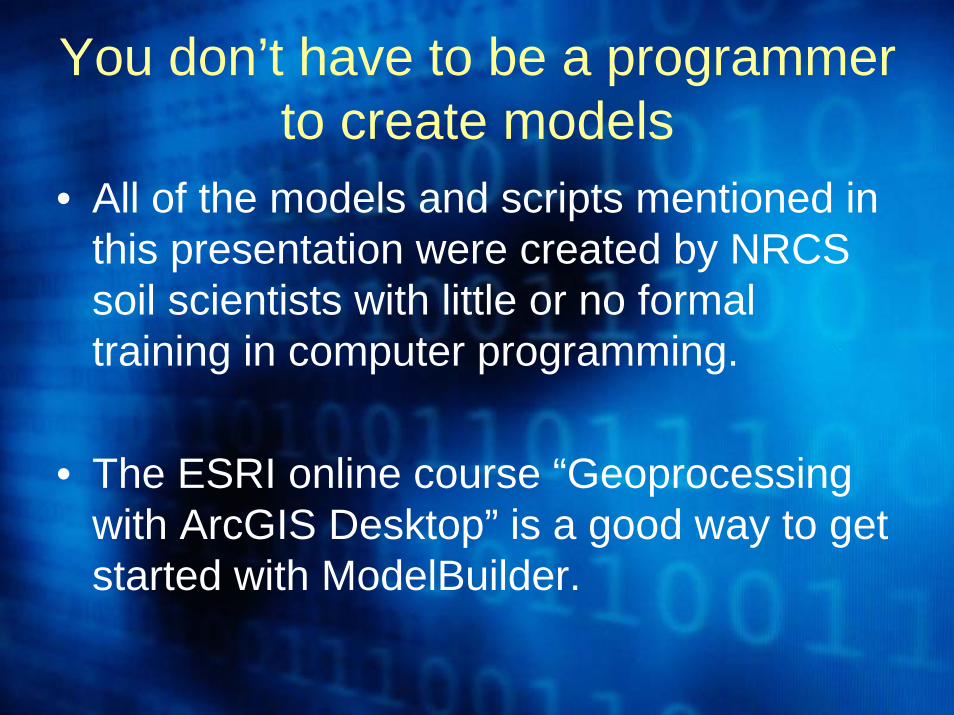
• You don’t have to be a programmer to create models
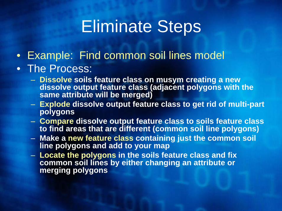
Eliminate Steps• Example: Find common soil lines model• The Process:
– Dissolve soils feature class on musym creating a new dissolve output feature class (adjacent polygons with the same attribute will be merged)
– Explode dissolve output feature class to get rid of multi-part polygons
– Compare dissolve output feature class to soils feature class to find areas that are different (common soil line polygons)
– Make a new feature class containing just the common soil line polygons and add to your map
– Locate the polygons in the soils feature class and fix common soil lines by either changing an attribute or merging polygons
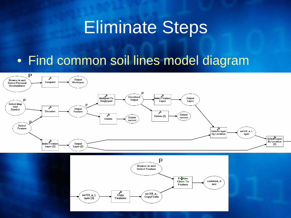
Eliminate Steps
• Find common soil lines model diagram
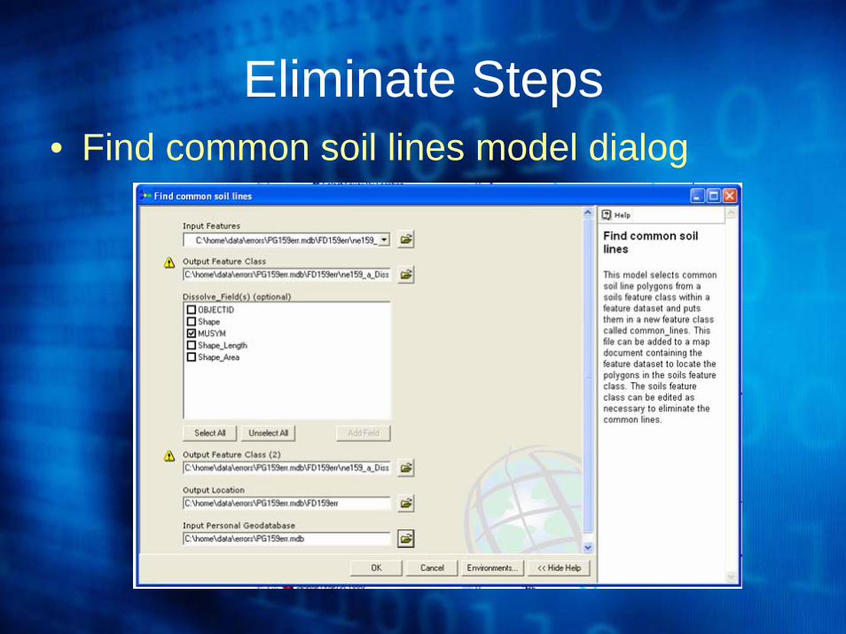
Eliminate Steps• Find common soil lines model dialog
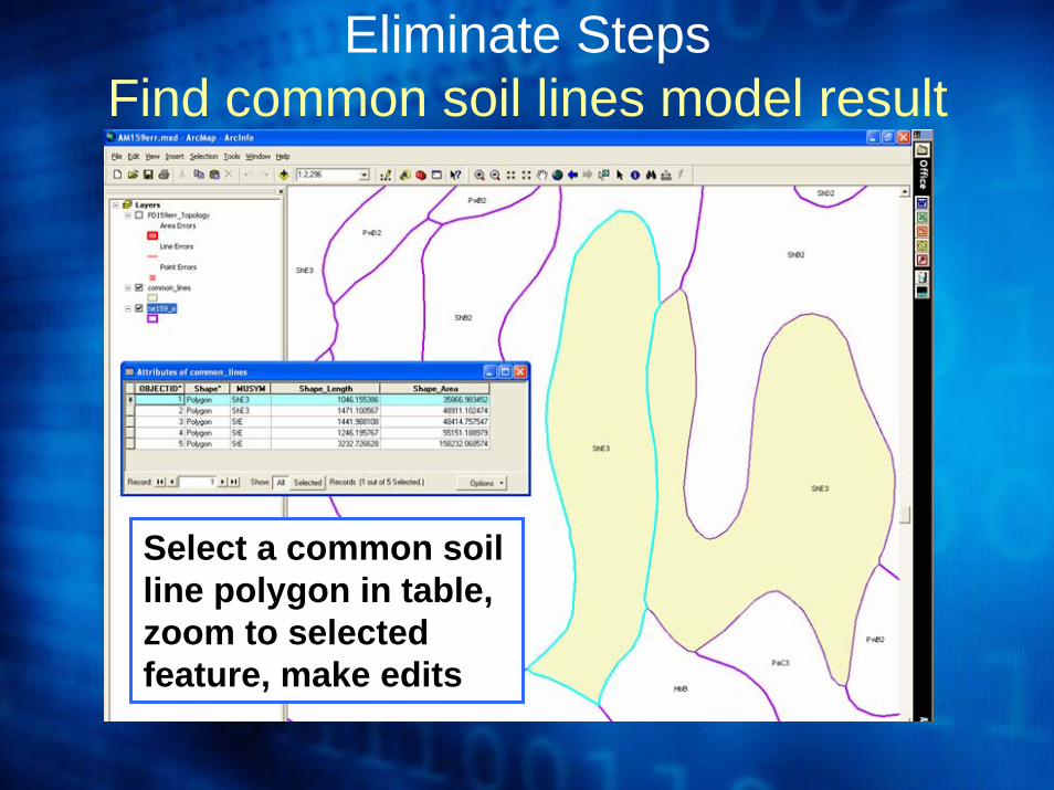
Select a common soil line polygon in table, zoom to selected feature, make edits
Eliminate StepsFind common soil lines model result
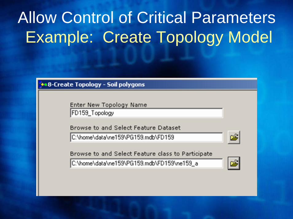
Allow Control of Critical ParametersExample: Create Topology Model
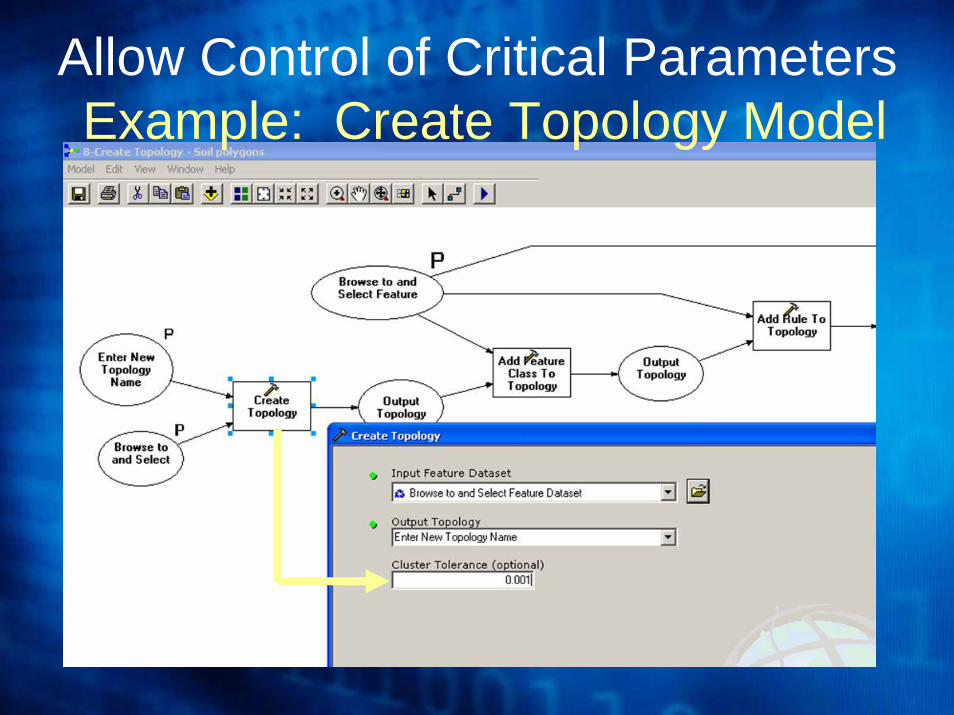
Allow Control of Critical ParametersExample: Create Topology Model
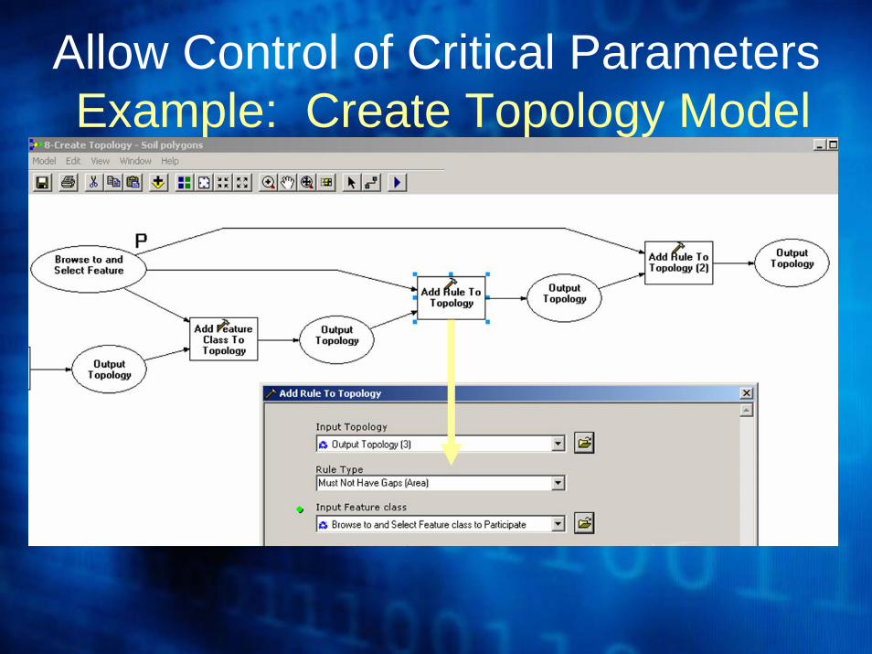
Allow Control of Critical ParametersExample: Create Topology Model
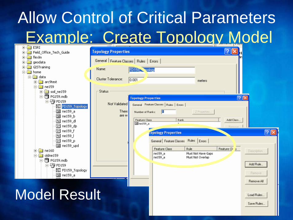
Allow Control of Critical ParametersExample: Create Topology Model
Model Result
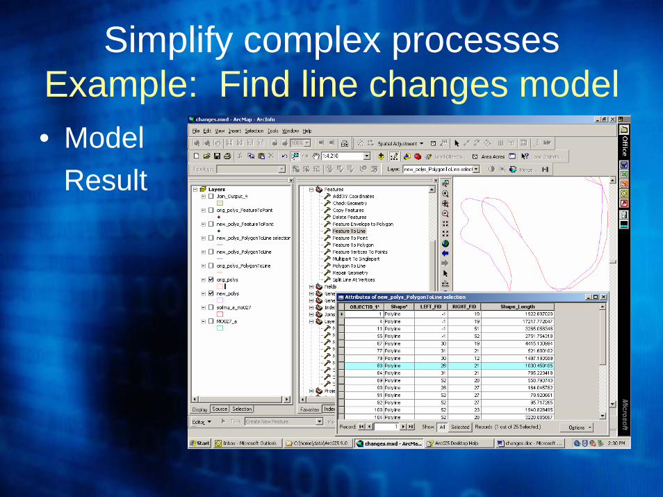
Simplify complex processes
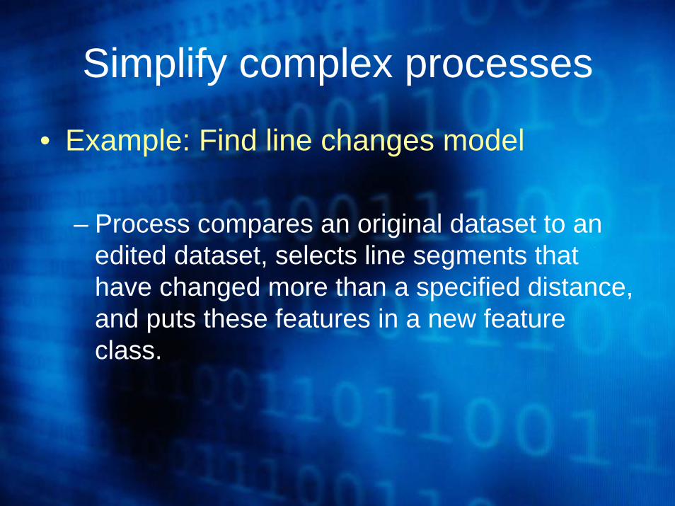
• Example: Find line changes model
– Process compares an original dataset to an edited dataset, selects line segments that have changed more than a specified distance, and puts these features in a new feature class.
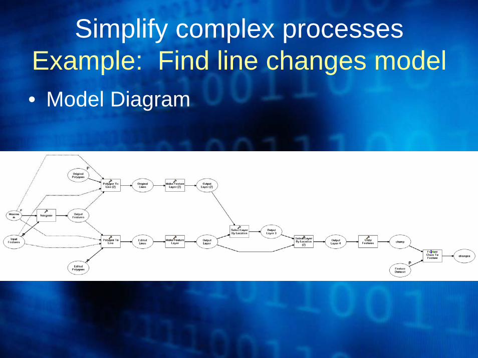
Simplify complex processesExample: Find line changes model• Model Diagram
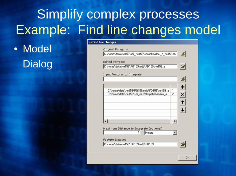
Simplify complex processesExample: Find line changes model• Model
Dialog
Simplify complex processesExample: Find line changes model• Model
Result
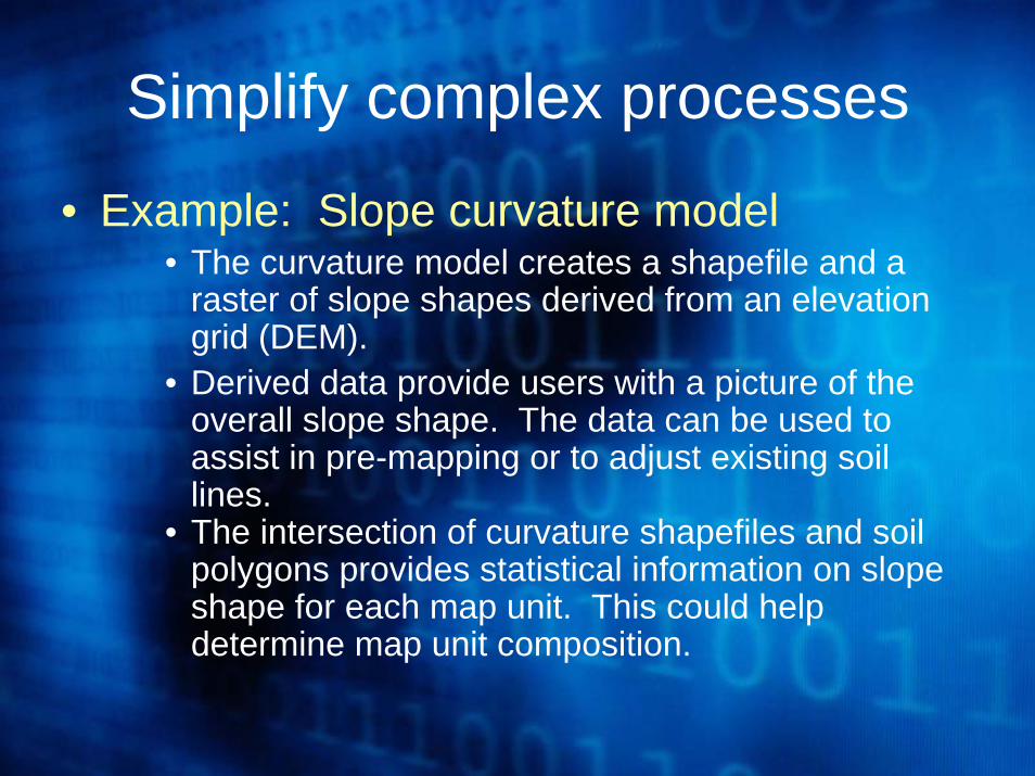
Simplify complex processes
• Example: Slope curvature model• The curvature model creates a shapefile and a
raster of slope shapes derived from an elevation grid (DEM).
• Derived data provide users with a picture of the overall slope shape. The data can be used to assist in pre-mapping or to adjust existing soil lines.
• The intersection of curvature shapefiles and soil polygons provides statistical information on slope shape for each map unit. This could help determine map unit composition.
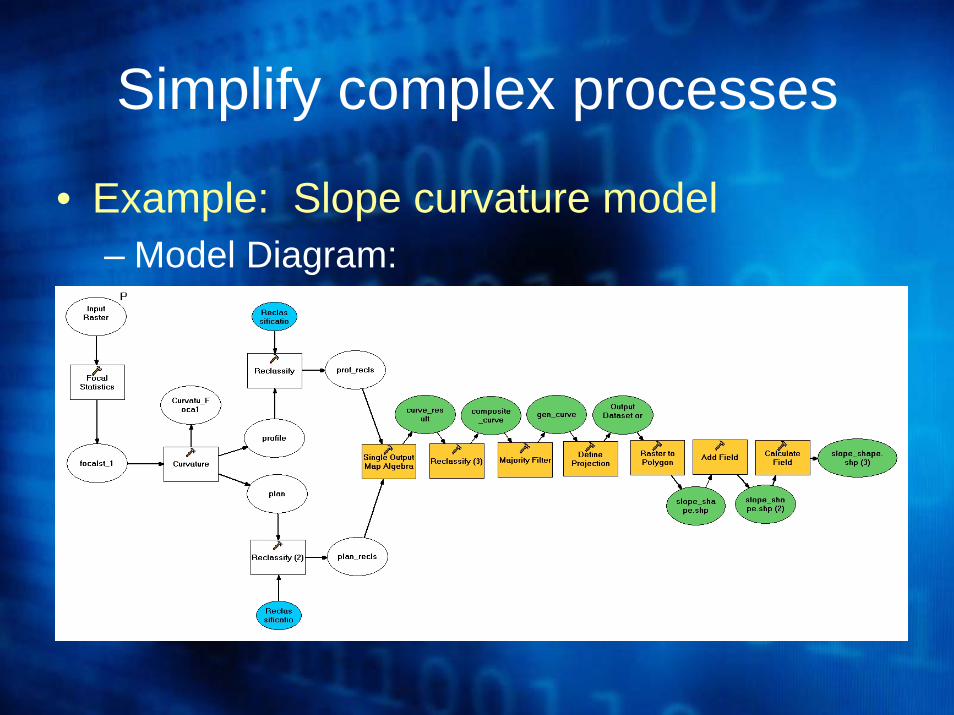
Simplify complex processes
• Example: Slope curvature model– Model Diagram:
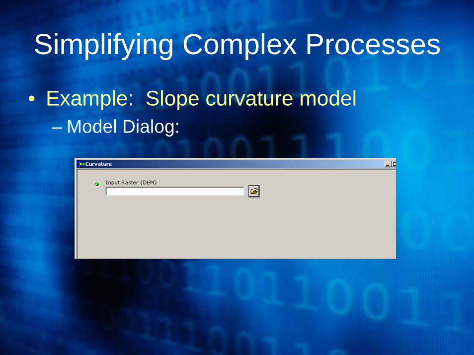
Simplifying Complex Processes
• Example: Slope curvature model– Model Dialog:
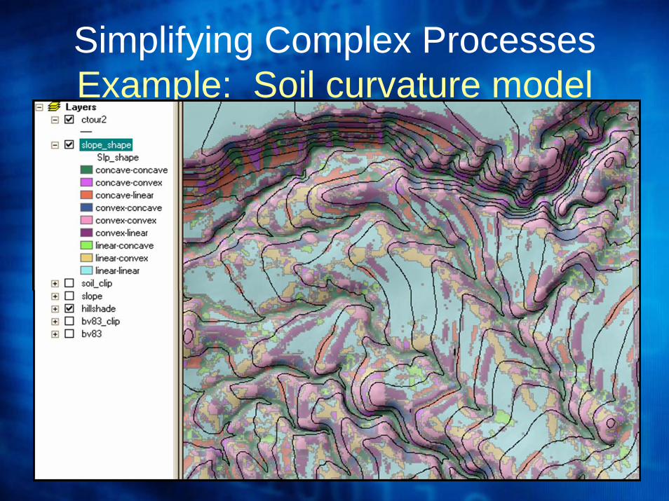
Simplifying Complex ProcessesExample: Soil curvature model
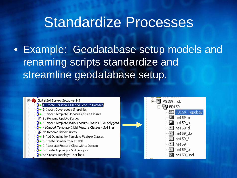
Standardize Processes
• Example: Geodatabase setup models and renaming scripts standardize and streamline geodatabase setup.
You don’t have to be a programmer to create models
• All of the models and scripts mentioned in this presentation were created by NRCS soil scientists with little or no formal training in computer programming.
• The ESRI online course “Geoprocessing with ArcGIS Desktop” is a good way to get started with ModelBuilder.
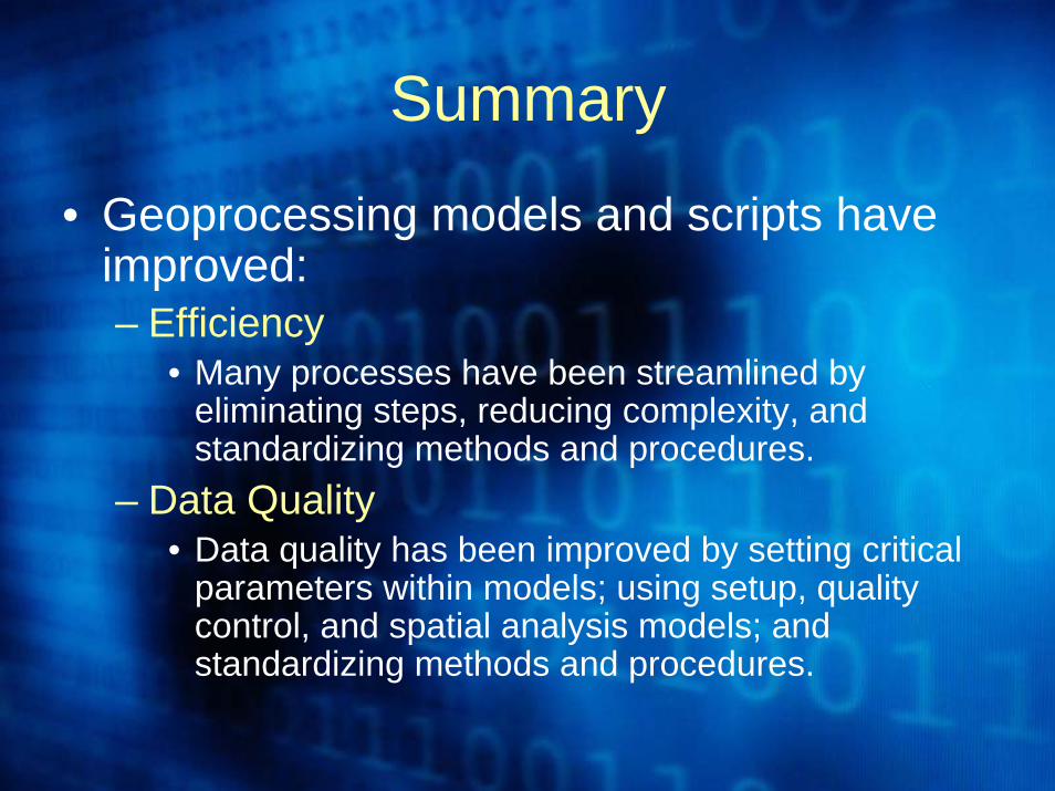
Summary
• Geoprocessing models and scripts have improved:– Efficiency
• Many processes have been streamlined by eliminating steps, reducing complexity, and standardizing methods and procedures.
– Data Quality• Data quality has been improved by setting critical
parameters within models; using setup, quality control, and spatial analysis models; and standardizing methods and procedures.
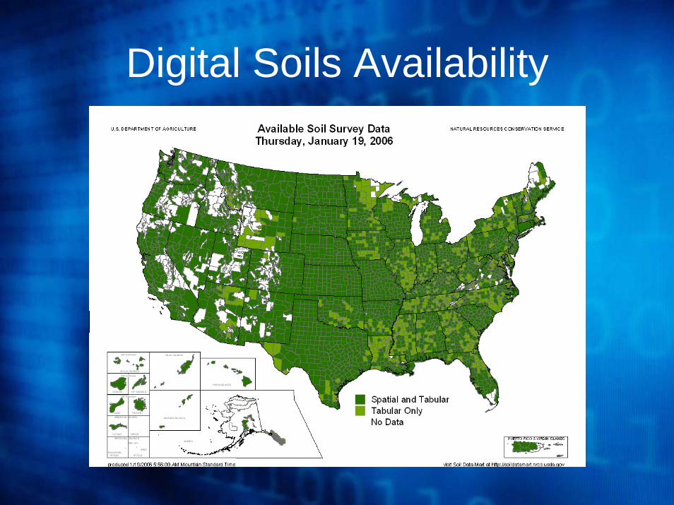
Digital Soils Availability
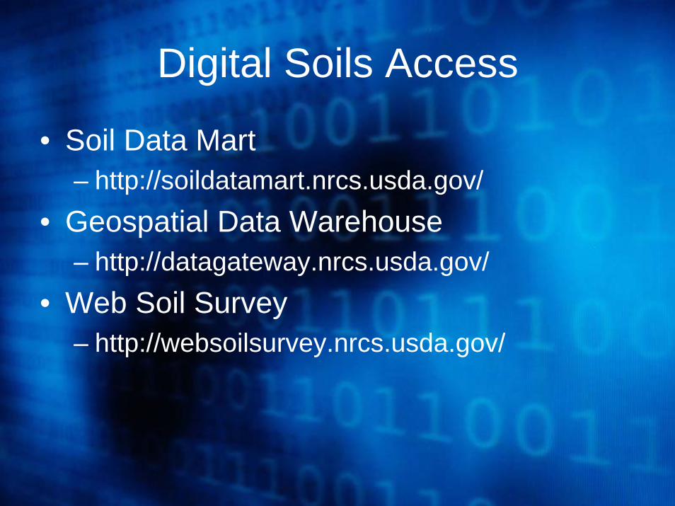
Digital Soils Access
• Soil Data Mart– http://soildatamart.nrcs.usda.gov/
• Geospatial Data Warehouse– http://datagateway.nrcs.usda.gov/
• Web Soil Survey– http://websoilsurvey.nrcs.usda.gov/
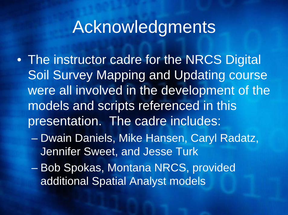
Acknowledgments
• The instructor cadre for the NRCS Digital Soil Survey Mapping and Updating course were all involved in the development of the models and scripts referenced in this presentation. The cadre includes:– Dwain Daniels, Mike Hansen, Caryl Radatz,
Jennifer Sweet, and Jesse Turk– Bob Spokas, Montana NRCS, provided
additional Spatial Analyst models

Author Information
Caryl RadatzSoil ScientistUSDA Natural Resources Conservation Service
601 Business Loop 70 WestParkade Center, Suite 250Columbia, MO 65203