Embed Size (px)
Citation preview
GEOGRAPHIC INFORMATION SERVICES, INC 2100 Riverchase Center, Suite 105 - Birmingham, AL 35244
Phone: (205) 941-0442 l Fax: (205) 982-7733
Geospatial Intelligence and Data Sharing for
Asset Management and Operations, Vicksburg GIS Day
14 March 2011 Dan Levine
Caleb Carter
Agenda • Who We Are and What we Do • Geospatial Intelligence and Asset Management • Some Examples • Demonstration • Questions

Who We Are…
• Small Business founded in 1991 • Award-winning GIS consulting firm • ESRI Platinum Business Partner • Federal, State & Local, and Private Sector Clients • Offices and/or staff in 27 states - Global Execution
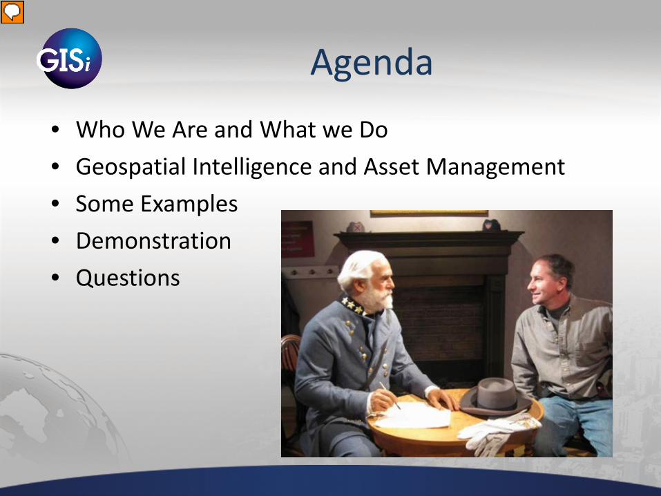
What We Do– Overview
Application Development
Services:
• Web • Mobile
• Desktop • Integration
Data Services:
• Design & Modeling • Migration
• Performance Optimization
Professional Services:
• Strategy
• Architecture • Staff Augmentation
• Installation & Configuration
• Training
C u s t o m e r D r i v e n S o l u t i o n s
Emerging Technologies Research and Development
Value Innovation
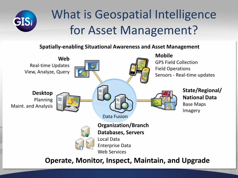
What is Geospatial Intelligence for Asset Management?
Web Real-time Updates
View, Analyze, Query
Mobile GPS Field Collection Field Operations Sensors - Real-time updates
State/Regional/ National Data Base Maps Imagery
Organization/Branch Databases, Servers Local Data Enterprise Data Web Services
Desktop Planning
Maint. and Analysis
Data Fusion
Spatially-enabling Situational Awareness and Asset Management
Operate, Monitor, Inspect, Maintain, and Upgrade
Some Examples
• 3M Sign Inventory Management • Arlington National Cemetery • Panhandle Energy • Railroad Inspection
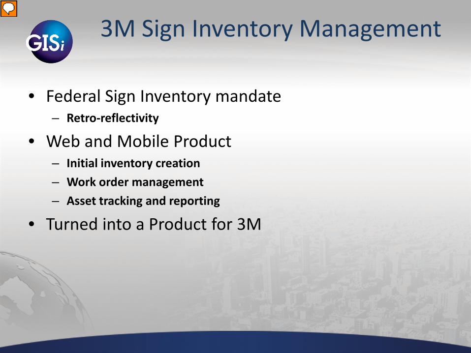
3M Sign Inventory Management
• Federal Sign Inventory mandate – Retro-reflectivity
• Web and Mobile Product – Initial inventory creation – Work order management – Asset tracking and reporting
• Turned into a Product for 3M
GEOGRAPHIC INFORMATION SERVICES, INC 2100 Riverchase Center, Suite 105 - Birmingham, AL 35244
Phone: (205) 941-0442 l Fax: (205) 982-7733

GEOGRAPHIC INFORMATION SERVICES, INC 2100 Riverchase Center, Suite 105 - Birmingham, AL 35244
Phone: (205) 941-0442 l Fax: (205) 982-7733
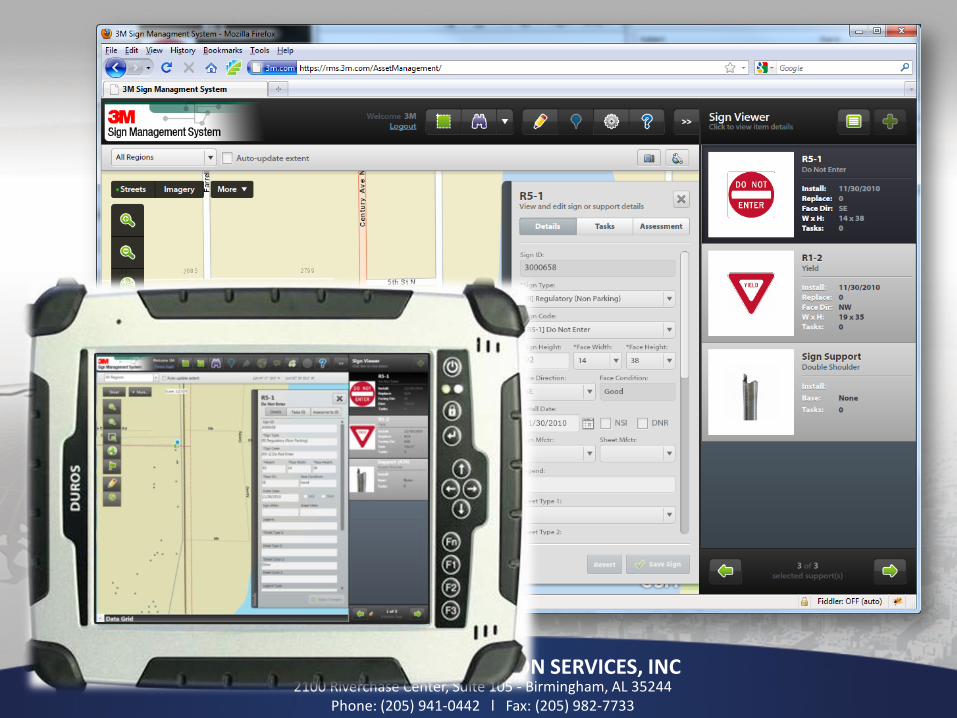
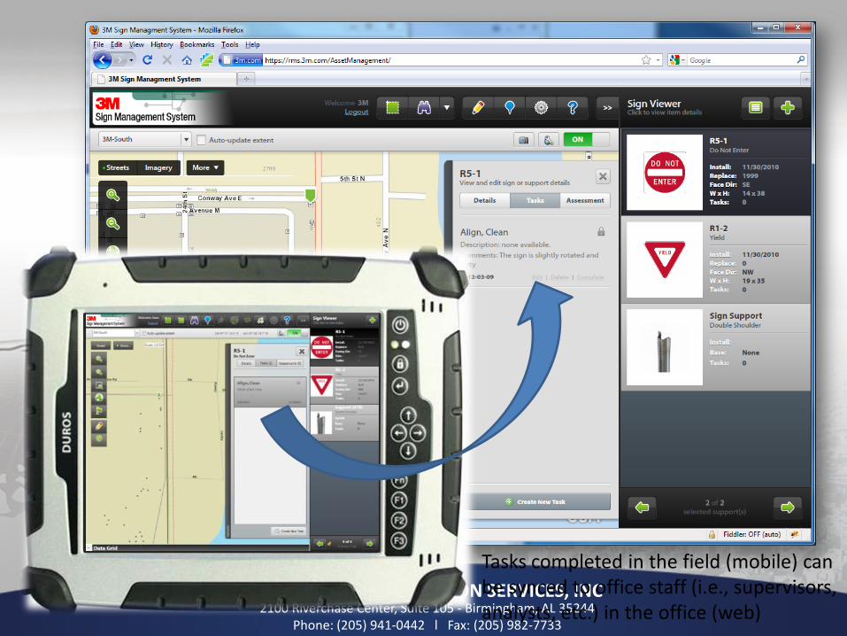
Tasks created against assets in the office (web) can be synced to workers in the field (mobile), and vice-versa.
GEOGRAPHIC INFORMATION SERVICES, INC 2100 Riverchase Center, Suite 105 - Birmingham, AL 35244
Phone: (205) 941-0442 l Fax: (205) 982-7733
Tasks completed in the field (mobile) can be synced to office staff (i.e., supervisors, analysts, etc.) in the office (web)
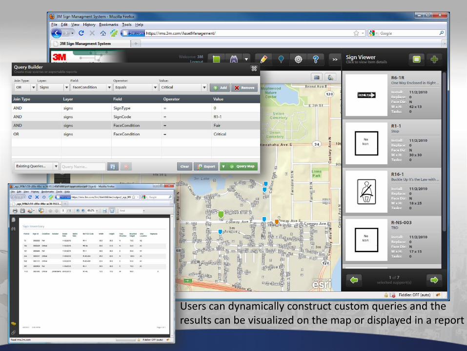
Users can dynamically construct custom queries and the results can be visualized on the map or displayed in a report

Arlington National Cemetery
• Big Data collection effort • Plot Management System • Ceremony Planning • Work Order Management • Public Web, Kiosk, Mobile apps
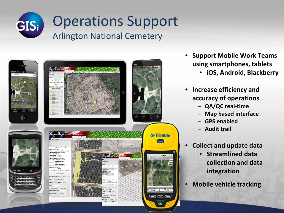
Operations Support Arlington National Cemetery
• Support Mobile Work Teams using smartphones, tablets
• iOS, Android, Blackberry
• Increase efficiency and accuracy of operations
– QA/QC real-time – Map based interface – GPS enabled – Audit trail
• Collect and update data
• Streamlined data collection and data integration
• Mobile vehicle tracking
Operations Support Arlington National Cemetery
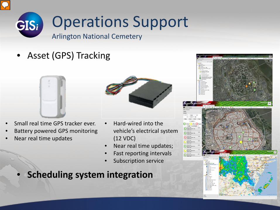
• Asset (GPS) Tracking
• Scheduling system integration
• Hard-wired into the vehicle’s electrical system (12 VDC)
• Near real time updates; • Fast reporting intervals • Subscription service
• Small real time GPS tracker ever. • Battery powered GPS monitoring • Near real time updates
Panhandle Energy
• SCADA Integration • Airborne Pipeline Surveillance
Demo
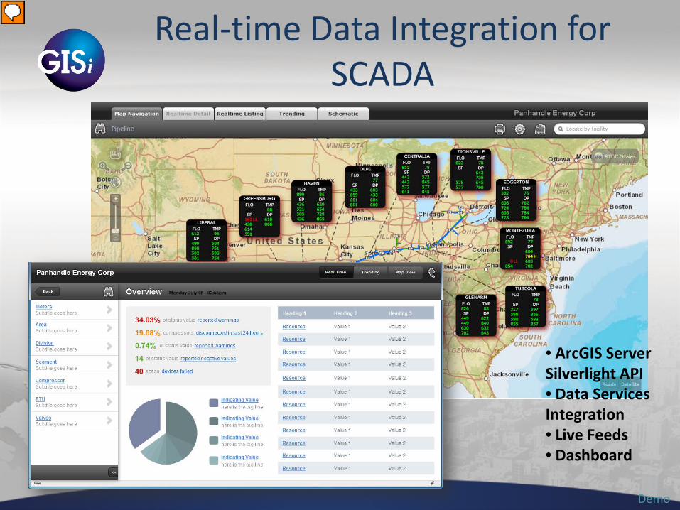
Real-time Data Integration for SCADA
• ArcGIS Server Silverlight API • Data Services Integration • Live Feeds • Dashboard

Surveillance w/ Mobile (Energy Distribution Example)
Demo
• ArcGIS Server Mobile 10 WPF • Integrated Voice • Dashboard

USACE Railroad Inventory and Inspections
• Project Goals – Reduce/Eliminate paper notes. – Increase Productivity – Shorten Delivery Schedule
• Technology – ArcGIS Mobile/Server – Trimble Positions
• Challenges – Single Pass Collection (Multiple Features Simultaneously) – Integration With Existing RAILER Software.
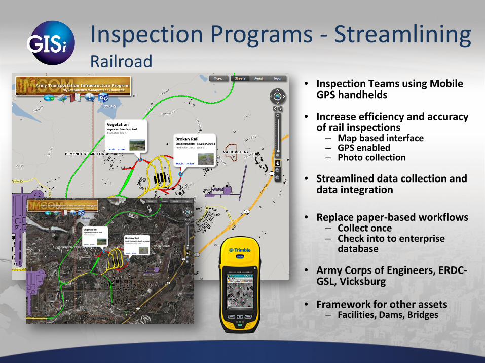
Inspection Programs - Streamlining Railroad
• Inspection Teams using Mobile GPS handhelds
• Increase efficiency and accuracy of rail inspections
– Map based interface – GPS enabled – Photo collection
• Streamlined data collection and
data integration
• Replace paper-based workflows
– Collect once – Check into to enterprise
database
• Army Corps of Engineers, ERDC-GSL, Vicksburg
• Framework for other assets
– Facilities, Dams, Bridges

Questions? Dan Levine
[email protected] Caleb Carter
www.gisinc.com showcase.gisinc.com
blog.gisinc.com
Thank You!
Emerging Technologies
• Augmented Reality – LAYARs with Geospatial Data – It’s not just about where the first down market is.
• Kinect – physical interaction with a map / app • GateWing
– Small UAV for aerial photo collection
• Humans vs. Zombies – Human Intelligence – Social Networking

Our Solutions – Learn More
http://showcase.gisinc.com/