Embed Size (px)
Citation preview
Geospatial Technologies Steering Committee Meeting
18 March 2005
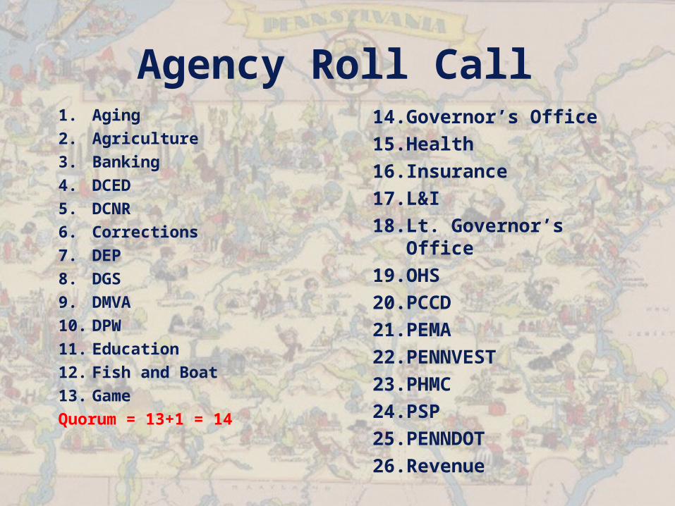
Agency Roll Call1. Aging2. Agriculture3. Banking4. DCED5. DCNR6. Corrections7. DEP8. DGS9. DMVA10. DPW11. Education12. Fish and Boat13. GameQuorum = 13+1 = 14
14.Governor’s Office15.Health16.Insurance17.L&I18.Lt. Governor’s
Office 19.OHS20.PCCD21.PEMA22.PENNVEST23.PHMC24.PSP25.PENNDOT26.Revenue
Any Additional Agenda Items or New Business?
January GTSC Meeting Minutes Review
Approval?
PAMAP Progress
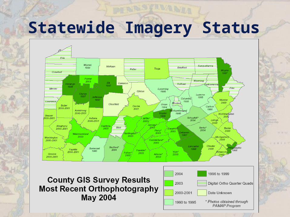
Statewide Imagery Status
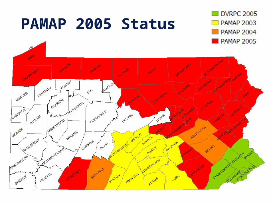
PAMAP 2005 Status
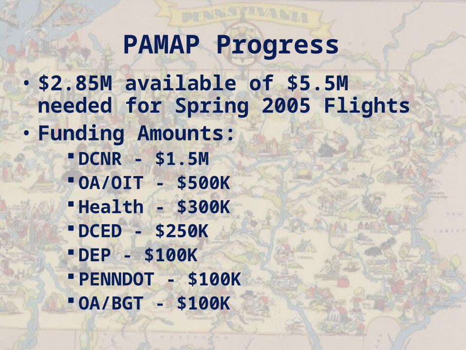
PAMAP Progress• $2.85M available of $5.5M
needed for Spring 2005 Flights• Funding Amounts:
DCNR - $1.5M OA/OIT - $500K Health - $300K DCED - $250K DEP - $100K PENNDOT - $100K OA/BGT - $100K
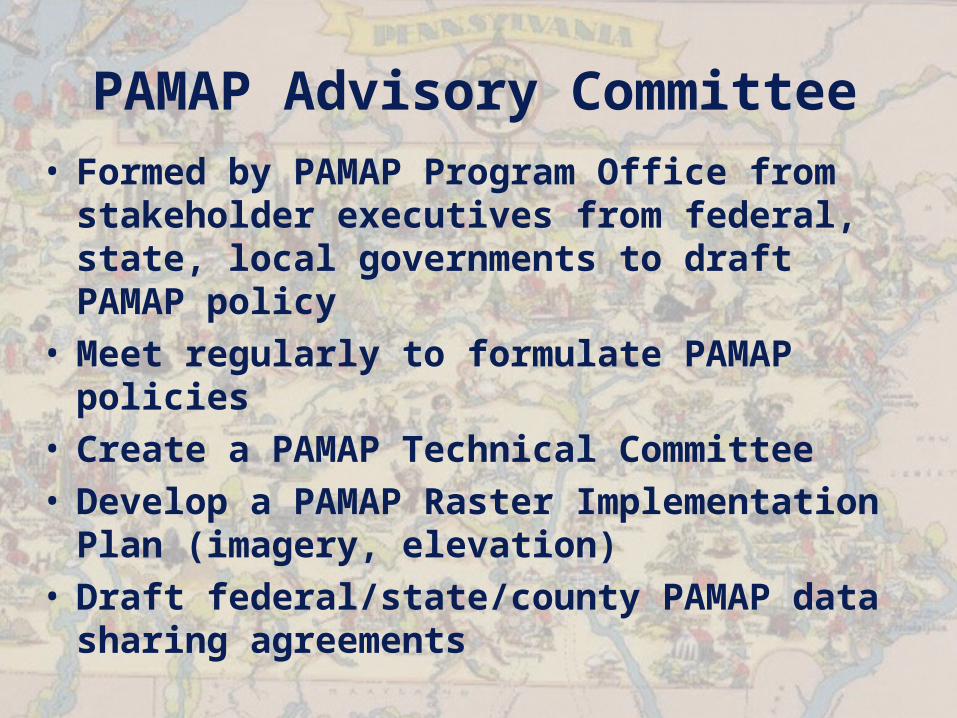
PAMAP Advisory Committee• Formed by PAMAP Program Office from
stakeholder executives from federal, state, local governments to draft PAMAP policy
• Meet regularly to formulate PAMAP policies
• Create a PAMAP Technical Committee• Develop a PAMAP Raster
Implementation Plan (imagery, elevation)
• Draft federal/state/county PAMAP data sharing agreements
NAIP 1m CIR Imagery Update

Statewide 2004 Summer/Fall Color Infrared 1m Pixel Imagery Example
CIR Access
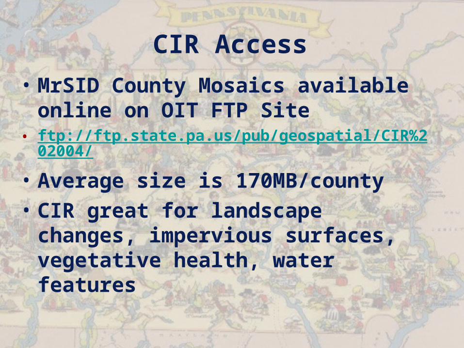
• MrSID County Mosaics available online on OIT FTP Site
• ftp://ftp.state.pa.us/pub/geospatial/CIR%202004/
• Average size is 170MB/county• CIR great for landscape changes,
impervious surfaces, vegetative health, water features

Statewide 2004 Summer/Fall Color Infrared 1m Pixel Imagery Example
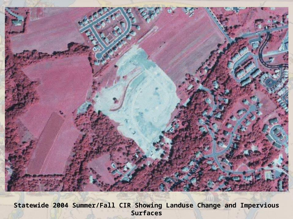
Statewide 2004 Summer/Fall CIR Showing Landuse Change and Impervious Surfaces
BGT Project Updates
Weather Project• Geospatial Enterprise Architecture
procured, designed, and being deployed• Requirements being finalized prior to
final review by Weather Workgroup and provided to DGS Procurement
• RFP for Data Services planned for release April 15, Proposals due 5/21?
• RFQs for Application Development in May/June
• Possibility of using PA-GEARS for weather dissemination and severe weather alerting
DHS ITEP Project• Budget approved by DHS on 3/3, notified
3/7• MOU between DHS CIO and OIT CIO signed
2/24 • Held meeting with Ryan Cast and
Geospatial Management Office in Harrisburg on 2/25
• Finalizing Concept of Operations, including interoperable geospatial data sharing and PEIRS geospatial enhancements
• Will leverage DHS source code assets from other federal projects
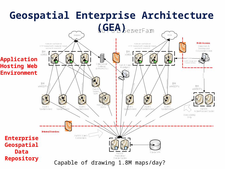
Geospatial Enterprise Architecture (GEA)
Application Hosting Web Environment
Enterprise Geospatial Data
Repository
`
Oracle SANArcSDE
Repository/Oracle Cluster
ArcIMSSpatial Server
ArcIMSSpatial Server
ArcIMSSpatial Server
P
ort 5
353
& 5
050
Port 5353 &
5050
Port 5353 &
5051
ArcIMSSpatial Server
ArcIMSSpatial Server
ArcIMSSpatial Server
P
ort 5
353
& 5
050
Port 5353 &
5051
State ArcGISDesktop and
Co-Location Users
ArcGIS CitrixMetaframe
Por
t 152
1
ArcSDE DirectConnections
BGT GIS Server Farm
Port 80
ArcIMS Image andFeature Services
Por t 5 15 1
ArcSDEActive/Passive Cluster
Data LoadingOnly
IBMx346s
IBMx445DPs IBM
x445DPs
IBMx346s
IBMx445DPs
MAN Access
ArcGIS ServerSOCs
Internal Services
ArcGISServerSOM
Citrix SecureGateway
(OAREMOTE)
Internet MAN
Po rt 80
Hardware Load Balanced
HTTP Servers/ArcIMS Application Servers
and ArcGIS Server ADF
Hardware Load Balanced
HTTP Servers/ArcIMS Application Servers
and ArcGIS Server ADF
Capable of drawing 1.8M maps/day?
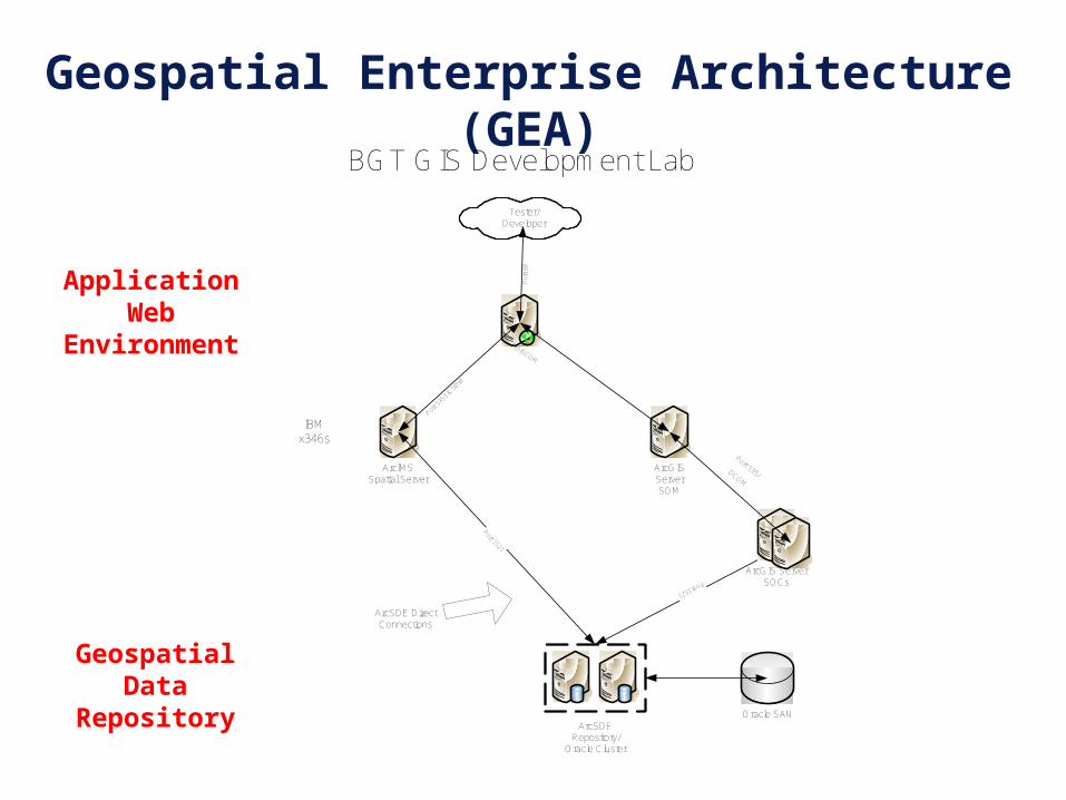
Geospatial Enterprise Architecture (GEA)
Application Web Environment
Geospatial Data Repository
Oracle SANArcSDE
Repository/Oracle Cluster
ArcIMSSpatial Server
P
ort 5
353
& 505
0
Port 1521
ArcSDE DirectConnections
BGT GIS Development Lab
IBMx346s
Port 1521
ArcGIS ServerSOCs
ArcGISServerSOM
Port 135/DCOM
Port
135/DCOM
Tester/Developer
Por
t 80
Address Geocoding Web Service
• Initial Web Service launched in production on 3/1
• Test page in staging:
http://www.bgtaddresstools.beta.state.pa.us/BasicAddressMatch/GeoCodeTestPage.aspx
• Currently only PA, ordered national address dataset
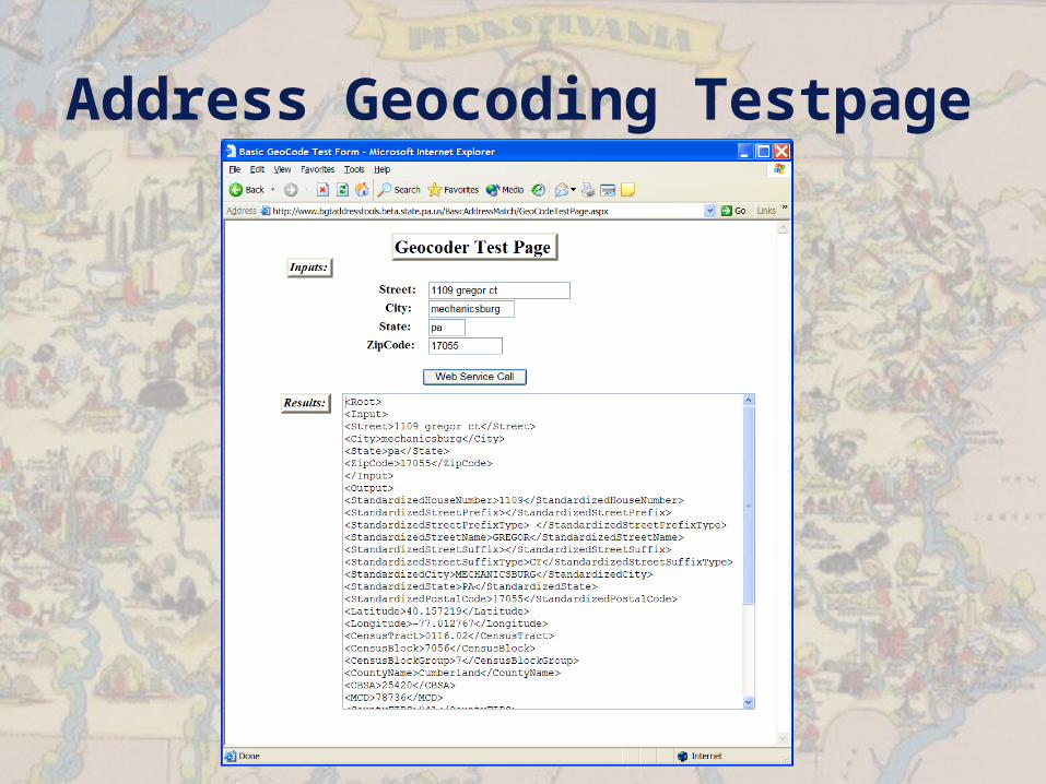
Address Geocoding Testpage

Address Geocoding Testpage<Root>
<Input>
<Street>1109 gregor ct</Street>
<City>mechanicsburg</City>
<State>pa</State>
<ZipCode>17055</ZipCode>
</Input>
<Output>
<StandardizedHouseNumber>1109</StandardizedHouseNumber>
<StandardizedStreetPrefix></StandardizedStreetPrefix>
<StandardizedStreetPrefixType> </StandardizedStreetPrefixType>
<StandardizedStreetName>GREGOR</StandardizedStreetName>
<StandardizedStreetSuffix></StandardizedStreetSuffix>
<StandardizedStreetSuffixType>CT</StandardizedStreetSuffixType>
<StandardizedCity>MECHANICSBURG</StandardizedCity>
<StandardizedState>PA</StandardizedState>
<StandardizedPostalCode>17055</StandardizedPostalCode>
<Latitude>40.157219</Latitude>
<Longitude>-77.012767</Longitude>
<CensusTract>0116.02</CensusTract>
<CensusBlock>7056</CensusBlock>
<CensusBlockGroup>7</CensusBlockGroup>
<CountyName>Cumberland</CountyName>
<CBSA>25420</CBSA>
<MCD>78736</MCD>
<CountyFIPS>041</CountyFIPS>
<MatchRationaleCode>0</MatchRationaleCode>
<MatchRationale> </MatchRationale>
<MatchStatusCode>0</MatchStatusCode>
<MatchStatus>OK</MatchStatus>
<MatchExtendedStatusCode>0</MatchExtendedStatusCode>
<MatchExtendedStatus>Match to left-side, same parity</MatchExtendedStatus>
<MatchContextCode>0</MatchContextCode>
<MatchContext>All</MatchContext>
</Output>
</Root>
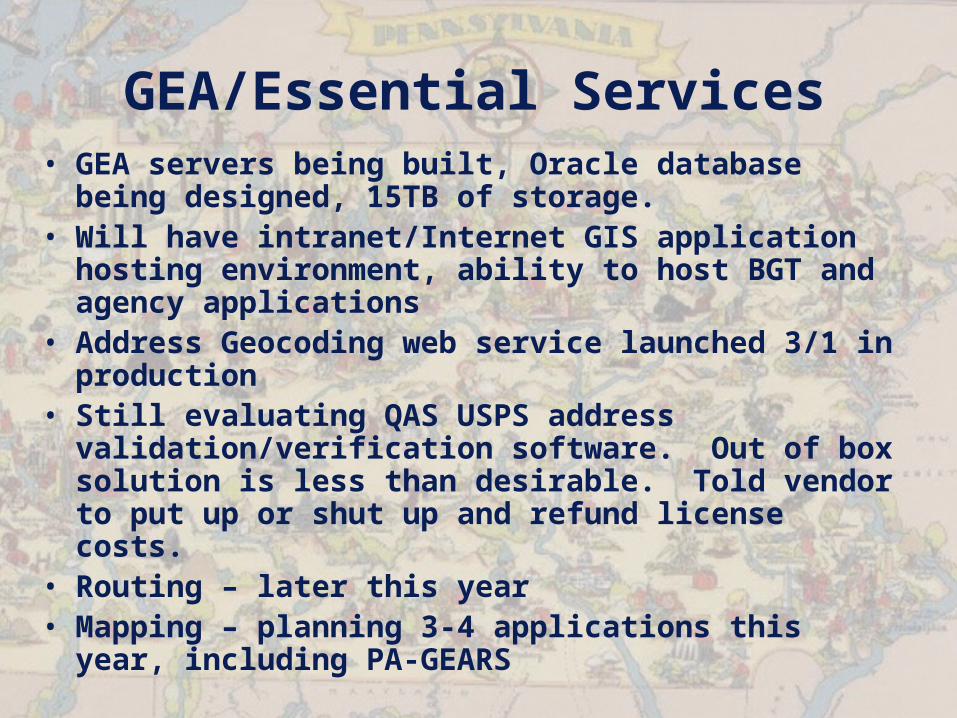
GEA/Essential Services• GEA servers being built, Oracle database
being designed, 15TB of storage. • Will have intranet/Internet GIS application
hosting environment, ability to host BGT and agency applications
• Address Geocoding web service launched 3/1 in production
• Still evaluating QAS USPS address validation/verification software. Out of box solution is less than desirable. Told vendor to put up or shut up and refund license costs.
• Routing – later this year• Mapping – planning 3-4 applications this year,
including PA-GEARS
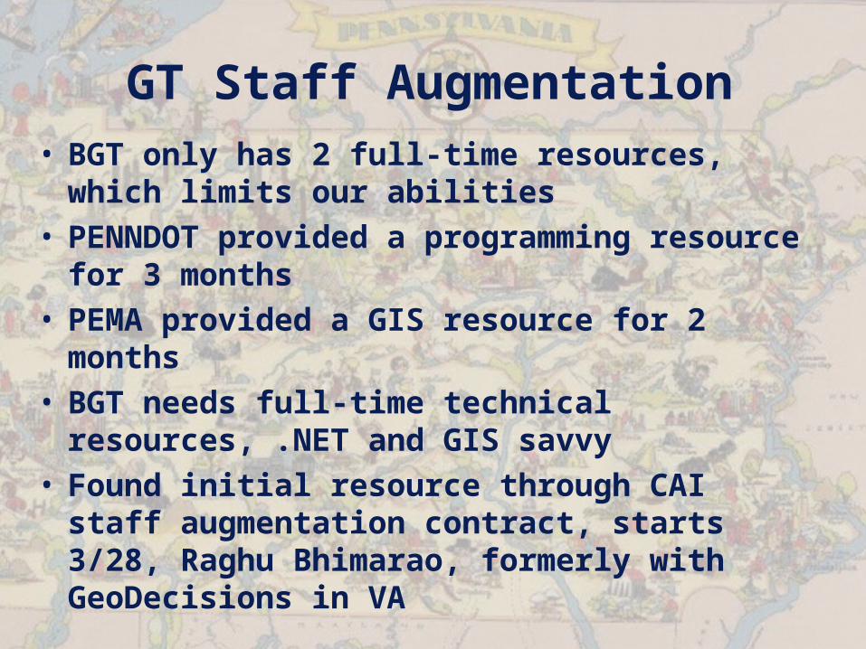
GT Staff Augmentation• BGT only has 2 full-time resources,
which limits our abilities• PENNDOT provided a programming
resource for 3 months• PEMA provided a GIS resource for 2
months• BGT needs full-time technical resources,
.NET and GIS savvy• Found initial resource through CAI staff
augmentation contract, starts 3/28, Raghu Bhimarao, formerly with GeoDecisions in VA
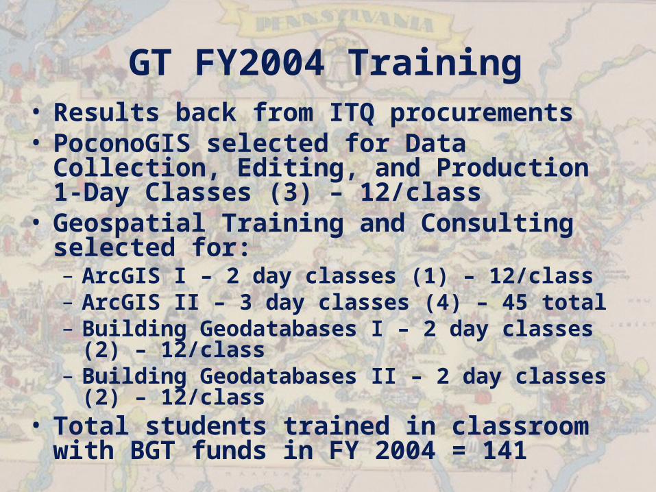
GT FY2004 Training• Results back from ITQ procurements• PoconoGIS selected for Data
Collection, Editing, and Production 1-Day Classes (3) – 12/class
• Geospatial Training and Consulting selected for:– ArcGIS I – 2 day classes (1) – 12/class– ArcGIS II – 3 day classes (4) – 45 total– Building Geodatabases I – 2 day classes (2)
– 12/class– Building Geodatabases II – 2 day classes
(2) – 12/class• Total students trained in classroom
with BGT funds in FY 2004 = 141
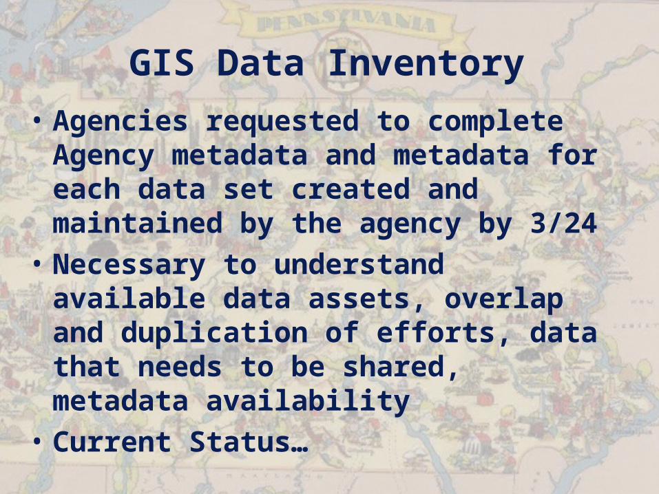
GIS Data Inventory
• Agencies requested to complete Agency metadata and metadata for each data set created and maintained by the agency by 3/24
• Necessary to understand available data assets, overlap and duplication of efforts, data that needs to be shared, metadata availability
• Current Status…
ITBs under DevelopmentRelated to GT
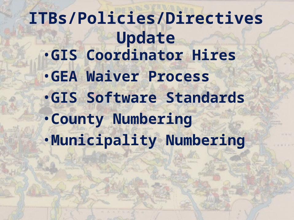
ITBs/Policies/Directives Update
•GIS Coordinator Hires•GEA Waiver Process•GIS Software Standards•County Numbering•Municipality Numbering
Metadata Standards:
GT Metadata Coordinators

Agreement to Rescind PAGIC (now GTC)
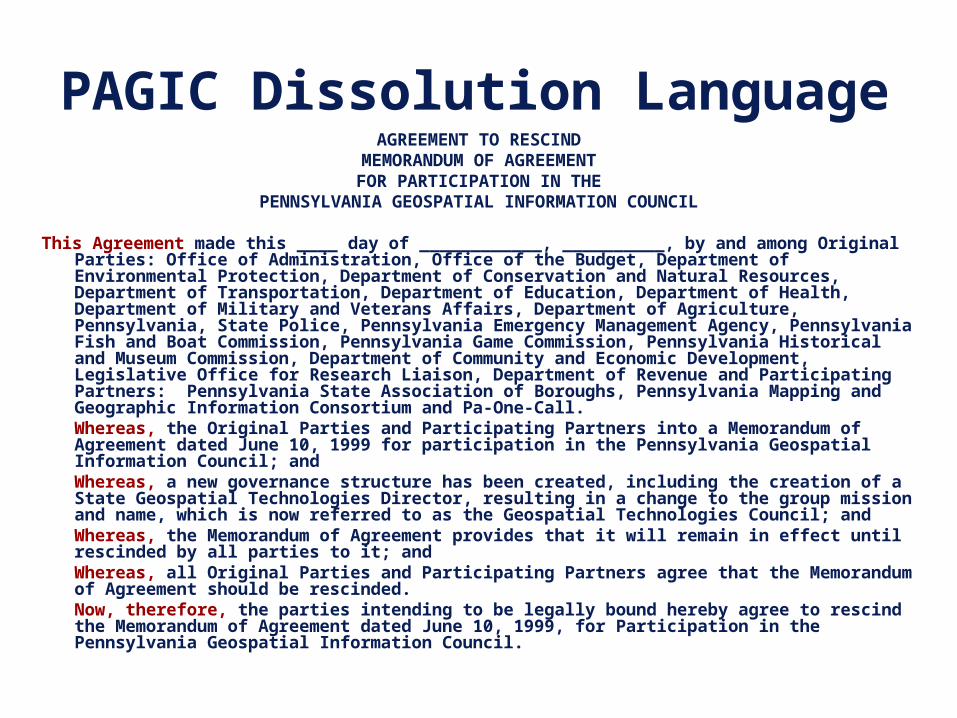
PAGIC Dissolution LanguageAGREEMENT TO RESCIND
MEMORANDUM OF AGREEMENTFOR PARTICIPATION IN THE
PENNSYLVANIA GEOSPATIAL INFORMATION COUNCIL
This Agreement made this ____ day of ____________, __________, by and among Original Parties: Office of Administration, Office of the Budget, Department of Environmental Protection, Department of Conservation and Natural Resources, Department of Transportation, Department of Education, Department of Health, Department of Military and Veterans Affairs, Department of Agriculture, Pennsylvania, State Police, Pennsylvania Emergency Management Agency, Pennsylvania Fish and Boat Commission, Pennsylvania Game Commission, Pennsylvania Historical and Museum Commission, Department of Community and Economic Development, Legislative Office for Research Liaison, Department of Revenue and Participating Partners: Pennsylvania State Association of Boroughs, Pennsylvania Mapping and Geographic Information Consortium and Pa-One-Call.Whereas, the Original Parties and Participating Partners into a Memorandum of Agreement dated June 10, 1999 for participation in the Pennsylvania Geospatial Information Council; andWhereas, a new governance structure has been created, including the creation of a State Geospatial Technologies Director, resulting in a change to the group mission and name, which is now referred to as the Geospatial Technologies Council; and Whereas, the Memorandum of Agreement provides that it will remain in effect until rescinded by all parties to it; andWhereas, all Original Parties and Participating Partners agree that the Memorandum of Agreement should be rescinded.Now, therefore, the parties intending to be legally bound hereby agree to rescind the Memorandum of Agreement dated June 10, 1999, for Participation in the Pennsylvania Geospatial Information Council.

Review of BGT Strategic Planning
Initiatives

GTAC Top 5 Issues and Objectives
• Standardized Training• Information Classification/Security • Recruitment and retention of skills• Required partnerships – Interagency, multiple
levels of government funding and resources• Data stewards – Who is the data steward, and
how communicated?• Develop need to share across state, federal,
and local• Develop process for data stewardship• Continued outreach to help identify
opportunities• Benefits of combining data• Integrated partnerships
• Capture data at 2 levels• Day-to-Day, operational• Emergency Management/Homeland Security
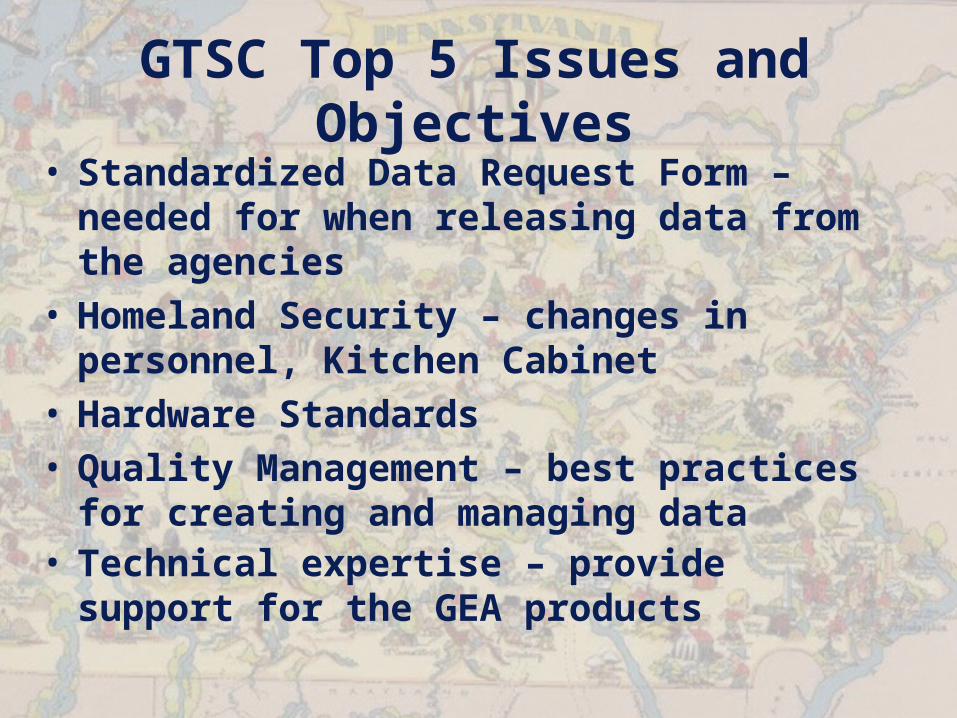
GTSC Top 5 Issues and Objectives
• Standardized Data Request Form – needed for when releasing data from the agencies
• Homeland Security – changes in personnel, Kitchen Cabinet
• Hardware Standards• Quality Management – best practices
for creating and managing data• Technical expertise – provide support
for the GEA products

New Business
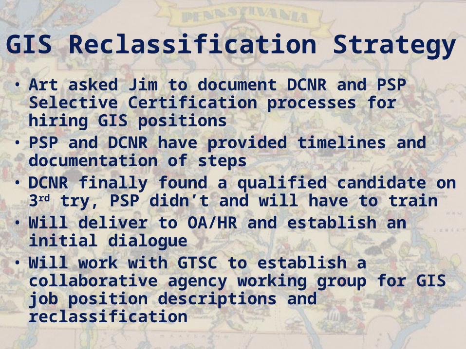
GIS Reclassification Strategy• Art asked Jim to document DCNR and PSP
Selective Certification processes for hiring GIS positions
• PSP and DCNR have provided timelines and documentation of steps
• DCNR finally found a qualified candidate on 3rd try, PSP didn’t and will have to train
• Will deliver to OA/HR and establish an initial dialogue
• Will work with GTSC to establish a collaborative agency working group for GIS job position descriptions and reclassification
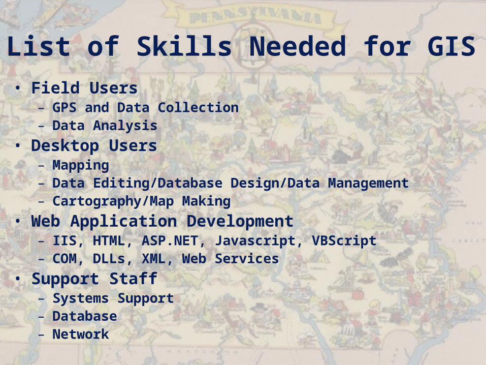
List of Skills Needed for GIS• Field Users
– GPS and Data Collection– Data Analysis
• Desktop Users– Mapping– Data Editing/Database Design/Data Management– Cartography/Map Making
• Web Application Development– IIS, HTML, ASP.NET, Javascript, VBScript– COM, DLLs, XML, Web Services
• Support Staff– Systems Support– Database– Network

April Meeting Topics?
1.
2.
3.
4.
5.
Motion to Adjourn?

Thanks!
Next Meeting 15 April 2005