Embed Size (px)
Citation preview
GeoVisualisation of health data
Prof Clive SabelGeography, CLES andEuropean Centre for Environment & Human Health
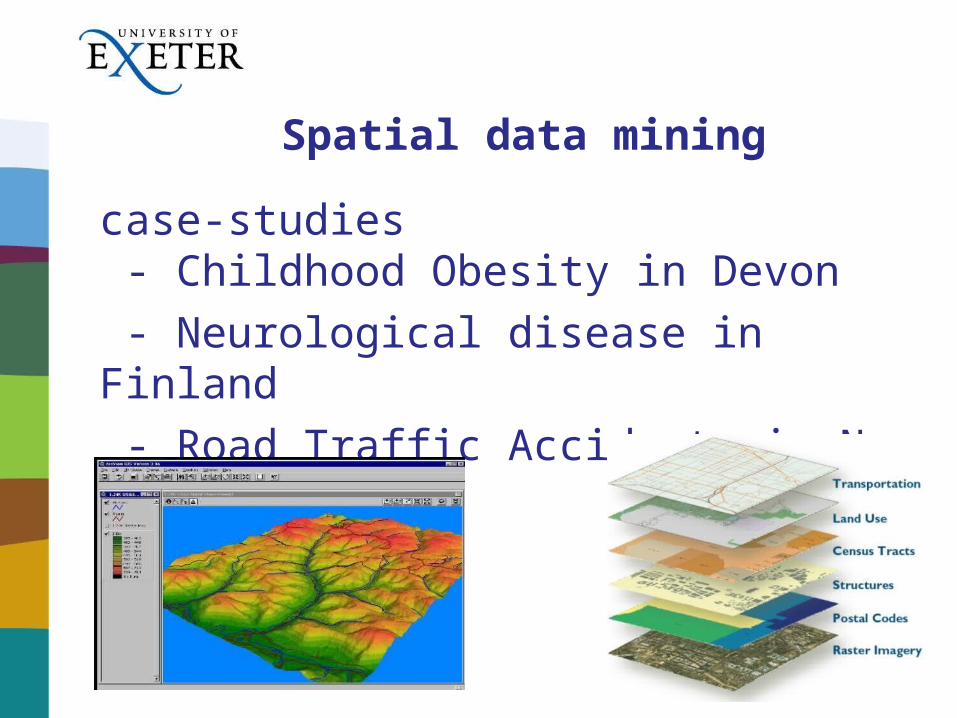
Spatial data mining
case-studies - Childhood Obesity in Devon
- Neurological disease in Finland
- Road Traffic Accidents in New Zealand

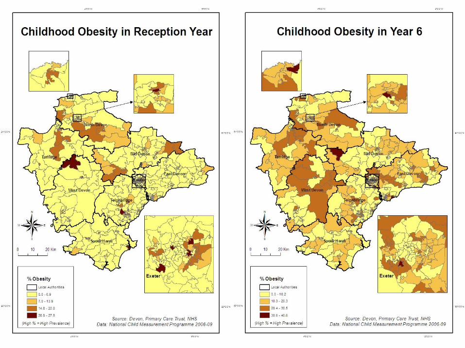
Childhood Obesity in Devon
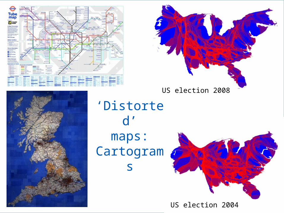
US election 2004
US election 2008
‘Distorted’maps:
Cartograms

HIV Prevalance
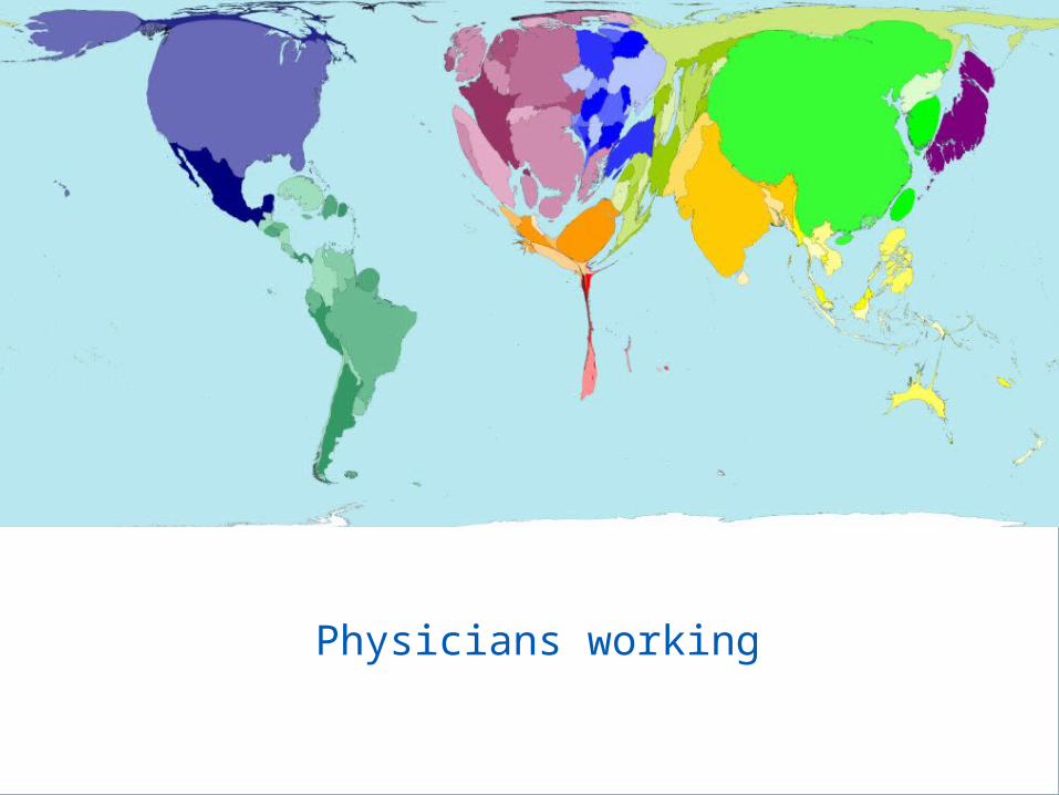
Physicians working

Neurological disease in Finland
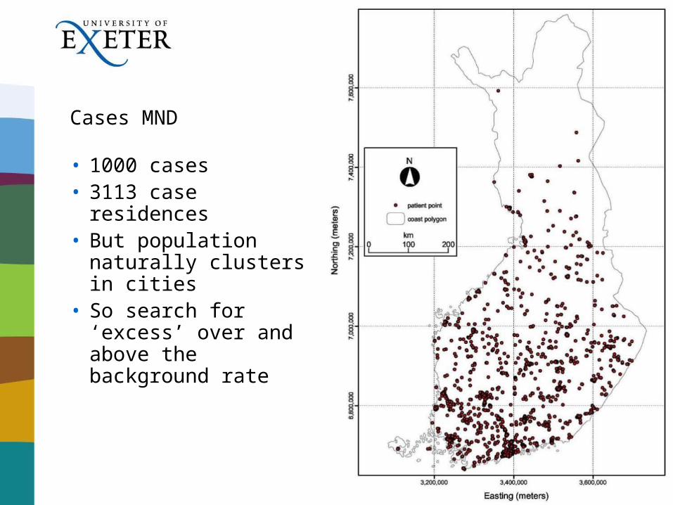
Cases MND
• 1000 cases• 3113 case residences• But population
naturally clusters in cities
• So search for ‘excess’ over and above the background rate
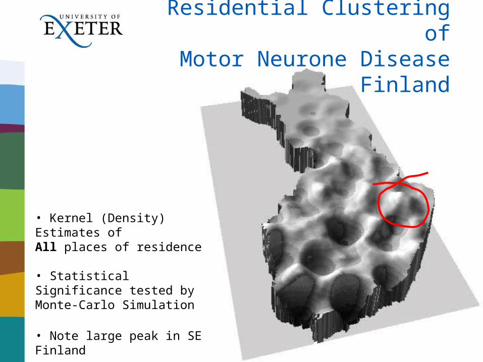
• Kernel (Density) Estimates ofAll places of residence
• Statistical Significance tested by Monte-Carlo Simulation
• Note large peak in SE Finland
Residential Clustering ofMotor Neurone Disease
Finland
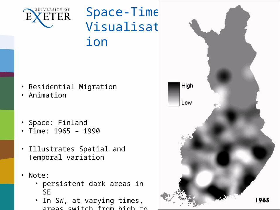
Space-TimeVisualisation
• Residential Migration• Animation
• Space: Finland• Time: 1965 – 1990
• Illustrates Spatial and Temporal variation
• Note:• persistent dark areas in SE• In SW, at varying times, areas
switch from high to low rates of disease
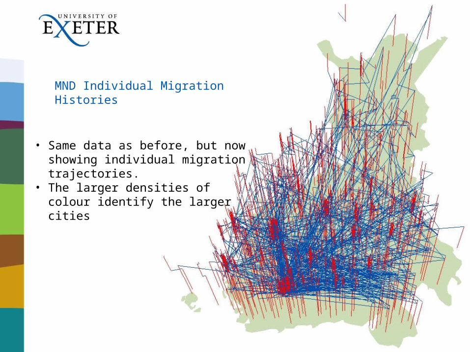
MND Individual Migration Histories
• Same data as before, but now showing individual migration trajectories.
• The larger densities of colour identify the larger cities
Road Traffic Accidents in New Zealand
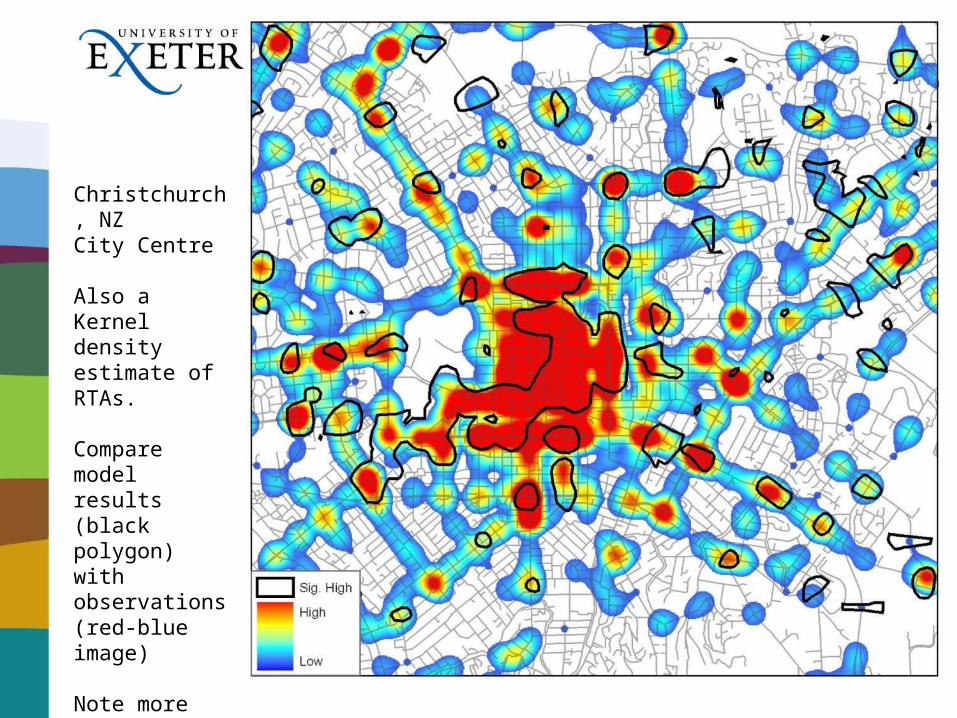
Christchurch, NZCity Centre
Also a Kernel density estimate of RTAs.
Compare model results (black polygon) with observations (red-blue image)
Note more accidents than modelled in thecity centre, and around junctions
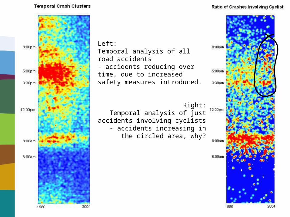
Left:Temporal analysis of all road accidents- accidents reducing over time, due to increased safety measures introduced.
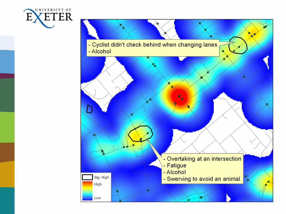
Right:Temporal analysis of just accidents
involving cyclists- accidents increasing in the circled area,
why?

Drive Safely!


![]sabel Pagan](https://img.pdfslide.net/doc/110x75/61e432d0f103732a724302ff/sabel-pagan.jpg)