Embed Size (px)
Citation preview
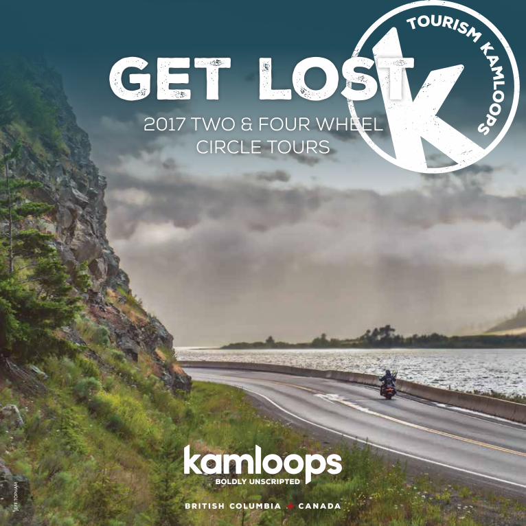
BRIT ISH COLUMBIA CANADA
get lost2017 two & four wheel
circle tours
JEFF
TO
PHAM

I was supposedto be homehours ago - these roadsare crazy fun[Took my bike outof the garage to blow the dust off]
Kamloops is more than a city, it’s a state of mind. It’s a small-town kind of friendly with metropolitan flavours on the side. Far from the hustle and bustle, it’s a place where you skip the crowds, stretch your legs and expand your horizons. Resting on the shores of two picturesque rivers, the landscapes invite a sense of improvised adventure.
Be amazed by twisty single-track bike trails and windy walkways. Poke around local shops and boutiques. Engage with the vibrant arts and culture scene. Feast upon the possibilities with the Kamloops Flavour Trail. Known as a foodie’s fantasy, sample an assortment that promises to satisfy and satiate even the most discerning of palettes. Indulge in a burgeoning bevy of wineries, craft breweries, restaurants and cafés that are overflowing with culinary enthusiasm and intensity.
Kamloops is a city for every season. It’s place for families, urban and rural adventurers. Don’t just escape, explore. Go off the grid, get lost and discover the unexpected along the way.
Tourism Kamloops Visitor Centre1290 Trans-Canada Highway West (Exit 368)
Kamloops, British Columbia, Canada V2C 6R31.800.662.1994
tourismkamloops.com
Jeff
Toph
am
100 Mile House
70 Mile House
Clinton
Ashcroft
Lytton
Peachland
Kelowna
Lake Country
VernonLumby
Needles
Summerland
Penticton
Hope
Pemberton
SpencesBridge
District ofLogan Lake
KeremeosOliver
OsoyoosRock Creek
Princeton
Little Fort
VavenbyClearwater
Wells Gray Provincial Park
District of Barriere
McLure
He�ey Creek Sun Peaks
Pritchard
Chase
Westwold Spallumcheen
Falkland
Armstrong
Enderby
Sicamous
Salmon Arm
Revelstoke
New Denver
Nakusp
Galena Bay
Silverton Kaslo
Balfour
Nelson
Slocan
Golden
Merritt
Salmo
Castlegar
Cherry Creek
Tobiano
SavonaCache Creek
Lillooet
Hwy 99To Whistler VIA
Pemberton
KAMLOOPS
Hwy 1To Vancouver
Hwy 5To Vancouver
Hwy 1To Vancouver VIASpences Bridge
& Lytton
Beverdell
Williams Lake
Riske Creek
Gang Ranch
Chasm
Bralorne
Gold Bridge
Lac La Hache
150 Mile House
Hat Creek Ranch Rayleigh
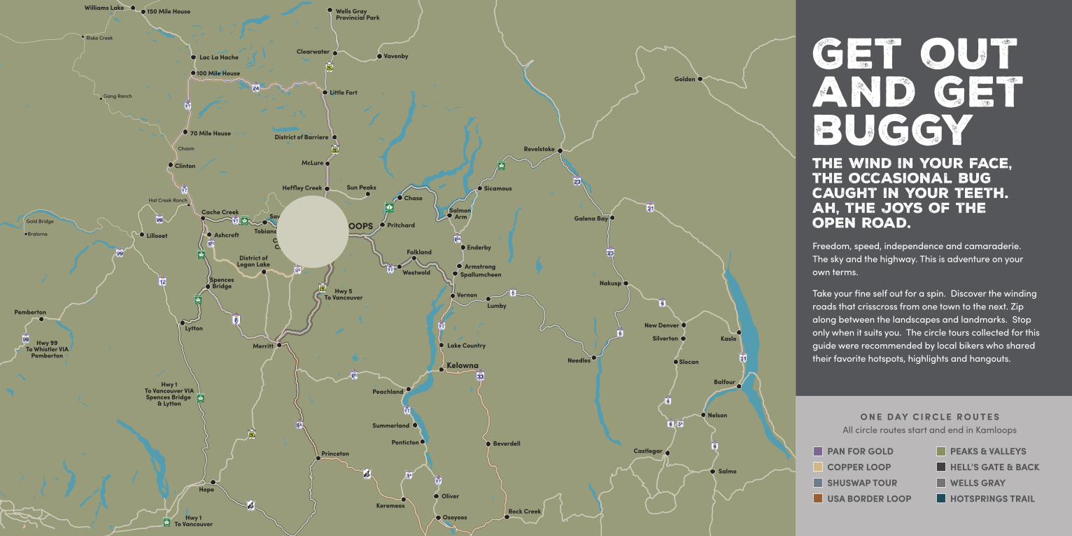
Get outand get buggyThe wind in your face, the occasional bug caught in your teeth. Ah, the joys of the open road. Freedom, speed, independence and camaraderie. The sky and the highway. This is adventure on your own terms.
Take your fine self out for a spin. Discover the winding roads that crisscross from one town to the next. Zip along between the landscapes and landmarks. Stop only when it suits you. The circle tours collected for this guide were recommended by local bikers who shared their favorite hotspots, highlights and hangouts.
O N E D AY C I R C L E R O U T E SAll circle routes start and end in Kamloops
PAN FOR GOLD COPPER LOOP SHUSWAP TOUR USA BORDER LOOP
PEAKS & VALLEYS HELL’S GATE & BACK WELLS GRAY HOTSPRINGS TRAIL
PAN FOR GOLDDISTANCE: 515 KMS / 320 MILES APPROX. TIME: 6 HOUR 15 MINUTESKamloops > Little Fort > 100 Mile House > Cache Creek > Spences Bridge > Merritt
KAMLOOPS TO LITTLE FORT (5 NORTH)Distance: 93 kms / 60 miles • Approx. Time: 1 hour
ORIGIN/DESTINATION: The route starts by taking riders north on Hwy 5 towards Barrière, the site of the 2003 mountain fire that threatened the entire town There are still remnants of burnt trees in the area reminding tourists and locals of the danger a cigarette or lightning can cause. Turn off on Hwy 24 in Little Fort and ride up the twisty mountain roads, and enjoy the many pristine lakes along this tour.
HIGHLIGHTS: Space Module Ice Cream Standfrom Expo ‘86.
LITTLE FORT TO 100 MILE HOUSE (24 WEST)Distance: 97 kms / 62 miles • Approx. Time: 1:10 hours
ORIGIN/DESTINATION: Head west towards 100 Mile House on Highway 24. When you reach Highway 97, you are at “Mile 97.” Need fuel for the bikes or a bite to eat? Turn right and travel 5 kms (3 miles) to 100 Mile House. Otherwise, turn left onto Highway 97 towards 70 Mile House and Cache Creek.
HIGHLIGHTS: See the remnants of the original “Cariboo Wagon Road” from the Gold Rush of the late 1850s. An original Barnard Express stage coach from the Gold Rush is on display in the parking area of the Red Coach Inn, on the north side of town.
100 MILE HOUSE TO CACHE CREEK (97 SOUTH)Distance: 113 kms / 71 miles • Approx. Time: 1:20 hours
HIGHLIGHTS: The Chasm–10 kms (6 miles) after 70 Mile House. Turn left onto Chasm Road. Continue southwest along this road and it will meet up with Highway 97 South. There are painted hills about 15 kms (9 miles) before Cache Creek. Also check out Historic Hat Creek Ranch, Bonaparte Bend Winery, Cariboo Jade Shop and Graffiti Days Show ‘n Shine in June
CACHE CREEK TO SPENCES BRIDGE (1 SOUTH)Distance: 50 kms / 31 miles • Approx. Time: 30 minutes
ORIGIN/DESTINATION: Head south on Highway 1 to Spences Bridge. There are limited gas stations between Cache Creek and Merritt, so ensure riders have sufficient fuel to travel 120 kms (75 miles).
HIGHLIGHTS: Big Horn Sheep
SPENCES BRIDGE TO MERRITT (8 SOUTH)Distance: 70 kms / 40 miles • Approx. Time: 1 hour
ORIGIN/DESTINATION: After crossing Spences Bridge, drive 0.5 kms and make a sharp turn to the left to Highway 8. Head southeast on Highway 8 towards Merritt, arriving along Nicola Ave.
HIGHLIGHTS: Take it slow and enjoy the picturesque drive along the winding river.
MERRITT TO KAMLOOPS (5A NORTH)Distance: 90 kms / 56 miles • Approx. Time: 1:15 hours
ORIGIN/DESTINATION: Either continue following Nicola Ave. until it meets up with Highway 5 or turn left onto Voght Street and follow it all the way up the hill. Voght Street will then turn into Highway 5A
HIGHLIGHTS: See the Historic Quilchena Hotel and working ranch, the surrounding farm land, and many lakes with likely sightings of eagles fishing.
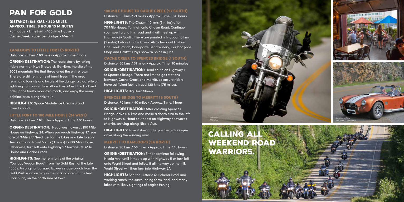
Mike Drew
CRUISINGMike Drew
KAMLOOPS FRICK AND FRACKKen Laven
Kamoteus on Flickr used under CC-BY licence.
Calling all Weekend Road Warriors.
COPPER MINE LOOPTOTAL DISTANCE: 433 KMS / 269 MILESTOTAL TIME: 5 HOURS 10 MINUTESKamloops > Little Fort > 100 Mile House > Cache Creek > Ashcroft > Logan Lake > Lac Le Jeune
KAMLOOPS TO LITTLE FORT (5 NORTH)Distance: 93 kms / 60 miles • Approx. Time: 1:15 hours
ORIGIN/DESTINATION: Head north on Yellowhead Highway 5 towards Little Fort.
HIGHLIGHTS: Space Module Ice Cream Stand from Expo ‘86. Take a side trip to Clearwater (31 kms / 19 miles north of Little Fort.) See Route 7 for details and attractions.
LITTLE FORT TO 100 MILE HOUSE (24 WEST)Distance: 97 kms / 62 miles • Approx. Time: 1:10 hours
ORIGIN/DESTINATION: Head west towards 100 Mile House on Highway 24. Upon reaching the junction of Highway 24/97, riders are at Mile 97. Head north on Highway 97 for 5 kms (3 miles) towards 100 Mile House, a suggested spot for fuel and a bite to eat. Those wanting to continue towards 70 Mile House will turn left onto Highway 97.
HIGHLIGHTS: See the remnants of the original “Cariboo Wagon Road” from the Gold Rush of the late 1850s. An original Barnard Express stage coach from the Gold Rush is on display in the parking area of the Red Coach Inn, on the north side of town.
100 MILE HOUSE TO CACHE CREEK (97 SOUTH)Distance: 113 kms / 71 miles • Approx. Time: 1:20 hours
HIGHLIGHTS: The Chasm–10 kms (6 miles) after 70 Mile House. Turn left onto Chasm Road. Continue southwest along this road and it will meet up with
Highway 97 South. There are painted hills about 15 kms (9 miles) before Cache Creek, Historic Hat Creek Ranch, Bonaparte Bend Winery, Cariboo Jade Shop, Graffiti Days Show ‘n Shine in June.
CACHE CREEK TO ASHCROFT (1 SOUTH)Distance: 10 kms / 6 miles • Approx. Time: 10 minutes
ORIGIN/DESTINATION: Continue on Highway 1 and follow the signs to Ashcroft. Turn left off the highway at the turning lane.
HIGHLIGHTS: Ashcroft Museum, Historic Fire Hall.
ASHCROFT TO LOGAN LAKE (97C SOUTH)Distance: 58 kms / 36 miles • Approx. Time: 45 minutes
ORIGIN/DESTINATION: After crossing Spences Bridge, drive 0.5 kms and make a sharp turn to the left to Highway 8. Head southeast on Highway 8 towards Merritt, arriving along Nicola Ave.
HIGHLIGHTS: Highland Valley Copper Mine. The Logan Lake Visitor Information Center is located inside a huge mining shovel that sits next to a 235-ton ore truck.
LOGAN LAKE TO KAMLOOPS (97D NORTH)Distance: 55 kms / 34 miles • Approx. Time: 45 minutes
ORIGIN/DESTINATION: Head northwest out of Logan Lake onto Highway 97D / Meadow Creek Road. Follow this road over the highway and towards Lac Le Jeune (continuing on Meadow Creek Rd.) This will eventually turn into Lac Le Jeune Rd. Follow this road all the way to Kamloops.
HIGHLIGHTS: Lac Le Jeune – take a seat at a picnic table and enjoy the beautiful day.
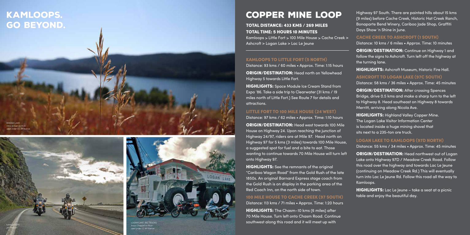
BRIDGE LAKEChris Schaer on Flickr used under CC-BY licence.
KAMLOOOPSJeff Topham
LOGAN LAKE, BIG TRUCKSAnson Chappel on Flickr used under CC-BY licence.
Kamloops. Go Beyond.
10
HOTSPRINGS TRAILTOTAL DISTANCE: 629 KMS / 391 MILESTOTAL TIME: 9 HOURS 40 MINUTESKamloops > Westwold > Vernon > Needles > Fauquier > Nakusp > Galena Bay Ferry > Revelstoke > 3 Valley Gap > Sicamous > Salmon Arm > Sorrento
KAMLOOPS TO VERNON (1 TO 97 EAST)Distance: 93 kms / 60 miles • Approx. Time: 1 hour
ORIGIN/DESTINATION: Head east from Kamloops on Highway 1 for approximately 25 kms (15 miles). Keep in the right lane and take the exit for Highway 97 towards Vernon.
HIGHLIGHTS: BC Wildlife Park, Westwold Church, Falkland’s Largest Canadian Flag, Falkland Stampede (May), O’Keefe Historic Ranch.
VERNON TO NAKUSP (6 EAST)Distance: 193 kms / 120 miles • Approx. Time: 3:25 hours
ORIGIN/DESTINATION: Follow Highway 97 South (32nd Street) until it meets with 25th Ave. Drive one block and take the next right onto Highway 6 and follow this highway heading east towards Lumby. 26 kms (16 miles) from Vernon, you will pass through Lumby, Cherryville, and Needles. Take the free ferry service across Arrow Lake to Fauquier and continue on through Burton before arriving at Nakusp. Visit arrowbridge.ca or call Western Pacific Marine 250.837.6676 for schedule.
HIGHLIGHTS: Ride the Needles Cable Ferry or visit the numerous hot springs along or close to this route:• Nakusp Hotsprings • Halcyon North of Nakusp• Ainsworth North of Nelson• Canyon Hotspring East of Revelstoke
NAKUSP TO REVELSTOKE (23 NORTH)Distance: 105 kms / 65 miles • Approx. Time: 1:40 hours
ORIGIN/DESTINATION: Head north out of Nakusp onto Highway 23. Arrive at the Galena Bay Ferry about 48 kms (30 miles) from Nakusp. The free ferry service will unload at Shelter Bay. Follow Highway 23 until you reach Revelstoke.
HIGHLIGHTS: Ride the Needles Cable Ferry
SIDE TRIP: Loop from Galena Bay to Kaslo by taking Highway 31. From Kaslo, take Highway 31A to New Denver, Highway 6 to Nakusp, and Highway 23 back to Galena Bay. This circle tour trip is approximately 340 kms (211 miles) and will take almost 6 hours but it’s an incredible area to tour.
REVELSTOKE TO SALMON ARM (1 WEST)Distance: 105 kms / 65 miles • Approx. Time: 1:10 hours
HIGHLIGHTS: Revelstoke Train Museum, Three Valley Gap Ghost Town and Resort, Enchanted Forest & Sky Trek Adventure Park, Crazy Creek Waterfalls & Suspension Bridge, The Last Spike Museum, and Dutchman Dairy Farms.
SALMON ARM TO KAMLOOPS (1 WEST)Distance: 109 kms / 68 miles • Approx. Time: 1:30 hour
ORIGIN/DESTINATION: After crossing Spences Bridge, drive 0.5 kms and make a sharp turn to the left to Highway 8. Head southeast on Highway 8 towards Merritt, arriving along Nicola Ave.
HIGHLIGHTS: Shuswap in one of the busiest lakes in BC. Houseboating is one of the major attractions along with sport boating, fishing and camping. Shuswap is a year round destination where thousands flock for summer vacation. Big and Little Shuswap Lakes, Dreamcycle Motorcycle Museum & Gift Shop, Adams River Salmon Run, beaches, white water rafting and golf.
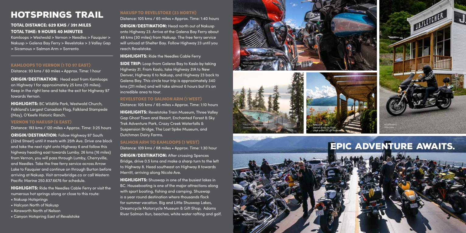
KOOTENAYSMike Drew
HALCYON HOTSPRINGS Candace Lewis
NEEDLES FERRYMIke Drew
NAKUSPDarren Kirby on Flickr used under CC-BY licence.
NEEDLES FERRYMike Drew
Epic adventure awaits.

USA BORDER LOOPDISTANCE: 637 KMS / 396 MILES APPROX. TIME: 8 HOURSKamloops > Vernon > Kelowna > Rock Creek > Osoyoos > Princeton > Merritt
KAMLOOPS TO VERNON (1 EAST)Distance: 118 kms / 73 miles • Approx. Time: 1:30 hours ORIGIN/DESTINATION: Head east from Kamloops on Highway 1 for approximately 25 kms (15 miles). Keep in the right lane and take the exit 399 for Highway 97 towards Vernon.
HIGHLIGHTS: BC Wildlife Park, Westwold old church, Falkland’s Largest Canadian Flag, Falkland Stampede (May), O’Keefe Historic Ranch, OVINO Winery.
VERNON TO KELOWNA (97 SOUTH)Distance: 53 kms / 33 miles • Approx. Time: 40 minutes
ORIGIN/DESTINATION: Head south on Highway 97 towards Kelowna.
HIGHLIGHTS: Kalamalka Lake, Sparkling Hills Spa,Predator Ridge Golf Course and Wineries.
KELOWNA TO OSOYOOS VIA ROCK CREEK (33 SOUTH)Distance: 175 kms / 108 miles • Approx. Time: 2 hours
ORIGIN/DESTINATION: Upon arrival into Kelowna, continue following Highway 97 (Okanagan Highway / Harvey Ave). Turn left onto Highway 33 and travel through Rutland towards Big White Ski Resort. Continue on Highway 33 towards Rock Creek / Osoyoos. Once in Rock Creek, turn right onto Highway 3 and continue to follow the signs for Osoyoos.
HIGHLIGHTS: Check out Nk’mip Cellars, North America’s first Aboriginal Winery in Osoyoos amongst other wineries.
OSOYOOS TO PRINCETON (3 WEST)Distance: 115 kms / 71 miles • Approx. Time: 1:35 hours
ORIGIN/DESTINATION: Head west out of Osoyoos on Highway 3 towards Keremeos and continue on Highway 3 to Princeton.
HIGHLIGHTS: Check out the Princeton Museum or the old Kettle Valley Railway Tunnels in Princeton.
PRINCETON TO MERRITT (5A NORTH)Distance: 89 kms / 55 miles • Approx. Time: 1:15 hours
ORIGIN/DESTINATION: After crossing Spences Bridge, drive 0.5 kms and make a sharp turn to the left to Highway 8. Head southeast on Highway 8 towards Merritt, arriving along Nicola Ave.
HIGHLIGHTS: Take it slow and enjoy the picturesque drive along the winding river.
MERRITT TO KAMLOOPS (5A NORTH)Distance: 90 kms / 56 miles • Approx. Time: 1:15 hours
ORIGIN/DESTINATION: Once reaching the junction before Merritt, either continue on this road and end up in the Merritt City centre or turn right and merge on to Highway 5 to Kamloops. As a slower alternative drive, consider turning right at the next intersection at Exit 290 to take Highway 5A (Old Merritt Highway) to Kamloops.
HIGHLIGHTS: See many lakes and farm lands with likely sightings of eagles fishing, and check out the Historic Quilchena Hotel and Working Ranch.
NEAR KEREMEOSMurray Foubister on Flickr used under CC-BY licence.
@montecreekranch
GROUP RIDEMike Drew
@mikewilliams007
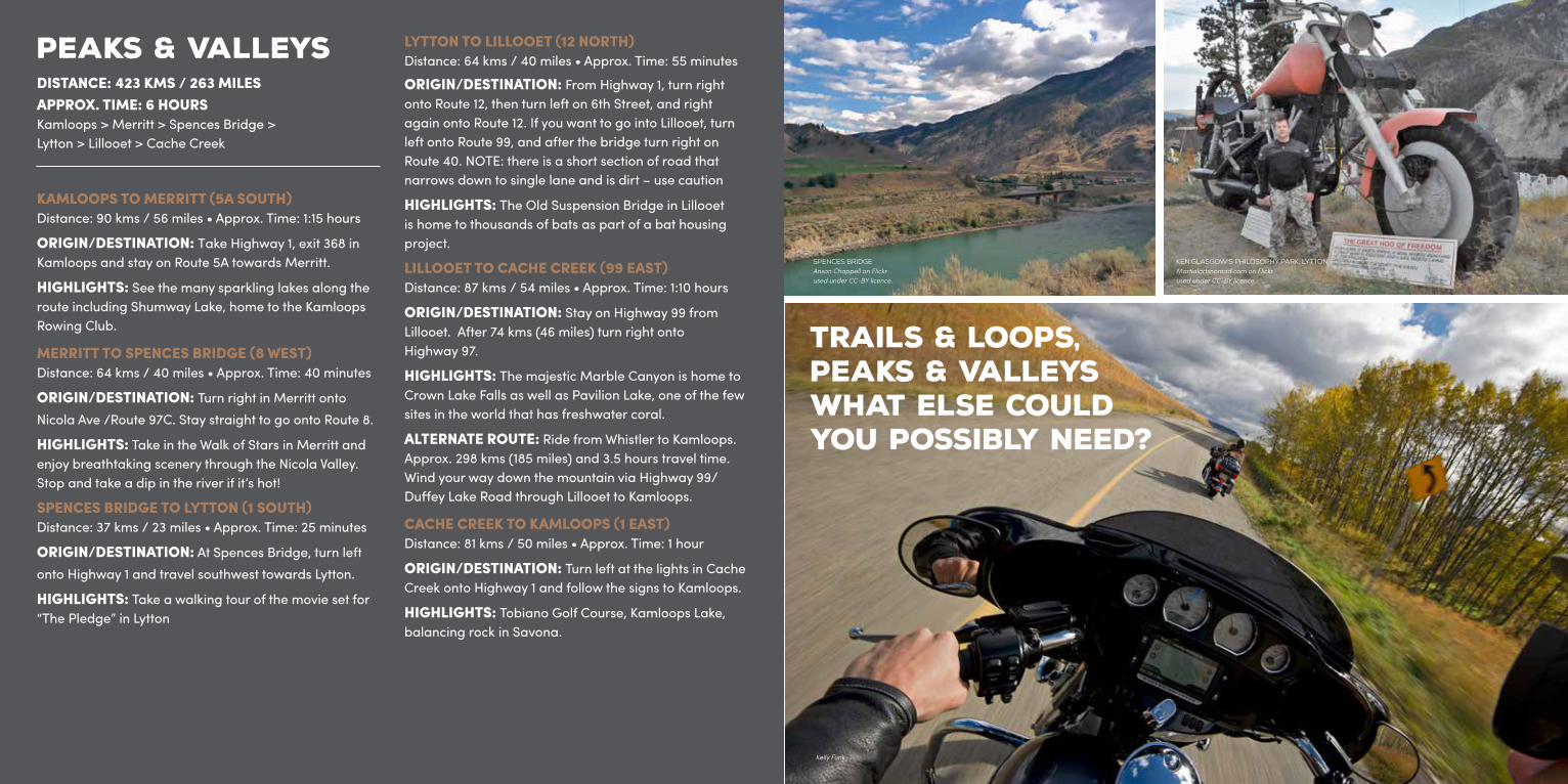
PEAKS & VALLEYSDISTANCE: 423 KMS / 263 MILES APPROX. TIME: 6 HOURSKamloops > Merritt > Spences Bridge > Lytton > Lillooet > Cache Creek
KAMLOOPS TO MERRITT (5A SOUTH)Distance: 90 kms / 56 miles • Approx. Time: 1:15 hours
ORIGIN/DESTINATION: Take Highway 1, exit 368 in Kamloops and stay on Route 5A towards Merritt.
HIGHLIGHTS: See the many sparkling lakes along the route including Shumway Lake, home to the Kamloops Rowing Club.
MERRITT TO SPENCES BRIDGE (8 WEST)Distance: 64 kms / 40 miles • Approx. Time: 40 minutes
ORIGIN/DESTINATION: Turn right in Merritt onto Nicola Ave /Route 97C. Stay straight to go onto Route 8.
HIGHLIGHTS: Take in the Walk of Stars in Merritt and enjoy breathtaking scenery through the Nicola Valley. Stop and take a dip in the river if it’s hot!
SPENCES BRIDGE TO LYTTON (1 SOUTH)Distance: 37 kms / 23 miles • Approx. Time: 25 minutes
ORIGIN/DESTINATION: At Spences Bridge, turn left onto Highway 1 and travel southwest towards Lytton.
HIGHLIGHTS: Take a walking tour of the movie set for “The Pledge” in Lytton
LYTTON TO LILLOOET (12 NORTH)Distance: 64 kms / 40 miles • Approx. Time: 55 minutes
ORIGIN/DESTINATION: From Highway 1, turn right onto Route 12, then turn left on 6th Street, and right again onto Route 12. If you want to go into Lillooet, turn left onto Route 99, and after the bridge turn right on Route 40. NOTE: there is a short section of road that narrows down to single lane and is dirt – use caution
HIGHLIGHTS: The Old Suspension Bridge in Lillooet is home to thousands of bats as part of a bat housing project.
LILLOOET TO CACHE CREEK (99 EAST)Distance: 87 kms / 54 miles • Approx. Time: 1:10 hours
ORIGIN/DESTINATION: Stay on Highway 99 from Lillooet. After 74 kms (46 miles) turn right onto Highway 97.
HIGHLIGHTS: The majestic Marble Canyon is home to Crown Lake Falls as well as Pavilion Lake, one of the few sites in the world that has freshwater coral.
ALTERNATE ROUTE: Ride from Whistler to Kamloops. Approx. 298 kms (185 miles) and 3.5 hours travel time. Wind your way down the mountain via Highway 99/Duffey Lake Road through Lillooet to Kamloops.
CACHE CREEK TO KAMLOOPS (1 EAST)Distance: 81 kms / 50 miles • Approx. Time: 1 hour
ORIGIN/DESTINATION: Turn left at the lights in Cache Creek onto Highway 1 and follow the signs to Kamloops.
HIGHLIGHTS: Tobiano Golf Course, Kamloops Lake, balancing rock in Savona.
SPENCES BRIDGEAnson Chappell on Flickr used under CC-BY licence.
Kelly Funk
KEN GLASGOW’S PHILOSOPHY PARK, LYTTONMartialartsnomad.com on Flickr used under CC-BY licence.
Trails & Loops, Peaks & Valleys what else could you possibly need?
MOUNTAIN SHEEP, SPENCES BRIDGERylee Isitt on Flickr used under CC-BY licence.
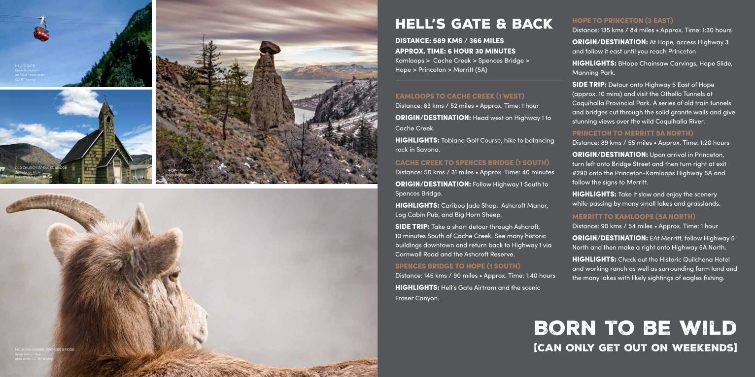
HELL’S GATE & BACKDISTANCE: 589 KMS / 366 MILES APPROX. TIME: 6 HOUR 30 MINUTESKamloops > Cache Creek > Spences Bridge > Hope > Princeton > Merritt (5A)
KAMLOOPS TO CACHE CREEK (1 WEST)Distance: 83 kms / 52 miles • Approx. Time: 1 hour
ORIGIN/DESTINATION: Head west on Highway 1 to Cache Creek.
HIGHLIGHTS: Tobiano Golf Course, hike to balancing rock in Savona.
CACHE CREEK TO SPENCES BRIDGE (1 SOUTH)Distance: 50 kms / 31 miles • Approx. Time: 40 minutes
ORIGIN/DESTINATION: Follow Highway 1 South to Spences Bridge.
HIGHLIGHTS: Cariboo Jade Shop, Ashcroft Manor, Log Cabin Pub, and Big Horn Sheep.
SIDE TRIP: Take a short detour through Ashcroft, 10 minutes South of Cache Creek. See many historic buildings downtown and return back to Highway 1 via Cornwall Road and the Ashcroft Reserve.
SPENCES BRIDGE TO HOPE (1 SOUTH)Distance: 145 kms / 90 miles • Approx. Time: 1:40 hours
HIGHLIGHTS: Hell’s Gate Airtram and the scenic Fraser Canyon.
HOPE TO PRINCETON (3 EAST)Distance: 135 kms / 84 miles • Approx. Time: 1:30 hours
ORIGIN/DESTINATION: At Hope, access Highway 3 and follow it east until you reach Princeton
HIGHLIGHTS: BHope Chainsaw Carvings, Hope Slide, Manning Park.
SIDE TRIP: Detour onto Highway 5 East of Hope (approx. 10 mins) and visit the Othello Tunnels at Coquihalla Provincial Park. A series of old train tunnels and bridges cut through the solid granite walls and give stunning views over the wild Coquihalla River.
PRINCETON TO MERRITT 5A NORTH)Distance: 89 kms / 55 miles • Approx. Time: 1:20 hours
ORIGIN/DESTINATION: Upon arrival in Princeton, turn left onto Bridge Street and then turn right at exit #290 onto the Princeton-Kamloops Highway 5A and follow the signs to Merritt.
HIGHLIGHTS: Take it slow and enjoy the scenery while passing by many small lakes and grasslands.
MERRITT TO KAMLOOPS (5A NORTH)Distance: 90 kms / 54 miles • Approx. Time: 1 hour
ORIGIN/DESTINATION: EAt Merritt, follow Highway 5 North and then make a right onto Highway 5A North.
HIGHLIGHTS: Check out the Historic Quilchena Hotel and working ranch as well as surrounding farm land and the many lakes with likely sightings of eagles fishing.
HELL’S GATEBjørn Bulthuisonon Flickr used under CC-BY licence.
BALANCING ROCKNigel Baillargeon
OLD CHURCH, SPENCES BRIDGEZemistor on Flickr used under CC-BY licence.
Born to be wild[can only get out on weekends]
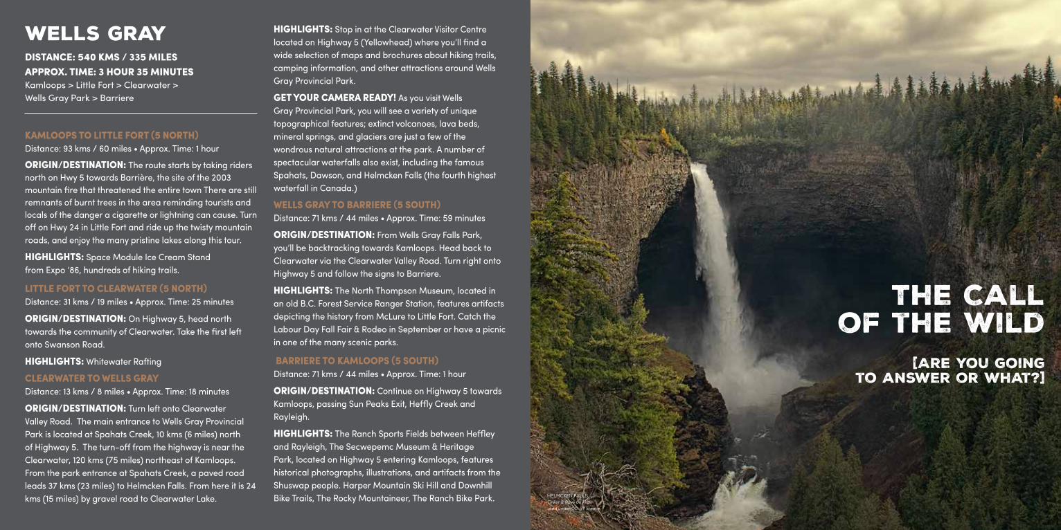
WELLS GRAYDISTANCE: 540 KMS / 335 MILES APPROX. TIME: 3 HOUR 35 MINUTESKamloops > Little Fort > Clearwater > Wells Gray Park > Barriere
KAMLOOPS TO LITTLE FORT (5 NORTH)Distance: 93 kms / 60 miles • Approx. Time: 1 hour
ORIGIN/DESTINATION: The route starts by taking riders north on Hwy 5 towards Barrière, the site of the 2003 mountain fire that threatened the entire town There are still remnants of burnt trees in the area reminding tourists and locals of the danger a cigarette or lightning can cause. Turn off on Hwy 24 in Little Fort and ride up the twisty mountain roads, and enjoy the many pristine lakes along this tour.
HIGHLIGHTS: Space Module Ice Cream Standfrom Expo ‘86, hundreds of hiking trails.
LITTLE FORT TO CLEARWATER (5 NORTH)Distance: 31 kms / 19 miles • Approx. Time: 25 minutes
ORIGIN/DESTINATION: On Highway 5, head north towards the community of Clearwater. Take the first left onto Swanson Road.
HIGHLIGHTS: Whitewater Rafting
CLEARWATER TO WELLS GRAYDistance: 13 kms / 8 miles • Approx. Time: 18 minutes
ORIGIN/DESTINATION: Turn left onto Clearwater Valley Road. The main entrance to Wells Gray Provincial Park is located at Spahats Creek, 10 kms (6 miles) north of Highway 5. The turn-off from the highway is near the Clearwater, 120 kms (75 miles) northeast of Kamloops. From the park entrance at Spahats Creek, a paved road leads 37 kms (23 miles) to Helmcken Falls. From here it is 24 kms (15 miles) by gravel road to Clearwater Lake.
HIGHLIGHTS: Stop in at the Clearwater Visitor Centre located on Highway 5 (Yellowhead) where you’ll find a wide selection of maps and brochures about hiking trails, camping information, and other attractions around Wells Gray Provincial Park.
GET YOUR CAMERA READY! As you visit Wells Gray Provincial Park, you will see a variety of unique topographical features; extinct volcanoes, lava beds, mineral springs, and glaciers are just a few of the wondrous natural attractions at the park. A number of spectacular waterfalls also exist, including the famous Spahats, Dawson, and Helmcken Falls (the fourth highest waterfall in Canada.)
WELLS GRAY TO BARRIERE (5 SOUTH)Distance: 71 kms / 44 miles • Approx. Time: 59 minutes
ORIGIN/DESTINATION: From Wells Gray Falls Park, you’ll be backtracking towards Kamloops. Head back to Clearwater via the Clearwater Valley Road. Turn right onto Highway 5 and follow the signs to Barriere.
HIGHLIGHTS: The North Thompson Museum, located in an old B.C. Forest Service Ranger Station, features artifacts depicting the history from McLure to Little Fort. Catch the Labour Day Fall Fair & Rodeo in September or have a picnic in one of the many scenic parks.
BARRIERE TO KAMLOOPS (5 SOUTH)Distance: 71 kms / 44 miles • Approx. Time: 1 hour
ORIGIN/DESTINATION: Continue on Highway 5 towards Kamloops, passing Sun Peaks Exit, Heffly Creek and Rayleigh.
HIGHLIGHTS: The Ranch Sports Fields between Heffley and Rayleigh, The Secwepemc Museum & Heritage Park, located on Highway 5 entering Kamloops, features historical photographs, illustrations, and artifacts from the Shuswap people. Harper Mountain Ski Hill and Downhill Bike Trails, The Rocky Mountaineer, The Ranch Bike Park. HELMCKEN FALLS
Tinker & Rove on Flickr used under CC-BY licence.
The Call of the Wild
[Are you goingto answer or what?]
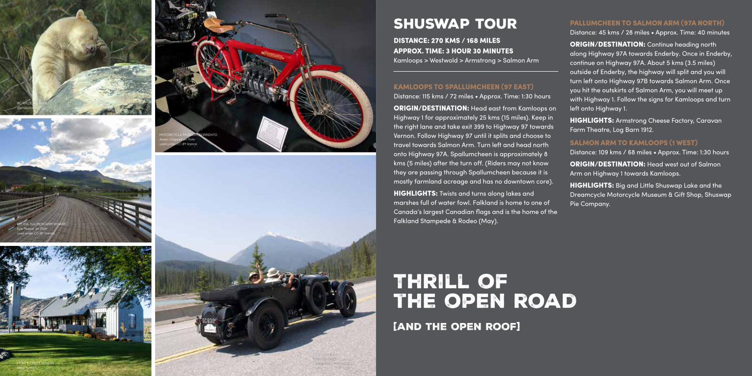
SHUSWAP TOURDISTANCE: 270 KMS / 168 MILES APPROX. TIME: 3 HOUR 30 MINUTESKamloops > Westwold > Armstrong > Salmon Arm
KAMLOOPS TO SPALLUMCHEEN (97 EAST)Distance: 115 kms / 72 miles • Approx. Time: 1:30 hours
ORIGIN/DESTINATION: Head east from Kamloops on Highway 1 for approximately 25 kms (15 miles). Keep in the right lane and take exit 399 to Highway 97 towards Vernon. Follow Highway 97 until it splits and choose to travel towards Salmon Arm. Turn left and head north onto Highway 97A. Spallumcheen is approximately 8 kms (5 miles) after the turn off. (Riders may not know they are passing through Spallumcheen because it is mostly farmland acreage and has no downtown core).
HIGHLIGHTS: Twists and turns along lakes and marshes full of water fowl. Falkland is home to one of Canada’s largest Canadian flags and is the home of the Falkland Stampede & Rodeo (May).
PALLUMCHEEN TO SALMON ARM (97A NORTH)Distance: 45 kms / 28 miles • Approx. Time: 40 minutes
ORIGIN/DESTINATION: Continue heading north along Highway 97A towards Enderby. Once in Enderby, continue on Highway 97A. About 5 kms (3.5 miles) outside of Enderby, the highway will split and you will turn left onto Highway 97B towards Salmon Arm. Once you hit the outskirts of Salmon Arm, you will meet up with Highway 1. Follow the signs for Kamloops and turn left onto Highway 1.
HIGHLIGHTS: Armstrong Cheese Factory, Caravan Farm Theatre, Log Barn 1912.
SALMON ARM TO KAMLOOPS (1 WEST)Distance: 109 kms / 68 miles • Approx. Time: 1:30 hours
ORIGIN/DESTINATION: Head west out of Salmon Arm on Highway 1 towards Kamloops.
HIGHLIGHTS: Big and Little Shuswap Lake and the Dreamcycle Motorcycle Museum & Gift Shop, Shuswap Pie Company.
Thrill of the open road[and the open roof]
BC WILDLIFE PARK@philipjansen67
MT. IDA, SALMON ARM WHARFKyle Pearce on Flickr used under CC-BY licence.
MONTE CREEK WINERYMary Putnum
MOTORCYCLE MUSEUM, SORRENTOAnson Chappell on Flickrused under CC-BY licence.
SALMON ARMCharles McGowan on Flickr used under CC-BY licence.

VARIABLE RENTALS630 Athabasca St West250-319-3424variablerentals.com
ALTERNATE CYCLE419 Mt. Paul Way250-434-6479alternatecycle.com
KAMLOOPS HARLEY-DAVIDSON1465 Iron Mask Road250-828-0622
OUTLAW MOTORSPORTS1455 Iron Mask Road250-828-2200outlawmotorsports.ca
MIDNIGHTMOTORCYCLE1285 Kimberley Crescent250-312-1212
RIVERCITY CYCLE LTD1794 Kelly Douglas Road250-377-4320rivercitycycle.com
VALLEY SPEED MACHINE SHOP LTDLorne St. 250-372-9438valleyspeed.ca
R E N T A L S& R e p a i r s
M AYFalkland Stampede
J U LYHarley Davidson hosts, Western Regional H.O.G Rally
A U G U S TSalmon Arm Roots & Blues Festival
S E P T E M B E RAnnual Kamloops Toy RunBarriere Fall Fair & Rodeo
B C W I L D L I F E PA R KKamloops, BC - Highway 1bcwildlife.org
C R A Z Y C R E E K S U S P E N S I O N B R I D G ESicamous, BC - Highway 1
G I A N T C E D A R S B O A R D WA L K T R A I LRevelstoke, BC - Highway 1
L O G B A R N 1 9 1 2Armstrong, BC - Highway 97Alogbarn.ca
H AT C R E E K R A N C HCache Creek, BC - Highway 5
O T H E L L O T U N N E L SHope BC - Highway 5
KAMLOOPS LAKE FROM TOBIANOTobiano Golf Course
HELMKEN FALLS IN WELLS GRAYWells Gray Provincial Park
KALAMALKA LAKEBetween Vernon and Lake Country
STEEP CANYON VIEWSHighway 12 Lillooet to Lytton
HOTSPRINGS AND MORE HOTSPRINGSHighway 23 Revelstoke to Needles
An
nu
al
Ev
en
ts
to
p
fi
ve
VI
EW
S
A T T R A C T I O N S
KAMLOPS HARLEY DAVIDSONBill McQuarrie
Mary PutnamKAMLOPSBill McQuarrie
KAMLOPS WILDLIFE PARKMary Putnam

tourismkamloops.com