Embed Size (px)
Citation preview

Gilberto Camara, Max J. Egenhofer, Karine Ferreira, Pedro Andrade, Gilberto Queiroz, Alber Sanchez, Jim Jones, and Lubia Vinhas
image: INPE
Fields as a Generic Data Typefor Big Spatial Data
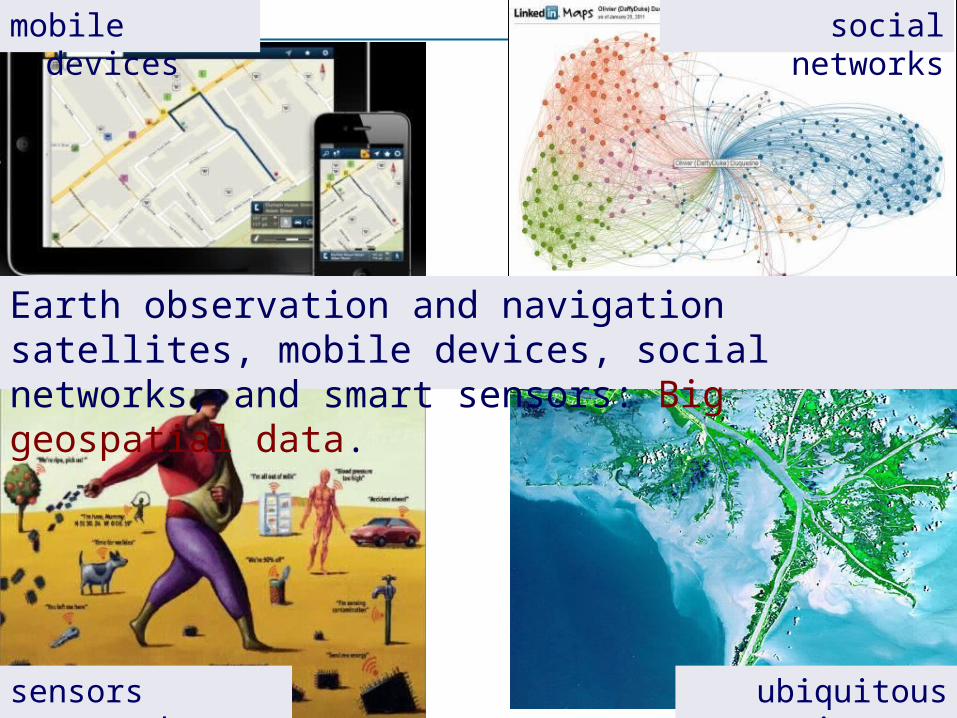
social networks
sensors everywhere
mobile devices
ubiquitous imagery
Earth observation and navigation satellites, mobile devices, social networks, and smart sensors: Big geospatial data.
How can we best use the information provided by big data sources?
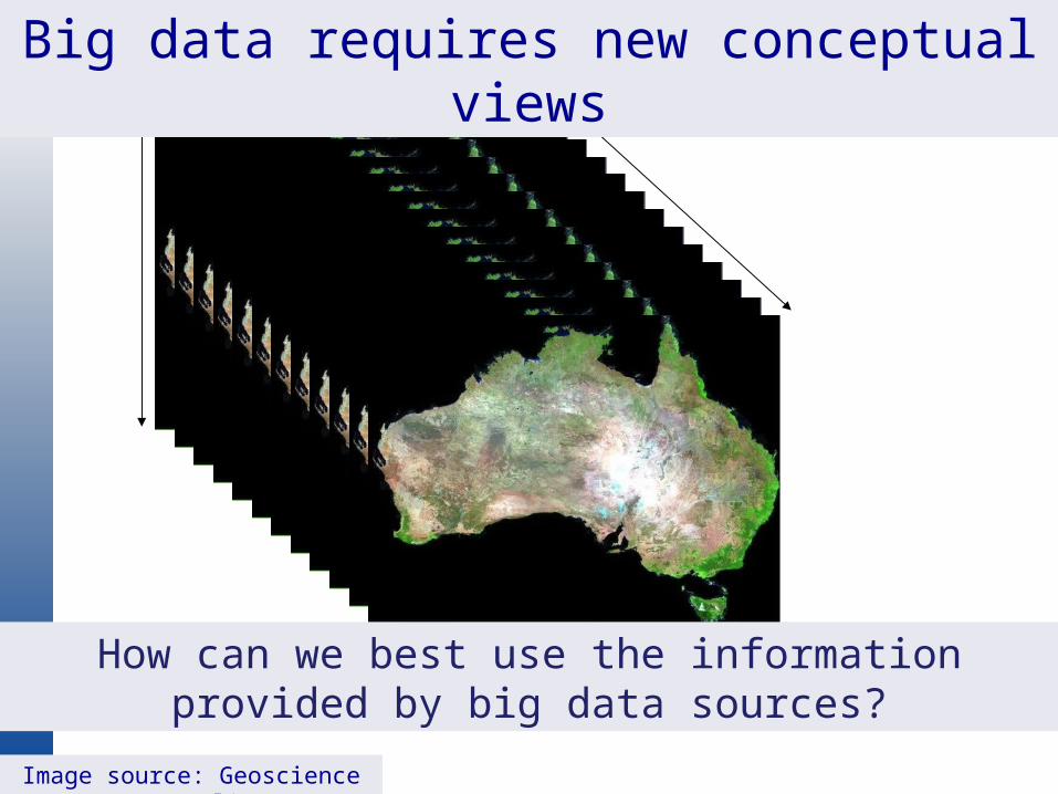
Big data requires new conceptual views
Image source: Geoscience Australia
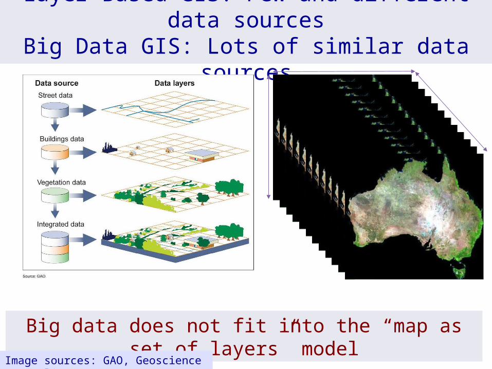
Layer-Based GIS: Few and different data sourcesBig Data GIS: Lots of similar data sources
Big data does not fit into the “map as set of layers” model
Image sources: GAO, Geoscience Australia
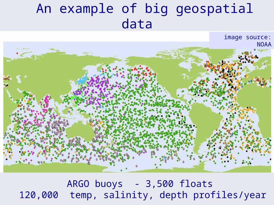
An example of big geospatial dataimage source: NOAA
ARGO buoys - 3,500 floats 120,000 temp, salinity, depth profiles/year
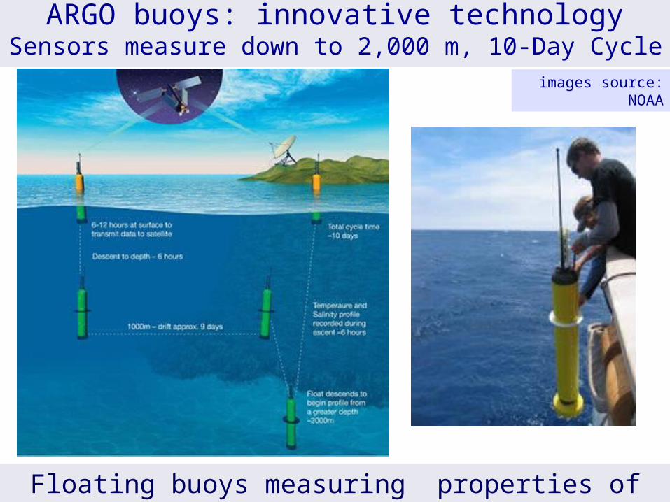
ARGO buoys: innovative technologySensors measure down to 2,000 m, 10-Day Cycle
Floating buoys measuring properties of the oceans
images source: NOAA

Another example: Free and big Earth Observation data
Image source: NASA
Open access data (US, EC, BR, CH): 5Tb/day
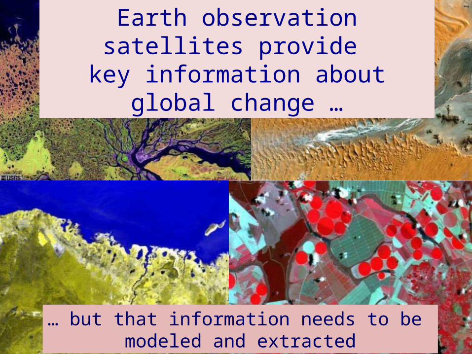
Earth observation satellites provide key information about global change …
… but that information needs to be modeled and extracted
To deal with big geospatial data, we need to reassess the core concepts of Geoinformatics
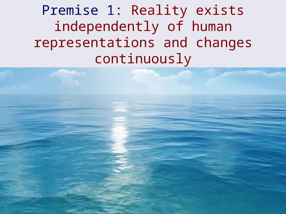
Premise 1: Reality exists independently of human representations and changes continuously
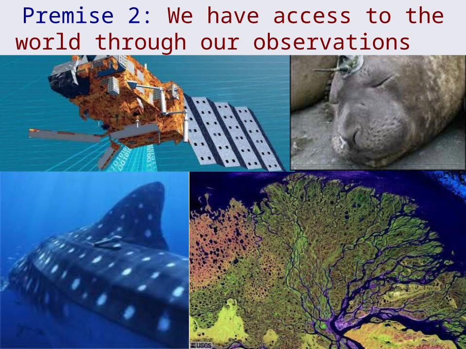
Premise 2: We have access to the world through our observations
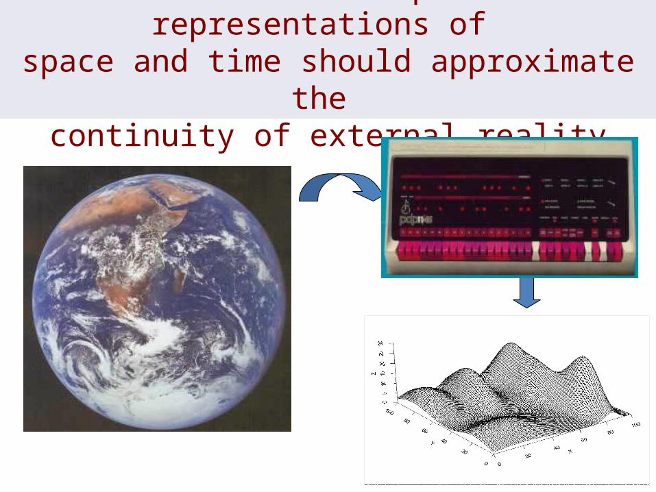
Premise 3: Computer representations of space and time should approximate the
continuity of external reality
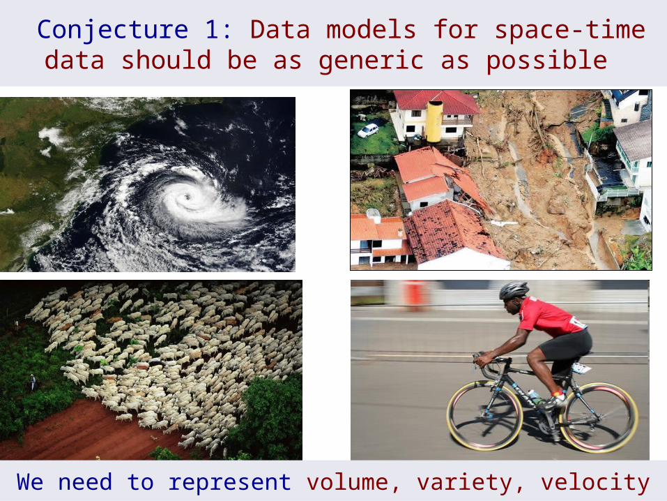
Conjecture 1: Data models for space-time data should be as generic as possible
We need to represent volume, variety, velocity
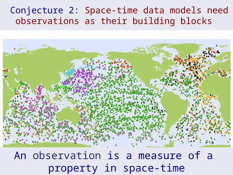
Conjecture 2: Space-time data models need observations as their building blocks
An observation is a measure of a property in space-time
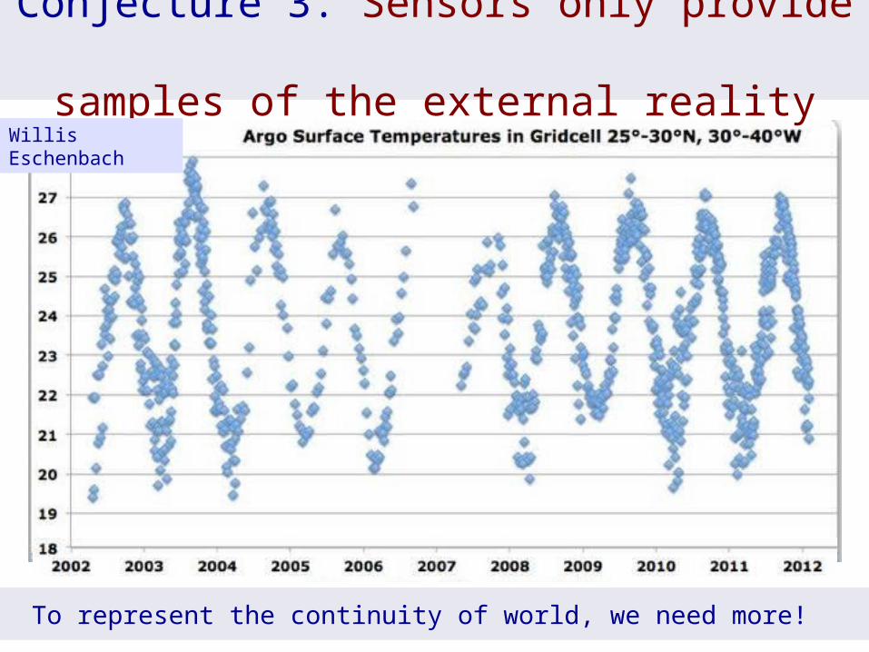
Conjecture 3. Sensors only provide samples of the external reality
To represent the continuity of world, we need more!
Willis Eschenbach
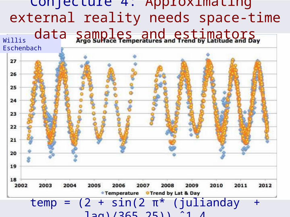
temp = (2 + sin(2 π* (julianday + lag)/365.25)) ˆ1.4
Willis Eschenbach
Conjecture 4: Approximating external reality needs space-time data samples and estimators
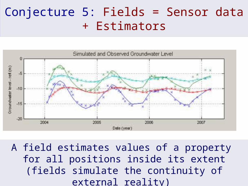
Conjecture 5: Fields = Sensor data + Estimators
A field estimates values of a property for all positions inside its extent
(fields simulate the continuity of external reality)
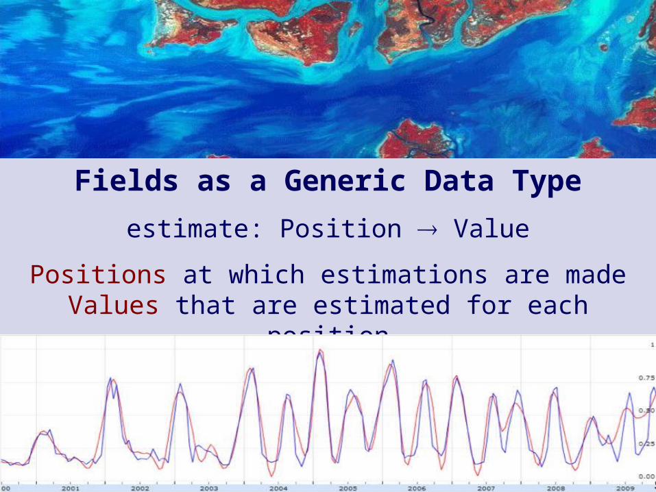
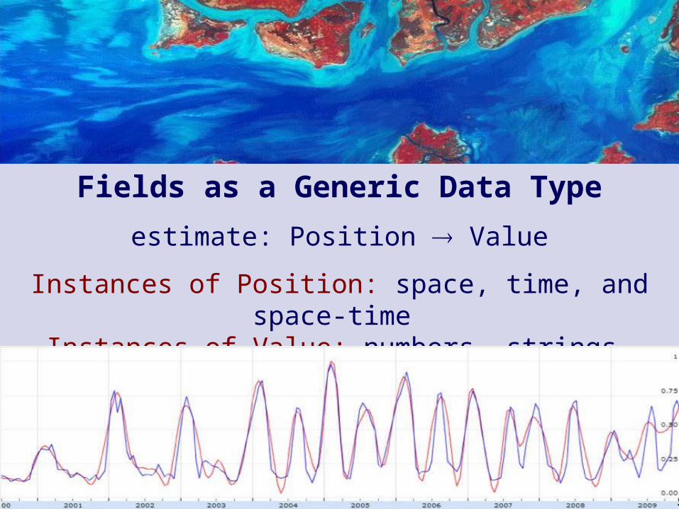
Fields as a Generic Data Type
estimate: Position Value
Positions at which estimations are madeValues that are estimated for each position

Fields as a Generic Data Type
estimate: Position Value
Positions are generic locations is space-timeValues are generic estimates for each position
Fields as a Generic Data Type
estimate: Position Value
Instances of Position: space, time, and space-time Instances of Value: numbers, strings, space-time
An Australian Geoscience Data Cube
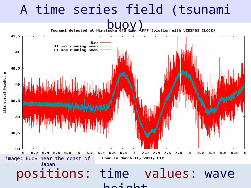
A time series field (tsunami buoy)
positions: time values: wave heightimage: Buoy near the coast of Japan

An Australian Geoscience Data Cube
A coverage field (remote sensing image)
image: USGS
positions: 2Dspace values: soil reflectance

An Australian Geoscience Data Cube
coverage setimages: USGS
A field of fields
positions: time values: coverages (2DSpace number)
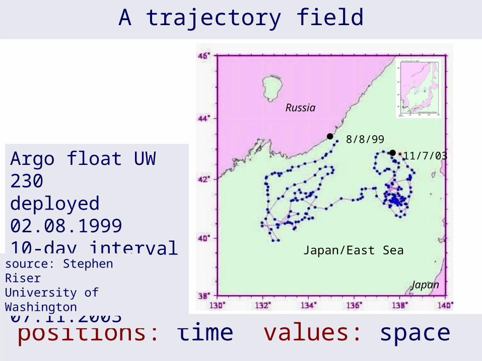
A trajectory field
positions: time values: space
8/8/99
11/7/03
Japan/East Sea
Russia
Japan
Argo float UW 230deployed 02.08.199910-day interval data until 07.11.2003
source: Stephen RiserUniversity of Washington

A field of fields (Argo floats in Southern Ocean)
Positions: space Values: trajectories (time space)
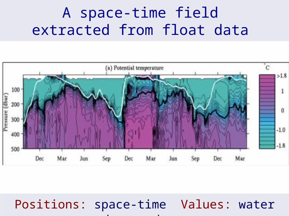
A space-time field extracted from float data
Positions: space-time Values: water temperature
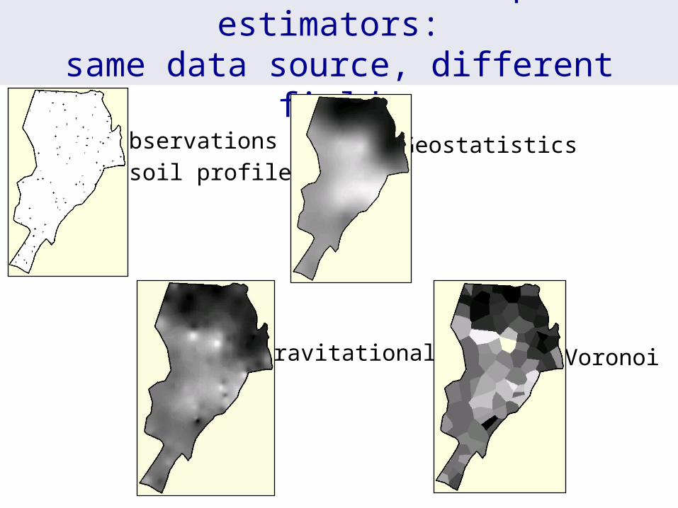
Different choices for spatial estimators: same data source, different fields
Observationsof soil profiles
Geostatistics
Gravitational Voronoi

Field data model
Field F [P:Position, V:Value, E:Extent, G:Estimator]
F1
domain(f1) = {p1,p2,p3}
estimate (f1, pnew) = g(f1, pnew)
extent (f1) = δ(A)
p1
p2
p3
pnew
Domain defines granularityEstimator provides value on all positions inside the extent
extent
A
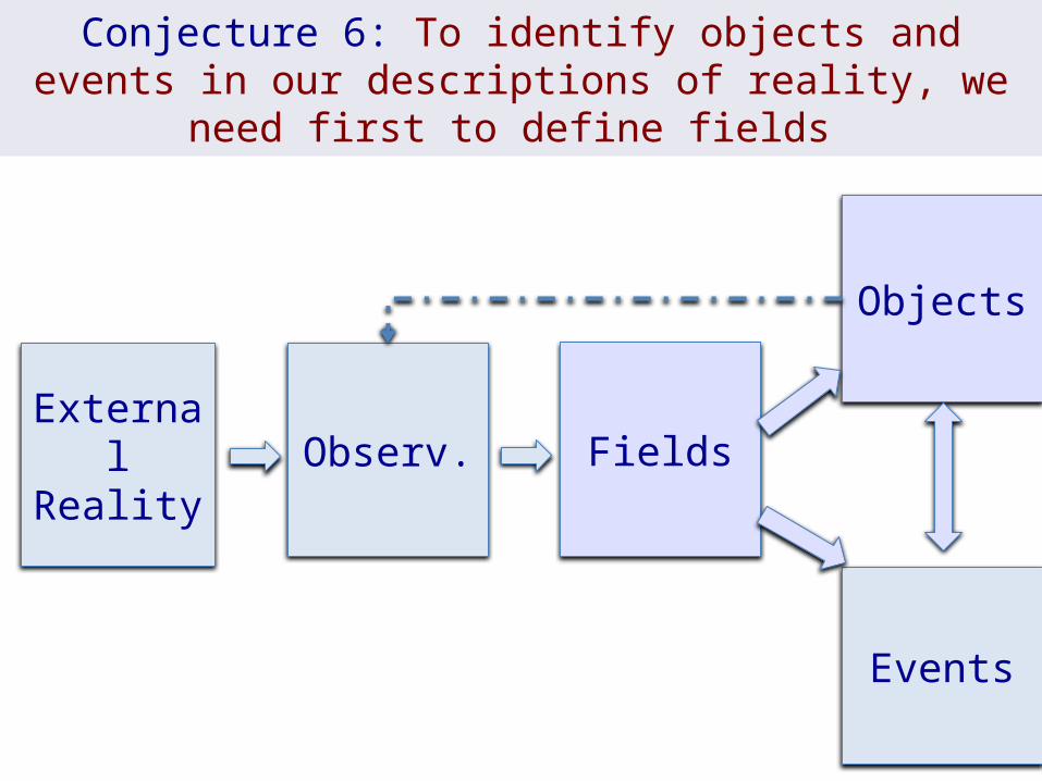
External Reality
Observ. Fields
Objects
Events
Conjecture 6: To identify objects and events in our descriptions of reality, we need first to define fields

What is a geo-sensor?What is a geo-sensor?
measure (s,t) = vs ⋲ S - set of locations in spacet ⋲ T - is the set of times. v ⋲ V - set of values
Field [E, P, V, G] uses E:Extent, P:Position, V:Value, G:Estimator new: E x G → Field add: Field x (P, V) → Field obs: Field → {(P, V)} domain: Field → {P} extent: Field → E estimate: Field x P → V subfield: Field x E → Field filter: Field x (V → Bool) → Field map: Field x (V → V) → Field combine: Field x Field x (V x V → V) → Field reduce: Field x (V x V → V) → V neigh: Field x P x (P x P → Bool) → Field
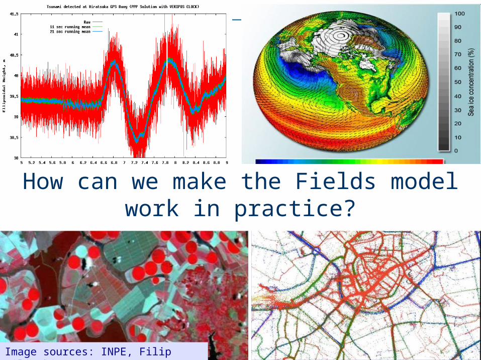
How can we make the Fields model work in practice?
Image sources: INPE, Filip Biljecki, UNAVCO
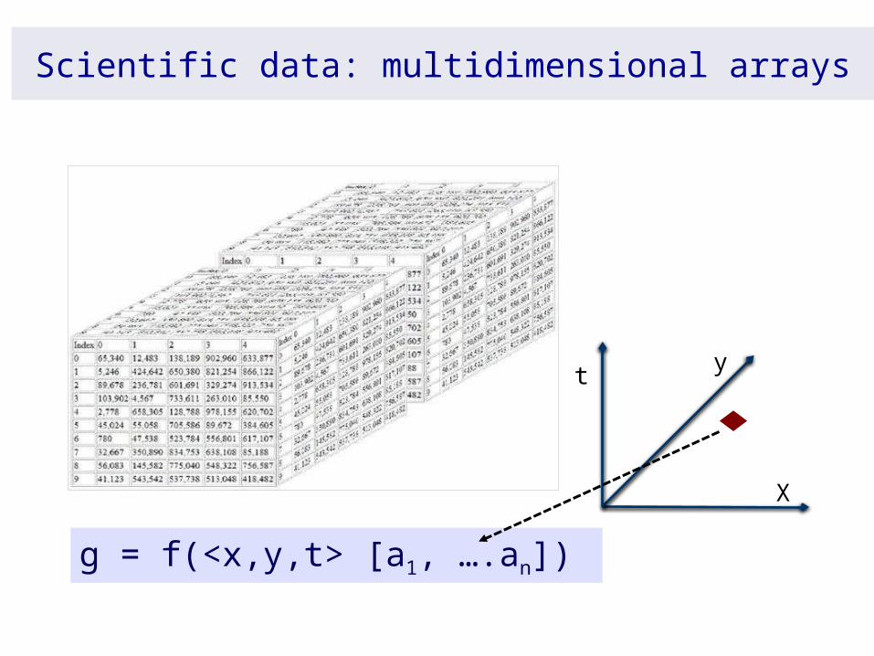
Scientific data: multidimensional arrays
X
yt
g = f(<x,y,t> [a1, ….an])
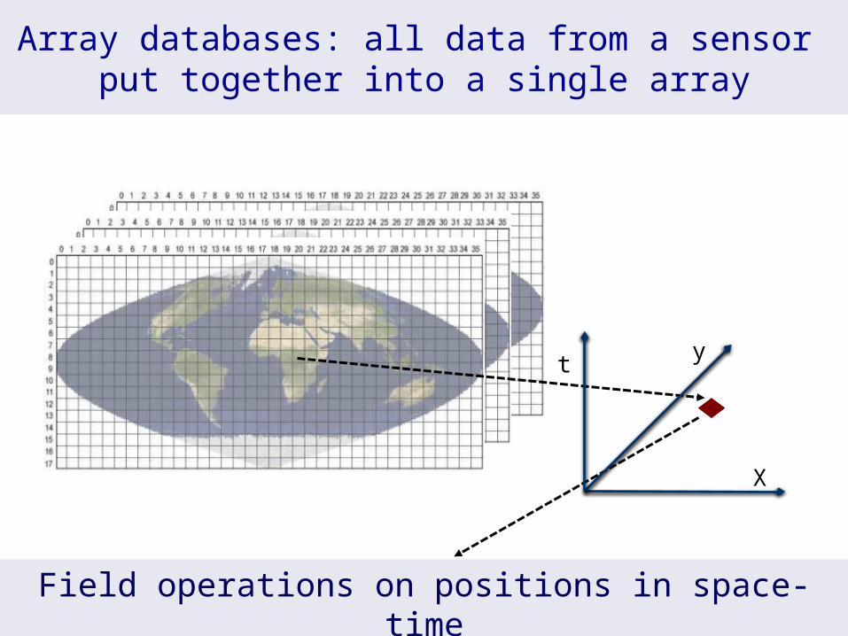
Array databases: all data from a sensor put together into a single array
Field operations on positions in space-time
X
yt
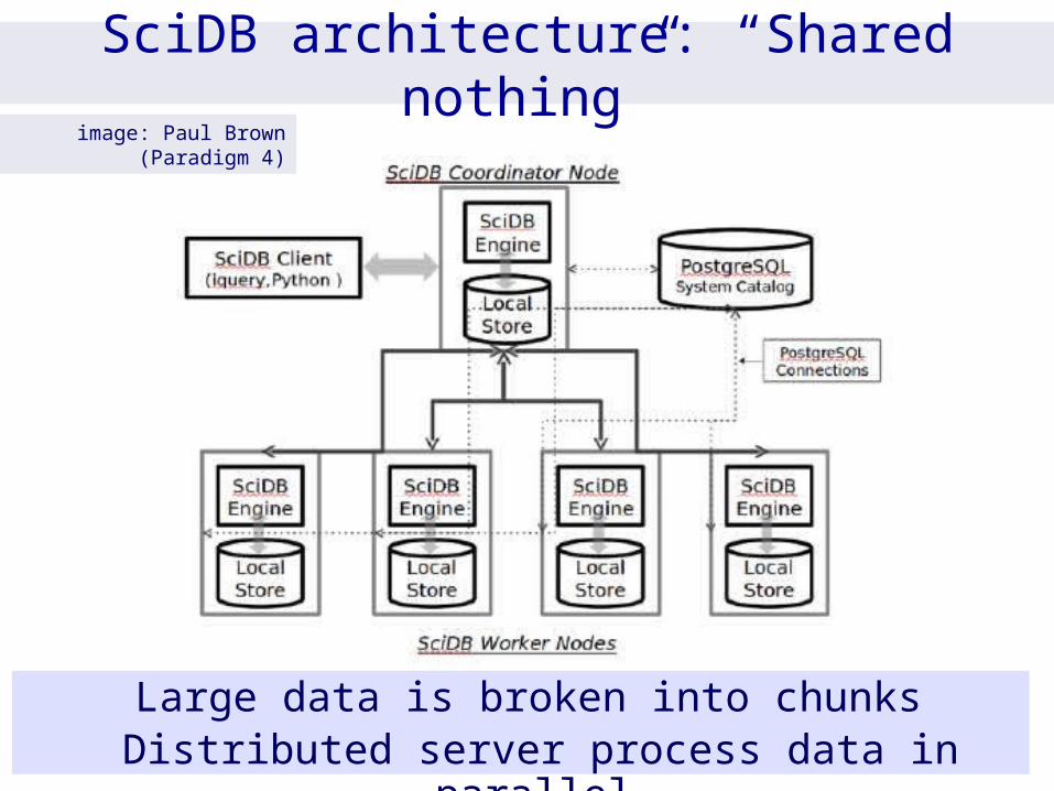
SciDB architecture: “Shared nothing”
Large data is broken into chunks Distributed server process data in parallel
image: Paul Brown (Paradigm 4)

Mapping the Fields data model to SciDB
What we have in SciDBArray management
Array analysis (linear algebra)Scalability, distributed proc
What we needSpatial, temporal, spectral, and
semantic reference systemsOperations in space-time data
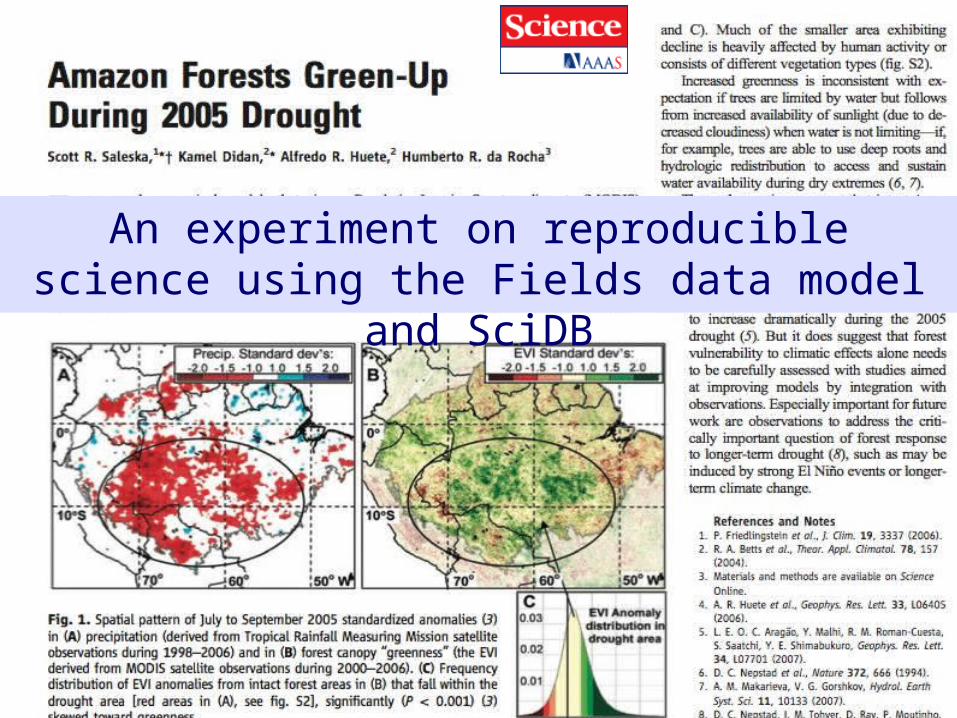
An experiment on reproducible science using the Fields data model and SciDB
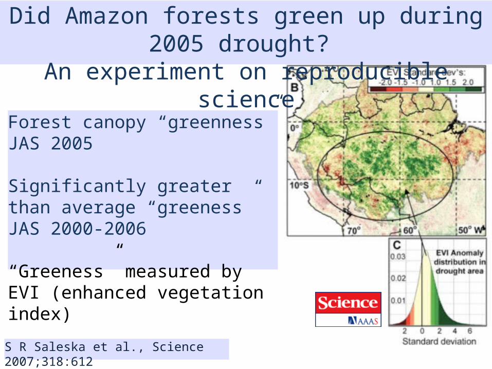
S R Saleska et al., Science 2007;318:612
Did Amazon forests green up during 2005 drought? An experiment on reproducible science
Forest canopy “greenness” JAS 2005 Significantly greater than average “greeness” JAS 2000-2006
“Greeness” measured by EVI (enhanced vegetation index)
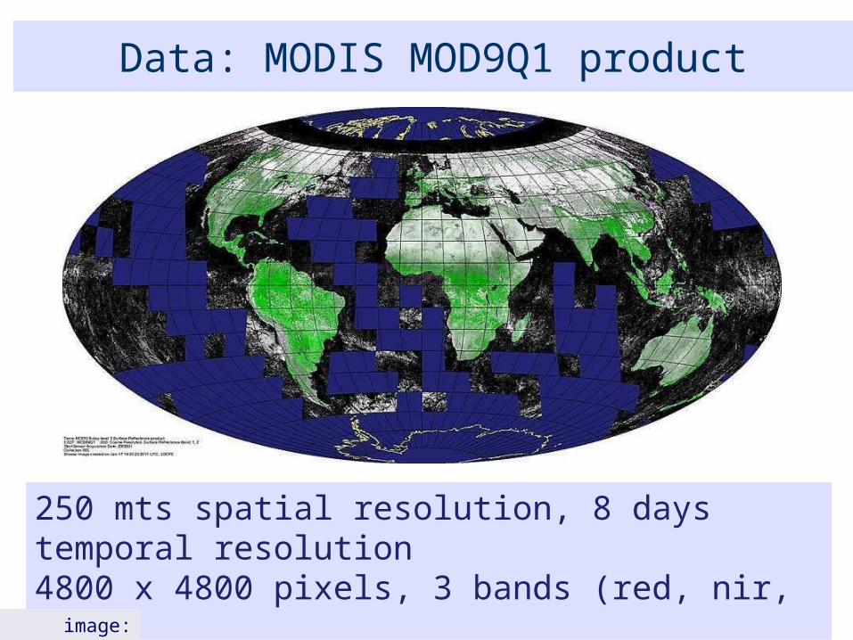
Data: MODIS MOD9Q1 product
250 mts spatial resolution, 8 days temporal resolution4800 x 4800 pixels, 3 bands (red, nir, qc)13 years of data (since 2000)image: NASA
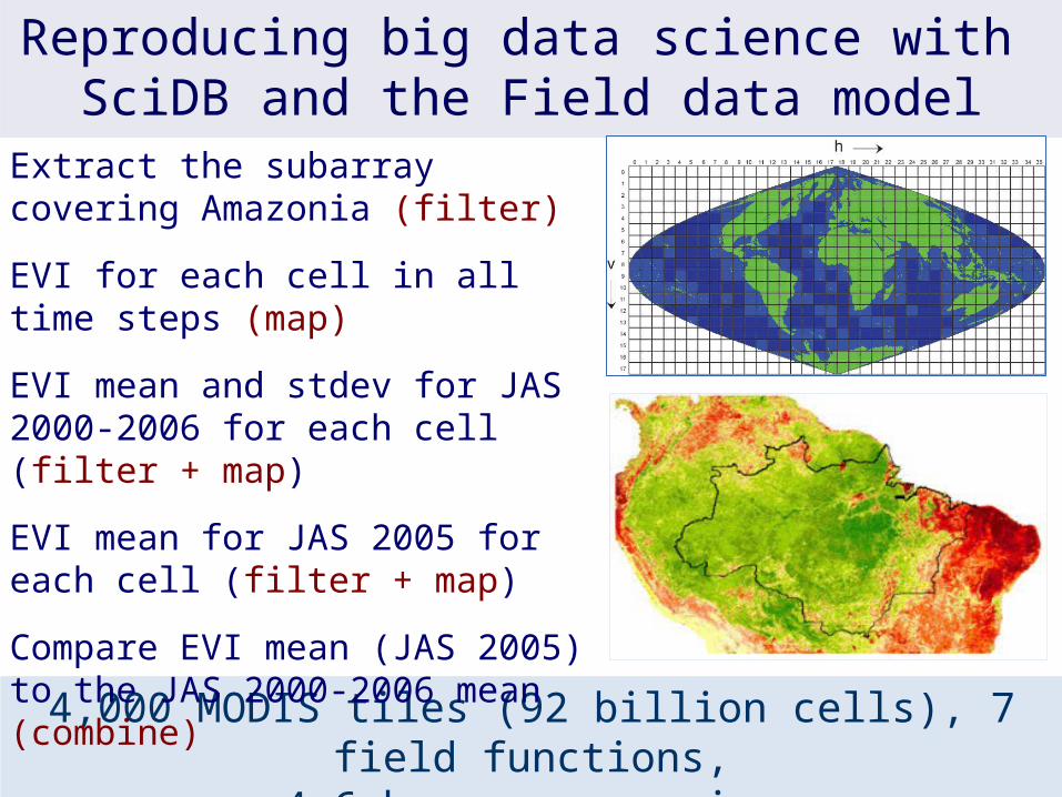
4,000 MODIS tiles (92 billion cells), 7 field functions,4.6 hours processing
Reproducing big data science with SciDB and the Field data model
Extract the subarray covering Amazonia (filter)
EVI for each cell in all time steps (map)
EVI mean and stdev for JAS 2000-2006 for each cell (filter + map)
EVI mean for JAS 2005 for each cell (filter + map)
Compare EVI mean (JAS 2005) to the JAS 2000-2006 mean (combine)

Our goal for the Fields data model
Remote visualization and method development
Big data EO management and analysis
40 years of Earth Observation data of land change accessible for analysis and modelling.
Field operations
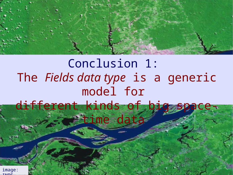
Conclusion 1: The Fields data type is a generic model for
different kinds of big space-time data
image: INPE

Conclusion 2: The Fields data type enables a better description of
of big space-time data than the layer view
image: INPE
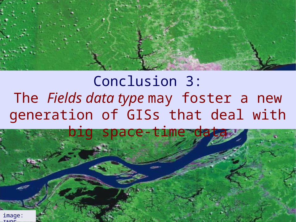
Conclusion 3:The Fields data type may foster a new generation
of GISs that deal with big space-time data
image: INPE