Embed Size (px)
Citation preview
GIS and GPS technologies toGIS and GPS technologies toGIS and GPS technologies to GIS and GPS technologies to implement implement NaturaNatura 2000 2000 network in network in
RomaniaRomaniaRomaniaRomania
11

Dr CristinaDr Cristina OanaOanaDr. CristinaDr. Cristina OanaOana
Technical SalesTechnical Sales DirectorDirector@ t@ [email protected][email protected]
B d ChB d ChBogdan CheveresanBogdan Cheveresan
Project&DatabaseProject&Database [email protected]@esriro.ro
22

AgendaAgenda
••ObjectivesObjectives
gg
ObjectivesObjectives••Project HighlightsProject Highlights••Equipments usedEquipments used••Business casesBusiness cases
33
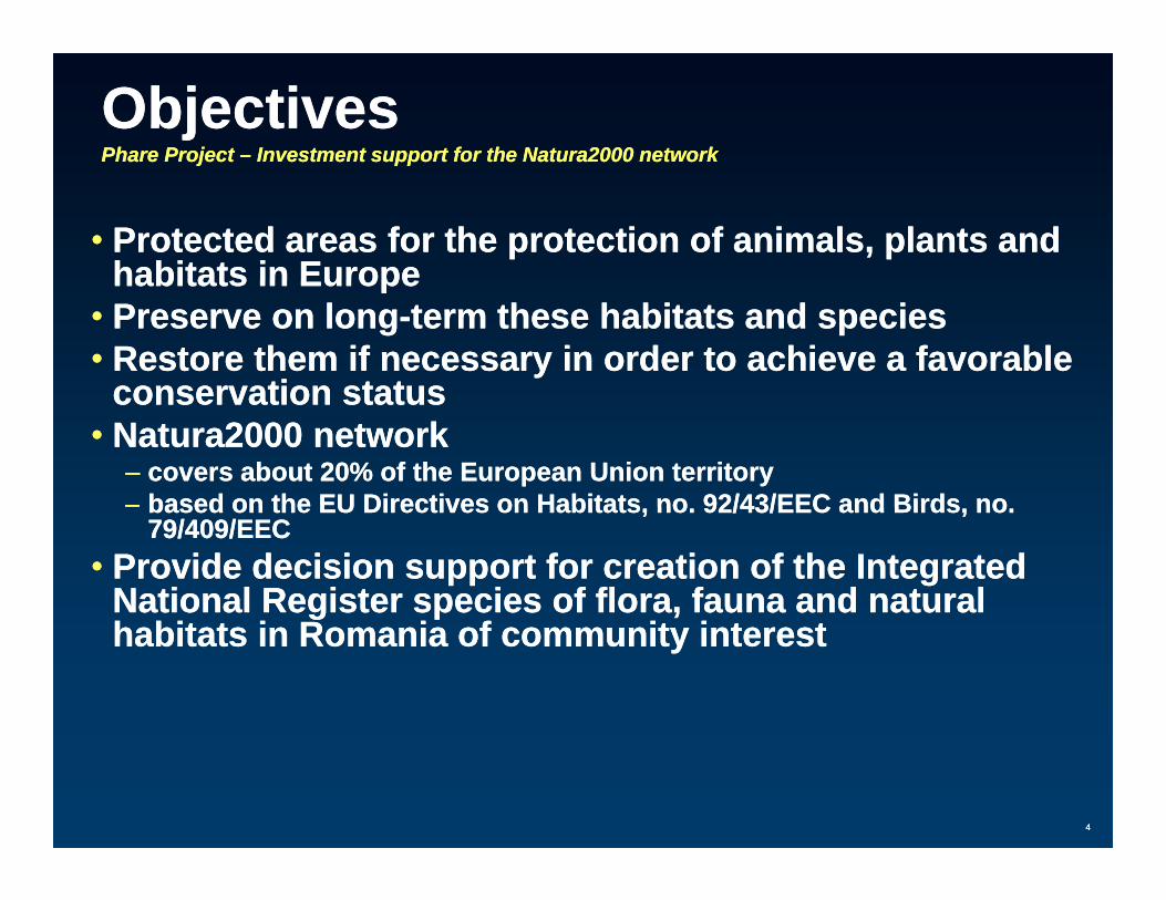
ObjectivesObjectivesPharePhare Project Project –– Investment support for the Natura2000 networkInvestment support for the Natura2000 network
•• Protected areas for the protection of animals, plants and Protected areas for the protection of animals, plants and habitats in Europehabitats in Europehabitats in Europehabitats in Europe
•• Preserve on longPreserve on long--term these habitats and speciesterm these habitats and species•• Restore them if necessary in order to achieve a favorable Restore them if necessary in order to achieve a favorable
conservation statusconservation statusconservation statusconservation status•• Natura2000 networkNatura2000 network
–– covers about 20% of the European Union territorycovers about 20% of the European Union territory–– based on the EU Directives on Habitats no 92/43/EEC and Birds nobased on the EU Directives on Habitats no 92/43/EEC and Birds nobased on the EU Directives on Habitats, no. 92/43/EEC and Birds, no. based on the EU Directives on Habitats, no. 92/43/EEC and Birds, no.
79/409/EEC79/409/EEC•• Provide decision support for creation of the Integrated Provide decision support for creation of the Integrated
National Register species of flora, fauna and natural National Register species of flora, fauna and natural ffhabitats in Romania of community interesthabitats in Romania of community interest
44
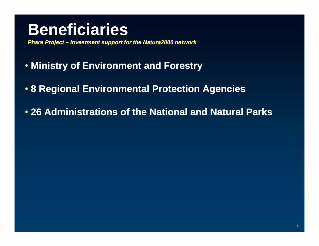
BeneficiariesBeneficiariesPharePhare Project Project –– Investment support for the Natura2000 networkInvestment support for the Natura2000 network
•• Ministry of Environment and ForestryMinistry of Environment and Forestry
•• 8 Regional Environmental Protection Agencies8 Regional Environmental Protection Agencies
•• 26 Administrations of the National and Natural Parks26 Administrations of the National and Natural Parks
55
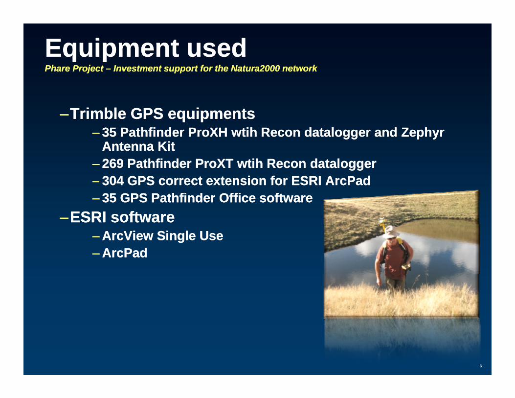
EquipmentEquipment usedusedPharePhare Project Project –– Investment support for the Natura2000 networkInvestment support for the Natura2000 network
––Trimble GPS equipmentsTrimble GPS equipments–– 35 Pathfinder 35 Pathfinder ProXHProXH wtihwtih Recon Recon dataloggerdatalogger and Zephyr and Zephyr
Antenna KitAntenna Kit–– 269 Pathfinder 269 Pathfinder ProXTProXT wtihwtih Recon Recon dataloggerdatalogger–– 304 GPS correct extension for ESRI 304 GPS correct extension for ESRI ArcPadArcPad–– 35 GPS Pathfinder Office software35 GPS Pathfinder Office software
––ESRI softwareESRI software–– ArcViewArcView Single UseSingle Use–– ArcPadArcPad
66
MARAMURES NATURAL PARKMARAMURES NATURAL PARK

Project highlightsProject highlightsMaramuresMaramures Natural ParkNatural Park
Increased efficiencyIncreased efficiency only 50only 50––Increased efficiency Increased efficiency –– only 50 only 50 seconds per feature and seconds per feature and relevant attributesrelevant attributes
––Easy to use by rangers after 4 days of training Easy to use by rangers after 4 days of training –– to to y y g y gy y g y gcollect, postcollect, post--process and load GPS measurements process and load GPS measurements into into GeodatabaseGeodatabase
––Recon handheld rugged design and allRecon handheld rugged design and all--day battery lifeday battery life
88
Recon handheld rugged design and allRecon handheld rugged design and all day battery lifeday battery life––Reliable even in toughest working conditions (extreme Reliable even in toughest working conditions (extreme
temperatures, humidity, drops)temperatures, humidity, drops)
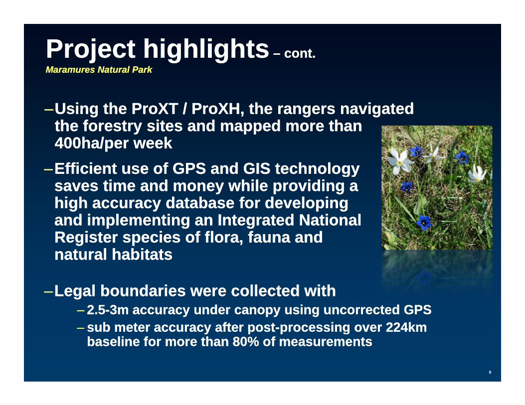
Project highlightsProject highlights –– cont.cont.MaramuresMaramures Natural ParkNatural Park
––Using the Using the ProXTProXT / / ProXHProXH, the rangers navigated , the rangers navigated the forestry sites and mapped more thanthe forestry sites and mapped more thanthe forestry sites and mapped more than the forestry sites and mapped more than 400ha/per week400ha/per week
––Efficient use of GPS and GIS technology Efficient use of GPS and GIS technology gygysaves time and money while providing a saves time and money while providing a high accuracy database for developing high accuracy database for developing and implementing an and implementing an Integrated National Integrated National p gp g ggRegister species of flora, fauna and Register species of flora, fauna and natural habitatsnatural habitats
––Legal boundaries were collected with Legal boundaries were collected with –– 2.52.5--3m accuracy under canopy using uncorrected GPS3m accuracy under canopy using uncorrected GPS–– sub meter accuracy after postsub meter accuracy after post--processing over 224kmprocessing over 224km
99
sub meter accuracy after postsub meter accuracy after post processing over 224km processing over 224km baseline for more than 80% of measurementsbaseline for more than 80% of measurements

L1/L2 PostL1/L2 Post--processedprocessed measurementsmeasurementsMaramuresMaramures Natural ParkNatural Park
Post-processing File Report
Differential Correction Summary:1 file processed. In this file:5606 (99.7%) of 5622 selected
positions were code corrected by post-processing
5582 (99.3%) of 5622 selected5582 (99.3%) of 5622 selected positions were carrier corrected
by post-processing285 (5.2%) of code positions
chosen over carrier, as they were of higher quality
Estimated accuracies for 5619 corrected positions are as follows:
Range Percentage---------- ----------
0-15cm -15 30cm15-30cm -
30-50cm 0.1%0.5-1m 80.4%
1-2m 16.2%2-5m 2.9%>5m 0.3%
1010
Differential correction complete.
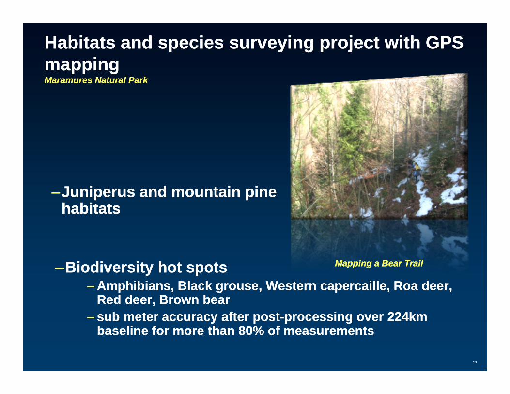
Habitats andHabitats and species surveying species surveying project with GPS project with GPS mappingmappingpp gpp gMaramuresMaramures Natural ParkNatural Park
––JuniperusJuniperus and mountain pine and mountain pine habitatshabitats
––Biodiversity hot spotsBiodiversity hot spots Mapping a Bear Trail Mapping a Bear Trail Biodiversity hot spotsBiodiversity hot spots–– Amphibians, Black grouse, Western Amphibians, Black grouse, Western capercaillecapercaille, , RRoaoa deer, deer,
Red deer, Brown bearRed deer, Brown bear–– sub meter accuracy after postsub meter accuracy after post--processing over 224km processing over 224km
1111
y py p p gp gbaseline for more than 80% of measurementsbaseline for more than 80% of measurements
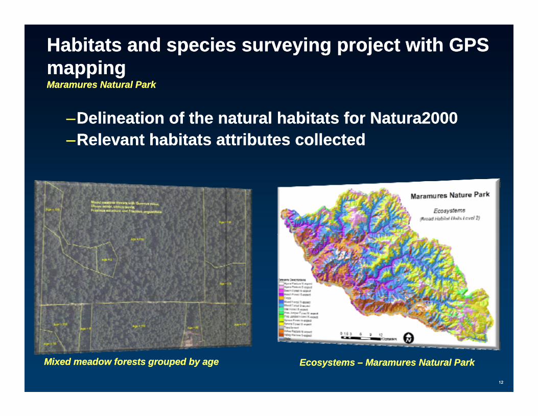
Habitats andHabitats and species surveying species surveying project with GPS project with GPS mappingmappingpp gpp gMaramuresMaramures Natural ParkNatural Park
––Delineation of the natural habitats for Natura2000Delineation of the natural habitats for Natura2000––Relevant habitats attributes collectedRelevant habitats attributes collected
1212
Mixed meadow forests grouped by ageMixed meadow forests grouped by age Ecosystems Ecosystems –– MaramuresMaramures Natural ParkNatural Park
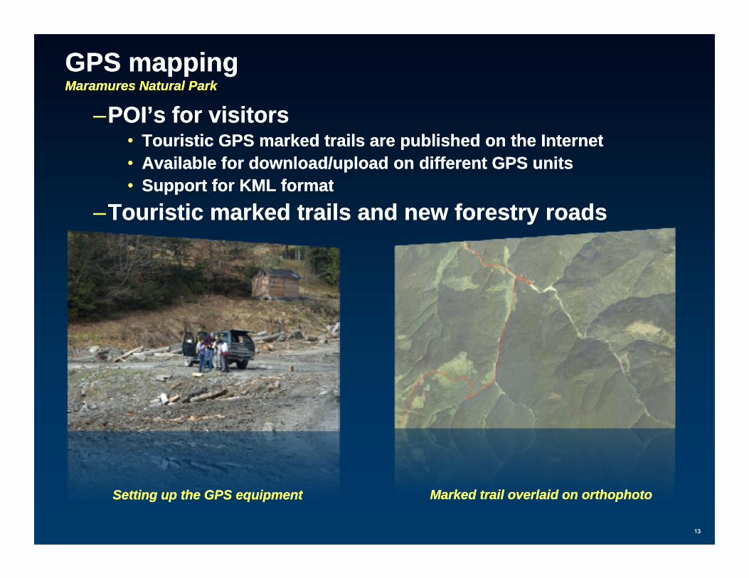
GPS mappingGPS mappingMaramuresMaramures Natural ParkNatural Park
POI’ f i itPOI’ f i it––POI’s for visitorsPOI’s for visitors•• Touristic GPS marked trails are published on the InternetTouristic GPS marked trails are published on the Internet•• Available for download/upload on different GPS unitsAvailable for download/upload on different GPS units
S t f KML f tS t f KML f t•• Support for KML formatSupport for KML format––Touristic marked trails and new forestry roadsTouristic marked trails and new forestry roads
1313
Marked trail Marked trail overlaid on overlaid on orthophotoorthophotoSetting up the GPS equipmentSetting up the GPS equipment

PIATRA CRAIULUI NATIONAL PARKPIATRA CRAIULUI NATIONAL PARK
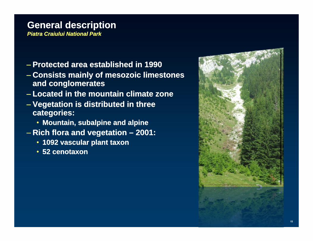
General descriptionGeneral descriptionPiatra Piatra CraiuluiCraiului National ParkNational Park
–– Protected area established in 1990Protected area established in 1990Consists mainly ofConsists mainly of mesozoicmesozoic limestoneslimestones–– Consists mainly of Consists mainly of mesozoicmesozoic limestoneslimestonesand conglomeratesand conglomerates
–– Located in the mountain climate zoneLocated in the mountain climate zone–– Vegetation is distributed in threeVegetation is distributed in threeVegetation is distributed in three Vegetation is distributed in three
categories:categories:•• Mountain, subalpine and alpineMountain, subalpine and alpine
–– Rich flora and vegetation Rich flora and vegetation –– 2001:2001:gg•• 1092 vascular plant 1092 vascular plant taxontaxon•• 52 52 cenotaxoncenotaxon
1515

Mapping andMapping and assessing the main types of habitatsassessing the main types of habitatsPiatra Piatra CraiuluiCraiului National ParkNational Park
–– Data sourcesData sources•• Topographic mapsTopographic mapsp g p pp g p p
–– contour lines, rivers, place contour lines, rivers, place geonamesgeonames, elevation, settlements, park , elevation, settlements, park boundaryboundary
•• Touristic mapsTouristic mapsF t t lF t t l•• Forest management plansForest management plans
•• IKONOS satellite imageryIKONOS satellite imagery•• OrthophotoOrthophoto, 1:5.000 scale, 1:5.000 scale•• GPS measurementsGPS measurements•• GPS measurementsGPS measurements•• NDVI index calculationNDVI index calculation
–– spectral reflectance analysis for plantsspectral reflectance analysis for plants
–– Mapping unit Mapping unit at the habitat level at the habitat level -- based on preliminary field based on preliminary field observations and other informationobservations and other information from an existing literature related from an existing literature related
1616
ggto the vegetation in this protected areato the vegetation in this protected area
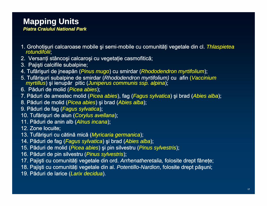
Mapping UnitsMapping UnitsPiatra Piatra CraiuluiCraiului National ParkNational Park
1. Grohotişuri calcaroase mobile şi semi1. Grohotişuri calcaroase mobile şi semi--mobile cu comunităţi vegetale din cl. mobile cu comunităţi vegetale din cl. Thlaspietea Thlaspietea rotundifoliirotundifolii;;
2. Versanţi stâncoşi calcaroşi cu vegetaţie casmofitică;2. Versanţi stâncoşi calcaroşi cu vegetaţie casmofitică;3 Pajişti calcifile subalpine;3 Pajişti calcifile subalpine;3. Pajişti calcifile subalpine;3. Pajişti calcifile subalpine;4. Tufărişuri de jneapăn (4. Tufărişuri de jneapăn (Pinus mugoPinus mugo) cu smirdar () cu smirdar (Rhododendron myrtifoliumRhododendron myrtifolium););5. Tufărişuri subalpine de smirdar (5. Tufărişuri subalpine de smirdar (Rhododendron myrtifolium) Rhododendron myrtifolium) cu cu afin afin ((Vaccinium Vaccinium
myrtillusmyrtillus) şi ienupăr pitic () şi ienupăr pitic (Juniperus communis ssp. alpinaJuniperus communis ssp. alpina););66 Păduri de molid (Păduri de molid (Picea abiesPicea abies););6. 6. Păduri de molid (Păduri de molid (Picea abiesPicea abies););7. Păduri de amestec molid (7. Păduri de amestec molid (Picea abiesPicea abies), fag (), fag (Fagus sylvaticaFagus sylvatica) şi brad () şi brad (Abies albaAbies alba););8. Păduri de molid (8. Păduri de molid (Picea abiesPicea abies) şi brad () şi brad (Abies albaAbies alba););9. Păduri de fag (9. Păduri de fag (Fagus sylvaticaFagus sylvatica););10 Tufărişuri de alun (10 Tufărişuri de alun (Corylus avellanaCorylus avellana););10. Tufărişuri de alun (10. Tufărişuri de alun (Corylus avellanaCorylus avellana););11. Păduri de anin alb (11. Păduri de anin alb (Alnus incanaAlnus incana););12. Zone locuite;12. Zone locuite;13. Tufărişuri cu cătină mică (13. Tufărişuri cu cătină mică (Myricaria germanicaMyricaria germanica););14 Păduri de fag (14 Păduri de fag (Fagus sylvaticaFagus sylvatica) şi brad () şi brad (Abies albaAbies alba););14. Păduri de fag (14. Păduri de fag (Fagus sylvaticaFagus sylvatica) şi brad () şi brad (Abies albaAbies alba););15. Păduri de molid (15. Păduri de molid (Picea abiesPicea abies) şi pin silvestru () şi pin silvestru (Pinus sylvestrisPinus sylvestris););16. 16. PăduriPăduri dede pin silvestru (pin silvestru (Pinus sylvestrisPinus sylvestris););17. Pajişti cu comunităţi vegetale din ord. 17. Pajişti cu comunităţi vegetale din ord. Arrhenatheretalia, Arrhenatheretalia, folosite drept fâneţe;folosite drept fâneţe;18 Pajişti cu comunităţi vegetale din al18 Pajişti cu comunităţi vegetale din al PotentilloPotentillo--NardionNardion folosite drept păşuni;folosite drept păşuni;
1717
18. Pajişti cu comunităţi vegetale din al. 18. Pajişti cu comunităţi vegetale din al. PotentilloPotentillo NardionNardion, folosite drept păşuni;, folosite drept păşuni;19. Păduri de larice (19. Păduri de larice (Larix deciduaLarix decidua).).
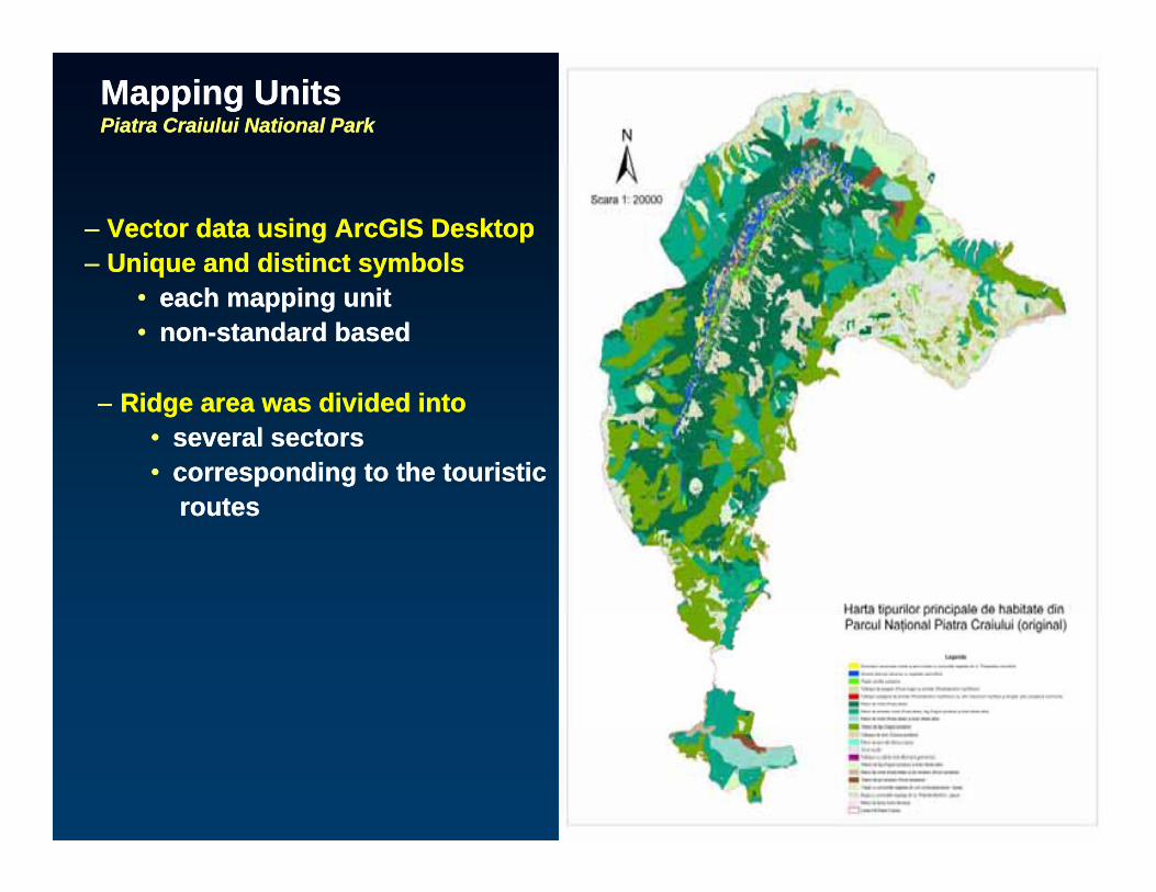
Mapping UnitsMapping UnitsPiatra Piatra CraiuluiCraiului National ParkNational Park
–– Vector data usingVector data using ArcGISArcGIS DesktopDesktop–– Unique and distinctUnique and distinct symbolssymbols
•• each mapping uniteach mapping unit•• nnonon--standard basedstandard based
–– Ridge area was divided intoRidge area was divided into•• several sectorsseveral sectors•• corresponding to the touristiccorresponding to the touristic
routesroutesroutesroutes
1818
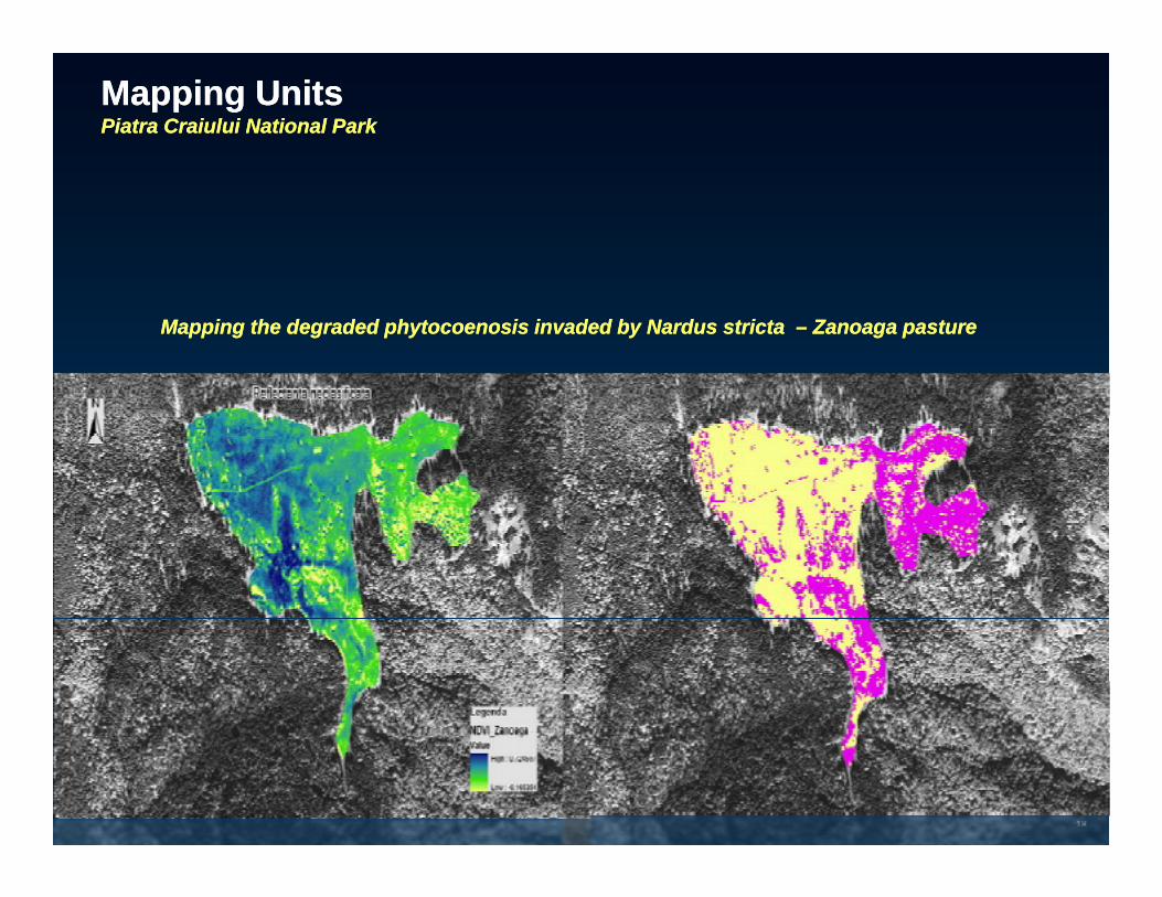
Mapping UnitsMapping UnitsPiatra Piatra CraiuluiCraiului National ParkNational Park
Mapping the degraded Mapping the degraded phytocoenosisphytocoenosis invaded by invaded by NardusNardus strictastricta –– ZanoagaZanoaga pasture pasture
1919
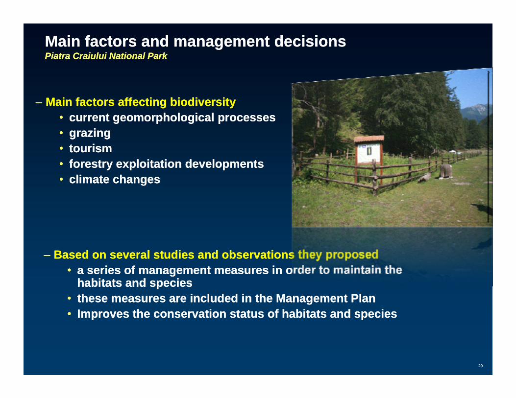
Main factors and management decisionsMain factors and management decisionsPiatra Piatra CraiuluiCraiului National ParkNational Park
–– Main factors affectingMain factors affecting biodiversitybiodiversity•• current current geomorphologicalgeomorphological processesprocesses•• grazinggrazing•• tourismtourism•• fforestryorestry exploitation developmentexploitation developmentss•• climate changesclimate changes
–– Based on several studies and observations they proposedBased on several studies and observations they proposed•• a series of management measures in order to maintain the a series of management measures in order to maintain the gg
habitats and specieshabitats and species•• these measures are included in the Management Plan these measures are included in the Management Plan •• Improves the conservation status of habitats and speciesImproves the conservation status of habitats and species
2020

2121