Embed Size (px)
Citation preview

GIS and Remote Sensing
Delaware Geographic AllianceUniversity of Delaware
Houston, TX; Landsat-7

What is a GIS?
• GIS stands for Geographic Information System
• A tool people can use to map and analyze geographic data
• Organizes data by where it occurs
Why is Geography Important?
• Our activities and decisions involve location in some way
• Examples: – Where to buy bread on the way home from work– Where to build new roads or hospitals

What is Remote Sensing?
• Geographers use pictures taken from satellites and sensors to help solve everyday problems.
• Examples include aerial imagery, infrared (IR) and microwave sensors, and sonar, but there are many more!
• This is known as remote sensing

How can we use remote sensing?
Some of the ways (but not all!) we can use remote sensing:
• Weather• Land use• Populations of organisms in
the ocean• Monitoring sea ice

What agencies might use remote sensing?
• Weather forecasters• Foresters• Agriculture• Ocean researchers• Biologists• Polar researchers
Provided by the SeaWiFS Project, NASA/Goddard Space Flight Center, and ORBIMAGE

An example
• One way that remote sensing can be used is in tracking land use changes through time.

This is an aerial picture of the Christiana Mall as it looks today. But it didn’t always look that way!

This is the mall in 2007. Can you spot any
changes between 2007 and 2011?


Here is a picture of the mall from 1997. The changes between 2007 and 2011 may be hard to spot, but changes are
easily seen when comparing 1997.
1997

• Remote sensing can also be used to detect vegetation and land types and even natural disasters.
• When using an infrared (IR) sensor, vegetation appears bright red and is easy to spot.
• IR sensors also allow tornado tracks to be easily seen.
LANDSAT ETM+ IR composite image of
Delaware Inland Bays
Photo from NASA Science News; ASTER sensor
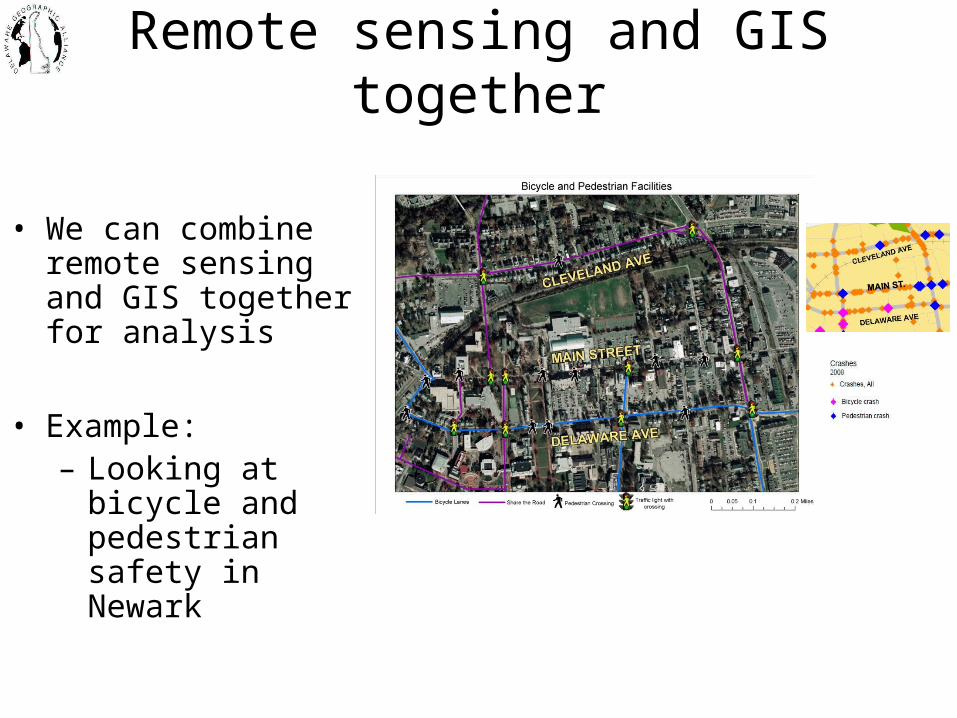
Remote sensing and GIS together
• We can combine remote sensing and GIS together for analysis
• Example: – Looking at bicycle
and pedestrian safety in Newark
Think About It
• Where do you think the camera was positioned to take aerial shots of Christiana Mall in 2007? In 1997?
• What is the best source for aerial photos and remote sensing images of our local area?
• Where can we access aerial images of other areas of the US and the world?