Embed Size (px)
Citation preview
GIS Modernization
J. Scrivner, Boardwalk Manager of Integrity Management & GIS
Jason Cradit, Willbros Director of Cloud Architecture & Security
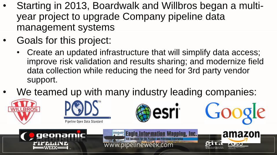
• Starting in 2013, Boardwalk and Willbros began a multi-year project to upgrade Company pipeline data management systems
• Goals for this project: • Create an updated infrastructure that will simplify data access;
improve risk validation and results sharing; and modernize field data collection while reducing the need for 3rd party vendor support.
• We teamed up with many industry leading companies:
• This included an update to our GIS database models:
• Previous Company GIS systems were based on PODS V3.x and V4.x Relational data models in separate databases.
• New Boardwalk PODS database is based on the PODS ESRI Spatial Version 5 data model.• Software & Database technology – PODS ESRI Spatial uses
the ESRI platform and the geodatabase as the base software package.
• One Database – One database and structure for all Company GIS data simplifies maintenance and validation.
Also, a completely updated suite of pipeline integrity vertical software was evaluated and implemented.
Willbros Professional Services:ArcGIS based Risk Analysis solution utilizing DRIP modelIntegra Link for remote accessing and viewing of GIS data
Geonamic Systems:Gas HCA/Class Calculator and Gas MAOP Calculator Mitigation Manager for risk data analysis/sharingIntegrity Dashboard - BAP assessment schedule maintenance
Eagle Information Mapping:PDMT (Pipeline Data Maintenance Tools) for maintaining pipeline centerline and attribute data.TurboRoute Alignment Sheet Generator for generating GIS data sheets
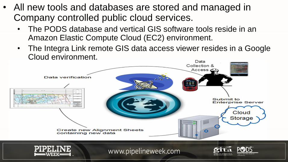
• All new tools and databases are stored and managed in Company controlled public cloud services.• The PODS database and vertical GIS software tools reside in an
Amazon Elastic Compute Cloud (EC2) environment.
• The Integra Link remote GIS data access viewer resides in a Google Cloud environment.
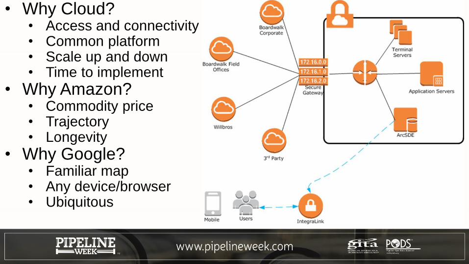
• Why Cloud?• Access and connectivity• Common platform • Scale up and down• Time to implement
• Why Amazon?• Commodity price• Trajectory• Longevity
• Why Google?• Familiar map• Any device/browser• Ubiquitous
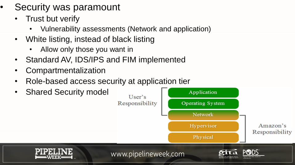
• Security was paramount• Trust but verify
• Vulnerability assessments (Network and application)
• White listing, instead of black listing
• Allow only those you want in
• Standard AV, IDS/IPS and FIM implemented
• Compartmentalization
• Role-based access security at application tier
• Shared Security model
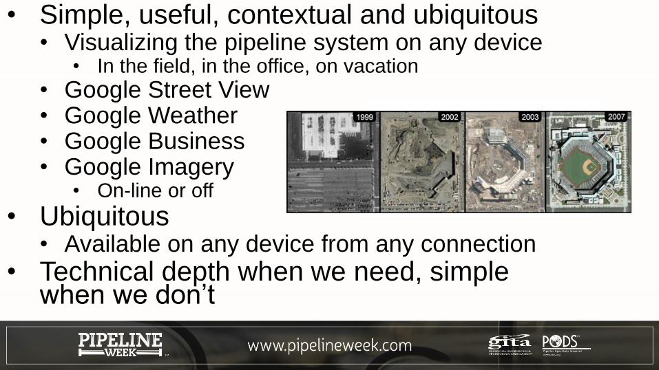
• Simple, useful, contextual and ubiquitous• Visualizing the pipeline system on any device
• In the field, in the office, on vacation
• Google Street View• Google Weather• Google Business• Google Imagery
• On-line or off
• Ubiquitous• Available on any device from any connection
• Technical depth when we need, simple when we don’t
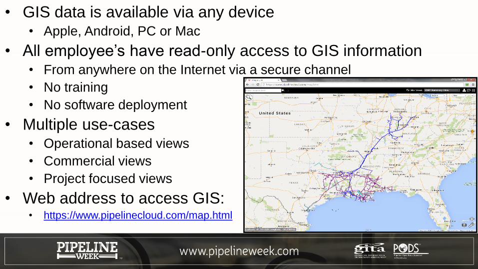
• GIS data is available via any device• Apple, Android, PC or Mac
• All employee’s have read-only access to GIS information • From anywhere on the Internet via a secure channel
• No training
• No software deployment
• Multiple use-cases• Operational based views
• Commercial views
• Project focused views
• Web address to access GIS:• https://www.pipelinecloud.com/map.html
Contact Information
J. Scrivner
270-688-6376
Jason Cradit
816-398-4574