Embed Size (px)
Citation preview

In the seven months since our last newsletter, a number of things have occurred tofurther the process of developing the Environmental Impact Statement (EIS) andPhase I Design Report for the U.S. Route 30 project. The U.S. Route 30 ProjectStudy Team has met with various stakeholders and stakeholder groups, conducteda Project Study Group (PSG) meeting, and held the sixth Community AdvisoryGroup (CAG) meeting. At these meetings, the project’s progress to date and thenext steps in the EIS process were discussed, which includes gathering input on
the six alignments under consideration.
In addition to updating you on the project status, the purpose of this newsletter is to afford you with an additionalopportunity to give the Project Study Team input on the six remaining alignments being evaluated. The ProjectStudy Team has been working diligently to evaluate the environmental impacts and the engineering feasibilityof the six proposed alignments. These alignments were developed after completing an environmental andengineering screening process of sixteen corridors that were initially identified during the early phase of thestudy. That brings us to an important juncture in the development of the project study: obtaining your inputon these six alignments.
Your comments are an important part of the project process and will be considered as we continue to moveforward in the development of the EIS document. Within this newsletter you will find a map of the alignmentsand a comment sheet. You may also visit the project website to view the map and obtain more detailed imagesof the project area. We are accepting comments on this portion of the project study until September 9, 2010.
I strongly encourage your participation in this evaluation and comment process. After careful consideration of public comments, the ProjectStudy Group will begin discussions to select two alignments that will be evaluated in the draft Environmental Impact Statement study. As always,a “no build” alternative will continue to be considered as well. Additional opportunities to provide comments regarding the project will continueto be available in the future, including a public hearing in early 2011.
I encourage you to visit the project website at http://www.dot.il.gov/us30/index1.html or contact the hotline at 1-866-ROUTE30(1-866-768-8330) to remain updated on the project’s progress and to provide the project team with your comments and/or questions.
Sincerely,
George F. Ryan, P.E.Deputy Director of Highways,Region Two Engineer
A Message From IDOT:IN THIS ISSUEThis publication is dedicated togathering comments on six proposedalignments for the U.S. Route 30Environmental Impact Statement andPhase I Design Report.
A Message From IDOT 1
Next Steps 1
U.S. Route 30 Project StudyTeam Meets with MorrisonBusiness Owners 2
Community AdvisoryGroup Meeting 2
We Need Your Input OnThe Six Alignments 3
Public Comment Form& Map Insert
ENVIRONMENTAL IMPACT STATEMENT and PHASE I DESIGN REPORTISSUE 5 - SUMMER 2010 NEWSLETTER
U.S. Route 30 Environmental ImpactStatement and Phase I Design ReportU.S. Route 30 Joint Venture TeamC/O Volkert, Inc.103 Lanter CourtCollinsville, IL 62234
Project TeamLead Agencies
Federal Highway Administration(FHWA)
Illinois Department of Transportation(IDOT)
Consultant TeamVolkert, Inc.
Project Management Consultant(Joint Venture)
Howard R. Green CompanyProject Management Consultant
(Joint Venture)
Hudson And Associates, LLC.Context Sensitive Solutions/Public
Involvement Consultant
Kaskaskia Engineering GroupGIS/Mapping and Environmental
Consultant
1
Next Steps
Opportunity to Comment onU.S. Route 30 Alignments
Inside: Read More!
Community Advisory Group MeetingOn Wednesday, June 2, 2010, the U.S. Route 30 Project Study Teamhosted their sixth Community Advisory Group (CAG) meeting at theOdell Community Center in Morrison, Illinois. The purpose of themeeting was to update the CAG on the progress of the U.S. Route 30Environmental Impact Statement (EIS) and Phase I Design Report andto gather input regarding the six alternatives identified for analysis.
During the meeting, CAG members learned that over the past fewmonths the Project Study Team had been working diligently to refinethe sixteen potential corridors for a future U.S. Route 30 alignment.The CAG committee had been instrumental in developing these corridorsearly in the project study. In order to begin the evaluation process, theProject Study Team developed approximately 200-foot-wide alternativealignments within the corridor areas. These alignments were thenmodified based on engineering and environmental conditions to eliminateor reduce impacts, and to ensure that they met the project’s approvedPurpose and Need Statement. As a result, six alignments were identifiedfor further study. Each of the six alignments was evaluated in-depthwith IDOT, FHWA, and various technical advisory groups. The technicaladvisory groups provided input and direction on issues such as accesspoints, geometric configuration, safety, and environmental issues. Ananalysis describing elements of each alignment was reported to theCAG members, highlighting environmental and engineering conditions,land-use impacts, and traffic data.
After the presentation, CAG members participated in an exercise duringwhich they were asked to discuss the six alignments and to note concerns,questions, and opinions about each alignment within a small group
setting. The following statements were voiced by CAG members as aresult of this discussion:
• Farmland should be preserved• Utilize the existing U.S. Route 30 alignment as much as possible• Prime residential development corridors near Morrison should
be considered• Truck traffic and access to landfill should be considered• The impacts to private property and homeowners should
be considered• Concerns regarding sustainability and viability of
Morrison businesses• Proximity to Morrison and to the industrial park would allow
for increased economic development growth opportunities• Concerns regarding the quality of life in the area• Concerns regarding restricting development and the compatibility
with surroundings along the north alignment• Environmental sensitivity and prudence is very important• Residential growth is a positive effect
The CAG was informed that their comments, as well as the public’sinput, would be shared with the PSG. This will aid the PSG in determiningwhich alignments will be carried forward for further study.
To review the CAG meeting minutes and presentation, please visit theproject website at http://www.dot.il.gov/us30/getinvolved2.html
2 3
The U.S. Route 30 Project Study Team has been analyzing traffic and crash data, assessing environmental impacts (displacements, agriculturalland impacts, water resource impacts, etc.), and evaluating engineering data (safety, congestion relief, etc.) on the six alignments over the pastmonths. In addition to these efforts, we have received input on the project from various stakeholders from the affected communities of Fulton,Morrison, Sterling, and Rock Falls.
Now we need your input! A project map illustrating each of the six alignments is included in this newsletter. In order to facilitate your reviewof these alignments, an overview of their similarities and differences are highlighted below. These elements are summarized within the variousportions of the project study area (western, central, eastern, and Moline Road to IL 40) and provide the location of the alignments along withprimary engineering and environmental considerations within each section. Please note that in order to meet Federal Highway Administration(FHWA) requirements, a “no build” alternative must also be considered as a part of the study.
We encourage you to review the alignments and provide feedback on the enclosed comment form or contact the project hotline at1-866-ROUTE30 (1-866-768-8330). The alignment map is also available on the project website as well as a web link to the U.S. Route 30Geographic Information System (GIS) portal, at http://gis.hrgreen.com/USHwy30_Public/. The U.S. Route 30 GIS portal provides details ofadditional project characteristics, such as environmental criteria and property information. Please be sure to provide your comments bySeptember 9, 2010. Your input is vital to the successful completion of this project study. .
Get Involved!
Project Website: http://www.dot.il.gov/us30/index1.html GIS Portal Website: http://gis.hrgreen.com/USHwy30_Public/
WE NEED YOUR INPUT ON THE SIX ALIGNMENTS
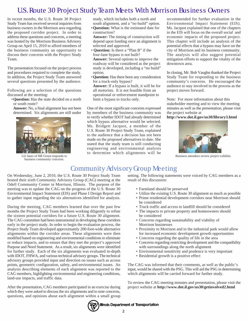
Gil Janes of HR Green responds tobusiness community concerns.
Business attendees review project exhibits.
In recent months, the U.S. Route 30 ProjectStudy Team has received several inquiries frombusiness owners in the Morrison area regardingthe proposed corridor project. In order toaddress these questions and concerns, a meetingwas hosted by the Morrison Business AdvisoryGroup on April 15, 2010 to afford members ofthe business community an opportunity todiscuss their concerns with the Project StudyTeam.
The presentation focused on the project processand procedures required to complete the study.In addition, the Project Study Team answeredseveral questions presented by the audience.
Following are a selection of the questionsdiscussed at the meeting: •Question: Has the state decided on a north
or south route?Answer: No, a final alignment has not beendetermined. Six alignments are still under
study, which includes both a north andsouth alignment, and a “no build” option.
•Question: What is the estimated date forconstruction?
Answer: The timing of construction willdepend upon funding once an alignment isselected and approved.
• Question: Is there a “Plan B” if thefour-lane bypass is not built?
Answer: Several options to improve theroadway will be considered as the projectstudy is developed, including a “no build”option.
•Question: Has there been any considerationfor a truck-only bypass?
Answer: If a bypass is built, it will be forall motorists. It is not feasible from anoperational or enforcement standpoint tolimit a bypass to trucks only.
One of the most significant concerns expressedby members of the business community wasto verify whether IDOT had already determinedwhich bypass alternative would be selected.Ms. Bridgett Jacquot, a member of theU.S. Route 30 Project Study Team, explainedto the audience that a decision has not beenmade on the proposed alternatives to date. Shestated that the study team is still conductingengineering and environmental analysisto determine which alignments will be
recommended for further evaluation in theEnvironmental Impact Statement (EIS).Ms. Jacquot explained that one of the chaptersin the EIS will focus on the overall social andeconomic impacts of the proposed project.This chapter will include an analysis of thepotential effects that a bypass may have on thecity of Morrison and its business community.The analysis will also suggest potentialmitigation efforts to support the vitality of thedowntown area.
In closing, Mr. Bob Vaughn thanked the ProjectStudy Team for responding to the businesscommunity’s concerns. He encouraged theaudience to stay involved in the process as theproject moves forward. .
Note: For more information about thisstakeholder meeting and to view the meetingminutes as well as the presentation, please visitthe project website athttp://www.dot.il.gov/us30/library3.html
U.S. Route 30 Project Study Team Meets With Morrison Business Owners
Please followthe insert
for fullmap view.
Western Portion (IL 136 to Hillside Road)• Alignments 1, 2, and 3 are located north of the existing
U.S. Route 30 roadway.• Alignments 4, 5, and 6 are located primarily on the existing
U.S. Route 30 roadway alignment.• Primary considerations within this portion of the project study
area include: railroad crossings, geometric constraints, accesspoint considerations, wetlands, stream crossings, forested areas,centennial farms, cemeteries, residential and agricultural impacts,and traffic safety concerns at the intersection of U.S. Route 30and IL 136.
Central Portion (Hillside Road to Lyndon Road)• Alignments 1 and 4 bypass the city of Morrison to the north.• Alignments 2, 3, 5, and 6 bypass the city of Morrison to the south.• Primary considerations within this portion of the project area
include: residential, commercial and agricultural property impacts,access to the Morrison downtown business community, accessto the Morrison Rockwood State Park, forested land, streamcrossings, wetlands, truck access to the industrial park, trafficsafety in the downtown area and access to the existingU.S. Route 30 roadway and IL 78.
Eastern Portion (Lyndon Road and Moline Road)• Alignments 1, 2, 4, and 5 primarily follow the existing
U.S. Route 30 roadway alignment.• Alignments 3 and 6 follow the existing Bunker Hill roadway
alignment.• Primary considerations within this portion of the project area
include: impacts to residential, commercial and agriculturalproperties, cemeteries, access to the landfill, access to the Morrisondowntown business community, stream crossings, forested areas,nature preserve, wetland impacts and traffic safety at access pointssuch as at the Emerson Road and Moline Road intersections.
Moline Road to IL 40• All six alignments follow the existing U.S. Route 30 roadway.
The primary considerations along this segment of roadway include:impacts to residential, commercial and agricultural properties, Rock River and Elkhorn Creek, wetland impacts and traffic safetyat access points.

Community Advisory Group MeetingOn Wednesday, June 2, 2010, the U.S. Route 30 Project Study Teamhosted their sixth Community Advisory Group (CAG) meeting at theOdell Community Center in Morrison, Illinois. The purpose of themeeting was to update the CAG on the progress of the U.S. Route 30Environmental Impact Statement (EIS) and Phase I Design Report andto gather input regarding the six alternatives identified for analysis.
During the meeting, CAG members learned that over the past fewmonths the Project Study Team had been working diligently to refinethe sixteen potential corridors for a future U.S. Route 30 alignment.The CAG committee had been instrumental in developing these corridorsearly in the project study. In order to begin the evaluation process, theProject Study Team developed approximately 200-foot-wide alternativealignments within the corridor areas. These alignments were thenmodified based on engineering and environmental conditions to eliminateor reduce impacts, and to ensure that they met the project’s approvedPurpose and Need Statement. As a result, six alignments were identifiedfor further study. Each of the six alignments was evaluated in-depthwith IDOT, FHWA, and various technical advisory groups. The technicaladvisory groups provided input and direction on issues such as accesspoints, geometric configuration, safety, and environmental issues. Ananalysis describing elements of each alignment was reported to theCAG members, highlighting environmental and engineering conditions,land-use impacts, and traffic data.
After the presentation, CAG members participated in an exercise duringwhich they were asked to discuss the six alignments and to note concerns,questions, and opinions about each alignment within a small group
setting. The following statements were voiced by CAG members as aresult of this discussion:
• Farmland should be preserved• Utilize the existing U.S. Route 30 alignment as much as possible• Prime residential development corridors near Morrison should
be considered• Truck traffic and access to landfill should be considered• The impacts to private property and homeowners should
be considered• Concerns regarding sustainability and viability of
Morrison businesses• Proximity to Morrison and to the industrial park would allow
for increased economic development growth opportunities• Concerns regarding the quality of life in the area• Concerns regarding restricting development and the compatibility
with surroundings along the north alignment• Environmental sensitivity and prudence is very important• Residential growth is a positive effect
The CAG was informed that their comments, as well as the public’sinput, would be shared with the PSG. This will aid the PSG in determiningwhich alignments will be carried forward for further study.
To review the CAG meeting minutes and presentation, please visit theproject website at http://www.dot.il.gov/us30/getinvolved2.html
2 3
The U.S. Route 30 Project Study Team has been analyzing traffic and crash data, assessing environmental impacts (displacements, agriculturalland impacts, water resource impacts, etc.), and evaluating engineering data (safety, congestion relief, etc.) on the six alignments over the pastmonths. In addition to these efforts, we have received input on the project from various stakeholders from the affected communities of Fulton,Morrison, Sterling, and Rock Falls.
Now we need your input! A project map illustrating each of the six alignments is included in this newsletter. In order to facilitate your reviewof these alignments, an overview of their similarities and differences are highlighted below. These elements are summarized within the variousportions of the project study area (western, central, eastern, and Moline Road to IL 40) and provide the location of the alignments along withprimary engineering and environmental considerations within each section. Please note that in order to meet Federal Highway Administration(FHWA) requirements, a “no build” alternative must also be considered as a part of the study.
We encourage you to review the alignments and provide feedback on the enclosed comment form or contact the project hotline at1-866-ROUTE30 (1-866-768-8330). The alignment map is also available on the project website as well as a web link to the U.S. Route 30Geographic Information System (GIS) portal, at http://gis.hrgreen.com/USHwy30_Public/. The U.S. Route 30 GIS portal provides details ofadditional project characteristics, such as environmental criteria and property information. Please be sure to provide your comments bySeptember 9, 2010. Your input is vital to the successful completion of this project study. .
Get Involved!
Project Website: http://www.dot.il.gov/us30/index1.html GIS Portal Website: http://gis.hrgreen.com/USHwy30_Public/
WE NEED YOUR INPUT ON THE SIX ALIGNMENTS
Gil Janes of HR Green responds tobusiness community concerns.
Business attendees review project exhibits.
In recent months, the U.S. Route 30 ProjectStudy Team has received several inquiries frombusiness owners in the Morrison area regardingthe proposed corridor project. In order toaddress these questions and concerns, a meetingwas hosted by the Morrison Business AdvisoryGroup on April 15, 2010 to afford members ofthe business community an opportunity todiscuss their concerns with the Project StudyTeam.
The presentation focused on the project processand procedures required to complete the study.In addition, the Project Study Team answeredseveral questions presented by the audience.
Following are a selection of the questionsdiscussed at the meeting: •Question: Has the state decided on a north
or south route?Answer: No, a final alignment has not beendetermined. Six alignments are still under
study, which includes both a north andsouth alignment, and a “no build” option.
•Question: What is the estimated date forconstruction?
Answer: The timing of construction willdepend upon funding once an alignment isselected and approved.
• Question: Is there a “Plan B” if thefour-lane bypass is not built?
Answer: Several options to improve theroadway will be considered as the projectstudy is developed, including a “no build”option.
•Question: Has there been any considerationfor a truck-only bypass?
Answer: If a bypass is built, it will be forall motorists. It is not feasible from anoperational or enforcement standpoint tolimit a bypass to trucks only.
One of the most significant concerns expressedby members of the business community wasto verify whether IDOT had already determinedwhich bypass alternative would be selected.Ms. Bridgett Jacquot, a member of theU.S. Route 30 Project Study Team, explainedto the audience that a decision has not beenmade on the proposed alternatives to date. Shestated that the study team is still conductingengineering and environmental analysisto determine which alignments will be
recommended for further evaluation in theEnvironmental Impact Statement (EIS).Ms. Jacquot explained that one of the chaptersin the EIS will focus on the overall social andeconomic impacts of the proposed project.This chapter will include an analysis of thepotential effects that a bypass may have on thecity of Morrison and its business community.The analysis will also suggest potentialmitigation efforts to support the vitality of thedowntown area.
In closing, Mr. Bob Vaughn thanked the ProjectStudy Team for responding to the businesscommunity’s concerns. He encouraged theaudience to stay involved in the process as theproject moves forward. .
Note: For more information about thisstakeholder meeting and to view the meetingminutes as well as the presentation, please visitthe project website athttp://www.dot.il.gov/us30/library3.html
U.S. Route 30 Project Study Team Meets With Morrison Business Owners
Please followthe insert
for fullmap view.
Western Portion (IL 136 to Hillside Road)• Alignments 1, 2, and 3 are located north of the existing
U.S. Route 30 roadway.• Alignments 4, 5, and 6 are located primarily on the existing
U.S. Route 30 roadway alignment.• Primary considerations within this portion of the project study
area include: railroad crossings, geometric constraints, accesspoint considerations, wetlands, stream crossings, forested areas,centennial farms, cemeteries, residential and agricultural impacts,and traffic safety concerns at the intersection of U.S. Route 30and IL 136.
Central Portion (Hillside Road to Lyndon Road)• Alignments 1 and 4 bypass the city of Morrison to the north.• Alignments 2, 3, 5, and 6 bypass the city of Morrison to the south.• Primary considerations within this portion of the project area
include: residential, commercial and agricultural property impacts,access to the Morrison downtown business community, accessto the Morrison Rockwood State Park, forested land, streamcrossings, wetlands, truck access to the industrial park, trafficsafety in the downtown area and access to the existingU.S. Route 30 roadway and IL 78.
Eastern Portion (Lyndon Road and Moline Road)• Alignments 1, 2, 4, and 5 primarily follow the existing
U.S. Route 30 roadway alignment.• Alignments 3 and 6 follow the existing Bunker Hill roadway
alignment.• Primary considerations within this portion of the project area
include: impacts to residential, commercial and agriculturalproperties, cemeteries, access to the landfill, access to the Morrisondowntown business community, stream crossings, forested areas,nature preserve, wetland impacts and traffic safety at access pointssuch as at the Emerson Road and Moline Road intersections.
Moline Road to IL 40• All six alignments follow the existing U.S. Route 30 roadway.
The primary considerations along this segment of roadway include:impacts to residential, commercial and agricultural properties, Rock River and Elkhorn Creek, wetland impacts and traffic safetyat access points.

In the seven months since our last newsletter, a number of things have occurred tofurther the process of developing the Environmental Impact Statement (EIS) andPhase I Design Report for the U.S. Route 30 project. The U.S. Route 30 ProjectStudy Team has met with various stakeholders and stakeholder groups, conducteda Project Study Group (PSG) meeting, and held the sixth Community AdvisoryGroup (CAG) meeting. At these meetings, the project’s progress to date and thenext steps in the EIS process were discussed, which includes gathering input on
the six alignments under consideration.
In addition to updating you on the project status, the purpose of this newsletter is to afford you with an additionalopportunity to give the Project Study Team input on the six remaining alignments being evaluated. The ProjectStudy Team has been working diligently to evaluate the environmental impacts and the engineering feasibilityof the six proposed alignments. These alignments were developed after completing an environmental andengineering screening process of sixteen corridors that were initially identified during the early phase of thestudy. That brings us to an important juncture in the development of the project study: obtaining your inputon these six alignments.
Your comments are an important part of the project process and will be considered as we continue to moveforward in the development of the EIS document. Within this newsletter you will find a map of the alignmentsand a comment sheet. You may also visit the project website to view the map and obtain more detailed imagesof the project area. We are accepting comments on this portion of the project study until September 9, 2010.
I strongly encourage your participation in this evaluation and comment process. After careful consideration of public comments, the ProjectStudy Group will begin discussions to select two alignments that will be evaluated in the draft Environmental Impact Statement study. As always,a “no build” alternative will continue to be considered as well. Additional opportunities to provide comments regarding the project will continueto be available in the future, including a public hearing in early 2011.
I encourage you to visit the project website at http://www.dot.il.gov/us30/index1.html or contact the hotline at 1-866-ROUTE30(1-866-768-8330) to remain updated on the project’s progress and to provide the project team with your comments and/or questions.
Sincerely,
George F. Ryan, P.E.Deputy Director of Highways,Region Two Engineer
A Message From IDOT:IN THIS ISSUEThis publication is dedicated togathering comments on six proposedalignments for the U.S. Route 30Environmental Impact Statement andPhase I Design Report.
A Message From IDOT 1
Next Steps 1
U.S. Route 30 Project StudyTeam Meets with MorrisonBusiness Owners 2
Community AdvisoryGroup Meeting 2
We Need Your Input OnThe Six Alignments 3
Public Comment Form& Map Insert
ENVIRONMENTAL IMPACT STATEMENT and PHASE I DESIGN REPORTISSUE 5 - SUMMER 2010 NEWSLETTER
U.S. Route 30 Environmental ImpactStatement and Phase I Design ReportU.S. Route 30 Joint Venture TeamC/O Volkert, Inc.103 Lanter CourtCollinsville, IL 62234
Project TeamLead Agencies
Federal Highway Administration(FHWA)
Illinois Department of Transportation(IDOT)
Consultant TeamVolkert, Inc.
Project Management Consultant(Joint Venture)
Howard R. Green CompanyProject Management Consultant
(Joint Venture)
Hudson And Associates, LLC.Context Sensitive Solutions/Public
Involvement Consultant
Kaskaskia Engineering GroupGIS/Mapping and Environmental
Consultant
1
Next Steps
Opportunity to Comment onU.S. Route 30 Alignments
Inside: Read More!

U.S. 30 Environmental Impact Statement Study and Phase I Design Report
Proposed Six Alignments (Summer 2010)Whiteside County, Illinois
Name
: New
slette
r_Aug
_201
0_11
x17
Ë
Morrison-RockwoodState Park
Legend
BridgesProject Boundary
Alternative 1
Alternative 6
Alternative 2Alternative 3Alternative 4Alternative 5

This form may also be completed online at http://www.dot.il.gov/Email/Email.asp?from=31
PLEASE PRINT ALL INFORMATION
Name:
Address:
City: State: Zip Code:
Telephone Number: ( )
Email:
Check one or more if applicable:
___ Homeowner ___Farmer/Farm Land Owner ___ Business Owner ___Special Interest ___ Developer
Which Special Interest Groups are you associated with, if any?
Would you like to remain on our mailing list? ___Yes ___No
What are your comments regarding the six alignments under evaluation for further environmental and engineering impacts, as shownon the enclosed map?
Please return comment form by September 9, 2010.
Your comments are greatly appreciated!