Embed Size (px)
Citation preview
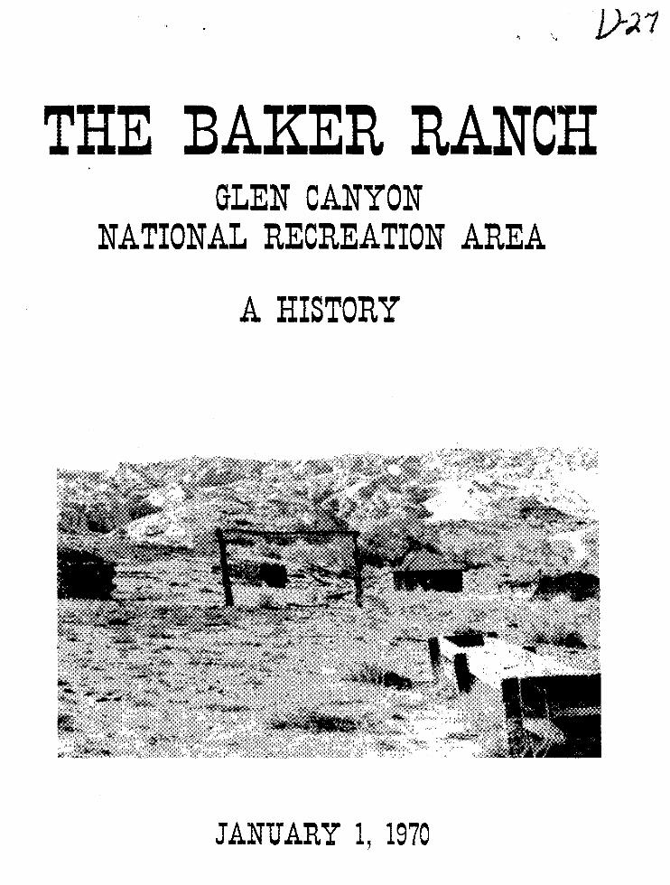
THE BAKER RANCH GLEN CANYON
NATIONAL RECREATION AREA
A HISTORY
JANUARY 1, 1970
TH BAKER RANCH A HISTORY·
GLEN CANYON NATIONAL RECREATION AREA
ARIZONA .. UTAH
BY
E.
I lSI OF IS
OFFICE OF ARCHEOLOGY AND HISTORIC PRESERVATION
JANUARY 1, 191'0
U.S. DEPARTMENT OF THE INTERIOR UTlONAl PUI( SERVICE
PREFACE
This study was undertaken to gather background historical
data on the Baker Ranch. The material will be used .in interpretive
planning and to decide whether there is sufficient reason to save
the structures from inundation by the waters of Lake Powell. The
work was done in response to Historical RSP GLCA-H-4 from Glen
Canyon National Recreation Area.
During the course of the research on this project, many individ
uals provided aid to me. Al Trulock, District Manager at Bullfrog
on upper Lake Powell, gave me the usual warm Park Service welcome on
my arrival there November 13. The next morning he drove Park
Naturalist Norm Salisbury, Environmental Specialist Gil Lusk, and
me to Baker Ranch. During my work at the Kane County Courthouse in
Kanab, Utah, several members of the courthouse staff were most helpful.
As usual the staff of the Utah Historical Society in Salt Lake City
gave all possible aid during my research there. I was most pleased
with the cooperation that various employees of Bureau of Land Manage
ment and-Bureau of Reclamation in the Salt Lake City office gave me.
Especially helpful was Mayo Call, of the Division of Resource Manage
ment, BLM, and Foster Lamb, Staff Appraiser in the Bureau of Reclama
tion. While in Salt Lake City, Dr. C. Gregory Crampton of the
University of Utah shared his considerable knowledge of the history
i
of the Glen Canyon region with me during a morning meeting.
I wish to extend my most sincere thanks to Mr. and Mrs. Carlyle
Baker of Teasdale, utah, the former for patiently answering my
questions over the telephone for nearly an hour and a half' and the
latter for enduring that rash of phone calls from me while her
husband was on roundup. Mr. Baker's sharing of his first-hand
knowledge of how he and his father operated their ranch on Halls
Creek made this entire report come alive.
Historian Frank B. Sarle~of the Division of History, read
the manuscript in both draft and final form for errors in punctuation
and style. Finally, Mary Shipman typed the report, turning a rough
draft into a finished product.
ii

Table of Contents
Preface
List of Illustrations
First Settler on Halls Creek
The Struggle to Settle and Live on Desert Land
The Desert Ranch of Eugene Baker and Sons
The Future of the Baker Ranch: Some Recommendations
Appendix I - The Desert Land Entries of Eliza, Thomas and Sarah Smith
Appendix II - The Rate of Fill for Lake Powell
Bibliography
Illustrations following page
iii
Page
i
iv
1
8
17
32
38
40
42
45
List of Illustrations
1. Area Map of Baker Ranch
2. Vicinity Map of Baker Ranch
3. Panoramic View, Baker Ranch
4. Baker Ranch, 1960
5. Main Ranch House
6. Main House, Baker Ranch
7. Rear and Side Views, Baker Ranch House
8. Rock Store Room, 1960 and 1969
9. Side View of Rock Store Room and Detail View of Rock Work
10. The Granary, 1960
11. Baker Ranch Granary in 1969
12. Rear and Side Views of Granary
13. View of Granary Looking Toward the Main House, and Detail of Corner
14. Two Views of the Chicken House
15. Ruins of the Blacksmith Shop, 1960
16. Ruins of the Blacksmith Shop, 1969
17. Mowing Machine
18. Ruins of a Buckboard
19. Iron Furnishings of a Sulky Hayrake
20. A Cookstove That Has Seen Better Days
21. Vineyard at the Baker Ranch
iv
Chapter I
FIRST SETrLER ON HALIB CREEK
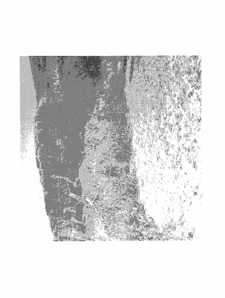
The four structures are clustered together, as if to assert
by their proximity mants right to live on this land. Across Halls
Creek to the east, the southern tip of Hall Mesa rises more than
450 feet above the creek bed and ranch buildings. Halls Creek,
nearing the end of its twisting, winding 45-mile journey along
the east face of Waterpocket Fold from Bitter Creek Divide to
the Colorado River, passes a thousand feet to the north of the
ranch buildings and then turns southeastward a half-mile east of
the ranch. Scattered about the four buildings is additional evi
dence of man's presence in the hostile environment of mesa, cliff,
canyon, and desert--a pile of rusting tin cans, parts of two
discarded stoves, the ruins of a buckboard, a rusted mowing machine,
the rims of several wagon wheels, and the iron furnishings of a
sulky hay rake. This and the rapidly disappearing evidence of
fields and irrigation ditches is all that remains of the efforts
of two different.families to make a home on the land during the
first 40 years of the century. Between 1907 and the mid-1940s
the family of Thomas Smith and later Eugene Baker and his sons
operated this desert ranch. They raised cattle and irrigated the
sandy soil to provide food for themselves and for their cattle.
1
It is known to~ as the Baker Ranch, after its second owner.
The first settler in the area was Charles Hall. The creek and
mesa both bear his name. Hall was born in Maine and came to the
Mormon state of Deseret about 1850. Soon after his arrival he was
selected as one of the colonists to establish the settlement of
Parowan in southwestern Utah. Here he lived from 1851 to 1876.
That year a few hardy settlers, including Charles Hall, traveled east
across the mountains more than a hundred miles to establish Escalante.
Hall's skill as a carpenter and brick maker was again put to good use.
Three years later, when it became known that the leaders of the pro-
posed San Juan Mission were seeking a short cut to the four corners
area, and that the route would require crossing of the Colorado River,
it was natural that Hall, who was also a boatbuilder, would be one of
those selected to conduct preliminary explorations.
Hall, along with Andrew P. Schow and Reuben Collet, shares the
credit for discovering the route through Hole-in-the-Rock to the San
Juan River settlements.l
While the 550 men, women and children of the
San Juan Mission were pushing slowly toward the passage through Hole-
1. The trek of the first settlers of the San Juan Mission is one of the more remarkable and dramatic stories of overland migration. Leaving from a spring 40 miles east of Escalante, they took wagons where wagons had never been before, built roads where roads were needed, and gave a permanent name to their journey and the mission. Hole-in-the-Rock was a narrow cleft in the west rim of Glen Canyon. Using blasting powder, the pioneers enlarged it to allow a wagon to pass through, then cut, blasted, and filled to make a roadway to the Colorado River below. The grade averaged 25 per cent and at some points approached 40 per cent. Distant in time and location from the Baker Ranch, we will not discuss it here. For those interested in this epic migration story, David E. Miller's Hole-in-the-Rock (Salt Lake City, 1959) is the best single source.
2
in-the-Rock to the Colorado River, Hall was building a boat to ferry
the wagons across the river. Built of prefabricated lumber brought
from Escalante, the boat was large enough to carry two wagons and
their teams across the river at one time. Between January 26, 1880,
and the first week in February, Hall and his two sons, Reed and John,
transported the 83 wagons of the expedition across the river. From
here the travelers continued east over Grey Mesa, through Clay Hill
Pass, across Grand Gulch, down Comb Wash and around Comb Ridge to
establish the town of Bluff in April 1880. Though still 16 miles
from their goal, the company stopped and settled. After six months
on the trail they had suddenly lost their push.
Hall, his two sons, and apparently their families2 remained at
the Hole-in-the Rock Crossing taking travelers across the river in
both directions. 3 Hall, however, began looking for a better crossing
of the Colorado and found one 35 miles upstream where Halls Creek
empties into the Colorado River.
Tradition states that Hall moved the ferry boat upstream from
Hole-in-the Rock to Halls Crossing. Considering its size, large
enough to hold two wagons, and the shoals, shallows, and rapids that
made up Lake Canyon, this sounds like an impossible feat. More
likely Hall· and his sons repeated the boat-building process at Halls
2. Handwritten account by Roxanna Dorrity Hall, wife of Reed Hall, cited by Miller, Hole-in-the Rock, p. 107.
3. For about a year the road built by the pioneers was the only link between the new settlement of Bluff and the older towns to the west. Traffic moved both ways through a cleft in the canyon rim.
3
Creek and constructed a ferry with lumber brought from Escalante and
perhaps using some parts of the Hole-in-the-Rock craft. Assuming that
he brought most of the material from Escalante, Hall also pioneered
and marked out the route from Escalante to the crossing. This trail,
named the Halls Crossing Road, went down Harris Wash to the Escalante
River, then, crossing the river, went up Silver Falls Creek. The road
turned east in Section 1 of T355R7E to pass south of Wagon Box Mesa
and cross the headwaters of Moody Creek. The road wound southeast
and then north to the head of Muley Twist Canyon, and dropped a
thousand feet in two miles to Muley Twist Creek, then followed
Muley Twist Creek to Halls Creek and went down Halls Creek past
the future site of the Baker Ranch to the Colorado River. 4 The boat
was constructed by nailing cross planks about ten feet long to two
pine logs approximately 30 feet long and tapered at each end. The
raft was then sealed with Pitch. 5
The ferry was current-operated. Crossing from west to east the
raft would be launched into the river, a man on each side would row,
while a third one steered. The boat would move on a slant across the
river to a landing place downstream. The raft would then be laboriously
hauled upstream to a point above the landing on the western bank and
floated back across the river to the west bank where it was moored.
4. The road is shown as a jeep or hiking trail on current United States Geological Survey maps. The route is described in C. Gregory Crampton, "Historical Sites in Glen Canyon Mouth of Hansen Creek to Mouth of San Juan River," University of Utah Anthropological Paper Number 61 (Glen Canyon Series #17), December 1962, p. 50.
5. Charles B. Hunt, P. Averitt, and R. Miller, "Geology and Geography of the Henry Mountains Region, Utah," United States Geological Survey Professional Paper, 228 (Washington, 1953), p. 15.
4
6 Ferry charges were a~rox1matel1 $5 per wagon and 75 cents per horse.
For three years Hall and his sons operated the ferry at Halls
Crossing, transporting travelers across the river. In 1883 the Denver
& Rio Grande Western Railroad was completed. Now settlers at Bluff
or other points east of the Colorado River canyons !could go north to
Thompson station and take trains to Denver or Salt Lake City. ~rave1
to the settlements would follow the same route. The long trek across
the canyons was no longer necessary and by 1884 business for the Halls
had ceased. That year or the next the ferry either broke loose in
high water or was cut loose by cattlemen to prevent its use by rust-
7 lers. The Halls did not replace it and left the area.
Where Charles Hall and his sons lived while operating the ferry
is open to question. His granddaughter, Lily Hall Denny, of Green
River, utah, says that he lived at the crossing, where he had a small
garden and some grape vines. Carlyle Baker, son of Eugene Baker,
states that Hall lived two miles above the Baker Ranch on Halls Creek
and eight miles from the crossing. According to Baker, he diverted
water from a spring and Halls Creek to irrigate a garden. Thomas
6. Ibid.
7. On at least one occasion, in 1881, three men from Bluff followed some horse thieves to a point "a few miles west of Halls Crossing" where, through a quirk of fate, they recovered not only their own horses, but the ~orses and saddles of the thieves. Returning to Halls Crossing, they began ferrying the goods and horses across the river. Just as the last load reached the east bank, the thieves opened fire and wounded Joseph llfman while the other men and the Hall brothers were securing the boat. After nearly dying from ini'ection, 4Yman and the other men were met by a wagon which took him back to Bluff. Albert R. Lylnan, The Edge of the Cedars: Walter C. Lylnan and the San Juan Mission (New York, 1966), pp. 24-27.
5
William Smith, son o~ the original settler o~ the Baker Ranch, stated
that Hall lived in a 16-bY-16-foot cabin two miles up Halls Creek
from the ranch. Smith goes on to describe how Hall would climb over
the slick rock slopes of Waterpocket Fold to a point 400 or 500 feet
above the creek, where he could see the ferry crossing eight miles
distant. Smith believed there was some means for travelers on the
east side of the river to signal the ferryman.8 In 1922 the States
of the Colorado River Basin were preparing to draw up a compact ~or
the division of the waters of the Colorado. John A. Widtsoe, utah's
representative to the meeting in Santa Fe, New Mexico, and ten
other gentlemen floated down the Colorado River from Halls Creek to
Lees Ferry to look at dam sites and become better acquainted with
the river. Widtsoe kept a journal of this trip. On September 7
the party ate at Halls Ranch: "Old ranch house now moved away. ,,9
Widtsoe does not locate the site very exactly. He mentions the
canyon of Halls Creek with overhanging rocks and a vast amphitheater
with perfect acoustics--"About six miles of rounding narrow gorge--10 .
in places only 30 feet across." The area was christened "Canopy
8. Crampton, "Historical Sites in Glen Canyon, Hansen Creek to San Juan River," pp. 51 and 59. Crampton interviewed Mrs. Denny, Carlyle Baker, and Thomas Smith during his research. Attempts by the author to contact both Smith and Baker showed that Smith no longer resides in Green River. Baker, who lives in Teasdale, Utah, substantiated the location of Halls Ranch as "about n two miles above the Baker Ranch during a telephone interview.
9. A. R. Mortensen, ed., "A Journal of John A. Widtsoe: Colorado River Party, September 3-19, 1922," utah Historical Quarterly, 23 (1955), p. 203. -
10. Ibid. 6
Gorge" by members of the party. Widtsoe indicates that Halls
Ranch is 3 1/2 or 4 hours south of Halls Divide by wagon and
states that Baker Ranch is an hour south of Halls Ranch. ll
Between 1884 or 1885, when the Halls left, and 1907-08, when
Thomas Smith and family arrived to establish a ranch or farm, there
were no permanent settlers along the lower portion of Halls Creek.
Intermittent mining activity took place along the Colorado River
during the 1890s and early 1900s both above and below the point
where Halls Creek joins the river. This lack of interest in the
Halls Creek Valley as a home in an era when free land elsewhere drew
people west is indicative of the hard harsh environment of little
rain, sandy soil, isolation, and high cliffs.
11. Ibid., p. 204. This writer attempted to determine the approximate location of Halls Ranch. Using the Hall Mesa Quadrangle, 15 minute series, published in 1953 by the U.S. Geological Survey, he computed the trail distance from Hall Divide to the Baker Ranch as 9 miles. ·Widtsoe states this distance was covered in 4 1/2 to 5 hours. Figuring a constant rate of speed for the wagon of 1.8 to 2.0 mph, this would place the Hall Ranch 1.8 or 2 miles above Baker's. This places it near a stream that joins Halls Creek from the west near the NE/NW quarter section line of Section 6 T38sRIOE, and approximately 500 feet south of the Garfield-Kane county line. Though subject to variables, this seems to substantiate both Carlyle Baker's and Thomas W. Smith's location and matches with the location given by Crampton, "Historical Sites Glen Canyon, Hansen Creek to San Juan River," p. 59.
7
Chapter II
THE STRUGGLE TO SETI'LE .AND LIVE ON DESERT LAND
In 1877 the United States Congress passed the Desert Land Act.
Though written to benefit the ranchers of the Great Plains and South-
west who desired a law to insure the maintenance of unfenced grazing
land, it was technically to encourage the agricultural development of
lands where rainfall was not sufficient to support crops. With less
than six inches of rain per year, the land along Halls Creek fit this
qualification admirably. Under the provision of this act a person
could gain tentative title to 640 acres of land with the initial
payment of 25 cents per acre. At the end of three years the claimant
had to prove he had irrigated a portion of the claim, and by paying
an additional dollar per acre, he could gain clear title to the tract.
On August 26, 1907, three individuals filed on 800 acres of land
along the lower portion of Halls Creek. Eliza J. Smith, 52, a farmer's
wife, made Desert Land Entry 5419 on 320 acres of land. Sarah Smith,
22, also a farmer's wife, claimed another 320 acres under Desert Land
Entry 5420. Thomas Smith, a 52-year-old farmer, filed Desert Land
Entry 5422 on 160 acres of land. 1 The three claims were all filed with
1. Thomas and Eliza J. Smith were .:husband and wife. Sarah Smith was their daughter-in-law. She was married to Thomas W. Smith. Obviously this was a family venture. Thomas W. Smith's name appears as a witness
8
the Clerk of the District Court in Loa, Utah, the Wayne County
seat. All three gave their residence as Thurber, Utah. 2
On September 3 all three made the initial 25-cent-per-acre
payment on their land. Under the provisions of the Desert Land
Act, the entrymen were required to make improvements each year of
at least one dollar for each acre claimed. At the beginning of the
fourth year--in the Smith's case, August or September 1911--the claim-
ant was to have brought water onto the land and raised a crop. Failure
to do this would lead to cancellation of the entry. During the next
three years the Smiths labored to fulfill these conditions.
By August 14, 1908, Sarah and Eliza Smith had each erected a
half mile of stake and rider fence and the same amount of buck fence.
Thomas Smith during the same period had built a half mile of buck
to the truth of Thomas Smith's request for an extension of time to make final proof. A Thomas B. Smith, possibly the entryman Thomas Smith, also appears as a witness on the yearly proofs filed by Sarah and Eliza Smith. Thomas William Smith, son of Thomas Smith, was living in Green River, Utah, in 1960 and was interviewed by Crampton during the research on his monograph on historic sites in Glen Canyon. Information on relationship of Tom, Eliza and Sarah Smith from a telephone conversation with Carlyle Baker of Teasdale, Utah, on December 30, 1969. Mr. Baker is about 60 years old and the son of Eugene Baker, who owned the ranch from about 1919 until his death in the early 1940s.
2. In 1914 Thomas W. Bicknell, an Easterner, offered a library to any town in Utah that would take his name. Two towns accepted the offer: Thurber in Wayne County and Grayson in San Juan County. Each received half of the library. Thurber changed its name to Bicknell and Grayson adopted the name Blanding, the maiden name of Mrs. Bicknell. Federal Writers Project, Utah: A Guide to the State (New York, 1941), p. 348.
9
fence. 3 The cost of this work satisfied the first year's requirements.
Between August 1908 and September 1909 all three began preparations
to divert part of the intermittent flow of Halls Creek to their land
for irrigation. Sarah put in a quarter-mile of ditch 6 feet deep
and 4 1/2 feet wide, costing $480. 4 Eliza dug a ditch 2 1/2 feet
wide, 1 1/2 feet deep, and a half mile in length plus clearing and
plowing three acres and putting up 40 rods, an eighth of a mile, of
fence four poles high. 5 Thomas Smith had installed 160 feet of 12-
3. The difference between stake and rider fence and buck fence proved rather hard to determine. The University of Chicago's A Dictionary of American English on Historical Principles (4 volumes, Chicago, 1944), Vol. 4, pp. 1945 and 2217, describes the former as follows: stake and rider fence has a rider supported by crossed stakes and is stronger than a worm fence. A stake is one of the crossed pieces of timber supporting the rider in certain fen~es. The rider in a rail fence is the top rail placed in the crotch of the crossed stakes or rails at the end of each panel. There was no description of a buck fence. Carlyle Baker, who has ranched in the region for more than forty years,described a buck fence as follows: Stand two posts upright and cross them in an X and lay a rider in the crotch. The cross pieces would be about two feet apart. Mr. Baker thought stake and rider and buck fences were identical. He recalled that there were two types of fencing on the Smith place when his father acquired it. One was cottonwood logs laid three of four high and held in place by poles driven into the ground, what is commonly called a post and rail fence. The other was a stake and rider fence. Telephone conversation with Carlyle Baker, Teasdale, Utah, December 30, 1969.
Barry Mackintosh, Historian at Fort Frederica National Monument, Georgia, described a buck fence as crossed stakes with a rider resting on the crotch of one set of stakes and passing under the crotch of the next set. This corresponds with Baker's description and also illustrates the similarity of the two types of fencing. 4. All material relating to a completed Desert Land Entry has been consolidated under the final patent number by the Bureau of Land Management. Sarah Smith had patent 1021309. These files are now in Record Group 49, Federal Records Center, Suitland, Maryland.
5. Ibid. Eliza Smith had Final Patent 1021310.
10
inch iron pipe and flume at a cost of $160.6 During the third year
they held tentative title to the land they put in additional ditches
and pipe. Thomas and Sarah Smith also undertook to build a dam across
Halls Creek to catch and hold the runoff. This dam was 6 feet high,
160 feet long and 30 feet wide. 7 Though not noted on her third-year
proof. Sarah Smith shared in the cost of constructing the dam.
September 1911 would have marked the fourth year that the three
had been on the land. By the end of this time they should have
brought water onto the land and produced at least one crop. For
Sarah and Thomas Smith this was not to be; a series of disasters
forced them to ask for a three-year extension. Eliza Smith, whose
land was to the west or upstream of both Sarah's and Thomas's, was
able to file her final proof and gain title to the land in 1912.
On May 10, 1909, Eliza Jane Smith applied to the State Engineer
to appropriate five cubic feet per second of water from Halls Creek
t th 360 .. h 1· 8 o e acres comprlslng er calm. utah State Engineer Caleb
Fanner, on March 19, 1910, approved the request and noted that "5
cubic feet per second of water flowing continuously during the
irrigation season is sufficient to irrigate the 320 acres of land
6. Second Yearly Proof filed by Thomas Smith in Final Patent 1021308, ibid.
7. Third Yearly Proof filed by Thomas Smith, ibid.
8. A flow of one cubic foot of water per second, also known as one second foot, for twelve hours is equal to one acre foot of water. Thus Eliza Smith was requesting the use of ten acre feet of water every 24 hours. An acre foot of water would cover a football field to the depth of one foot.
11
specified in the application as that which is to be irrigated.,,9
In the summer of 1910 Eliza had 40 acres planted in corn and had a
yield of 40 bushels per acre. In 1911 she again planted 40 acres
of corn and again received a yield of 40 bushels per acre. Eliza
filed her notice of application for title in the Panguitch (Utah)
Progress in September 1911. Her claim was protested on the basis
of lacking water rights on September 29, 1911. A letter from
the State Engineer and additional proof caused the protest to be
set aside. On October 22, 1912, the final proof was accepted and
title to the land was granted to Eliza Smith subject to survey of
10 the land. By November 27, 1911, Eliza had constructed corrals,
stables, and a granary on the property. 11
Though Eliza Smith had successfully completed her entry within
the stated time, Tom and Sarah suffered several problems that forced
them to request two extensions. The first was that both had assumed
that the dam across Halls Creek could be built of rock and earth
available nearby. When this was attempted, it was discovered that
these materials were not suitable and the dam would have to be built
of concrete. The cement had to be transported by wagon over 150
9. Caleb Fanner to Register and Receiver, United States Land Office, Salt Lake City, December 16, 1911. In file of Eliza Smith, Patent 1021310, RG 49, Federal Record Center, Suitland.
10. Because the area was not surveyed until 1923-24, the final patents were not issued until November 24, 1928.
11. Eliza Smith, Pat. 1021310, RG 49, Federal Records Center, Suitland.
12
miles of very primitive roads. All this would not only delay
bringing water on the land, but would also increase the cost to
an average of $3 an acre, or an extra $1,440. 12 Both requests were
transmitted with recommendation of approval by the Salt Lake City
Land Office. In May 1911 the three-year extension requested by
Thomas Smith was approved by the Commissioner of the General Land·
Office. Sarah Smith received only a two-year extension, to
November 1, 1912.13
Granted these extensions, both claimants worked to complete
development of their claims within the time allowed. Four-strand
wire fencing was erected on both claims. Additional main and
lateral canals were begun and partially completed by Sarah and
Thomas Smith. The digging of the main canal was complicated by
the discovery of several rock ledges, which had to be blasted out.
On Sarah Smith's claim, the extent of the ledge forced the resurvey
of the main canal with a resultant delay in completion. Tom Smith
had meanwhile cleared 100 acres, plowed and cultivated 50, and made
\ 12. On October 19, 1910, both Thomas ?nd Sarah Smith filed petitions to U.S. Land Office with the Clerk of the District Court in Loa asking for a three-year extension to complete final proof on their claims. The petitions were almost identical in wording and presented the reasons given above. Sarah Smith, Patent 1021309. Thomas Smith, Patent 1021308, RG 49, Federal Records Center, Suitland.
13. In addition to an entry number and a patent number, each land transaction involving the Federal domain was given a serial number by the local land office. A register of actions taken on these transactions was kept in the local land office. In the case of the Smiths, this was Salt Lake City. Thomas Smith was given Serial Number 0309 and Sarah Smith 0310. Serial Register of Land Entries, Bureau of Land Management, Salt Lake City.
13
it ready for seed as soon as water was available. In addition to
the problems with the completion of the main canal, a flood on
May 20, 1912, washed out part of the dam and headgates and damaged
the canal irreparably. All these problems resulted in neither
Sarah nor Thomas Smith being able to complete their proof within
the extensions granted in 1911.14
Sarah in April and Thomas in September of 1913 requested
extensions of the time allowed to complete their entry. The exten-
sion granted Sarah Smith expired on November 1, 1912. In late
January 1913 she was notified that her entry had expired and she had
90 days to file proof or show cause why her entry should not be
canceled. On April 18 she filed an affidavit requesting an exten-
sion to November 30, 1914. She received an extension to September 3,
1914. The first extension for Thomas Smith expired on September 3,
1913, and he requested a second one until August 17, 1914, This was
granted by the Commissioner of the General Land Office. On that
date both Thomas and Sarah Smith filed their notice of intention to
make their proof. Testimony on the final proof was recorded by the
Clerk of the District Court in Loa on September 30, 1914 and notice
was published in the Panguitch Progress the same day. In mid-
October the entry was challenged until proof to title to water could
14. This brief discussion of the problems encountered by the Smiths is based on their requests for a second extension. On April 18, 1913, Sarah Smith filed an affidavit for extension of time, requesting an extension to November 30, 1914. Thomas Smith requested an extension to August 17, 1914, in his application of September 12, 1913. Ibid.
14
be establ1shed. 15 Apparently Thomas Smith was aware the challenge
was coming, as State Engineer W. D. Beers wrote to Register and
Receiver, U.S. Land Office, Salt Lake City, certifying that Thomas
Smith had requested and received the right to appropriate 12 1/2
cubic feet of water per second from Halls Creek in February 1913.
The request had been approved in November and in September 1914
eight cubic feet of water per second had been assigned to Sarah
16 Smith for her use. In April 1915 the final proof was accepted.
The patent could not be granted until the area was surveyed.
Having gained title to the land, the Smiths appeared to have a
fine future ahead of them. Approximately 100 acres of land was
under cultivation, most of it planted in corn yielding 30 to 40
bushels per acre. The main canal was five feet wide at the bottom,
two feet deep, and 2 1/4 miles long. There was one branch canal 3 1/2
feet wide, one foot deep and 2 1/2 miles long plus two or three miles
of lateral ditches. In addition to the main house there were corrals,
stables, and a granary in the northeast corner of Section 8. The
Smiths, within a year or two after filing their final proof, had 500
15. Entries 0309 and 0310 in Serial Register of Land Entries, Bureau of Land Management, Salt Lake City.
16. W.D. Beers, Utah State Engineer, to Register and Receiver, U.S. Land Office, Salt Lake City, October 12, 1914. In Patent File 1021308, RG 49, Federal Records Center, Suitland. Interestingly, the application was for water to serve 800 acres, rather than the 480 held by Thomas and Sarah Smith. Apparently the 320 acres owned by Eliza was being watered from the same dam and ditches as the other two.
15
or 600 head of cattle.17 After the seven-year struggle to bring the
land into bloom, the benefits must have seemed sweet to the Smith
family. They enjoyed them, however, for less than five years.
In 1919 the Smiths sold out to Eugene Baker and his sons of
Escalante. 18
17. In June 1937 a hearing was held on the request of Eugene Baker and Sons to challenge the grazing allotment set by the Government. During the course of the hearing, a Mr. George Coombs testified that he had worked for Thomas Smith for three or four years, but never for Baker. Since Baker purchased the ranch about 1919, this would place Coombs' employment from 1915 or 1916 to 1919. Coombs stated that Smith had 500 or 600 head of cattle. Lloyd Baker, a son of Eugene Baker, worked for Smith from 1916 to 1919 as a cowboy. "A Hearing in the Matter of the Appeal of Eugene Baker and Sons from the Decision of the Acting Regional Grazier, June 7, 1937," pp. 57 and 60, Closed Grazing Files, Utah Grazing District No.5, Eugene Baker and Sons, File T29524 BIM, Denver Federal Record.s Center. Cited hereafter as "Hearing Eugene Baker and Sons ," 'Closed Grazing Files, Utah Dist. #5, File T29524 DFRC.
18. Since the area had not been surveyed, the Smiths could not record the sale in the deed books of Kane County. In 1923 the land was surveyed. The Smiths in 1927 formally transferred the 480 acres to Eugene Baker and Sons, Sarah Smith holding her 320 acres out. Ten years later Sarah Smith sold her 320 acres to Baker and Sons on March 10, 1937. The isolated nature of the ranch is highlighted by the fact that the transactions of October 22, 1927, were not recorded until February 3, 1937. The sale of Sarah Smith's 320 acres was recorded three days after it took place. Kane County Deed Book 02, pp. 130, 131, and 135, Kane County Courthouse ,Kanab , Utah.
16
Chapter III
THE DESERT RANCH OF EUGENE BAKER AND SONS
Eugene Baker of Escalante had been active as a rancher in the
region along the Colorado River for several years before he acquired
the Smith's ranch or farm. He had previously owned the Trachyte
Ranch, about 14 miles from the town of Rite on the Colorado and 42
miles north-northeast in a straight line from the ranch on Halls
Creek. l When the Bakers acquired the property there were several
structures on the ranch. There was a granary and storage shed used
for saddles and harnesses, a small log structure used ultimately
for a chicken coop, a log ranch house, some corrals, and an old
2 machine shed.
Between 1919, when Eugene Baker and Sons took over the ranch, 3
1. Telephone conversation with Carlyle Baker of Teasdale, Utah, December 30, 1969. Mr. Baker is_the son of Eugene Baker.
2. The log ranch house burned down and all that remains of the machine shed is two uprights and a cross piece which now resemble the entrance gate to the ranch. The other two buildings are still standing. Ibid.
3. The exact date that the Bakers acquired the ranch is not known. Carlyle Baker in a conversation with the author said he believed it was about 1920, as his father sold the Trachyte Ranch in 1919. H. K. Carlisle, Special Agent for the Grazing Service, U.S. Department of the Interior, in a report to Chesley P. Seeley, Acting Regional Grazier for Utah Grazing District 5, on June 7, 1937, stated that "They have owned this land since 1919 and used it in connection with their stock operations, using the public lands • • • continuously
17
and 1923 the Bakers added several buildings to the complex. Baker
built corrals and sheds to care for his horses and a few of the
weak cattle and to house his equipment and the feed that he either
harvested on the place or brought in by pack mule. Some of these
buildings were log, while others were frame. Sometime between 1919
and the summer of 1922, the log ranch house built by the Smiths and
used by the Bakers burned down. Eugene Baker then built a three-room
frame house, using lumber from bunk houses, derricks, and other
structures of an oil drilling camp in the Circle Cliff area some 30
miles north and west of the ranch by trail. From this same purchased
lumber he built additional sheds and other outbuildings. 4 By 1923
the ranch complex was relatively complete.
Two descriptions of the Baker Ranch and the surrounding country
in the years before 1925 have been found. In September 1922, John
Widtsoe visited the ranch on his way to the Colorado River. As he
traveled down Halls Creek he noted the high, horizontal red cliffs
to the east and the equally high, nearly vertical grey cliffs of the
Waterpocket Fold on the west. A mile or two below the ranch, both
terminated--the one on the east forming the tip of Hall Mesa and the
since 1919." Report in Closed Grazing Files, Utah Grazing District #5, File T29524, DFRC. Eugene Baker, in testimony during a hearing on the decision of the U.S. Regional Grazier on the allotment granted them in June 1937, stated that he was "quite sure" he got possession of the ranch in 1918. "Hearing Eugene Baker and Sons," p. 44. Closed Grazing Files, Utah District #5, File T29524, DFRC. For this report the date 1919 will be used as the date the site became the Baker Ranch.
4. Telephone conversation with Carlyle Baker of Teasdale, Utah, on December 30, 1969.
18
grey strata to the west sloping down to the river. Three or four
miles before reaching the Colorado, Halls Creek cuts deep into the
rock to form a narrow canyon, then emerges, crosses a sandy bar, and
joins the big river. 5 The soil along Halls Creek, according to
Widtsoe, was red and sandy. Widtsoe, who as Utah's representative
to the Santa Fe Compact was thinking in terms of reservoirs and dams,
noted that it would be susceptible to irrigation. Baker Ranch was
described as a small three-room shanty, cistern, and corral run by
the "two Baker Brothers, sons of Brother Baker of Richfield. tr6
A little over a year later, in October 1923, Elliot Bird and
Robert C. Yundt surveyed Township 38 South, Range 10 East for the
General Land Office.7 They described the soil in the vicinity of
the Ranch as second- and third-rate, but considered the area as
fair to good for grazing. The surveyors noted the presence of a
shed, a one-room log cabin, a three-room frame house, about three
5. Mortensen, "A Journal of John A. Widtsoe, II pp. 203-05.
6. This would probably be Lloyd and Carlyle Baker, the two of the four Baker sons most actively involved in the operations.
7. It was this survey that provided the legal description enabling the Smiths to receive patent to the land. These the1 got on November 24, 1928. The ranch complex was in the N!_N! NE4 Section 8 T38sR10E •. The original survey of the land places it there, although current USGS maps locate the ranch in the northwest corner of Section 9. The 800 acres that made up the three desert land entries of Thomas, Eliza, and Sarah Smith which were acquired by Eugene Baker and Sons included the following lands: NEi NEi Section 8; the NWi and SEi of Section 9, plus the NEi swt and S! NEi Section 9; and the swt of Section 10, plus all of the SE4 of the section except NEi SE4 and finally the swi NWi of Section 10.
19
miles of fencing, a corral, and same old irrigation ditcheB. 8
Baker Ranch was, during its quarter-century of existence, an
oasis in the wilderness of sandstone, dry creeks, scattered springs,
high cliffs and narrow canyons. Halls Creek forms the northeastern
boundary of the Kaiparowits Region, described in a United States
Geological Survey paper as "a vast expanse of undeveloped grazing
land utilized by a sparse population that clusters in a few small
settlements where water for irrigation is available the
recognized 'ways of going' may be called roads only for the want
of a better name. They are in reality trails with alternating
stretches of sand, bare rock, and steep inclines over which with
few mishaps a skillful driver may conduct a strongly built lightly
loaded wagon. For most of the Kaiparowits region saddle horses and
pack trains are the only practicable means of transport. 119
Six small towns dotted the Kaiparowits region, the two eastern-
most being Escalante and Boulder, the others being west of the
Kaiparowits Plateau. The remainder was unoccupied land.
The ranch buildings at Hite, at Halls Creek, and in the Henry Mountains are intermittently occupied and prospectors come and go from their cabins in upper Glen Canyon, but neither white men nor Indians have chosen this region for more than temporary use. Furthermore, the settlements themselves ~6 separated from one
. another by natural barriers.
8. Survey Notes and Plat on T38SRIOE, Bureau of Land Management, Salt Lake City, pp. 423-25. 9. Herbert E. Gregory and R.C. Moore, liThe Kaiparowits Region: A
Geographic and Geologic Reconnaissance of Parts of Utah and Arizona," U.S.G.S. Professional Paper 164 (Washington, 1931), p. 4.
10. Ibid., p. 29.
20
Until the final years of the 1920s the Baker ranch, at Halls Creek,
was occupied all year. The :Bakers had a farmer there who cultivated
the land and took care of the property, including about 25 or 30
chickens. In 1927 or 1928 a flood washed out the diversion dam and
it was never rebuilt. From that time on the buildings were occupied
only three or four months during each year while they were rounding
up cattle in the spring and fall or winter feeding a few calves or
II poor cattle in January and February.
At its peak operation, the Baker Ranch complex contained an
impressive number of buildings. In addition to the three-room
frame house and the outbuildings constructed by Eugene Baker and
sons, there were several structures that the Smiths had constructed.
A storage cellar was located a short distance from the kitchen door.
Built into the side of a small hill, it was constructed of rock with
a clay mortar. Both the Smiths and Bakers used this for the storage
of canned goods and other foodstuffs. In November 1911 Eliza Smith
filed her third-year proof and listed as improvements corrals, stables
and a granary. The Bakers used the large log building that is still
standing as a granary and for storage of saddles, bridles, and other
goods. A short distance from the large log structure is a smaller
building, also built by the Smiths, that the Bakers used for a
chicken coop during the 1920s. To the rear of the granary are the
remnants of a fifth bui1ding--three or four logs high and L-shaped.
ll. Telephone conversation with C~lyle Baker of Tea.sdale, utah, on December 30, 1969.
21
This was the blacksmith shop containing a forge, bellows, anvil,
and blacksmith tools. Here the Bakers, and probably the Smiths, both
80 miles distant from the nearest town and 40 miles from the nearest
neighbor, did their own blacksmithing and iron work. These five
structures--main house, storage cellar, granary, chicken house, and
blacksmith shop--are the only ones that have not disappeared through
fire or appropriation. l2 The posts and cross piece visible beyond
the chicken coop in several photographs of the ranch are the remnants
of the machine shed where farm implements were stored by the Smiths
13 and Bakers. The five buildings provide mute evidence of mants
determination to live, thrive, and survive in a basically hostile
environment.
During the years that the Bakers operated the ranch year round,
and for a few years after, the site did present an oasis-like
appearance. Native cottonwood trees were planted around the main
house to shield it from the hot sun as well as from heat that
radiated off the high cliffs to the east and west of the ranch site.
West of the main house there was a vineyard with a nice row of grapes
l2. To simplify identification and discussion in the illustrations, the buildings have been given the following letters: Building A is the main house. Building B the rock storage cellar. The large log building used as the granary is Building C. The chicken coop is labeled D. Building E is the remnants of the blacksmith shop.
13. Information on the buildings and their uses was provided by Carlyle Baker during a telephone conversation on December 30, 1969.
22
and an orchard containing apples, peaches, apricots, and cherries.14
Water tram Whiskey Creek was brought down in a concrete ditch to
the vineyard and orchard. The Bakers located a diversion dam north
and west of the buildings and irrigated between 60 and 80 acres,
raising mostly alfalfa and some corn. The dam built by the SmithS
was below or downstream from the ranch house. Cooking and drinking
water was stored in a cistern about 150 feet east of the main ranch
house. Holding two or three thousand gallons, it was filled from
Whiskey Creek. The top was covered and water drawn up with a bucket
and rope. The daily fare consisted mainly of canned goods packed
in on mules fram Escalante, 80 trail miles distant; dried and, in
season, fresh fruit; cured or jerked meats; and during the winter
same fresh beef, plus eggs from the chickens. Although Eugene
Baker's family included eight children, only he and his four sons
ever lived on the ranch. His wife and the girls remained in Escalante.
Of the four sons--Lloyd, Rodney, Carlyle, and Gordon--Lloyd and
Carlyle were the most involved with the ranch.15
Whether Eugene Baker and his sons purchased the Thomas Smith
14. In 1962 Foster R. Lamb, staff appraiser with the Bureau of Reclamation, visited the Baker Ranch and took photographs, including one of the vineyard. Mr. Lamb generously loaned these to me and they are included in the illustrations. Lamb located the vineyard up Whiskey Creek northwest of the ranch house.
15. All the information in the above paragraph was from a long and informative telephone conversation with Carlyle Baker on December 30, 1969. Mr. Baker, who first came to the ranch when he was 10 or 12, noted also that he and his brothers went to school in Escalante from about mid-October to mid-March and "some of us boys thought that was too long."
23
herd when he acquired the ranch in 1919 is not known. Very possibly
he brought a herd trom the Trachyte Ranch. In 1921 and 1923-24,
16 Lloyd Baker purchased the herds of Al:f'red Black and a Mr. Liston.
These were run in cammon with the family herd. 17 During the first
15 years the Bakers owned the ranch, they ran between 800 and 1,000
head on a range bordered in a rough triangle by the Henry Mountains
on the north, the Colorado River on the east, and Waterpocket Fold
18 on the south and west. This range was open and used by other
stockmen with ranches in the Henry Mountains, farther north along
the Waterpocket Fold, or in the vicinity of Hite on the Colorado
River. Baker and Sons also had approximately 1,600 acres under
16. Testimony of' Eugene Baker in "Hearing Eugene Baker and Sons," p. 45. Closed Grazing Files, Utah District #5, File T29524 DFRC.
17. The Baker operation was decidedly a f'amily operation. Lloyd Baker had a ranch near Green River, Utah, in later years, and he occasionally would feed cattle on the Green River ranch. Other family members also owned cattle which were run in common. In April 1935, Eugene Baker asked f'or a permit to graze 1,200 cattle and 75 horses on his ranch and adjoining government land. He broke down the ownership of' the cattle as follows: Eugene Baker--400, Rhoda Baker--100, Carlyle Baker--100, Gordon Baker--100, Lloyd Baker--300, Mrs. George Baker--100, and William Baker and George Peterson--100. Closed grazing Files, Utah District #5, Eugene Baker and Sons, File T29524 DFRC.
18. In an application f'or grazing privileges dated May 18, 1936, Eugene Baker described the public domain he would use as bounded by the Colorado River, the Henry Mountains, and Waterpocket Fold. Ibid. Carlyle Baker in a telephone conversation on December 30, 1969, gave the same description of the limit of' their range and noted that their cattle also would graze on top of' the Waterpocket Fold. The right-angled triangle f'ormed by these boundaries measures approximately 25x35x40 miles.
24
fence. This included the 800 acres he had ~urchased tram the Smiths
~lus an additional 800 acres in sections 9, 10, and 11 plus small
~ortions of sections 8, 14, and 15 in T38SRIOE. The area was largely
enclosed by natural boundaries with wire or cottonwood ~ole fences
across draws of small canyons.19
The rhythm of ranch o~erations varied little from year to year.
In November and December the calves were weaned and se~ated from
their mothers. They might be fed on the ranch for a few weeks and
then turned out to graze in the lower ~ortions of Grand Gulch where
the Bakers traditionally wintered calves. In January and February
a few poor cows or weak calves would be winter-fed within the enclosed
area about the ranch, feeding on the yearts growth of grass, weedS,
brush, and cottonwood leaves and shoots. If the previous summer had
been e8~cially dry, the Bakers might provide some su~plemental hay
or cottonseed cake for their stock, but most years they wintered on
the range. In the spring the cattle would be rounded up and about
200 head of yearling steers plus a few calves would be driven to
Green River, utah, and sold. Green River, located on the Denver &
19. Testimony of H.K. Carlisle, Special Agent for the Grazing Service, !THearing Eugene Baker and Sons," p. 36. Closed Grazing Files, Utah District #5, File 29524 DFRC. The enclosure of 800 acres of public land was probably not a conscious land grab by Eugene :Baker. The original entries by the Smiths had been on unsurveyed land. In 1927 the entries were adjusted to fit the surveyed section and quarter section lines. It is entirely possible that the fences linking natural boundaries around the 1,600 acres in T38sRlOE were there when he bought the property and he had just maintained them. In his testimony during the hearings (p. 47), Eugene Baker indicates that he did not know that only half the land under fence was his until Carlisle mentioned it.
25
Rio Grande Western Railroad, i8 approximately 120 miles by trail
fram the randh area. The cattle would graze during the aummer in
the area bounded by the river, the Henry Mountains, and Waterpocket
Fold. The fall roundup would gather about 100 head, including
those missed in the spring, and they also would be taken to Green
River for sale.20 In the final two months of the year it would
again be time to separate calves from cows to wean them. In
addition to the cattle, the Bakers had about 25 to 40 horses and
mules which they used for working the cattle and to pack or haul in
the needed supplies for the operation of the ranch. After they
stopped raising their own alfalfa, the Bakers had to bring in all
the supplemental feed for their animals. On the average they would
bring in from 10 to 15 tons of oats, fed mostly to their horses or
mules, about 10 tons of cottonseed cake, for the cattle, and between
21 10 and 20 tons of hay during the course of a year.
The size of the Baker herd was cut drastically between 1935 and
1938. This came as a result of the passage of the Taylor Grazing
Act on June 28, 1934, which gave the Department of the Interior
20. Telephone conversation with Carlyle Baker. Evidence in the Closed Grazing Files indicates that during the 1930s the Bakers also drove cattle north toward the Upper Fremont River Valley and the vicinity of Richfield, Utah.
21. These general figures are taken from information filed by Eugene Baker and Sons in letters and applications for grazing permits filed with the Regional Grazier in the District 5 office at Richfield. Letter from E. Baker to Chesley P. Seeley, Richfield, Utah, November 29, 1938. Information filed by Baker in 1937 (c), and application for 1936 grazing privileges dated May 18, 1936. Closed Grazing Files, Utah District #5, File T29524 DFRC.
26
the right to regulate gruing on the public dOmain.
Though viewed by many cattlemen, including the Bakers, as an
infringement on their long-held right to graze a large number of
cattle on a given area, it ultimately worked to the improvement
of the range. The act had six basic goals. First, to stop the
destruction of public grazing lands through improper use. Second,
to bring some stability to the range cattle industry. Third, to
classify grazing lands to insure their proper use. Fourth, to
facilitate transfer of land between the Federal and State govern-
ment. Fifth, to establish grazing districts in each State and issue
permits to graze on the public domain. Finally, the act was to
facilitate the charging of a reasonable fee for grazing. 22
Within Utah, eight grazing districts were established. The
act worked in this way. Within each district a commensurate rule
or ratio was established, whereby the rancher had to feed his live-
stock on his own land for a given number of months each year and then
would be allowed to graze the same number of cattle on the public
domain for the remainder of the year. In Grazing District #5, the
commensurate rule was set at two to ten. Thus each licensee must
be able to take care of his own livestock for two months to be
eligible to graze on the public domain for ten months. 23 Permits
were set up in Class I, II, and III. Class I was based on the amount
of range to which the rancher had claim through historic use. This
22. N. Keith Roberts and B. Gardner, "Livestock and the Public Lands," utah Historical ~rterly, 32 (Summer 1964}, pp. 294-95. 23. Testimony of C.P. Seeley, Acting Regional Grazier, in "Hearing Eugene Baker and Sons," p. 3. Closed Grazing Files, Utah District #5, File T29524 DFRC.
27
priority by use was based on the years 1928-34. Class II was use of
the Federal range after Class I needs have been fulfilled. 24
In 1935 the Bakers were grazing 1,200 cattle and 75 horses.
Seven years earlier, in 1928, they had approximately 900 cattle and
40 horses. The government began to reduce the allotment in 1935. In
1936 they had 900 cattle. The permits for 1937 granted them rights
to graze 700 cattle and 40 horses--420 cattle and 10 horses on Class I
and 280 cattle and 30 horses on Class III land. From May 1937 to May
1938 the Bakers were given permits for 440 cattle on the two permits.
This number was, apparently, the carrying capacity of the area where
Baker's cattle grazed, as determined by the District Grazier. From
May 1938 until October 1943, the number of cattle remained constant
at 440. The number of horses allowed to graze on Federal land was
ten. 25
The Bakers were not overly pleased with the reduction in the
size of their herds. In the spring of 1937 they demanded a hearing
on the decision of the Regional Grazier as to the size of their
permit. The result of this hearing was a careful study of the exact
24. On December 29, 1969, I called Lee Laitala in the Division of Operations, Bureau of Land Management, Washington, D. C., for information on what each grazing allotment meant. Though the Bakers held some Class III allotments, neither Mr. Laitala or anyone else in the division could find out what this was. Mr. Laitala had worked in a grazing district with headquarters in Miles City, Montana, prior to coming to Washington.
25. On the left front cover of one of the three file jackets that make up the Eugene Baker and Sons grazing file there are the grazing permits for 1937 to 1943. The above figures are taken from this source. Closed Grazing Files, Utah District #5, File T29524 DFRC.
28
carrying capacity of the 800 acres of private land and the 640 acres
of land leased from the State of utah, in Section 2 T38SR10E. The
Bakers made a strong case that the number of cattle allowed by the
Regional Grazier would make it impossible to operate at a profit.
The decision was modified to allow approximately 440 cattle per
year and the Bakers continued to operate the ranch.
One beneficial result of the Taylor Grazing Act was the creation
of land allotments for each rancher. The tracts surrounding the
private lands of the rancher were for his exclusive use, but did not
limit the area over which his cattle could graze. Thus his private
holdings as well as land in the immediate vicinity were protected
from use by livestock other than his own. The allotment for Eugene
Baker and Sons was based on natural boundaries and extended from one
to two miles to the northeast, east, and southeast of his land in
Sections 8, 9, and 10. It narrowed to the northwest and went up
Grand Gulch or Halls Creek to Muley Twist Canyon, a distance of 20
or 25 miles. At some points in Grand Gulch the allotment was only
a quarter or half-mile wide. 26
In 1928, possibly after the diversion dam was washed out at the
ranch, the Baker family shifted their base of operations from
Escalante to Bicknell. Eugene Baker purchased a small ranch just
east of Bicknell, which became the home ranch. Supplies were now
purchased in the Fremont Valley towns of Bicknell, Loa, or Richfield
26. Finding of Fact and Decision of Examiner, J.H. Leech, IIHearing Eugene Baker and Sons,1I in front of transcript. Ibid.
29
and taken south along the Waterpocket Fold. By the mid-1930s,
supplies could be taken south as tar as The Post by wagon or truck
. 27 and transported from there by mule. Except for this change, life
at the Baker Ranch continued as it had in the past. In 1942 or
1943 Eugene Baker died and his sons continued to operate the ranch
until 1945. In the spring of that year Carlyle acquired his preserit
28 ranch on Thousand Lake Mountain north of Loa, Utah.
The ranch passed into the hands of Gordon Baker, a younger
brother of Carlyle. He held it for less than three years. On
February 15, 1946, Gordon and Mary Baker, of Richfield, Utah, sold
the property to ten livestock ranchers from Wayne County, Utah.
From 1946 until 1953 these ten individuals grazed and tended their
separately owned livestock together under the name of the Halls Creek
Cattle Association. On February 3, 1953, the ten members of the
association decided to transfer their grazing privileges, which
they had purchased with the property, to more productive holdings
in Wayne County. They did this with the consent of the Bureau of
27. About 30 trail miles from the ranch, The Post was only half as far as Escalante and the terrain considerably smoother.
28. Telephone conversation with Carlyle Baker, December 30, 1969. In May and June 1943 Carlyle Baker, as administrator of Eugene Baker's Estate, and Carlyle and Lloyd Bpker and wives sold to Gordon Baker, son of Eugene Baker, the 800 acres of land and all water rights and improvements on Halls Creek. It took about two years to gather all the cattle and complete other jobs, thus it was 1945 before Carlyle Baker was able to begin his own ranch. The record of the sale of the ranch is in Miscellaneous Records, Book 0-3, p. 110, and Warranty Deed Records, Book N-3, p. 65, in Kane County Court House, Kanab, Utah.
30
Land Management. At the same time they agreed to subdivide the 800
acres on Balls Creek into ten tracts and convey separate tracts to
each of the ten members, granting all of them the free use of the
house and corrals in the northeast corner of section 8. Allocation
of the tracts was done by drawing lots. The water right remained
appurtenant to all 800 acres. 29 For the next ten years the property
remained in the hands of these ten individuals with occasional trans-
fers or sale of small portions to others. Between April and July
1963 the United States bought up most of the property, paying an
average of $65 per acre30 and in a few contested cases considerably
more.
The 800 acres on which Sarah, Eliza, and Thomas Smith filed
Desert Land Entries in 1907 returned to the government after more
than a half century. Two families had lived on the land, at least
part of the time, for the first 40 of the 56 years and the main
house had been used by many other individuals during the final 16
years. A few structures, the ruins of irrigation ditches, short
stretches of fence, and an orchard and vineyard, stand in lonely
isolation--a monument to man's struggle to live in this harsh and
hostile land.
29. Foster Iamb, .Appraisal Report o~ Baker Ranch (1962), Files Bureau of Reclamation, Salt Lake City. All the transactions are recorded -in the Warranty Deed Book B-3, pp. 42-52, Kane County Court House, Kanab, Utah.
30. In Official Records Book 0-11 in the Kane County Court House, the prices paid for individual tracts of land are given.
31
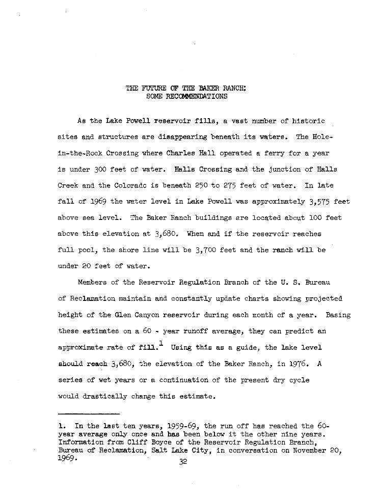
THE FUTURE OF THE BAKER RANCH: SOME RECOMMENDATIONS
As the Lake Powell reservoir fills, a vast number of historic
sites and structures are disappearing beneath its waters. The Hole-
in-the-Rock Crossing where Charles Hall operated a ferry for a year
is under 300 feet of water. Halls Crossing and the junction of Halls
Creek and the Colorado is beneath 250 to 275 feet of water. In late
fall of 1969 the water level in Lake Powell was approximately 3,575 feet
above sea level. The Baker Ranch buildings are located about 100 feet
above this elevation at 3,680. When and if the reservoir reaches
full pool, the shore line will be 3,700 feet and the ranch will be
under 20 feet of water.
Members of the Reservoir Regulation Branch of the U. S. Bureau
of Reclamation maintain and constantly update charts showing projected
height of the Glen Canyon reservoir during each month of a year. Basing
these estimates on a 60 - year runoff average, they can predict an
approximate rate of fill.l Using this as a guide, the lake level
should reach 3,680, the elevation of the Baker Ranch, in 1976. A
series of wet years or a continuation of the present dry cycle
would drastically change this estimate.
1. In the last ten years, 1959-69, the run off has reached the 60-year average only once and has been below it the other nine years. Information from Cliff Boyce of the Reservoir Regulation Branch, Bureau of Reclamation, Salt Lake City, in conversation on November 20, 1969. 32
A more immediate threat than flooding is the increased vandalism
that will occur as the level of the lake slowly rises and boaters
can reach the area with only a short walk. At present the buildings
are still in nearly perfect condition. Most of windows in the main
house are unbroken, the door is still on its hinges, and there are no
major changes from its appearance eight to ten years earlier when
Dr. C. Gregory Crampton visited the ranch. This is e~ually true of
the other buildings. The rock storeroom is in fine condition. Some
of the chinking is missing from the large log building, but it is
still very solid. The smaller log structure, the chicken house, is
deteriorating, but still has most of the pole-and-dirt roof. None
of the three have doors. A nice section of rail fence three and four
rails high is north and east of the buildings. There is considerable
litter about the area--a wooden feed trough near the remains of the
machine shed, a rusted mowing machine near the small log building,
wire and cable hanging on the corner of what was the blacksmith
shop, an old tub hanging on one end of the large log building, innumer
able rusting tin cans, the remains of at least two stoves, and the
iron furnishings of a sulky rake. Though evidence of recent visits
can be found--the main house was used as an overnight stop and camp
ing area for those who grazed cattle in the area until the government
bought the property--there has been little disturbance of the scene.
All the buildings are posted with signs identifying them as government
property and warning against trespass.
How much longer the site will exist in its present sheer, stark,
33
lonely beauty 1. ot considerable concern. When the great American
boat-borne touri.t and vandal discover. the site and can reach it
with a minimum of effort, things will change. Presumably the
windows will go first, then some of the smaller items such as
stove lids will be carried off. The fence rails will end up in a
fire. It is not beyond the realm of possibility that someone will
burn down the main house--after 50 years in the desert sun it will
be dry enough. And ultimately someone will attempt to carry off
either the mowing machine or one of the stoves. When the water
reaches the area it will cover ruins, not a ranch. With an effective
ranger/interpretive force of four In The Bullfrog District to cover
120 miles of main lake plus side canyons so numerous that no attempt
is made to even patrol them, protection of the ranch will be nil.
2 Halls Creek will be just one of the larger side canyons.
A decision to allow the ranch to be vandalized and flooded would
be both unwise and criminal. Baker Ranch was a single habitation in
a wilderness and a terminal point or way station on the trails that
crossed the Waterpocket Fold or came down Halls Creek. It was a desert
ranch and as such revealed the story of the hard life that settlers
who tried to live in this land of little water and much sand and stone
endured. 'Since it cannot be left in place, an unfortunate fact, it
should be moved to a point well above the farthest extent of the
Halls Creek embayment. A possible site for relocating the ranch
2. As one of the larger ones it may be patrolled periodically, but such intermittent security will be little protection against vandals.
34
buildings would be the supposed site of Ball. Ranch. It is 35 or
more feet above high water (3,700 ft.) and at least a hal.1' mile
from the farthest extent of the shore line. Since most guesses
place the old Hall Ranch near the stream in north half of section 6
T38sR10E, this could be used to tell the story of settlement on Halls
Creek from 1881 to 1961. There are other sites farther up Halls
Creek that could be used instead--in section 25 R9ET37S on the stream
that flows east from Waterpocket Fold to join Halls Creek, or on any
of the wide benches west of Halls Creek and north of Section 6
T38SR10E. The most important consideration is to save the ranch
buildings and preserve them for the enjoyment and understanding of
future generations.
The preservation of the buildings could be important both to
Glen Canyon National Recreation Area and to Capitol Reef National
Monument. One of the last official acts of President Lyndon B.
Johnson was to expand the monument to include nearly all of the
Waterpocket Fold. The boundaries of the two National Park Service
units meet ten miles north and west of the present location of the
Baker Ranch. A dirt road and jeep trail goes south from Notom in
the Fremont River Valley and follows the pioneer road down Halls
Creek. Winding through some very spectacular country along the
face of Waterpocket Fold, this might be developed into a scenic
drive in the future. There has also been some talk of ramming a
parkway through the canyon country to the north of the Halls Creek
and Bullfrog Creek Embayments. Though designated a "parkway" it
would be a high speed road. The cost will be astronomical. The
35
need will be miniscule. Damage to the environment of canyon and
cliff will be extensive. If such a road is ever developed, it would
pass near the several proposed relocations of the Baker Ranch build-
ings. However, it is doubtful that people roaring along at 70 miles
per hour are going to be deterred from their route by such an
attraction. A proper appreciation of what it meant to live in such
a harsh isolated area would be accentuated by an approach at a rela-
tively slow speed along the eroded and carved cliff face of the
Waterpocket Fold.
A program to preserve and transfer the ranch buildings should
be started in fiscal year 1971.3 First, historic structures reports
should be completed on all the buildings. It is especially important
that record photographs and drawings be done of each building so that,
should they be vandalized, they can be restored. Second, a decision
should be reached in cooperation with the park on where the complex
is to be located. Next, plans should be made on how to best move
the structures, including how much of the historic litter to transport
to the new site. The most feasible method, considering the total lack
of roads, is to dismantle the four main structures and reconstruct
them at the selected site. Fourth, and finally, the park should be
considering how to protect and interpret the buildings after they
3. The reason for doing it sooner rather than later is that now the site is still undamaged. Waiting is going to mean a greater chance of malicious destruction. Admittedly the water may not reach Baker Ranch in 1976, but each year it will get closer. It will be truly sad if Baker Ranch is forgotten now to become a crash project in 1975 or 1976.
have been moved. The approach to the site should be by a short
trail and the interpretation at the site be limited to a small folder
identifying the buildings and their use, and describing the hardships
of ranching in this isolated region. In brief, the visitor should
be able to feel the isolation and desolate surroundings with a
minimum of interpretive intrusion.
Preserved and protected, the ranch site can be an interesting
addition to the story of man in Glen Canyon. Only the upper portion
of the Hole-in-the-Rock route is still visible. All evidence of
mining in Glen Canyon is gone. Glen Canyon as seen by Powell in 1869
or Widtsoe in 1922 or river men in the 1950s is also gone. So many
historic sites, of varying degrees of importance, are now under a
hundred or more feet of water. Baker Ranch can be saved. It will
not be to the credit of the National Park Service if it is not.
37
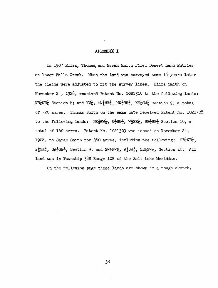
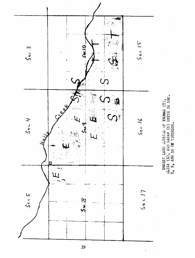
APPENDIX I
In 1907 Eliza, Thoma~and Sarah Smith filed Desert Land Entries
on lower Halls Creek. When the land was surveyed some 16 years later
the claims were adjusted to fit the survey lines. Eliza Smith on
November 24, 1928, received Patent No. 1021310 to the following lands:
NEiNEt Section 8; and NWt, SW!NEt, NW~Et, NEi-SWi- Section 9, a total
of 320 acres. Thomas Smith on the same date received Patent No. 1021308
to the following lands: NE~i-, wtswi-, W~Ei-, SEi-SE-t Section 10, a
total of 160 acres. Patent No. 1021309 was issued on November 24,
1928, to Sarah Smith for 360 acres, including the following: SEi-NEi-,
E~SEi-, swtsEt, Section 9; and swi-NWk, w~swi-, SEi-SWi-, Section 10. All
land was in Township 38s Range 10E of the Salt Lake Meridian.
On the following page these lands are shown in a rough sketch.
In .J GI
~
, ' .. '
II
-'" .... .,
\'1"-. . .
i
-~ f'·· .'. I ~.:,; . l< .. ,
1 .
I ~""'It •
~ \
I I " \ I
~ .:~"
.. trr., ...... ,
,~ :,~ ~~' <h "
'\I ¥;~ . \
-r .:; ... ,.
~~~
"t..
, -, ...
-..
j ~ ~:
V)I
---+-_. --+-!
39
L-,
~
t:J \/)
• .. ~ ,..... oJ E-i '-'i:=i ~~ OH
'-..!> :::t::a: E-iCfl -- • r", ,-... Lx1
o,J ':)CflO (I) '-'2
VI ~::X::oJ H22 CO po: ("/"\ t-<<Ill:-4 """'0) r~ ~
PO PZ
3 <.,~ t-<~~ ~'-'<Il fa <Il .. . N '" ~H
~~
r--.;
rJ Vt
APPENDIX II
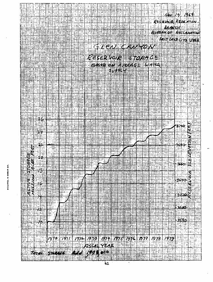
One of the jobs of the Reservoir Regulation Branch of the United
States Bureau of Reclamation is to maintain records on the present
and future storage of reservoirs throughout the area of their respon
sibility. The rate of fill for Glen Canyon's Lake Powell is based on
a 60-year runoff average. In November of 1969, Cliff Boyce of the
Reservoir Regulation Branch in the Salt Lake City Office of the
Bureau of Reclamation prepared a chart showing the projected fill
rate for Lake Powell. Based on this chart, the lake will reach the
Baker Ranch in 1976. Though admittedly only an estimate, this does
provide some measure of how soon the National Park Service must act
to move and save the buildings.
40
ci u c ~ .. " ... " ... w .. .. :> ... "
~ ,... I·t-~"" .,-+ :t-··~·, r" '-, T -~ - - -. ... r- , "tj- .--- -," ~ .-. t- ~ .• ~·:-T -~ .
41
BIBLIOGRAPHY
Manuscripts
Crampton, C. Gregory, Field Notes on Historical Sites in Glen Canyon, RG 310xes 1 and 2, Western History Collection, University of Utah Library.
Crampton, C. Gregory, Glen Canyon Historic Sites Survey Project-Proofs and Negatives for sites 29-53, RG 3, Box 4, Western History Collection, University of Utah Library.
Desert Land Act Patent No. 1021308 (Thomas Smith), RG 49, Federal Records Center, Suitland, Maryland.
Desert Land Act Patent No. 1021309 (Sarah Smith), RG 49, Federal Records Center, Suitland, Maryland.
Desert Land Act Patent No. 1021310 (Eliza Smith), RG 49, Federal Records Center, Suitland, Maryland.
Closed Grazing Files, Utah Grazing District No.5, Eugene Baker and Sons, File T29524, Bureau of Land Management, Denver Federal Records Center, Denver, Colorado.
Kane County Courthouse Records, Kanab, Utah: Assessment Rolls Kane County, 1925 Miscellaneous Records Books 0-2 and 0-3 Official Records Book 0-11 Patent Records Book H-3 Warranty Deed Records Book N-3 and N-4
Lamb, Foster, Appraisal Report of the Baker Ranch, 1962, Bureau of Reclamation Files, Salt Lake City Office.
Serial Registers of Land Entries, Bureau of Land Management, Salt Lake City Office.
Survey Notes and Plat on T38SR10E Salt Lake Meridian, Bureau of Land Management, Salt Lake City Office.
42
Personal Interview
Baker, Carlyle. Telephone conversation with Mr. Baker of Teasdale, Utah, December 30, 1969, by the author.
Books and Periodicals
Carroll, Elsie C., History of Kane County, Salt Lake City, utah Printing Company, 1960.
Crampton, C. Gregory, Historical Sites in Glen Canyon, Mouth of Hansen Creek to Mouth of San Juan River, University of Utah Anthropological Papers No. 61 (Glen Canyon Series No. 17), December 1962.
Crampton, C. Gregory, Outline Histor of the Glen Can on Re 1922, University of Utah Anthropological Paper No. 2 Series #9), September 1959.
Crampton, C. Gregory, Standing Up Country: The Canyonlands of Utah and Arizona, New York, Alfred A. Knopf, 1964.
Federal Writers Project, Utah,A Guide To The State, New York, Hastings House, 1941.
Freeman, Lewis R., Down The Grand Canyon, New York, Dodd, Mead and Company, 1924.
Gregory, Herbert E.,and Moore, R. C., "The Kaiparowits Region: A Geographic and Geologic Reconnaissance of Parts of Utah and Arizona," USGS Professional Paper 164, Washington, GPO, 1931.
Hunt, Charles B.; Averitt, P.; and Miller, R.j "Geology and Geography of The Henry Mountains Region,Utah," USGS Professional Paper 228, Washington, GPO, 1953.
Lyman, Albert R., The Edge Of The Cedars: Walter C. Lyman and the San Juan Mission, New York, Carlton Press, 1966.
Mortonsen, A. R. (ed.), "A Journal of John A. Widtsoe; Colorado River Party, Sept. 3-19,1922," Utah Historical Quarterly, 23 (1955), pp. 195-233.
Roberts, N. Keith and Ge.rdner, B., "Livestock and The Public Lands," Utah Historical Quarterly, 32 (Summer 1964), pp. 285-301.
Rusho, W. L., "River Running 1921: The Diary of E. L. Kolb," Utah Historical Quarterly, 37 (Spring 1969), pp. 269-83. ----
University of Chicago, A Dictionary of American English on Historical Principles, 4 vols. Chicago, University of Chicago Press, 1944.
43

Illustrations
44
1. Area Map, Baker Ranch
It has been called "standing up country," this land of canyons
and cliffs in southern Utah and northern Arizona. Located in the
midst of this spectacular region, the Baker Ranch occupies a horizon
tal bench in a land of the vertical. Just south of the Garfield
Kane County line at the end of Hall Mesa, the ranch is circled in
the attached map.
Some idea of the ruggedness of the land can be gathered from
the closeness of the 200-foot contour intervals on the map. In
the northeastern corner is the Trachyte Ranch, which Eugene
Baker sold before he purchased the ranch on Halls Creek. The entire
course of Halls Creek is shown, from Bitter Creek Divide to the
Colorado River. The region between the Waterpocket Fold and the
eastern edge of the map is the approximate area grazed by the Baker's
cattle during their tenure on the ranch. In the northwestern quarter
of the map just south of Swap Mesa is The Post, where Eugene and
Carlyle Baker transferred their supplies from wagon to mules for the
journey to the ranch.
This segment is part of the Escalante, Utah--Arizona Sheet;
Western United States 1:250,000 Series, published by the United States
Geological Survey. The map was produced in 1956 ,tTi th a limited revi
sion in 1962. The scale is approximately 1/4 inch to the mile.
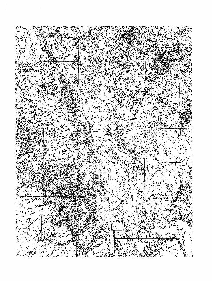
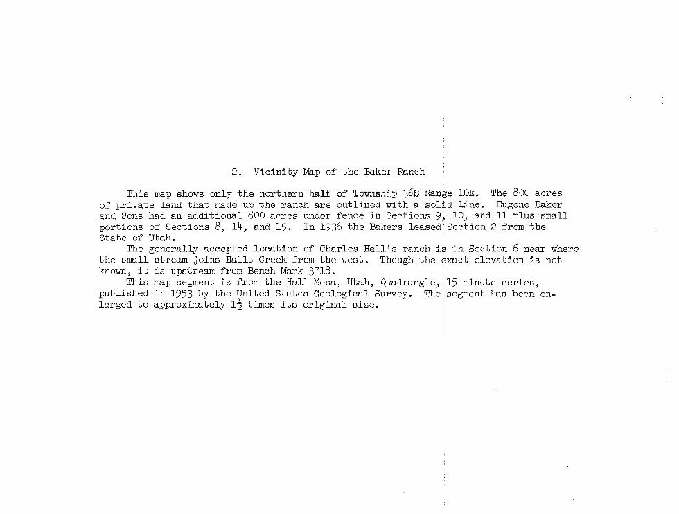
2. Vicinity Map of the Baker Ranch
This map shows only the northern half of Township 36s Range 10E. The 800 acres of private land that made up the ranch are outlined with a solid line. Eugene Baker and Sons had an additional 800 acres under fence in Sections 9, 10, and 11 plus small portions of Sections 8, 14, and 15. In 1936 the Bakers leased Section 2 from the State of Utah.
The generally accepted location of Charles Hall's ranch is in Section 6 near where the small stream joins Halls Creek from the west. Though the exact elevation is not known, it is upstream from Bench Mark 3718.
This map segment is from the Hall Mesa, Utah, Quadrangle, 15 minute series, published in 1953 by the United States Geological Survey. The segment has been enlarged to approximately l~ times its original size.
iii
o
.... !? fl!:
L/ ! I ~)
~ C J /) GAR..fINELD CO I / -~:...~~ -Y--"KA E ~};>f I --- ... • _ ..
1 \, t i . \,
3 '~t 2 ~ 1 ,-, '<-0,,/
(rfr , ,·-:c64 3680 £:"'1
)
... II.!
g
······10··
; .}" ,'i t l"
38~ti' G~ ! a:
12 t, 11 I ~ -~'i\s'oo I ,...., "-, 1 "
L "~ '"
t15914~ ", ~/' '( . i
\.. '"" / .A .' I . '. r .... " . ' . fl~ 44:,':... '+_..- c/' i \:f1
~, '~e-... ""
" ._. , ...... ""'" <.~- ".';~ 1 ';
.. :~ /l ~ / }'~'/ "); \;:.0 13 j~ .//
"i,~. (r~ VAS
i '. 5U' ~Nt'lRlR" 15
~c" f-'
4t'1J1'" £'1('10
o ;,:;, .. MItES E',[.Jii~=r,:::E~-:.:E3::::1£faC::E~~~~~~~3:::====:- -::=====,_",_::=r~=-,,::-..::~}=:,~' -----.
3000 3000 6000 9000 lSOOO 18000 21000 FEET
1 ,5 0 1 2 3 4 5 KILOMETERS ~S::::::~i::;;= :! .====:..:, .. =::e-0C=:::= ~~'::0"::::.=r==: ,,···,':=3
CONTOUR INTERVAL 80 FEET DASHED LINES REPRESENT 40 FOOT CONTOURS
DATUM IS MEAN SEA LEVEL
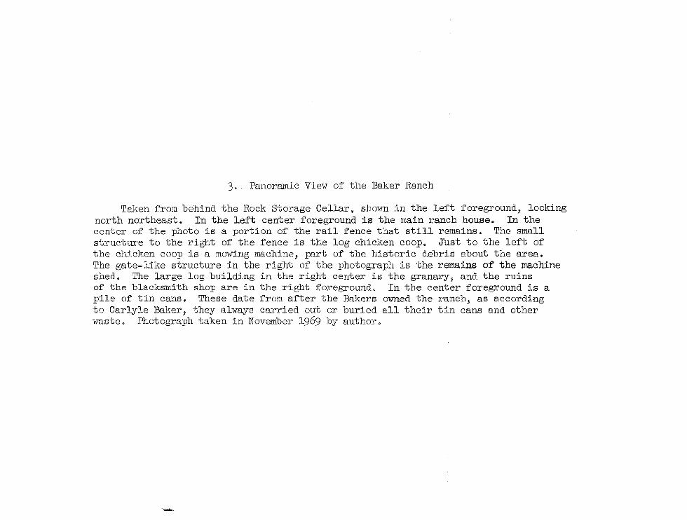
3. Panoramic View of the Baker Ranch
Taken from behind the Rock storage Cellar, shown in the left foreground, looking north northeast. In the left center foreground is the main ranch house. In the center of the photo is a portion of the rail fence that still remains. The small structure to the right of the fence is the log chicken coop_ Just to the left of the chicken coop is a mowing machine, part of the historic debris about the area. The gate-like structure in the right of the photograph is the remains of the machine shed. The large log building in the right center is the granary, and the ruins of the blacksmith shop are in the right foreground. In the center foreground is a pile of tin cans. These date from after the Bakers owned the ranch, as according to Carlyle Baker, they always carried out or buried all their tin cans and other waste. Photograph taken in November 1969 by author •
.-.
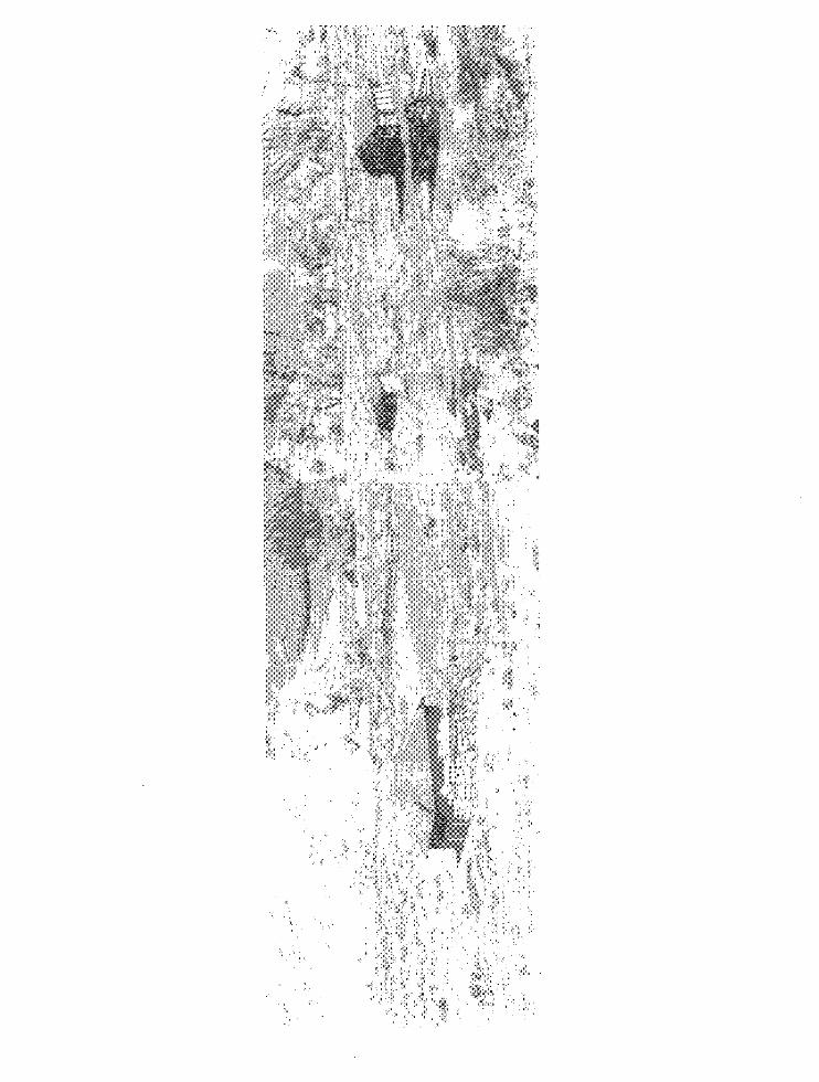
4. Baker Ranch, 1960
This photograph, taken in June 1960 by Dr. C. Gregory Crampton of the University of Utah, shows three of the four remaining buildings at Baker Ranch. Shown is the rear of the main house, the western wall of the storage cellar, and the front of the small log chicken coop, Building D. Note the tree trunks and limbs between the main house and the chicken coop. Photograph from Glen Canyon Historic Sites Survey Project, Proofs and Negatives, Sites 29-53, RG 3, Box 4, Western History Collection, University of Utah Library.
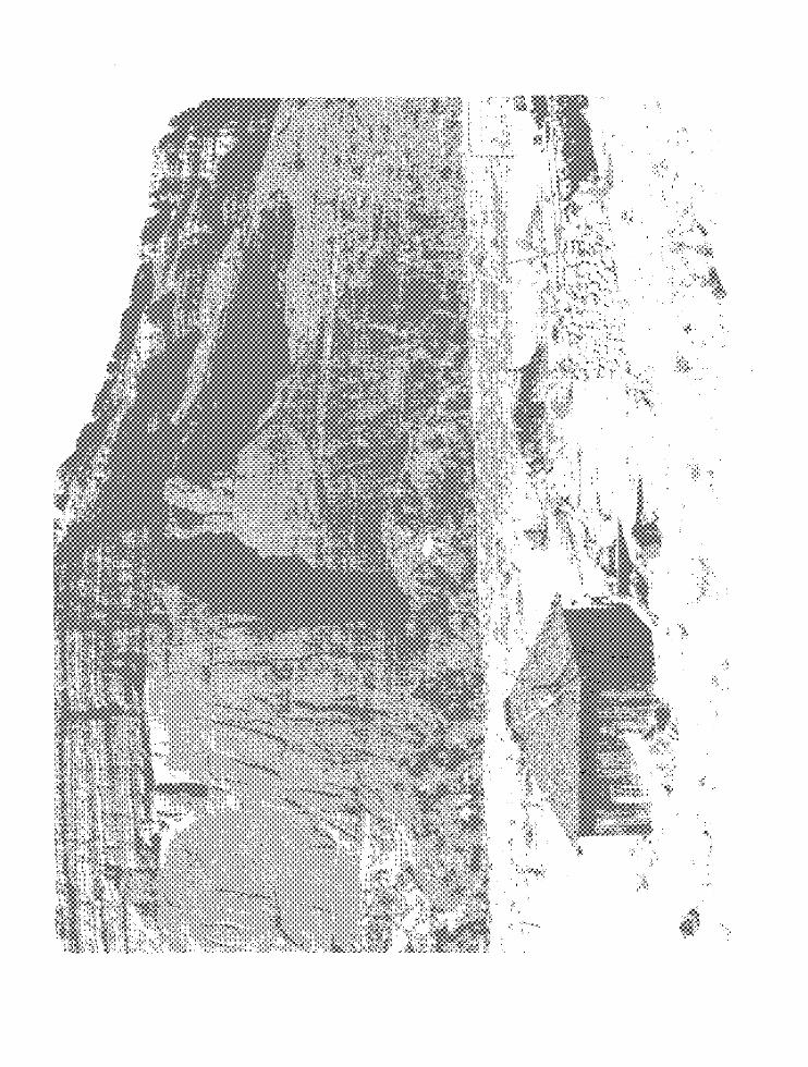
5. Main Ranch House
This three-room frame house was built in 1921 or 1922 by Eugene Baker with lumber salvaged from an oil camp near the Circle Cliffs, 30 miles north and west of the ranch. Photograph taken in November 1969 by the author. (Unless otherwise identified all photos in the report were taken by the author.)
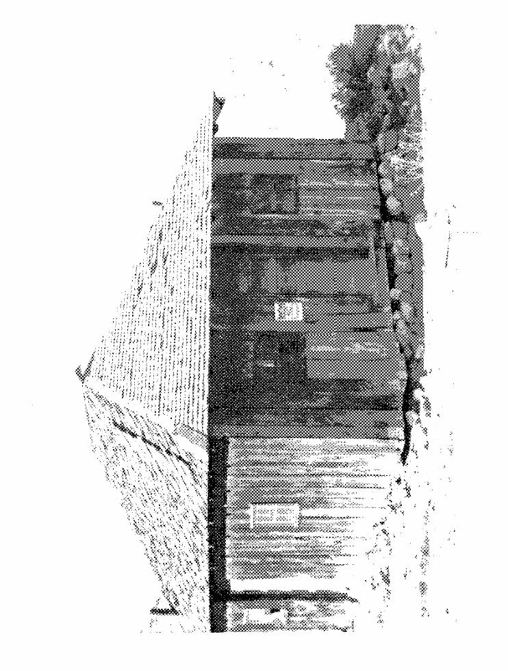
6 v· ~I '[- 1. 'f' 1 • jYJ!u.n J .. 01We J .lar,er .. 1tUW . .l
Thj.s photograph taken from hl front of' the storage cellct:L' (.,hows the kitchen door in the matn house. 'ro the left are the remaJ.rw of an old stove. 'J.'he shingle roof is still in fair condition.
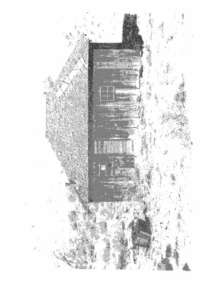
7 A. Rear of the Main House
The washpan hanging in the window gives evidence that the house was used until recent times. Inside the structure is additional evidence of its use as an overnight camping stop: several jars of matches, a hat hung by a wire from a rafter to protect it from mice, and a 1964 Chevrolet Truck catalogue.
7 B. Side of Baker Ranch House
To the left of the house can be seen part of the blacksmith shop. On the right a portion of the storage cellar is visible. Note especially the size of the planks used in building the structure.
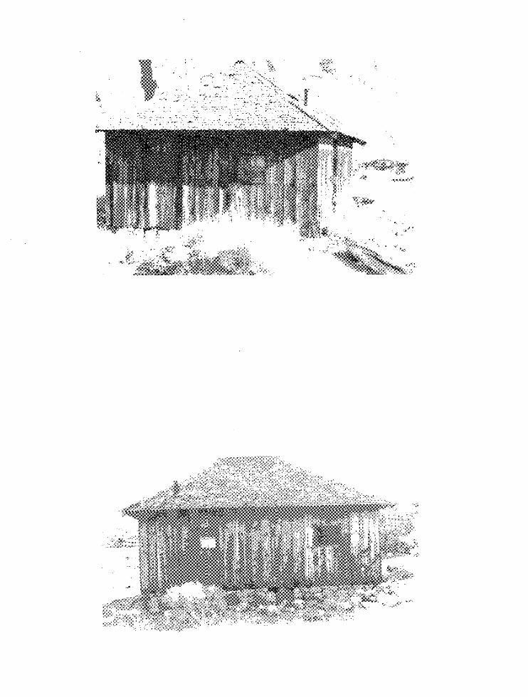
8A. Rock Store Room, 1960
This photograph taken by Cramp:;on in 1960 shovrs t::le fr'ont of the store room as it looked about ten years ago. Glen Cm12Ton I1istor:Lc Sites Survey, RG 3, Box 4, 'western History Collection, Unive:csi of Utah Library.
8 B. R:)ck Store Room, 1969
The store room from a slightly different angle window as well. as the entry way. A cOD1:tJarison of the S1101,JS how l:I:t-;:·le deterioration b.as occu..rred in ~vhis last nine years.
the s:Lde t'iW photographs
dl1l'ing the
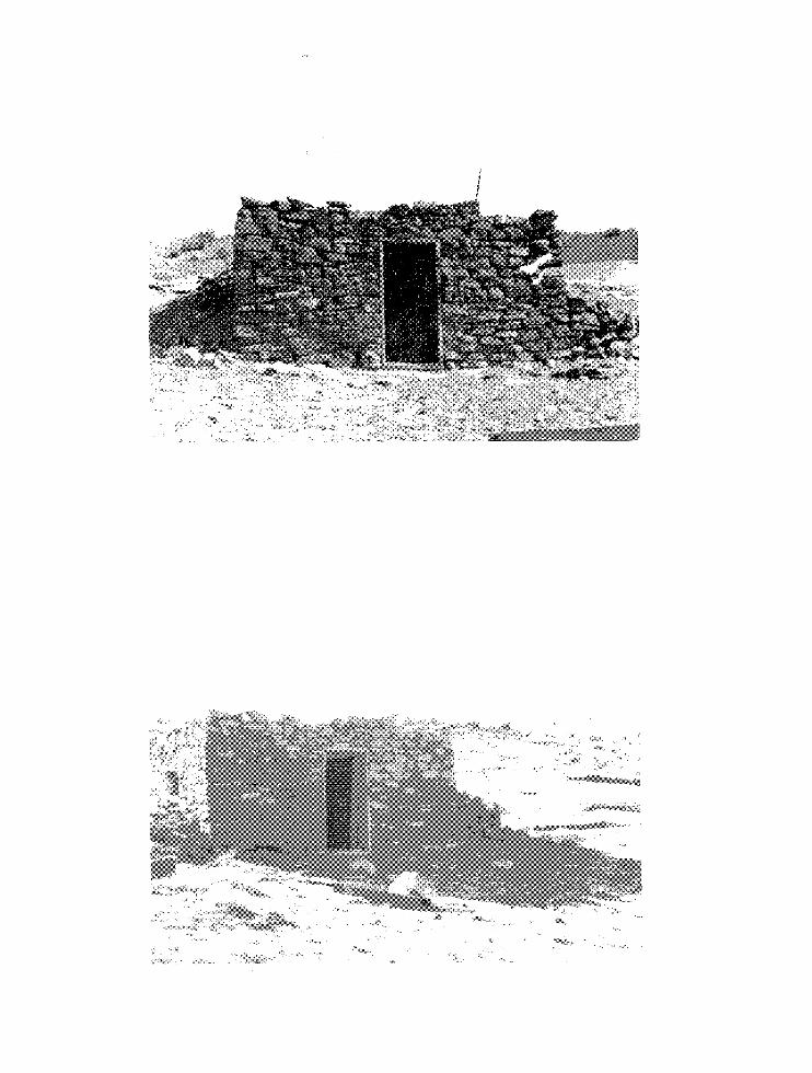
9 A~ Side \rievT of tl'1e 3.ock Storage Cellar
Built :l.l'lto "Cne slope of the g:cou.nd south or the main. houses "'0118 store room 'liTith l-rS dooT and single windoVT was a cool :::;lace to ~'Ceep canned goods and other items. In the :foTeg'i'o1L."ld car: "be seen some of the tir:o cans and other Tefu_se that litter tlle 8i te ~
'the ::~oc'~'\.s ""Goget:~e? l:as not cie-c.eriorated appre·:~.tablJ' in tb.e las:: ;::alf = c: e nt ur~r 0
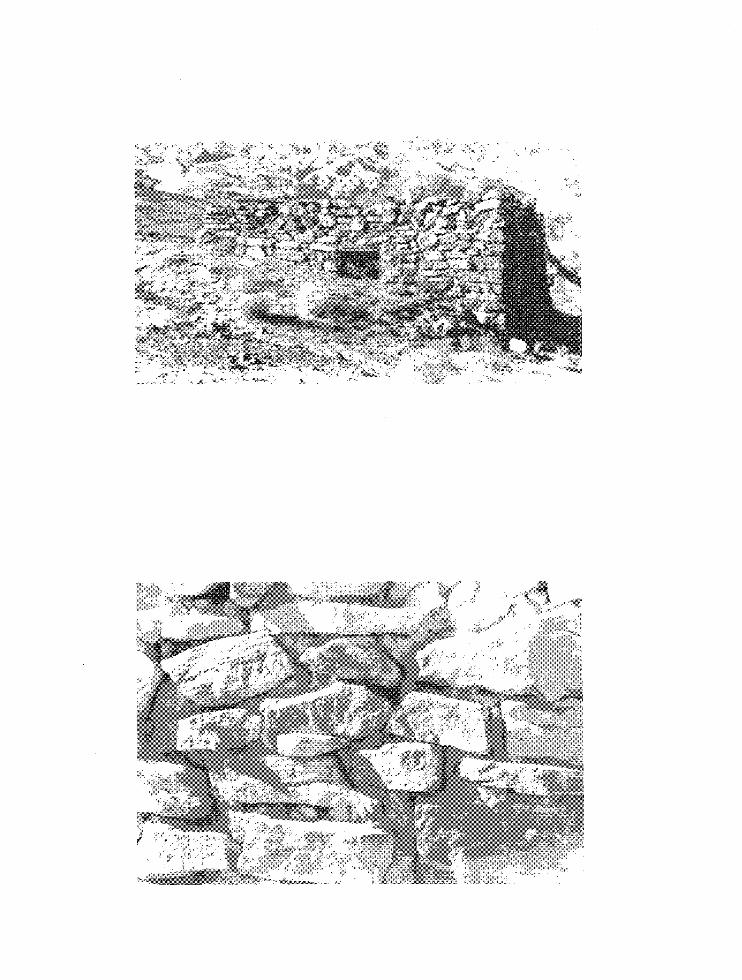
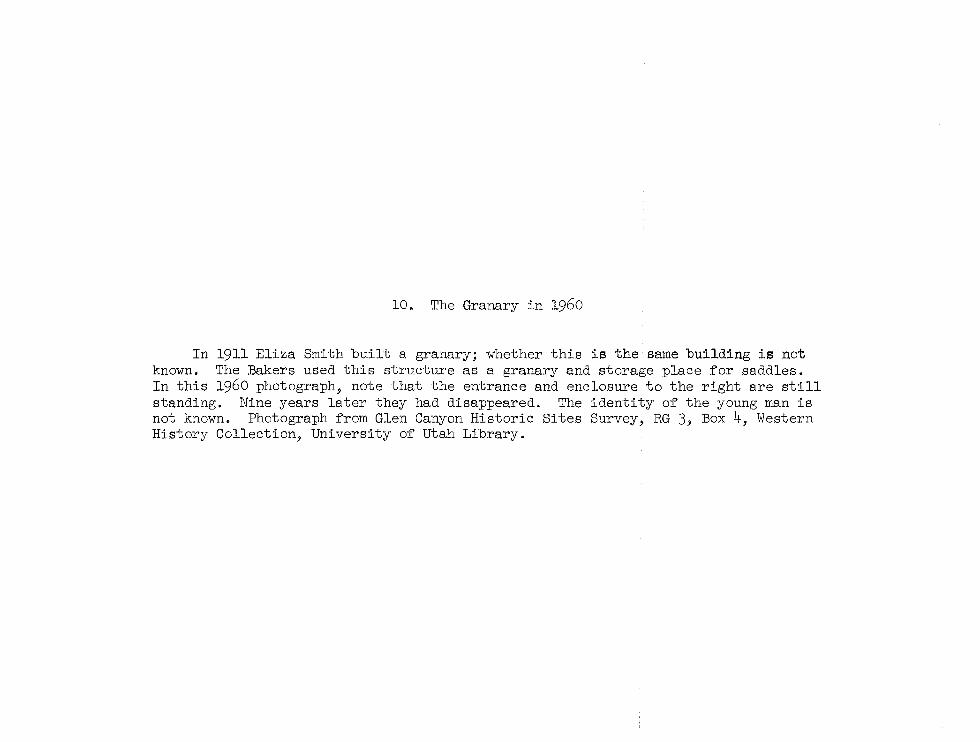
10. The Granary in 1960
In 1911 Eliza Smith built a granary; whether this is the same building is not known. The Bakers used this structure as a granary and storage place for saddles. In this 1960 photograph, note that the entrance and enclosure to the right are still standing. Nine years later they had disappeared. The identity of the young man is not known. Photograph from Glen Canyon Historic Sites Survey, RG 3, Box 4, Western History Collection, University of Utah Library.
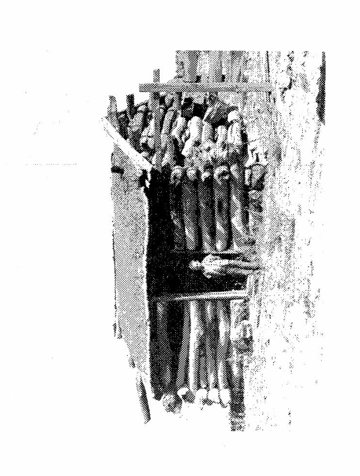
11, The Baker Rtcmeh Granary in 1969
In the nine years sinee Dr. C. Gregory Crampton vis:Lted and tYIU 6i te, the granary has changed very IHtle. Some of' the ehin.:':":ing has fallen from between the logs and the roof has lost a bj_t more of' its dirt cover. Must notieeable is the absence of the plank fence on the right side of tbe building. 'I.'o the right rear ln the photo can be seen a portion of the blacksm:tth shop.

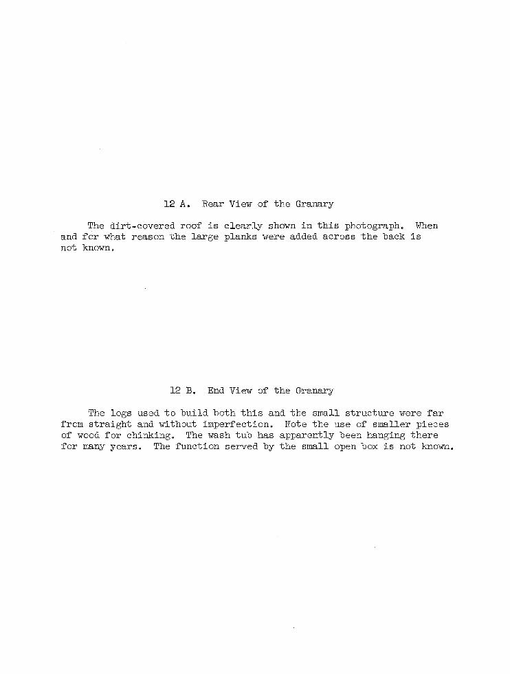
12 A. Rear View of the Granary
The dirt-covered roof is clearly shown in this photograph. When and for what reason the large planks were added across the back is not known.
12 B. End View of the Granary
The logs used to build both this and the small structure were far from straight and without imperfection. Note the use of smaller pieces of wood for chinking. The wash tub has apparently been hanging there for many years. The function served by the small open box is not known.
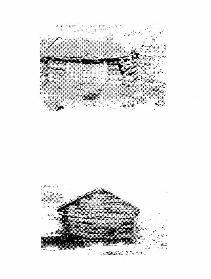
· '",'
f
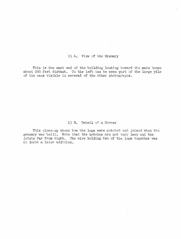
13 A. View of the Granary
This is the east end of the building looking toward the main house about 200 feet distant. To the left can be seen part of the large pile of tin cans visible in several of the other photographs.
13 B. Detail of a Corner
This close-up shows how the logs were notched and joined when the granary was built. Note that the notches are not very deep and the joints far from tight. The wire holding two of the logs together was no doubt a later addition.
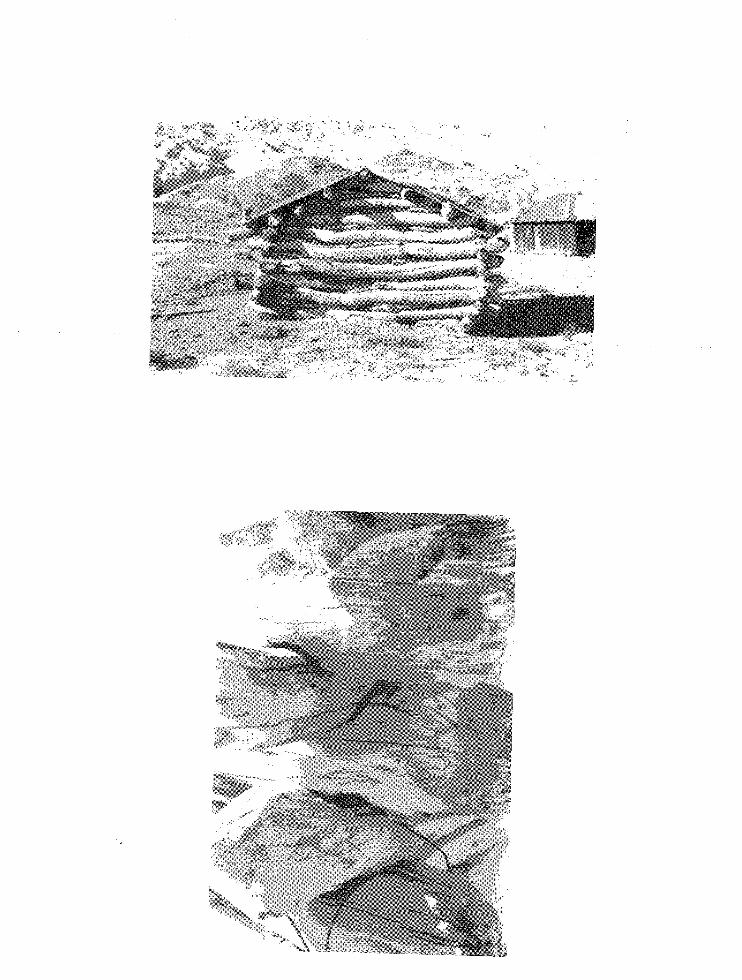
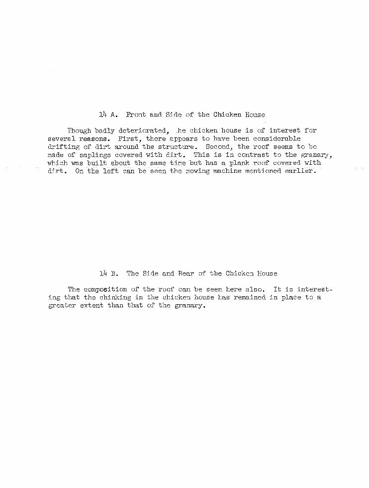
14 A. Front and Side of the Chicken House
Though badly deteriorated, .he chicken house is of interest for several reasons. First, there appears to have been considerable drifting of dirt around the structure. Second, the roof seems to be made of saplings covered with dirt. This is in contrast to the granary, which was built about the same time but has a plank roof covered with dirt. On the left can be seen the mowing machine mentioned earlier.
14 B. The Side and Rear of the Chicken House
The composition of the roof can be seen here also. It is interesting that the chinking in the chicken house has remained in place to a greater extent than that of the granary_
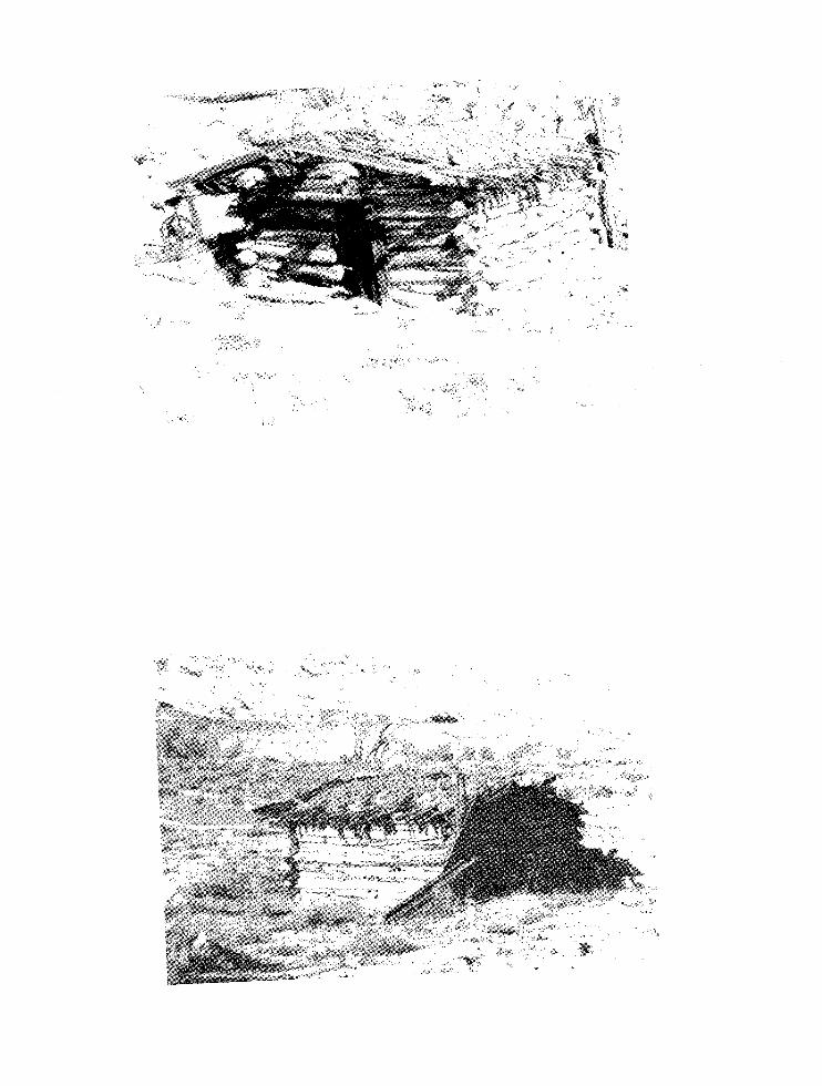
15. Ruins of the Blacksmith Shop in 1960
A comparison of this photograph with the two that follow will show how some of the corrals and pens have disappeared in the last decade. There is evidence of a pen attached to the granary in 1960. Where the steel cable came from is not known. Very possibly it was salvaged from one of the dredging operations that took place along the Colorado River. Photograph, taken by Dr. Crampton, is part of the Glen Canyon Historic Sites Survey Material in the Western History Collection of the University of Utah Library.
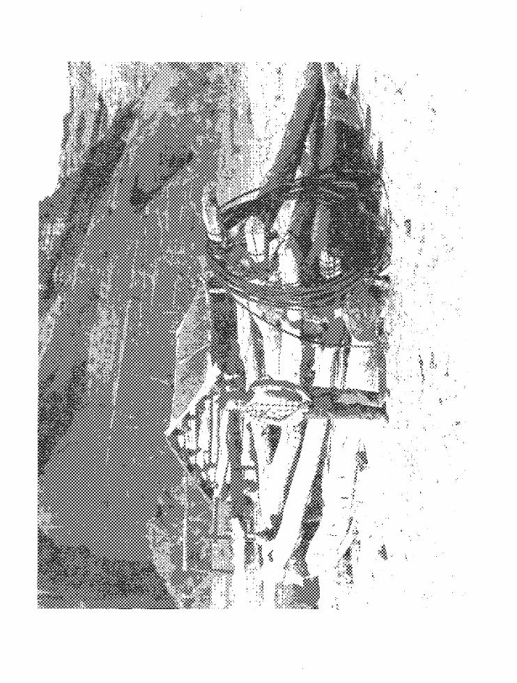
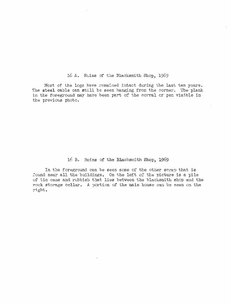
16 A. Ruins of the Blacksmith Shop, 1969
Most of the logs have remained intact during the last ten years. The steel cable can still be seen hanging from the corner. The plank in the foreground may have been part of the corral or pen visible in the previous photo.
16 B. Ruins of the Blacksmith Shop, 1969
In the foreground can be seen some of the other scrap that is found near all the buildings. On the left of the picture is a pile of tin cans and rubbish that lies between the blacksmith shop and the rock storage cellar. A portion of the main house can be seen on the right.
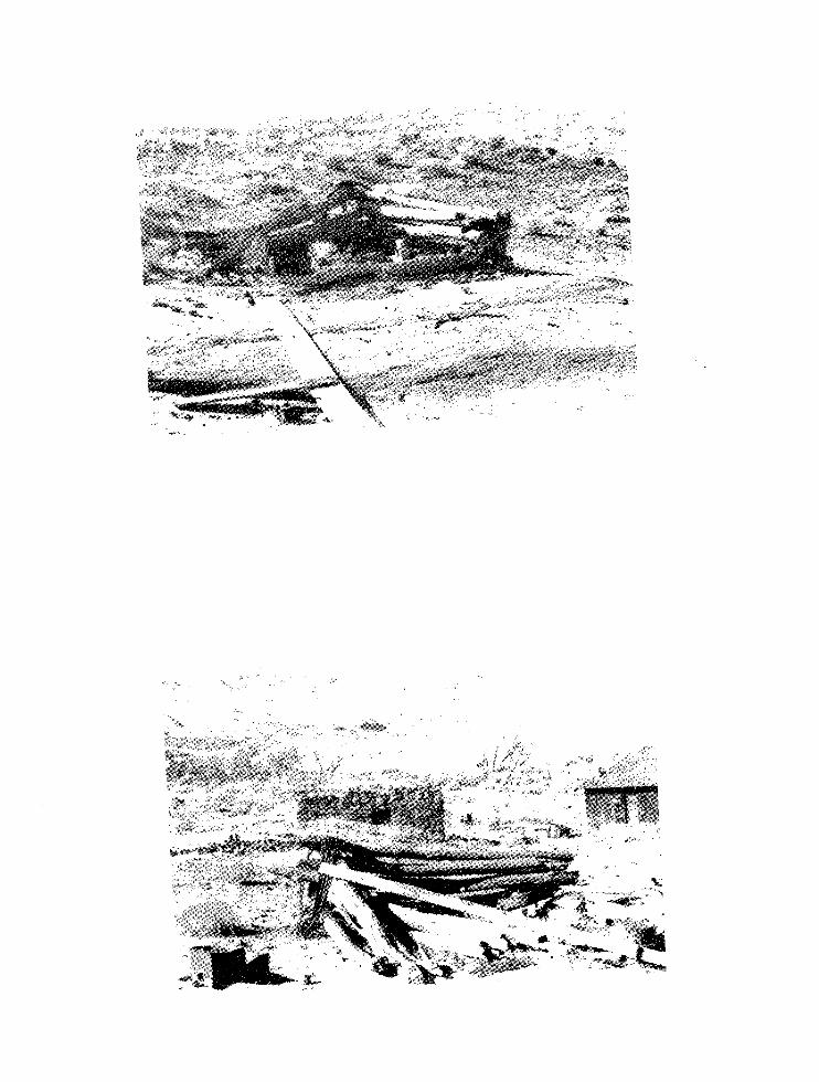
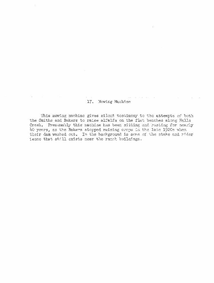
17. Mowing Machine
This mowing machine gives silent testimony to the attempts of both the Smiths and Bakers to raise alfalfa on the flat benches along Halls Creek. Presu~3bly this machine has been sitting and rusting for nearly 40 years, as the Bakers stopped raising crops in the late 19206 when their dam washed out. In the background is SODle of the stake and rider ience that still exists near the ranch buildings.
-
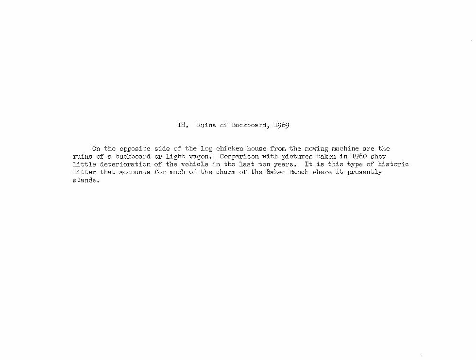
18. Ruins of Buckboard, 1969
On the opposite side of the log chicken house from the mowing machine are the ruins of a buckboard or light wagon. Comparison with pictures taken in 1960 show little deterioration of the vehicle in the last ten years. It is this type of historic litter that accounts for much of the charm of the Baker Ranch where it presently stands.
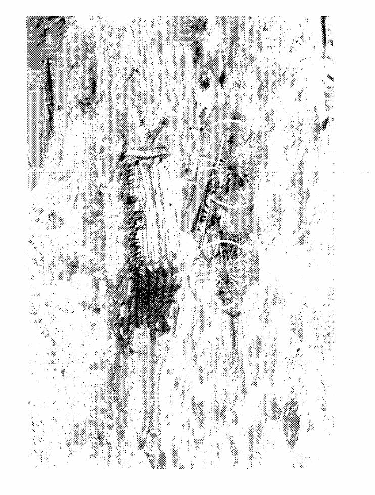
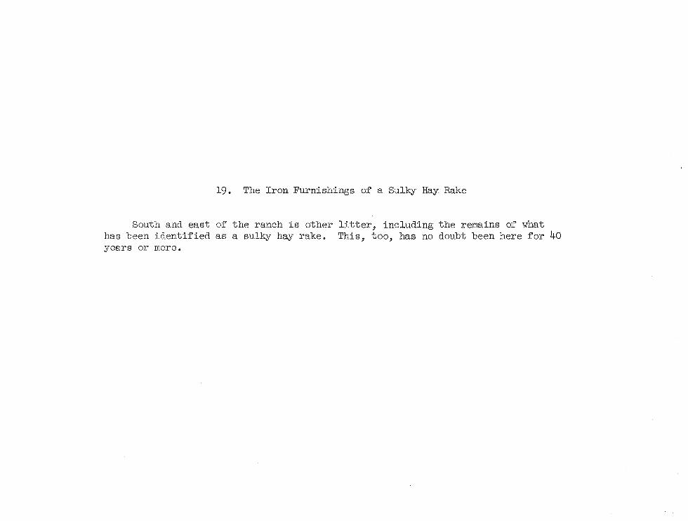
19. The Iron Furnishings of a Sulky Hay Rake
South and east of the ranch is other litter, including the remains of what has been identified as a sulky hay rake. This, too, has no doubt been here for 40 years or more.
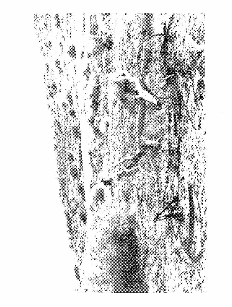
•
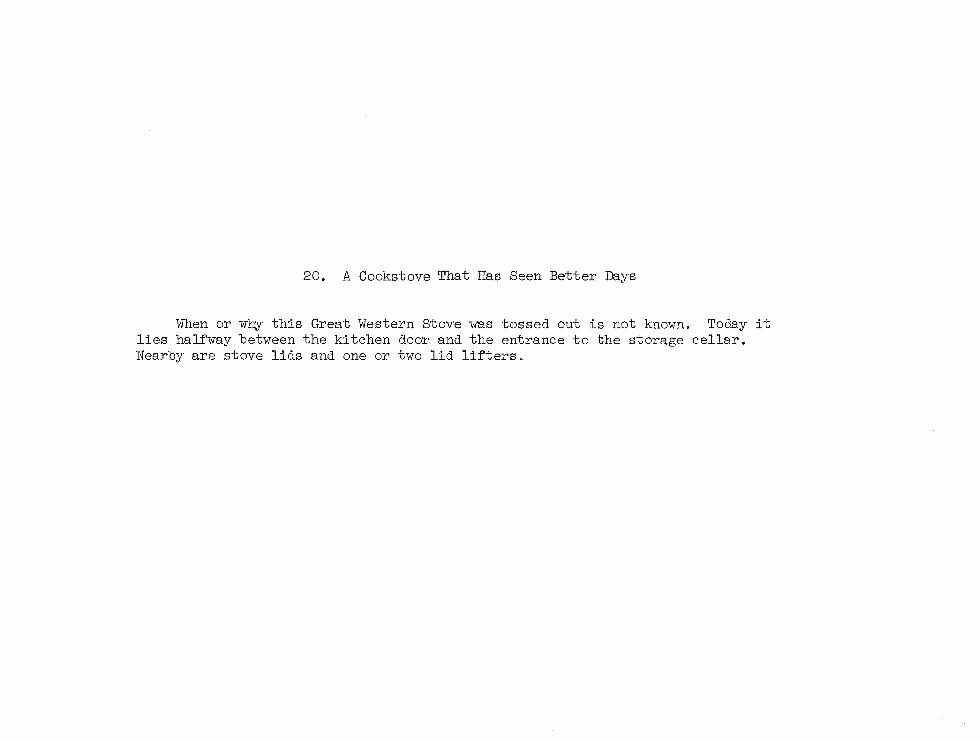
20. A Cookstove That Has Seen Better Days
\Vhen or why this Great Western Stove was tossed out is not known. Today it lies halfway between the kitchen door and the entrance to the storage cellar. Nearby are stove lids and one or two lid lifters.
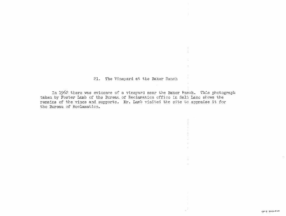
21. The Vineyard at the Baker Ranch
In 1962 there was evidence of taken by Foster Lamb of the Bureau remains of the vines and supports. the Bureau of Reclamation.
a vineyard near the Baker Ranch. This photograph of Reclamation office in Salt Lake shows the Mr. Lamb visited the site to appraise it for
GP 0 893-135