Embed Size (px)
Citation preview
GLG 410 FINAL PROJECT:
VA EARTHQUAKE ANALYSIS
Introduction:
August 23rd, 2011 a magnitude 5.8 earthquake struck in Louisa County, 5 miles SSW from Mineral, VA.
Largest earthquake east of the Rocky Mountains since 1897.
The quake was felt from South Carolina to Maine, and even closed parts of DC.
Geology of Piedmont Region
The earthquake occurred in the VA seismic zone, in the Piedmont Region.
Originally formed as zone of repeated continental collision that created the Appalachian Mountains.
Numerous reverse faults formed during periods of orogeny were reactivated during Mesozoic extension.
Faults
Epicenter lies between Spotsylvania fault and Chopawamsic Fault.
Earthquake shows reverse slip faulting on a north to northeast striking fault plane (~5-15km long slip)
GOOGLE EARTH
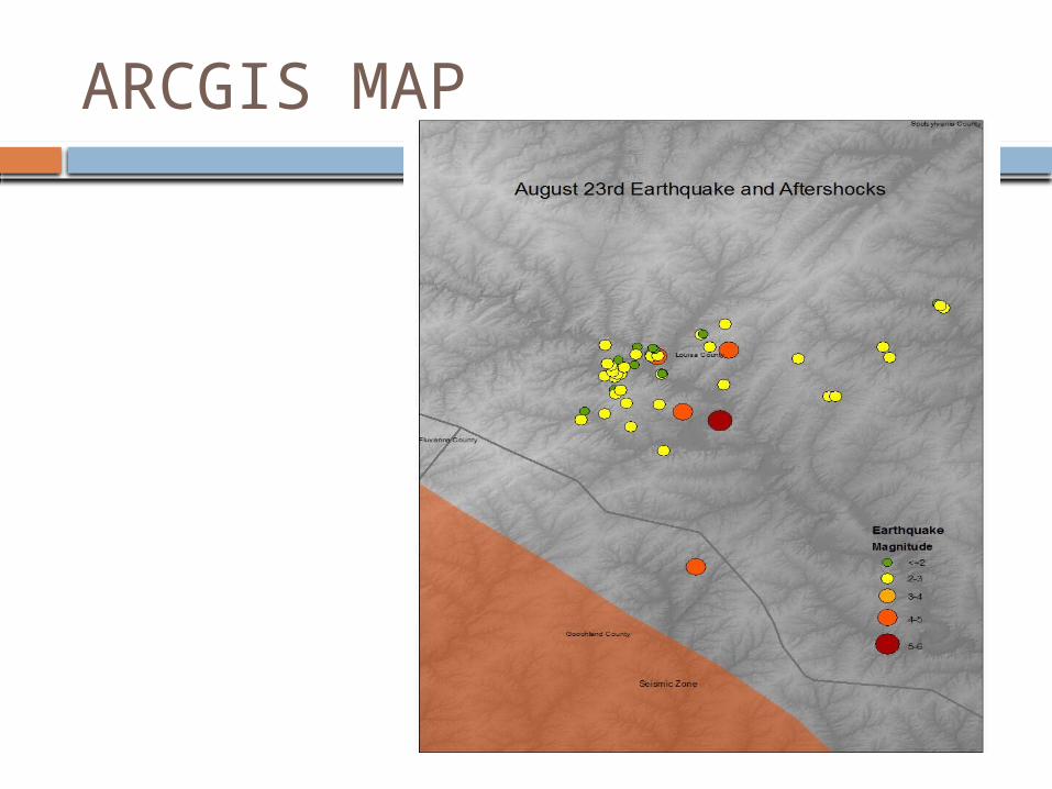
ARCGIS MAP
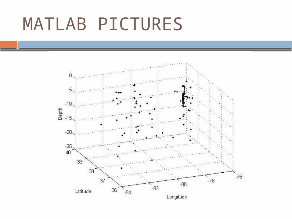
MATLAB PICTURES
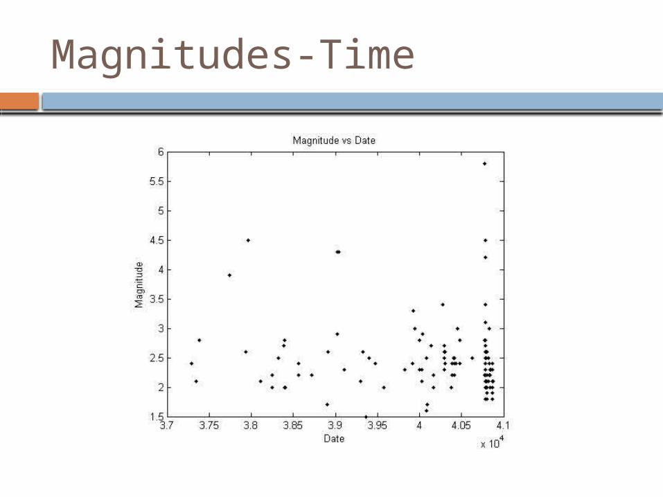
Magnitudes-Time
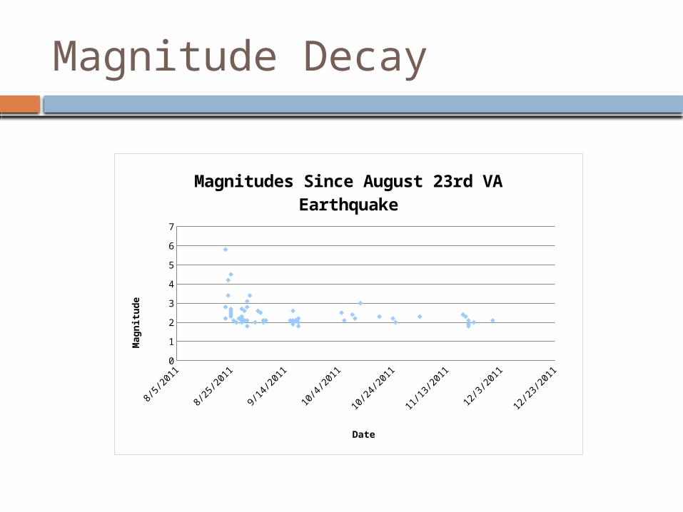
Magnitude Decay
8/5/2011 8/25/2011 9/14/2011 10/4/2011 10/24/2011 11/13/2011 12/3/2011 12/23/20110
1
2
3
4
5
6
7
Magnitudes Since August 23rd VA Earthquake
Date
Magnit
ude
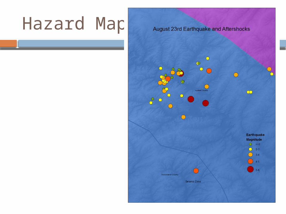
Hazard Map
Further Research
Create more detailed KML file for GOOGLE earth.
Research future aftershocks
Plot faults on arcmap
Thank You
Have a good break!