Embed Size (px)
Citation preview
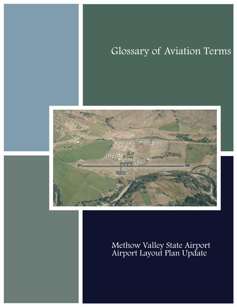
Airport Layout Plan UpdateMethow Valley State Airport
Glossary of Aviation Terms
Methow Valley State Airport
Airport Layout Plan Report
September 2010 G-1 Glossary
Century West Engineering
GLOSSARY OF AVIATION TERMS
The following glossary of aviation terms was compiled and edited by David Miller, AICP for use in
aviation planning projects.
Accelerate Stop Distance Available (ASDA) – The length of the takeoff run available plus the length
of a stopway, when available.
Agricultural Aviation – The use of fixed-wing or rotor-wing aircraft in the aerial application of
agricultural products (i.e., fertilizers, pesticides, etc.).
Air Cargo - All commercial air express and air freight with the exception of airmail and parcel post.
Air Carrier/Airline - All regularly scheduled airline activity performed by airlines certificated in
accordance with Federal Aviation Regulations (FAR Part 121).
Air Taxi - Operations of aircraft "for hire" for specific trips, commonly referred to an aircraft
available for charter (FAR Part 135).
Aircraft Approach Category - A grouping of aircraft based how fast they come in for landing. As a
rule of thumb, slower approach speeds mean smaller airport dimensions and faster speeds mean
larger dimensions from runway widths to the separation between runways and taxiways.
The aircraft approach categories are:
Category A - Speed less than 91 knots;
Category B - Speed 91 knots or more but less than 121 knots
Category C - Speed 121 knots or more but less than 141 knots
Category D - Speed 141 knots or more but less than 166 knots
Category E - Speed 166 knots or more
Aircraft Operation - A landing or takeoff is one operation. An aircraft that takes off and then lands
creates two aircraft operations.
Methow Valley State Airport
Airport Layout Plan Report
September 2010 G-2 Glossary
Century West Engineering
Aircraft Owners and Pilots Association (AOPA) – International aviation organization.
Aircraft Holding Area – An area typically located adjacent to a taxiway and runway end designed to
accommodate aircraft prior to departure (for pre–takeoff engine checks, instrument flight plan
clearances, etc.). Per FAA design standards, aircraft holding areas should be located outside the
runway safety area (RSA) and obstacle free zone (OFZ) and aircraft located in the holding area
should not interfere with normal taxiway use (taxiway object free area). Sometimes referred to as
holding bays or “elephant ear.” Smaller areas (aircraft turnarounds) are used to facilitate aircraft
movement on runways without exit taxiways where back-taxiing is required.
Airplane Design Group - A grouping of airplanes based on wingspan. As with Approach Category,
the wider the wingspan, the bigger the aircraft is, the more room it takes up for operating on an
airport. The Airplane Design Groups are:
Group I: Up to, but not including 49 feet
Group II: 49 feet up to, but not including 79 feet
Group III: 79 feet up to, but not including 118 feet
Group IV: 118 feet up to, but not including 171 feet
Group V: 171 feet up to, but not including 214 feet
Group VI: 214 feet up to, but not including 262 feet
Airport - A landing area regularly used by aircraft for receiving or discharging passengers or cargo,
including heliports and seaplane bases.
Airport Improvement Program (AIP) - The funding program administered by the Federal Aviation
Administration (FAA) with user fees which are dedicated to improvement of the national airport
system. This program currently provides 95% of funding for eligible airport improvement projects.
The local sponsor of the project (i.e., airport owner) provides the remaining 5% known as the
"match."
Airport Layout Plan (ALP) - The FAA approved drawing which shows the existing and anticipated
layout of an airport for the next 20 years or so. An ALP is prepared using FAA design standards.
Airport Reference Code (ARC) - An FAA airport coding system. The system looks at the types of
aircraft which use an airport most often and then based upon the characteristics of those airplanes
(approach speed and wing span), assigns a code. The code is then used to determine how the
Methow Valley State Airport
Airport Layout Plan Report
September 2010 G-3 Glossary
Century West Engineering
airport is designed and what design standards are used. An airport designed for a Piper Cub (an
aircraft in the A-I approach/design group) would take less room than a Boeing 747 (an aircraft in the
D-V approach/design group).
Airport Reference Point (ARP) – The approximate mid-point of an airfield that is designated as the
official airport location.
Airports District Office (ADO) - The "local" office of the FAA that coordinates planning and
construction projects. Staff in the ADO is typically assigned to a particular state, i.e., Oregon, Idaho,
or Washington. The ADO for Oregon, Washington and Idaho is located in Renton, Washington.
Airspace - The area above the ground in which aircraft travel. It is divided into corridors, routes, and
restricted zones for the control and safety of traffic.
Alternate Airport – An airport that is available for landing when the intended airport becomes
unavailable. Required for instrument flight planning in the event that weather conditions at
destination airport fall below approach minimums (cloud ceiling or visibility).
Annual Service Volume (ASV) - An estimate of how many airplanes and airport can handle based
upon the number and types of runways, the aircraft mix (large vs. small, etc), and weather
conditions with a “reasonable” amount of delay. ASV is a primary planning standard used to
determine when a runway (or an airport) is nearing its capacity, and may require new runways or
taxiways. As operations levels approach ASV, the amount of delay per operation increases; once
ASV is exceeded, “excessive” delay generally exists.
Approach End of Runway - The end of the runway used for landing. Pilots generally land into the
wind and choose a runway end that best aligns with the wind.
Approach Surface - Also FAR Part 77 Approach or Obstacle Clearance Approach - An imaginary
(invisible) surface which rises off the ends of a runway which must be kept clear to provide airspace
for an airplane to land or take off in. The size of the approach surface will vary depending upon how
big and how fast the airplanes are, and whether or not the runway has an instrument approach for
landing in bad weather.
Apron - An area on an airport designated for the parking, loading, fueling, or servicing of aircraft
(also referred to as tarmac and ramp).
ARFF - Aircraft Rescue and Fire Fighting, i.e., an on airport response required for certificated
commercial service airports (see FAR Part 139).

Methow Valley State Airport
Airport Layout Plan Report
September 2010 G-4 Glossary
Century West Engineering
Automated Surface Observation System (ASOS) and Automated Weather Observation System
(AWOS) – Automated observation systems providing continuous on-site weather data, designed to
support aviation activities and weather forecasting.
AVGAS - Gasoline used in airplanes with piston engines.
Avigation Easement - A form of limited property right purchase that establishes legal land use
control prohibiting incompatible development of areas required for airports or airport-related
purposes.
Back-Taxiing – The practice of aircraft taxiing on a runway before takeoff or after landing, normally,
in the opposite direction of the runway’s traffic pattern. Back-taxiing is generally required on
runways without taxiway access to both runway ends.
Based Aircraft - Aircraft stationed at an airport on an annual basis. Used as a measure of activity at
an airport.
Capacity - A measure of the maximum number of aircraft operations that can be accommodated on
the runways of an airport in an hour.
Ceiling – The height above the ground or water to base of the lowest cloud layers covering more
than 50 percent of the sky.
Charter - Operations of aircraft "for hire" for specific trips, commonly referred to an aircraft
available for charter.
Circle to Land or Circling Approach – An instrument approach procedure that allows pilots to
“circle” the airfield to land on any authorized runway once visual contact with the runway
environment is established and maintained throughout the procedure.
Common Traffic Advisory Frequency (CTAF) – A frequency used by pilots to communicate and
obtain airport advisories at an uncontrolled airport.
Conical Surface - One of the "FAR Part 77 "Imaginary" Surfaces. The conical surface extends
outward and upward from the edge of the horizontal surface at a slope of 20:1 to a horizontal
distance of 4,000 feet.
Critical Aircraft - Aircraft which controls one or more design items based on wingspan, approach
speed and/or maximum certificated take off weight. The same aircraft may not be critical to all
design items.
Methow Valley State Airport
Airport Layout Plan Report
September 2010 G-5 Glossary
Century West Engineering
Crosswind - When used concerning wind conditions, the word means a wind not parallel to the
runway or the path of an aircraft. Sometimes used in reference to a runway as in "Runway 7/25 is
the crosswind runway" meaning that it is not the runway normally used for the prevailing wind
condition. As an aeronautical term, a direct crosswind is exactly 90-degrees opposite the direction
of flight; more acute crosswind angles are known as quartering headwinds or tailwinds. From an
airport planning perspective, crosswind runways are generally justified when a primary runway
accommodates less than 95 percent of documented wind conditions (see wind rose).
Crosswind Runway – A secondary runway that is oriented to allow aircraft to safely take off or land
when wind conditions do not favor the primary runway.
Decision Height (DH) – For precision instrument approaches, the height (typically in feet or meters
above runway end touchdown zone elevation) at which a decision to land or execute a missed
approach must be made by the pilot.
Departure Surface – A surface that extends upward from the departure end of an instrument
runway that should be free of any obstacle penetrations. For instrument runways other than air
carrier, the slope is 40:1, extending 10,200 feet from the runway end. Air carrier runways have a
similar surface designed for one-engine inoperative conditions with a slope of 62.5: 1.
Displaced Threshold – A landing threshold that is located at a point other than the runway end.
Usually provided to mitigate close-in obstructions to runway approaches for landing aircraft.
DNL - Day-night sound levels, a method of measuring noise exposure.
Easement – An agreement that provides use or access of land or airspace (see avigation easement)
in exchange for compensation.
Enplanements - Domestic, territorial, and international revenue passengers who board an aircraft
in the states in scheduled and non-scheduled service of aircraft in intrastate, interstate, and foreign
commerce and includes intransit passengers (passengers on board international flights that transit
an airport in the US for non-traffic purposes).
Entitlements - Distribution of Airport Improvement Plan (AIP) funds from the Airport & Airways
Trust Fund to commercial service airport sponsors based on enplanements or cargo landed weights.
Also, Non-Primary General Aviation Entitlements now incorporated in AIP funding for general
aviation airports.
Federal Aviation Administration (FAA) - The FAA is the branch of the U.S. Department of
Transportation that is responsible for the development of airports and air navigation systems.
Methow Valley State Airport
Airport Layout Plan Report
September 2010 G-6 Glossary
Century West Engineering
FAR Part 77 - Federal Aviation Regulations which establish standards for determining obstructions
in navigable airspace. FAR stands for Federal Aviation Regulations, Part 77 refers to the section in
the regulations, i.e., #77. FAR Part 77 is commonly used to refer to imaginary surfaces, the primary,
transitional, horizontal, conical, and approach surfaces. These surfaces vary with the size and type
of airport.
FAR Part 139 - Federal Aviation Regulations which establish standards for airports with scheduled
passenger commercial air service. Airports accommodating scheduled passenger service with
aircraft more than 9 passenger seats must be certified as a “Part 139” airport. Airports that are not
certified under Part 139 may accommodate scheduled commercial passenger service with aircraft
having 9 passenger seats or less.
Final Approach Fix (FAF) – The fix (location) from which the final instrument approach to an airport
is executed; also identifies beginning of final approach segment.
Final Approach Point (FAP) – For non-precision instrument approaches, the point at which an
aircraft is established inbound for the approach and where the final descent may begin.
Fixed Base Operator (FBO) - An individual or company located at an airport providing aviation
services. Sometimes further defined as a "full service" FBO or a limited service. Full service FBOs
typically provide a broad range of services (flight instruction, aircraft rental, charter, fueling, repair,
etc) where a limited service FBO provides only one or two services (such as fueling, flight instruction
or repair).
Fixed Wing - A plane with one or more "fixed wings," as opposed to a helicopter that utilizes a
rotary wing.
Flexible Pavement – Typically constructed with an asphalt surface course and one or more layers of
base and subbase courses that rest on a subgrade layer.
Flight Service Station (FSS) - An office where a pilot can call (on the ground or in the air) to get
weather and airport information. Flight plans are also filed with the FSS.
General Aviation (GA) - All civil (non-military) aviation operations other than scheduled air services
and non-scheduled air transport operations for hire.
Glide Slope (GS) – For precision instrument approaches, such as an instrument landing system (ILS),
the component that provides electronic vertical guidance to aircraft. Visual guidance indicators
(VGI) define a glide slope (glide path) through a series of colored lights that are visible to pilots
when approaching a runway end for landing.
Methow Valley State Airport
Airport Layout Plan Report
September 2010 G-7 Glossary
Century West Engineering
Global Positioning System (GPS) - GPS is a system of navigating which uses satellites (SATNAV) to
establish the location and altitude of an aircraft. GPS supports both enroute flight and instrument
approach procedures.
Helicopter Landing Pad (Helipad) – A designated landing area for rotor wing aircraft. Requires
protected FAR Part 77 imaginary surfaces, as defined for heliports (FAR Part 77.29).
Helicopter Parking Area – A designated area for rotor wing aircraft parking that is typically accessed
via hover-taxi or ground taxiing from a designated landing area (e.g., helipad or runway-taxiway
system). If not used as a designated landing area, helicopter parking pads do not require dedicated
FAR Part 77 imaginary surfaces.
Heliport – A designated helicopter landing facility (as defined by FAR Part 77).
Height Above Airport (HAA) – The height of the published minimum descent altitude (MDA) above
the published airport elevation. This is normally published in conjunction with circling minimums.
High Intensity Runway Lights (HIRL) - High intensity (i.e., very bright) lights are used on instrument
runways where landings are made in foggy weather. The bright runway lights help pilots to see the
runway when visibility is poor.
High Speed (Taxiway) Exit – An acute-angled exit taxiway extending from a runway to an adjacent
parallel taxiway which allows landing aircraft to exit the runway at a higher rate of speed than is
possible with standard (90-degree) exit taxiways.
Hold/Holding Procedure – A defined maneuver in controlled airspace that allows aircraft to circle
above a fixed point (often over a navigational aid or GPS waypoint) and altitude while awaiting
further clearance from air traffic control.
Home Built Aircraft - An aircraft built by an amateur; not an FAA Certified factory built aircraft.
Horizontal Surface - One of the FAR Part 77 Imaginary (invisible) Surfaces. The horizontal surface is
an imaginary flat surface 150 feet above the established airport elevation. Its perimeter is
constructed by swinging arcs (circles) with a radius of 5,000 feet for all runways designated as utility
or general; and 10,000 feet for all other runways from the center of each end of the primary surface
and connecting the adjacent arc by straight lines. The resulting shape looks like a football stadium.
It could also be described as a rectangle with half circles on each end with the runway in the middle.
Initial Approach Point of Fix (IAP/IAF) – For instrument approaches, a designated point where an
aircraft may begin the approach procedure.

Methow Valley State Airport
Airport Layout Plan Report
September 2010 G-8 Glossary
Century West Engineering
Instrument Approach Procedure (IAP) – A series of defined maneuvers designed to enable the safe
transition between enroute instrument flight and landing under instrument flight conditions at a
particular airport or heliport. IAPs define specific requirements for aircraft altitude, course, and
missed approach procedures. See precision or nonprecision instrument approach.
Instrument Flight Rules (IFR) - IFR refers to the set of rules pilots must follow when they are flying
in bad weather. Pilots are required to follow these rules when operating in controlled airspace with
visibility (ability to see in front of themselves) of less than three miles and/or ceiling (a layer of
clouds) lower than 1,000 feet.
Instrument Landing System (ILS) - An ILS is a system used to guide a plane in for a landing in bad
weather. Sometimes referred to as a precision instrument approach, it is m designed to provide an
exact approach path for alignment and descent of aircraft. Generally consists of a localizer, glide
slope, outer marker, middle marker, and approach lights. This type of precision instrument system
is being replaced by Microwave Landing Systems (MLS).
Instrument Meteorological Conditions (IMC) - Meteorological conditions expressed in terms of
visibility, distance from clouds, and ceiling less than minima specified for visual meteorological
conditions.
Instrument Runway - A runway equipped with electronic and visual navigational aids that has been
designated for a straight-in precision or nonprecision instrument approach.
Itinerant Operation - All aircraft operations at an airport other than local, i.e., flights that come in
from another airport.
Jet Fuel – Highly refined grade of kerosene used by turbine engine aircraft. Jet-A is currently the
common commercial grade of jet fuel.
Landing Area - That part of the movement area intended for the landing and takeoff of aircraft.
Landing Distance Available (LDA) – The length of runway which is available and suitable for the
ground run of an airplane landing.
Left Traffic – A term used to describe which side of a runway the airport traffic pattern is located.
Left traffic indicates that the runway will be to the pilot’s left when in the traffic pattern. Left traffic
is standard unless otherwise noted in facility directories at a particular airport.
Large Aircraft - An aircraft that weighs more than 12,500 lbs.
Methow Valley State Airport
Airport Layout Plan Report
September 2010 G-9 Glossary
Century West Engineering
Local Area Augmentation System (LAAS) – GPS-based instrument approach that utilizes ground-
based systems to augment satellite coverage to provide vertical (glideslope) and horizontal (course)
guidance. LAAS approaches have the technical capabilities to provide approach minimums
comparable to a Category I and II instrument landing system (ILS). The FAA indicates that a LAAS
system can support approaches to multiple runways and potentially multiple airports within a range
of approximately 30 nautical miles.
Local Operation - Aircraft operation in the traffic pattern or within sight of the tower, or aircraft
known to be departing or arriving from flight in local practice areas, or aircraft executing practice
instrument approaches at the airport.
Localizer – For precision instrument approaches, such as an instrument landing system (ILS), the
component that provides electronic lateral (course) guidance to aircraft.
LORAN C - A navigation system using land based radio signals, which indicates position and ground
speed, but not elevation. (See GPS)
Localizer Performance with Vertical Guidance (LPV) – Satellite navigation (SATNAV) based GPS
approaches providing “near category I” precisions approach capabilities with course and vertical
guidance LPV approaches are expected to eventually replace traditional step- down, VOR and NDB
procedures by providing a constant, ILS glideslope-like descent path. LPV approaches use high-
accuracy WAAS signals, which allows narrower glideslope and approach centerline obstacle
clearance areas, safely providing decision altitudes as low as 250 feet, compared with 200 feet for
ILS.
Magnetic Declination – Also called magnetic variation, is the angle between magnetic north and
true north. Declination is considered positive east of true north and negative when west. Magnetic
declination changes over time and with location. Runway end numbers, which reflect the magnetic
heading/alignment (within 5 degrees +/-) occasionally require change due to declination.
MALSR - Medium-intensity Approach Lighting System with Runway alignment indicator lights. An
airport lighting facility which provides visual guidance to landing aircraft.
Medevac - Fixed wing or rotor-wing aircraft used to transport critical medical patients. These
aircraft are equipped to provide life support during transport.
Medium Intensity Runway Lights (MIRL) - Runway lights which are not as intense as HIRLs (high
intensity runway lights). Typical at medium and smaller airports which do not have sophisticated
instrument landing systems.
Methow Valley State Airport
Airport Layout Plan Report
September 2010 G-10 Glossary
Century West Engineering
Microwave Landing System (MLS) - An instrument landing system operating in the microwave
spectrum, which provides lateral and vertical guidance to aircraft with compatible equipment. It
was touted as the replacement for the ILS but never achieved this status.
Minimum Descent Altitude (MDA) – The lowest altitude in a nonprecision instrument approach
that an aircraft may descend without establishing visual contact with the runway or airport
environment.
Minimums - Weather condition requirements established for a particular operation or type of
operation.
Missed Approach – A maneuver conducted by a pilot when an instrument approach cannot be
completed to a landing.
Missed Approach Point (MAP) – The defined location in a nonprecision instrument approach where
the procedure must be terminated if the pilot has not visually established the runway or airport
environment.
Movement Area - The runways, taxiways and other areas of the airport used for taxiing, takeoff and
landing of aircraft, i.e., for aircraft movement.
MSL - Elevation above Mean Sea Level.
National Plan of Integrated Airport Systems (NPIAS). The NPIAS is the federal airport classification
system that includes public use airports that meet specific eligibility and activity criteria. A “NPIAS
designation” is required for an airport to be eligible to receive FAA funding for airport projects.
Navigational Aid (Navaid) - Any visual or electronic device that helps a pilot navigate. Can be for
use to land at an airport or for traveling from point A to point B.
Noise Contours – Continuous lines of equal noise level usually drawn around a noise source, such as
runway, highway or railway. The lines are generally plotted in 5-decibel increments, with higher
noise levels located nearer the noise source, and lesser exposure levels extending away from the
source.
Non-directional Beacon (NDB) - Non-Directional Beacon which transmits a signal on which a pilot
may "home" using equipment installed in the aircraft.
Non-Precision Instrument (NPI) Approach - A non-precision instrument approach provides
horizontal (course) guidance to pilots for landing. NPI approaches often involve a series of “step
down” sequences where aircraft descend in increments (based on terrain clearance), rather than
Methow Valley State Airport
Airport Layout Plan Report
September 2010 G-11 Glossary
Century West Engineering
following a continuous glide path. The pilot is responsible for maintaining altitude control between
approach segments since no "vertical" guidance is provided.
Obstacle Clearance Surface (OCS) – As defined by FAA, an approach surface that is used in
conjunction with alternative threshold siting/clearing criteria to mitigate obstructions within
runway approach surfaces. Dimensions, slope and placement depend on runway type and approach
capabilities. Also know as Obstacle Clearance Approach (OCA).
Obstruction - An object (tree, house, road, phone pole, etc) that penetrates an imaginary surface
described in FAR Part 77.
Obstruction Chart (OC) - A chart that depicts surveyed obstructions that penetrate an FAR Part 77
imaginary surface surrounding an airport. OC charts are developed by the National Ocean Service
(NOS) based on a comprehensive survey that provides detailed location (latitude/longitude
coordinates) and elevation data in addition to critical airfield data.
Parallel Taxiway – A taxiway that is aligned parallel to a runway, with connecting taxiways to allow
efficient movement of aircraft between the runway and taxiway. The parallel taxiway effectively
separates taxiing aircraft from arriving and departing aircraft located on the runway. Used to
increase runway capacity and improve safety.
Passenger Facility Charge (PFC) – A user fee charged by public agencies controlling a commercial
service airport can charge enplaning passengers a fee facility charge. Public agencies must apply to
the FAA and meet certain requirements in order to impose a PFC.
Precision Approach Path Indicator (PAPI) - A system of lights located by the approach end of a
runway that provides visual approach slope guidance to aircraft during approach to landing. The
lights typically show green if a pilot is on the correct flight path, and turn red of a pilot is too low.
Precision Instrument Runway (PIR) - A runway served by a "precision" instrument approach landing
system. The precision landing systems allows property equipped airplanes and trained pilots to land
in bad weather.
Precision Instrument Approach - A precision instrument approach is a system which helps guide
pilots in for a landing in thick fog and provides "precise" guidance as opposed to a non-precision
approach that is less precise.
Primary Runway - That runway which provides the best wind coverage, etc., and receives the most
usage at the airport.
Methow Valley State Airport
Airport Layout Plan Report
September 2010 G-12 Glossary
Century West Engineering
Primary Surface - One of the FAR Part 77 Imaginary Surfaces, the primary surface is centered on top
of the runway and extends 200 feet beyond each end. The width is from 250' to 1,000' wide
depending upon the type of airplanes using the runway.
Procedure Turn (PT) - A maneuver in which a turn is made away from a designated track followed
by a turn in an opposite direction to permit an aircraft to intercept the track in the opposite
direction (usually inbound).
Relocated Threshold – A runway threshold (takeoff and landing point) that is located at a point
other than the runway end. Usually provided to mitigate nonstandard runway safety area (RSA)
dimensions beyond the end of a runway.
Rigid Pavement – Typically constructed of Portland cement concrete (PCC), consisting of a slab
placed on a prepared layer of imported materials.
Rotorcraft - A helicopter.
Runway – A defined area intended to accommodate aircraft takeoff and landing. Runways may be
paved (asphalt or concrete) or unpaved (gravel, turf, dirt, etc.), depending on use. Water runways
are defined takeoff and landing areas for use by seaplanes.
Runway End Identifier Lights (REILs) - These are distinctive flashing lights that help a pilot identify
the runway.
Runway Object Free Area (OFA) – A defined area surrounding a runway that should be free of any
obstructions that could in interfere with aircraft operations. The dimensions for the OFA increase
for runways accommodating larger or faster aircraft.
Runway Protection Zone (RPZ) - An area off the end of the runway that is intended to be clear in
case an aircraft lands short of the runway. The size is small for airports serving only small airplanes
and gets bigger for airports serving large airplanes. The RPZ used to be known as a clear zone –
which was a good descriptive term because you wanted to keep it clear.
Runway Safety Area (RSA) – A prepared ground area surrounding a runway that is intended to
accommodate inadvertent aircraft passage without causing damage. The dimensions for the RSA
increase for runways accommodating larger or faster aircraft.
Segmented Circle - A system of visual indicators designed to show a pilot in the air the direction of
the traffic pattern at that airport.
Small Aircraft - An aircraft that weighs less than 12,500 lbs.
Methow Valley State Airport
Airport Layout Plan Report
September 2010 G-13 Glossary
Century West Engineering
Straight-In Approach – An instrument approach that directs aircraft to a specific runway end.
Stop and Go – An aircraft operation where the aircraft lands and comes to a full stop on the runway
before takeoff is initiated.
T-Hangar – A rectangular aircraft storage hangar with several interlocking "T" units that minimizes
building per storage unit. Usually two-sided with either bi-fold or sliding doors.
Takeoff Distance Available (TODA) – the length of the takeoff run available plus the length of
clearway, if available.
Takeoff Run Available (TORA) – the length of runway available and suitable for the ground run of
aircraft when taking off.
Threshold – The beginning of that portion of a runway that is useable for landing.
Tiedown - A place where an aircraft is parked and "tied down." Surface can be grass, gravel or
paved.
Touch and Go – An aircraft operation involving a landing followed by a takeoff without the aircraft
coming to a full stop or exiting the runway.
Traffic Pattern - The flow of traffic that is prescribed for aircraft landing and taking off from an
airport. Traffic patterns are typically rectangular in shape, with upwind, crosswind, base and
downwind legs and a final approach surrounding a runway.
Transitional Surfaces - One of the FAR Part 77 Imaginary Surfaces, the transitional surface extend
outward and upward at right angles to the runway centerline and the extended runway centerline
at a slope of 7:1 from the sides of the primary surface and from the sides of the approach surfaces.
Transport Airport - An airport designed and constructed to serve large commercial airliners.
Portland International and SEATAC are good examples of transport airports.
Utility Airport - An airport designed and constructed to serve small planes. Aurora State Airport in
Oregon, Nampa Airport in Idaho, or Arlington Airport in Washington are examples of utility airports.
Vertical Navigation (VNAV) – Vertical navigation descent data or descent path, typically associated
with published GPS instrument approaches. The use of any VNAV approach technique requires
operator approval, certified VNAV-capable avionics, and flight crew training.
Visual Approach Slope Indicator (VASI) - A system of lights located by the approach end of a
runway which provides visual approach slope guidance to aircraft during approach to landing. The
Methow Valley State Airport
Airport Layout Plan Report
September 2010 G-14 Glossary
Century West Engineering
lights typically show some combination of green and white if a pilot is on the correct flight path, and
turn red of a pilot is too low.
Visual Flight Rules (VFR) - Rules that govern the procedures to conducting flight under visual
conditions. The term is also used in the US to indicate weather conditions that are equal to or
greater than minimum VFR requirements. In addition, it is used by pilots and controllers to indicate
type of flight plan.
Visual Guidance Indicator (VGI) – Equipment designed to provide visual guidance for pilots for
landing through the use of different color light beams. Visual Approach Slope Indicators (VASI) and
Precision Approach Path Indicators (PAPI) defined above are examples.
Waypoint – A specified geographical location used to define an area navigation route or the flight
path of an aircraft employing area navigation.
Wide Area Augmentation System (WAAS) – GPS-based instrument approach that can provide both
vertical (glideslope) and horizontal (course) guidance. WAAS-GPS approaches have the technical
capabilities to provide approach minimums nearly comparable to a Category I instrument landing
system (ILS).
Wind Rose - A diagram indicating the prevalence of winds from various directions in relation to
existing or proposed runway alignments.