Embed Size (px)
Citation preview

GNSS.asia Market & Technology Trends | Edition 3, 2021
www.GNSS.asia
Market & TechnologyTrends2021 / Edition 3

Disclaimer: The views expressed in this report do not reflect the position of the European Union, European Commission, or the European Union Agency for the Space
Programme (EUSPA). The views in the report only reflect the opinions of the project and the report authors.
GNSS.asia is funded by the European Union within Horizon 2020, the EU Framework Programme
for Research and Innovation, under grant agreement no 870296.
Copyright © GNSS.asia, 2021 This document and the information contained in it is subject to applicable copyright and other intellectual property rights under the laws
of the Federal Republic of Germany and other states. Third parties may download, copy, print and provide the document in its entirety to other third parties provided
that there is no alteration of any part of it. Information contained in the document may be excerpted, copied, printed and provided to third parties only under the
condition that the source and copyright owner is clearly stated as follows: “Source: Market and Technology Trends Report, Edition 3, copyright © GNSS.asia, 2021”

GNSS.asia Market & Technology Trends | Edition 3, 2021
www.GNSS.asia
GNSS.asia Market & Technology Trends
www.GNSS.asia
Executive Summary
222
THE GNSS MARKET IN ASIA-PACIFIC IN A NUTSHELL
Asia Pacific; 31%
Europe (EU28); 26%
South America; 5%
Russia & Non-EU28; 6%
North America; 27%
Middle East & Africa; 5%
€150 BnGNSS market
revenue 2019
▪ Asia-Pacific accounts for 53.5% of the global
GNSS installed base in 2019
▪ The market is €46 Bn in revenue in 2019 and it
is expected to grow up to €106 Bn in 20291
55%
38%
7%
Road
Consumer service
Others
2,4%
1,4%
0,7%
0,6%
0,5%
0,5% 0,3%0,3%
0,1%
Geomatics AgricultureDrones MaritimeCritical Infrastrucctures Manned aviationSpacecraft RailEmergency Response
Revenues
distribution
1: https://www.euspa.europa.eu/system/files/reports/market_report_issue_6_v2.pdf

GNSS.asia Market & Technology Trends | Edition 3, 2021
www.GNSS.asia
GNSS.asia Market & Technology Trends
www.GNSS.asia
Executive Summary
333
Japan’s National Space Policy Secretariat announced that from 30 November, the
official broadcast of its centimetre-level augmentation service will be upgraded from
IS-QZSS-L6-001 to IS-QZSS-L6-003, increasing the maximum number of augmented
satellites to 17 for a more stable positioning accuracy.
UPGRADED
STABILITY FOR
QZSS’ CLAS
July 2020 saw the official launch of BeiDou-3, with the launch of the
55th BDS system to complete the 30-satellite constellation, providing
additional system redundancy, a short message capability and
improvements to accuracy.
BEIDOU-3 HAS
OFFICIALLY LAUNCHED
LOW POWER,
ANTI-SPOOFING
HARDWARE
The Korean Positioning System (KPS) failed its initial feasibility tests
in July 2020 due to high costs and weak military support. However,
the project will go through another round as the Korean New Deal is
reliant on high accuracy GNSS-solutions.
KPS INITIAL FEASIBILITY
TESTS FAILED
China’s BDStar released the world’s first 22nm chips that are one
quarter of the size of the previous generation whilst only consuming one
fifth of the power. New receivers and antenna were seen in Japan, with
hardware released by Sony, Furuno Electric, and Komine Radio Electric.
WORLD’S FIRST 22NM
RECEIVER CHIPSETS
An increase in funding for smart cities around the region, with Japanese
companies supporting 26 smart city projects across ASEAN through funding
from both Japan Oversea Infrastructure Investment Corporation for Transport &
Urban Development and the Japan Bank for International Cooperation.
SMART CITIES
FOR ASEAN
The Ministry of Science and Technology has announced the
Space Development Plan for the next three years (2020-2022),
including projects for satellite navigation, communication, and
even an indigenous launch vehicle.
KOREA’S DEVELOPMENT
PLAN FOR SPACE
Taiwan has increased its focus on 5G for IoT and smart manufacturing,
including the setup of a 5G open laboratory in Taoyuan County, a 5G mmWave
smart factory to be built , and a 5G-enabled smart manufacturing plant at Delta
Electronics’ production complex.
TAIWAN FOCUS
ON 5G SMART
MANUFACTURING
India aspires to become “toll-booth free” with GNSS-based solutions
within the next three years to reduce congestion and increase the
tolling-related income. The GNSS-based tolling system is to replace
the current electronic tolling system.
INDIA TO USE GNSS-
BASED TOLLING
GNSS has enabled innovation related to autonomous buses in New Taipei City,
drone mail delivery on Siaoliouciou Island, and autonomous collision avoidance
and berthing for vessels on the Love River.
Autonomy was seen in several downstream markets, with a new smart driving
innovation laboratory, and large-scale tests and launches of autonomous cars,
trucks, and even road construction vehicles in China.
GNSS TO ENABLE
AUTONOMY ON
THE ROAD, RAIL,
SEA, AND SKY
Taiwan saw GNSS receivers, modules, and trackers, including an ultra-
lower-power GNSS module for IoT applications from Yuechung, and a new
GNSS receiver with anti-jamming and anti-spoofing capabilities by Wintec.
KEY GNSS MARKET & TECHNOLOGY TRENDS IN ASIA-PACIFIC

GNSS.asia Market & Technology Trends | Edition 3, 2021
www.GNSS.asia
GNSS.asia Market & Technology Trends
www.GNSS.asia
Executive Summary
444
KEY GNSS STAKEHOLDERS IN ASIA-PACIFIC
Japan
Australasia
Korea
China
Taiwan
India
INSTITUTIONS SYSTEM INTEGRATORS / PROVIDERSHARDWARE MANUFACTURERS
GNSS.asia Market & Technology Trends | Edition 3, 2021
www.GNSS.asia
GNSS.asia Market & Technology Trends
www.GNSS.asia
Table of Contents
5
TABLE OF CONTENTS
1. MARKET & TECHNOLOGY TRENDS IN INDIA
2. MARKET & TECHNOLOGY TRENDS IN CHINA
3. MARKET & TECHNOLOGY TRENDS IN TAIWAN
4. MARKET & TECHNOLOGY TRENDS IN SOUTH KOREA
5. MARKET & TECHNOLOGY TRENDS IN JAPAN
6. MARKET & TECHNOLOGY TRENDS IN AUSTRALASIA
7. ABOUT GNSS.ASIA
8. ANNEX
6
12
22
30
38
47
52
53

GNSS.asia Market & Technology Trends | Edition 3, 2021
www.GNSS.asia
GNSS.asia Market & Technology Trends
www.GNSS.asia
India
6
OVERVIEW OF INDIAN MARKET TRENDS
6
▪ India is an emerging and open market with a high number of start-ups and
opportunities for significant modernisation of infrastructure.
▪ Strongest predicted economic growth of a major economy in 2022, with an estimated
growth of between 8.2% and 11.8% depending on the COVID-19 impact2.
▪ Huge potential customer base for consumer solutions, a predicted increase of
smartphone users from 250 million in 2015 to 970 million in 2025 3.
KEY TRENDS IN EDITION THREE
▪ India’s space industry is increasingly opening up to the private sector, with the
Indian Department of Space announcing a policy to allow foreign direct investment
in the sector with initial applications from OneWeb and KSAT.
▪ The newly created IN-SPACe is creating public policy structures that allow for
Indian firms to use existing IRSO infrastructure, resources, and data, as well as
allowing private players to set up launch offices and build private launch vehicles.
▪ Toll plazas are to be replaced with GNSS-based solutions within the next three
years to reduce congestion and increase the tolling-related income.
2: https://www.reuters.com/article/us-india-economy-gdp-idUSKBN25Z0VF3: https://www.business-standard.com/article/companies/news-in-the-age-of-fb-115061201153_1.html

GNSS.asia Market & Technology Trends | Edition 3, 2021
www.GNSS.asia
GNSS.asia Market & Technology Trends
www.GNSS.asia
India
77
In late 2020 the Indian Department of Space (DoS) announced India’s
new space policy which is to open up the space sector to both foreign
direct investment and to allow foreign companies to set up facilities in
the country. The exact details of the policy are yet to be defined,
instead, it is to be defined by the new Indian National Space Promotion
and Authorisation Centre (IN-SPACe) when it is fully operational. The
newly formed In-SPACe has already seen applications from companies
such as OneWeb and KSAT, a Norwegian-based global
telecommunications service provider.
Indian legislators are working to make the space more accessible to privates
INDIA’S NEW
SPACE POLICY
ALLOWS FOREIGN
SPACE INVESTMENT
ISRO will permit the private players to set up their own launch office at Sriharikota that they can use for launching
their spacecraft or rocket. The agency will offer such dispatches for free. ISRO will give them all the expertise they
require to set up the facility, as ISRO has experience in operating two launchpads and two rocket gathering
structures at Sriharikota. 3 In addition to the launch office, India’s DoS has entered into its very first non-disclosure
agreement with Agnikul Cosmos Pvt to build private satellite launch vehicles.
SPACE IS
INCREASINGLY
OPEN TO THE
PRIVATE SECTOR
To spread the space sector and to boost the space economy, the Indian
government launched the Indian National Space Promotion and
Authorisation Centre (IN-SPACe). IN-SPACe will determine the needs and
demands of private players, including educational and research institutions,
and explore ways to accommodate these requirements in consultation with
the Indian Space Research Organisation (ISRO). In order to allow them to
carry out their space-related activities, existing ISRO infrastructure, both
ground-based and space-based, scientific and technical resources and even
data, are expected to be made available to stakeholders.
In December 2020, a Mechatronics Engineering student at SASTRA
University, Riyasdeen, won the ‘Cubes in Space’ global design
competition where he designed the world’s lightest FEMTO satellite, a
type of satellite with a mass lower than 100g. The design competition
had approximately 1000 students participating from 73 countries, with
Riyasdeen’s designing the VISION SAT v1 and V2 at a size of 37mm
with a payload of 30mm using 3D printing and polyetherimide
thermoplastic resins. V1 is to be launched as part of the SR-7 NASA
Rocket Mission and v2 shall be part of the NASA Balloon Mission RB-6,
launching in June and August 2021 respectively.
AN INDIAN
STUDENT DESIGNED
THE WORLD’S
LIGHTEST SATELLITE
VISION SAT v1

GNSS.asia Market & Technology Trends | Edition 3, 2021
www.GNSS.asia
GNSS.asia Market & Technology Trends
www.GNSS.asia
India
INDIA TO
PURCHASE 1
MILLION NAVIC
CHIPSETS
88
Consumer solutions are a hot topic across India with smart devices and mobiles being commonplace
0
5
10
15
20
25
30
35
2018 2019 2020
Sh
ipm
en
ts (
Mill
ion
s)
The growth of India’s wearable market 2018-2020 1
Earwear Wrist Band WatchTesting
14 MonthsReadiness 4 Months
ImplementationDeployment
2 Years
Support and Maintenance
3 Years
1.i 1.ii 2 3
Development
The average price of smart products has been heavily reduced in
the last few years, with the price of a smartwatch being reduced
by 37% between Q3 2019 and Q3 2020 which has resulted in a
great increase in the market penetration. In addition to the
reduced price, the ongoing COVID-19 pandemic has resulted in a
STRONG GROWTH IN
INDIA’S WEARABLES
MARKET IN Q3 2020
All India Institute of Medical Sciences (AIIMS), Nagpur, in collaboration
with IIT Jodhpur and IIT Nagpur has planned and built a model for
powerful tracking and monitoring of confirmed and suspected COVID
patients. This device is in the form of a smart wristband, providing
mobile free operation, using a geofencing technology that will provide a
real-time alert on any breach in the quarantine zone. The wristband
gives real-time, objective and reliable information such as the
temperature, heart rate, respiratory rate, and oxygen levels, ensuring
that the isolated individual will seek early clinical assistance.
SMART WRISTBAND
TO TRACK
CORONA POSITIVE
AND SUSPECTED
PATIENTS
STUDENTS
DEVELOPED
A NAVIC
RECEIVER CHIP
The Indian Institute of Technology Bombay, a technical university in
Mumbai, India, has developed an indigenous radio frequency receiver chip
that will receive signals from NavIC, India‘s regional navigation satellite
system. The chip itself was designed by students and researchers at IIT
Bombay, with the project being funded by the Indian Ministry of Electronics
and Information Technology (MeitY) and it is being supported by ISRO.
The Indian Ministry of Electronics and Information technology issued a
request for proposal on 27 November 2020 to procure a total of 1 million NavIC
chipsets as part of its plans to develop the downstream Indian GNSS markets.
This proposal outlines that the objective is to set up and promote indigenous
GNSS technology, with proposal itself covering the three phases below.
growing demand for consumer solutions such as wireless headphones, smart bands, and smartwatches. These
increases have been significant, with the whole wearable market growing 165.1% in Q3 20204.
4: https://www.statista.com/statistics/1118025/india-wearable-devices-shipped-by-product-category/
GNSS.asia Market & Technology Trends | Edition 3, 2021
www.GNSS.asia
GNSS.asia Market & Technology Trends
www.GNSS.asia
India
99
through tolls without stopping. FASTag began as a trial in late 2014 and by 1 January 2021, it was mandatory at
every toll plaza in the country.
The exact details of a potential GNSS-based replacement are not yet known, but when taking a view of the wider
market, a GNSS-based solution does have some advantages in that there is no need for any roadside equipment
such as toll booths and would allow modifications to be made to the tolled road network with minimal effort.
MapMyIndia Move, an Indian augmented reality (AR) application,
has been developed with features to track and monitor locations,
health, and status of both people and vehicles, even providing
information on vehicle misuse and the driving behaviour of your
cars. This application is powered by location data and it is
intended to take a unique social community-driven approach
allowing users to see and report local issues at particular
locations. These local issues are relevant to their communities
and can include traffic delays, potholes, waterlogging, fire burning,
garbage dumps, broken streetlights, unsafe areas,
GNSS is enabling innovation throughout India’s vast road network
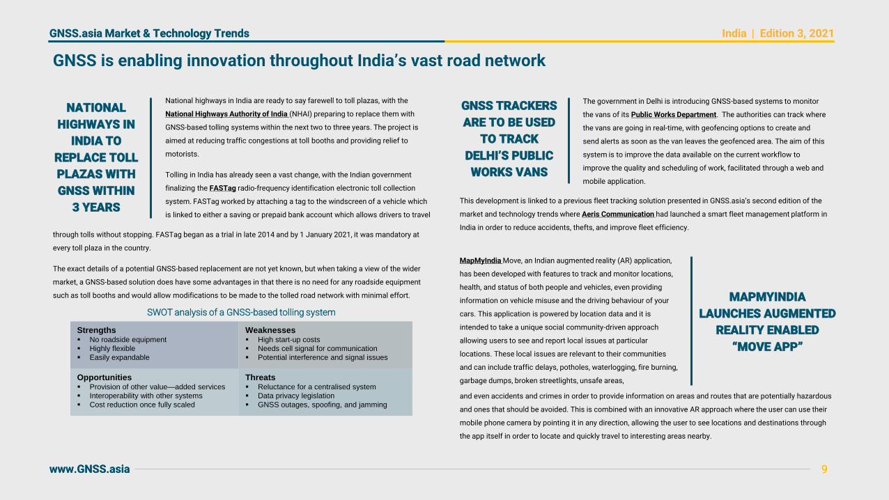
Weaknesses▪ High start-up costs
▪ Needs cell signal for communication
▪ Potential interference and signal issues
Threats▪ Reluctance for a centralised system
▪ Data privacy legislation
▪ GNSS outages, spoofing, and jamming
Strengths▪ No roadside equipment
▪ Highly flexible
▪ Easily expandable
Opportunities▪ Provision of other value—added services
▪ Interoperability with other systems
▪ Cost reduction once fully scaled
SWOT analysis of a GNSS-based tolling system
NATIONAL
HIGHWAYS IN
INDIA TO
REPLACE TOLL
PLAZAS WITH
GNSS WITHIN
3 YEARS
National highways in India are ready to say farewell to toll plazas, with the
National Highways Authority of India (NHAI) preparing to replace them with
GNSS-based tolling systems within the next two to three years. The project is
aimed at reducing traffic congestions at toll booths and providing relief to
motorists.
Tolling in India has already seen a vast change, with the Indian government
finalizing the FASTag radio-frequency identification electronic toll collection
system. FASTag worked by attaching a tag to the windscreen of a vehicle which
is linked to either a saving or prepaid bank account which allows drivers to travel
GNSS TRACKERS
ARE TO BE USED
TO TRACK
DELHI’S PUBLIC
WORKS VANS
The government in Delhi is introducing GNSS-based systems to monitor
the vans of its Public Works Department. The authorities can track where
the vans are going in real-time, with geofencing options to create and
send alerts as soon as the van leaves the geofenced area. The aim of this
system is to improve the data available on the current workflow to
improve the quality and scheduling of work, facilitated through a web and
mobile application.
This development is linked to a previous fleet tracking solution presented in GNSS.asia’s second edition of the
market and technology trends where Aeris Communication had launched a smart fleet management platform in
India in order to reduce accidents, thefts, and improve fleet efficiency.
MAPMYINDIA
LAUNCHES AUGMENTED
REALITY ENABLED
“MOVE APP”
and even accidents and crimes in order to provide information on areas and routes that are potentially hazardous
and ones that should be avoided. This is combined with an innovative AR approach where the user can use their
mobile phone camera by pointing it in any direction, allowing the user to see locations and destinations through
the app itself in order to locate and quickly travel to interesting areas nearby.

GNSS.asia Market & Technology Trends | Edition 3, 2021
www.GNSS.asia
GNSS.asia Market & Technology Trends
www.GNSS.asia
India
1010
The Indian Tsunami Early Warning Centre (ITEWC) was
built up at Indian National Centre for Ocean Information
Services (INCOIS), Hyderabad, a self-sufficient body
under the Ministry of Earth Sciences.
India’s regional SBAS is enabling innovation in the sky, land, and sea
INDIA TO PROVIDE TIDAL
WAVE WARNINGS TO
OCEAN CENTRES
On 8 December 2020, the International Maritime Organisation
recognised NavIC as part of the World-Wide Radio Navigation
System (WWRNS) in the 102nd meeting of its Maritime Safety
Committee. This recognition came as the committee stated that
NavIC met the operational requirements to assist ships in
navigating ocean waters.
IMO RECOGNISED
NAVIC AS PART OF
WORLD-WIDE RADIO
NAVIGATION SYSTEM
DronaMaps, a Gurugram-based Tech30 start-up that captures
geospatial data to create 3D maps from captured images, has been
helping state governments by using their platform to track COVID-19
hotspots. DronaMaps offers an end-to-end platform that assists in
the collection, processing, visualisation, and dissemination of drone
data, providing the information to key decision-makers in order to
increase the significance of the data used in mapping.
WORLD BANK
BACKED DRONES
USED TO FIGHT
COVID-19
The Haryana government has been using drones to combat the spread of
locusts, the efforts of which have been appreciated by the United Nation’s Food
and Agriculture Organisation (FAO), especially in the fight against the spread of
desert locusts in the western and central states. As locusts are mostly inactive
after sunset, the agriculture ministry has made the decision to approve drone
operations at night, and even to allow the use of engine powered drones where
possible due to their ability to carry heavier payloads than battery-operated
models, resulting in a greater volume of pesticide being deployed.
The start-up has been working with Aditya Birla and SAP to create a command-and-control centre to be used for
volumetric analysis from drone-based maps. DronaMaps was part of the Tech Emerge Resilience programme
ran by the World Bank and have received funding from ACT, an initiative set up by the Indian VC ecosystem in
order to fight against COVID, and they have deployed a coronavirus solution in Rajasthan, Punjab, Chhattisgarh,
and Haryana, with further deployments planned for the near future.
ENGINE-POWERED
DRONES TO
COMBAT LOCUSTS
The ITEWC gives tidal wave administrations to 25 Indian Ocean nation centres as a component of the
Intergovernmental Oceanographic Commission (IOC) of the UNESCO system. INCOIS was built using Global
Navigation Satellite System solutions as well as Strong Motion Accelerometers in Andaman and Nicobar Islands to
address the rising difficulties in giving exact and early tsunami warnings.
India is the fourth country to have its satellite navigation system recognised, and it is able to be used instead of
GPS up to 1,500 kilometres from the Indian boundaries. This is a marked first as it is the first regional system to
be recognised, with the other systems being the USA’s GPS, Russia’s GLONASS, and China’s BeiDou systems.
NavIC itself consists of four satellites in a geosynchronous orbit and three satellites in a geostationary orbit,
each of which is at an altitude of 36,000 kilometres, providing two levels of service, a standard positioning
service open to civilians and a restricted service open to authorised users such as the military.
The Center for Railway Information System (CRIS), the innovation arm of the Ministry
of Railways, has teamed up with ISRO to execute the Real-time Train Information
System (RTIS) project. Indian Railways has introduced a GNSS aided geo-augmented
navigation system (GAGAN) based system to gain train development and train-related
information. With the assistance of the new framework, railways will be capable to
track the movement of trains like arrival and departure and run through timings at the
station, improving the efficiency of train operations.
GAGAN
INTRODUCED
ON INDIAN
RAILWAYS

GNSS.asia Market & Technology Trends | Edition 3, 2021
www.GNSS.asia
GNSS.asia Market & Technology Trends
www.GNSS.asia
India
1111
In Andhra Pradesh, a state in the southeast of India, the government have
announced that they are to undertake the largest resurvey of its lands in
almost a century. The government are to plan to map lands in 17,000+ villages
by August 2023 as part of a plan to update its existing databases in
collaboration with the Survey of India. This mammoth task begins with over
14,000 surveyors being deployed across the state, with aid being provided by
a range of devices such as drones and mobile workstations.
India puts increased efforts in GNSS-enabled land surveying and monitoring
Chamoli et al published ‘Capability of NavIC , an Indian GNSS
Constellation, for Retrieval of Surface Soil Moisture’, a paper that
investigates the use of India’s regional satellite navigation
constellation, NavIC, for the study of soil moisture. The researchers
analysed the sensitivity of soil moisture by comparing the results
obtained from NavIC multi-path data with in-situ measurements and
observed that the results were in good agreement with the observed
soil moisture measurements. This is expected to be beneficial for
applications such as groundwater estimation, flood forecasting, and
for agricultural applications.
GNSS AND HIGH-
RESOLUTION
SATELLITES USED
TO MONITOR
USE OF
GOVERNMENT LAND
The government of Odisha launched the Bhubaneswar Land Use
Intelligence System (BLUIS), a web and mobile-based solution that
would alert the local government of any attempts to misuse or change
the use of government lands. BLUIS was announced by Chief Minister
Naveen Patnaik, who announced that all the government lands in the
city will be monitored using space data, including both high-resolution
images and GNSS.
ANDHRA PRADESH
ARE TO RESURVEY
LAND USING
DRONES TO
UPDATE RECORDS
GNSS-R USED IN AN
EXPLORATORY
FLOOD MAPPING
RESEARCH PROJECT
In late 2018, the Indian region of Kerala was hit by the worst floods it
has experienced in over a century, displacing over 5 million people
and shutting down the state’s airport. This is a symptom of a larger
problem, with over 12% of India’s area being prone to flooding, a
statistic that is only going to get worse due to climate change.
PROMISING
RESEARCH FINDINGS
FOR THE USE OF
NAVIC IN SURFACE
SOIL MONITORING
The last detailed survey was done between 1928-1931 using traditional methods, but this new and updated survey is
utilising one drone per district to mark land parcels in order to make the records tamper-proof, beginning with
agricultural areas and villages before moving onto cities.
The idea of BLUIS is to create a geo-tagged repository to safeguard the land, with the system being able to notify
government authorities of any new construction on the land in real-time, providing an improvement over the
current systems which do not have the required transparency and accountability. The satellite imagery will be
used to not only identify the changes, but it will also support the legal actions against the encroachment through
the litigation management system and act as a smart technology solution that assists with tasks from
appointment to providing evidence in legal cases.
In order to combat this, researchers at IITB-Monash Research Academy, a joint academic venture between IIT
Bombay and Monash University in Melbourne, have used near-real-time satellite data to identify and map
surface water across the country, which is then used to model and record flooding in order to help the
authorities warn local communities of threats due to intense rainfalls. This technique utilises Global Navigation
Satellite System – Reflectometry (GNSS-R), which is where passive sensing is used to take advantage of the
signal delays between each satellite in order to obtain geophysical information and it is used in many
applications from soil monitoring to oceanography.

GNSS.asia Market & Technology Trends | Edition 3, 2021
www.GNSS.asia
GNSS.asia Market & Technology Trends
www.GNSS.asia
China
12
▪ China was the first to be affected by the COVID-19 pandemic, but it was also the first
to apply GNSS-based solutions to assist in its recovery and is even considering
additional infrastructure investment to offset covid’s economic impact
▪ China released the 14th Five-Year plan in which the innovation and development of
industries that are related to BeiDou are promoted
▪ Strong customer base for consumer solutions due to the high penetration of mobile
devices with over 1 billion monthly users of WeChat, a multi-purpose application that
acts as a social media, messaging, and payment app
KEY TRENDS IN EDITION THREE
▪ The final BeiDou-3 satellite has been launched to complete the 30-satellite
constellation, providing improvements to accuracy, short message service
capability, and additional system redundancy
▪ The latest generation of GNSS positioning chips have been released, these are the
world’s first 22nm chips and are one quarter of the size of the previous generation
whilst only consuming one fifth of the power
▪ Autonomy was seen in several downstream markets, with a new smart driving
innovation laboratory, and large scale tests and launches of autonomous cars,
trucks, and even road construction vehicles
OVERVIEW OF CHINESE MARKET TRENDS

GNSS.asia Market & Technology Trends | Edition 3, 2021
www.GNSS.asia
GNSS.asia Market & Technology Trends
www.GNSS.asia
China
1313
Chinese President Xi Jinping announced the official launch of the
BeiDou-3 (BDS-3) global satellite navigation system on 31 July.
The satellite is a geostationary orbit satellite, offers high-
precision GNSS navigation timing services, as well as satellite-
based augmentation, short message communication (RDSS),
precision single-point positioning and other special services.
There are two main methods for evaluating the precision of satellite
clocks, a single-satellite method (SSM) and a multi-satellite method
(MSM), both of which provide a solution to the problem of timescale
differences between satellites. Each of these methods has different
strengths, with SSM using a reference satellite and MSM using an
estimation of the timescale difference which is then removed.
Upstream developments include the launch of BeiDou-3 and China’s first IoT Constellation
BEIDOU-3
OFFICIALLY LAUNCHED
Apart from Beijing's ‘Implementation Plan for Promoting
BeiDou Technology Innovation and Industrial Development
(2020-2022)’, BeiDou will be “deeply applied” in seven major
fields such as smart Winter Olympics, environmental
protection, and smart transportation which will create a
benchmark for smart cities in China.
The BeiDou-3 system consists of 35 satellites, including three geostationary satellites, three inclined
geosynchronous orbit satellites, and twenty-four medium Earth orbit satellites. In addition to acting as a GNSS,
BDS-3 also features a satellite-based augmentation system similar to the European EGNOS. BDS has adopted the
BeiDou Coordinate System which complies with the standards of the International Earth Rotation and Reference
System Service, with BeiDou also adopting the BeiDou Navigation Satellite System Time (BDT) as its time
reference. The BeiDou Signal In Service document also provides details of the user alarm signal which specifies
that the up and down-link signals are compliant with COSPAS-SARSAT.
BEIDOU PROMOTION AND
IMPLEMENTATION PLANS
SEEN IN MANY
DOWNSTREAM INDUSTRIES
IMPROVED
SATELLITE CLOCK
PRECISION ANALYSIS
On 25 July, the Tianqi 10 low-orbit Internet of
Things satellite was successfully launched at the
Taiyuan Satellite Launch Centre and is expected to
provide Internet of Things data communication
services from two weeks from the launch.
This is of importance to BDS as BDS consists of three types of satellites in different orbits which each have a
different level of orbital accuracy. Researchers from several Chinese institutes published a paper investigating
a new and improved MSM to evaluate the timescale differences using three International GNSS Service analysis
centres over two months and found that the assimilated orbital errors have a large impact on the estimation of
MSM timescale differences. This new method improved upon the traditional MSM by between 0.07 and 0.16
nanoseconds and proved that the improved method is accurate, with the best precision for the MEO clock
products, and that the MSM has overcome some of the problems associated with the single-satellite method.
CHINA'S FIRST IOT
SATELLITE CONSTELLATION
The Tianqi constellation, as China's first IoT constellation to achieve data applications, will provide data
services and is the seventh in-orbit IoT data service satellite, aiming to further improve the global real-time
communication service capability of the constellation to meet the narrowband data communication needs of
applications such as IoT, mine hydrology monitoring, marine ranching, intelligent container, ecological
environment monitoring, forest fire-prevention, green mining, and smart agriculture, enhancing China's global
data acquisition capability.
Apart from this, other BeiDou+ demonstration projects are now announced to be applied to the Hangzhou Asian
Games. On 7 September 2022 Hangzhou Asian Games power supply area six power transmission projects
through the power BeiDou augmentation system design and construction plan evaluation, which marks the
history of the Asian Games will be the first use of power BeiDou augmentation system.

GNSS.asia Market & Technology Trends | Edition 3, 2021
www.GNSS.asia
GNSS.asia Market & Technology Trends
www.GNSS.asia
China
1414
The Zhongguancun BeiDou and Spatial Information Service Industry
Forum was held on 27 August 2020 in the Haidain District, the
forum showcased the latest independent BeiDou-3-based
innovations, including the latest generation of BDS high-precision
navigation chips, pace-based satellite measurement, control
transceivers and the BeiDou+ Remote Sensing global application
service platform.
Boom in GNSS hardware, including the world’s first 22nm positioning chip
WORLD’S FIRST
22NM NAVIGATION
CHIPSET TO ENTER
MASS PRODUCTION
Fujian Questing Technology Co., Ltd. released the first BeiDou
positioning schoolbag in Fuzhou. The positioning schoolbag uses
FindNow, the world's first BeiDou accelerated positioning service, and
FindM Pro, a sub-meter high-precision positioning service provided by
Qianxun Spatial Intelligence Inc. (Qianxun SI), to build the location
service cloud platform based on cloud computing and data technology
through the integration and construction of the BeiDou ground-based
network. Users can obtain real-time, fast and accurate positioning
through the mobile phone APP, which enables electronic geofencing
and tracking for up to 6 months.
GNSS TO HELP FIND
MISSING CHILDREN AND
PREVENT BULLYING
China's Child Safety Emergency Response (CCSER) platform
signed a strategic cooperation agreement with Onetwothree, a
national high-tech enterprise and a subsidiary of the location-
based service provider NAVINFO. The two parties will rely on
CCSER's child protection practice and Onetwothree's powerful
location services and smart wearable experience to develop
wearable smart devices to prevent missing children, school
bullying, child sexual assault, and increase protection for children.
BEIDOU SCHOOL
BAG RELEASED
IN FUZHOUHARDWARE
MANUFACTURERS TO
PRODUCE NEW HIGH
PRECISION RECEIVERS
Chinese companies are launching new high precision multi-
frequency receivers able to consistently provide centimetre-
level accuracy even in complex environments. Real-world
testing shows that the positioning usability, continuity,
accuracy, and reliability in obstructed environments of these
new products is comparable with the established ones. In
addition, several new IMU-enhanced GNSS RTKs are available
on the market, combining GNSS positioning data with high-
performance, six-axis IMUs to provide accurate location in
challenging environments such as tunnels, in city centres, and
in heavy forestry.
One highlight of the forum was the demonstration of BDStar’s latest ‘high-precision positioning chipset’ which
was demonstrated for the first time in 2020 and was to be released in late 2020. This new chip is the world’s
first 22nm positioning chip and it is a quarter of the size of the previous generation of chips whilst only
consuming a fifth of the power when it enters mass production in 2021.

GNSS.asia Market & Technology Trends | Edition 3, 2021
www.GNSS.asia
GNSS.asia Market & Technology Trends
www.GNSS.asia
China
1515
August 2020 saw the official launch of the ‘Smart
Driving and High Precision Map Industry Innovation
Laboratory’ at the Global Geographic Information
Developers Conference 2020 (WGDC 2020).
Zhengzhou recently opened its autonomous bus lane one, featuring
buses that are able to change lanes, stop at stations, and detect
traffic lights. The buses obtain centimetre-level positioning data by
integrating Find AUTO, an intelligent driving service of Qianxun SI,
which is combined with other sensors, radars, and cameras in order
to correctly locate the bus position, identify which lane it is in, and
guide the driving system to make the best possible driving decisions.
Autonomous driving innovation is boosted throughout China, including testing and launches
AUTONOMOUS DRIVING TO BE
BOOSTED BY AN INDUSTRY
EXCHANGE LABORATORY
SAIC Motors has launched a group of intelligent heavy-duty trucks
with L4 autonomous driving capabilities, allowing the trucks to
perform precise stopping parking and close queuing manoeuvres.
This technology has many benefits, such as improving the capacity
in passing the Donghai Bridge which can now be crossed at a speed
of 60 km/h with only 20 metres between each vehicle, which is only a
fraction of the 150 metre distance needed for safe manual crossing
at that speed.
SAIC MOTORS
LAUNCHED LEVEL-4
AUTOPILOT HEAVY-
DUTY SMART TRUCKS
The decreased distance is not the only improvement, they have also seen other great success, achieving a 100%
stopping in place success rate which improves the efficiency of loading and unloading the vehicle as even the
most experienced driver would not be guaranteed to stop exactly in place. The trucks themselves achieved the
Shanghai Smart Networked Vehicle Open Road Test License last year and have been on the job for almost a year
and a half. The trucks themselves are equipped with FindAUTO, the intelligent driving service of Qianxun Spatial
Intelligence which is based on BeiDou satellite and ground-based augmentation system and it can provide
centimetre-level positioning, vision laser perception system and high-precision map, helping heavy trucks to stop
in 15 seconds, regardless of the weather, light sources and other influences, and it can ensure the safety of
driving in complex environments.
AUTOPILOTED BUS
LANE OPENED
IN ZHENGZHOU
Qianxun Spatial Intelligence launched the first large-scale road test
of high-precision positioning for autonomous driving. The tests are
set to last approximately a year, with a test vehicle being equipped
with Qianxun's spatial-temporal intelligent algorithm and BeiDou’s
high-precision positioning service. The vehicles have been tested on
half of the major urban expressways and highways across the country
in different scenarios under a range of weather conditions and at
different altitudes to continuously verify and iterate on the algorithm
and service. Previously, Qianxun SI has completed 300,000 km of
high-precision positioning road tests.
LARGE-SCALE
ROAD TESTING OF
HIGH-PRECISION
POSITIONING FOR
DRIVERLESS CARS
According to the test results, the real-time dynamic positioning accuracy of the test vehicle can reach up to a 2
centimetre-level positioning, which meets or exceeds the extensive needs for the deployment of L3-level
autopilot, car-roadway collaboration, and lane-level navigation solutions. Road trail results also show that in
complex road conditions, the combination of satellite + inertial guidance algorithm can still ensure the effect
of high-precision positioning.
The innovation laboratory is off to a good start with the first batch of partners including Didi, Huawai, and Baidu
Maps,. The laboratory will connect partners to build a platform for industry exchange in the field of autonomous
driving to promote the collaborative development of China’s intelligent driving and high-precision mapping
industries. These high precision maps play a crucial role in achieving a true autopilot by improving the vehicle’s
perception and high-precision positioning capabilities.

GNSS.asia Market & Technology Trends | Edition 3, 2021
www.GNSS.asia
GNSS.asia Market & Technology Trends
www.GNSS.asia
China
1616
On July 13, the Beijing Capital International
Airport (PEK) completed an in-flight test using
BeiDou. The test was to simulate whether there
is electromagnetic interference between the
aircraft and the BeiDou equipment on the flight.
The BeiDou Satellite Based Augmentation System (BDSBAS) Civil Service
Platform Monitoring Station passed the project acceptance test and
completed the installation of the first two Xinjiang stations (Urumqi
station and Qiemo station). It will be built to provide satellite-based
augmentation services in accordance with the requirements of ICAO
standards and specifications. The monitoring station is an important
infrastructure of the BDSBAS civil service platform, providing high-
precision and reliable observation data support for its services.
Strong development in China’s skies thanks to GNSS
SUCCESSFUL ELECTRO-MAGNETIC
INTERFERENCE TESTING FOR
BDS-BASED AIRCRAFT
Medical samples in hospitals traditionally needed to be manually delivered
for examination, taking at least 20 minutes. Tan Jialong and his team at the
studio of Hunan Curis Intelligent Technology Co., Ltd, in Hunan, have
developed a UAV-based solution to deliver blood and other medical samples
to the pathology building of the Second Affiliated Hospital of Nanhua
University. The drones have shortened the delivery time from 20 minutes
down to 70 seconds, a reduction of approximately 95%. The medical
samples are now taken to the roof and loaded onto the drone, which then
has the route set so the samples automatically arrive at the target.
DRONES USED TO
REDUCE MEDICAL
SAMPLE DELIVERY
TIME BY 95%
The research team behind this have been developing the second generation of drones featuring upgrades to
components such as parachutes, airbags, positioning devices, battery life, and much more. The development of
this system was funded by the sale of civilian drones and by performing aerial photography, with the testing
processes crashing nearly 30 drones before the team were awarded new type patents as well as 13 computer
software copyrights. The future plans for the team involve upgrading the regional network of medical logistics
drones and the building of a command centre at municipal, provincial, and national levels in order to expand this to
other hospitals, as well as to leverage the solution to fight fires and much more as the technology matures.
TESTING AND
INSTALLATION
OF THE
BDS-SBAS
MONITORING
STATIONS
The EU-China Bilateral Aviation Safety Agreement (BASA) went into
effect on 1 September, giving a boost to the regions’ aviation
manufacturers by simplifying the process of gaining product approvals
from the European Union Aviation Safety Agency (EASA) and the Civil
Aviation Administration of China (CAAC), while also ensuring high
safety and environment standards will continue to be met.
EU-CHINA AVIATION
SAFETY AGREEMENT
In recent years, China's civilian drone industry has
developed rapidly, playing an important role in many fields
such as plant protection, aerial photography, surveying and
mapping, and inspection.
CHINA’S DRONE
MARKET FORECASTED
TO GROW 60% P.A.
Affected by aviation control, network security, privacy and personal safety, the global civilian drone development
has now lagged behind the pace of the industrial drone industry. Currently, there are more than 6,000 UAV
enterprises in China and the largest market for civilian drones lies in the provision of government public services,
such as security, firefighting, meteorology, etc., accounting for 70% of the total demand. The market with the
greatest potential for drones in the future is expected to appear in the civilian sector, with new market demand
appearing in agriculture, cargo transportation, airborne wireless network data acquisition and other fields. It is
predicted that by 2023 China's civilian drone market is expected to reach 96.8 billion-yuan, military drones about
35 billion yuan (4.5M EUR), the overall market size of the drone industry will be more than 100 billion yuan (12.8M
EUR), with a compound annual growth rate of more than 60%5. 5: https://www.chinadaily.com.cn/a/201902/25/WS5c732fb4a3106c65c34eb180.html
Since the vast majority of current civil aircraft in China is produced in Europe and the U.S., the use of the BeiDou
positioning and tracking equipment on current civil aircraft should first solve technical incompatibilities. After
continuous trials, it was concluded there is no compatibility problem between BeiDou and current civil aircraft
during the flight.
GNSS.asia Market & Technology Trends | Edition 3, 2021
www.GNSS.asia
GNSS.asia Market & Technology Trends
www.GNSS.asia
China
1717
Since China announced “the Special Plan for the Application of
BeiDou Satellite Navigation System in the Transport Industry”,
Shanghai Port has achieved full coverage of BeiDou telemetry
for public trunk beacons. In addition, the BeiDou short message
function can be used to monitor the real-time position,
luminous status, light quality and battery efficiency of all the
beacons in the waters in the Shanghai Port area, and can
provide all-weather, round-the-clock, high-precision and highly
reliable navigation services to ships.
The Chinese government has used BeiDou to monitor and warn
of geological disasters, including landslides, in many parts of
the country due to continuous heavy rainfall, using BeiDou to
both monitor the hazards and to provide a timely warning to
citizens to reduce the harm caused by these disasters.
Improved safety in both maritime navigation and for emergencies including landslides
BEIDOU’S SHORT
MESSAGE FUNCTION IS
MONITORING VESSELS
All public navigational facilities including lighthouses,
land guides, sea buoys, etc. in Qinhuangdao Port have
been fully covered by the BeiDou system, greatly
improving the navigation security capability. BeiDou’s
lighthouse monitoring system sets up a series of
functions such as status monitoring, lighthouse remote
control, route tracking, etc., which can provide remote
real-time monitoring and management.
BEIDOU TO POWER SMART
LIGHTHOUSES AT THE
QINHUANGDAO PORT
By applying the BeiDou system, not only can more comprehensive and accurate navigation assistance information
be provided, but the greater integration of the information of each port can be used to serve more port enterprises
and ships. In particular, the BeiDou system's unique short message communication function can be transmitted
directly through the satellite when there is no base station or mobile phone signal in the sea area, realising real-
time information interaction between terminals.
BDS FOR EMERGENCY
LANDSLIDE WARNINGS
Qianxun SI uses BeiDou high-precision service drones in order
to position drones in the dike area in real-time to restore the
situation following the disaster and to provide a scientific
basis for disaster relief. The aerial images from the drones are
used to assess the scope of the disaster, to accurately
measure the location and length of the dike, and to provide
data on flooded high-voltage towers and homes in the area.
On July 11, the BeiDou Cloud Monitoring Platform’s artificial intelligence warning system in Aba, Sichuan,
issued a landslide warning after a sudden heavy rainfall, enabling locals to avoid the dangerous areas. The AI
system uses BeiDou’s high precision technology for monitoring, with the sensors in the area detecting ground
movements and displacement before the disaster occurs. The system then uses this in a big data-based AI
system in order to achieve an automatic online monitoring and warning system that works in all weather.
BEIDOU HIGH-PRECISION
SERVICE TO NAVIGATE
DRONES FOR
EMERGENCY SITUATIONS
The drones are used to provide a 3D reconstruction that is used to predict the inundation area of the homes
following the water level rises and to calculate the amount of earthwork that would be needed to fill the breach
of the dike. In addition, this Qianxun has built more than 2,600 BDS ground-based augmentation stations
across the country, allowing the Qianxun-based drones to achieve real-time centimetre-level positioning,
eliminating the need to build base stations on-site and to increase the success of the rescue operations by
providing additional time.

GNSS.asia Market & Technology Trends | Edition 3, 2021
www.GNSS.asia
GNSS.asia Market & Technology Trends
www.GNSS.asia
China
1818
China National Railway Group Corporation recently issued
the "New Era Transportation Powerful Railways First
Planning Outline", to be implemented until 2035, aiming to
be the first to build a modern railway network. Trains will
integrate BeiDou satellite navigation technology, 5G
communication technology, and other components of the
air-world integrated control system.
CRRC Corporation Limited, the world’s largest rolling stock
manufacturer by revenue, has recently launched the world's first
automated MINI maglev train, announced at the annual ‘2020
Fifteenth Shanghai International Rail Transit Exhibition
(Rail+Metro China 2020)’, hosted at the Shanghai International
Convention Centre.
Industries such as rail benefit from the completion of BeiDou-3
BEIDOU+5G TO INCREASE
TRAIN-LINE TRANSPORT
CAPACITY BY 30%
BeiDou communication antenna is to be installed on rail locomotive
control systems to enhance the wireless data transmission between
the train and the ground. When trains are in motion, the onboard
system is to collect real-time data such as status, safety, and
monitoring information, which is in turn transmitted to the
dispatching command centre via BeiDou. This solution even works
when the locomotive power supply is disconnected, with the driver
still being able to send positional information, amongst other data, to
the command centre via the BeiDou short messaging system in
order to improve the emergency capabilities. This is enabled via the
BeiDou Positioning Early Warning System, developed by China’s
Railway Electronification Bureau, a platform to provide accurate and
efficient real-time safety protection, as well as enabling the remote
monitoring of both vehicles and operators who are on-site to
improve overall safety.
BEIDOU’S
POSITIONING
EARLY WARNING
SYSTEM IMPROVES
RAIL EFFICIENCY
AND SAFETY
The train will use a control system supported by BeiDou positioning to replace the traditional track circuitry
and will use 5G technology to achieve direct communication between trains with more accurate positioning
and better security. The new control system will shorten the train's tracking interval from the current minimum
of three minutes to about two minutes and increase the line transport capacity by more than 30%.
CRRC LAUNCHED
THE WORLDS’ FIRST
AUTOMATED MINI
MAGLEV TRAM
2020 was the first time that sections of the Jingxiong expressway were
operated with unmanned construction machinery. These unmanned
intelligent equipment clusters were comprised of three pavers and six rollers,
completing the paving and compaction of the highway stabilised soil. The
innovative unmanned road construction equipment is equipped with BeiDou
powered positioning systems that collect information about the surrounding
environment via a sensor device that can be retrofitted to the vehicles. The
BeiDou system allows for optimal planning of the operational pathing
according to the local environment, as well as providing automatic warnings,
emergency stopping functionality, and automatic obstacle avoidance,
amongst other protections, providing the ability to control the construction
vehicle with an accuracy of 2-3cm, an improvement of 50%.
The vehicle is to be part of the medium-traffic public network in Lingang and it is a re-design of the traditional low-
floor trams. It is guided by photoelectromagnetic, digitally guided low-floor train with rubber wheels. The vehicle is
guided using a digital orbital guidance method that primarily uses electromagnetic markings which are
supplemented by satellite and visual navigation methods. The vehicle has a capacity of 302 people, with a
maximum speed of 70km/hour, with an extremely fast charging time of only 12 minutes, allowing it to travel up to
30km at a time. The technologies also enable functions such as speed limit controlling, an obstacle alarm, body
posture corrections, and can provide additional information to the driver such as target speed, automatic stopping,
and lane deviation. Reports suggested that the Dishuihu Station of the T1 Demonstration Line in the Shanghai
Lingang New Area is to be completed by the end of 2020, after which the tram will be put into use.
UNMANNED
CONSTRUCTION
MACHINES USE
BEIDOU TO
IMPROVE SAFETY
AND ACCURACY

GNSS.asia Market & Technology Trends | Edition 3, 2021
www.GNSS.asia
GNSS.asia Market & Technology Trends
www.GNSS.asia
China
1919
In Inner Mongolia, the government has installed a grassland intelligent
monitoring system for herders free of charge. Sheep and cattle are fitted with
collars based on the BeiDou system which are then used to locate and track the
position of the sheep. The BeiDou system transmits the position to the
information centre and then to the grazing personnel's handheld terminal.
Herders have realised that remote herding can not only locate the position of
cattle and sheep in real-time and report on the recent movement history but it
can also be used in an alerting system when the animals leave the predefined
geofenced areas and can even recommend the best route to herd the animals.
In the exhibit area of China Construction First Bureau, the
CSCEC-HC-5, a BeiDou high-precision positioning solution
was displayed. The CSCEC-HC-5 was the first application of
the BeiDou system in the civil engineering industry in China
as it was used in both the construction and safety
monitoring of the 600 metre Shenzhen Ping An Finance
Centre project. BeiDou was used to determine the
deformation caused by temperature differences, wind, and
much more in the construction of super high-rise buildings.
BeiDou is enabling everything from sheep herding through to construction and farming
BEIDOU TO BE
USED TO
REMOTELY
HERD SHEEP
IN INNER
MONGOLIA
FOR FREE
August 2020 saw the successful demonstration of a smart weeding
machine in rice fields by the Jiangsu Academy of Agricultural
Sciences in Qiaoli Village, Xiaoshan District, Zhejiang Province.
Professor Zhang Ruihong from Yangzhou University leads the
research team behind the project which uses BeiDou positioning data
in order to accurately eliminate weeds, leading to both healthier
seedlings as well as reducing the number of pesticides needed.
INTELLIGENT
WEEDING SYSTEM
TO REDUCE
PESTICIDE USE
This advancement is important as the weeds grow rapidly in the humid and warm rice fields in southern China,
resulting in fewer nutrients being available for farming. The traditional method of solving this would be to use
herbicides, which would result in both soil pollution for a long time and damaged rice. In addition to the
environmental benefits, the BeiDou-based system improves efficiency whilst reducing labour costs.
EXHIBITION BEIDOU
EQUIPMENT USED
IN SKYSCRAPER
CONSTRUCTION
Alibaba Group has formed a preliminary solution to solve the
problem of human-elephant conflict in Yunnan where BeiDou's
high-precision positioning technology and short message
capability will be used for elephant conservation. In order to better
monitor the movements of these herds, positioning collars will be
worn on the herd's head and dromedary elephants, enabling real-
time, accurate monitoring of areas where Asian elephants are
active. In addition, using the BeiDou system, the monitors can
know exactly where they are in the forest without relying on a
mobile communication network and can communicate with the
outside world through the BeiDou short messaging system, with
text, voice, images, and other types of content being supported in
the transmission.
The data collected by this system was used to provide timely warnings and correctional information during
construction, enhancing the stability and accuracy of the construction in real-time. This solution offered benefits
compared with the traditional methods using lasers and precision levels. These benefits include improved data
quality and data signals, and it provides the ability to observe high-rise buildings above 200 metres, even in
complex, obstructed environments.
ALIBABA-CREATED
SOLUTION USES
BEIDOU TO MONITOR
ELEPHANT HERDS

GNSS.asia Market & Technology Trends | Edition 3, 2021
www.GNSS.asia
GNSS.asia Market & Technology Trends
www.GNSS.asia
China
In 2019, the size of China's service robot market reached 2.2 B U.S.
dollars (1.8 M EUR), accounting for about 23% of the global market6.
The market size increased 33.3% year-on-year, higher than the
growth rate of the global service robot market. Liu Qian, Chairman of
the Board of FN Robotics, said: "In the future, the field where most
robots will be used is no longer the automotive industry, but the
medical industry. With increasingly aging population, the demand for
medical robots is increasing, and surgical robots have been widely
used. In the next 50 years, the market size of medical robots will be
larger than that of automotive robots."
2020
In Guiyang, Metro Line 1 and the Guiyang Bus Rapid
Transit system are now equipped with face recognition
devices. Passengers who use face recognition to travel
need to register their identity information on the app and
link it to their chosen payment method. The driving force
behind Guiyang's face recognition comes from the
Shanghai-based AI unicorn, Etu Technology.
On September 15, the 22nd China International Industry Fair
(CIIF) opened in Shanghai. In this exhibition, Germany's KUKA
brought an industrial robot with the highest precision, smallest
footprint and largest arm span in the market. It is mainly used in
the field of consumer electronics including applications such as
the assembly of rechargeable batteries. After scanning work
tags and work orders, the robots can automatically tell workers
how to complete the assembly, allowing unskilled operators to
get up to speed quickly. The robot can work side by side with the
worker throughout the assembly process, forming a perfect
human-machine interface to complete the assembly of a
complex network device.
AI, 5G, and Robotics are hot topics seen in China for this edition
FACIAL RECOGNITION IS
BEING USED TO PAY IN
THE GUIYANG PUBLIC
TRANSPORT SYSTEM
More than 80% of the typical application scenarios of 5G and AI are
overlapping, with the two being deeply integrated resulting in the joint
promotion significant changes in socio-economic production relations
and modes of production. The scale of 5G network coverage provides a
ubiquitous carrying space for AI, solving the huge pain point of the lack
of carriers and channels for AI technology to land, and greatly
promoting the development and prosperity of the AI industry. AI is
present in many application scenarios of health care, for example,
virtual assistants have already been carried out in many hospitals in
China, applied to intelligent guidance and intelligent consultation.
In the global face recognition authoritative test held by the U.S. National Institute of Standards and
Technology, Etu's algorithm has won first place for three consecutive years, with a false alarm rate of one
in a trillion. It is reported that the Guiyang face recognizing bus has been in trial operation for half a year
before, completed more than one million facial authentications. The payment system has completed
transactions of millions of yuan without an error. In the future, the scene of using recognition will be
extended to different public places such as scenic spots, communities, business districts and central
business districts.
GERMANY’S KUKA
PRESENTED THE MOST
PRECISE INDUSTRIAL
ROBOT AT CIIF
AI IS INCREASINGLY
BEING COMBINED
WITH 5G IN THE
MEDICAL INDUSTRY
Big data and information construction in medical service outreach is increasing in function, for example,
artificial intelligence diagnosis in lung cancer lung nodules, which has brought great help to young doctors and
the simplification of a large number of workloads. Artificial intelligence medical imaging research is also
important, for example, in the gastrointestinal endoscopy AI-assisted diagnosis and treatment model, where the
AI can identify what type of polyps are present and how much risk of malignancy there is based on a large
amount of data, thus providing good guidance for subsequent treatment.
6: https://ifr.org/case-studies/collaborative-robots/stihl-opens-up-new-
CHINA’S SERVICE
ROBOTS ACCOUNT
FOR A QUARTER OF
THE GLOBAL MARKET

GNSS.asia Market & Technology Trends | Edition 3, 2021
www.GNSS.asia
GNSS.asia Market & Technology Trends
www.GNSS.asia
China
2121
Recently, researchers from the Chinese Academy of
Sciences and engineers from Beijing Huayirei Technology
Co., Ltd. built a standard enclosed sample plot in Cocosili
and completed the set-up, installation, and commissioning of
the instruments. The third-generation BeiDou system was put
into use to achieve real-time transmission of monitoring data
in uninhabited areas.
Zhao Zhiguo, director of the MIIT, revealed that more than 2.8
million malicious attacks related to connected car systems
were detected in China this year and auto companies are
currently not well aware of the importance of network security.
BeiDou to support global megatrends such as climate change and the rise of the sharing economy
BEIDOU USED TO
MONITOR ECOLOGICAL
AND CLIMATE CHANGE
IN UNINHABITED AREAS
According to the global trend of an ageing society, elders are increasingly living
alone. They are not able to ask for help after accidents and their family members
cannot remotely interact with the elderly. The smart badge developed by Jimi IoT
solves the problem of care for the elderly. By receiving the satellite timing signal,
the built-in positioning terminal can make the positioning error control within 1
meter. With the easy to operate elderly badge, their family members can learn
about the elderly through the mobile app. If the elderly in danger, they can press
the SOS button to contact children, relatives, nearby hospitals, etc. Children can
view the location of the elderly through the mobile phone once they are lost.
JIMI’S IOT
SMART BADGES
TO ASSIST IN
REMOTE CARE
OF THE ELDERLY
Since 2017, with the support of the Sanjiangyuan National Park Administration, researchers have established
the same monitoring sample plots, together with the application of technologies such as the Internet of Things,
cloud computing and model simulation, to investigate a wide variety of scientific issues. These issues include
the interaction mechanism between ecological and hydrological changes and human activities as well as
climate change in the Sanjiangyuan area, and provide data products for the scientific, intelligent and precise
management of the National Park.
SUPPORT PLATFORM
DEVELOPED TO IMPROVE
V2X CYBERSECURITY
Shenzhen has launched a high-precision fixed-point
parking pilot project for sharing bikes, aiming to use
the BeiDou system's high-precision positioning to
achieve the management mode of "fixed-point
parking and payment" for shared bicycles and to
reduce the random parking of bicycles.
To enhance the overall information security capabilities of intelligent networked vehicles, China Automotive
Technology Research Centre led the automotive enterprises and research institutions to build the automotive
industry networked vehicle mutual support platform. The platform mainly applies digital certificate and cryptographic
algorithm technology to provide services of security certificate issuance, unified identity authentication and secure
message encryption for V2X communication.
BEIDOU’S HIGH-PRECISION
POSITIONING USED FOR BIKE
SHARING MANAGEMENT
In the area, bicycle-sharing enterprises installed BeiDou system positioning terminals on bicycles. In
accordance with the high precision parking frame position data provided by the authorities, bicycle-sharing
enterprise delineates the virtual electronic fence and determine whether the vehicle parked in the designated
area. After the implementation of the new model of bike management, users can only lock the bike and make
payment when they park the bicycle in the designated parking area.

GNSS.asia Market & Technology Trends | Edition 3, 2021
www.GNSS.asia
GNSS.asia Market & Technology Trends
www.GNSS.asia
Taiwan
22
▪ World leader in chip manufacturing and semiconductor board integration which
means that Taiwan is driving multi-GNSS adoption
▪ Strong foundation in hardware manufacturing has resulted in companies moving on
to integrate hardware and software, combining megatrends such as 5G and AI
▪ Swift reaction to market trends has resulted in consolidating opportunities in
consumer solutions, smart transportation, electronics, and IoT
KEY TRENDS IN EDITION THREE
▪ An increased focus on 5G for IoT and Smart Manufacturing, including the setup of a
5G open laboratory in Taoyuan County, a 5G mm wave smart factory to be built, and
a 5G-enabled smart manufacturing plant at Delta Electronics’ production complex
▪ New GNSS receivers, modules, and trackers have been released, including an ultra-
lower-power GNSS module for IoT applications from Yuechung, and a new GNSS
receiver with anti-jamming and anti-spoofing capabilities by Wintec
▪ GNSS has enabled innovation related to autonomous buses in New Taipei City,
drone mail delivery on Siaoliouciou Island, and autonomous collision avoidance and
berthing for vessels on the Love River
OVERVIEW OF TAIWANESE MARKET TRENDS
GNSS.asia Market & Technology Trends | Edition 3, 2021
www.GNSS.asia
GNSS.asia Market & Technology Trends
www.GNSS.asia
Taiwan
23
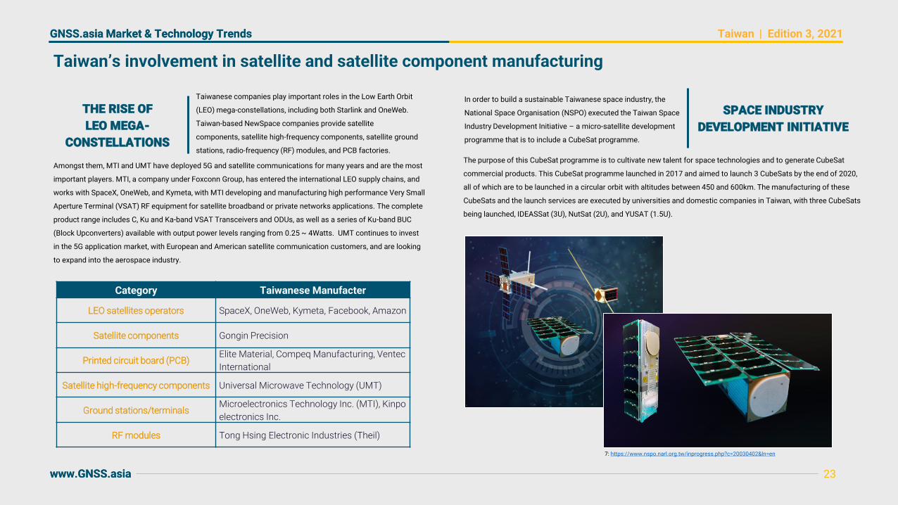
Taiwanese companies play important roles in the Low Earth Orbit
(LEO) mega-constellations, including both Starlink and OneWeb.
Taiwan-based NewSpace companies provide satellite
components, satellite high-frequency components, satellite ground
stations, radio-frequency (RF) modules, and PCB factories.
Category Taiwanese Manufacter
LEO satellites operators SpaceX, OneWeb, Kymeta, Facebook, Amazon
Satellite components Gongin Precision
Printed circuit board (PCB)Elite Material, Compeq Manufacturing, Ventec
International
Satellite high-frequency components Universal Microwave Technology (UMT)
Ground stations/terminalsMicroelectronics Technology Inc. (MTI), Kinpo
electronics Inc.
RF modules Tong Hsing Electronic Industries (Theil)
In order to build a sustainable Taiwanese space industry, the
National Space Organisation (NSPO) executed the Taiwan Space
Industry Development Initiative – a micro-satellite development
programme that is to include a CubeSat programme.
Taiwan’s involvement in satellite and satellite component manufacturing
THE RISE OF
LEO MEGA-
CONSTELLATIONS
Amongst them, MTI and UMT have deployed 5G and satellite communications for many years and are the most
important players. MTI, a company under Foxconn Group, has entered the international LEO supply chains, and
works with SpaceX, OneWeb, and Kymeta, with MTI developing and manufacturing high performance Very Small
Aperture Terminal (VSAT) RF equipment for satellite broadband or private networks applications. The complete
product range includes C, Ku and Ka-band VSAT Transceivers and ODUs, as well as a series of Ku-band BUC
(Block Upconverters) available with output power levels ranging from 0.25 ~ 4Watts. UMT continues to invest
in the 5G application market, with European and American satellite communication customers, and are looking
to expand into the aerospace industry.
SPACE INDUSTRY
DEVELOPMENT INITIATIVE
The purpose of this CubeSat programme is to cultivate new talent for space technologies and to generate CubeSat
commercial products. This CubeSat programme launched in 2017 and aimed to launch 3 CubeSats by the end of 2020,
all of which are to be launched in a circular orbit with altitudes between 450 and 600km. The manufacturing of these
CubeSats and the launch services are executed by universities and domestic companies in Taiwan, with three CubeSats
being launched, IDEASSat (3U), NutSat (2U), and YUSAT (1.5U).
7: https://www.nspo.narl.org.tw/inprogress.php?c=20030402&ln=en
GNSS.asia Market & Technology Trends | Edition 3, 2021
www.GNSS.asia
GNSS.asia Market & Technology Trends
www.GNSS.asia
Taiwan
24
Taiwan’s leading the way in the design and development of consumer solution hardware
EXPANDING THE CAPABILITIES OF WEARABLE DEVICES WITH GNSSA TAIWANESE CASE STUDY
The most common wearable devices in Taiwan are smartwatches, smart glasses, smart fabrics, and tracking
bracelets. Most wearables focus on sport and entertainment purposes, but medical wearable devices are
also gaining more traction due to the increasing demand from Taiwan’s ageing society.
Taiwan’s IT industry is one of the most important for the consumer solutions market, with extensive
experience in both the supply chain and in research and development being present throughout the region.
For examples, LOCOSYS Technology provides OEM/ODM services from both hardware and software in
GNSS and Wireless Communication to Embedded System and Consumers electronics, including GPS
watches and loggers. Another example is RiTdisplay Corporation who built several PMOLED lines to produce
mini panels for smartwatches, sport bands, and heartbeat detectors.
Taiwan’s well-known textiles industry is another important sector for wearables. An example of a textile-
based innovation is the rise of smart cloth-textile material with wearable devices embedded into the material
itself.
Large textile producers have adopted the new technology over the last few years, with companies such as
AIQ Smart Clothing Inc focusing on a washable smart cloth with inbuilt heart rate monitors.
Read more about this in our innovation blog article.
Customers increasing expectations lead to the release of
improved versions of existing hardware. Current trends
want to address problems related to power consumption,
information protection and IoT functions integration.
NEW GNSS
HARDWARE RELEASED
Recently several products have been released from companies such as Yuechung International Corp. and
Wintec. In particular, new receivers are designed to be less power demanding to improve the operating times of
IoT applications such as trackers, wearables, and portable devices; and more resilient to interference,
supporting message integrity protection, anti-jamming, and anti-spoofing, to provide reliable positioning in
difficult environments.
New receivers could also integrate additional sensors to report the current overall status of systems in which
they are integrated such as cars or boats.

GNSS.asia Market & Technology Trends | Edition 3, 2021
www.GNSS.asia
GNSS.asia Market & Technology Trends
www.GNSS.asia
Taiwan
Innovation seen in the road transportation market, with autonomous buses and GNSS-tracked goods
25
Taiwan's Customs Administration of Ministry of
Finance plans to establish a GNSS monitoring system
to improve the control mechanism for goods
transportation in the Free Trade Zone.
The Customs Administration contracted the Taiwan Telematics Industry
Association (TTIA) to establish industry standards for IoT cargos monitoring
equipment. It has gone through several industry public hearings and group
workshops, participated by stakeholders such as vehicle-mounted devices
producers, seal equipment suppliers, system integrators, telecommunications
operators, and land transporters such as container semitrailers and bonded
trucks to discuss the equipment’s technical specifications and procedures.
FREE TRADE ZONES TO USE
GNSS-MONITORING SYSTEM
Since the introduction of the Unmanned Vehicles Technology
Innovative Experimentation Act, WinBus became the first locally
developed autonomous minibus and is now entering the trial period.
Automotive Research and Testing Centre (ARTC) supervised the
whole process of design and production of the vehicle which is
capable of accommodating up to fifteen passengers. Other
specifications of the minibus include the maximum speed of fifty
kilometres per hour and the maximum range of seventy kilometres.
AUTONOMOUS
BUS TESTING AT
SPEEDS OF UP TO
50 KILOMETRES
PER HOUR
TV and online retailer Momo.com Inc has set up a new logistics
subsidiary, Fu Sheng Logistics Co. to oversee the company’s
extensive shipping operations. Leveraging Momo’s 23 satellite
warehouses and distribution centres nationwide, Fu Sheng
SAME-DAY
DELIVERY SHIPMENT
USING GNSS
is in charge of executing the retailer’s same-day shipment plan for deliveries in Taipei, New Taipei City, Taoyuan,
Taichung, Tainan and Kaohsiung. The company is to set up another seven satellite warehouses and distribution
centres by the end of the year. Fu Sheng has also installed GNSS trackers on its vehicles to monitor risks and
collect data relevant to shipments.
ESTABLISHMENT
OF INDUSTRY
STANDARDS FOR
IOT CARGO
MONITORING
After discussion of practical issues and collecting opinions, the drafts of “On-Board Unit Industrial Standard for
Container and Truck Cargo Transportation” and “On-Board Unit and Peripheral Device Industrial Standard for Container
and Truck Cargo Transportation” were published
A self-driving bus service of a short 600-meter ride has opened to the
public in Tamsui, New Taipei City with C-V2X technology since
September. This is the first autonomous bus in Taiwan to incorporate
cellular vehicle-to-everything (C-V2X) technology, allowing it to
communicate with roadside detectors, an online monitoring network,
and other vehicles. The project was commissioned by New Taipei
City’s transport bureau and supported by the Ministry of
Transportation and Communications.
TAMSUI HAS
OPENED AN
AUTONOMOUS
C-V2X BUS LANE
The "Cross-regional tracking system for the Free Trade Zone cargos" will integrate cargo delivery time and
designated delivery route data for real-time monitoring of cargo delivery status. The Customs Bureau is testing
the system with truck fleet operators and is scheduling the launch for late 2020.

GNSS.asia Market & Technology Trends | Edition 3, 2021
www.GNSS.asia
GNSS.asia Market & Technology Trends
www.GNSS.asia
Taiwan
Satellite navigation controls the skies with developments related to both planes and drones being seen
The Air Navigation and Weather Services, CAA, MOTC performs its
function in accordance with the rules and regulations of ICAO and
relevant international standards thereby providing all information on
air traffic control, flight information, aeronautical meteorology,
aeronautical telecommunication, ground-based navaids for all civilian
and military aircraft inside the Taipei Flight Information Region.
The Ministry of Transportation and Communications (MOTC) is launching a
national UAV contest as part of the nation’s strategy of tapping into the drone
market as the technology is applied in new ways in an increasing number of fields
worldwide. Taiwan government has allocated NT$4.2 billion (US$145.76 million)
to a smart transportation system project to fund drone applications. The
Directorate-General of Highways plans to use drones to facilitate bridge
inspections, while Chunghwa Post expects to use drones for mail delivery.
26
A NATIONAL
UAV CONTEST
AND FUNDING
FOR DRONES
Chunghwa Post might begin testing unmanned aerial vehicles (UAVs) to
deliver mail to Siaoliouciou Island from March 2021. The move is part of
the Ministry of Transportation and Communications’ push to increase
the commercial use of drones. The postal company previously tested
UAVs for mail delivery in Tainan’s Zuojhen District and on Alishan
mountain. Although drones could help the post office overcome troubles
delivering to isolated areas, they can only carry 20kg at a time.
CHUNGHWA POST
TO BEGIN USING
DRONES TO
DELIVER MAIL
CIRC joined the Commercial UAV Show in
London on 10-11 November to showcase
its commercial intelligent drone solutions
INTELLIGENT AND AUTONOMOUS
DRONES SHOWCASED
AN OVERVIEW OF
THE DEPLOYMENT
OF ADS-B
Amongst the surveillance equipment applied by the office, there are 11 sets of Automatic Dependent
Surveillance–Broadcast (ADS-B) as seen in the image below, which shows the equipment at airports in gold and
the equipment outside of airports in blue.
and 5 autonomous drone models with onboard edge AI, a nest for charging and protection from the elements
and a flight management system for scheduled or fast response click and fly missions. CIRC also launched
the world’s first autonomous navigation solution featuring 3D LiDAR SLAM.

GNSS.asia Market & Technology Trends | Edition 3, 2021
www.GNSS.asia
GNSS.asia Market & Technology Trends
www.GNSS.asia
Taiwan
A recent research project presented its result of
establishing the Taiwan Semi-Kinematic Reference
Frame based on surface deformation model derived
from GNSS Data.
The Ship and Ocean Industries R&D Center (SOIC) in
collaboration with Kaohsiung City Shipping Co., Ltd., Dapeng
Bay Yacht Co., Ltd., Tachou Ship Building Co., Ltd., and
Information and Communications Research Laboratories (ICL),
ITRI, has initiated testing of a solar ship autonomous navigation.
27
GNSS has enabled autonomous river navigation and surface deformation modelling
e-GNSS, Taiwan’s high-precision real-time dynamic positioning system, is
set to be replaced with a new coordinate system on 1 May 2021. The
system had previously referenced the Surveying and Mapping Centre in
Tiachung City, LGB0, but from 01 May the whole of Taiwan is to use the
relevant tracking centres of TWD97.
The table below shows the coordinate frame definition with more
information being available here.
International Coordinate Reference Frame ITRF94
Starting Date [JP Time] 01 May 2021
Fixed Station Name X-Coordinates Y-Coordinates Z-Coordinates
Survey and Mapping Centre (LSB0) -2,967,207.333 m 5010439.297 m 2593842.976 m
Velocity Vel_N Vel_E Vel_U
LSB0 -0.0042 m/yr 0.0000 m/yr -0.0022 m/yr
AUTONOMOUS
NAVIGATION AND
COLLISION AVOIDANCE
GNSS DATA HAS BEEN USED
IN SEMI-KINEMATIC
REFERENCE FRAME RESEARCH
E-GNSS
COORDINATE
SYSTEM TO BE
FIXED ON TWD97
The experiment has been taking place on the Love River channel in Kaohsiung City with the help of Solar Ship
No. 3. The focus is on assessing various advanced developments including intelligent collision avoidance
technology and automatic berthing technology, with images of the route and vessel seen below.
The researchers observed 437 continuous GNSS stations from January 2003 to December 2019 to estimate the
horizontal velocity fields in Taiwan. They also integrated twelve horizontal velocity fields between 2003 and
2018 from 785 campaign-mode GNSS sites surveyed by the Central Geological Survey to derive the horizontal
grid velocity models using the Kriging spatial interpolation method. Independent GNSS observations of 1400
stations collected by the National Land Surveying and Mapping Center (NLSC) between 2013 and 2018 were
also used for exterior checking on the accuracy of the surface deformation model. In addition, the network-
based RTK system in Taiwan established by NLSC, named e-GNSS, is proposed to be used for assessing the
accuracy of the velocity model and for the decision on the timing of velocity model renewal.

GNSS.asia Market & Technology Trends | Edition 3, 2021
www.GNSS.asia
GNSS.asia Market & Technology Trends
www.GNSS.asia
Taiwan
TECO Electric & Machinery showcased its smart-factory
solution during Taipei Int'l Industrial Automation Exhibition
2020. The smart-factory solution consists of many self-
developed key components, including digital electric meter,
inverter, motor, and PLC (programmable logic controller),
coupled with visualized detection technology and sensors,
capable of exhibiting visualized data on display.
28
An increased focus on 5G in combination with IoT, Industry 4.0, and smart manufacturing
Taiwan established a new 5G “open lab” in Taoyuan County
to provide Taiwanese manufacturer with access to Cisco’s
cloud-based mobile network to develop their own 5G
telecom equipment, such as small-cell base stations, and
modems, as well as various Internet of things (IoT)
hardware. This move is designed to democratise the
historically oligopolistic market dominated by several firms
including Nokia Oyj, Ericsson AB, and Huawei.
NEW 5G OPEN
LABORATORY FOR
TELECOM EQUIPMENT
DEVELOPMENT
Far EasTone Telecommunications (FET), Delta Electronics, and
Microsoft Taiwan have joined forces to establish the first 5G-
enabled smart manufacturing plant at Delta's production
complex in Taoyuan. The aspiration is to combine IT, OT, and CT
technologies to vividly showcase the full potential of cross-
domain Industry 4.0 synergies in the age of 5G. The new concept
is expected to considerably boost efficiency at all production
stages and increase the per capita output by 300-500% percent8.
DELTA’S PRODUCTION
COMPLEX TO USE 5G
FOR INDUSTRY 4.0
Chunghwa Telecom, ASE, and Qualcomm Technologies, Inc. are
planning to jointly build Taiwan's first 5G mmWave enterprise private
network smart factory. It is expected to serve as a catalyser for three
major areas: artificial intelligence and automated guided vehicles smart
transportation, remote augmented reality assistance and green
technology. The initiative is supported by the MOEA’s 5G office which
expects that the facility will be completed by the end of 2020.
TAIWAN’S FIRST
5G MMWAVE
SMART FACTORY
SMART FACTORY
SOLUTIONS SHOWCASED
AT THE INDUSTRIAL
AUTOMATION EXHIBITION
The solution has been applied in smart production lines in TECO's plants, materializing automated control and
digitalized management. The solution also boasts big-data and AIoT technologies, provided by TECO subsidiary ITTS,
enabling information visualization and interactive analysis, as a result of which management can have a firm grip on
the latest information for decision making.
Another highlight of the smart-factory solution is DC-servo smart vehicles on a rail, with maximum load reaching 600
kilos, for smart warehousing, applicable in logistics and IC plants. IoT products also figure prominently in the
solution, which furnishes key machinery and equipment such smart functions as vibration and temperature detection,
remote control, and cloud functions.
8: https://www.digitimes.com/news/a20200609PD202.html
Nokia will provide Taiwanese mobile operator, Chunghwa
Telecom (CHT) with a range of products from its innovative
small cells portfolio to support CHT’s initiative to deliver
5G CELLS DEPLOYED
ACROSS THE COUNTRY
comprehensive 5G coverage. CHT is the first operator in Taiwan to deploy a 5G non-standalone (NSA) small cells
solution enabling instant 5G coverage in specific areas such as business as well as tourist districts. Nokia has
already commenced deployment and has installed 140 5G small cells to date.

GNSS.asia Market & Technology Trends | Edition 3, 2021
www.GNSS.asia
GNSS.asia Market & Technology Trends
www.GNSS.asia
Taiwan
oToBrite and the National Center for High-performance
Computing (NCHC) of NARLabs have joined hands to
develop an AI perception and recognition system using the
Big data collection, modelling, prediction, transmission, storage and
information security protection all require the establishment of
Infrastructure as a Service, Platform as a Service and Software as a
Service systems in addition to joint efforts by members in software and
hardware ecosystems. Taiwan’s National Center for High-Performance
Taiwan’s future digital data governance focuses
on smart healthcare offerings including generic
drugs, new pharmaceuticals, medical supplies,
29
Digital governance is ensuring advancements in AI and other technologies to assist the public
Digital Government Programme 2.0 of Taiwan
Goal 1: Accelerate release of
data to drive the reuse of data
Goal 2:Utilise public welfare data to create a new vision of governance
Goal 3:Link technology
applications for a new era of innovation
The programme is based upon the following basis’:
Basis 1: Create high-security data transfer facilities
Basis 2: Support measure for complete digital transformation
TAIWAN’S FUTURE DIGITAL
DATA GOVERNANCEAUTOMATED AI VALET
PARKING SYSTEM
NEW AI CHIP
DEVELOPMENT LABORATORY
FULL-SCREEN
FINGERPRINT SCANNERS
Egis Technology Inc, a leading provider of fingerprint
biometric will co-work with FocalTech Systems Co., a
leading developer of human-machine interface
solutions, in developing the next-generation full-screen
fingerprint technologies and applications (also known
as “fingerprint touch display driver IC, or FTDDI”).
INDUSTRY AND
ACADEMIA TO
PROMOTE SOFTWARE
AS A SERVICE
and health and well-being promotion, and the strategy for biomedical big data concerning disease prevention,
diagnosis, medicine, nursing and long-term care services should be even more comprehensively formulated.
Taiwan’s current "Digital Government Program 2.0 of Taiwan (2021-2025)" focuses on the three major goals:
"accelerating the release and reuse of government data", "Utilize people's livelihood information to create a
new public governance" and "Using digital technologies to improve public service". The programme goals and
promotion strategies are presented below.
Computing at the National Applied Research Laboratories teamed up with academic and industrial segments to
strengthen these services, as well as to promote them to industry.
The AI Chip Design Lab aims to provide Taiwanese IC design houses with access to advanced design tools and
design and verification services, lowering the barrier of entry to AI. The lab is scheduled to officially start operations
in October 2021.
The Industrial Technology Research Institute (ITRI)
and Synopsys are to set up a joint artificial
intelligence chip laboratory in Hsinchu.
Taiwan Computing Cloud (TWCC), creating a memory-type automated valet parking system and taking Taiwan to
level 4 (1) of driving automation. By using TWCC for deep learning, the time it takes to model each individual
intelligent driving training exercise was halved, while technical upgrades will be at least four times faster.

GNSS.asia Market & Technology Trends | Edition 3, 2021
www.GNSS.asia
GNSS.asia Market & Technology Trends
www.GNSS.asia
South Korea
30
▪ Increasingly ambitions, with large upstream projects and comprehensive downstream
market development – Korea is investing in projects such as launch vehicles, a
regional satellite navigation system, and even a lunar exploration programme
▪ The Korean New Deal, including both a Digital and Green New Deal, is to embrace
megatrends such as Digitalisation, Data, AI, and Climate Change, all of which rely on
GNSS-powered solutions such as autonomous driving, shipping, and smart cities
▪ Government-led projects, both upstream and down, may generate critical investment
and demand for the ICT and digital sectors
KEY TRENDS IN EDITION THREE
▪ The Korean government announced in July 2020 the “Digital New Deal initiative”
centred on AI, 5G, and Big Data. GNSS is expected to play an essential role in
Cooperative Intelligent Transport System (C-ITS)
▪ The Ministry of Science and Technology has announced the Space Development
Plan for Next Three Years (2020-2022), a three-year plan that includes projects for
satellite navigation, communication, and even an indigenous launch vehicle
▪ Non-contact technologies are gaining momentum in Korea, with a surge in usage
being seen during COVID – increases were seen for AI-speakers, drones, and
autonomous driving, which also benefits from SK Telecoms partnering with Uber
OVERVIEW OF KOREAN MARKET TRENDS

GNSS.asia Market & Technology Trends | Edition 3, 2021
www.GNSS.asia
GNSS.asia Market & Technology Trends
www.GNSS.asia
South Korea
31
Korea is utilising upstream government projects to catch up with more advance space players
Korea’s ambitious plan to build its own satellite navigation system
by 2034 failed to pass the preliminary feasibility test in July 2020,
however, the project has been selected to go through a feasibility
study again. The Korean Positioning System did not pass the study
because of its massive cost at € 2.1 billion, competition with other
high-priority projects, and weak support from the military. The
project gets a second chance to challenge the preliminary
feasibility study, as the Korean government has recently laid out the
digital “New Deal” policies where autonomous cars, drones, and
location-based services would play a critical role. On 28 July, South Korean Deputy National Security Advisor,
Hyun-chong KIM, announced that the restrictions on its use of
solid-fuel rockets were lifted following the revision of the missile
guidelines agreed between South Korea and the United States.
KOREA’S THREE-
YEAR SPACE
DEVELOPMENT PLAN
On 23 July 2020, the Ministry of Science & Technology (MIST)
announced the Space Development Plan for Next Three Years
(2020-2022) to complement the Basic Plan for Space
Development Promotion in 2018. The plan identified several
outstanding items including the Nuri, a Korean indigenous
launch vehicle project with four 75-ton engines clustered in the
first stage which will undergo a special inspection. The rocket
is scheduled for launch in February and October 2021.
LAUNCH FOR KOREA’S LUNAR
EXPLORATION PROGRAMME
On 25 September, the Korea Aerospace Research
Institute (KARI) announced the schedule of Korea’s
first lunar exploration project that started in 2016.
SOLID-FUEL ROCKETS
NOW ALLOWED
The original guidelines had restricted Korea’s ability to develop solid-fuel rockets as part of the US policy to
control Korea’s weapons development out of concerns for a regional arms race. After a series of revisions that
extended the maximum range allowed for Korea, restrictions on maximum weights for warheads were lifted in
2017. The additional revision in July has effectively unlocked Korea's potential for space vehicles as well as long-
range missile capabilities. It is expected that South Korea will launch numerous military satellites and build more
powerful missiles in the years to come
KOREAN POSITIONING
SYSTEM FAILED
FEASIBILITY TESTS
Demand for high-precision precision, navigation, and timing information will increase to support all these devices
and platforms. China’s recent completion of the BeiDou system has also triggered public interest in an
independent satellite navigation system. Thus, it seems likely that the KPS project will pass the study.
Once approved, the first inclined geosynchronous orbit satellite will be launched in 2027, and a total of 8 satellites
(3 GEOs & 5 IGSOs) will constitute the system. By 2034, the KPS will provide six services – i.e., Open Service,
Satellite-based Augmentation System complimentary service, metre-level service, centimetre-level service, Search
and Rescue service, and a Public Regulated Service.
The country’s first lunar orbiter will be launched atop the Falcon 9 rocket of Space X, from Cape Canaveral Air
Force Base in Florida in August 2022. The project has so far suffered multiple delays and cost overruns due to
weight problems. Now, the launch schedule is on track as the first step in the project to a moon landing in
2030. KARI is preparing the project with NASA and Space X.

GNSS.asia Market & Technology Trends | Edition 3, 2021
www.GNSS.asia
GNSS.asia Market & Technology Trends
www.GNSS.asia
South Korea
32
A rise in smart, consumer solutions has been seen as non-contact technologies gain momentum
The 10th Automotive Industry Development Forum took place on
21 October. In addition to discussing market outlook, participants
pointed out that South Korean industries are heavily reliant on
imported electric and autonomous driving car parts. Korean
industries lead in battery management systems for electric
vehicles (EVs) and fuel cell stack for hydrogen vehicles.
Due to the COVID-19 pandemic, digitalisation and non-contact business
technologies are gaining momentum. In South Korea, location-based
consumer solutions have already been around, but they are cultivating
more users and expanding service areas. In September, the Ministry of
Science & ICT reported that smart devices and digital services have
significantly grown with rising demand due to the COVID-19 pandemic.
HEAVY RELIANCE
ON IMPORTED
VEHICLE PARTS
However, they are far behind in areas of battery pack, converter technologies, hydrogen storage, and hydrogen
charging components. In case of the self-driving cars, foreign reliance is especially concerning.
In the meantime, the Korea Automotive Technology Institute is making efforts to localise critical components for
self-driving vehicles. The institute has tested an autonomous shuttle of its own development using domestic
products including a battery drive motor, LiDAR, radar, and camera sensors. The institute is advancing its design
technology for autonomous vehicles and components and is working on level 3 critical technologies.
MOLIT CONDUCTED
LARGE SELF-
DRIVING TESTING IN
DECEMBER 2020
The Ministry of Land, Infrastructure and Transport (MOLIT)
conducted a large self-driving bus road test in early December.
The tests included the level 3 tests where the bus operated
autonomously in a normal driving situation at a speed of 50km
per hour. The test also saw the bus make a precise stop at the
designated posts and the bus also demonstrated its ability to
drive and stop as it receives road information from preceding
vehicles. With more companies expressing interest in self-driving
cars, LG UPlus announced that it signed a MoU with multiple local
and international partners in November, aiming at developing
autonomous driving technology using V2X and 5G.
SURGE IN SMART
DEVICES AND
DIGITAL SERVICES
SK Telecom, a telecommunication giant in South Korea,
announced on 16 October that it would spin off its mobility
platform and form a partnership with Uber Technologies. The
separate entity, T Map Mobility, would take over SKT’s mobility
services and set up a joint venture with Uber in the first half of
2021. SKT expects the partnership would create synergy as Uber
brings in advanced taxi-hailing service and its global experience
combined with T map, SKT’s navigation service platform.
Specifically, cumulative sales of AI-based speakers increased nearly 46% in March year-on-year. Whilst internet-
only bank accounts grew to 24 million or 50% surge, devices that require high-precision location data saw
considerable growth. The number of drone registrations spiked to 13,234 units (41.7% growth) and 93
autonomous vehicles were tested from 62 in the previous year.
KOREAN TELECOMS
GIANT, SK TO
PARTNER WITH UBER

GNSS.asia Market & Technology Trends | Edition 3, 2021
www.GNSS.asia
GNSS.asia Market & Technology Trends
www.GNSS.asia
South Korea
HYDROGEN-POWERED
DRONES DEPLOYED
FOR SAR TESTING
HYUNDAI MOTOR
TO BUILD UAM
INFRASTRUCTURE
IN THE UK
33
Drones are one of the eight industries designated and supported by the government
On 11 November, a drone carrying 80kg of rice as a dummy payload
flew seven minutes over Yeouido, a financial district in Seoul, and safely
landed near the Han River. It was the first drone test in a downtown
area as part of preparing South Korea’s urban air mobility (K-UAM)
system by 2025.
SOUTH KOREA’S DREAMS OF A DRONE FUTURE
INSIGHTS INTO THE KOREAN URBAN AIR MOBILITY (K-UAM) ROADMAP
Drones have been heavily used by the South Korean military whist being viewed by many citizens as futuristic
toys. However, over the past few years there has been a significant expansion of the use of drones into
civilian applications by both industry and the Korean government. Between 2015 and 2020, the commercial
and civilian drone markets had an annual growth of 19%, with the total shipments of drones being expected
to reach 2.4 million units by 2023.
Our GNSS.asia Project Manager for Korea has provided an analysis of the drone policies of the Korean
government, including the Korean drone roadmap, regulations and frameworks, and the Korean Urban Air
Mobility roadmap that was announced in June 2020. In addition to the government policies, the analysis also
covers industry initiatives from key stakeholders such as Hyundai Motors and Doosan Mobility Innovation.
Read our analysis in the GNSS.asia innovation blog post on the Urban Air Mobility Roadmap here
On 6 August, Hyundai Motor announced that it would partner with
Urban Air-Port, a British mobility company, to develop urban air mobility
infrastructure in two cities in the UK. Noting the importance of UAM
infrastructure, Hyundai Motor aims to balance its focus on flight
vehicles with UAM facilities. Hyundai Motor already showcased its new
business structure centred on smart mobility and unveiled an electric
VTOL vehicle at CES 2020 in January.
Doosan Mobility Innovation (DMI) introduced the DS-30
type drone, equipped with a fuel-cell power pack and a
hydrogen tank. It can fly for 2 hours up to 80km and
carry a payload of 5kg, whereas regular drones that
operate on batteries often struggle to fly over 30
minutes.
SUCCESSFUL DRONE
TAXI TESTING
FOR K-UAM
The government is determined to take an initiative in drone transportation as seen its tight timeline for K-UAM
operation. However, critics pointed out that a domestic drone qualified for testing has not been released and that
the test drone was made in China. The test both illustrated the possibility of urban air mobility in Seoul and the
gap between the government’s goal and the reality of the drone industry.
Its ability to stay airborne longer and carry a decent payload makes it suitable for emergency
response. The drone was tested for a SAR operation in November where it successfully carried out a
mission to search and spot a person in distress at sea, drop a life vest, and transmit the persons
GNSS coordinates to rescuers.

GNSS.asia Market & Technology Trends | Edition 3, 2021
www.GNSS.asia
GNSS.asia Market & Technology Trends
www.GNSS.asia
South Korea
The government of North Gyeongsang Province, in the
south-eastern part of Korea, announced policies to
support marine industries related to the East Sea / the
Sea of Japan. In particular, the provincial government
would focus on marine equipment and machinery
suitable for use in the deep part of the East Sea. Some
of the candidates included unmanned vessels
34
Rising interest in unmanned ships and vessels, as well as the integration of GNSS into agriculture
Go-heung County, South Jeonlla, announced in July that it had finally won the “Smart
Farming Demonstration & Diffusion Project Using the 5G-based Drone” through a
competitive process managed by the Ministry of Trade, Industry and Energy.
The four-year project involves the Korea Aerospace Research Institute (KARI), the
Korea Institute of Optical Technology, the Korea Drone Industry Promotion
Association, and Sunchun University. It will first set up a 5G network and a drone
commercialisation demonstration centre at Go-heung Aviation Centre by 2023. Once
established, the project will help prepare manuals for the cultivation and management
of crops using 5G drones. The county expects the project to provide means to address
the labour shortage and subsequent productivity decrease.
GO-HEUNG
COUNTY TO SET
UP A DRONE
CENTRE FOR
AGRICULTURE
BY 2023
On 7 September, the Rural Development Administration
announced that an unmanned "smart pest control robot" has
been developed, which moves inside an orchard and accurately
sprays pesticide on its own. The robot is a caterpillar-tracked
vehicle equipped with a GNSS receiver and a gyroscopic motion
sensor. It also uses LiDAR sensors, which measure the
distance to objects with laser-type light sources, to identify the
presence and shape of trees. Based on the data obtained
through LiDAR, the smart control unit manages the application
amount of pesticide. Moreover, it is designed to tell trees apart
from buildings and pipes which will allow the robot to only
spray pesticides on the areas which require it.
GNSS-BASED SMART
PEST CONTROL
ROBOT DEVELOPED
TO REDUCE
PESTICIDE WASTE
N. GYEONGSANG’S
POLICIES TO SUPPORT
UNMANNED VESSELS
AND EQUIPMENT
Samsung Heavy Industries (SHI)
announced on 19 October that it has
demonstrated remote-controlled ship
operations.
SAMSUNG HEAVY INDUSTRIES
DEMONSTRATED A REMOTE-
CONTROLLED TUGBOAT
operated either by remote control or by autonomous navigation. This marks a change from the usual method of
controlling the vessels and ships from land control centres using GNSS information to confirm their location.
The province’s plan also included information and communications infrastructure and a control system.
The test ship was a 38-metre long and 300-tonne tugboat and it was operated from SHI’s land control
centre. The ship was equipped with the Samsung Autonomous Ship (SAS), an autonomous navigation
system developed by SHI. The demonstration included collision avoidance, remote control methods, and
autopilot functions. The SAS collects information from both radar and GNSS signals to find optimal routes
and it controls steering and propulsion system based on the information.

GNSS.asia Market & Technology Trends | Edition 3, 2021
www.GNSS.asia
GNSS.asia Market & Technology Trends
www.GNSS.asia
South Korea
KRISO chose UrsaNav of Billerica, Massachusetts as the prime contractor in July 2020 to install the eLoran system near
Inchon, a port city close to Seoul. Two existing Loran-C transmitter sites will be upgraded to the eLoran standard, and
one new eLoran site will be added. Two differential eLoran correction stations have already been deployed as part of the
eLoran testbed.
eLoran is an advanced terrestrial navigation system that can stably provide PNT services without radio disturbance by
using a terrestrial transmission tower rather than a satellite and the eLoran services will be available in South Korea
from 2021 with developments in GNSS integrity and correction information services up to a 10-cm accuracy being
expected to be available by 2023.
The eLoran system itself will have 43 differential eLoran stations across the country which shall be used along with the
five eLoran transmitter stations as seen in the image on the left-hand side of this page. The system itself is not intended
to replace GNSS in the country, but instead act to improve the robustness of PNT services for maritime, road
transportation, and infrastructure including television broadcasts throughout the country.
35
Korea is securing its infrastructure to protect it from interference, spoofing, and jamming
The eLoran system is required to safeguard the region from GNSS
jamming attacks, with the system being designed to provide an
accuracy equal to or better than 20m. These jamming attacks
threaten to disrupt shipping and air movements through disruptions
on the L1, L2, and L5 bands. In order to mitigate this risk, the Korean
government decided to enhance the previous Loran-C system to
avoid any reliance on foreign infrastructure and systems.
South Korea’s eLoran Transmitter Stations
SAFER NAVIGATION
BY COMBINING
GNSS WITH ELORAN
AN OVERVIEW OF THE
ELORAN SYSTEM
In the past, there were incidents in which timing signals from GNSS had
been blocked by jamming from North Korea. Now, the Korea Research
Institute of Ships and Oceans Engineering (KRISO), together with the Korea
Ministry of Oceans and Fisheries (MOF), is developing the capability of its
eLoran system to provide PNT information.
DAPA’S PROJECT ON
SECURED SATELLITE
COMMUNICATION SYSTEMS
WAS COMPLETED
Korea’s Defense Acquisition Program Administration
(DAPA) has completed the satellite communication
system project in the rear area of Korea in August, using
the Mugunghwa-6 commercial satellite. The rear areas
include the middle and southern parts of the Korean
Peninsula from the demarcation line with North Korea. The completion of the project will provide the military
with the continuity in command, control, communication, computer & intelligence (C4I) as the satellite could
complement communication disconnection on landline and weak signals in a military communication network.

GNSS.asia Market & Technology Trends | Edition 3, 2021
www.GNSS.asia
GNSS.asia Market & Technology Trends
www.GNSS.asia
South Korea
Policies are categorised into two areas: (1) the integration of 5G and AI into
industries; and (2) policies for a smart government that utilises 5G and AI.
(1) Integration of 5G and AI
▪ Production of 195 immersive contents in areas such as culture, sports and
36
Korea’s €120 billion mega-development plan includes both a Digital New Deal and a Green New Deal
The Digital New Deal, in particular, aims to build a digital economy and
promote growth in promising non-contact industries (in Korea, the local
English term ‘untact’ is often used). It heightens the competitiveness of Korea
and its industries by establishing digital infrastructures in areas such as data,
This subsection of the Digital New Deal is more related to
potential GNSS application. Digital technologies and AI will
be deployed to create a Cooperative Intelligent
DIGITALISATION OF SOCIAL
OVERHEAD CAPITAL
DATA POLICIES
IN THE DIGITAL
NEW DEAL
AI AND 5G IN
THE DIGITAL
NEW DEAL
network and artificial intelligence (DNA for short). At the same time, major infrastructures including those for
transportation, water resources, urban planning, and logistics will be digitised.
The ‘data ecosystem,’ which involves the collection, utilisation, disclosure, integration, and distribution of data will
be reinforced. A data control tower will be established for the integrated management of public and private data.
Specific policies are as follows:
▪ Disclosure of 142,000 public data; and the expanded collection and utilisation of data in fields such as
manufacturing and medical industries
▪ Establishment of big data platforms for different sectors, and the introduction of vouchers for data
purchasing and processing to 8,400 companies
▪ Collection of additional data for AI-learning (1,300 types of data), and the introduction of vouchers on
processing the data for AI-learning for 6,700 SMEs
▪ transportation; the construction of 160 smart museums and galleries based on ICT; and the development
of technology to commercialize self-driving vehicles and self-navigating vessels
▪ Construction of 12,000 smart factories; the provision of AI-based home services (e.g., indoor purification
of fine dust); and the implementation of leading projects that integrate AI with other technologies in areas
close to people’s lives.
▪ Support for 1,000 start-up businesses providing ‘untact’ (non-contact) services; the creation of a new
‘Smart Korea Fund’ worth KRW 6 trillion; and the provision of vouchers for AI solutions to 3,400 SMEs, and
smart service solutions to 1,350 SMEs
(2) Making a smart government that adopts a smart working environment by utilizing 5G and cloud networks
▪ Implementation of pilot projects based on blockchain technology (e.g., to prevent duplicate claims on
welfare benefits) and the provision of customized information on government subsidy and pension plans
▪ Phased establishment of 5G at all government complexes; and the transition to cloud computing of public
information system
Transportation System (C-ITS) on major roads and IoT sensors will be installed on all railways and three national fishing harbours. Regarding the geographic information system, a precise road map
and a comprehensive 3D map will be prepared on 15 types of underground structures; measuring instruments will be installed on 120 km of the underground utility-pipe conduit; and a digital platform
will be set up at 29 harbours. For safer water management, real-time monitoring and remote controlling systems will be set up for national rivers (73 rivers, 3,600 km), 27 reservoirs, and 37 nationally
managed dams. Regarding disaster management, 510 early-warning systems will be installed for slope land and other areas with high risk for disasters and additional flood warning systems will be set
up in 180 parking lots located near high water levels.
GNSS.asia Market & Technology Trends | Edition 3, 2021
www.GNSS.asia
GNSS.asia Market & Technology Trends
www.GNSS.asia
South Korea
In 2020, the world has seen a serious deterioration in US-
China relations. Against the political backdrop, the two
countries have spatted over the Huawei equipment and
its potential backdoor issues. In South Korea, LG UPlus,
one of the three big telecommunications companies,
relies on Huawei for its base station equipment.
37
Korea is also focused on other mega-trends including robotics, cyber, and climate change
Korea is accelerating its efforts to become the world’s fourth-largest player in the robot industry by 2023.
According to the government’s five-year Third Robot Basic Plan in August 2020, the country set a goal to
promote 20 key robotics companies and deploy 700,000 industrial robots by that year. Meanwhile, private
companies have introduced diverse service robots with self-driving/moving capability.
SK TO DEVELOP 5G
MOBILE EDGE
COMPUTING POWERED
SELF-DRIVING ROBOTS
Baedal Minjok (short for Baemin), South Korea’s leading food delivery
app service provider, started to test five delivery robots inside an
apartment complex in August 2020. The delivery robot named Dilly Drive
rolls at the speed of 4-5km per hour and operates up to 8 hours once
charged, delivering 6 packages of food per trip. Customers place orders
and check the current location of Dilly Drive via the Baemin app, with the
robot sending notifications 100m before and upon its arrival.
On 4 August, SK Telecom announced that it has signed an
MOU with Robotis, a domestic robot company, to develop
autonomous robots based on 5G mobile edge computing
(MEC), which enables cloud computing capabilities and an
IT service environment at the edge of cellular networks.
BAEMIN LAUNCHED
SELF-MOVING
ROBOTIC CARTS
FOR OUTDOOR
FOOD DELIVERY
The outdoor delivery robot requires advanced technology as they need to detect the movement of people, cars,
bicycles, and even animals while being able to operate on bumpy roads and diverse weather conditions. From
June, Woowa Brothers, Baemin’s parent company, has been testing the system with SK Telecom to improve its
performance.
AN INCREASE IN US
PRESSURE TO AVOID
HUAWEI EQUIPMENT
Moreover, Huawei’s networking equipment is reported to be widely used in large corporations and financial firms
other than LG UPlus. Considering the cost-effectiveness, Huawei has been providing the best option so far
meaning that it is hard to find networks that do not use Huawei equipment.
LG UPlus is not considering migrating away from its current equipment as it would mean rebuilding its network
from the LTE communications grid. However, its political cost keeps rising as the US is campaigning for a
Huawei ban more explicitly than before. For instance, on 21 July, Robert Strayer, the US deputy assistant
secretary of state, commented during a video conference that companies are urged to migrate to trusted
vendors. It remains to be seen how Korean companies will react to US pressures and Chinese counter-threats.
DIGITAL EFFICIENT
ENERGY MANAGEMENT
Turning public buildings into energy-efficient buildings by way
of employing high-performance insulation and building an AI
and IoT based water management system are key to the
transition plan. For efficient energy management, a smart grid
will be built with advanced metering infrastructure. The plan
also laid out the promotion of electric vehicles (EVs) and
hydrogen cars as well as renewable energy sources.
Both companies are aiming to obtain a head start in the self-driving robot market. Robotis is already an
established robot company in Korea offering modularised and standardised solutions to robotics
technologies. SKT and Robotis agreed to improve the self-driving performance by taking advantage of 5G in
transmitting large amounts of visual and sensor information.

GNSS.asia Market & Technology Trends | Edition 3, 2021
www.GNSS.asia
GNSS.asia Market & Technology Trends
www.GNSS.asia
Japan
3838
▪ Japan’s aging population and increased urbanisation means that its highly-
subsidised agricultural industry is turning to GNSS-driven technology solutions
▪ QZSS, Japan’s satellite-based augmentation system is driving innovation across
many downstream application domains as its uptake increases
▪ Significant government investment into both space and space-enabled businesses,
including spearheading R&D throughout the Asia-Oceania region
KEY TRENDS IN EDITION THREE
▪ Japan’s National Space Policy Secretariat announced that from 30 November, the
official broadcast of its centimetre-level augmentation service will be upgraded
from IS-QZSS-L6-001 to IS-QZSS-L6-003, increasing the maximum number of
augmented satellites to 17 for a more stable positioning accuracy
▪ An increase in funding for smart cities around the region, with Japanese companies
supporting 26 smart city projects across ASEAN through funding from both Japan
Oversea Infrastructure Investment Corporation for Transport & Urban Development
and the Japan Bank for International Cooperation
▪ New receivers and antenna from Sony, Furuno Electric, and Komine Radio Electric
OVERVIEW OF JAPANESE MARKET TRENDS

GNSS.asia Market & Technology Trends | Edition 3, 2021
www.GNSS.asia
GNSS.asia Market & Technology Trends
www.GNSS.asia
Japan
MICHIBIKI SUPPORTED
THE RETURN OF
HAYABUSA-2
3939
Global Positioning Augmentation Service Corporation
(GPAS), launched the commercial-based distribution
service of its centimetre-class precise GNSS
augmentation service worldwide from August 2020.
Upstream developments in Japan include international collaboration and improved augmentation systems
The US Space Force and Japan’s Office of National Space
Policy signed a Memorandum of Understanding to launch US
payloads on Japan’s Quasi-Zenith Satellite System. The
Department of the Air Force’s Space and Missile Systems
Center is developing the payloads, which feature Space Domain
Awareness optical sensors and will launch from Japan’s
Tanegashima Space Center in 2023 and 2024, respectively.
ONE YEAR OF SUCCESS FOR QZSS (MICHIBIKI) IN JAPAN
UNIQUE INSIGHTS FROM THE QZSS BUSINESS INNOVATION COUNCIL
In June 2020, the Quasi-Zenith Satellite System Business Innovation Council, QBIC, authored a guest
innovation blog article analysing the results of the first year of operation of the Japanese satellite
constellation.
This article uses the results of a survey launched by QBIC on the uptake of QZSS in different downstream
market segments, with the article covering the current uptake by market segment, the demand for different
types of services, the barriers to entry, and the business priorities.
In addition to the analysis, conclusions were presented that would be beneficial to European stakeholders
including lessons learned and possible market entrance opportunities.
Read the article by QBIC on the uptake of Michibiki in our innovation blog here.
The Japan Aerospace Exploration Agency, JAXA, succeeded in
recovering the return of the spacecraft Hayabusa-2 in Woomera,
Australia. Hayabusa-2, which was launched in 2014, took two
samples from a c-type asteroid in the search for more information
about the history of the solar system and the origin of life.
Michibiki was essential in the recovery mission, as it was used to locate the landing location of the return capsule
in the desert. The return capsule deployed a parachute on the way down, meaning that the landing point
estimation was not accurate as JAXA have no control over the wind strength and direction. JAXA worked with
the Australian Five Directional Search Stations to set up an area in which to search for the capsule, with a
Michibiki compatible receiver being used to find and locate the position, achieved using a precise position fixing
method called MADOCA, which allowed the return of the capsule to Japan on 8 December.
MOU BETWEEN
JAPAN’S NSPO AND
THE US SPACE FORCE
The MoU intends to secure capabilities from GNSS to communications satellites and much more, serving as a
document to increase the space partnership in alignment with both allies’ national space policies, with them
intending to deepen and expand space cooperation.
QZSS LAUNCHED
THE UPGRADED
VERSION OF THE
CLAS SYSTEM
November 2020 saw the announcement from the National Space Policy
Secretariat that from 30 November the official broadcast of the
augmentation information compliant with IS-QZSS-L6-003 from all the
Quasi-Zenith Satellites (QZS-1, 2, 3, and 4), which increased the number of
augmented to a maximum of 17 for more stable positioning accuracy.
CM-CLASS
AUGMENTATION SERVICE

GNSS.asia Market & Technology Trends | Edition 3, 2021
www.GNSS.asia
GNSS.asia Market & Technology Trends
www.GNSS.asia
Japan
4040
New GNSS hardware has been developed and released, including CLAS antenna and a SLAS tracker
OCG’S STANDARD ON
MOVING FEATURES
ENHANCES TIME-VARYING
OBJECT TRACKING
The Open Geospatial Consortium (OCG) announced that
the OCG Membership approved the Moving Features
Encoding Extension – JSON as an official standard. The
OCG is an international consortium of more than 500
businesses, government agencies, research
organizations, and universities driven to make
geospatial (location) information and services FAIR -
Findable, Accessible, Interoperable, and Reusable. The
framework provides an encoding for OGC Moving
Features as an alternative to XML or CSV. The moving
features contain a location that continuously changes
over time, as well as dynamic attributes whose values
vary with time. The ability to attribute time-varying
properties to an object has utility and value in many
application areas, including COVID-19 tracking, traffic
congestion, and air pollution monitoring.
High-precision GNSS receivers for IoT and wearable devices
should come with low power consumption to improve the
overall system’s battery life. Positioning solutions could be
now available with a required power as low as 9mW.
Significant progress has been also made for what concerns
antennas. Advancements include the reduction in internal
board size whilst ensuring a significantly reduced noise due
to the lack of a metal shield on the rear of the case
MULTI-FREQUENCY
GNSS LOW POWER
HARDWARE RELEASED
Honda R&D, a research and development division of the Honda
group has developed an SLAS terminal that is intended to reduce
the number of accidents that occur when children are walking to
school. The terminal is named Ropot, and it is to be fixed upon the
children's schoolbag. This solution marks the areas in which extra
attention is required, such as at busy crossings, and it will work in
conjunction with a smartphone to remind the child to take special
care when crossing the road.
HONDA R&D
DEVELOPED AN
SLAS-COMPATIBLE
TRACKER FOR
SCHOOL CHILDREN
The accuracy of this is ensured by combining 4G LTE with Michibiki’s SLAS, providing improved performance
when compared to the previous GNSS-based solutions. The Ropot will take measurements every second, and it
is to provide location data once every ten seconds, as well as providing the data to the cloud once every 100
seconds to save battery consumption.

GNSS.asia Market & Technology Trends | Edition 3, 2021
www.GNSS.asia
GNSS.asia Market & Technology Trends
www.GNSS.asia
Japan
TYPE DESIGNATION
FOR HONDA’S L3
AUTONOMOUS DRIVING
4141
April 2020 saw a newly signed contract between Ruter,
Holo, Toyota Motor Europe, and Sensible 4, who worked
together to pave the way for Toyota’s vehicles to be
retrofitted with Sensible 4’s autonomous driving software
in the next phase of Ruter’s self-driving vehicle trials.
There has been a heavy focus on autonomous driving, with testing, developments, and type designations
SoftBank Corp. and Subaru successfully verified the world’s first on-
site merging vehicle assistance utilising 5G and cellular V2X in August
2020. Both companies have been jointly researching use cases related
to safe driving assist and autonomous driving control since 2019.
The first use case saw SoftBank and Subaru verifying the possibility of
safe merging assistance for autonomous vehicles driving on a
highway, with each vehicle sending various types of the vehicle
information to a MEC server via 5G. This is intended to be used to
calculate the future collision between vehicles, preventing accidents
through the use of warning and deceleration command messages,
with the test showing that vehicles could safely merge.
TOMTOM JOINED THE
EU-JAPAN BUSINESS
ROUND TABLE
April 2020 saw Alain de Taeye, a member of TomTom’s
management board was confirmed as the 55th member of the
EU-Japan Business Round Table (BRT). TomTom is joining the
BRT’s Working Party on Digital Innovation & Mobility, with Alain
sharing his expertise in high definition mapping for autonomous
driving. TomTom has been targeting the Japanese market and
has been collaborating with major Japanese companies.
Examples include Bridgestone Corporation acquiring a provider of TomTom Telematics in 2019, Denso and
TomTom cooperating in R&D software for autonomous vehicles, and TRI-AD, the Toyota Research Institutes of
Advanced Development joining TomTom in R&D for advanced map making for autonomous driving.
SOFTBANK
SUCCESSFULLY
VERIFIED THE
WORLD’S FIRST ON-
SITE MERGING
VEHICLE ASSISTANCE
The second use case saw that SoftBank and Subaru verified safe merging assistance in situations where there
wasn’t enough space to merge, for example, in a traffic jam. The request was sent using vehicle-to-vehicle
communication and it allowed the vehicle to send an entry request to allow the vehicle to merge in the immediate
future.
In November 2020, Honda Motor Co., Ltd announced that it
had received the required type designation for level 3
autonomous driving from the Japanese Ministry of Land,
Infrastructure, Transport, and Transport (MLIT). Level
three autonomous driving is seen as a substantial leap in
terms of technology, where vehicles are to have
environmental detection capabilities and they can make
informed decisions for themselves, for example moving
past slow-moving vehicles, with the ability for humans to
override the tasks.
SENSIBLE 4 PROVIDES
FULL-STACK
AUTONOMOUS DRIVING
SOFTWARE TO TOYOTA
Sensible 4 is providing its all-weather autonomous driving system in Oslo, with the aim to launch a new service
in Nordre Follo, Oslo. The purpose of this partnership is to explore the ways in which autonomous vehicles can
be integrated into Oslo, with S4 being able to enable self-driving in all weather conditions and environments
such as snow, rain, and fog. Sensible 4 is a Finnish self-driving technology company developing full-stack
software for autonomous vehicles. Their technology combines information from multiple sensors, allowing
self-driving cars to operate even in the most challenging of weather conditions. In 2020, Sensible 4 raised 5.8
million euros from Japanese technology investors in their Series A round, after winning best start-up at the
Dubai World Challenge for Self-Driving cars in 2019. Sensible 4 has already seen investment and support from
Japan, with Itochu, one of the largest trading companies in Japan who have participated in the aforementioned
Series A funding as well as SB Drive, a subsidiary of SoftBank, who has announced a collaboration with
Sensible 4 by providing Dispatcher, a centralised operation management system for self-driving vehicles.

GNSS.asia Market & Technology Trends | Edition 3, 2021
www.GNSS.asia
GNSS.asia Market & Technology Trends
www.GNSS.asia
Japan
4242
SkyDrive Inc., a major developer of urban air
mobility solutions successfully conducted the first
public demonstration flight in Japan with its new
SD-03 flying car at the 10,000 m2 Toyota test field
where SkyDrive has its development centre.
Enabling aerospace innovation, both on the ground and for urban air mobility
In addition to Volocopter, JAL has had a long-term
business strategy that involved entering the urban air
mobility ecosystem. In January 2020, JAL began
delivering unmanned test vehicles in the city of Yabu, in
February they JAL signed a cooperation agreement with
Bell for Asian urban mobility that includes a feasibility
study on air taxis. Later in the year, JAL continued to
transport goods around Japan and increase its
participation in studies for drone deliveries and sign an
agreement to explore medical delivery services by drone.
JAL AND VOLOCOPTER
SIGN AN AGREEMENT ON
AIR MOBILITY SERVICES
Japan Airlines (JAL) and Germany’s Volocopter GmbH entered into
a cooperation agreement to promote the development of urban air
mobility. This follows the development seen in February 2020, when
JAL’s innovation fund invested in Volocopter with the aim to create
and develop the next generation of electrically powered air taxis and heavy lift cargo drones as part of their Series
C funding round. The agreement is intended to promote the commercial operations of air taxis in Japan by
establishing local partnerships and working on increasing market demand and social acceptance. Volocopter has
seen great success in the region, with examples including Voloctoper’s successful test flights over Singapore’s
Marina Bay and their current focus on receiving commercial certification from the European Union Aviation
Safety Agency (EASA).
ANA IS THE FIRST
JAPANESE AIRLINE
TO USE A ROBOTIC
LOADER AND
AUTOMATED TOWER
JAL CONTINUES TO
BRING INNOVATION
TO THE URBAN AIR
MOBILITY LANDSCAPE
All Nippon Airways, Japan’s largest airline by revenue and
passenger numbers, partnered with Toyota Industries to test
and develop robotic baggage loaders and autonomous
towing tractors at the Kyushu Saga International Airport
where they have been conducting tests to improve the
efficient and safe optimisation without human inputs. These
tests are intending to be demonstrators which would be
further rolled out across Japan.
SKYDRIVE CONDUCTED
THE FIRST
DEMONSTRATION OF ITS
SD-03 FLYING CAR
The SD-03 is a single-seat vehicle, designed to be the world’s smallest electric vertical take-off and landing
model. The dimensions are 2m x 4m x 4m and it occupies the equivalent space of two parked cars.
The intention is to continue flight tests under a range of different conditions including weather as part of their
drive to comply with the safety provisions of the Civil Aeronautics Act.
GNSS.asia Market & Technology Trends | Edition 3, 2021
www.GNSS.asia
GNSS.asia Market & Technology Trends
www.GNSS.asia
Japan
4343
The results of the Australia-Japan 2020 QZSS Emergency
Warning System trial project was presented in a paper by
Choy et al., which aimed to evaluate and demonstrate the
feasibility of utilising QZSS to support emergency warning
and response in Australia. The dedicated mobile application
was developed to decode the warning messages and to
visualise the relevant information on a map. The trial was
successful, with emergency warning messages being
received and decoded using the QZSS enabled receivers and
the dedicated application.
QZSS driving innovation in the Maritime, Emergency Response, and Agriculture markets
Japan's National Agriculture and Food Research
Organization (NARO) has developed a prototype of a
robot that automatically harvests fruit including apples
and pears using machine learning and AI that
automatically identify characteristics. The machine
learning model was fed using 1,500 pictures of pears,
enabling it to identify fruit by its ripeness to allow for
pears to only be picked when they were ripe. The robot is
fed by a camera in combination with a V-shaped tree by
using a grafting technique and the robot itself is based
upon an adapted golf-cart design.
JAPAN MARITIME DAILY
DELIVERED SEMINARS
ON CLAS FOR
AUTOMATIC BERTHING
The Japan Maritime Daily, a specialist shipping and logistics
newspaper, held a webinar on 31 August to introduce
automatic ship manoeuvring technology that applies
Michibiki’s CLAS. The webinar was on ‘moving a ship from
space’, where New Japan Marine Kyushu Co., Ltd., which was
adopted for ‘demonstration experiment using Michibiki’, as
well as conducting a demonstration of the automatic berthing
of small pleasure boats using CLAS.
AI AND ML
ENABLED-FRUIT
PICKER MATCHES
THE PICKING SPEED
OF A HUMAN
THE SUCCESS OF A
QZSS-ENABLED
MOBILE APP FOR
BUSHFIRES AND
TSUNAMI WARNINGS
Michibiki’s centimetre level augmentation services to be used in a
public demonstration where crawler-type autonomous vehicles are
to be used to autonomously running a tea plantation with high
accuracy. CLAS has also been used in other agricultural
applications, with drones being used to measure tree growth and to
minimise the deviation and improve the spraying precision of
fertiliser.
MICHIBIKI’S CLAS
TO AUTOMATE
TEA HARVESTING
President Yamamoto, of New Japan Marine Kyushu, introduced the company and provided an overview of how
the automatic berthing system works to position, orientate, and attitude by using a set of three antennas and
receivers. This technology is expected to be used in crowded sea areas such as Tokyo Bay, where there are
already pilots who teach the crew of large merchant ships how to manoeuvre in crowded waterways.

GNSS.asia Market & Technology Trends | Edition 3, 2021
www.GNSS.asia
GNSS.asia Market & Technology Trends
www.GNSS.asia
Japan
44
Core Co., Ltd. held a webinar on introducing Michibiki-enabled
GNSS receivers for drone surveying in civil engineering and
construction sites. The webinar was jointly held with Jan de Turck
from Septentrio, who are co-developing the GNSS receivers. The
Geospatial Information Authority of Japan stipulated that a mark
is known as a ‘control point’ needs to be placed upon the ground
within the range of the aerial photograph.
Acquisitions, investment, and knowledge sharing has been seen in geomatics and critical infrastructures
HERE has the world’s largest and most accurate location information database to visualise vehicle locations
and operation conditions. MC and NTT are jointly working on developing services to optimise routes in logistics
by using HERE’s expertise and database. Both companies are studying alliances for last-mile delivery and truck
line transportation. MC and NTT have already started to partner with local transportation operators in smart
cities by integrating HERE’s location technology.
MITSUBISHI CORP
AND NTT ACQUIRE
30% OF HERE
Mitsubishi Corporation and Nippon Telegraph and Telephone
Corporation (NTT) announced that they have completed the
acquisition of a 30% stake in HERE Technologies in May 2020
through a Netherlands-based holding company. HERE is the
world’s leading company in the location-based services field,
expanding its platform from automotive through to other sectors
such as logistics, urban transportation, retail, and finance.
ZENRIN TO JOIN THE
HERE MARKETPLACE
ZENRIN Co., Ltd., possesses a strong market share in
mapping software, in-car navigation and IT services, and
technologies, and they have built many standards of maps
from autonomous driving, car navigation, and much more by
adapting to the complicated Japanese traffic environments.
As of June 2020, HERE and ZENRIN announced that ZENRIN will use the HERE Marketplace as a new data
distribution channel, which is one of the key components of the entire HERE platform, a one-stop solution for
the creating and licencing of location-centric products and services. This partnership marks a strong point in
the long-term growth strategy for HERE in the Asia Pacific region.
CORE CO., LTD. HELD
A WEBINAR ON
USING CLAS FOR
DRONE SURVEYING
Not only is it normally time-consuming for the workers to install and recover via walking around the site, but it is
also difficult in mountainous areas, cliff-faces, and disaster areas. This is achieved through the use of Michibiki’s
CLAS at the shooting site, then it uses positioning correction data from the reference station via WiFi which
sends a commercially available drone via RTK positioning. This solution should solve the problems faced by
walls in the immediate vicinity of the positioning point, removing signals including multipath in open sky areas.
NTT DOCOMO
INC. INVESTED
IN MAAS
NTT DoCoMo Inc., one of the three main mobile carriers in Japan have announced
an investment of approx. 150 million euros into the taxi dispatch application
service provider Mobility Technologies Co., Ltd (MoT)., which has seen
investment from companies such as Toyota Motor Corporation since 2017.

GNSS.asia Market & Technology Trends | Edition 3, 2021
www.GNSS.asia
GNSS.asia Market & Technology Trends
www.GNSS.asia
Japan
SUPPORT FOR
SMART CITIES
4545
Japanese institutions and companies are at the forefront of smart city development in ASEAN
The Japanese government is to encourage Japanese
companies to join 26 smart city projects across the ten
ASEAN member countries including Hanoi, Ho Chi Minh,
Jakarta, Bangkok, Singapore and Kuala Lumpur.
The Japanese government is to encourage Japanese companies to join 26 smart city projects
across the ten ASEAN member countries including Hanoi, Ho Chi Minh, Jakarta, Bangkok, Singapore
and Kuala Lumpur.
This funding is intended to stimulate Japan’s competitiveness in the region, with the Japan Oversea
Infrastructure Investment Corporation for Transport & Urban Development (JOIN) allowing
Japanese companies to form joint ventures with local companies and the Japan Bank for
International Cooperation (JBIC) extending credit lines to environmental programmes that aim to
reduce greenhouse gas emissions, increasing the use of renewable energy and preventing air and
water pollution.
As part of the smart city project, there are three main areas measures for overseas smart city
developments:
▪ Implement a concrete smart city project foundation
▪ Promote financial support for smart city proposals
▪ Strengthen support and mutual cooperation
Japan-Asean Smart city mapping

GNSS.asia Market & Technology Trends | Edition 3, 2021
www.GNSS.asia
GNSS.asia Market & Technology Trends
www.GNSS.asia
Japan
JAPAN-ASEAN TO
PROMOTE THE
DIGITALISATION OF
TRADE PROCEDURES
4646
Strong push towards smart technologies from both the government and industry
There has been an increase in the cases of GNSS outages
throughout the world, with interference and jamming resulting in
the loss of GNSS signals which have affected vessels’ navigation
and communication equipment. September 2020 saw one outage
in the Sea of Japan as part of a wider series of outages. These
outages are just one of the examples of the problems that the
QZSS system is intended to resolve, as QZSS will include a range
of jamming and spoofing protection.
THE 14TH GPS/QZSS ROBOT CAR CONTEST IN JAPAN
UNIQUE INSIGHTS FROM THE ORGANISERS OF THE CONTEST
In January 2021, the Institute of Positioning, Navigation, and Timing of Japan (IPNTJ) wrote an innovation
blog post for GNSS.asia on the 14th GPS/QZSS Robot Car Contest in Japan that provided unique insights into
the Japanese competition with a long legacy of promoting the development and adoption of GNSS.
The GPS/QZSS Robot Car Contest is a competition for robot cars to drive autonomously with satellite
positioning. The contest is organised by the Institute of Positioning, Navigation, and Timing of Japan (IPNTJ)
and has been held every year in late October or early November at Tokyo University of Marine Science and
Technology (TUMSAT) in conjunction with the GPS/GNSS Symposium convened by IPNTJ.
The articles covered the history of the contest, its rules and expectations, the technological developments
and spill-over effects, the new format, and the results and highlights of the competition itself.
IPNTJ announced that this new format could be a great opportunity to collaborate with GNSS innovators
around the globe, with the 2021 contest being potentially expanded overseas under the new name of
GNSS/QZSS Robot Car Contest .
Read IPNTJ’s insights on GNSS/QZSS Robotic Car Contest in the GNSS.asia innovation blog post here
SBI CRYPTOCURRENCY
MARKET MAKER
July 2020 saw Japanese financial conglomerate, SBI Holdings,
buy a minority stake in B2C2, a London-based cryptocurrency
market maker for 25 million euros. B2C2 currently provides
liquidity to banks, hedge funds, and exchanges, and is intending
to use SBI’s resources to launch a full prime brokerage for
crypto and other asset classes, with SBI looking to use B2C2’s
liquidity to support clients trading cryptocurrencies.
According to Japan’s Kyodo News, Japan is promoting blockchain
technology as a trade digitalisation enabling in ASEAN. NTT Data
Solution is leading an 18-member consortium of Japan’s largest
companies, including Itochu Corporation, Kanematsu Corporation,
Marubeni, Mitsubishi Corporation, Mitsui & Co, Sojitz Corporation,
Sumitomo Corporation, Toyota Tsusho Corporation, K Line, NYK Line,
ONE, Nippon Express, Mizuho Bank, MUFG Bank, SMBC, Mitsui
Sumitomo Insurance, Sompo Japan Insurance, and Tokio Marine &
Nichido Fire Insurance.
This consortium, TradeWaltz, began using blockchain in Vietnam in 2020, and it will aim to use blockchain to
identify bottlenecks in the supply chain
GNSS OUTAGES
THROUGHOUT
ASIA, INCLUDING
THE SEA OF JAPAN

GNSS.asia Market & Technology Trends | Edition 3, 2021
www.GNSS.asia
GNSS.asia Market & Technology Trends
www.GNSS.asia
Australasia
474747
▪ Positioning technologies for location-based services and intelligent transport
services (road, rail, maritime and aviation) usage is growing year on year along with
the number of users who expect real-time, accurate, high-integrity services
▪ Australia and New Zealand are in a partnership to jointly deliver components for the
Southern Positioning Augmentation Network (SPAN), the first Satellite-Based
Augmentation System (SBAS) in the Southern Hemisphere
▪ The already existing 200 ground station Australian network will be increased with
over 500 third-party operated new multi-GNSS stations9
KEY TRENDS IN EDITION THREE
▪ Australia is upgrading and expanding its GNSS ground station network, increasing
the number of stations from 130 to 200 stations in a bid to improve capabilities
▪ GNSS is increasingly being used to enable smart cities in Australasia, with GTT, a
leader in smart traffic signal control systems, adding GNSS capabilities to increase
its performance in urban canyons with high levels of interference
▪ The world’s first satellite-based augmentation system enabled phone has been
successfully demonstrated, with the aim of it being to showcase what services
would be available for the upcoming SouthPAN Australasia SBAS system
OVERVIEW OF THE AUSTRALASIAN MARKET
9: https://newsroom.ngis.com.au/positioning-australia-for-the-future

GNSS.asia Market & Technology Trends | Edition 3, 2021
www.GNSS.asia
GNSS.asia Market & Technology Trends
www.GNSS.asia
Australasia
The upcoming Australia-New Zealand Satellite-Based Augmentation System
has now been officially named the South Positioning Augmentation Network,
or SouthPAN. The development of SouthPAN is being led by Geoscience
Australia and Land Information New Zealand under the Australia New Zealand
Science, Research, and Innovation Cooperation Agreement.
48
Exciting upstream developments, including SouthPAN, the upcoming AUS-NZ SBAS system
48
Positioning Australia, a national program of Australia that aims to
ensure that accurate and reliable positioning data is available
anytime and anyplace, is set to establish a network of 200 GNSS
ground stations by both upgrading the existing 130 stations and
creating 70 new stations across the country This programme is run
by Geoscience Australia, a geoscience agency of the Australian
government, and it is to develop precise positioning capabilities to
improve communication, productivity, and foster innovation10.
AUSTRALIA IS
UPGRADING ITS GNSS
GROUND STATIONS
AUSTRALIA’S
NEW SBAS
SYSTEM NAMED
AMSA, the Australian Maritime Safety Agency,
announced that it has discontinued its differential global
positioning system (DGPS) on 1 July 2020 due to it
being no longer needed for safe navigation.
AUSTRALIA SHUT DOWN
ITS DIFFERENTIAL GLOBAL
POSITIONING SYSTEM
Position Partners has launched MiRTK, an open
architecture correction service for GNSS equipment. MiRTK
aims to offer an alternative to the existing solutions with
ultra-high-frequency radio correction services that enable
POSITION PARTNERS’
NEW GNSS CORRECTION
SERVICE LAUNCHED
SouthPAN is intended to augment the positioning capabilities presented, improving the accuracy of the positioning
from 5-10 metres to 0.1 metres without the need for any mobile or internet coverage. Testing and independent
reporting has previously shown that the improved accuracy has both economic benefits and that it will improve
safety and productivity across the region once it is fully operated and certified by 2025.
Position Partners, an Australian provider of positioning and
machine controls, has launched MiRTK, an open architecture
correction service for GNSS equipment. MiRTK aims to offer an
NEW GNSS
CORRECTION SERVICE
alternative to the existing solutions with ultra-high-frequency radio correction services that enable high-accuracy
location data. MiRTK is based upon a small modem that is attached to a tripod and it using a signal to connect it to
the base station, this modem is connected to the internet and it provides service across the Telstra network,
Australia’s largest mobile network. This solution offers many benefits over existing solutions including that it is not
limited by range from the GNSS base station and it does not require a line of sight with the survey machine.
SBAS SIGNALS
SUCCESSFULLY RECEIVED IN
WESTERN AUSTRALIA
The first signals from the SouthPAN have been
successfully received by Thales Australia in October
2020 at the Optus Satellite teleport in Western
Australia. Thales has been conducting the tests using
10: https://www.ga.gov.au/news-events/news/latest-news/seeking-expressions-of-interest-for-global-navigation-satellite-system-gnss-ground-station-site-hosts
This is to have no impact on the accuracy of satellite navigation, nor the safety of navigation, but it will affect
any GNSS receivers that have an integrated DGPS receiver. The exact effect differs depending on the model
and year, but if you have a model from before 2003, ASMA recommends switching to a multi-constellation
receiver that includes Receiver Autonomous Integrity Monitoring (RAIM) if you want integrity monitoring, or to
switch to an SBAS capable GNSS receiver to take advantage of the upcoming SBAS system.
high-accuracy location data. MiRTK is based upon a small modem that is attached to a tripod which is then
connected to the base station via a single cable, this modem is connected to the internet, and it offers many
benefits over existing solutions including that it is not limited by range from the GNSS base station and it does
not require a line of sight with the survey machine.
special equipment that has been specifically manufactured for customers close to the equator rather than the
existing Eurocentric solutions from Thales. The testing itself is being done using signals from NIGCOMSAT-1R, a
satellite typically covering Africa, but the signals just about reach the western coast of Australia.

GNSS.asia Market & Technology Trends | Edition 3, 2021
www.GNSS.asia
GNSS.asia Market & Technology Trends
www.GNSS.asia
Australasia
The world’s first smartphone that used data from a satellite-based
augmentation system (SBAS) dual-frequency multi-constellation
(DFMC) was demonstrated in a collaborative project between
Frontier SI and the Royal Melbourne Institute of Technology. This
service was developed within the Australia-New Zealand SBAS
Test-bed and it combined the precise correction service from
DFMC SBAS with data from the Android Raw GNSS API.
WORLD’S FIRST
SBAS ENABLED
PHONE SERVICE
DEMONSTRATED
49
GNSS enabled hardware applications have been developed and deployed including drones and rovers
Over 500 thousand Euros have been awarded to the
University of New South Wales Engineering
researchers over 10 grants which aim to develop
FUNDING TO DEVELOP
INDIGENOUS GNSS RECEIVERS
A trial began in 2020 in Western Australia where the
McGowan Government has begun a two-year trial that was
launched to track up to 100 high-risk offenders who had
already breached restraining orders. and build the capacity and capability of Australia’s space sector, businesses, and research organisations.
Professor Andrew Dempster, the Director of the Australian Centre for Space Engineering Research, will manage a
grant for the project ‘Advanced GNSS Receiver for CubeSats, Rockets, and Remote Sensing’. Professor Dempster’s
senior research associate, Dr Eamonn Glennon, is to use the grant to upgrade Kea, their existing single-frequency
GPS receiver, to be able to use multiple frequencies, antennas, and systems to use the receiver for new
applications such as GNSS reflectometry, as well as monitoring the Earth’s ionosphere. Kea is one of only two
flight-proven receivers that have been manufactured in Australia or New Zealand.
The project itself is intended to be a commercial demonstration of the improved services available with the
upcoming SouthPAN SBAS system.
GNSS TO TRACK
DOMESTIC OFFENDERS
These devices are used in combination with additional police officers, correction staff, and increased
rehabilitation treatment to reduce offences and is yet another example of the wide range of GNSS applications
for the security and safety.

GNSS.asia Market & Technology Trends | Edition 3, 2021
www.GNSS.asia
GNSS.asia Market & Technology Trends
www.GNSS.asia
Australasia
Furuno released the WASSP S3r, a cost-effective, professional
survey and mapping multibeam sounder that aims to create an
accurate bathymetric map of underwater features for various
survey situations at a 10x faster rate than a single-beam sounder.
LOCATION TECHNOLOGY
DEPLOYED TO ASSIST
EMERGENCY RESPONDERS
50
GNSS is improving emergency response on ground and sea
September 2020 saw the Australian Communications and
Media Authority (ACMA) announce that it is to facilitate a trial
of GNSS repeaters to transmit signals underground in
locations such as tunnels. These devices have previously
been prohibited as they can cause interference when not
operated properly, but that is an issue that should be resolved
in the tests being conducted in Sydney and Melbourne.
TRIALS OF GNSS
REPEATERS FOR
EMERGENCY SERVICES
TO USE IN TUNNELS
GNSS TO
IMPROVE SMART
CITY TRAFFIC
MANAGEMENT
Global traffic technology, the global leader in smart traffic signal priority
control systems, has added GNSS capabilities to its Opticom solutions to
improve the reliability of the signal priority for connected vehicles. The
addition of GNSS is to combat the poor performance of GPS in urban
canyons and to reduce the multipath effects that negatively impact the
accuracy and performance.
FURUNO RELEASED
NEW A SURVEY AND
MULTIBEAM SOUNDER
GNSS will also help to provide more consistent, reliable priority control in dense urban areas around bridges,
tunnels, and tall buildings to reduce performance issues around intersections and assist the emergency
services in navigating the city.
Fugro, a leading geo-intelligence and asset integrity solution
provider, are to deploy uncrewed surface vessels in the area
within the Gulf St Vincent and Investigator Strait, the major
waterway for the approach to Port Adelaide. This data is to
be used to update the nautical charts to support traffic,
fishing, tourism, and recreational boating, and it will be used
to improve the gulf’s oceanography and to support the
development of an accurate tide model for future traffic.
UNCREWED SURFACE
VESSELS TO COLLECT
OCEAN DATA
December 2020 saw the deployment of advanced
mobile location technology into Australia’s
emergency service telephone number calls. The
advanced mobile location technology reportedly uses
SYNTONY TO PARTNER
WITH RFI FOR
TUNNEL POSITIONING
One of the key players in the underground GNSS repeater industry,
Syntony-GNSS, have partnered with RFI to bring underground PNT
solutions to Australasia. Syntony’s SubWAVE is an underground
GNSS positioning solution that helps saves lives and reduce
accidents in subway tunnels and stations by providing accurate
location data to emergency and rescue services.
GNSS to provide the precise location of those in need to the operators when an emergency call is made. This
GNSS-based method is 4000 times more accurate than the previous cell tower triangulation solution, allowing
first responders to find the person in need much faster.
To achieve this rapid speed, the device needed a solution for RTK + INS to ensure that the 3D representations
were accurately placed. This required a dual antenna system supported by the SBG Ellipse-D Inertial Navigation
System. The Ellipse-D is the smallest RTK INS on the market that provides that level of performance and it is
intended to be integrated into a wide variety of products.

GNSS.asia Market & Technology Trends | Edition 3, 2021
www.GNSS.asia
GNSS.asia Market & Technology Trends
www.GNSS.asia
Australasia
that the receivers can also be accommodated on small, low-cost spacecraft. This solution is beneficial for areas
such as floor inundation mapping and is being developed by a joint project between the New Zealand Space
Agency and NASA who are to deploy a new IIP receiver on commercial aircraft to improve collaboration on GNSS-
R. The new IIP Receiver will enhance the capabilities of the CYGNSS, which is a satellite system that aims to
improve hurricane forecasting by understanding the interactions between the sea and the air, with enhancements
including 4x better temporal and spatial sampling, a 5x better vertical resolution, and better canopy correction.
As noted in the previous edition of the market and technology trends, Air New Zealand is the world’s first
passenger airline to partner with NASA for an earth science mission. In this scenario, aircraft are used as they are
typically much closer to the land and sea than satellites which allows for an enhanced resolution and quality of
information. The data is to be collected and processed at the University of Auckland with the receivers being
developed by the University of Michigan.
51
GNSS is a key enabler of geomatics applications such as climate monitoring and mines exploration
GNSS-BASED SOLUTIONS
REPLACING TRADITIONAL LEVEL
CROSSING IN MELBOURNE
C.R. Kennedy, a geospatial solutions provider,
released a case study on the Level Crossings
Removal Project, a project aiming to monitor
rail movement across 300 metres
August 2020 saw the release of the Government of South
Australia’s latest Cadastral Survey Guidelines, guidelines that
professional surveyors will use to establish and re-establish true
property boundaries. These guidelines are built using information
gathered from coordination data, with information from surveyors
being provided to the survey operator to Geoscience Australia.
NEW CADASTRAL
SURVEY GUIDELINES
GNSS USED IN
EXPLORATION OF
GOLD MINING SITES
Newcrest, Australia’s leading gold mining company, published their
inferred mineral resource estimate for various sites across Australia.
This is part of an exploration to estimate the quantity, grade, shape,
and physical characteristics of the mineral resources to best plan the
drilling and mining of resources. In the modern exploration process,
handheld GNSS receivers are used to obtain the location of drill
collar locations, often combined with RTK technology.
GNSS constellations are being used as the transmitter half of
radars by adapting them to measure the signals that are
scattered from the surface back into space. The use of GNSS-
R as part of a Bistatic Radar is beneficial due to their very low
cost and power when compared to traditional solutions, and
RECEIVER DEPLOYED BY
AIR NZ TO IMPROVE
NASA’S CYGNSS
Original Capability Enhanced Capability
GPS L1 C/A GPS L1/L5 and Galileo E1/E5
4 parallel channels 20 simultaneous channels
Co-pol only Co-pol and X-pol
of rail in two sites using an automated system. The case study outlines how the Leica GeoMoS monitoring
system was able to deliver real-time alerts and data, which not only improves efficiency but also vastly
improves safety as personnel do not have to enter the rail corridor, leading to a reduction in the administrative
burden by removing the need for safety permits and Track Force Projection Coordinators. The GeoMoS monitor
was combined with the GeoMoS Now which allowed the generated alerts and data to be analysed and
displayed graphically.

GNSS.asia Market & Technology Trends | Edition 3, 2021
www.GNSS.asia
GNSS.asia Market & Technology Trends
www.GNSS.asia
About GNSS.asia
52
ABOUT GNSS.ASIA
Since 2012, GNSS.asia has been bridging GNSS industries from Asia-Pacific and
Europe. Its objective is to facilitate industrial cooperation between the two
regions, to support institutional relations, and to maximise Galileo adoption. The
project, offers a series of services to EU industry and institutions, ranging from
WHO ARE WE?
market analyses and stakeholder mapping, to business matchmaking, local marketing opportunities and the
latest technology trends.
Our team members in Japan, South Korea, India, Taiwan, and China keep their ground presence and their fingers
on the pulse of local GNSS market developments..
WHAT ARE OUR
OBJECTIVES?
Via a network of local representatives across Asia, supplemented with
expert knowledge of technology trends, GNSS.asia has three objectives:
• Leverage industrial cooperation across continents: GNSS.asia aims to
stimulate the creation of partnerships through industrial matchmaking
and outreach events. These include workshops, industry seminars, delegation visits and roundtables
• Support institutional relations: Via a network of local institutional partners, GNSS.asia can support EU
and Asia-Pacific civil institutions in their aims of cooperation and standardisation
• Drive EGNSS adoption: GNSS.asia promotes the benefits of Galileo and EGNOS as service enablers
and performance enhancers in the multi-GNSS hotspots of Asia-Pacific
WHAT CAN
GNSS.ASIA
DO FOR YOU?
GNSS.asia promotes the benefits of Galileo and EGNOS to industrial and
institutional stakeholders in Asia-Pacific providing a series of services:
• Networking & Matchmaking Support: Personalised interviews to identify
your organisation’s priorities; Introduction to key stakeholders including
our institutional and industrial partners; Organisation of moderated matchmaking sessions to assist in
your networking
• Dissemination & Marketing Support: Key speaking slots at our GNSS.asia workshops and seminars;
Distribution of your promotional material at international events; Demonstration and exhibition of your
products/services; The ability to showcase your company through our innovation blog
• Market Entry Support: Information on market trends via our Market and Technology Trends report;
Access to the latest GNSS-related news via our newsletter; Identification of business opportunities for
your organization; Access to local teams with in-depth market knowledge and other key stakeholders
Facilitate industrial cooperation on GNSS across continents

GNSS.asia Market & Technology Trends | Edition 3, 2021
www.GNSS.asia
Methodology
Methodology
The Market and Technology Trends Report is released by GNSS.asia to monitor the development of the Global
Navigation Satellite System markets in the Asia-Pacific region.
The GNSS downstream component is made by all the entities which rely on signals and infrastructures provided
by the upstream component of the GNSS value chain to enable their application and services. This downstream
industry can be broken down into three segments: manufacturers of GNSS components such as receivers,
chipset, antennae; system integrators, which enable GNSS in larger systems such as vehicles; service
providers, which offer GNSS enabled services such as maps, health tracking, etc.
The Market and Technology Trends Report covers different application areas in which GNSS finds use. They
are divided into Six priority areas: Digital, Agri-Food, Mobility-Transport, Raw materials, Renewable energy,
Construction; and eight other areas: Aerospace & Defence, Textiles, Electronics, Health, Retail, Proximity &
Social Economy, Tourism, Creative & Cultural Industries.
53
ANNEX: METHODOLOGY
Sources
This report makes use of publicly available data and information, stakeholder consultation, and reports
published by private publishers. Sources used include:
3SNEWS, Analytics India Magazine, ASE Global, Autohome, Aviation Voice, BeiDou, Bridgestone, Business
Today, BYNAV, CAS, CDAC, CGTN, China News, Civils Daily, CNBC, Coretronic-Robotics, CPC People, Digitimes,
DNAINDIA, EGISTEC, EMCTW, ESA, EUJC, EUSPA, FEG, Financial Express, Furuno, GARMIN, Gongin, GPS World,
GSC-Europa, Guancha, Hangzhou, Harvard, ICAO, Indian Express, ISRO, Kinpo, Komiemusen, Ledger Insights,
Mitsubishi Corp, MLIT, Monash, MTI Group, Nature, NCHC, NDTV, New Indian Express, Nikkei, NSFC, NSPO,
OGC, QXWZ, Reuters, Sensible4, Sina, SOHU, SOIC, Sony, SpaceChina, Statista, Subaru, Synopsys, Taipei Time,
Taiwan Today, Taiwanese Customs, Teco, The ASEAN Post, The Hindu, Theil, Times of India, TomTom, UMT
TW, Ventec Group, WinTec, Xinhuanet, Xinmin, ZeeNews, and Zenrin amongst other sources.
GNSS.asia relies on local teams of experts based in Japan, South Korea, India, Taiwan, and China. Each team,
supported by the European team, put significant effort in selecting the most relevant trends and news coming
from their selected region. This research involves obtaining input for key stakeholders in industry, institutions,
event-specific news, and the translation of articles and reports that are not available in the English language.
Disclaimer
The GNSS.asia Market & Technology Trends Report Edition 3 was carried out by the GNSS.asia project team with the support of SpaceTec Partners, the Investment Innovation and Research Alliance, the European Chamber of Commerce in China, the European Chamber of Commerce in Taiwan, and the EU-Japan Centre for Industrial Cooperation.
The information provided in this report is the project teams best estimates at the time of publication, and although GNSS.asia has taken utmost care in checking the content, GNSS.asia accepts no responsibility for the further use made of the content of the report.
Any comments to improve the next issue are welcome and should be addressed to: [email protected]

Register now for
industry support on
www.gnss.asia
Write us [email protected]
In-Seung Kay
SpaceTec Partners
South Korea
Angela Hsiao
EU Chamber of
Commerce Taiwan
Taiwan
Julia Lohse
SpaceTec Partners
Europe
Tiantian Qi
EU Chamber of
Commerce China
China
Varadarajan Krish
IIRA
India
Ionut Dragan
SpaceTec Partners
Europe
Fabrizio Mura
EU-Japan Centre for
Industrial Cooperation
Japan
Ravikumar
IIRA
India
Gaetano Caccavallo
SpaceTec Partners
Europe
Rainer Horn
SpaceTec Partners
Europe
Luca Escoffier
EU-Japan Centre for
Industrial Cooperation
Japan
Davof Xu
EU Chamber of
Commerce China
China