Embed Size (px)
Citation preview
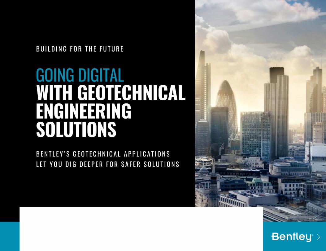
GOING DIGITAL WITH GEOTECHNICAL ENGINEERING SOLUTIONS
B U I L D I N G F O R T H E F U T U R E
B E N T L E Y ’ S G E O T E C H N I C A L A P P L I C A T I O N S L E T Y O U D I G D E E P E R F O R S A F E R S O L U T I O N S
2
TABLE OF CONTENTS
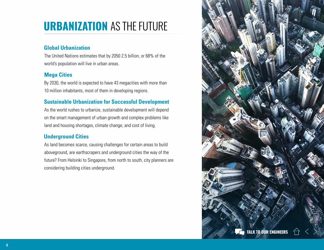
URBANIZATION AS THE FUTURE
3
Global UrbanizationThe United Nations estimates that by 2050 2.5 billion, or 68% of the
world’s population will live in urban areas.
Mega CitiesBy 2030, the world is expected to have 43 megacities with more than
10 million inhabitants, most of them in developing regions.
Sustainable Urbanization for Successful DevelopmentAs the world rushes to urbanize, sustainable development will depend
on the smart management of urban growth and complex problems like
land and housing shortages, climate change, and cost of living.
Underground CitiesAs land becomes scarce, causing challenges for certain areas to build
aboveground, are earthscrapers and underground cities the way of the
future? From Helsinki to Singapore, from north to south, city planners are
considering building cities underground.
HOW CAN CONSTRUCTION COMPANIES TAKE ADVANTAGE OF BUILDING OPPORTUNITIES IN THE CITIES OF THE FUTURE?
4
The growth is there…According to Deloitte the construction industry is expected
to grow by an average of 3.6% a year over the next three
years, with revenues estimated at USD 15 trillion by 2025.
Asia-Pacific remains the largest global construction market,
while the Middle East and parts of Africa are expected to
achieve the fastest growth by 2022. In the long term, eight
global construction markets – China, the US, India, Indonesia,
the UK, Mexico, Canada, and Nigeria – will account for 70%
of all global growth in construction until 2035.
…but also, low productivityConstruction is considered as the industry with the lowest
productivity gains of the past 30 years and with limited
appetite for innovation.
… low profitabilityMost engineering and construction firms continue to
experience low profitability and margins. The industry’s
traditionally low margins, low labor productivity, combined
with increasing project complexity and supply chain
constraints, will put extra pressure on companies’ profitability.
… and high costsConstruction and input costs for key building materials
such as steel are rising, driven by limited supply and tariff
uncertainties with talent shortages further complicating
cost structure.
GEOTECHNICAL CHALLENGES IN URBAN CONSTRUCTION
5
Congested and ever-growing cities pose some
specific challenges for the construction company
and its geotechnical engineering department.
Get More Out of Limited SpaceLimited land footprint requires greater project optimization
and urban development requires taller buildings with deeper
foundations. Yet, for construction companies, taller, thinner,
and deeper brings its own challenges related to safety,
stability, and subsidence. Therefore, thorough subsurface
investigation is a must and project managers must involve
geotechnical engineers in the earliest stages of planning
to ensure low geotechnical and project risk.
Understanding the Ground ConditionsWhile it is not unheard of for project stakeholders to be
unwilling to invest in thorough site investigation, in-depth
knowledge of the ground conditions can save operational
costs while greatly minimizing project, financial, and
safety risk.
Design Proper StructuresAccounting for the properties of soil, underground water,
structures, and their interaction allow construction managers
to model the most relevant structures and make
the optimal excavation and construction decision.
Be Mindful of the Adjacent Buildings and InfrastructureA pressing problem geotechnical engineers face is how to
manage adjacent structures. Successfully managing adjacent
structures relies on properly investigating the site, working
closely with stakeholders, and creating an excavation model
that can mitigate the financial risk of negative effects on the
adjacent building or infrastructure.
Complex Underground InfrastructureAnother problem is excavating around underground space
that could include public facilities or subway connectors,
transportation systems, water and sewerage piping, power
generation and cabling lines, telecommunications, and
defense facilities. Modeling around these obstacles can
be a complex, expensive, and risky endeavor.
Building for the FutureAnalyzing seismic conditions, soils, underground water,
and advanced soil-structure interaction allows for safe
and long-term operation of every building.
6
THE DIGITAL SOLUTIONS FOR ANY GEOTECHNICAL CHALLENGE Whether you are an investor, contractor, project manager, or geotechnical engineer, Bentley’s geotechnical solutions can provide you
with the digital geotechnical applications to transform your construction operations for better productivity and efficiency.
Through its five brands and digital solutions for every stage of the workflow, Bentley’s geotechnical team innovates the most
comprehensive suite of digital applications for the geotechnical professional.
From data gathering, storage, and information management, to the most robust analysis, planning and model design, to construction
and operations management, Bentley has you covered with trusted geotechnical software solutions, know-how, and training for
every type of geotechnical project.
“We produce the world’s most accurate and accessible geotechnical analysis solutions, backed by world-class geotechnical expertise, to produce safer structures and environments for all.”
– Raoul Karp, Vice President, Engineering Simulation, Bentley Systems
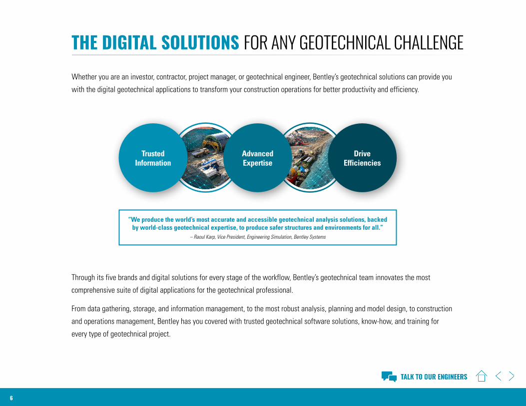
Trusted Information
Advanced Expertise
Drive Efficiencies
7
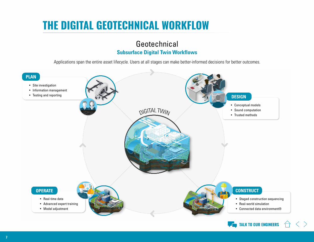
THE DIGITAL GEOTECHNICAL WORKFLOW
• Site investigation• Information management • Testing and reporting
• Staged construction sequencing• Real-world simulation• Connected data environment®
• Real-time data • Advanced expert training• Model adjustment
PLAN
• Conceptual models• Sound computation• Trusted methods
DESIGN
CONSTRUCTOPERATE
GeotechnicalSubsurface Digital Twin Workflows
Applications span the entire asset lifecycle. Users at all stages can make better-informed decisions for better outcomes.
8
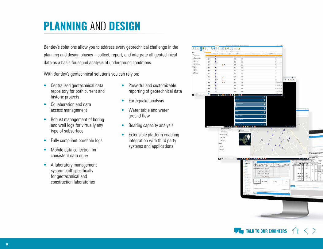
PLANNING AND DESIGNBentley’s solutions allow you to address every geotechnical challenge in the
planning and design phases – collect, report, and integrate all geotechnical
data as a basis for sound analysis of underground conditions.
With Bentley’s geotechnical solutions you can rely on:
• Centralized geotechnical data repository for both current and historic projects
• Collaboration and data access management
• Robust management of boring and well logs for virtually any type of subsurface
• Fully compliant borehole logs
• Mobile data collection for consistent data entry
• A laboratory management system built specifically for geotechnical and construction laboratories
• Powerful and customizable reporting of geotechnical data
• Earthquake analysis
• Water table and water ground flow
• Bearing capacity analysis
• Extensible platform enabling integration with third party systems and applications
9
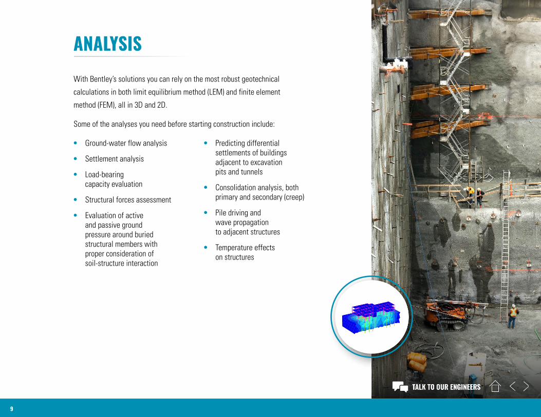
ANALYSISWith Bentley’s solutions you can rely on the most robust geotechnical
calculations in both limit equilibrium method (LEM) and finite element
method (FEM), all in 3D and 2D.
Some of the analyses you need before starting construction include:
• Ground-water flow analysis
• Settlement analysis
• Load-bearing capacity evaluation
• Structural forces assessment
• Evaluation of active and passive ground pressure around buried structural members with proper consideration of soil-structure interaction
• Predicting differential settlements of buildings adjacent to excavation pits and tunnels
• Consolidation analysis, both primary and secondary (creep)
• Pile driving and wave propagation to adjacent structures
• Temperature effects on structures
10
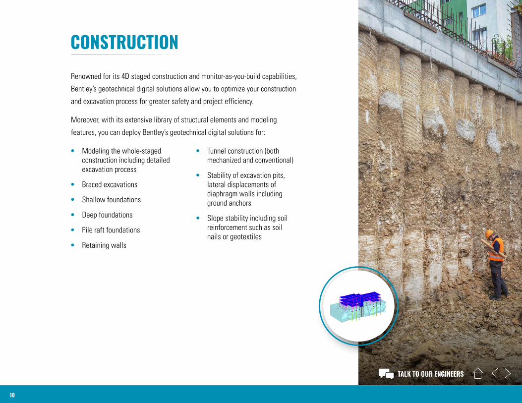
CONSTRUCTIONRenowned for its 4D staged construction and monitor-as-you-build capabilities,
Bentley’s geotechnical digital solutions allow you to optimize your construction
and excavation process for greater safety and project efficiency.
Moreover, with its extensive library of structural elements and modeling
features, you can deploy Bentley’s geotechnical digital solutions for:
• Modeling the whole-staged construction including detailed excavation process
• Braced excavations
• Shallow foundations
• Deep foundations
• Pile raft foundations
• Retaining walls
• Tunnel construction (both mechanized and conventional)
• Stability of excavation pits, lateral displacements of diaphragm walls including ground anchors
• Slope stability including soil reinforcement such as soil nails or geotextiles
11
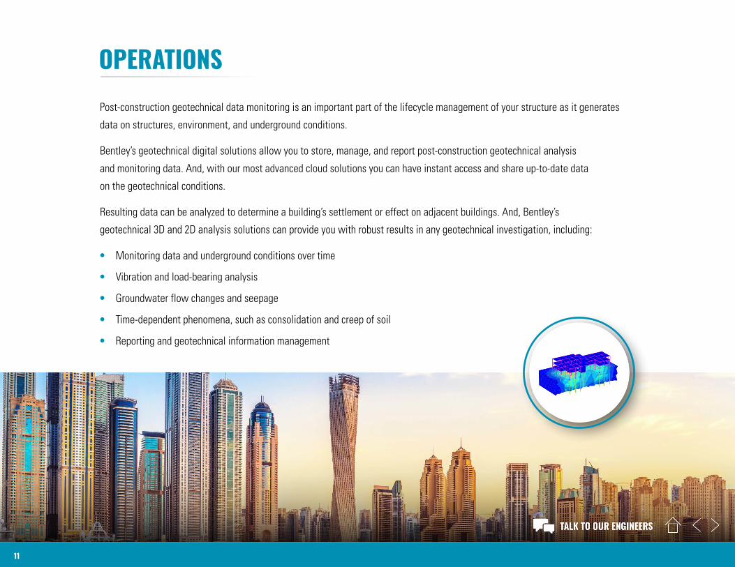
OPERATIONSPost-construction geotechnical data monitoring is an important part of the lifecycle management of your structure as it generates
data on structures, environment, and underground conditions.
Bentley’s geotechnical digital solutions allow you to store, manage, and report post-construction geotechnical analysis
and monitoring data. And, with our most advanced cloud solutions you can have instant access and share up-to-date data
on the geotechnical conditions.
Resulting data can be analyzed to determine a building’s settlement or effect on adjacent buildings. And, Bentley’s
geotechnical 3D and 2D analysis solutions can provide you with robust results in any geotechnical investigation, including:
• Monitoring data and underground conditions over time
• Vibration and load-bearing analysis
• Groundwater flow changes and seepage
• Time-dependent phenomena, such as consolidation and creep of soil
• Reporting and geotechnical information management
12
BENTLEY’S GEOTECHNICAL DIGITAL SOLUTIONSBentley’s geotechnical engineering software is used by geotechnical professionals and is ubiquitous for geotechnical
projects in infrastructure and building construction, mining, offshore, oil and gas, environment, dams, and reservoirs.
PLAXIS®
PLAXIS is the most sophisticated and complete geotechnical engineering software solution for 360-degree analysis, modeling,
and design.
PLAXIS is renowned as a robust, reliable, and user-friendly finite element software solution for analysis of soil and rock deformation
and stability, as well as soil structure interaction and groundwater and heat flow. With its industry leading computational
procedures, PLAXIS provides a comprehensive solution for design and analysis of soils, rocks, and associated structures.
OpenGround®
OpenGround is a comprehensive solution for collecting, reporting, managing, visualizing, analyzing, and accessing geotechnical
data. Our advanced digital workflows combine both subsurface and surface data into one cohesive design to provide engineers
with better collaboration and efficiency. The improved access and reliability saves time and money in the planning, design, analysis,
construction, and operation of infrastructure projects.
13
BENTLEY’S GEOTECHNICAL DIGITAL SOLUTIONSgINT®
gINT’s suite of software solutions allows you to manage and report on your geotechnical subsurface data with a wide range
of reports. gINT improves productivity with centralized data management and reporting for geotechnical subsurface projects,
as well as streamlines processes with accessible, interoperable data for subsurface reporting for soils, borelogs, and lab tests.
Keynetix™
Keynetix’s geotechnical software solutions ensure consistent information management along all stages of the data journey,
from planning through to site work and reporting. Keynetix technology allows you to have a single source of truth for your data
for greater project efficiency. Regardless of whether it is a single borehole exploratory hole or the most complex construction
project, our intelligent data management applications ensure trusted, accessible data from on-site logging to national archive.
14
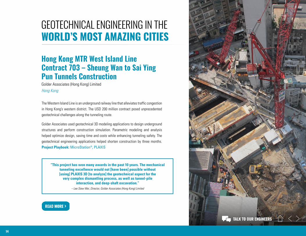
Hong Kong MTR West Island Line Contract 703 – Sheung Wan to Sai Ying Pun Tunnels ConstructionGolder Associates (Hong Kong) Limited Hong Kong
The Western Island Line is an underground railway line that alleviates traffic congestion in Hong Kong’s western district. The USD 200 million contract posed unprecedented geotechnical challenges along the tunneling route.
Golder Associates used geotechnical 3D modeling applications to design underground structures and perform construction simulation. Parametric modeling and analysis helped optimize design, saving time and costs while enhancing tunneling safety. The geotechnical engineering applications helped shorten construction by three months. Project Playbook: MicroStation®, PLAXIS
“This project has won many awards in the past 10 years. The mechanical tunneling excellence would not [have been] possible without [using] PLAXIS 3D [to analyze] the geotechnical aspect for the
very complex dismantling process, as well as tunnel-pile interaction, and deep-shaft excavation.”
– Lee Siew Wei, Director, Golder Associates (Hong Kong) Limited
GEOTECHNICAL ENGINEERING IN THE WORLD’S MOST AMAZING CITIES
15
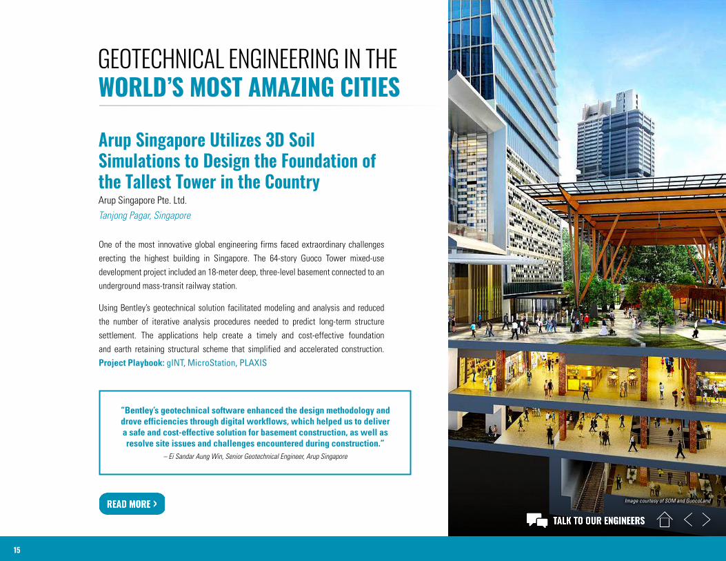
Arup Singapore Utilizes 3D Soil Simulations to Design the Foundation of the Tallest Tower in the CountryArup Singapore Pte. Ltd.Tanjong Pagar, Singapore
One of the most innovative global engineering firms faced extraordinary challenges erecting the highest building in Singapore. The 64-story Guoco Tower mixed-use development project included an 18-meter deep, three-level basement connected to an underground mass-transit railway station.
Using Bentley’s geotechnical solution facilitated modeling and analysis and reduced the number of iterative analysis procedures needed to predict long-term structure settlement. The applications help create a timely and cost-effective foundation and earth retaining structural scheme that simplified and accelerated construction. Project Playbook: gINT, MicroStation, PLAXIS
“Bentley’s geotechnical software enhanced the design methodology and drove efficiencies through digital workflows, which helped us to deliver a safe and cost-effective solution for basement construction, as well as resolve site issues and challenges encountered during construction.”
– Ei Sandar Aung Win, Senior Geotechnical Engineer, Arup Singapore
GEOTECHNICAL ENGINEERING IN THE WORLD’S MOST AMAZING CITIES
Image courtesy of SOM and GuocoLand
16
GEOTECHNICAL ENGINEERING IN THE WORLD’S MOST AMAZING CITIES
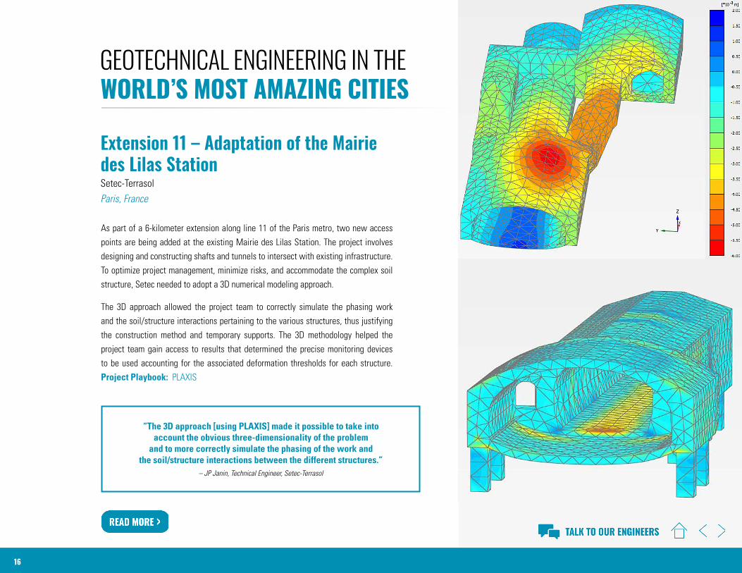
Extension 11 – Adaptation of the Mairie des Lilas StationSetec-TerrasolParis, France
As part of a 6-kilometer extension along line 11 of the Paris metro, two new access points are being added at the existing Mairie des Lilas Station. The project involves designing and constructing shafts and tunnels to intersect with existing infrastructure. To optimize project management, minimize risks, and accommodate the complex soil structure, Setec needed to adopt a 3D numerical modeling approach.
The 3D approach allowed the project team to correctly simulate the phasing work and the soil/structure interactions pertaining to the various structures, thus justifying the construction method and temporary supports. The 3D methodology helped the project team gain access to results that determined the precise monitoring devices to be used accounting for the associated deformation thresholds for each structure. Project Playbook: PLAXIS
“The 3D approach [using PLAXIS] made it possible to take into account the obvious three-dimensionality of the problem
and to more correctly simulate the phasing of the work and the soil/structure interactions between the different structures.”
– JP Janin, Technical Engineer, Setec-Terrasol
17
GEOTECHNICAL ENGINEERING IN THE WORLD’S MOST AMAZING CITIES
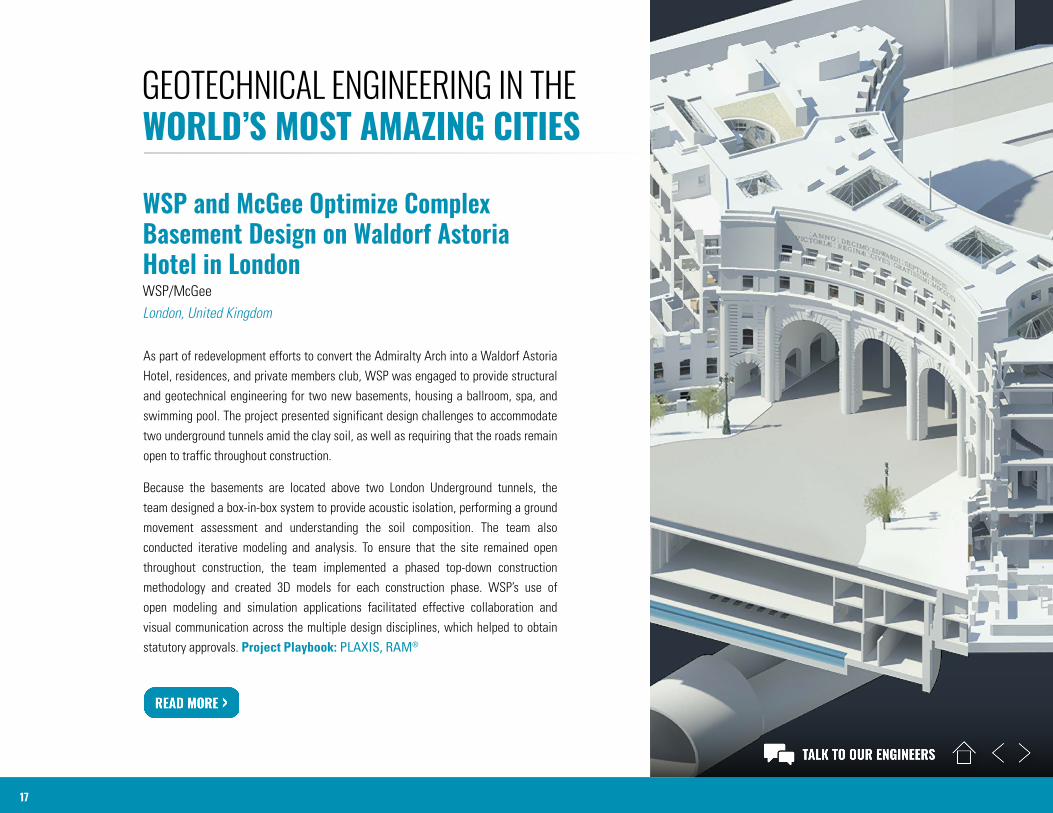
WSP and McGee Optimize Complex Basement Design on Waldorf Astoria Hotel in LondonWSP/McGeeLondon, United Kingdom
As part of redevelopment efforts to convert the Admiralty Arch into a Waldorf Astoria Hotel, residences, and private members club, WSP was engaged to provide structural and geotechnical engineering for two new basements, housing a ballroom, spa, and swimming pool. The project presented significant design challenges to accommodate two underground tunnels amid the clay soil, as well as requiring that the roads remain open to traffic throughout construction.
Because the basements are located above two London Underground tunnels, the team designed a box-in-box system to provide acoustic isolation, performing a ground movement assessment and understanding the soil composition. The team also conducted iterative modeling and analysis. To ensure that the site remained open throughout construction, the team implemented a phased top-down construction methodology and created 3D models for each construction phase. WSP’s use of open modeling and simulation applications facilitated effective collaboration and visual communication across the multiple design disciplines, which helped to obtain statutory approvals. Project Playbook: PLAXIS, RAM®
GEOTECHNICAL ENGINEERING
© 2021 Bentley Systems, Incorporated. Bentley, the Bentley logo, connected data environment, gINT, Keynetix, MicroStation, PLAXIS, PLAXIS 3D, and RAM are either registered or unregistered trademarks or service marks of Bentley Systems, Incorporated or one of its direct or indirect wholly owned subsidiaries. Other brands and product names are trademarks of their respective owners. 01/21
Embrace confidence, credibility, and control in your geotechnical applications. With Bentley’s geotechnical engineering software,
users can access a complete digital workflow. By utilizing our applications users can rely on secure solutions for data-driven
decisions through enhanced collaboration – when and where it is needed. Users can add layers of safety and reduce risk by
accessing a connected data environment where applications offer advanced interoperability and integration. Advanced expertise
and methods of sound computation are delivered by a trusted team of experts, ensuring they are easier to use and provide more
robust 3D modeling and analysis.
Use our applications to plan, design, analyze, construct, and operate for increased safety and reliability in projects.
1-800-BENTLEY (1 800 236 8539)