Embed Size (px)
Citation preview
Government of Newfoundland and Labrador
Department of Fisheries and Land Resources
Agriculture and Lands Branch
LAND FOR AGRICULTURE DEVELOPMENT
Property Summary -2017AOI-17 MATTHEWS POND
July 2017
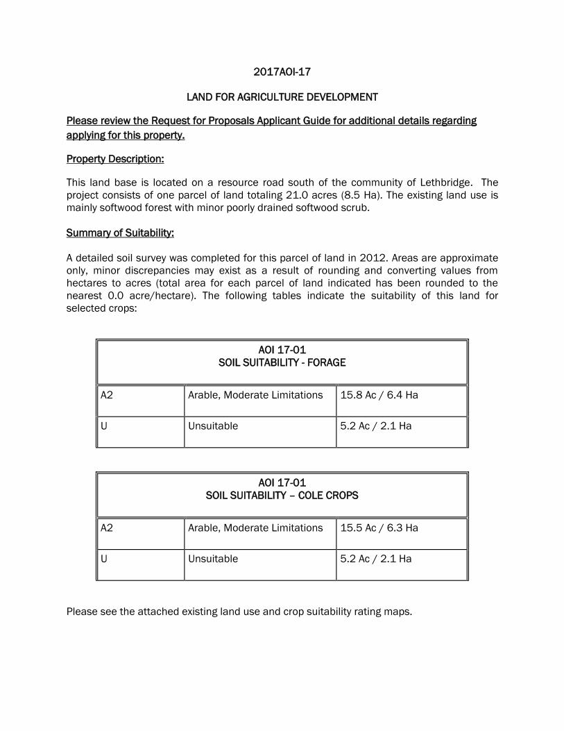
2017AOI-17
LAND FOR AGRICULTURE DEVELOPMENT
Please review the Request for Proposals Applicant Guide for additional details regarding
applying for this property.
Property Description:
This land base is located on a resource road south of the community of Lethbridge. The
project consists of one parcel of land totaling 21.0 acres (8.5 Ha). The existing land use is
mainly softwood forest with minor poorly drained softwood scrub.
Summary of Suitability:
A detailed soil survey was completed for this parcel of land in 2012. Areas are approximate
only, minor discrepancies may exist as a result of rounding and converting values from
hectares to acres (total area for each parcel of land indicated has been rounded to the
nearest 0.0 acre/hectare). The following tables indicate the suitability of this land for
selected crops:
AOI 17-01
SOIL SUITABILITY - FORAGE
A2 Arable, Moderate Limitations 15.8 Ac / 6.4 Ha
U Unsuitable 5.2 Ac / 2.1 Ha
AOI 17-01
SOIL SUITABILITY – COLE CROPS
A2 Arable, Moderate Limitations 15.5 Ac / 6.3 Ha
U Unsuitable 5.2 Ac / 2.1 Ha
Please see the attached existing land use and crop suitability rating maps.

Other Considerations:
Successful applicant(s) may be subject to other requirements as may be specified by
Provincial and Federal Governments.
Survey:
Successful applicant(s) will be responsible for costs associated with the legal land survey
prior to approval of title.
Attachments:
1) Application/Farmland Development Proposal
2) 2017AOI-17 Matthews Pond - Land Use Map
3) 2017AOI-17 Matthews Pond – Forage Suitability Map
4) 2017AOI-17 Matthews Pond – Cole Crop Suitability Map
Notes Regarding Application Process:
Applications for land within this area are accepted on a first come first serve basis and will
require a completed Farm Development Plan.
For additional information, please contact:
Coolene Brake, Land Management Specialist
Department of Fisheries and Land Resources
Fortis Building
4 Herald Avenue
P.O. Box 2006
Corner Brook, NL
A2H 6J8
Telephone: (709) 637 – 2081
Further information can be obtained by contacting The Land Management Division at 709-
637-2081 or by visiting the Departments website at www.gov.nl.ca.

17-0121.0Ac.
Wooded
M:\CRBKA\Shared\Agrifoods\LRS\Soils\Survey Intensity Level 2 (Detailed)\AOI Soils_Suitability\AOI Lot Layouts\AOI 17-Existing Land Use.mxd
µ
1:10,500
Existing Land Use of the Agricultural Area of Interest #17
Matthews Pond, NLLegend
Area of InterestAOI 17 LotsPoorly drainedResource RoadsStreams
Location Map (NTS 02C/05)
Department of Fisheries and Land ResourcesApril, 2017
Designed for Illustrative Purposes ONLY.
0 100 200 300 400 500Meters
1 Acre = 0.404686 Hectares
Port BlandfordLethbridge
³²
Clarenv ille
£¤230
Sm ithSou nd New Burnt Cove
Harcourt
Jamestown
Goose B
ay Winter Brook
£¤234
Clode
³²
Sound
³²
Charlot tetown
£¤233
Musgravetown
£¤230
George's BrookMilton
Matthews Pond
813A2
15.8Ac
1271U
5.2Ac
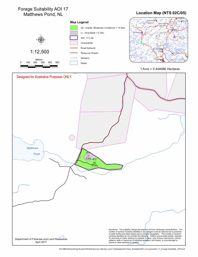
M:\CRBKA\Shared\Agrifoods\LRS\Soils\Survey Intensity Level 2 (Detailed)\AOI Soils_Suitability\AOI Lot Layout\AOI_17_Forage Suitability_CFP.mxd
µ1:12,500
Forage Suitability AOI 17Matthews Pond, NL
Map LegendA2 - Arable, Moderate Limitations = 15.8AcU - Unsuitable = 5.2AcAOI 17 LotsUnavailableRoad NetworkResource RoadsStreamsWater
Department of Fisheries and Land ResourcesApril 2017
Designed for Illustrative Purposes ONLY.
0 100 200 300 400 500Meters
1 Acre = 0.404686 Hectares
Disclaimer: The suitability ratings are based on soil and landscape characteristics. The number of acres/or hectares identified in any polygon could be reduced due to proximity to water bodies and steep slopes due to complex topography. The number of acres/or hectares identified do not consider the following: buffers around water bodies; potential for and kinds of roads; distance to markets; location, size of farms; land tenure; cultural patterns; skills or resources of individual operators; and hazard to crop damage by storms or other extremes in weather.
Location Map (NTS 02C/05)
Port BlandfordLethbridge
³²
Clarenv ille
£¤230
Sm ithSou nd New Burnt Cove
Harcourt
Jamestown
Goose B
ay Winter Brook
£¤234
Clode
³²
Sound
³²
Charlot tetown
£¤233
Musgravetown
£¤230
George's BrookMilton

Matthews Pond
813A2
15.8Ac
1271U
5.2Ac
M:\CRBKA\Shared\Agrifoods\LRS\Soils\Survey Intensity Level 2 (Detailed)\AOI Soils_Suitability\AOI Lot Layout\AOI_17_Cole Crop Suitability_CFP.mxd
µ1:12,500
Cole Crop Suitability AOI 17Matthews Pond, NL
Map LegendA2 - Arable, Moderate Limitations = 15.8AcU - Unsuitable = 5.2AcAOI 17 LotsUnavailableRoad NetworkResource RoadsStreamsWater
Department of Fisheries and Land ResourcesApril 2017
Designed for Illustrative Purposes ONLY.
0 100 200 300 400 500Meters
1 Acre = 0.404686 Hectares
Disclaimer: The suitability ratings are based on soil and landscape characteristics. The number of acres/or hectares identified in any polygon could be reduced due to proximity to water bodies and steep slopes due to complex topography. The number of acres/or hectares identified do not consider the following: buffers around water bodies; potential for and kinds of roads; distance to markets; location, size of farms; land tenure; cultural patterns; skills or resources of individual operators; and hazard to crop damage by storms or other extremes in weather.
Location Map (NTS 02C/05)
Port BlandfordLethbridge
³²
Clarenv ille
£¤230
Sm ithSou nd New Burnt Cove
Harcourt
Jamestown
Goose B
ay Winter Brook
£¤234
Clode
³²
Sound
³²
Charlot tetown
£¤233
Musgravetown
£¤230
George's BrookMilton

CL-
0001
/03-
01
Fisheries and Land Resources
APPLICATION FOR CROWN LANDS
FOR DEPARTMENT USE ONLY
APPLICATION NO.
FILE NO.
DATE REGISTERED
RECEIPT NO.
AMOUNT
INDICATED ON PLAN NO.
DATE
INITIAL
TOPO NO. INITIAL
APPLICANT INFORMATION
SURNAME GIVEN NAME MIDDLE NAME AGE
MAILING ADDRESS
CITY/TOWN PROVINCE POSTAL CODE
BUSINESS TELEPHONE HOME TELEPHONE
ARE YOU A RESIDENT OF THE PROVINCE OF NEWFOUNDLAND AND LABRADOR? YES NO
ARE YOU AN EMPLOYEE OF THE DEPARTMENT OF FISHERIES AND LAND RESOURCES? YES NO
HAVE YOU, YOUR SPOUSE, OR ANY DEPENDENT CHILDREN EVER APPLIED FOR, OR RECEIVED LAND FROM THE CROWN? YES NO
IF YES, SPECIFY TITLE NO(s).
PROPOSED TENURE AND USE TYPE OF APPLICATION
LAND USE
LEASE
RESIDENCE
GRANT LICENCE TO OCCUPY
COTTAGE AQUACULTURE AGRICULTURE (provide details below)
COMMERCIAL (provide detailed description below) OTHER (provide details below)
DESCRIBE BUILDINGS TO BE ERECTED (if applicable)
DIMENSIONS: LENGTH PROPOSED WATER AND SEWAGE FACILITIES (if applicable)
WIDTH
WELL SEPTIC MUNICIPAL WATER MUNICIPAL SEWER OTHER (provide details below)

Page 2 LAND DESCRIPTION
1. THE LAND IS SITUATED AT
IN THE ELECTORAL DISTRICT OF
2. IS THE LAND APPLIED FOR LOCATED WITHIN MUNICIPAL BOUNDARIES? YES NO
3. APPROXIMATE DIMENSIONS OF THE LAND FRONTAGE metres DEPTH metres
4. DISTANCE TO CLOSEST WATERBODY metres
NAME OF WATERBODY (if applicable)
5. IS THE SITE ACCESSIBLE BY ROAD? YES NO
IF NO, WILL THE SITE REQUIRE NEW ROAD CONSTRUCTION FOR ACCESS? YES NO
IF YES, WHAT WILL BE THE APPROXIMATE LENGTH OF THE ROAD? metres
FOR SITES WITHOUT ROAD ACCESS, PLEASE INDICATE METHOD OF TRANSPORTATION WALKING A.T.V. BOAT SNOWMOBILE AIRCRAFT
FOR SITES WITHOUT ROAD ACCESS, LOCATION OF ACCESS ROUTE MUST BE INDICATED ON THE MAP ATTACHED TO THE APPLICATION AND ACCESS BY A.T.V. MUST BE IN ACCORDANCE WITH A.T.V. REGULATIONS.
6. IS THE SITE PRESENTLY OCCUPIED: FENCES, BUILDINGS, SIGNS, CLEARING, LOCAL UNDERSTANDING? YES NO
IF YES, STATE YEAR OCCUPATION COMMENCED, AREA OCCUPIED AND NAME OF PERSON WHO DEVELOPED OR OCCUPIED THE LAND
7. ARE YOU AWARE OF ANY EVIDENCE OF PREVIOUS LAND USE, SUCH AS FENCES, BUILDINGS, SIGNS, CLEARING. LOCAL UNDERSTANDING, ETC.? YES NO
IF YES, STATE YEAR OCCUPATION COMMENCED, AREA OCCUPIED AND NAME OF PERSON WHO DEVELOPED OR OCCUPIED THE LAND
DESCRIPTION OF LAND Please Note: When your application is accepted by this Department you are required to identify the site in the field by clearly marking your corner posts. If there is a discrepancy between the area marked in the field and the area indicated on the map, the latter shall prevail.
Sketch the land applied for showing distance to prominent nearby features such as buildings, fences, road intersections. Map must also be attached.
BOUNDED ON NORTH BY
BOUNDED ON SOUTH BY
BOUNDED ON EAST BY
BOUNDED ON WEST BY
PLEASE NOTE: IT IS THE POLICY OF THE CROWN LANDS DIVISION TO ACCEPT APPLICATIONS ON A FIRST COME - FIRST SERVED BASIS.
APPLICATIONS MUST BE FULLY COMPLETED, WITH A MAP SHOWING THE EXACT LOCATIONS OF THE LAND APPLIED FOR TOGETHER WITH THE APPLICATION FEE. ONLY THEN WILL THE APPLICATION BE ACCEPTED AND DEEMED REGISTERABLE BY THIS DEPARTMENT.
Page 3 SKETCH USE THE AREA BELOW TO SKETCH THE LAND APPLIED FOR SHOWING DISTANCE TO PROMINENT NEARBY FEATURES SUCH AS BUILDINGS, FENCES, ROAD INTERSECTIONS. MAP MUST ALSO BE ATTACHED.
AFFIDAVIT OF APPLICANT (to be read carefully)
I, do hereby make oath and declare as follows: (a) (b)
(c) (d)
(e)
(f)
(g)
The information contained in this application is true and correct to the best of my knowledge and belief. I have inspected the land applied for and have found no evidence of occupation (with the exception of No. 6 and/or No. 7 on page 2, where applicable). I am not aware of any adverse claim to the land applied for by any person(s). I recognize and accept that I am solely responsible for correctly identifying the parcel of land that is the subject of this application. I fully understand that acceptance of this application by the Department does not give me any rights or privileges in relation to the land under application. I FULLY UNDERSTAND THAT THE LAND IS NOT TO BE OCCUPIED UNTIL I RECEIVE A FULLY EXECUTED TITLE DOCUMENT. I FULLY UNDERSTAND THAT UNDER SECTION 14 OF THE LANDS ACT, THE MINISTER OF FISHERIES AND LAND RESOURCES OR THE LIEUTENANT-GOVERNOR IN COUNCIL MAY CANCEL, AMEND OR OTHERWISE DEAL WITH THE GRANT, LEASE, LICENCE OR EASEMENT AT ANY TIME PRIOR TO THE DELIVERY OF A FULLY EXECUTED TITLE DOCUMENT.
Sworn before me
At
this day of 20
Official Administering Oath Applicant’s Signature
NOTE: A non-refundable processing fee of ONE HUNDRED AND FIFTY DOLLARS ( $150.00 plus H.S.T.)
must accompany this application.
Cheques or money orders are to be made payable to the NEWFOUNDLAND EXCHEQUER ACCOUNT.
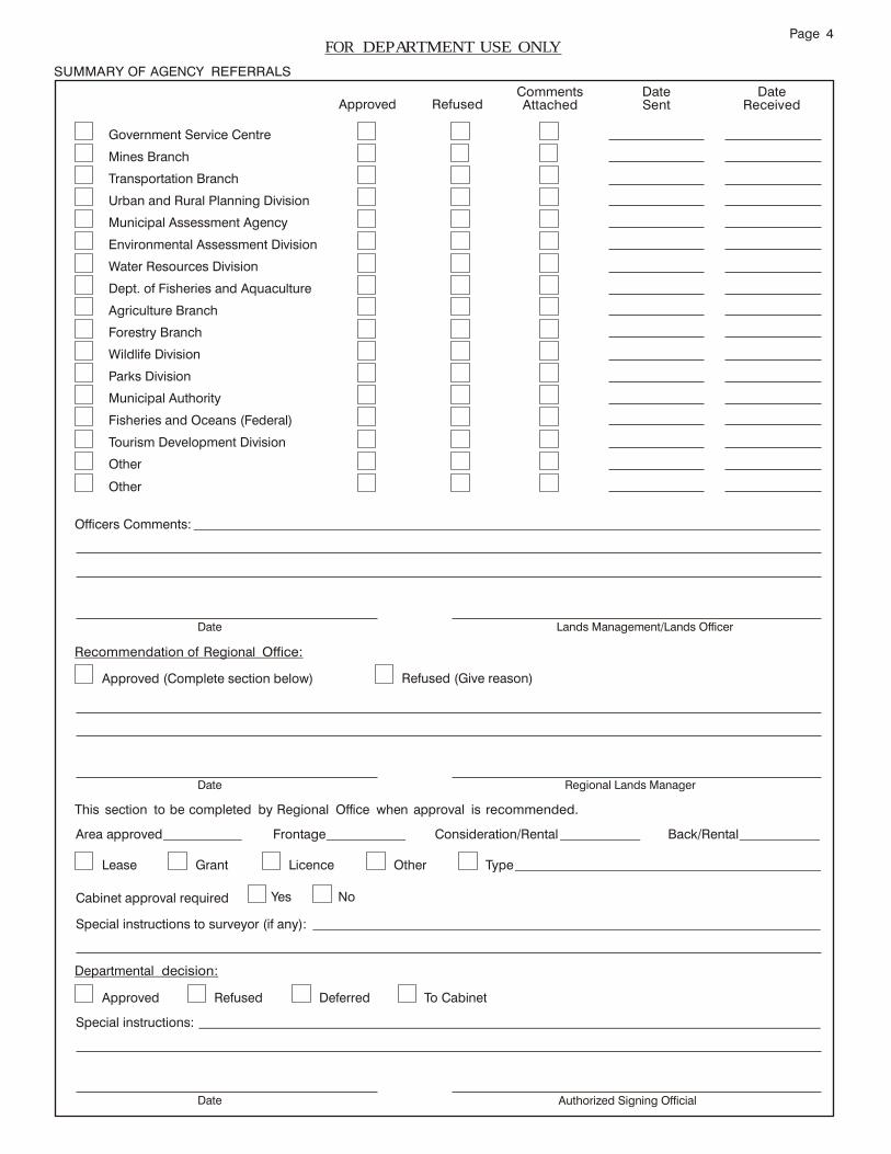
Page 4 FOR DEPARTMENT USE ONLY
SUMMARY OF AGENCY REFERRALS
Government Service Centre
Mines Branch
Transportation Branch
Urban and Rural Planning Division
Municipal Assessment Agency
Environmental Assessment Division
Water Resources Division
Dept. of Fisheries and Aquaculture
Agriculture Branch
Forestry Branch
Wildlife Division
Parks Division
Municipal Authority
Fisheries and Oceans (Federal)
Tourism Development Division
Other
Other
Approved Refused
Comments Attached
Date Sent
Date Received
Officers Comments:
Date Lands Management/Lands Officer
Recommendation of Regional Office:
Approved (Complete section below)
Refused (Give reason)
Date Regional Lands Manager
This section to be completed by Regional Office when approval is recommended.
Area approved
Frontage Consideration/Rental Back/Rental
Lease Grant Licence Other Type
Cabinet approval required Yes No
Special instructions to surveyor (if any):
Departmental decision:
Approved Refused Deferred To Cabinet
Special instructions:
Date Authorized Signing Official
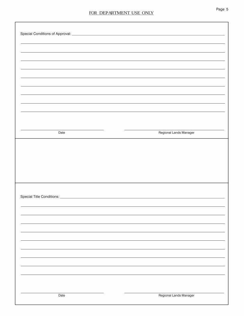
Page 5 FOR DEPARTMENT USE ONLY
Special Conditions of Approval:
Date Regional Lands Manager
Special Title Conditions:
Date Regional Lands Manager

1
Agriculture and Lands Branch
Agriculture Crown Land Report (Farm Plan)
Commercial Farming
SECTION A: To be completed by the applicant in conjunction with the
Agriculture Development Officer.
1. Identification:
Name: Agric. Lease Application #:
Address: Telephone Number:
Postal Code:
2. Location of Land:
(a) Place: (b) Acreage Applied for:
(c) Bounded by: On the North: On the South: On the West: On the East:
(d) Is the land within a Municipal or Regional Planning Area? Yes No
If Yes, which area?
(e) If land is zoned, indicate the type of zoning, ie.
Residential Community Farming
Rural Agricultural
Resource Other ___________________________
(f) Distance of land from: Publicly Maintained Road:
Electrical Services:
(g) Is the land accessible by road? What is the type and condition of the
road?
3. Applicant’s Plans and Objectives:
Briefly state the purpose and need for land
2
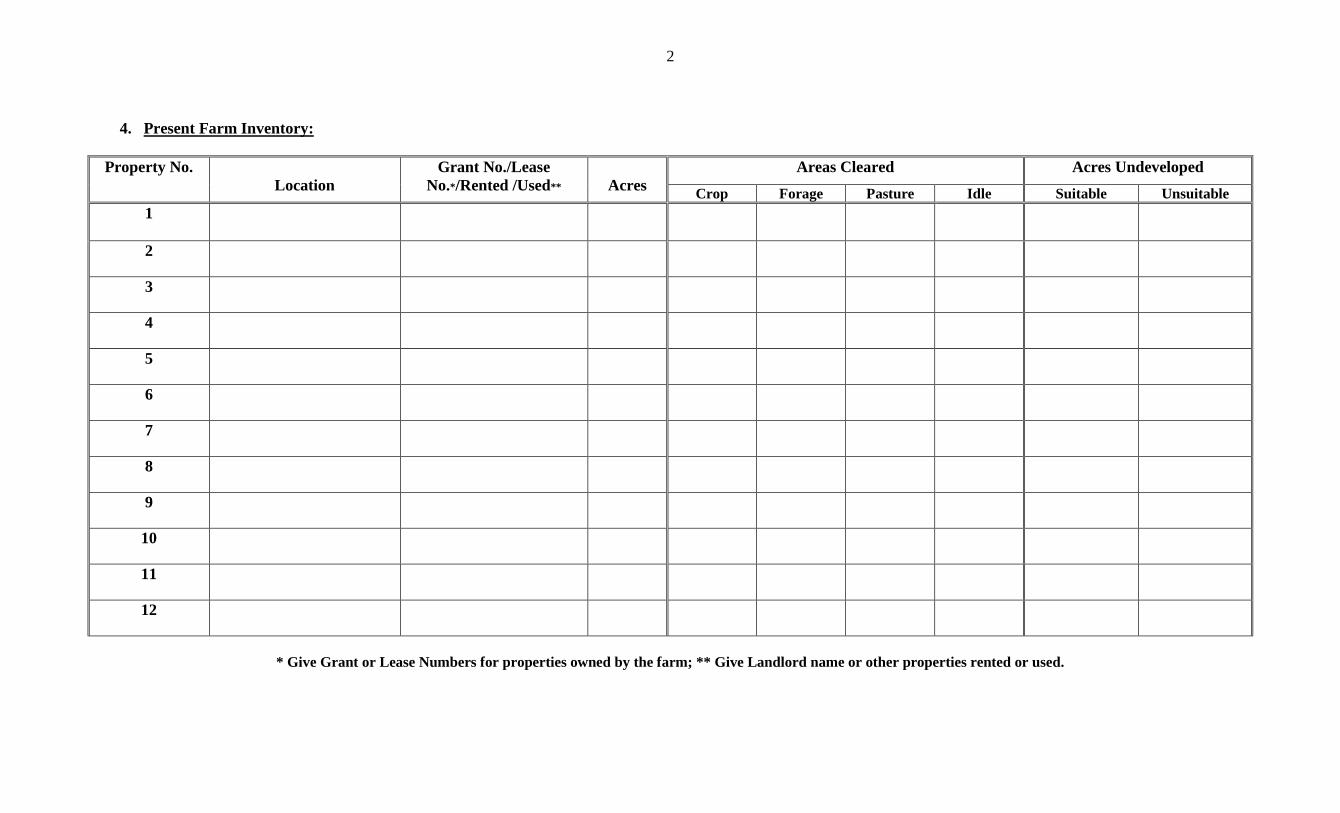
4. Present Farm Inventory:
Property No.
Location
Grant No./Lease
No.*/Rented /Used**
Acres
Areas Cleared Acres Undeveloped
Crop Forage Pasture Idle Suitable Unsuitable
1
2
3
4
5
6
7
8
9
10
11
12
* Give Grant or Lease Numbers for properties owned by the farm; ** Give Landlord name or other properties rented or used.

3
5. Livestock Inventory:
Dairy Swine
Average no. of cows Average no. of sows Average milk
production/cow/year No. of hogs marketed
Total liters of milk/year Beef Average no. in herd Sheep No. marketed Average no. of ewes No. of lambs marketed Layers Size of flock Broilers Eggs sold Size of flock No. marketed Fur Type No.
If the above data is not representative of normal years, please explain:
6. Quotas:
Commodity
Present Approved
Quota 20___
Anticipated
20___ 20___ 20___ 20___
7. Machine Inventory:
Type/Model Year Purchased Age Original Cost Market Value
4
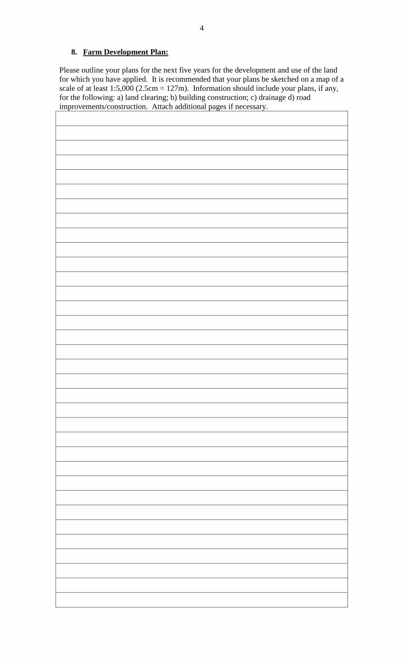
8. Farm Development Plan:
Please outline your plans for the next five years for the development and use of the land
for which you have applied. It is recommended that your plans be sketched on a map of a
scale of at least 1:5,000 (2.5cm = 127m). Information should include your plans, if any,
for the following: a) land clearing; b) building construction; c) drainage d) road
improvements/construction. Attach additional pages if necessary.
5
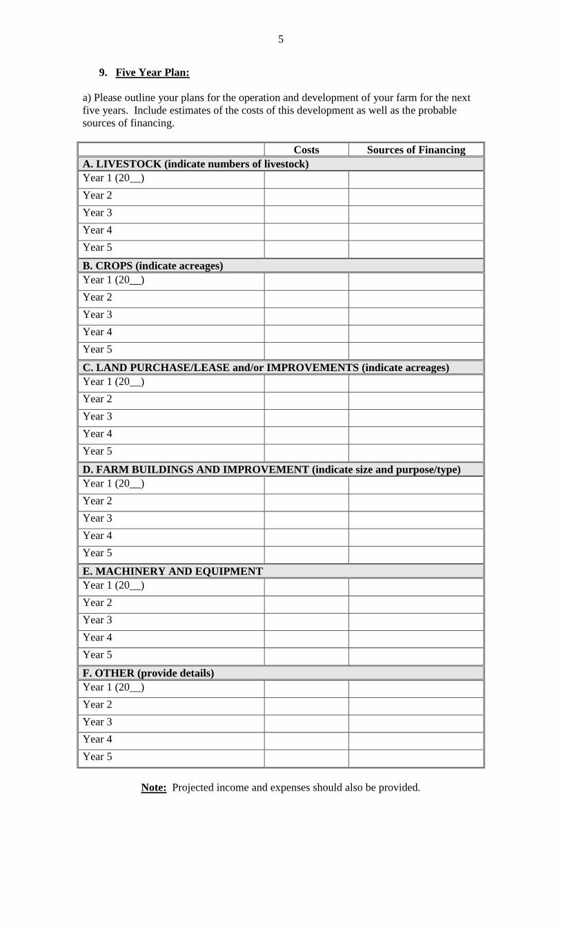
9. Five Year Plan:
a) Please outline your plans for the operation and development of your farm for the next
five years. Include estimates of the costs of this development as well as the probable
sources of financing.
Costs Sources of Financing
A. LIVESTOCK (indicate numbers of livestock)
Year 1 (20__) Year 2 Year 3 Year 4 Year 5 B. CROPS (indicate acreages)
Year 1 (20__) Year 2 Year 3 Year 4 Year 5 C. LAND PURCHASE/LEASE and/or IMPROVEMENTS (indicate acreages)
Year 1 (20__) Year 2 Year 3 Year 4 Year 5 D. FARM BUILDINGS AND IMPROVEMENT (indicate size and purpose/type)
Year 1 (20__) Year 2 Year 3 Year 4 Year 5 E. MACHINERY AND EQUIPMENT
Year 1 (20__) Year 2 Year 3 Year 4 Year 5 F. OTHER (provide details)
Year 1 (20__) Year 2 Year 3 Year 4 Year 5
Note: Projected income and expenses should also be provided.

6
b: Will the proposed development require an outside source of capital? __________.
If Yes, please indicate the proposed amount and sources of financing for developing the
land under application. (Note 10c).
Source Kind (loan, grant, etc.) Estimated Amount
Required
c: Will road construction, upgrading or maintenance be required? (Note 10c).
d: Will electrical facilities be required? (Note 10c).
10. Applicants Signature:
Are you aware of the following?
A. THE APPLICANT MUST NOT UNDERTAKE ANY DEVELOPMENT OR ERECT
ANY BUILDINGS, ENTER UPON OR TAKE POSSESSION OF THE LAND
APPLIED FOR IN ANY WAY UNTIL A LEASE FROM THE DEPARTMENT OF
ENVIRONMENT AND CONSERVATION HAS BEEN ISSUED.
YES NO
B. THE LESSEE MUST CLEAR AND CULTIVATE (UNLESS STATED
DIFFERENTLY) 10% OF THE LEASED LAND WITHIN 2 YEARS, 25% WITHIN 5
YEARS, 50% WITHIN 10 YEARS, AND 75% WITHIN 15 YEARS, AND THE
FAILURE TO CARRY OUT THE CONDITIONS OF THE LEASE RELATIVE TO
THE PROPERUSE OF THE LAND AND THE PAYMENT OF RENTALS, WILL
RESULT IN THE CANCELLATION OF THE LEASE.
YES NO
C. APPROVAL OF THE APPLICATION FOR CROWN LAND DOES NOT COMMIT
THE GOVERNMENT OF PROVIDING THE APPLICANT OR FARM UNIT WITH
FINANCIAL ASSISTANCE, LAND CLEARING ASSISTANCE, IMPROVED OR
UPGRADED ACCESS, ELECTRICAL SERVICES OR ANY OTHER GOVERNMENT
SPONSORED PROGRAMS OR SERVICES.
YES NO
I hereby certify that to the best of my knowledge and belief, the information provided for this
report is true and correct. Personal information collected is used to process applications, this
information is confidential and handled as required by the Access to Information and
Protection of Privacy (ATIPP) Act. It may be shared with in the Department for program
delivery purposes. Any questions or comments may be directed to the Manager of
Environmental and Land Use Services at (709)637-2081.
Signed _________________________ __________________________ Date: ___________________

7
SECTION B: To be completed by the Agriculture Development Officer.
1. Assessment of Land Suitability:
(a) Percentage of land that is: mineral soil:
%
peatland:
%
(b) Soil/land characteristics:
In consideration of the following soil and land characteristics, are there any limitations
which would be a significant hindrance to development the property for the intended
purpose?
Drainage Yes No
If Yes, elaborate:
Stoniness Yes No
If Yes, elaborate:
Soil Depth Yes No
If Yes, elaborate:
Slopes Yes No
If Yes, elaborate:
(c) Land Suitability (Acreage): Acres
How many acres are:
(i) Suitable for clearing and cultivation for vegetable production?
(ii) Suitable for clearing and cultivation for forage production
only?
(iii) Marginal for clearing and cultivation for forage production
only?
(iv) Suitable for clearing for pasture only? (v) Unsuitable?
TOTAL
2. Assessment of Applicant:
a) Comment on the Management practices of the applicant. ie. Production skills,
management skills, record keeping and technical courses.
8
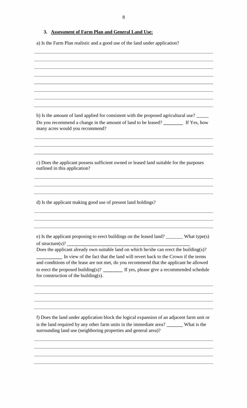
3. Assessment of Farm Plan and General Land Use:
a) Is the Farm Plan realistic and a good use of the land under application?
b) Is the amount of land applied for consistent with the proposed agricultural use? _____
Do you recommend a change in the amount of land to be leased? ______ If Yes, how
many acres would you recommend?
c) Does the applicant possess sufficient owned or leased land suitable for the purposes
outlined in this application?
d) Is the applicant making good use of present land holdings?
e) Is the applicant proposing to erect buildings on the leased land? _______ What type(s)
of structure(s)? ______________________________________ Does the applicant already own suitable land on which he/she can erect the building(s)?
________ In view of the fact that the land will revert back to the Crown if the terms
and conditions of the lease are not met, do you recommend that the applicant be allowed
to erect the proposed building(s)? ______ If yes, please give a recommended schedule
for construction of the building(s).
f) Does the land under application block the logical expansion of an adjacent farm unit or
is the land required by any other farm units in the immediate area? _____ What is the
surrounding land use (neighboring properties and general area)?
9
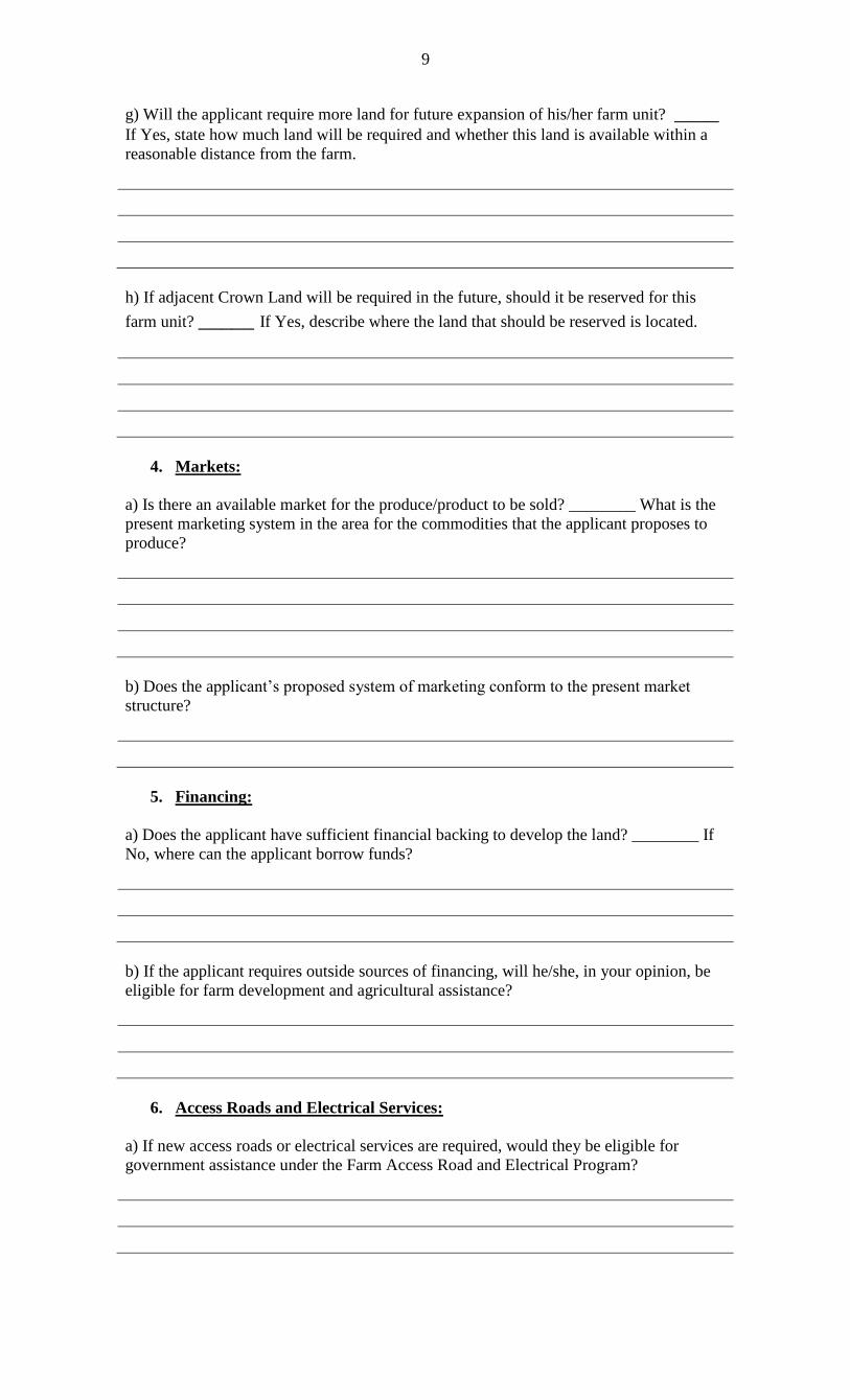
g) Will the applicant require more land for future expansion of his/her farm unit? ____ If Yes, state how much land will be required and whether this land is available within a
reasonable distance from the farm.
h) If adjacent Crown Land will be required in the future, should it be reserved for this
farm unit? _____ If Yes, describe where the land that should be reserved is located.
4. Markets:
a) Is there an available market for the produce/product to be sold? ________ What is the
present marketing system in the area for the commodities that the applicant proposes to
produce?
b) Does the applicant’s proposed system of marketing conform to the present market
structure?
5. Financing:
a) Does the applicant have sufficient financial backing to develop the land? ________ If
No, where can the applicant borrow funds?
b) If the applicant requires outside sources of financing, will he/she, in your opinion, be
eligible for farm development and agricultural assistance?
6. Access Roads and Electrical Services:
a) If new access roads or electrical services are required, would they be eligible for
government assistance under the Farm Access Road and Electrical Program?

10
7. Comments and Recommendations (Comments of other Specialists should be
attached where applicable):
Date Signature of Agriculture Development Officer