Embed Size (px)
Citation preview
SM
Great River Energy GIS
John Auel United Services Group
SM
Background
• Bachelor of Science at the University of Wisconsin, Steven’s Point – Area of Emphasis – Cartography
• Currently employed at United Services Group for the past 12 years. • GIS Technician II
SM
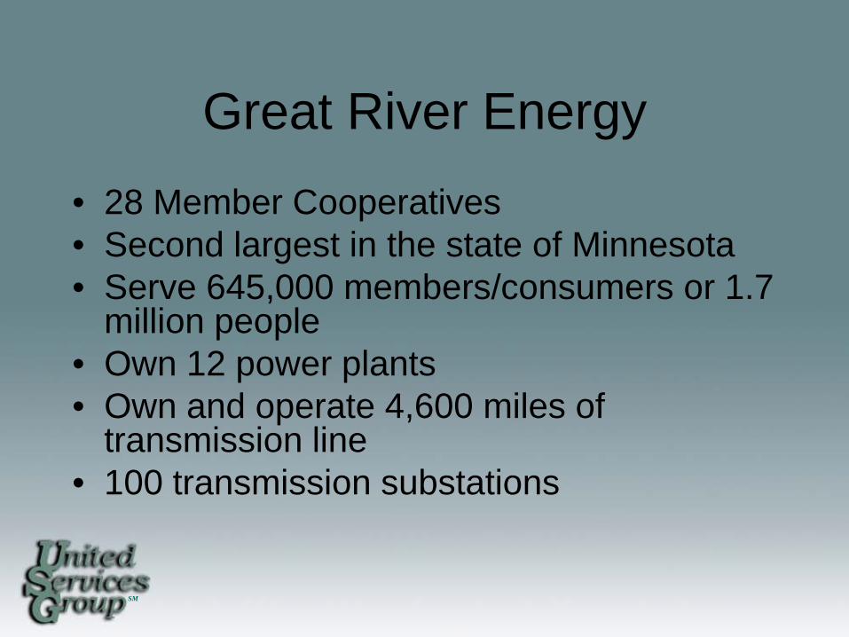
Great River Energy • 28 Member Cooperatives • Second largest in the state of Minnesota • Serve 645,000 members/consumers or 1.7
million people • Own 12 power plants • Own and operate 4,600 miles of
transmission line • 100 transmission substations
SM
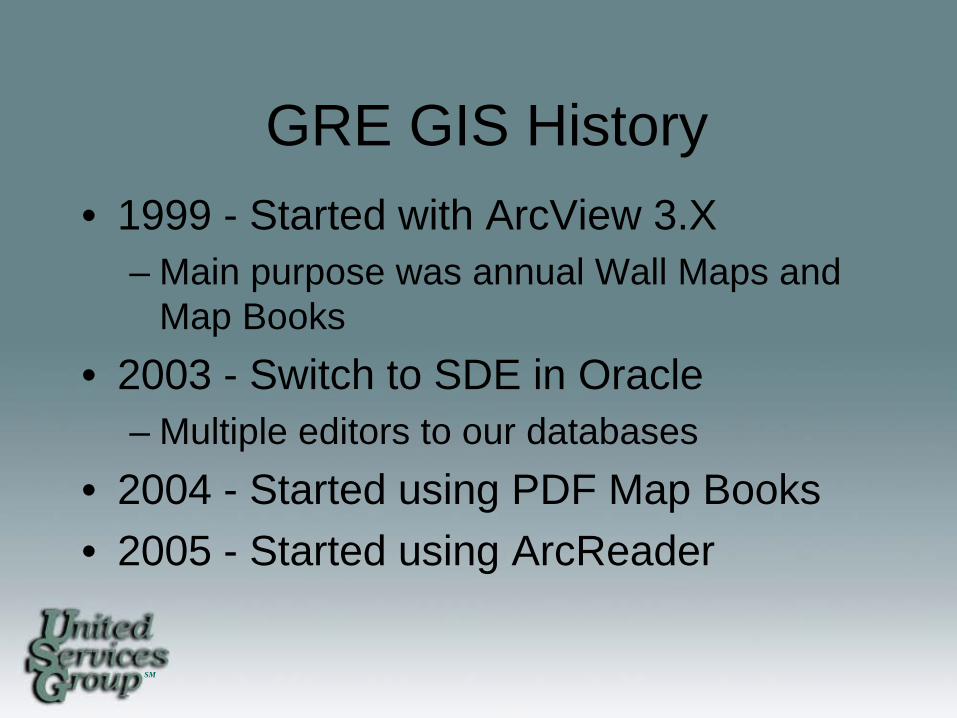
GRE GIS History • 1999 - Started with ArcView 3.X
– Main purpose was annual Wall Maps and Map Books
• 2003 - Switch to SDE in Oracle – Multiple editors to our databases
• 2004 - Started using PDF Map Books • 2005 - Started using ArcReader
SM
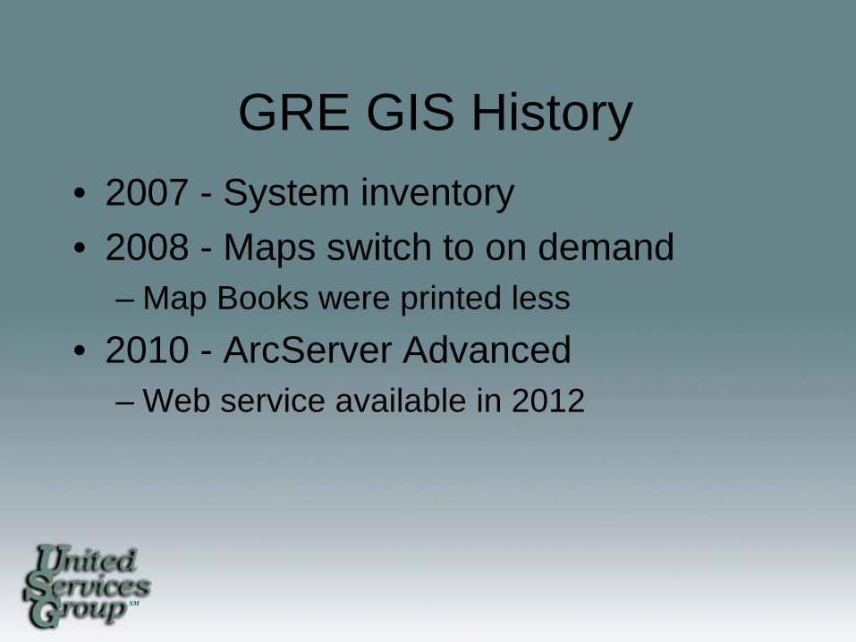
GRE GIS History • 2007 - System inventory • 2008 - Maps switch to on demand
– Map Books were printed less • 2010 - ArcServer Advanced
– Web service available in 2012
SM
Current Projects • Standard Web Viewer • Vegetation Management • System One Line • AVL (Automatic Vehicle Location) • Gopher State One Call
SM
Standard Web Viewer
• One stop shop to see all our system data – System Map – System One Line – Content Management (Oracle) – Asset Management (Maximo) – Drawing Management (Adept)
SM
Best way to use our data
• What do we want to do with the web service? – See the maps – See the data – Search for data – Turn layers on and off – Edit our data
SM
Widgets
• Decide on which way we need to go – ArcGIS Template Viewer for Silverlight
• Configure through .xml
– Silverlight Viewer • Programmers would have to do all the
customizing.
SM
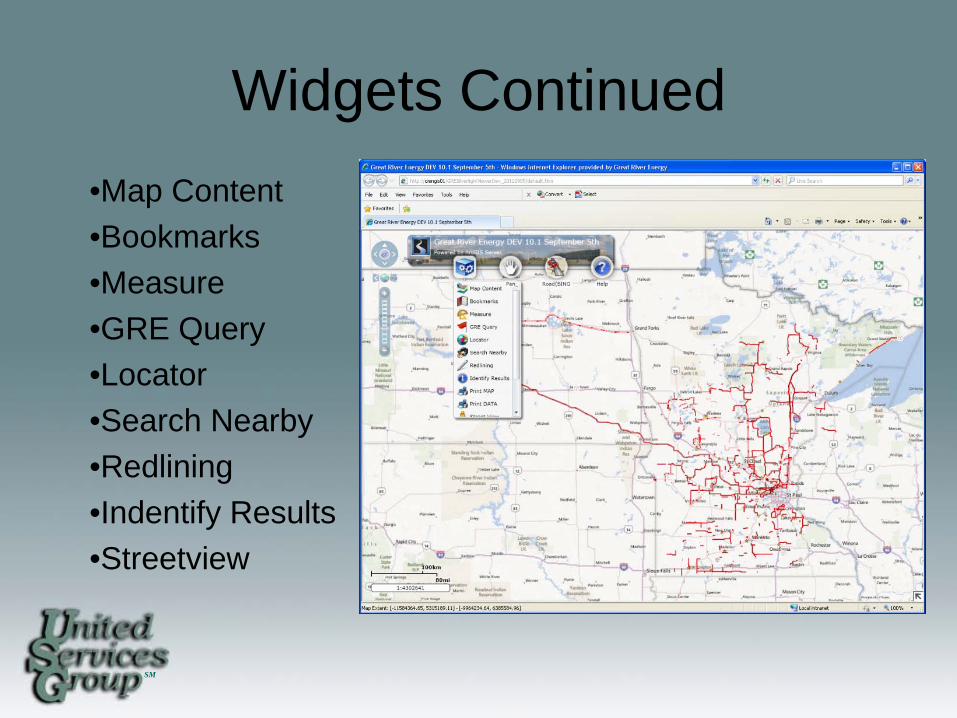
Widgets Continued •Map Content •Bookmarks •Measure •GRE Query •Locator •Search Nearby •Redlining •Indentify Results •Streetview
SM
Standard Web Viewer • Issues
– Telling people it’s coming • Ten years or more
– Not knowing which is the right way for GRE to go
• Success – We finally have one with our data – Coworkers are finding the value of having
all the data
SM
Vegetation Management
• 2011 – Started looking into the process on how we
can help and use our data
– Corridor Software They configured their software to work with our vegetation workflow.
SM
Vegetation Management • 2012
– Going through the new software – Ordering the new hardware – Making changes to the data model – Pilot project
SM
Vegetation Management • 2013
– Implement to the field – Still training contractors
SM
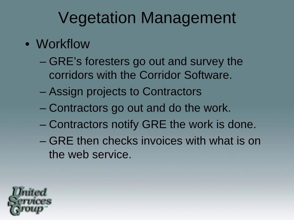
Vegetation Management • Workflow
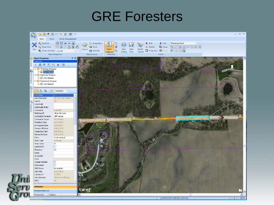
– GRE’s foresters go out and survey the corridors with the Corridor Software.
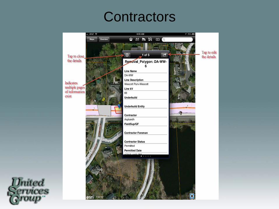
– Assign projects to Contractors – Contractors go out and do the work. – Contractors notify GRE the work is done. – GRE then checks invoices with what is on
the web service.
SM
GRE Foresters
SM
Contractors
SM
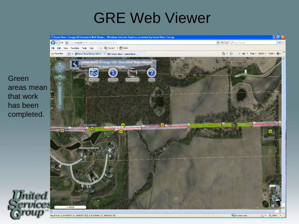
GRE Web Viewer
Green areas mean that work has been completed.

SM
GRE Web Viewer
Office workers then double check work with invoices turned in.
SM
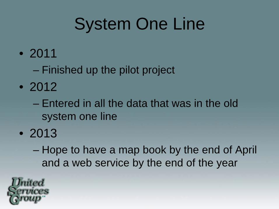
System One Line • 2011
– Finished up the pilot project • 2012
– Entered in all the data that was in the old system one line
• 2013 – Hope to have a map book by the end of April
and a web service by the end of the year
SM
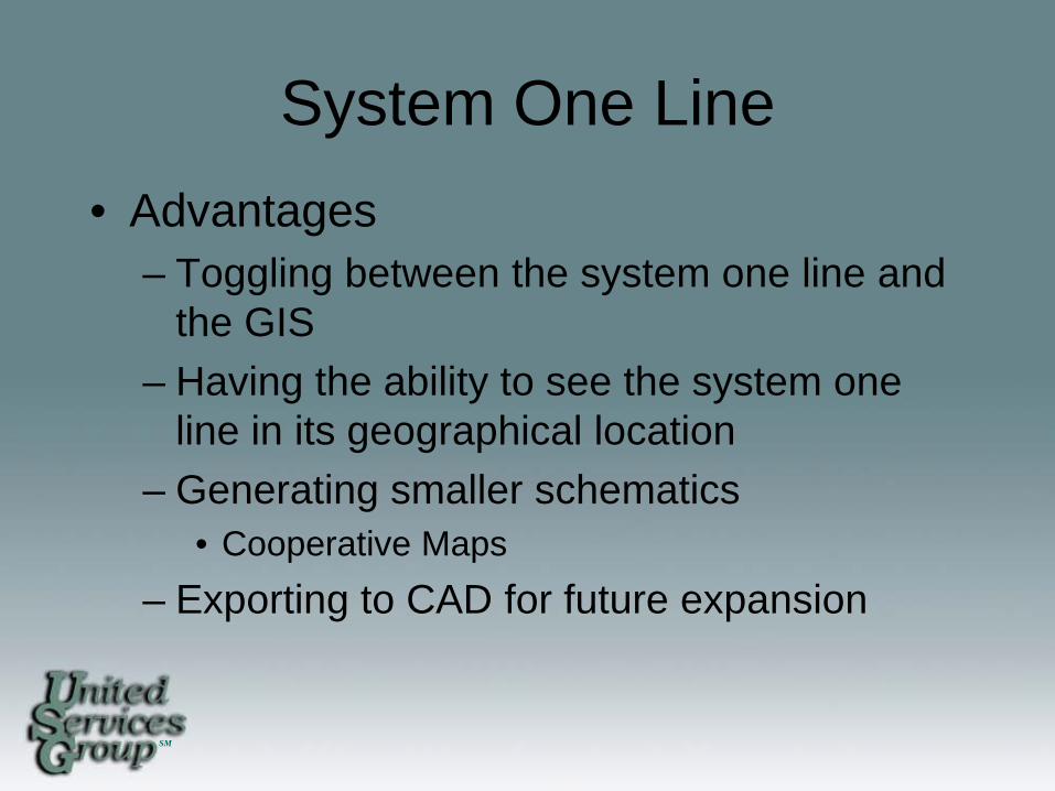
System One Line • Advantages
– Toggling between the system one line and the GIS
– Having the ability to see the system one line in its geographical location
– Generating smaller schematics • Cooperative Maps
– Exporting to CAD for future expansion
SM
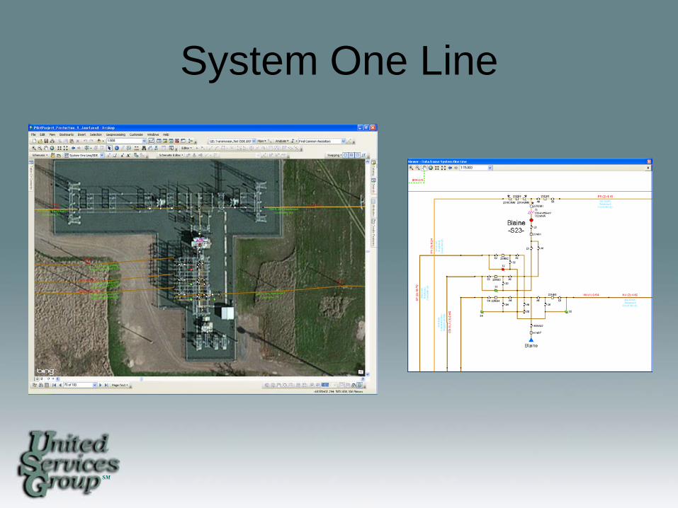
System One Line
SM
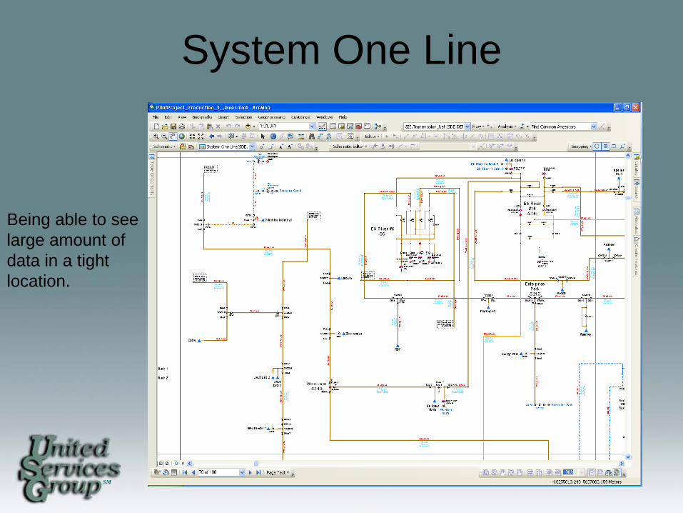
System One Line
Being able to see large amount of data in a tight location.
SM
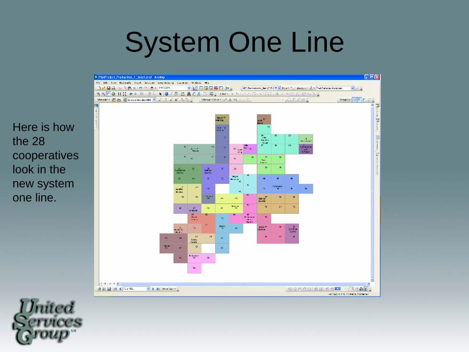
System One Line
Here is how the 28 cooperatives look in the new system one line.
SM
System One Line
• Issues – Tons of data – Exporting to new databases – Knowing the best way to use the schematic
extension • One drawing or multiple schematics • Draw or system, or let the extension run it
through a default.
SM
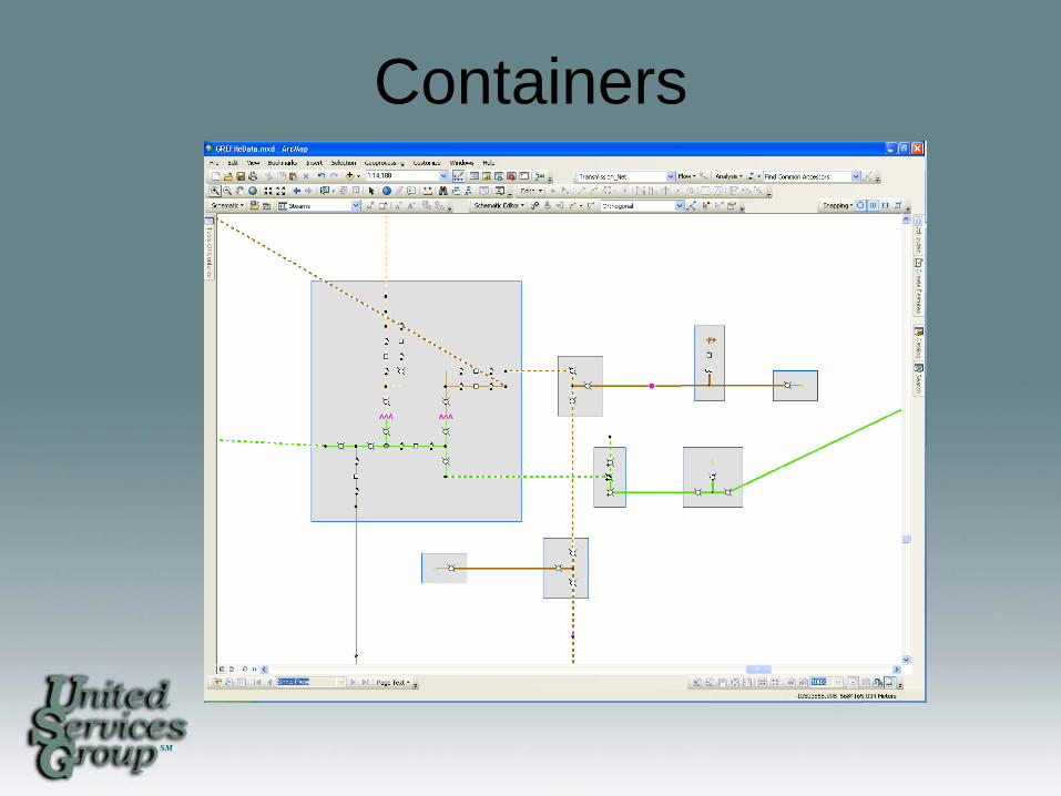
Containers
SM
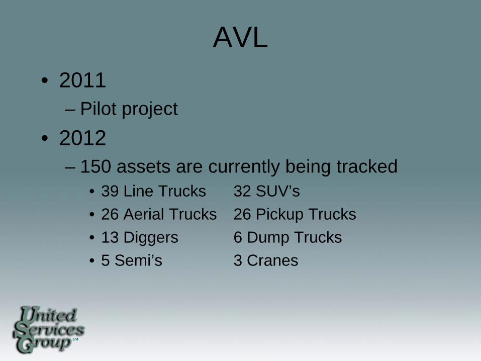
AVL • 2011
– Pilot project • 2012
– 150 assets are currently being tracked • 39 Line Trucks 32 SUV’s • 26 Aerial Trucks 26 Pickup Trucks • 13 Diggers 6 Dump Trucks • 5 Semi’s 3 Cranes
SM
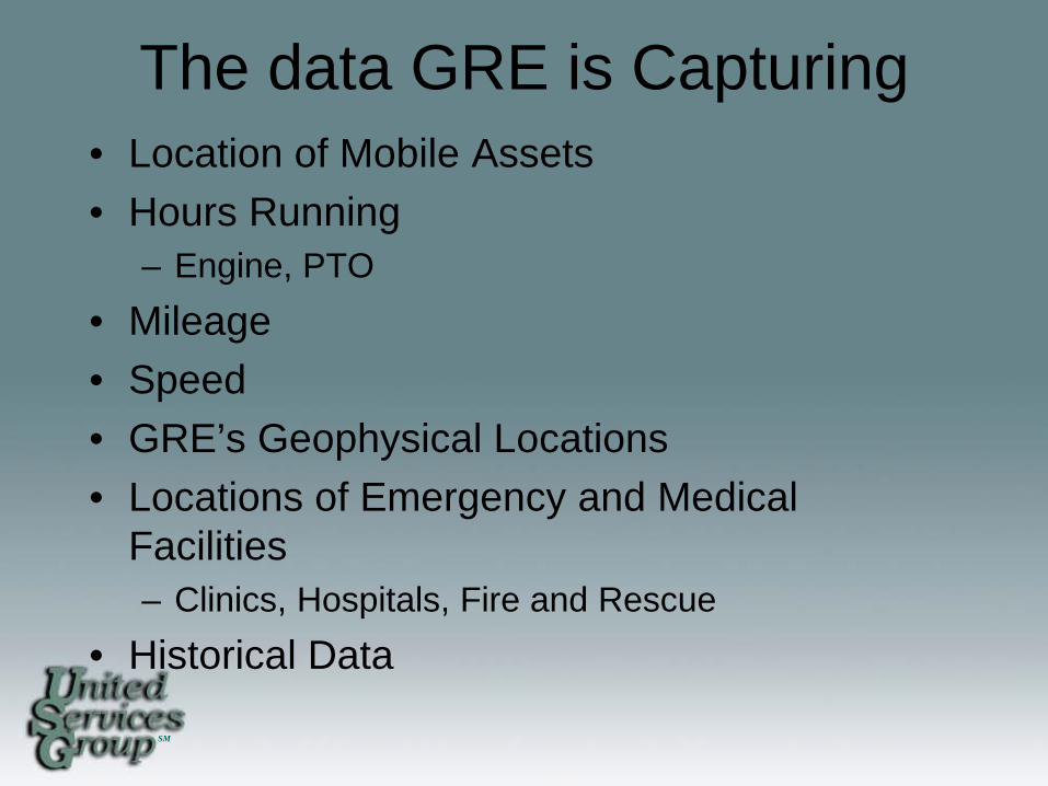
The data GRE is Capturing • Location of Mobile Assets • Hours Running
– Engine, PTO • Mileage • Speed • GRE’s Geophysical Locations • Locations of Emergency and Medical
Facilities – Clinics, Hospitals, Fire and Rescue
• Historical Data
SM
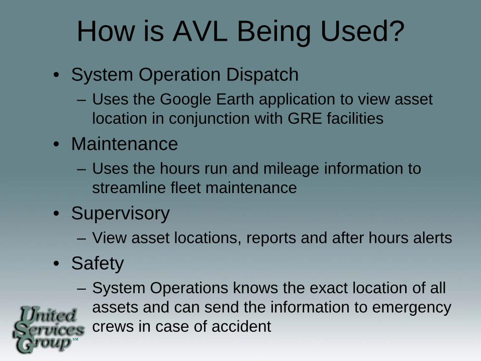
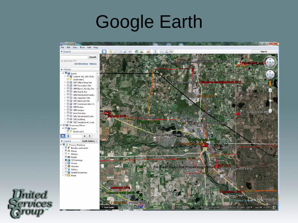
How is AVL Being Used? • System Operation Dispatch
– Uses the Google Earth application to view asset location in conjunction with GRE facilities
• Maintenance – Uses the hours run and mileage information to
streamline fleet maintenance • Supervisory
– View asset locations, reports and after hours alerts • Safety
– System Operations knows the exact location of all assets and can send the information to emergency crews in case of accident
SM
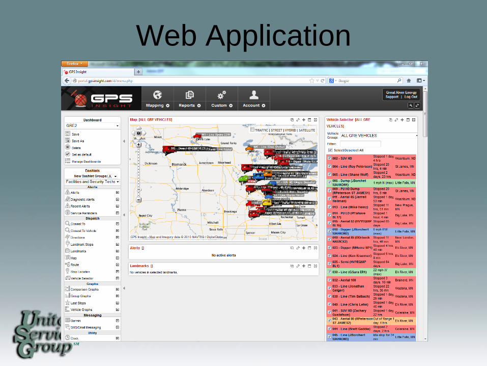
Web Application
SM
Google Earth
SM
AVL Going Forward
• Interface AVL with GIS System – Plans to go away from Google Earth and
into our Standard Web Viewer • Installation on additional assets
– Entering the new asset into our database

SM
Gopher State One Call
• Notification system established to inform all Minnesota underground facility operator of intended excavation.
SM
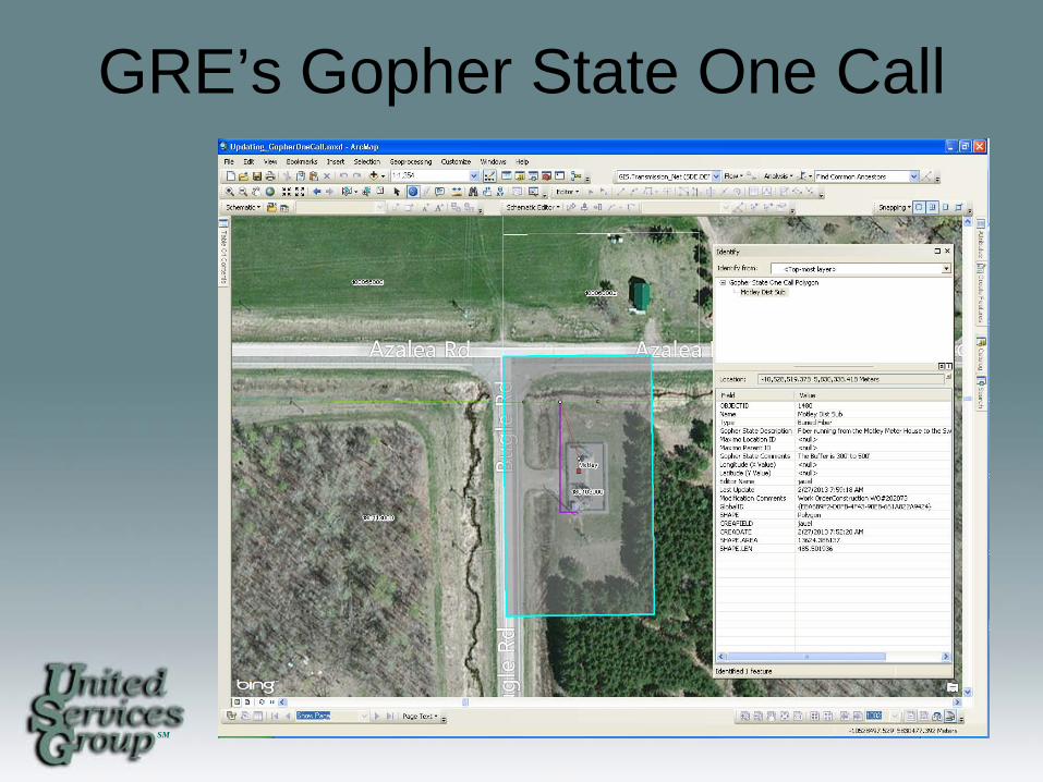
GRE’s Gopher State One Call
• To help GRE System Operations deal with requests we have created our own dataset that tracks our underground features.
• We have a feature that deals with polygons, lines, and points that could be at risk with Gopher State One Call.
SM
GRE’s Gopher State One Call
• Each feature is in it’s correct location on the system map.
• Description on what it is and where it might be going.
• Send update to Gopher State about every six months.
SM
GRE’s Gopher State One Call
SM
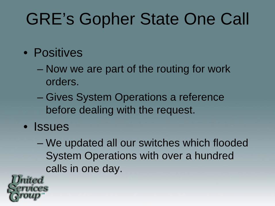
GRE’s Gopher State One Call
• Positives – Now we are part of the routing for work
orders. – Gives System Operations a reference
before dealing with the request. • Issues
– We updated all our switches which flooded System Operations with over a hundred calls in one day.
SM
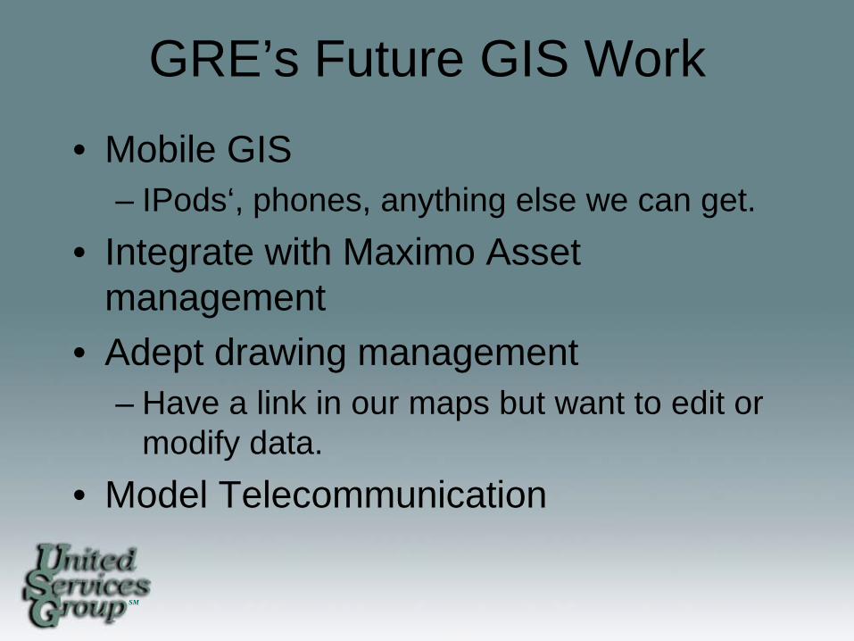
GRE’s Future GIS Work • Mobile GIS
– IPods‘, phones, anything else we can get. • Integrate with Maximo Asset
management • Adept drawing management
– Have a link in our maps but want to edit or modify data.
• Model Telecommunication