Embed Size (px)
Citation preview
Groundwater Impacted System Management Plan
Chesham System
(River Chess)
January 2021

2
Version control
Version Date Amendment Author Checked Reviewed
1-d1 Nov 2020 Draft for EA NW and AJ DJ APH
1-d2 Jan 2021 Final Draft for
EA
DJ APH KD
1-V1 Jan 2021 Version 1 DJ APH KD
1-V2 July 2021 Update to
introductory
text and
infiltration
potential
figures
DJ APH KD
1-V3 July 2021 Update to
infiltration
potential
figures
DJ APH KD
Annual
Update 2021
October
2021
Addition of
the Annual
Update 2021
DJ APH KD

3
Table of contents
Introduction
Brief description of Chesham catchment
Problem characterisation
Anticipated unavoidable discharges
General outline plan & timescale
Chesham Infiltration Management Plan
High level approach statement
Investigations
Monitoring
Mitigation
Updates
Appendices - Groundwater infiltration potential analysis
Investigations & remedial work undertaken since 2019/20 and future plans
Addendum – Annual Update 2021
4
6
6
7
8
11
11
12
12
12
12
13
14
18

4
This document sets out Thames Water’s approach to the management of groundwater infiltration in sewerage systems where the influence of groundwater infiltration is viewed as excessive and likely to be the source of uncontrolled escape of untreated or partially treated sewage.
All sewerage systems combined and separate will experience some groundwater infiltration1 and a nominal allowance in design will be made for this. However, in some catchments, the impact of groundwater infiltration can be considerable, leading to impacts on service during periods of high groundwater, typically during the winter.
Groundwater can enter the sewerage system through the pipes and manholes, this may occur at a defect (crack, hole, displaced joint) or on a normal joint on the sewer or in the manhole. A key point to note is that where infiltration occurs it is not necessarily an indicator that the sewer is in poor structural state simply that jointing techniques used are not completely watertight.
Ingress of groundwater is not limited to the public system that Thames Water owns and maintains but potentially the private drains, manholes, and sewers that connect to our system.
Preventing and reducing the impact of groundwater infiltration is predominately achieved through the lining of sewers and
sealing of manholes. This entails the application of a synthetic liner within the pipe that creates a contiguous membrane for the length of the pipe or possibly section if the source of ingress can be narrowed down. For manholes, it will typically entail sealing in a similar manner.
To line all sewers and manholes within most catchments would be prohibitively expensive to do so. Our approach to date has been centred on a ‘find and fix’ basis which has involved monitoring and investigating the networks in periods of high groundwater to identify sources of ingress and fix as we find them. This approach is constrained for the reason that investigations are typically limited to periods of high groundwater and when high groundwater occurs there are limited windows of time in which investigations can be successfully undertaken before flows either subside or the system is fully surcharged meaning CCTV surveys are not possible2. Once sections of sewers have been lined, it will be a case of waiting until high groundwater levels reoccur to assess the effectiveness of the work undertaken, which may not be the subsequent winter but several years later.
It is recognised that the approach to date lacks a degree of certainty of resolution and for this reason, Thames Water has in 2020 undertaken a different approach for the medium to long-term management of groundwater, which is covered within this
1 Sewers for Adoption makes an allowance for 10% of normal wastewater flow to allow for unaccounted flows such as groundwater infiltration.
2 On occasions it is possible to over-pump between manholes to isolate sections of sewer to survey, this is not always feasible when the flows involved are simply too great to over-pump or the location prohibits this approach.
Introduction

5
document under the plan section. These plans require significant investment which Thames Water will seek to secure. In the meantime, we will continue to investigate sources of infiltration when it occurs and where feasible, undertake the work through our capital maintenance budgets. We refer to these as ‘minor works’ opportunities i.e. where we have a high degree of certainty of reducing point sources of infiltration and can do so with reasonable costs and time.
The structure of this document has been created with input from the Environment Agency. Sections covered in this document include our ‘Outline Plan’ with timescales, Mitigation i.e. how we intend to manage the risk until our plan is fully implemented and when we will publish future updates on progress against this plan.

6
Chesham is located in the Chiltern Hills, Buckinghamshire, England, 11 miles South East of the County town of Aylesbury. Chesham serves a population equivalent3 of 37,250 with a predominantly separate sewerage network totalling some 139 km in length excluding private drains and sewers. The extent of the catchment is shown in Figure 1.0 above.
Problem characterisation
The foul sewerage system in Chesham has become overwhelmed, in some locations for weeks at a time, in recent years following prolonged heavy rainfall, resulting in the Sewage Treatment Works (STW) at times struggling to manage the flows. We have found that the system has become overwhelmed because of a combination of groundwater infiltration into public sewers and private drainage, surface water runoff
Brief description of Chesham catchment
3 Population equivalent or unit per capita loading, (PE), in waste-water treatment is the number expressing the ratio of the sum of the pollution load produced during 24 hours by industrial facilities and services to the individual pollution load in household sewage produced by one person in the same time.
1.0 – Chesham STW catchment

7
from saturated fields and surface water misconnections into the foul sewage system (such as down pipes from roofs), and also that flood water from the River Chess may also have entered sewers through manholes.
The root causes of sewer surcharges are therefore numerous and resolution of issues complex, requiring all stakeholders responsible for drainage in the catchment to work together to resolve them.
In recent winters the problems associated with groundwater infiltration have been predominately at the sewage treatment works, with no known escapes from manholes in the network being reported or instances of restricted toilet use as a result of surcharged sewers.
Our permit conditions for Chesham STW state:
“The discharge from a Combined Sewer Overflow (‘CSO’) or a sewage works storm tank shall consist solely of storm sewage effluent resulting from rainfall runoff or snowmelt into the sewerage system” and that “The discharge from a Combined Sewer Overflow (‘CSO’) or a sewage works storm tank shall not operate in dry weather conditions”.
The Flood and Water Management Act 2010 places a responsibility on Lead Local Flood Authorities (LLFAs), to manage flood risk from surface and groundwater, plus a duty on all Risk Management Authorities (RMAs), to cooperate regarding flood risk. In our role as an RMA, Thames Water will work with Buckinghamshire County Council and Hertfordshire County Council as lead local flood authorities, Buckinghamshire County Council, Dacorum Borough Council as planning authorities, and the
Environment Agency to ensure that a collaborative approach can be developed to address the problems.
Thames Water also has a statutory obligation to comply with environmental legislation. The Water Framework Directive establishes a strategic approach to managing the water environment, which the Environment Agency achieves through River Basin Management Plans and setting environmental objectives for groundwater and surface water. The environment is also protected from adverse effects of discharges of urban wastewater through the Urban Wastewater Treatment Directive, which requires us to improve and extend the sewerage system according to section 94 of the Water Industry Act (1991).
In conclusion, groundwater infiltration in the Chesham catchment has led to incidences where the sewage treatment works has not been able to cope with all incoming flows, triggering spills to the storm tanks in periods of dry weather.
On occasions where the incoming flow has exceeded treatment capacity for sustained periods, the storm tanks have become overloaded and spill to river has occurred on both wet and dry days.
Anticipated unavoidable discharges
Within recent years no unavoidable discharges, either planned or unplanned, have occurred from the network as a direct result of the influence of groundwater infiltration. The impact has been at the sewage treatment works.

8
Key to bringing the impact of groundwater infiltration under control will be an enhanced monitoring regime. We have identified and have installed several telemetered depth monitor locations around the Chesham system – see Figure 2.0.
Complementing the flow [at the treatment works] and depth measurement [in the sewer network] we will use pumping station run time data, rainfall data, river level data, and groundwater level data to create a full picture of movement and source of flows around the catchment.
Zones of Groundwater Risk
We engaged with JBA Consulting to develop plans for Chesham that identify zones of groundwater risk, see Figure 2.0. These zones are modelled areas where the groundwater has been determined to be above the sewer and hence pose a potential risk for groundwater ingress.
The sewer depth monitors referred to earlier are being sited in and around these zones to verify and calibrate the risk in each of the zones.
General outline plan & timescale
Figure 2.0 – Chesham monitoring and infiltration zones

9
If following the proposal to the sealing in part or wholly4 of the high risk zones in AMP85, should it be required, the system is found to be still experiencing excessive infiltration we would then look to potentially seal ‘private’ laterals and/or drains along with starting to seal the medium to low risk zones. The decision on this will be based on information obtained from the monitors and depending on the scale of further work required this may need to form part of PR296 investment planning.
The monitors are also to be used to monitor change within the system hence even should we determine that infiltration
4 Decision of extent of sealing will be based on outcomes of works undertaken in AMP7, results of monitoring and successful submission of our plans for investment for AMP8.
5 Asset Management Plan 8 – covering work between 2025-2030
6 Price Review 2029
has been brought under control, we will continue to monitor for potential trends in infiltration suggesting the need for further work. We also anticipate monitoring the response of the catchment to surface water and where appropriate will use the monitor data to address this source of storm flow.
With this plan we remain committed to minimising the impact of groundwater on the sewerage system in Chesham.
Our general medium to long term plan is therefore to apply a hierarchy to sealing the sewer as follows:
Activity When Description
Model Zones 2020/21
JBA have been engaged to undertake modelling
activities to identify the areas to be targeted for
sealing in the 56 systems identified as being
impacted by infiltration across the Thames Water
region..
Install monitors 2020
Monitors have been installed in the zones to help
calibrate and validate the zones. Each year
completeness / coverage monitors will be reviewed
and added to / or modified as necessary.
Calibrate zones Refined each year
Following each winter, we intend to review the data
from the monitors and if necessary, redefine the
zones.
Look & Lift Each winter
The look & lift surveys have two purposes, firstly to
compliment the monitoring and secondly to identify
‘quick fixes’ that we would address through our
normal capital maintenance.
CCTV 2020-2023
Required to confirm sewer condition and also
provide information to assist with costing any sewer
lining.

10
Activity When Description
Minor works 2020-2023
As mentioned, if we detect minor works being
required, we would look to resolve these as and
when we find them.
PR24 2023/24
Ideally through monitoring and on-going
investigations work towards managing the
infiltration risk, in AMP7, will be successful.
However, in the absence of evidence justifying the
need not to undertake sealing of the high-risk zone
this is to be included as part of PR24 investment
plan. This work will be subject to Cost Benefit
Analysis and Best Technical Knowledge Not
Entailing Excessive Cost (BTKNEEC) assessments.
High risk zone sealing 2025-30 Sealing of high-risk zone undertaken subject to
need being demonstrated.

11
As detailed above the impact of Infiltration is principally experienced at the sewage treatment works.
As part of our current investment plan, we are going to be undertaking a project to increase flow to full treatment. The main driver for the upgrade is growth, however the rate of maximum observed infiltration is considered as part of the calculation for the new treatment flow rates. This project is required to be completed by 2025, however we are looking to bring this forward to be completed by 2023.
In the intervening period, we intend to continue to monitor the network for potential sources of infiltration that may improve the performance prior to the upgrade of the sewage treatment works.
High level approach statement
For Chesham our approach to tackling infiltration will be undertaken as follows:
1. We will take a twin track approach of developing a solution at the sewage treatment works that involves increasing the flow to full treatment capability of the site. At present, our programme for implementation of the upgrade of Chesham STWs is completion by 20237.
2. In parallel to the progression of the STWs solution to deal with the infiltration received we will investigate the network with a view to identifying
sources of ingress of infiltration that are cost effective8 to address. To investigate the network, we/will
• Have undertaken a desktop analysis to determine infiltration high to low risk zones (October 2020);
• Installed additional monitoring to back up the analysis (a) and to aide focusing of locations for identification of infiltration (target 2020/21). Each year we will assess the completeness of monitoring and if required add to or modify the current locations.
• Undertake sample CCTV in the high to low risk zones to assess the general asset health of the sewers and manholes (ongoing).
• Review results of Winter 2019/20 and 2020/21 with historic data to build up evidence to support interventions in the network (Summer 2021).
3. Where interventions can be undertaken as part of normal sewer maintenance activities these will be communicated and progressed. If significant investment is identified as being required, then this will need to be considered in terms of relative need compared to other systems being investigated for infiltration reduction and need. However, where viable opportunities are identified these will be included in our AMP8 (2025-30) programme of investment.
7 Chesham STW project is a 2025 WINEP output, we are looking to deliver earlier if possible.
8 Assessment of cost effectiveness is based on assessment of the ratio of the cost of a solution to the monetised benefit gained from implementing the solution i.e. reduction in flood/pollution risk and/or reduced operating costs.
Chesham Infiltration Management Plan
12
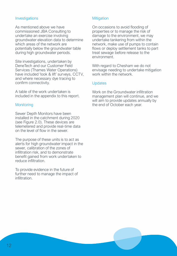
Investigations
As mentioned above we have commissioned JBA Consulting to undertake an exercise involving groundwater elevation data to determine which areas of the network are potentially below the groundwater table during high groundwater periods.
Site investigations, undertaken by DeneTech and our Customer Field Services (Thames Water Operations) have included ‘look & lift’ surveys, CCTV, and where necessary dye tracing to confirm connectivity.
A table of the work undertaken is included in the appendix to this report.
Monitoring
Sewer Depth Monitors have been installed in the catchment during 2020 (see Figure 2.0). These devices are telemetered and provide real-time data on the level of flow in the sewer.
The purpose of these units is to act as alerts for high groundwater impact in the sewer, calibration of the zones of infiltration risk, and to demonstrate benefit gained from work undertaken to reduce infiltration.
To provide evidence in the future of further need to manage the impact of infiltration.
Mitigation
On occasions to avoid flooding of properties or to manage the risk of damage to the environment, we may undertake tankering from within the network, make use of pumps to contain flows or deploy settlement tanks to part treat sewage before release to the environment.
With regard to Chesham we do not envisage needing to undertake mitigation work within the network.
Updates
Work on the Groundwater infiltration management plan will continue, and we will aim to provide updates annually by the end of October each year.

13
Appendix
Groundwater infiltration potential analysis
The sewer network classified by the groundwater infiltration risk zones. The lengths of sewers within these zones are presented in the table below.
Sewer Length by Groundwater Infiltration Risk Zones
Risk category Description Length (km) Percentage
High Predicted groundwater
extreme >1m above pipe
invert
10.51 8.2
Medium Predicted groundwater
extreme 0-1m above pipe
invert
5.77 4.5
Low Predicted groundwater
extreme 0-1m below pipe
invert
7.47 5.8
Very Low Predicted groundwater
extreme >1m below pipe
invert
104.27 81.5
Total 128.02 100.0
Risk category Description Number Percentage
High Inundation risk in 3.3% AEP
fluvial or pluvial event
524 14.3
Medium Inundation risk in 1% AEP
fluvial or pluvial event
258 7.0
Low Inundation risk in 0.1% AEP
fluvial or pluvial event
520 14.2
Very Low All other manholes 2369 64.5
Total 3671 100.0
In addition, the table below presents the surface water flood risk classification for manholes within the catchment.
Manholes by Surface Water Inundation Risk Category

14
Elements Units Value Comment
Planned Survey m 4,614 Survey was planned for a
significant part of the Chesham
valley floor. It was possible to
complete 80% of the survey
(see Figure 2).
Survey Completed m 3,688
% 80
Lengths
(No.)
81
Clear Flow Observed m 940.64 25.5% of the sewer network
surveyed had evidence of
groundwater infiltration.% 25.5
Sewer
Infiltration
Locations
Identified
Infiltration Gushing No. 4 30 groundwater infiltration
locations were identified in the
sewers.
Of those 6 were identified as
“gushing” and therefore should
be the focus of repair as soon as
possible.
Target completion by 2021/22 –
note two locations involve piles
through the sewer and hence
these will be particularly
complex to address.
Infiltration Gushing at
Joint
2
Infiltration Running 3
Infiltration Running at
joint
11
Infiltration Dripping 0
Infiltration Dripping at
joint
4
Infiltration Seeping 0
Infiltration Seeping at
joint
6
Grand Total 30
Investigations & remedial work undertaken since 2019/20 and future plans
The three tables below summarise the findings of the survey and implementation work identified in the 2019/20 period. The final table summarises our current known plans for remediating groundwater infiltration issues.
2019/20 Survey Statistics

15
Elements Units Value Comment
Manhole
Infiltration
Locations
Identified
Infiltration
around pipe
No. 9 groundwater infiltration locations
were identified at manhole
locations.
Of those 2 were identified as
“gushing” and therefore should be
the focus of repair as soon as
possible.
Infiltration
through
benching
Infiltration
through
chamber wall
3
Gushing 2
Running 3
Dripping
Seeping 1
Grand Total 9
Monitoring Locations Active No. 14 14 Water level monitoring locations
have been installed within the
catchment. Their locations are
shown in Figure 2.
Details of other Surveys No other surveys have occurred in
the catchment during the period.
2019/20 Implementation Works
Activities Value Comment
Sewer Lining Length (m) 0 We are currently progressing the priority 1
locations below though our governance
process for remediation, progress of which
is being monitored also by the EA.
Infiltration Points Targeted
(no.)
0
Manhole Sealing (no.) 0
16
Priority 2020/2021 Known follow On Work
Survey See main text
Sewer Lining 6 gushing locations identified 26 weeping locations
identified in 2019/20
Locations identified in Future
Surveys
Manhole Sealing – Infiltration
Ingress
1 gushing location identified 7 weeping locations identified
in 2019/20
Locations identified in Future
Surveys
Manhole Sealing – Pluvial and
Fluvial Ingress
Plan to be developed based on at risk manholes identified in
JBA analysis.
Sewage Treatment Works
Upgrade
See wording in the main body of the report.
Future Works

17
Glossary of terms
AEP – Annual Exceedance Potential
AMP – Asset Management Programme
CCTV – Closed Circuit Television
EA - Environment Agency
IRP – Infiltration Reduction Plans
MH- Manhole
STW – Sewage Treatment Works
WINEP – Water Industry National Environment Programme

18
Addendum – Annual Update 2021
Table of contents
Introduction
Hydrological Review
Infiltration Review
Green Recovery
Summary
Investigations & remedial work undertaken in period and future work
2
3
6
8
9
10

2
Introduction
Figure 1 – Chesham monitoring and infiltration zones
This addendum to the Chesham Groundwater Infiltration System Management Plan 2020 (GISMP) provides an update on performance/work undertaken in the period from September 2020 to September 2021 (the UK Hydrological Year 1) key points covered include:
• Hydrological Conditions
• How the sewerage system has performed over this period
• Mitigation / remedial measures progressed over the last year and being planned.
• Summary and next steps
7 Happy New Water Year! | National River Flow Archive (ceh.ac.uk)

Chesham is situated in the Chilterns East Colne water resources area. Figure 2 shows the monthly total rainfall depths against the long-term average rainfall in the in the location of Chesham over the period taken from the 1Environment Agency Water Situation Report August 2021 1
The graph indicates that monthly rainfall at times in the last year has significantly exceeded long-term averages, this was especially notable in the winter period.
Figure 3 shows the location of the British Geological Survey (BGS) monitoring borehole at Ashley Green which has been monitoring the same Chalk aquifer than lies beneath Chesham since 1961. Figures 4 and 5 show river levels in the River Chess at Chesham which are a good indication of local groundwater levels over time Figure 6 and 7 show the last two and ten years of groundwater level data overlain on expected ranges. This shows how recent groundwater levels have compared against the expected range. They show that generally over the last two winters groundwater levels have been notably high, with the groundwater maximum close to the exceptionally high range..
2020-21 Hydrological Review
Figure 2 – Monthly rainfall depths local to the system
This section summaries the hydrological conditions at Chesham in the period
31Environment Agency Water Situation Report August 2021
https://assets.publishing.service.gov.uk/government/uploads/system/uploads/attachme
nt_data/file/1016481/Thames_Water_Situation_Report_August_2021.pdf ).

4
Figure 3 – Location of Ashley Green Monitoring Borehole Relative to Chesham
Figure 4 – 2020-2021 River levels at Chesham (River Chess) – River Levels UK (riverlevels.uk)
Figure 5 – 2016-2021 River levels at Chesham (River Chess) – River Levels UK (riverlevels.uk)

5
(Environment Agency Water Situation Report August 2021): https://assets.publishing.service.gov.uk/government/uploads/system/uploads/attachment_data/file/1016481/Thames_Water_Situation_Report_August_2021.pdf
Figure 6 – 2018-2021 Groundwater levels at Ashley Green. (Environment Agency Water Situation Report August 2021)
Figure 7 – 2011-2021 Groundwater levels at Ashley Green. (Environment Agency Water Situation Report August 2021)

6
Investigations & remedial work undertaken in the period and future work
Lift and Look and CCTV surveys will be continued over future winter periods where groundwater levels allow. A summary of findings will be provided in the next period.
The two tables below summarise remediation work undertaken in the period.
Remediation works in period
Activities Value Comment
Sewer Lining
Length (m)
104m complete.
3 patch repairs are also complete.
A further patch repair (which first
requires excavation to remove a steel
bar through the sewer) is due to be
complete by November 2021.
Remaining work subject to site
conditions being suitable.
In addition to the work outlined:
• A redundant pipe found to be
allowing a significant amount of
river water ingress has been
filled.
• Installation of 2 low leak manhole
covers is due by November
2021.
• Our operational teams are due to
implement a further 40m of
sewer liner within the system
prior to Winter 2021.
Manhole
Sealing (no.)
1 complete

7
Activity Planned work in 2021/22 Known follow On Work
Survey Surveys will continue over the
winter periods in AMP7
(2020-2025).
To be confirmed
Sewer Lining All known priority lining
locations have been briefed
and are in progress.
To be confirmed
Manhole Sealing – Infiltration
Ingress
334 manholes as part of
Green Recovery*
To be confirmed
Manhole Sealing – Pluvial and
Fluvial Ingress
None
Sewage Treatment Works
(STW) Upgrade
As part of our current investment plan, we are undertaking a
project to increase flow to full treatment through the STW. The
main driver for the upgrade is growth, however the rate of
maximum observed infiltration is considered as part of the
calculation for the new treatment flow rates. This project is
required to be completed by 2025, however we are looking to
bring this forward to be completed by 2023.
Future Works
*Scope and procurement of this work is being finalised therefore final numbers to be delivered
may change slightly.

There was no impact in the network over the winter period in the form of property flooding or pollutions as a result of groundwater infiltration. All impact from groundwater infiltration is seen at the STW.
Figure 8 shows the number of spills per month from Chesham Sewage Treatment Works (STW). The greatest number of number of spills occurred in March and April which correlates with periods of high river levels in the River Chess. Levels in the River Chess are representative of local groundwater levels.
The Chesham system experiences a lag between rainfall and high levels of groundwater infiltration due to the time taken for the rainfall to percolate through the chalk and reach the river Chess.
2020-21 Infiltration Review
Figure 8 – Number of spills (discharge count) at Chesham Sewage treatment Works (STW) (taken from Event Duration monitor (EDM) Data).*
This section summaries the scale of infiltration at Chesham over the period
8 *2020 verified and audited EDM data. 2021 calendar year data is awaiting verification
before being published.

9
The Chesham system has been selected to be the focus of an accelerated programme of works to reduce spills to the environment.
This programme of works is part of the Green Recovery initiative using additional investment beyond our original PR19 settlement to support economic recover from the COVID-19 pandemic.
The focus of the project in Chesham in AMP7 is to reduce groundwater infiltration (to sewers) and mapping of both surface and foul sewerage systems to detect cross connections.
The upper reaches of the River Chess has been specifically selected such that any improvement in receiving river water quality can be easily ascertained from this work. This pilot will also provide supporting evidence for expanding the approach for other systems and inclusion as part of investment in PR24 for delivery in AMP8 (2025 -2030) onwards.
The delivery of manhole chamber lining to prevent groundwater ingress is due to commence in November 2021 and conclude in June 2022 (see ‘Future Works’ table for further detail).
The Green Recovery

10
The winter of 2020-21 was a particular went winter with groundwater levels in the chalkaquifer beneath Chesham notably high for long periods.
The Chesham system sees a lag between high groundwater levels and high flowsreceived in the network and at the Sewage Treatment Works as a result of time takenfor the rainfall to percolate through the chalk and reach the sewer network. This isreflected in the patterns of discharge (spills) seen at the Sewerage Treatment works asshown by the Event Duration Monitoring (EDM) data.
Surveys carried out to date have identified several manholes and sewers that requirepriority remediation. Works have been completed at a number of these locations andfurther works are due to be complete by November 2021.
Remedial measures will continue to be implemented as identified and a widerprogramme of works to remove unwanted flows from the foul system has beenaccelerated as part of the Green Recovery Programme. Manhole chamber lining andmanhole cover sealing is due to commence in November 2021 and complete in June2022
In addition to remediation in the network. as part of our current investment plan we areundertaking a project to increase flow to full treatment at the STW. The main driver forthe upgrade is growth, however the rate of maximum observed infiltration is consideredas part of the calculation for the new treatment flow rates. This project is required to becompleted by 2025, however we are looking to bring this forward to be completed by2023.
Summary