Embed Size (px)
Citation preview
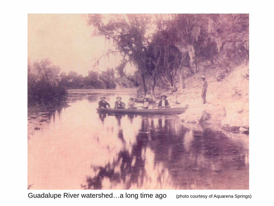
Guadalupe River watershed…a long time ago (photo courtesy of Aquarena Springs)
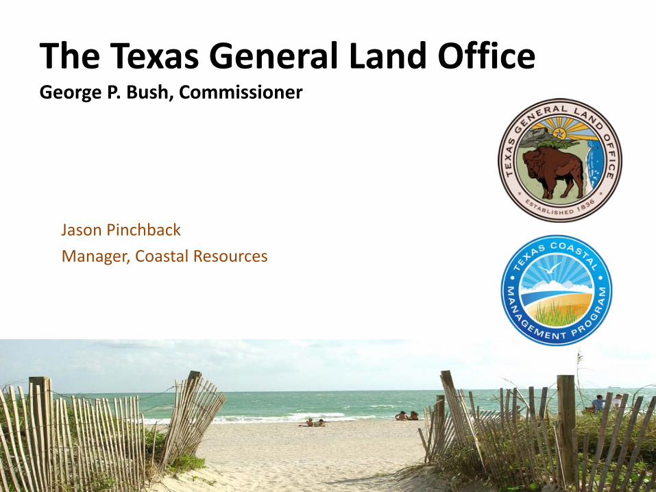
The Texas General Land OfficeGeorge P. Bush, Commissioner
Jason PinchbackManager, Coastal Resources
This presentation is based upon professional research and analysis within the scope of Texas General Land Office statutory responsibilities and priorities but, unless specifically noted, does not necessarily reflect official positions or decisions.
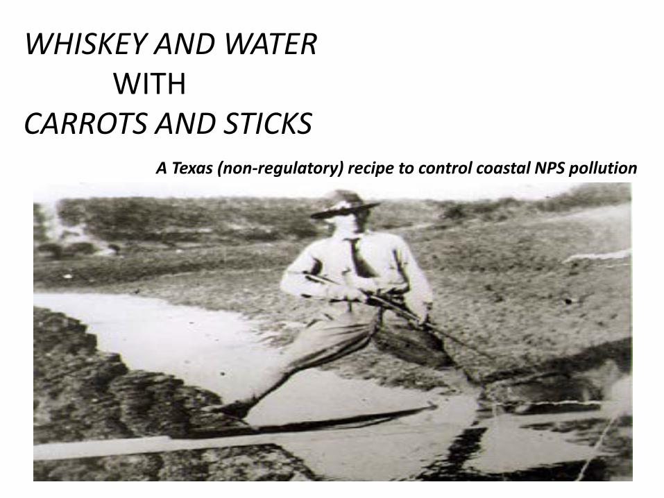
WHISKEY AND WATERWITH
CARROTS AND STICKSA Texas (non-regulatory) recipe to control coastal NPS pollution
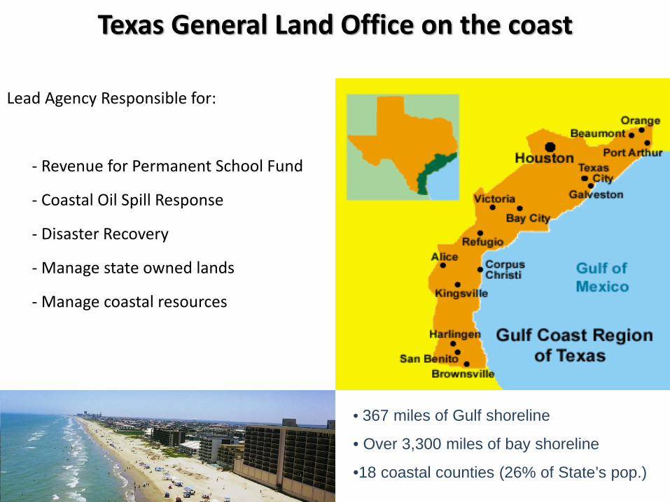
Texas General Land Office on the coast
Lead Agency Responsible for:
- Revenue for Permanent School Fund
- Coastal Oil Spill Response
- Disaster Recovery
- Manage state owned lands
- Manage coastal resources
• 367 miles of Gulf shoreline
• Over 3,300 miles of bay shoreline
•18 coastal counties (26% of State’s pop.)

This bus represents the Texas Coast… …and more folks are on the way!
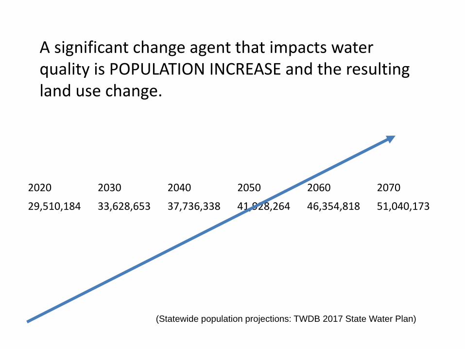
2020 2030 2040 2050 2060 2070
29,510,184 33,628,653 37,736,338 41,928,264 46,354,818 51,040,173
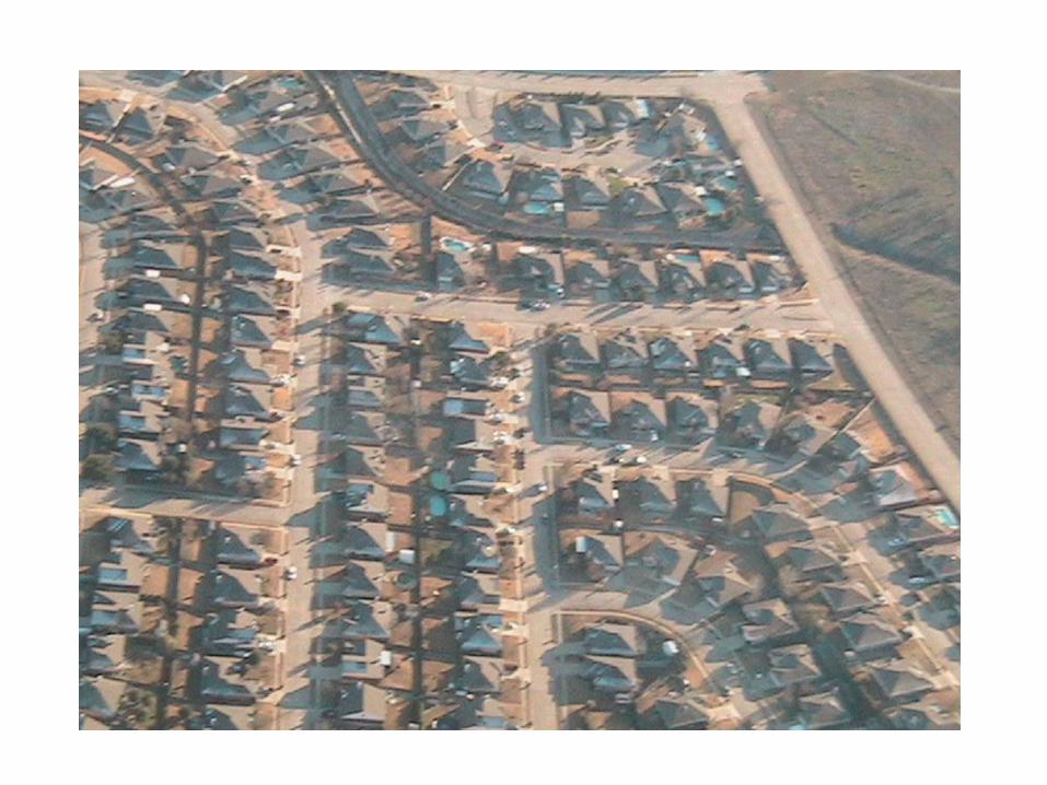
A significant change agent that impacts water quality is POPULATION INCREASE and the resulting land use change.
(Statewide population projections: TWDB 2017 State Water Plan)
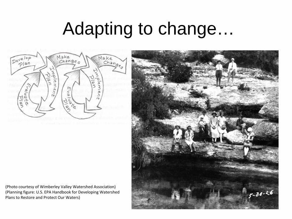
Adapting to change…
(Photo courtesy of Wimberley Valley Watershed Association)(Planning figure: U.S. EPA Handbook for Developing Watershed Plans to Restore and Protect Our Waters)
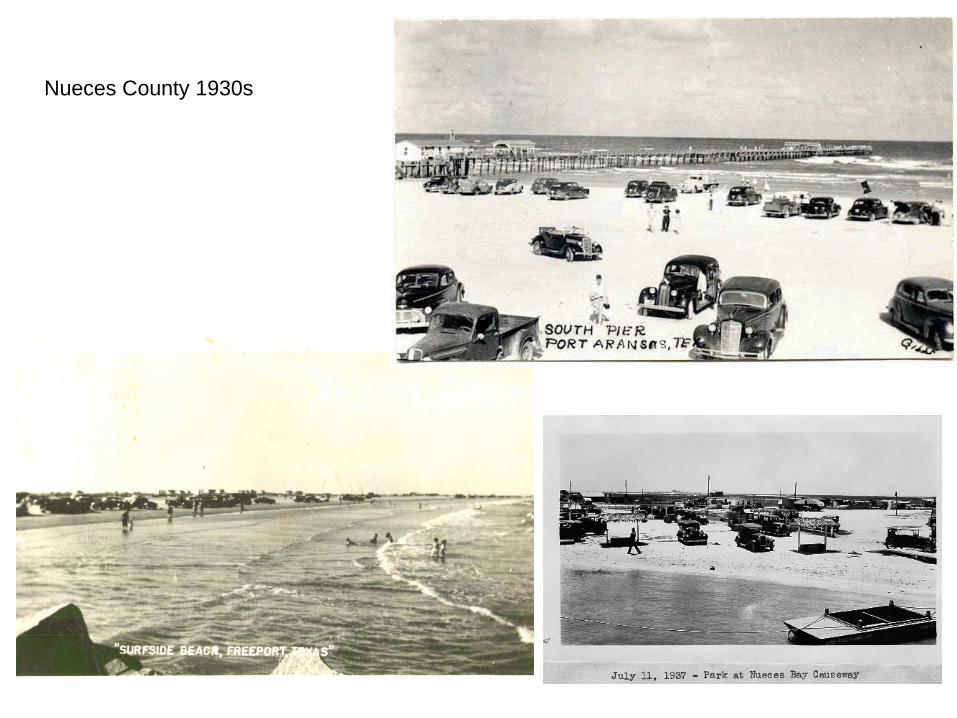
Nueces County 1930s
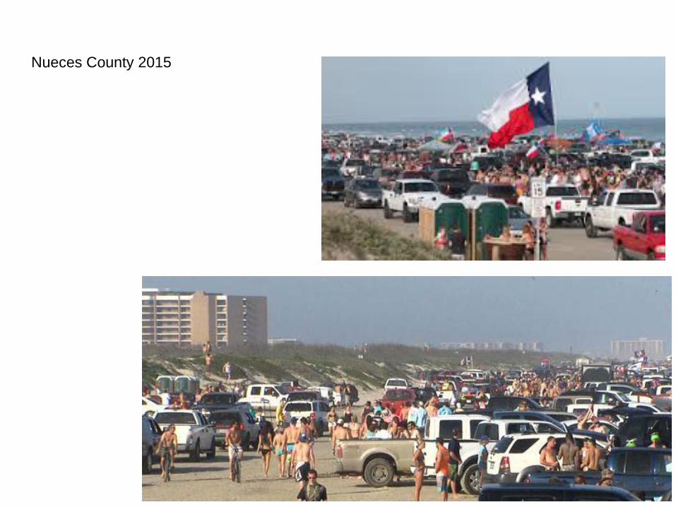
Nueces County 2015
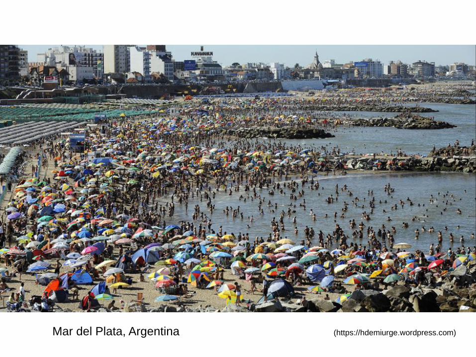
Mar del Plata, Argentina (https://hdemiurge.wordpress.com)
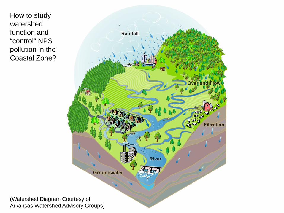
(Watershed Diagram Courtesy of Arkansas Watershed Advisory Groups)
How to study watershed function and “control” NPS pollution in the Coastal Zone?
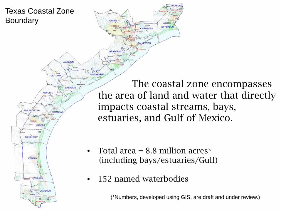
The coastal zone encompasses the area of land and water that directly impacts coastal streams, bays, estuaries, and Gulf of Mexico.
• Total area = 8.8 million acres* (including bays/estuaries/Gulf)
• 152 named waterbodies
Texas Coastal Zone Boundary
(*Numbers, developed using GIS, are draft and under review.)
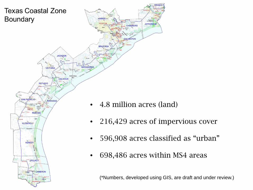
• 4.8 million acres (land)
• 216,429 acres of impervious cover
• 596,908 acres classified as “urban”
• 698,486 acres within MS4 areas
(*Numbers, developed using GIS, are draft and under review.)
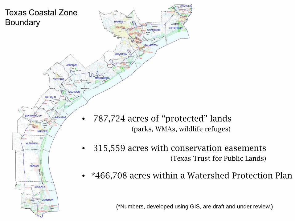
• 787,724 acres of “protected” lands (parks, WMAs, wildlife refuges)
• 315,559 acres with conservation easements (Texas Trust for Public Lands)
• *466,708 acres within a Watershed Protection Plan
(*Numbers, developed using GIS, are draft and under review.)
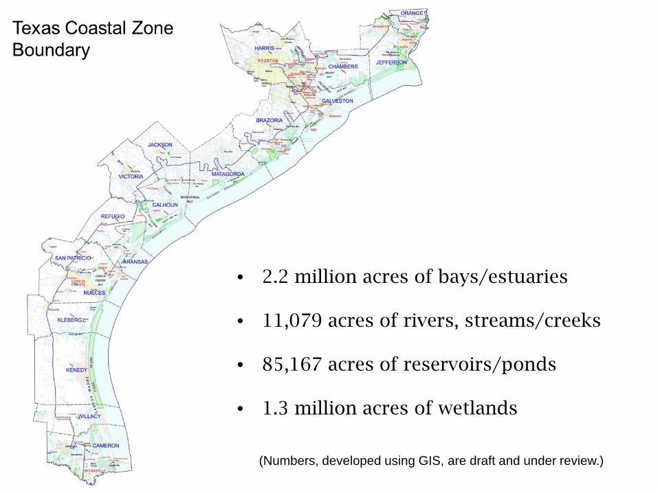
• 2.2 million acres of bays/estuaries
• 11,079 acres of rivers, streams/creeks
• 85,167 acres of reservoirs/ponds
• 1.3 million acres of wetlands
(Numbers, developed using GIS, are draft and under review.)
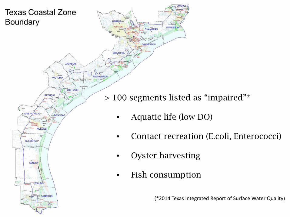
> 100 segments listed as “impaired”*
• Aquatic life (low DO)
• Contact recreation (E.coli, Enterococci)
• Oyster harvesting
• Fish consumption
(*2014 Texas Integrated Report of Surface Water Quality)
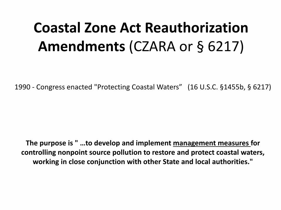
Coastal Zone Act Reauthorization Amendments (CZARA or § 6217)
1990 - Congress enacted "Protecting Coastal Waters” (16 U.S.C. §1455b, § 6217)
The purpose is " …to develop and implement management measures for controlling nonpoint source pollution to restore and protect coastal waters,
working in close conjunction with other State and local authorities."

The purpose is " …to develop and implement management measures for controlling nonpoint source pollution to restore and protect coastal waters,
working in close conjunction with other State and local authorities."
Management Measures are intervention and mitigation actions and policies that
collectively work to “control” NPS pollution.
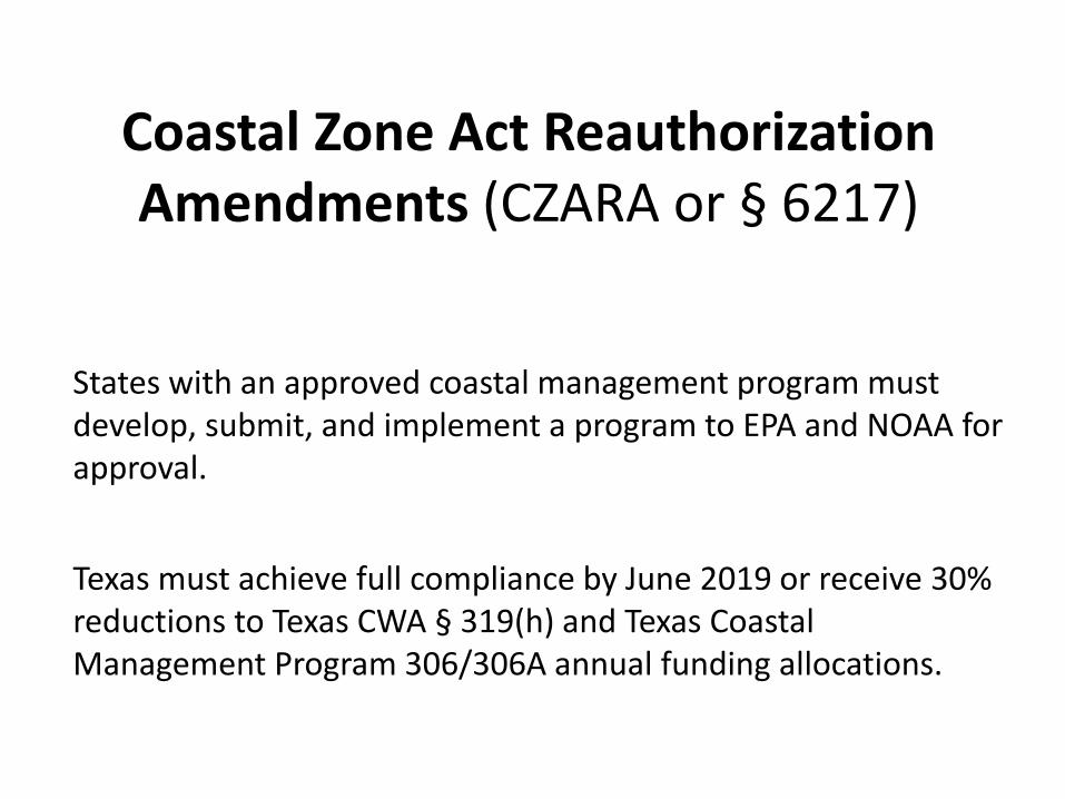
Coastal Zone Act Reauthorization Amendments (CZARA or § 6217)
States with an approved coastal management program must develop, submit, and implement a program to EPA and NOAA for approval.
Texas must achieve full compliance by June 2019 or receive 30% reductions to Texas CWA § 319(h) and Texas Coastal Management Program 306/306A annual funding allocations.
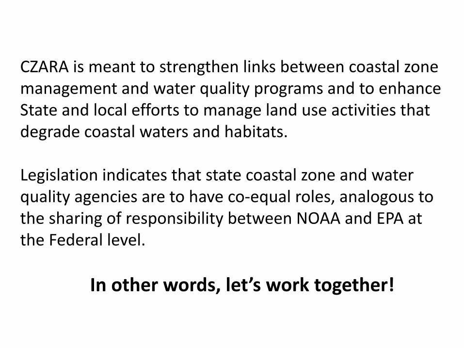
CZARA is meant to strengthen links between coastal zone management and water quality programs and to enhance State and local efforts to manage land use activities that degrade coastal waters and habitats.
Legislation indicates that state coastal zone and water quality agencies are to have co-equal roles, analogous to the sharing of responsibility between NOAA and EPA at the Federal level.
In other words, let’s work together!
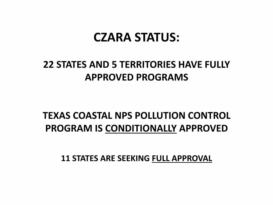
CZARA STATUS:
22 STATES AND 5 TERRITORIES HAVE FULLY APPROVED PROGRAMS
TEXAS COASTAL NPS POLLUTION CONTROL PROGRAM IS CONDITIONALLY APPROVED
11 STATES ARE SEEKING FULL APPROVAL
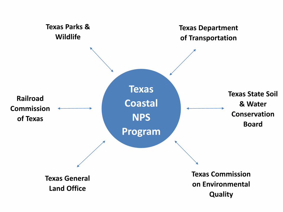
Texas Parks & Wildlife
Railroad Commission
of Texas
Texas General Land Office
Texas Commission on Environmental
Quality
Texas Department of Transportation
Texas State Soil & Water
Conservation Board
Texas Coastal
NPS Program
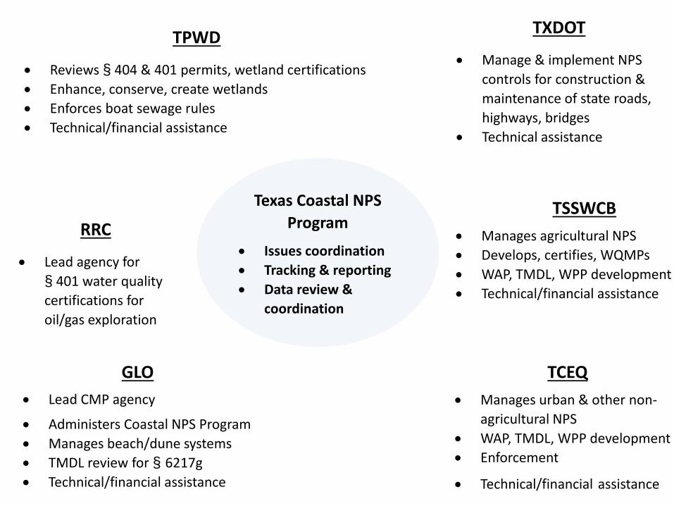
TPWD
• Reviews § 404 & 401 permits, wetland certifications• Enhance, conserve, create wetlands• Enforces boat sewage rules• Technical/financial assistance
RRC
• Lead agency for § 401 water quality certifications for oil/gas exploration
GLO• Lead CMP agency
• Administers Coastal NPS Program• Manages beach/dune systems• TMDL review for § 6217g• Technical/financial assistance
TCEQ• Manages urban & other non-
agricultural NPS• WAP, TMDL, WPP development• Enforcement
• Technical/financial assistance
TXDOT
• Manage & implement NPS controls for construction & maintenance of state roads, highways, bridges
• Technical assistance
TSSWCB• Manages agricultural NPS• Develops, certifies, WQMPs• WAP, TMDL, WPP development• Technical/financial assistance
Texas Coastal NPS Program
• Issues coordination• Tracking & reporting• Data review &
coordination
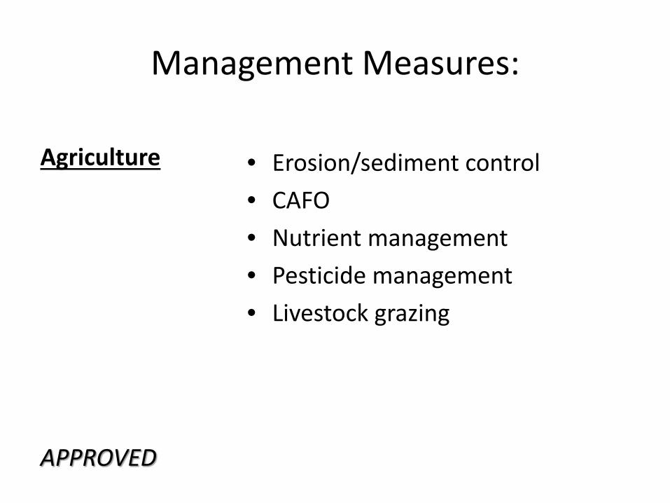
Management Measures:
Agriculture
APPROVED
• Erosion/sediment control• CAFO • Nutrient management• Pesticide management• Livestock grazing
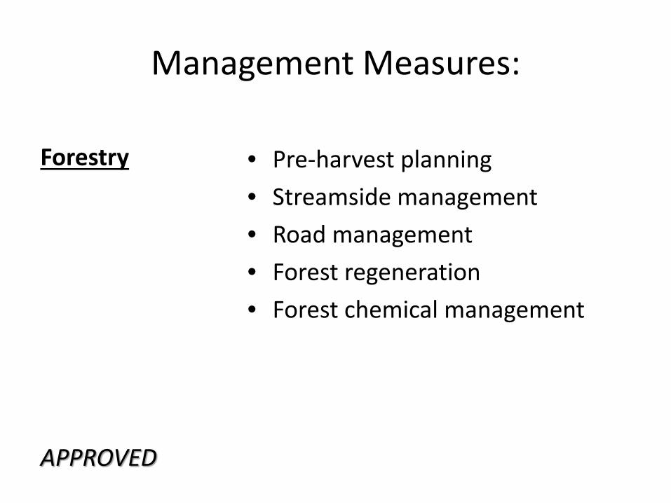
Management Measures:
Forestry
APPROVED
• Pre-harvest planning• Streamside management• Road management• Forest regeneration• Forest chemical management
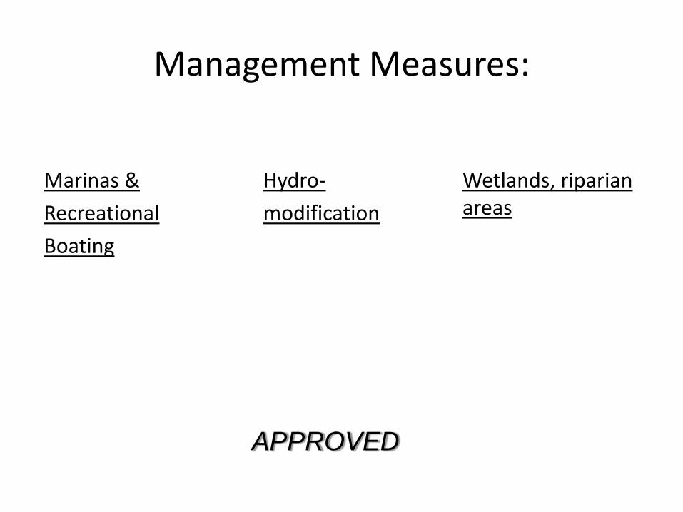
Management Measures:
Marinas &Recreational Boating
Hydro-modification
Wetlands, riparian areas
APPROVED
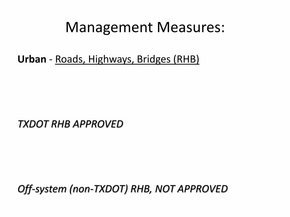
Management Measures:
Urban - Roads, Highways, Bridges (RHB)
TXDOT RHB APPROVED
Off-system (non-TXDOT) RHB, NOT APPROVED
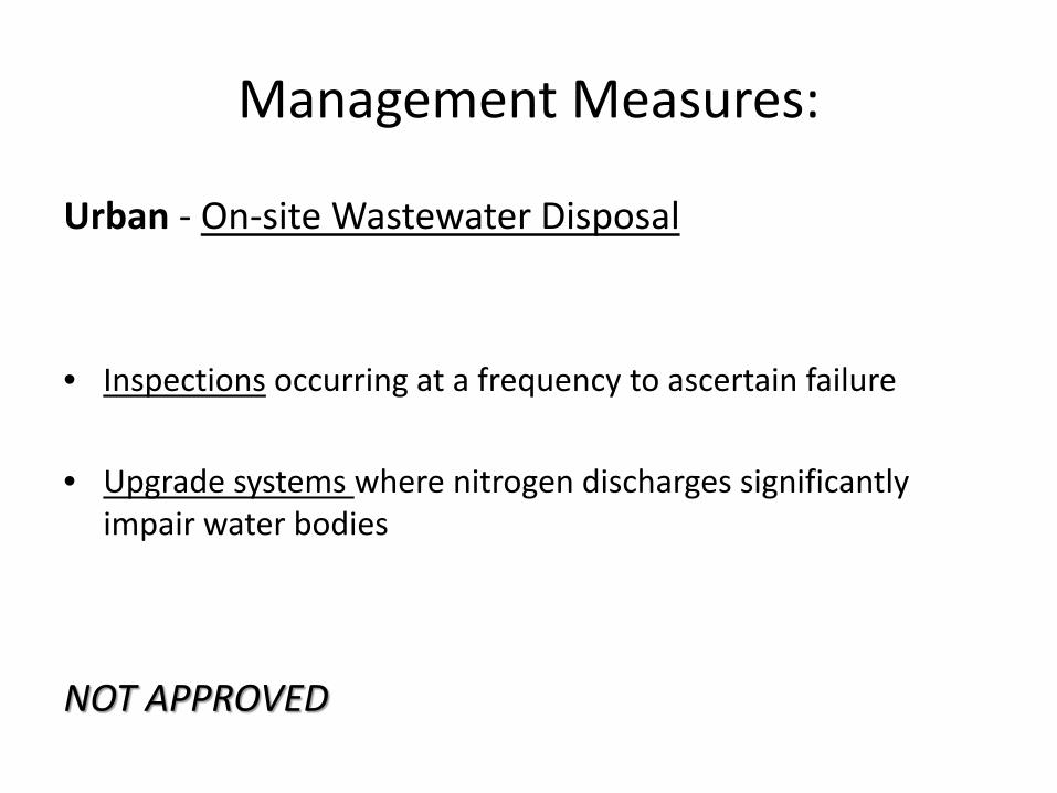
Management Measures:
Urban - On-site Wastewater Disposal
• Inspections occurring at a frequency to ascertain failure
• Upgrade systems where nitrogen discharges significantly impair water bodies
NOT APPROVED
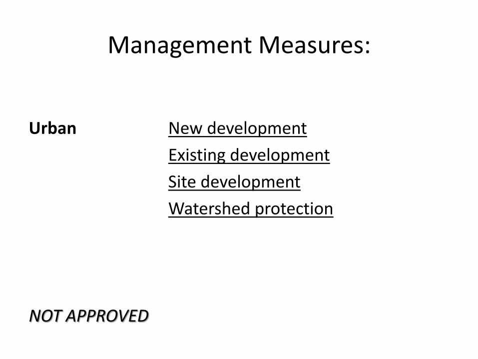
Management Measures:
Urban
NOT APPROVED
New developmentExisting developmentSite developmentWatershed protection
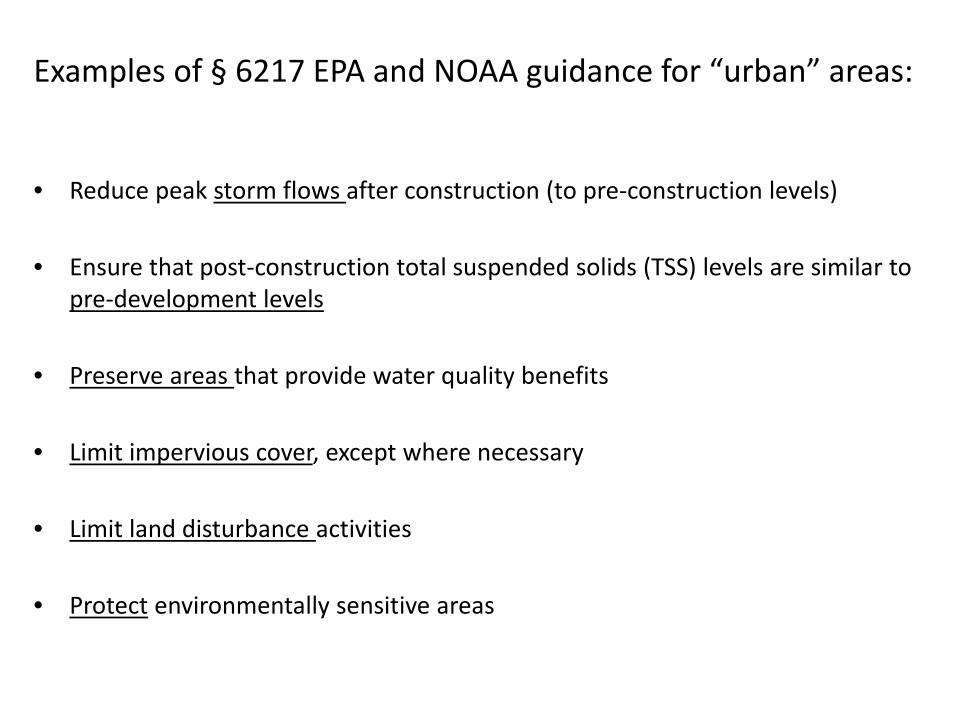
Examples of § 6217 EPA and NOAA guidance for “urban” areas:
• Reduce peak storm flows after construction (to pre-construction levels)
• Ensure that post-construction total suspended solids (TSS) levels are similar to pre-development levels
• Preserve areas that provide water quality benefits
• Limit impervious cover, except where necessary
• Limit land disturbance activities
• Protect environmentally sensitive areas
Planning and coordinating…
NPS ENTRANCENPS Control Devices
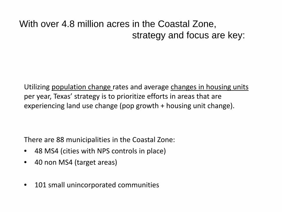
Utilizing population change rates and average changes in housing units per year, Texas’ strategy is to prioritize efforts in areas that are experiencing land use change (pop growth + housing unit change).
There are 88 municipalities in the Coastal Zone:• 48 MS4 (cities with NPS controls in place)• 40 non MS4 (target areas)
• 101 small unincorporated communities
With over 4.8 million acres in the Coastal Zone, strategy and focus are key:
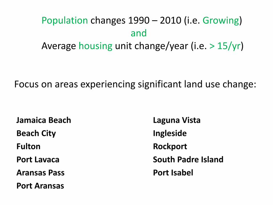
Population changes 1990 – 2010 (i.e. Growing)and
Average housing unit change/year (i.e. > 15/yr)
Focus on areas experiencing significant land use change:
Jamaica Beach Laguna VistaBeach City InglesideFulton RockportPort Lavaca South Padre IslandAransas Pass Port IsabelPort Aransas
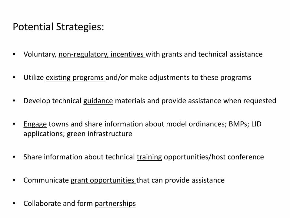
Potential Strategies:
• Voluntary, non-regulatory, incentives with grants and technical assistance
• Utilize existing programs and/or make adjustments to these programs
• Develop technical guidance materials and provide assistance when requested
• Engage towns and share information about model ordinances; BMPs; LID applications; green infrastructure
• Share information about technical training opportunities/host conference
• Communicate grant opportunities that can provide assistance
• Collaborate and form partnerships
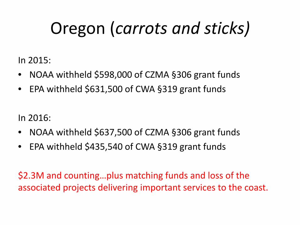
Oregon (carrots and sticks)
In 2015: • NOAA withheld $598,000 of CZMA §306 grant funds • EPA withheld $631,500 of CWA §319 grant funds
In 2016: • NOAA withheld $637,500 of CZMA §306 grant funds• EPA withheld $435,540 of CWA §319 grant funds
$2.3M and counting…plus matching funds and loss of the associated projects delivering important services to the coast.
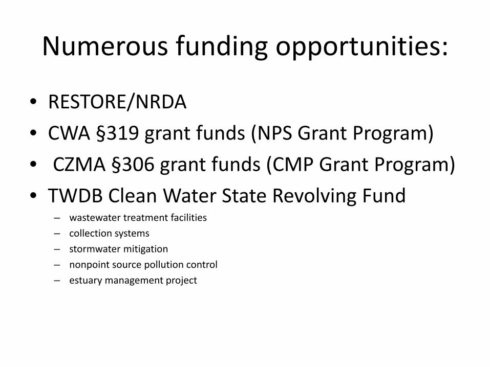
Numerous funding opportunities:
• RESTORE/NRDA• CWA §319 grant funds (NPS Grant Program)• CZMA §306 grant funds (CMP Grant Program)• TWDB Clean Water State Revolving Fund
– wastewater treatment facilities– collection systems– stormwater mitigation– nonpoint source pollution control– estuary management project
Texas Coastal Management Program
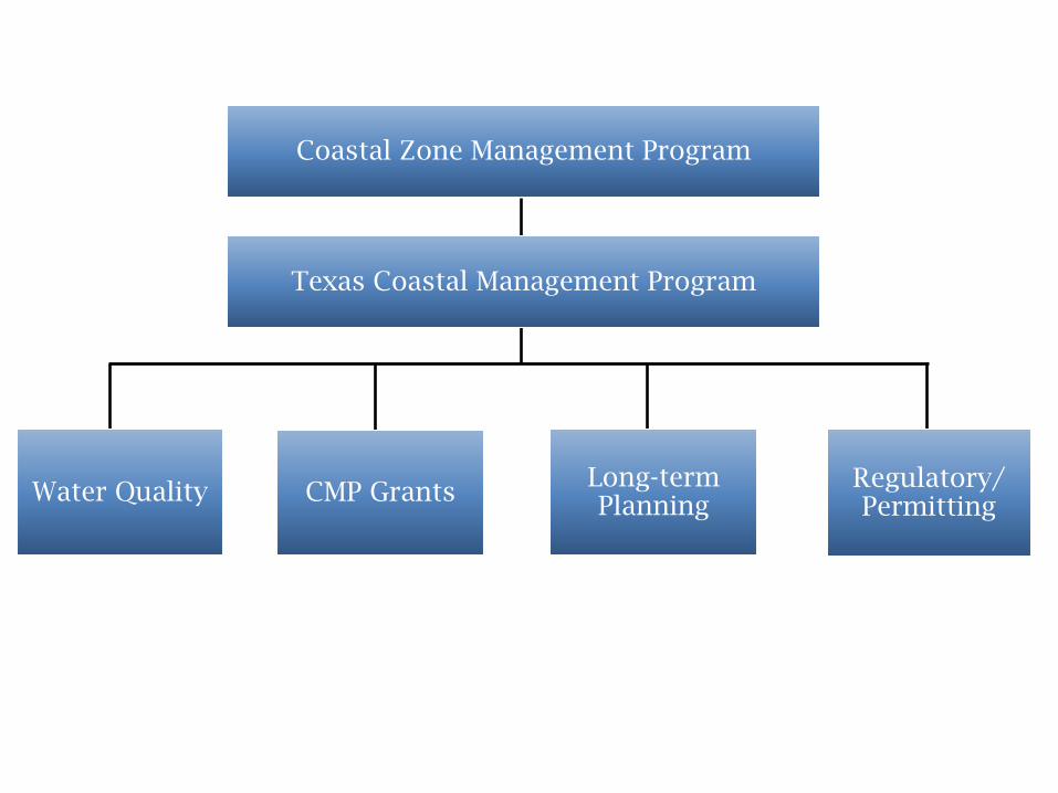
Coastal Zone Management Program
Texas Coastal Management Program
Water Quality CMP Grants Long-term Planning
Regulatory/ Permitting
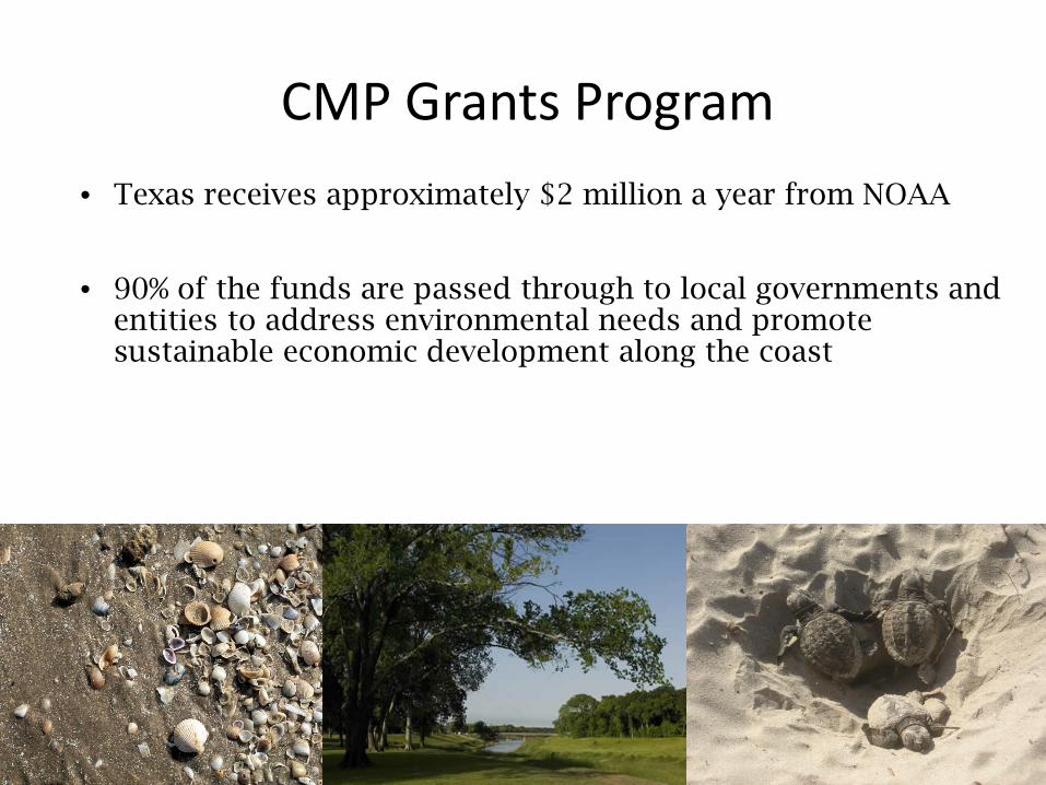
CMP Grants Program • Texas receives approximately $2 million a year from NOAA
• 90% of the funds are passed through to local governments and entities to address environmental needs and promote sustainable economic development along the coast
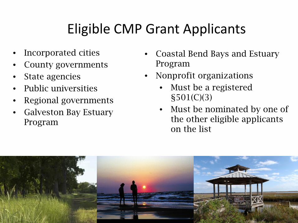
Eligible CMP Grant Applicants• Incorporated cities
• County governments
• State agencies
• Public universities
• Regional governments
• Galveston Bay Estuary Program
• Coastal Bend Bays and Estuary Program
• Nonprofit organizations
• Must be a registered §501(C)(3)
• Must be nominated by one of the other eligible applicants on the list
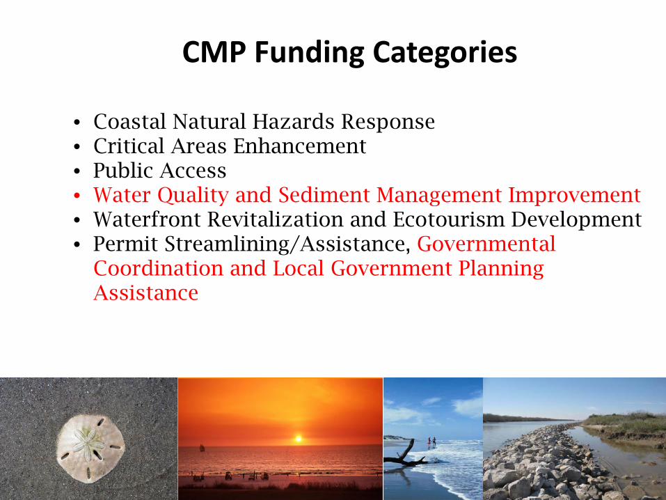
• Coastal Natural Hazards Response• Critical Areas Enhancement• Public Access• Water Quality and Sediment Management Improvement• Waterfront Revitalization and Ecotourism Development• Permit Streamlining/Assistance, Governmental
Coordination and Local Government Planning Assistance
CMP Funding Categories
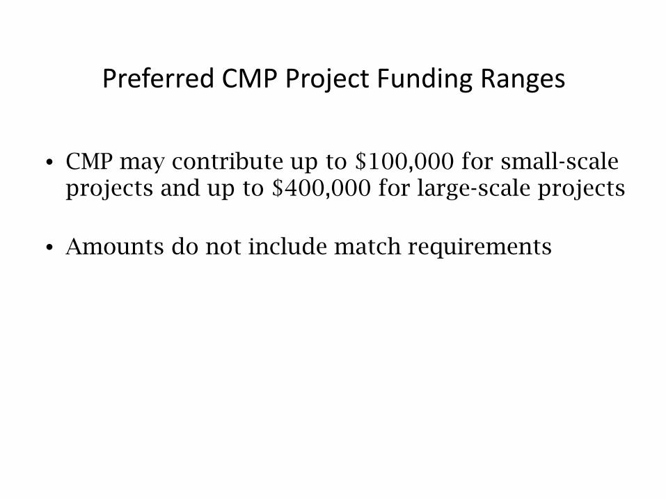
Preferred CMP Project Funding Ranges
• CMP may contribute up to $100,000 for small-scale projects and up to $400,000 for large-scale projects
• Amounts do not include match requirements
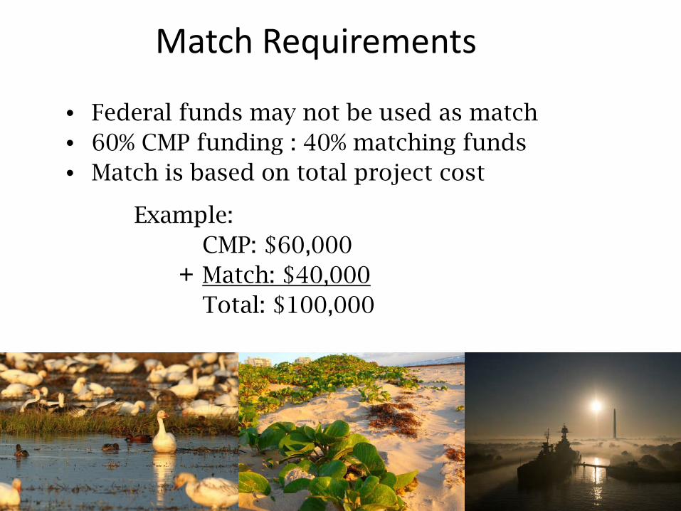
Match Requirements
• Federal funds may not be used as match• 60% CMP funding : 40% matching funds • Match is based on total project cost
Example: CMP: $60,000Match: $40,000Total: $100,000
+
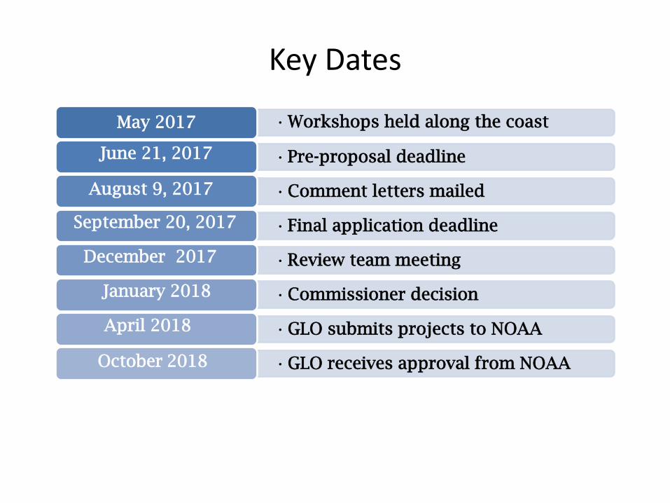
Key Dates
•Workshops held along the coast May 2017
•Pre-proposal deadlineJune 21, 2017
•Comment letters mailedAugust 9, 2017
•Final application deadlineSeptember 20, 2017
•Review team meetingDecember 2017
•Commissioner decisionJanuary 2018
•GLO submits projects to NOAAApril 2018
•GLO receives approval from NOAA October 2018
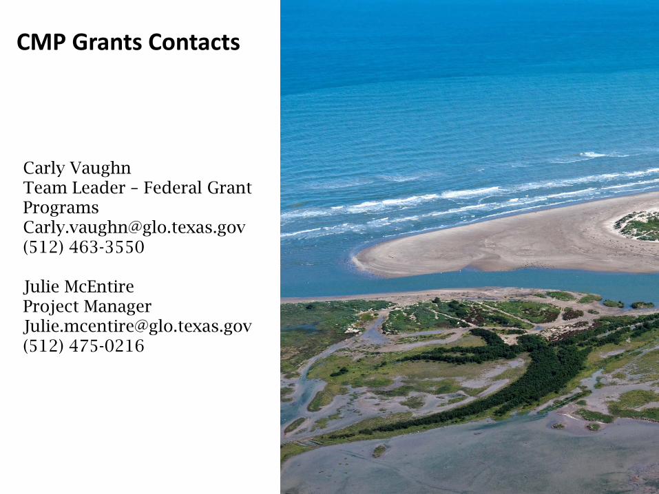
Carly VaughnTeam Leader – Federal Grant [email protected](512) 463-3550
Julie McEntireProject [email protected](512) 475-0216
CMP Grants Contacts
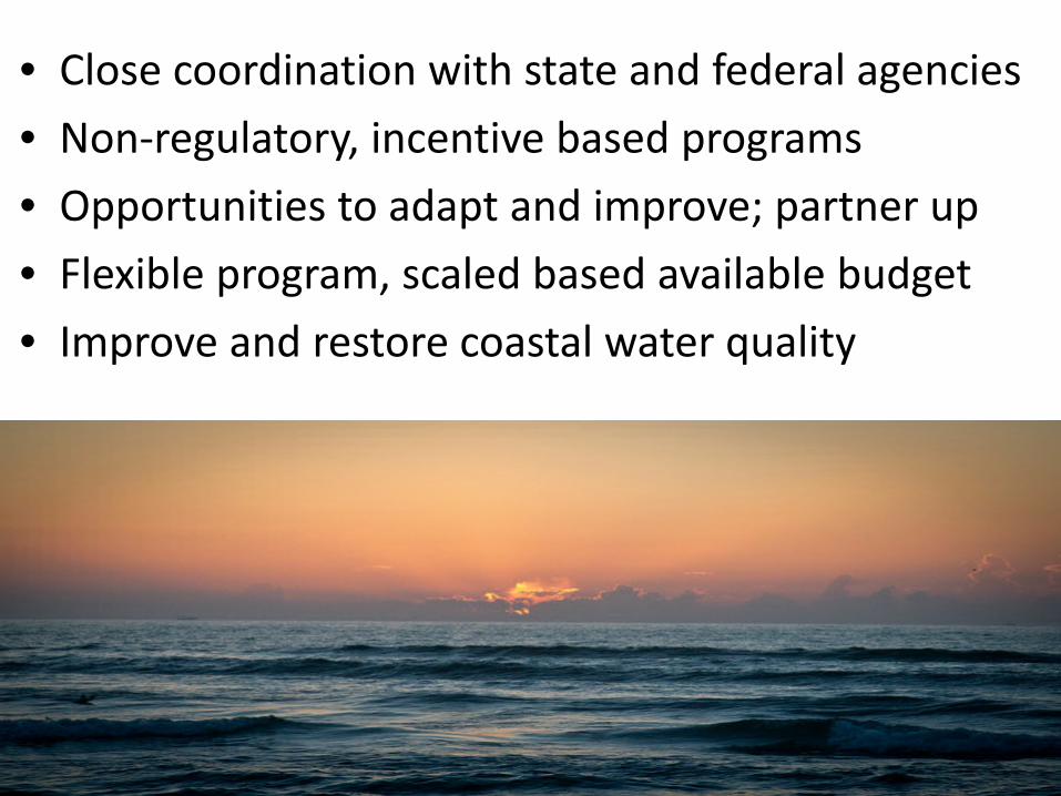
• Close coordination with state and federal agencies• Non-regulatory, incentive based programs• Opportunities to adapt and improve; partner up• Flexible program, scaled based available budget• Improve and restore coastal water quality
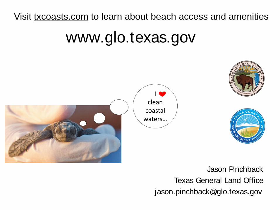
www.glo.texas.gov
Jason PinchbackTexas General Land Office
Visit txcoasts.com to learn about beach access and amenities
I clean
coastal waters…