Embed Size (px)
Citation preview


GUIDELINES FOR DEVELOPING
AN EARTHQUAKE SCENARIO
Publication and distribution of this report was funded by the Endowment Fund of the Earthquake Engineering Research Institute
and FEMA, Department of Homeland Security
March 2006

©2006 Earthquake Engineering Research Institute499 14th Street, Suite 320Oakland, California 94612-1934Telephone: (510) 451-0905Fax: (510) 451-5411Website: http://www.eeri.org
All rights reserved. Downloading and reproduction of this document is encouraged.
Publication and distribution of this report was funded by the Endowment Fund of the Earthquake Engineering Research Institute (EERI) and FEMA, Department of Homeland Security.
ISBN #1-932884-16EERI Publication No. EF2006-01
Printed in the United States of America
Writers:Jane Preuss, PlanWest PartnersJames Godfrey, EERI
Reviewers:Rich Eisner, California Offi ce of Emergency ServicesJohn Hooper, Magnusson Klemencic AssociatesWilfred D. Iwan, CaltechMarshall Lew, MACTEC Ellen Rathje, University of Texas, AustinSusan Tubbesing, EERI
Production:James Godfrey, EERI
Cover image: USGS Fact Sheet 017-03

AN OVERVIEW OF SCENARIO PLANNING 1The Benefi t to the CommunityHow to Use these Guidelines
LAUNCHING THE SCENARIO 5Engage the Community
ORGANIZING THE PLANNING EFFORT 6Create a ScheduleWorkgroupsWorkgroup LeadersManagement TeamProject Director
CONSTRUCTING THE SCENARIO 10Components
The EarthquakeEstimating Damage and ImpactsResponse and Community RecoveryBeyond the Earthquake
Useful ToolsThe Advantage of Multidisciplinary Planning
PRESENTATION 16
FUNDING THE PROJECT 18
CONCLUSION 20
TABLE OF CONTENTS
What can be done now to prevent the damages from a catastrophic earthquake?
Scenarios are widely used to better understand and help plan for the future. A successful scenario tells the story of a defi ned earthquake and its specifi c impacts. It draws the reader in by incorporating familiar aspects of the community that they can readily recognize. It helps decision makers to visualize specifi c impacts that are based on currently accepted scientifi c and engineering knowledge.
Few regions have fully formed response plans for earthquakes. Even fewer regions have mitigation plans in place that involve the various segments of a community. A scenario improves awareness of what an earthquake can do to a community as a whole.
By bringing together experts from a number of disciplines and taking advantage of their unique knowledge and perspectives to describe a single, catastrophic event, a community can produce a scenario that realistically describes the earthquake risk and potential impacts, giving clear reasons for individuals, businesses, and policy makers to act now to prevent devastating losses. The same participants who will respond or work to rebuild the community when an actual earthquake occurs should be involved in the multi-agency planning of the scenario.
Scenarios help to challenge assumptions. Confl icts that arise between planners when constructing a scenario can help to clarify issues or areas where knowledge is lacking. Challenges from other agencies provide new views which would not be possible if disaster planning occurred privately or individually.
Currently we do not have the scientifi c knowledge to predict the precise location, predict the precise location, predicttime, and magnitude of a future earthquake. However, we do have many tools and suffi cient scientifi c and engineering knowledge to forecast likely events and their forecast likely events and their forecastimpacts.
The scenario will not specifi cally instruct an audience how to respond, but by providing a wide variety of information about the projected earthquake, readers will be able to identify areas of greatest vulnerability to inform decisions and actions.
AN OVERVIEW OF SCENARIO PLANNING
1

Some scenarios are created to expose problems in the present system. Often, weaknesses become evident only in a catastrophic event. A scenario can test strategies for response, relief, and recovery. They can project performance levels of buildings and other structures under various design codes and policies. When new policies are established, a scenario can project how they will infl uence the nature, level and extent of damage.
By telling a story, scenarios give life to abstract concepts. They provide a common language for all players in the community: the planners and builders, policy makers, residents, and emergency responders. Because the effects of an earthquake are so varied, scenario developers should plan to communicate their story to a wide audience.
The general audience for the completed scenario may grasp simple concepts through the use of narrative, but quantitative data will give an authoritative voice to the report. Scenarios must be credible and relevant to compel decision makers to use them. A plausible earthquake scenario builds on current knowledge of local seismicity and geology, and incorporates characteristics of the building stock, lifelines, and other infrastructure within social, economic, and cultural context of the community at risk.
The Benefi t to the Community
When a major earthquake occurs in a community where policy makers and the public are unaware of an earthquake risk and have not taken steps to address that risk, losses to buildings, infrastructure, the economy, and lives can be catastrophic. Buildings that are not engineered for seismic safety may collapse or become uninhabitable. Transportation networks may be severed, affecting the lives of commuters and workers. Disruption of utility systems may result; fi re and chemical releases may interrupt critical services, and threaten life safety. Landslides and, in coastal communities, tsunamis, may also cause further severe losses.
A well crafted scenario provides a powerful tool for members of private industry, government offi cials, and the general public to begin to draft mitigation policies and programs. It will help the community weigh various risks associated with the earthquake and begin to set priorities that will systematically reduce the impact of the likely future event.
An Overview of Scenario Planning2
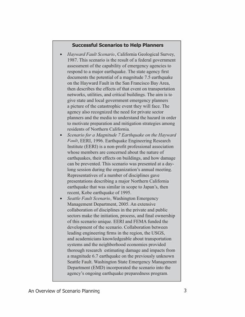
• Hayward Fault Scenario, California Geological Survey, 1987. This scenario is the result of a federal government assessment of the capability of emergency agencies to respond to a major earthquake. The state agency fi rst documents the potential of a magnitude 7.5 earthquake on the Hayward Fault in the San Francisco Bay Area, then describes the effects of that event on transportation networks, utilities, and critical buildings. The aim is to give state and local government emergency planners a picture of the catastrophic event they will face. The agency also recognized the need for private sector planners and the media to understand the hazard in order to motivate preparation and mitigation strategies among residents of Northern California.
• Scenario for a Magnitude 7 Earthquake on the Hayward Fault, EERI, 1996. Earthquake Engineering Research Institute (EERI) is a non-profi t professional association whose members are concerned about the nature of earthquakes, their effects on buildings, and how damage can be prevented. This scenario was presented at a day-long session during the organization’s annual meeting. Representatives of a number of disciplines gave presentations describing a major Northern California earthquake that was similar in scope to Japan’s, then recent, Kobe earthquake of 1995.
• Seattle Fault Scenario, Washington Emergency Management Department, 2005. An extensive collaboration of disciplines in the private and public sectors make the initiation, process, and fi nal ownership of this scenario unique. EERI and FEMA funded the development of the scenario. Collaboration between leading engineering fi rms in the region, the USGS, and academicians knowledgeable about transportation systems and the neighborhood economies provided thorough research estimating damage and impacts from a magnitude 6.7 earthquake on the previously unknown Seattle Fault. Washington State Emergency Management Department (EMD) incorporated the scenario into the agency’s ongoing earthquake preparedness program.
Successful Scenarios to Help Planners
An Overview of Scenario Planning 3

These Guidelines will lead you through the four basic steps of scenario development.
Launching the Scenario. The initial announcement of a scenario project will attract participants from relevant disciplines who can contribute to the development of the story. It also announces the effort to those who are expected to use the scenario or to initiate mitigation policies.
Constructing the Scenario. To be comprehensive, a scenario should include sections that describe the components of the earthquake risk and projected effects on the community. Each section of the scenario should be considered carefully to ensure credibility and to establish the project’s value to the community.
Organizing the Planning Effort. The credibility of the scenario will depend on who participates in the planning process. The primary work group for scenario development may be a few individual planners in related disciplines, or may consist of a large number of representatives from a large collaboration of agencies. Establish leadership. A project director is needed to guide the disparate interests of the group. The director’s guidance will help ensure that the scenario speaks with one voice.
Presentation. It is critical that the presentation of the completed scenario reach those people who are expected to take action or who can demand action from policy makers. It should address those involved in building and maintaining critical structures, and response and recovery planners. The scenario should be presented in a medium and language that can easily be grasped by a wide audience of homeowners, businesses, and others interested in the security of the community.
How to Use these Guidelines
An Overview of Scenario Planning4

The First Outreach Meeting: Engage the Community
Be realistic about the community’s level of interest in developing a scenario. One way to gauge that interest is to begin the scenario project with an open forum designed to attract a wide range of individuals who have been active in earthquake research and mitigation fi elds. Use the meeting to identify the level and sources of political commitment to hazard mitigation generally, and earthquake mitigation specifi cally. By involving a number of disciplines, broad community support for the scenario can be built.
Some ideas to ensure an effective meeting• Discuss participants’ expectations for the project. Who will use the
scenario and how? Will it stir the general public to take measures in self-preparedness or will the scenario serve as a lobbying tool for new government policy?
• Stress the need for the participation of experts from a wide range of disciplines. Who will sponsor the scenario, providing funds and other support? Who will take ownership of the scenario when it is completed?
• Demonstrate local support for the effort by including speakers and endorsements from government, leaders in the business community, and members of the academic and research fi elds.
• Together, determine the size, scope, and probability of the scenario event. The earthquake and its impact must refl ect current scientifi c and engineering knowledge to be credible to policy makers and others who will be in a position to take necessary actions.
• Remember that the scenario is a tool to enhance advocacy. It is the fi rst step toward mitigation, which can take many years to accomplish.
• Keep a sign-in list of participants. This list provides an indication of interested people who may be called upon to serve on committees or periodically review the scenario as it develops. It will also help to identify users of the fi nal product.
LAUNCHING THE SCENARIO
Launching the Scenario 5

To ensure credibility and to stress the importance of the effort, the scenario project should be completed within a timeframe set out to the audience when the project is fi rst announced. Establish various internal timelines to effectively manage the disparate planning groups and to keep them on schedule.
Different components of the scenario will take different amounts of time to complete. Some sections will require the data of another section before work can begin. For example, an inventory of seismically vulnerable buildings may take time to create. To show how those buildings will be damaged, however, the planners developing this section will need information about ground motion. Those data need to be supported by earth science research. A fl ow chart can be helpful to keep work on the various sections on time. (Figure 1) Strong leaders for each of the planning groups are needed. Designate an overall project director to guide the project to the deadline.
ORGANIZING THE PLANNING EFFORT
Figure 1: A sample fl ow chart showing the various timelines for the work groups creating each scenario component.
Organizing the Planning Effort
Jan Feb Mar Apr May Jun Jul Aug Sep Oct Nov DecGeological DataGeotechnical DataBuildingsLifelinesTransportationSocial/Economic ImpactsResponseRecommendations
6
Workgroups
The most accurate picture of the proposed earthquake and its effects is created only when experts from a wide variety of disciplines are involved. A successful scenario integrates science, engineering, social and economic issues, and government planning.
Eventual users of the scenario will represent many perspectives, including all levels of government, local businesses, homeowners, hospital administrators, utility and school districts, and many others. Examples of participants include members of the following groups and associations:
• Earth Scientists (seismologists, geologists)• Civil Engineers (including specialized committees representing
transportation and geotechnical interests)• Engineering Geologists• Structural Engineers • Architects• Land Use Planners • Transportation Engineers• State and Local Emergency Managers • State Geological Survey• Area Colleges and Universities• Regional Earthquake Planning Groups, where they exist• Business Contingency Planners • Hospital Associations• Seismic or Multi-hazard Safety Commission, where it exists• Association of Regional Governments, Utilities, and School Districts• Transit Authorities
Establish work groups by organizing the participants around the components of the scenario. The components (discussed in the chapter, Constructing the Scenario) include a description of the earthquake and its features, estimates of damage and impact, and discussion of response and community recovery issues.
Work groups are the most active and critical cogs in the scenario process. The members of the work groups are responsible for writing the individual sections. The most active participants may not be the same people who were invited to the initial preview meeting. As the scenario evolves, new perspectives may become
Organizing the Planning Effort7

important, and the resources of additional disciplines will become helpful. To maximize the long term impact and credibility of the scenario, members should represent a diversity of affi liations (i.e., not only from one agency or company).
Work group members who represent larger groups—for example, a government agency, an engineering fi rm—may be more effective than an individual consultant because the organization may have a bigger voice in the community. Inevitably, during the course of the development process, the schedules of some members may preclude their active participation. Planners who represent an organization can be represented by colleagues from that organization, ensuring continuity.
Work Group Leaders
Establish a leader for each work group. During the development of the scenario, that leader will be the public face for that particular discipline. When the media, for example, have a question about transportation resiliency in an earthquake, the leader of the transportation work group can be called upon to answer that question. Leaders will assign parts of the discipline’s analysis to various members and ensure that work is produced on schedule. The leader takes responsibility for the fi nal report of that group.
The position of work group leader will demand considerable volunteer time, so dedication and commitment to the entire planning process is necessary. Public recognition as a technical lead in a community’s planning effort can demonstrate the company’s dedication to community safety, and help to offset the unpaid contribution to the project.
Management Team
Create a management team consisting of the leaders of each work group. The various groups working on each section or variable cannot work independently of the others. The work group leaders should meet regularly throughout the process to ensure that the parts of the scenario are developing according to schedule and are in concert with one another. Periodic reports of work group fi ndings enable disciplines to quickly review another group’s progress.
Throughout the planning process regularly evaluate the information to ensure that the scenario remains on track to achieve the project goals. Regularly discuss the validity of assumptions developed along the way. This method of evaluation
Organizing the Planning Effort 8
ensures an internally consistent and integrated document. The evaluation also educates workgroup leaders, providing new relevant information for their own sections.
Project Director
The administrative tasks of such a large work project should be the responsibility of a single leader. A project director ensures the regular sharing of information as the various sections of the scenario are separately developed. Through the management team, the director guides the progress of the project.
The project director acts as editor, compiling the work of the groups and helping the work groups see the big picture. By periodically circulating work group drafts, the director can alert the planners to possible inconsistencies.
Ongoing reviews can be conducted through a secure website on which drafts are posted or through the distribution of numbered drafts. The committees and participants will generate a great deal of information that must be accessible to all the scenario planners. Ideally, one of the participating organizations can host the storage of information, either physically or electronically.
Organizing the Planning Effort9

CONSTRUCTING THE SCENARIO
Components
To ensure credibility, the analyses of each component must stand on the best available science and engineering. A good scenario will be comprehensive and demonstrate interrelationships between various parts of the community. For example, a section on building damage should include the earthquake’s effect on such critical structures as hospitals, fi re and police stations, which must also be addressed by writers of the section on emergency response. Descriptions of the nature and extent of damage to the existing building stock are critical for those developing the section on economic and social impact refl ecting housing losses, small business interruption, etc..
Listed below are the basic components of an effective earthquake scenario.
The EarthquakeWhy is an earthquake expected? How big will the earthquake be? When will it occur? What will it do?
Figure 2: An explanation of different kinds of earthquake faults, which will have unique effects on your region.
Constructing the Scenario 10

Describe why the earthquake will cause the damages described in the following sections of the scenario. Though diagrams and narrative should be simple, assumptions need to be based on scientifi c research and reviewed carefully by the workgroup for accuracy. Geologists and seismologists provide knowledge about the nature of the earthquake event length, duration, magnitude, etc.. (Figure 2) Geotechnical engineers provide expertise on how the ground behaves in an earthquake and how that affects engineered buildings and structures. (Figure 3) The particular kind of ground motion expected in the region can determine the level and type of building damage to expect. The following sections, which describe the effects of the earthquake on our daily environment, should be able to tie damage projections to the nature of the earthquake depicted in this fi rst section.
Figure 3: The effects of liquefaction, one result of an earthquake, on a structure.
Estimating Damage and ImpactsThe audience for your scenario will be primarily interested in the projected losses caused by the earthquake. The most obvious loss is damage to buildings and other structures (or to “the built environment”). Quantify descriptions of building damage; where possible, use fi gures to show the estimated magnitude of the problem.
In order to paint a comprehensive picture of the disaster, each section that describes an earthquake effect should refer to other sections describing various aspects of the community. For example, to explain the seismic impact and the
Constructing the Scenario11

damage to unreinforced masonry (URM) buildings, it will be important to know how many URM buildings are in the region and what type of services they provide. Do they house low income families or small businesses? Are they used as schools or other critical facilities? This information helps to better defi ne the particular impact on the community. The three-day closure of a two-story offi ce building to assess and repair nonstructural damages to lighting and water systems will have a different impact on the community than will a similar closure of a critical care facility or public health hospital.
Stress the wide reach of a catastrophic disaster. Based on soil conditions, directivity, and other geologic features describe how ground motion may impact a quiet neighborhood miles away from the damages near the epicenter. Transportation system interruptions are interesting not only to transit agencies, as impacts on specifi c roadways and bridges challenge emergency response operations and create economic impacts on neighborhoods throughout the region. (Figure 4)
Figure 4: A map showing the extent of ground motion in a projected 6.7 Seattle Fault earthquake. Ground motion is at its peak in the areas shaded in red. in red. in red
Constructing the Scenario 12

Response and recovery concerns life safety and the social impact of disasters. By nature, descriptions of these activities will be more qualitative than sections describing the earthquake and damage estimates. Link social impacts to quantitative data. For example, to estimate demands for mass care shelters, a planner should be familiar with the projected damages to single and multi family housing. Estimates of shelter needs must also take into account the number of commuters who could be stranded due to regional transportation system failures.
The economic impact of the event is one of the most important considerations for decision makers. The recovery section should explain the challenges of returning a community to its pre-earthquake status. Consider earthquake effects on large and small businesses, referring to experience with other disasters in your region.
Attempt to estimate cost and duration of lifeline recovery, especially of the transportation system, which directly impacts both response immediately after the earthquake, and the long term economic recovery. Economists should be drawn in to explain the dependency of local commerce on the transportation systems. Public decision making about infrastructure improvements often takes many years. Discussion can be shortened if the alternatives, and the implications of those alternatives, are considered in the scenario, before the disaster happens.
Response and Community Recovery
Beyond The Earthquake
Consider the possible opportunities that an earthquake could create. For example, an earthquake could provide a long awaited opportunity for community redevelopment of areas already identifi ed in the community’s plan for redevelopment.
Historic preservation may be a critical issue. Earthquakes often seriously damage signifi cant historic buildings. Unless a mechanism for preservation has been considered before the earthquake such structures may not be preserved or rebuilt. Alternatively, if a plan for historic preservation does not exist, decisions about the removal or renovation of these structures may result in rancorous debate that could delay reconstruction and economic recovery for months, if not years.
Consructing the Scenario13

Useful Tools
Every state is required by FEMA to prepare and adopt a Hazard Mitigation Plan, which can be a good starting point for the scenario. (Completion of such a plan, if it is still in development may also be a good justifi cation for the scenario project.) Some local communities adopt plans that provide more detailed information than the state plan. To be approved by FEMA, the Hazard Mitigation Plan must include features that can be used to structure your scenario:
• a risk assessment identifying local hazards, losses from past disasters and vulnerabilities
• a mitigation strategy that includes goals, specifi c projects with priorities, and estimated timeline for implementation
• a maintenance process for the resulting plan that includes public involvement.
Existing Hazard Mitigation Plans will contain data on past disasters. Disaster information in that plan can be used to initiate your scenario, especially if you have not experienced a recent earthquake.
FEMA has supported the development of HAZUS (Figure 5), an earthquake damage and loss estimation model. Using census databases of building stock, highway and utility lifelines, demographic, and economic information, together with geographic maps, HAZUS projects earthquake damage in a community. Physical and economic losses can then be estimated. HAZUS can also estimate casualties, fi re, and loss of function, depending on the available data.
A benefi t of using HAZUS for your scenario is that the tool can also estimate losses from fl ood and wind disasters and can be applied to a community’s multi-hazard mitigation program.
Figure 5: The HAZUS software program, which requires an existing GIS application, is available for free from http://www.fema.gov/hazus/
Constructing the Scenario 14

The latest technology used by one discipline can be combined with new tools The latest technology used by one discipline can be combined with new tools of other disciplines to create a scenario that is precise and credible. In the development of the Seattle Fault scenario, LiDAR was used to identify the previously unmapped Seattle fault. (LiDAR is a remote sensing device, similar previously unmapped Seattle fault. (LiDAR is a remote sensing device, similar to radar, which uses pulsed laser rather than microwaves to identify geographic features, such as faults, despite obscuring ground cover, such as trees or man-made structures.) In addition, the USGS used current attenuation models to defi ne the areas with the highest ground motions. These data, together with the databases of HAZUS, were used to create a loss estimation model for the region surrounding the fault. Though the advantage of using a number of different technologies to generate data is clear, the director should set baseline assumptions to ensure consistency throughout the scenario report.
The Advantage of Multidisciplinary Planning
Constructing the Scenario15

PRESENTATIONAn effective presentation of the scenario is critical to atracting public awareness and initiating mitigation action. As a fi rst step, identify the potential audiences for the presentation. The scenario can be explained to a live audience or distributed as a published document. New groups or stakeholders, not envisioned at the start, may have shown interest during the project. Create a distribution plan that will reach all who have a vested interest in seismic safety.
A confusing, unfocused compilation of technical details will not stir an audience to action and will dilute the message of the scenario. Tell a story based on the best scientifi c and engineering knowledge available. Graphics are an important way to make complex data comprehensible. Colorful bar graphs are more interesting than lists of numbers and equations. Pictures of earthquake damage from similar events in other countries add urgency.
A common map is the single most effective component (Figure 6). On it you can clearly defi ne the geographic focus—show potential landslide locations, the extent of ground motion, liquefaction zones, and the distribution of structural damage. These features can highlight where emergency response will be needed, and where the greatest impacts on recovery and reconstruction are located.
Figure 6: A map used for the Seattle Scenario shows a particularly vulnerable cluster of water, fuel, and sewage lifelines that will experience severe ground motion.
Presentation 16

The scenario can be presented in a one-time workshop or in modules that focus the scenario to the interests of different stakeholder groups. For example, an audience that has the power to make decisions on highway retrofi t projects is primarily interested in the transportation section of the scenario; present that material in the context of how the damages to the network affect critical functions of the community, such as the availability of medical care and the economic recovery of regional businesses and neighborhoods.
To inspire earthquake preparedness among individuals and to build broad support for government mitigation policies, such as the rehabilitation of schools and other public facilities, present the scenario simply and dramatically. Use newspapers and local television stations to reach the general public. Despite data-intensive statistics, building inventories, or HAZUS printouts the media want dramatic descriptions of the earthquake. Describe the effects of the earthquake in day-to-day terms.
To advocate for stronger building codes and regulations or fi nancial incentives for the strengthening of older buildings, present the scenario to policy-makers and their staff in a more technical and comprehensive form. When speaking to an audience of small business owners, include experts who can explain specifi c economic impacts of the earthquake. Some seismic effects are beyond a company’s direct control, such as disruption to transportation systems, water, power, and communications. However, a business may still have the power to secure the condition of buildings through structural improvements, or the continuity of operations through contingency planning. Banks and insurers will be curious about loss estimation and how risk details were calculated. For such an audience, a demonstration of some of the technical tools used to create the scenario may be useful.
At every opportunity, try to get the audience to commit to actions that can prevent earthquake losses now, in the short term, as well as actions that will need to be taken over time.
Presentation17

FUNDING THE PROJECT
The cost of the scenario project varies considerably depending on the depth of the planning required. There is no single model for funding because an earthquake scenario developed for a particular region is unique. In the 1987 Hayward Fault scenario produced by the California Geological Survey, federal funding, from the National Earthquake Hazard Reduction Program, partially fi nanced an effort that was internally supported through staff time and resources provided by the state agency. The 1996 Hayward Fault scenario was created by individuals invited to develop a day-long scenario presentation as part of an EERI annual meeting. Although the authors worked together over a period of several months to integrate their presentations, they were not compensated for their contribution to the scenario. Funds were subsequently made available by FEMA to transcribe, edit, and print the fi nal scenario. In the case of the Seattle Fault Scenario, a combination of state and federal agencies, private businesses, a university, and EERI contributed signifi cant staff time, space, and technical resources; but again, technical input was largely contributed by professionals in the earthquake community.
Businesses or fi rms in your area have a signifi cant interest in the impacts of the event on their operations and may be willing to contribute funds or resources as a service to the effort. The involvement of a few key regional companies can inspire others to lend their expertise and staff to the scenario effort. A participating agency can provide logistical assistance by sharing existing internet tools for online communication between planners. In-kind contributions of meeting space, editing services, maps, or graphic services are valuable contributions from participating organizations or agencies. If scenario development occurs in conjunction with other multihazard planning, other sources of funds could be available, depending on the levels of government involved in the project.
A single owner or sponsor of the scenario will give a sense of unity to the project. The right sponsor adds credibility to the report. In some cases ownership evolves during the development process. For example, in each of the two Hayward Fault scenarios, a single agency initiated the project and sponsored the preparation, ultimately taking long-term responsibility for distribution and implementation. However, in the case of the Seattle Fault Scenario, EERI sponsored the initiation and development of the project and the State of Washington printed and distributed the report and is actually involved in its implementation.
Funding the Project 18

The extent to which the scenario is used to infl uence mitigation relies on broad participation from the community.The issue of ownership should be carefully considered. If planning is centralized and the fi nal product resides within one agency, other participating agencies may feel that their fi ndings are not valued, leading to a drop in participation, resulting in a less comprehensive scenario. Similarly, after the project is complete, if one agency is seen to “own” the scenario, others may not see a responsibility to advocate for mitigation. Value the contributions of all participants.
Funding the Project19

CONCLUSION
The scenario project began with the question: What can be done now to prevent damages from a catastrophic earthquake? The answer will be found as you study and report on the various impacts of the earthquake. Mitigation activities will begin once you convince those with a stake in the safety of the community of the nature and extent of the earthquake risk and how that risk can be addressed.
Mitigation is a long and challenging process. By regularly presenting—through small meetings and well chosen media—a credible scenario, you will create advocates who can increase public awareness and initiate mitigation policy and programs.
Conclusion 20