Embed Size (px)
Citation preview
METROPOLIS A green CITY OF YOUR OWN! HANDOUTS
© John Martoni, 2010 82
Appendix 2
HANDOUTS
METROPOLIS A green CITY OF YOUR OWN! HANDOUTS
© John Martoni, 2010 83
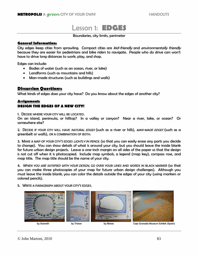
Lesson 1: EDGES Boundaries, city limits, perimeter
General Information: City edges keep cities from sprawling. Compact cities are kid-friendly and environmentally friendly because they are easier for pedestrians and bike riders to navigate. People who do drive cars won’t have to drive long distances to work, play, and shop.
Edges can include: Bodies of water (such as an ocean, river, or lake) Landforms (such as mountains and hills) Man-made structures (such as buildings and walls)
Discussion Questions: What kinds of edges does your city have? Do you know about the edges of another city?
Assignment: DESIGN THE EDGES OF A NEW CITY!
1. DECIDE WHERE YOUR CITY WILL BE LOCATED. On an island, peninsula, or hilltop? In a valley or canyon? Near a river, lake, or ocean? Or somewhere else?
2. DECIDE IF YOUR CITY WILL HAVE NATURAL EDGES (such as a river or hills), MAN-MADE EDGES (such as a greenbelt or walls), OR A COMBINATION OF BOTH.
3. MAKE A MAP OF YOUR CITY’S EDGES LIGHTLY IN PENCIL (so that you can easily erase any parts you decide to change). You can show details of what is around your city, but you should leave the inside blank for future urban design projects. Leave a one-inch margin on all sides of the paper so that the design is not cut off when it is photocopied. Include map symbols, a legend (map key), compass rose, and map title. The map title should be the name of your city.
4. WHEN YOU ARE SATISFIED WITH YOUR DESIGN, GO OVER YOUR LINES AND WORDS IN BLACK MARKER (so that you can make three photocopies of your map for future urban design challenges). Although you must leave the inside blank, you can color the details outside the edges of your city (using markers or colored pencils).
5. WRITE A PARAGRAPH ABOUT YOUR CITY’S EDGES.
by Azeneth by Tristan by Moises Caja Granada Museum Exhibit (Spain)
METROPOLIS A green CITY OF YOUR OWN! HANDOUTS
© John Martoni, 2010 84
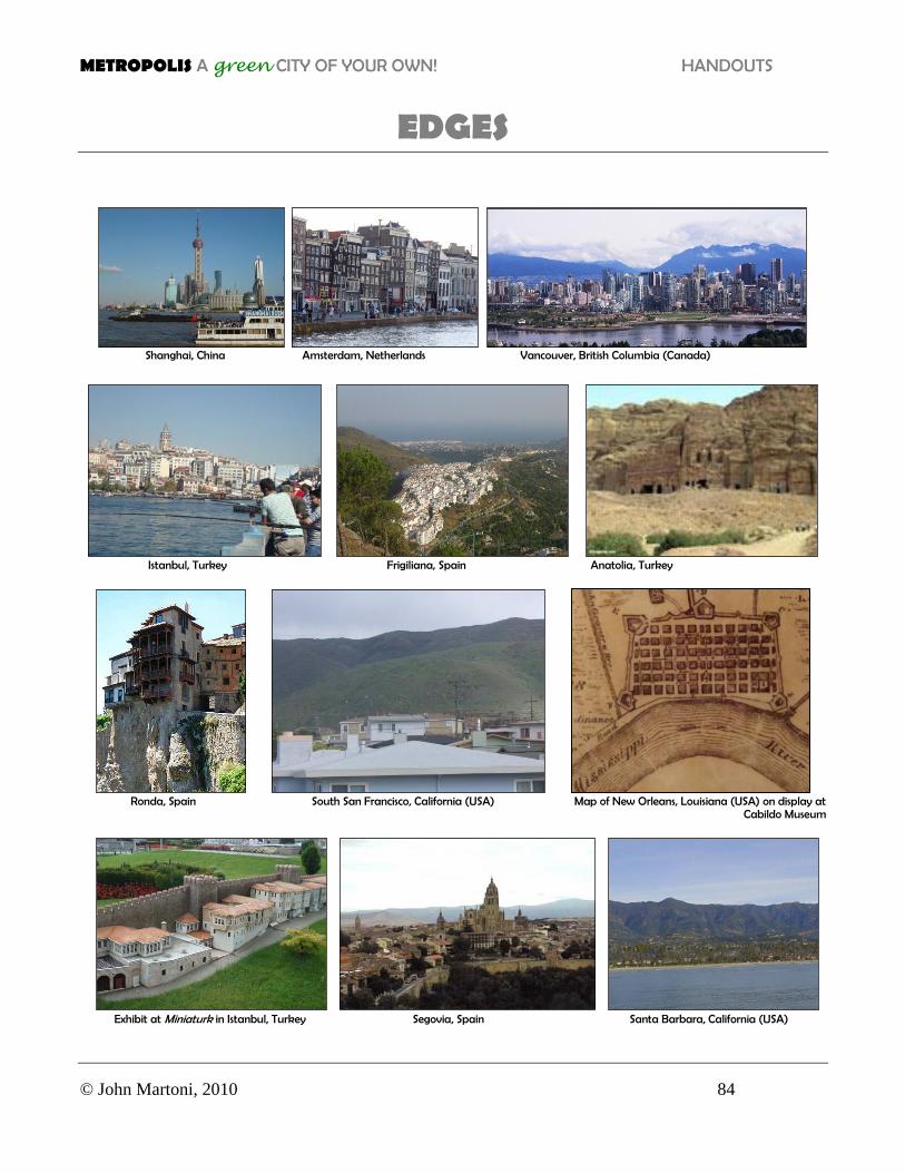
EDGES
Shanghai, China Amsterdam, Netherlands Vancouver, British Columbia (Canada)
Istanbul, Turkey Frigiliana, Spain Anatolia, Turkey
Ronda, Spain South San Francisco, California (USA) Map of New Orleans, Louisiana (USA) on display at
Cabildo Museum
Exhibit at Miniaturk in Istanbul, Turkey Segovia, Spain Santa Barbara, California (USA)
METROPOLIS A green CITY OF YOUR OWN! HANDOUTS
© John Martoni, 2010 85
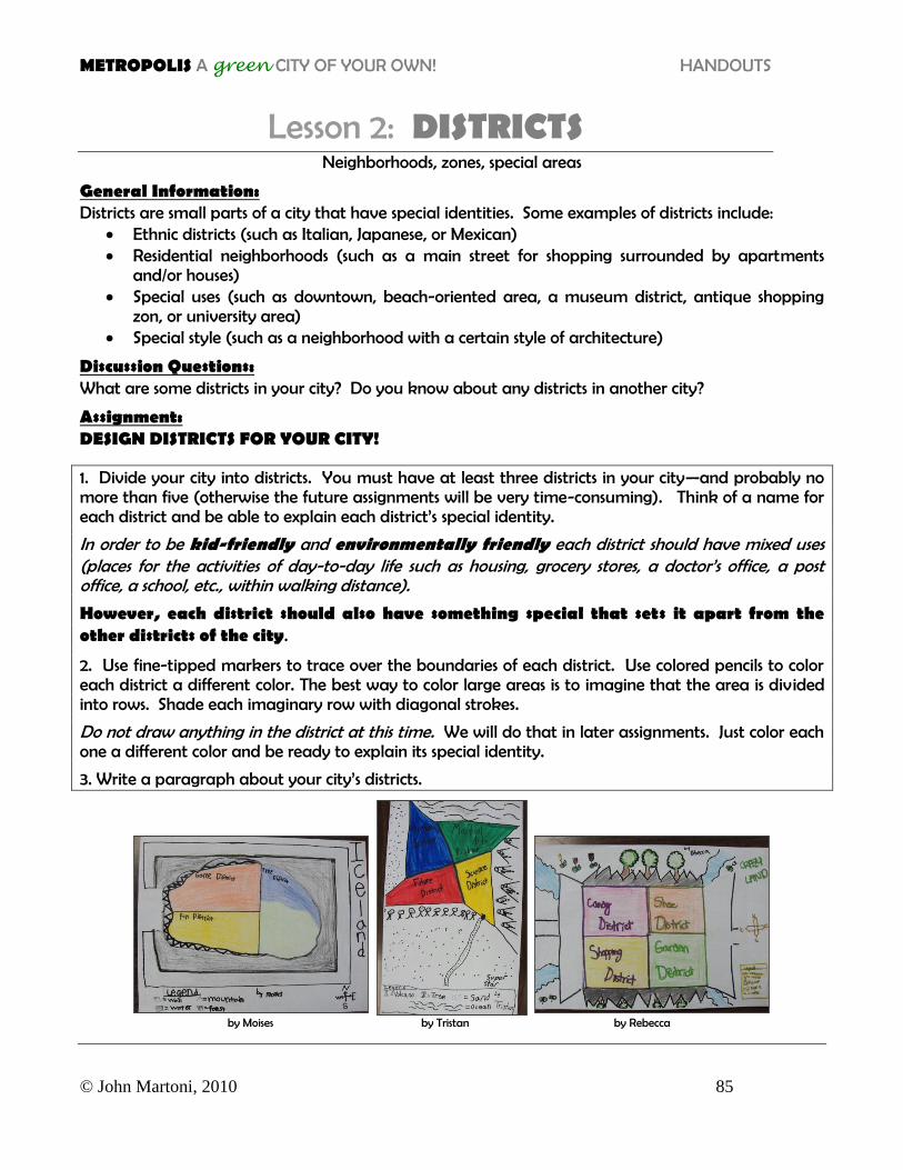
Lesson 2: DISTRICTS
Neighborhoods, zones, special areas
General Information: Districts are small parts of a city that have special identities. Some examples of districts include:
Ethnic districts (such as Italian, Japanese, or Mexican) Residential neighborhoods (such as a main street for shopping surrounded by apartments
and/or houses) Special uses (such as downtown, beach-oriented area, a museum district, antique shopping
zon, or university area) Special style (such as a neighborhood with a certain style of architecture)
Discussion Questions: What are some districts in your city? Do you know about any districts in another city?
Assignment: DESIGN DISTRICTS FOR YOUR CITY!
1. Divide your city into districts. You must have at least three districts in your city—and probably no more than five (otherwise the future assignments will be very time-consuming). Think of a name for each district and be able to explain each district’s special identity.
In order to be kid-friendly and environmentally friendly each district should have mixed uses (places for the activities of day-to-day life such as housing, grocery stores, a doctor’s office, a post office, a school, etc., within walking distance).
However, each district should also have something special that sets it apart from the other districts of the city.
2. Use fine-tipped markers to trace over the boundaries of each district. Use colored pencils to color each district a different color. The best way to color large areas is to imagine that the area is divided into rows. Shade each imaginary row with diagonal strokes.
Do not draw anything in the district at this time. We will do that in later assignments. Just color each one a different color and be ready to explain its special identity.
3. Write a paragraph about your city’s districts.
by Moises by Tristan by Rebecca
METROPOLIS A green CITY OF YOUR OWN! HANDOUTS
© John Martoni, 2010 86
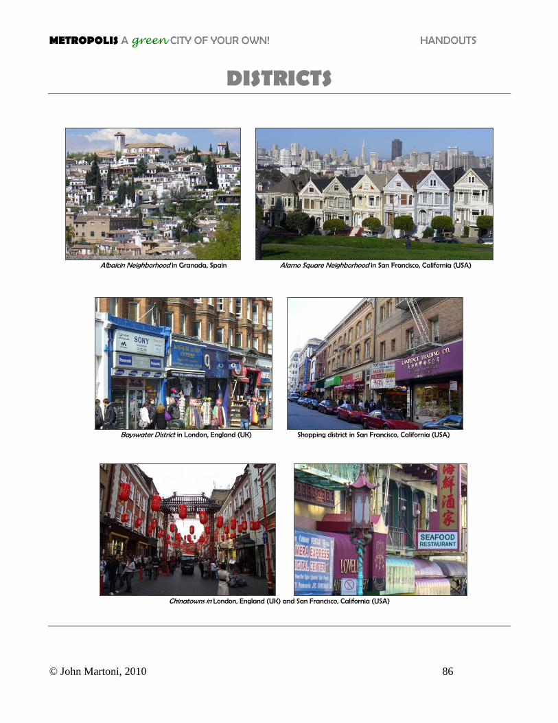
DISTRICTS
Albaicin Neighborhood in Granada, Spain Alamo Square Neighborhood in San Francisco, California (USA)
Bayswater District in London, England (UK) Shopping district in San Francisco, California (USA)
Chinatowns in London, England (UK) and San Francisco, California (USA)
METROPOLIS A green CITY OF YOUR OWN! HANDOUTS
© John Martoni, 2010 87
Lesson 3: PUBLIC SPACES Plazas, squares, parks
General Information: Public spaces are outdoor places to hang out. Some types of public spaces include plazas, squares, and parks. Kid-friendly and environmentally friendly public spaces should be centrally located in each district so that they can be easily reached without a car. Good locations for public spaces are along busy streets or at the intersection of busy streets.
Discussion Questions: What kinds of public spaces does your city have? Do you know about the public spaces of another city?
Assignment: DESIGN A PUBLIC SPACE FOR EACH DISTRICT IN YOUR CITY!
1. On a photocopy of your edges draw the boundaries of the districts you planned in the last assignment (lightly in pencil).
2. Create a public space in each district. Sketch its location on your city map lightly in pencil (so that you can easily erase parts you change your mind about without having to start all over again).
3. Name each public space.
4. When you are satisfied with your sketch, use fine-tipped markers and/or colored pencils to finalize your design.
5. Write a paragraph about your city’s public spaces.
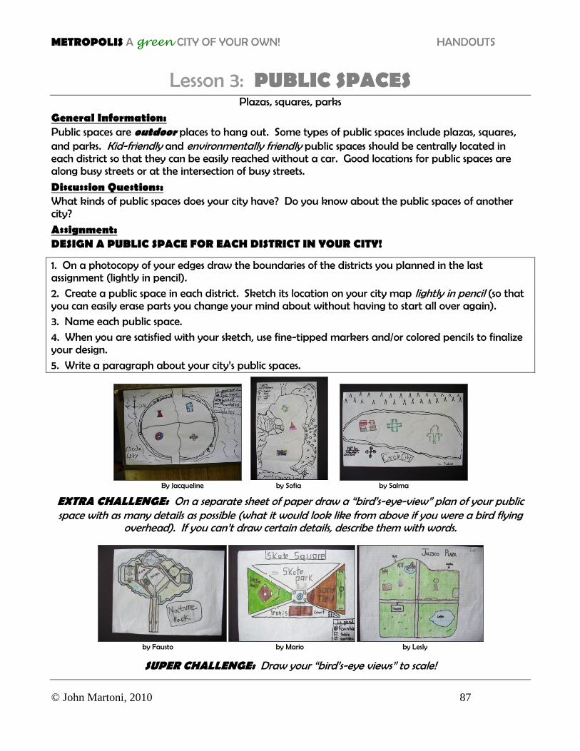
By Jacqueline by Sofia by Salma
EXTRA CHALLENGE: On a separate sheet of paper draw a “bird’s-eye-view” plan of your public space with as many details as possible (what it would look like from above if you were a bird flying
overhead). If you can’t draw certain details, describe them with words.
by Fausto by Mario by Lesly
SUPER CHALLENGE: Draw your “bird’s-eye views” to scale!

METROPOLIS A green CITY OF YOUR OWN! HANDOUTS
© John Martoni, 2010 88
PUBLIC SPACES
San Francisco, California (USA) San Francisco, California (USA) Chicago, Illinois (USA)
Siena, Italy Chicago, Illinois (USA)
Public spaces in Chicago, Illinois (USA)
Public spaces in San Francisco, California (USA)
METROPOLIS A green CITY OF YOUR OWN! HANDOUTS
© John Martoni, 2010 89
Lesson 4: LANDMARKS Prominent structures, unique sights, conspicuous attractions
General Information: Landmarks are structures that are easy to recognize. They help people to know where they are. They make cities unique and give cities some personality. They often become symbols of a city. Some examples include the Eiffel Tower in Paris, Big Ben in London, and the Hollywood Sign in Los Angeles. Landmarks can be buildings, statues, fountains, signs, bridges, or any other type of structure.
Discussion Questions: What kinds of landmarks does your city have? Do you know about the landmarks of another city?
Assignment: DESIGN LANDMARKS FOR YOUR CITY!
Create a landmark for each public space in your city:
1. On either graph paper or a blank sheet of paper, sketch an “elevation plan”*** of the front of one of your landmarks with as many details as possible. If you can’t draw certain details, describe them with words. Draw lightly in pencil (so that you can easily erase parts you change your mind about without having to start all over again).
***An “elevation plan” is what it looks like from directly in front at street level.
2. Sketch the location of your landmark on your city plan lightly in pencil (so that you can easily erase parts you change your mind about without having to start all over again).
3. Give the landmark a name.
4. When you are satisfied with your sketch, use fine-tipped markers and/or colored pencils to finish your design.
5. Write a paragraph about your city’s landmarks. ***Teacher’s Notes: Amazing Buildings by Kate Hayden (DK Readers) and Draw 50 Buildings and Other Structures by Lee J. Ames (Broadway Books) are great resources for ideas and drawing tips.
EXTRA CHALLENGE Draw the elevation plan of your landmark to scale.
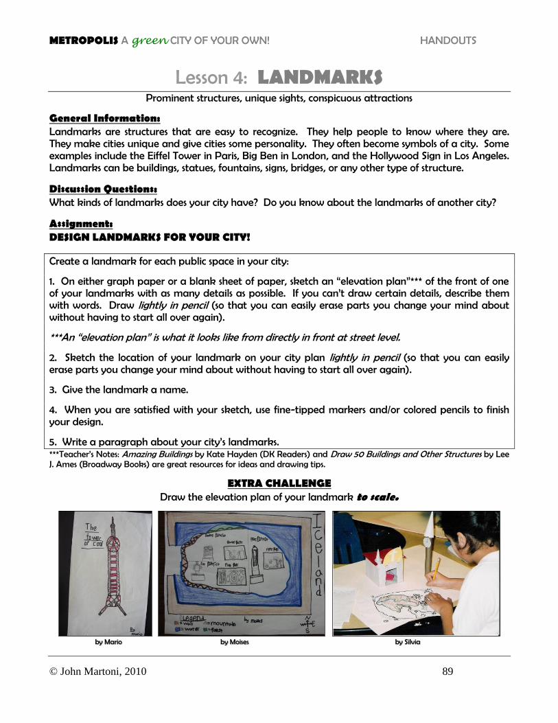
by Mario by Moises by Silvia
METROPOLIS A green CITY OF YOUR OWN! HANDOUTS
© John Martoni, 2010 90
LANDMARKS
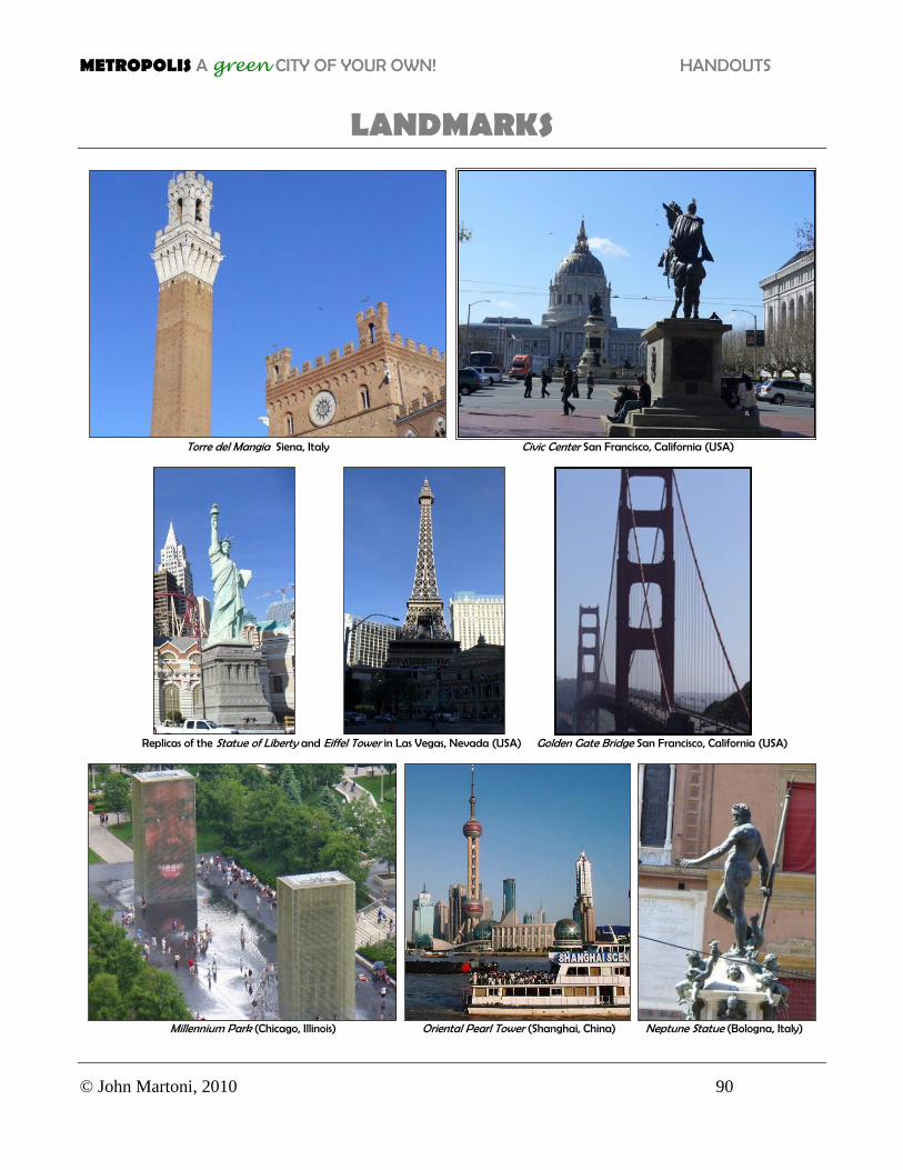
Torre del Mangia Siena, Italy Civic Center San Francisco, California (USA)
Replicas of the Statue of Liberty and Eiffel Tower in Las Vegas, Nevada (USA) Golden Gate Bridge San Francisco, California (USA)
Millennium Park (Chicago, Illinois) Oriental Pearl Tower (Shanghai, China) Neptune Statue (Bologna, Italy)
METROPOLIS A green CITY OF YOUR OWN! HANDOUTS
© John Martoni, 2010 91
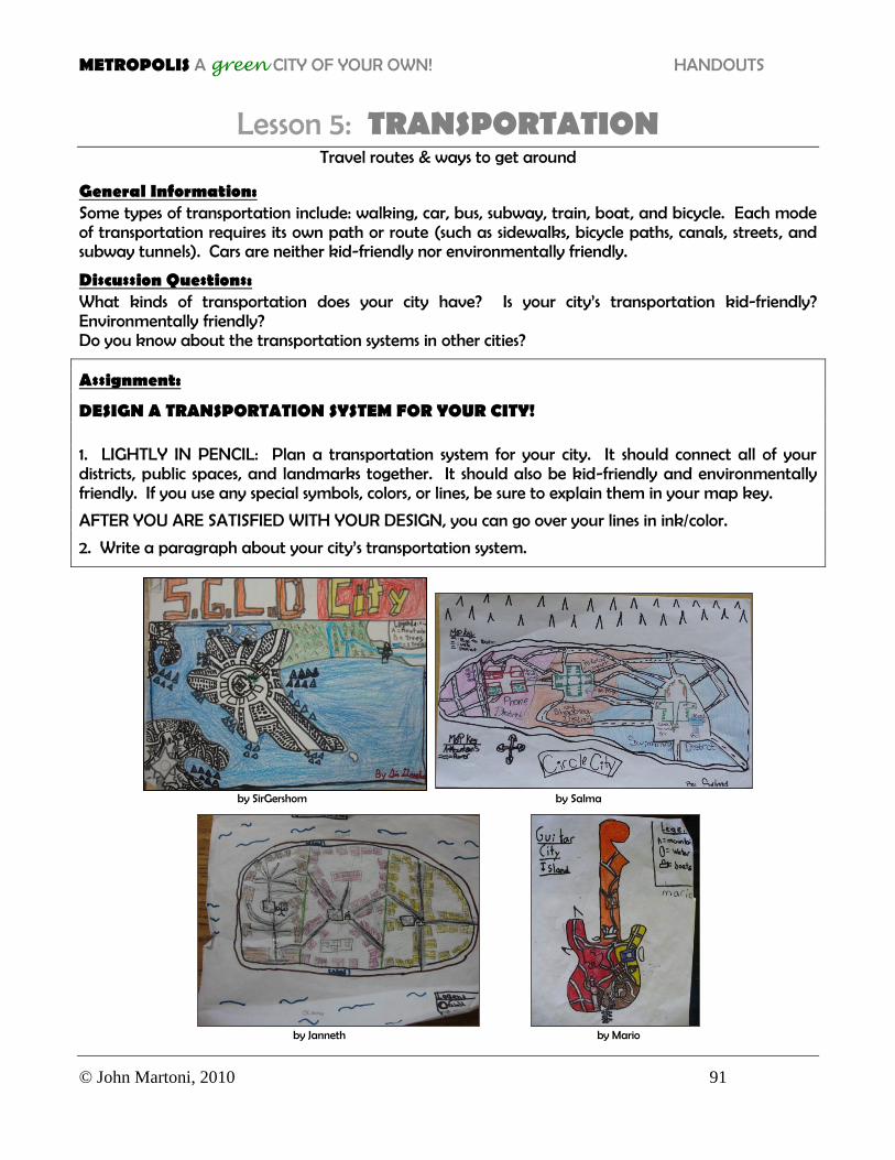
Lesson 5: TRANSPORTATION Travel routes & ways to get around
General Information: Some types of transportation include: walking, car, bus, subway, train, boat, and bicycle. Each mode of transportation requires its own path or route (such as sidewalks, bicycle paths, canals, streets, and subway tunnels). Cars are neither kid-friendly nor environmentally friendly.
Discussion Questions: What kinds of transportation does your city have? Is your city’s transportation kid-friendly? Environmentally friendly? Do you know about the transportation systems in other cities?
Assignment:
DESIGN A TRANSPORTATION SYSTEM FOR YOUR CITY! 1. LIGHTLY IN PENCIL: Plan a transportation system for your city. It should connect all of your districts, public spaces, and landmarks together. It should also be kid-friendly and environmentally friendly. If you use any special symbols, colors, or lines, be sure to explain them in your map key.
AFTER YOU ARE SATISFIED WITH YOUR DESIGN, you can go over your lines in ink/color.
2. Write a paragraph about your city’s transportation system.
by SirGershom by Salma
by Janneth by Mario
METROPOLIS A green CITY OF YOUR OWN! HANDOUTS
© John Martoni, 2010 92
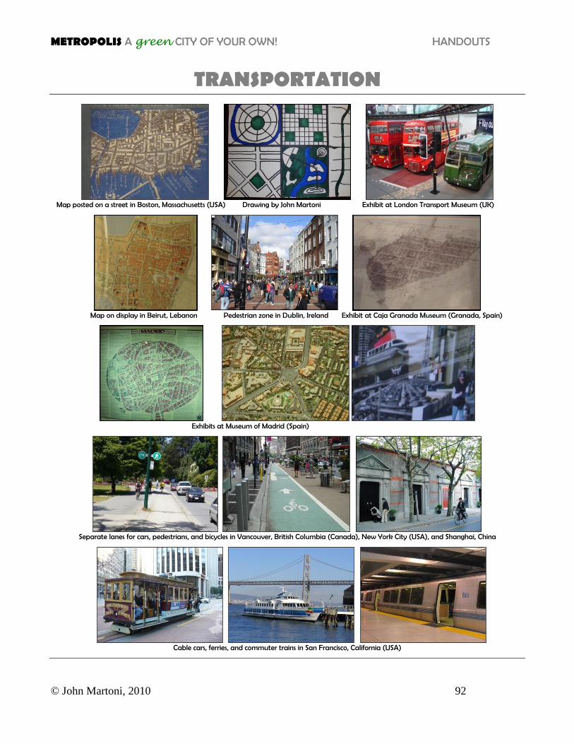
TRANSPORTATION
Map posted on a street in Boston, Massachusetts (USA) Drawing by John Martoni Exhibit at London Transport Museum (UK)
Map on display in Beirut, Lebanon Pedestrian zone in Dublin, Ireland Exhibit at Caja Granada Museum (Granada, Spain)
Exhibits at Museum of Madrid (Spain)
Separate lanes for cars, pedestrians, and bicycles in Vancouver, British Columbia (Canada), New York City (USA), and Shanghai, China
Cable cars, ferries, and commuter trains in San Francisco, California (USA)