Embed Size (px)
Citation preview

On behalf of Metrolinx, in coordination with the City of Mississauga
Port Credit GO Station Area Master Plan Study
Handouts from Advisory Panel Meeting #1Handouts from Advisory Panel Meeting #1 (Held April 23, 2015)

Port Credit GO Station Area Master Plan Study - Handouts from Advisory Panel Meeting #1 (held April 23, 2015)
Agenda: g1. Group Introductions
• IBI Group• Metrolinx
Cit f Mi i• City of Mississauga• Advisory Panel
2. Purpose of the Advisory Panel
3 Requirement for a Master Plan Study3. Requirement for a Master Plan Study • Official Plan Policies for a Port Credit GO Station Area Master Plan (Special Site 12) • Metrolinx Parking Structure and Transit-Oriented Development Plans and Request for Qualifications (RFQ) and Request
for Proposal (RFP) Process
4 Overview of Existing Planning Provisions:4. Overview of Existing Planning Provisions: • The Big Move (Metrolinx Regional Transportation Master Plan) • Mississauga Official Plan and Port Credit Local Area Plan• Port Credit Built Form Guidelines • Zoning By-lawZoning By law
5. Scope of the Master Plan Study
6. Group Discussion on Issues, Concerns, Opportunities and Constraints (land use, built form, transportation, other)
2
7. Proposed Agenda for the Second Advisory Panel Meeting (May 26th)
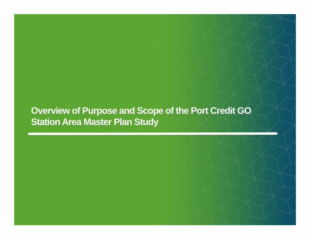
Overview of Purpose and Scope of the Port Credit GO Station Area Master Plan Study

Port Credit GO Station Area Master Plan Study - Handouts from Advisory Panel Meeting #1 (held April 23, 2015)
Purpose and Objectives of the Master Plan Studyp j yBackground
• The City of Mississauga Official Plan (MOP) and Port Credit Local Area Plan (PCLAP) identifies lands south of the Port Credit GO Station (Special Site 12) as:• Being an important location that can further develop the Mobility Hub;• Being an important location that can further develop the Mobility Hub;
• Having potential for intensification appropriate for a Community Node (height and density should generally be lower than City Centre and Major Nodes), accommodating mixed use development (including some employment), and potential heights of between 2-22 storeys; and
• Having need for further study to confirm appropriate type of redevelopment.
Purpose:• Determine appropriate development parametres for all Special Site 12 lands;
• Articulate more detailed land use and built form expectations for GO station parking lot, given interest in a new garage and transit oriented development, and finding a private sectorgiven interest in a new garage and transit oriented development, and finding a private sector partner; and
• Provide sufficient guidance that City of Mississauga is comfortable with incorporating the Queen Street right-of-way into a development.
Objectives of the Master Plan:Objectives of the Master Plan:
• Address Special Site 12 policies that require the Master Plan Study;
• Identify new Official Plan policies to ensure appropriate redevelopment occurs, recognizing a suitable balance between flexibility and definitiveness; and
City Staff and Council, landowners, developers, local residents and other stakeholders will all
4
• Strive for transit-oriented development (TOD) that showcases best-practices, while providing a feasible and realistic opportunity for public-private partnership.
stakeholders will all benefit from further clarity and direction.

Port Credit GO Station Area Master Plan Study - Handouts from Advisory Panel Meeting #1 (held April 23, 2015)
Scope of the Master Plan Study p y• Metrolinx and IBI Group developed a scope of work / approach for the Master Plan Study, in consultation with the City of
Mississauga, which is comprised of the following tasks:
• Background Review and Assessment (e.g. existing policies, regulations and guidelines, site and neighbourhood context);
• Review of Infrastructure Capacity (e g water sewer and stormwater management);Review of Infrastructure Capacity (e.g. water, sewer and stormwater management);
• Land Use Analysis (e.g. appropriate type and amount of development, requirements/incentives to attract employment uses, identifying complementary uses the could support rapid transit and transit-oriented development);
• Built Form Analysis (e.g. shadow impact, appropriate range of heights, building massing, interface with heritage buildings);
• Urban Design and Landscape Analysis (e.g. guidelines to address character and planned function of the area);
• Transportation Analysis (e.g. existing conditions, background growth, testing of development concepts, mitigation measures);
• Consultation - three-tier approach engage in meaningful and open dialogue on what is appropriate land use and built form;
5
• Draft and Final Master Plan Report; and
• Recommendations on Implementation and Draft Official Plan Amendment Policies.

Port Credit GO Station Area Master Plan Study - Handouts from Advisory Panel Meeting #1 (held April 23, 2015)
Anticipated Timing & Next Steps for the Master Plan Study p g p yMaster Plan Study • February – May: Planning, urban design, transportation and engineering analysis and additional consultation;
• June: Draft Findings:P bli O H ti i t d t b h ld J 16 2015• Public Open House anticipated to be held June 16, 2015
• July: Preparation of Draft and Final Master Plan Reports (Submitted to Metrolinx and the City of Mississauga);
• Summer: Review of Master Plan and Preparation of Planning Report (Recommendations) by City Staff; and
• Fall: Master Plan and City Staff Report brought to City Council and the Planning and Development Committee.
Potential Official Plan Amendment• To incorporate recommendations from the Master Plan Study and City Staff, if
required/appropriate.• Mandatory public meeting.y p g
Other Approvals Required Prior to New Development Proceeding:• Rezoning
• To implement the policies of MOP, further define and regulate uses and set standards for each permitted use (e.g. height, density, lot coverage, setbacks, parking, etc.).pe tted use (e g e g t, de s ty, ot co e age, setbac s, pa g, etc )
• Mandatory public meeting.
• Site Plan Approval• To implement the technical policies of the MOP. • Conditions of Site Plan Approval may include the location of buildings and structures, massing/
6
conceptual design of buildings, access, parking, loading, garbage handling facilities, walkways, lighting, fencing, landscaping and grading, matters related to exterior design, provision for public spaces, accessibility, sustainability, etc.

High-level Overview of Existing Planning Framework Governing Land Use and Development in the Port Credit GO Station Master Plan Study Area

Port Credit GO Station Area Master Plan Study - Handouts from Advisory Panel Meeting #1 (held April 23, 2015)
Package Contentsg• The Mississauga Official Plan (MOP) and the Port Credit Local Area Plan (PCLAP) identify an intended role for lands within
proximity to the Port Credit GO Station and provide general policy direction for future growth and development. The Plans also stipulate that further study of land use and urban design is required in advance of any new development on the specific lands (i.e. Special Site 12).
A M Pl b l d h i f i f h Ci f h d fi h i f d l d• A Master Plan must be completed, to the satisfaction of the City, to further define the appropriate types of development and to address land use, built form, transportation and heritage resources. The findings from the Master Plan Study may result in amendments to the MOP (including the PCLAP).
• Metrolinx has plans to build a new parking garage for GO Transit users and mixed-use development on its existing surface parking lot. Metrolinx has initiated the Master Plan Study and retained consultant team from IBI Group to lead the study process and to coordinate with the City of Mississauga.
• This draft preliminary information package provides a high-level overview of the policies and regulations that are currently in place in the Port Credit GO Station Area Master Plan Study area, including:
• The Big Move: Transforming Transportation in the Greater Toronto and Hamilton Area: Gateway Mobility Hub
• Mississauga Official Plan: Community Node, Major Transit Station Area and Mobility Hub and Mixed Use or Utility.
• Port Credit Local Area Plan: Central Residential Precinct.
8
• Mississauga Zoning By-law 0225-2007: D Zone (Development), H-RA2-48 (Residential Apartment Dwellings, Exception Zone -Hold), RA1-24 (Residential Apartment Dwellings, Exception Zone).

Port Credit GO Station Area Master Plan Study - Handouts from Advisory Panel Meeting #1 (held April 23, 2015)
Provincial Policies and Plans – The Big Moveg• The Province of Ontario has taken a three-part approach to prepare the Greater Toronto and Hamilton Area (GTHA) for growth
and sustainability:• The Greenbelt Plan (2005), which protects more than 1.8 million acres of environmentally sensitive and agricultural land in the heart of
the region;
• Places to Grow: The Growth Plan for the Greater Golden Horseshoe (2006, office consolidation 2013, which is intended to manage and direct population and job growth; and
• Metrolinx Regional Transportation Plan, The Big Move: Transforming Transportation in the Greater Toronto and Hamilton Area (2008), which is a long-term strategic plan for an integrated, multi-modal, regional transportation system that identifies transit improvementprojects and goals for establishing mobility hubs.
• Places to Grow designates Port Credit as ‘Built Up Area’ and identifies the Lakeshore West GO Transit rail line as ‘Improved Higher Order Transit’. The Big Move designates the Port Credit GO Station as a ‘Gateway Mobility Hub’.
• Mobility Hubs are major transit station areas located at the interchange of two or more current or planned regional rapid transit lines. They have, or are planned to have, an attractive, intensive concentration of employment, living, shopping and enjoyment.
• The Port Credit Mobility Hub is currently served by the Lakeshore West GO Transit rail line. Planned rapid transit initiatives include the Hurontario/Main Light Rapid Transit (LRT) and the electrification of the Lakeshore rail line to provide Regional Express Rail (RER).
9
*Refer to The Big Move for additional details: http://www.metrolinx.com/en/regionalplanning/bigmove/ big_move.aspx

Port Credit GO Station Area Master Plan Study - Handouts from Advisory Panel Meeting #1 (held April 23, 2015)
Mississauga Official Plan (MOP)g ( )• The Mississauga Official Plan (MOP) is a legal document that sets out a vision for
where and how a City will grow.
• MOP was adopted by Council in September 2010 (replacing the 2003 Mississauga Plan) It consists of a principle document and several local area plans whichPlan). It consists of a principle document and several local area plans which address unique circumstances particular to specific areas of the City.
• The Official Plan review process was initiated to establish policies that will guide Mississauga through its next stage of growth (to 2031) and to align with recent legislative and policy initiatives set out by the Province of Ontario and the Region of Peel.Municipal Official Plans must conform with federal, provincial and regional policies and legislation.
• MOP provides policies to manage and direct the physical change of the city and the effects of such change on the social, economic, cultural and natural environment. It also forms the basis for detailed land use designations and urban design policies, and sets the context for the review and approval of development applications.
• Schedules of MOP identify the Port Credit GO Station and lands to the south as:• Community Node;
• Major Transit Station Area; and
• Mobility Hub.
Note: Hurontario Street is also identified as an ‘Intensification Corridor’ and a ‘High Order Transit Corridor’
• Schedules of MOP designate lands south of the Port Credit GO Station as:• Mixed Use; and
• Utility.
10

Port Credit GO Station Area Master Plan Study - Handouts from Advisory Panel Meeting #1 (held April 23, 2015)
Mississauga Official Plan - Community Nodeg y• To establish a framework for planning policies, MOP identifies a City Structure that organizes Mississauga into functional areas.
The City Structure is the basis of the urban hierarchy, which provides guidance regarding density, height, uses and appropriate growth. Greatest heights and densities are directed to the City Centre (Downtown), followed by ‘Major Nodes’ and then ‘Community Nodes’.
• The central portion of Port Credit, including the GO Station and lands to the south, are identified as a ‘Community Node’. Community Nodes are Intensification Areas and are to provide a similar mix of uses as Major Nodes, but with lower densities and heights. Examples of policy direction provided by MOP include:
• Community Nodes will achieve a gross density of between 100 and 200 residents and jobsbetween 100 and 200 residents and jobs combined per hectare (5.3.3.4).
• Community Nodes will achieve an average population to employment ratio between 2:1 to 1:2, measured as an average across the entire area of each node (5.3.3.6).
• Local area plans will determine how the density and population to employment targets will be achieved within Community Nodes (5.3.3.7).
• Community Nodes will develop as centres for surrounding Neighbourhoods and be a locationsurrounding Neighbourhoods and be a location for mixed use development (5.3.3.8).
• Development in Community Nodes will be in a form and density that complements the existing character of historical Nodes or that achieves a high quality urban environment within more
11
recently developed Nodes (5.3.3.11).
Source: IBI Group based on Schedule 1b of the Mississauga Official Plan

Port Credit GO Station Area Master Plan Study - Handouts from Advisory Panel Meeting #1 (held April 23, 2015)
Mississauga Official Plan - Major Transit Station Areas & Mobility Hubg j y• The Port Credit GO Station and lands within 500 metres are identified as a ‘Major Transit Station Area’ and a ‘Mobility Hub’.
Examples of policy direction provided by MOP include:
• The focus for intensification will be Intensification Areas, which are the Downtown, Major Nodes, Community Nodes, Corporate Centres, Intensification Corridors and Major Transit Station Areas, as shown on Schedule 2: Intensification Areas (5.5.1).
• Office development will be encouraged to locate within Major Transit Station Areas (5.5.10).
• Major Transit Station Areas will be planned and designed to provide p a ed a d des g ed o p o deaccess from various transportation modes to the transit facility, including consideration of pedestrians, bicycle parking and commuter pick-up/drop-off areas (5.5.16).
• Mississauga will promote the development of land use and transportation facilities around anchor hubs and gateway hubs in a manner that supports the Metrolinx Regional Transportation Plan (8.6.1).p ( )
• Mobility hubs may be required to provide amenities such as secure storage facilities for bicycles, car-share drop-off areas, heated waiting areas, traveller information centres, cafes and
12
restaurants, as well as services such as daycares, grocery stores or post offices (8.6.3).

Port Credit GO Station Area Master Plan Study - Handouts from Advisory Panel Meeting #1 (held April 23, 2015)
Mississauga Official Plan – Land Use Designationsg g• Schedule 10 and Chapter 11 of MOP outline land use permissions. The following summarizes those which apply to the Port
Credit GO Station Area Master Plan Study area (Special Site 12):
• Mixed Use: commercial parking facility, conference centre, entertainment, recreation and sports facility, financial institution, funeralestablishment, overnight accommodation, personal service establishment, post-secondary educational facility, restaurant, retail store,
id ti l d ffi d itt d i ll d i ti dresidential, secondary office and uses permitted in all designations ; and
• Utility: uses permitted in all designations (e.g. telecommunications facility, community infrastructure, etc.), parking and accessory uses.
13
Source: IBI Group based on Schedule I‐2 of the Mississauga Official Plan

Port Credit GO Station Area Master Plan Study - Handouts from Advisory Panel Meeting #1 (held April 23, 2015)
Port Credit Local Area Plan (PCLAP)( )• The Port Credit Local Area Plan (PCLAP) was approved in November 2014 (i.e. Official Plan Amendment No. 19 to the
Mississauga Official Plan). It provides policies for lands in south central Mississauga.
• The Port Credit GO Station and surrounding lands are located within a ‘Community Node Character Area’ and a ‘Central Residential Area’ precinct. Additional development is anticipated within the Community Node, with varying form and scale,Residential Area precinct. Additional development is anticipated within the Community Node, with varying form and scale, depending on the precinct. High urban design standards are expected. Examples of PCLAP policy objectives include:
• To ensure that the greatest height and density will be in close proximity to the GO station and future LRT transit stop at Hurontario Street and Park Street (10.2).
• To ensure building heights will reflect an appropriate transition towards the Credit River, Lake Ontario Shoreline, the mainstreet area, and surrounding , gneighbourhoods (10.2).
• To recognize key locations in the vicinity of the GO station and waterfront that require additional study prior to redevelopment (10.2).redevelopment (10.2).
• Floor plate size for buildings over six storeys will decrease as building height increases, to address among other matters: a. overall massing (reduce ‘wall effect’), b. visual impact of buildings, c. protect skyviews, and d. limit shadow impact (10.2.1.2).
• Buildings over six storeys will maintain distance separations that, amongst other matters, address the following: a. existingseparations between buildings, b. overcrowding of skyviews and skyline, c. protection of view corridors, and d. privacy and overlook of
14
p g , g y y , p , p yoccupants.

Port Credit GO Station Area Master Plan Study - Handouts from Advisory Panel Meeting #1 (held April 23, 2015)
Port Credit Local Area Plan (PCLAP)( )• Schedule 2B of the PCLAP identifies height limits within the Community Node. Policy 10.2.2.3 stipulates that a detailed land
use and urban design study will be required for the Special Site 12 lands to verify appropriate heights, design, transition to adjacent land and mix of uses.
Source: IBI Group based on Schedule 2B of the Port Credit Local Area Plan
15
Source: IBI Group based on Schedule 2B of the Port Credit Local Area P lan
*Refer to the Port Credit Local Area Plan for confirmation and additional details: http://www.mississauga.ca/portal/residents/portcreditreview

Port Credit GO Station Area Master Plan Study - Handouts from Advisory Panel Meeting #1 (held April 23, 2015)
Port Credit Local Area Plan (PCLAP)( )• The PCLAP identifies the Special Site 12 lands as requiring
special attention, as they are in an important location that can further the development of the Port Credit Mobility Hub.
• Before development can proceed on the lands, a comprehensive Master Plan must be prepared, to the satisfaction of the City, that identifies the appropriate type of development/redevelopment, addressing land use, built form transportation and heritage resources
16
form, transportation and heritage resources.

Port Credit GO Station Area Master Plan Study - Handouts from Advisory Panel Meeting #1 (held April 23, 2015)
Port Credit Built Form Guide• The Port Credit Built Form Guide forms an appendix to the PCLAP and is to be read in conjunction with the policies of the
MOP and the PCLAP. It demonstrates how the urban form policies of the PCLAP can be achieved.
• The Community Node within Port Credit is expected to exhibit a high quality of urban design that should reinforce and enhancethe identify of Port Credit as a vibrant and memorable urban place.
• The Guide includes built form provisions to help minimize shadow and wind impact of taller buildings and improve skylines and views. Examples include: • Maximum building heights of 22 storeys; • Use of smaller floor plates; and• Minimum distance separation of 35 to 40 metres from any portion
of a building that is over 6 storeys to another building over 6 storeys.
• The Guide identifies lands south of the Port Credit GO Station as a ‘Place Making Opportunity’ and provides recommendations for the public realm, such as:• Provision of at-grade retail on certain streets;• The treatment of building frontages and signage;• The treatment of building frontages and signage;• Provision of landscaping; and• Location and design of parking, servicing and loading areas
and ventilation.
17
• The Guide is to be used during the design and review of development applications. Depending on the context or site, exceptions and variation from the Guide may be considered at the discretion of the City.

Port Credit GO Station Area Master Plan Study - Handouts from Advisory Panel Meeting #1 (held April 23, 2015)
Mississauga Zoning By-Law 0225-2007g g y• A Zoning By-law is the legal document that implements policies and objectives described in the Official Plan. It regulates the use
and development of buildings by stating exactly what types of land uses are permitted in various areas and establishes precise standards /requirements (e.g. height, lot size, lot coverage, frontage, setbacks, supply and design of parking and loading spaces, etc).
• The Mississauga Zoning By-law zones lands within Special Site 12 as:
• D Zone (Development): permits a building or structure legally existing on the date of passing of the By-law and the existing legal use of such building or structure;
• H-RA2-48 (Residential Apartment Dwellings, Exception Zone - Hold): permits a detached dwelling, duplex or triplex dwelling legally existing on the date of passing of the By-law and accessory buildings and structures; The holding symbol H is to be removed from the whole or any part of the lands zoned H-RA2-48 by further amendment to Map 08 of Schedule B of the By-law.
• RA1-24 (Residential Apartment Dwellings, Exception Zone): permits a detached dwelling legally existing on the date of passing of the By-law and an office within an existing detached dwelling; or
Utilit it tilit b ildi (i l di th d f t l i ti )• Utility: permits utility buildings (including those used for telecommunications), water and sewage plants, electrical transformer and distribution facilities and passive recreational uses.
• With the exception of the southwest parcel within Port Credit GO Station Area Master Plan Study (i.e. 80 High Street East), all lands within the Master Plan Study Area will need to be rezoned to reflect the new ‘Mixed Use’ land use designation of MOP.
18
*Refer to the Mississauga Zoning By-law 0225 for confirmation and additional information: http://www.mississauga.ca/portal/residents/zoningbylaw

Draft Information Boards

Port Credit GO Station Area Master Plan Study - Handouts from Advisory Panel Meeting #1 (held April 23, 2015)
20

Port Credit GO Station Area Master Plan Study - Handouts from Advisory Panel Meeting #1 (held April 23, 2015)
21


![March 5, 2013 Meeting Agenda and Handouts [PDF, 695KB]](https://img.pdfslide.net/doc/110x75/58873ab31a28abbd3d8c5961/march-5-2013-meeting-agenda-and-handouts-pdf-695kb.jpg)