Embed Size (px)
Citation preview
Hans Burchard
Leibniz Institute for Baltic Sea Research Warnemünde
Trying to model Greenland’s fjords with GETM
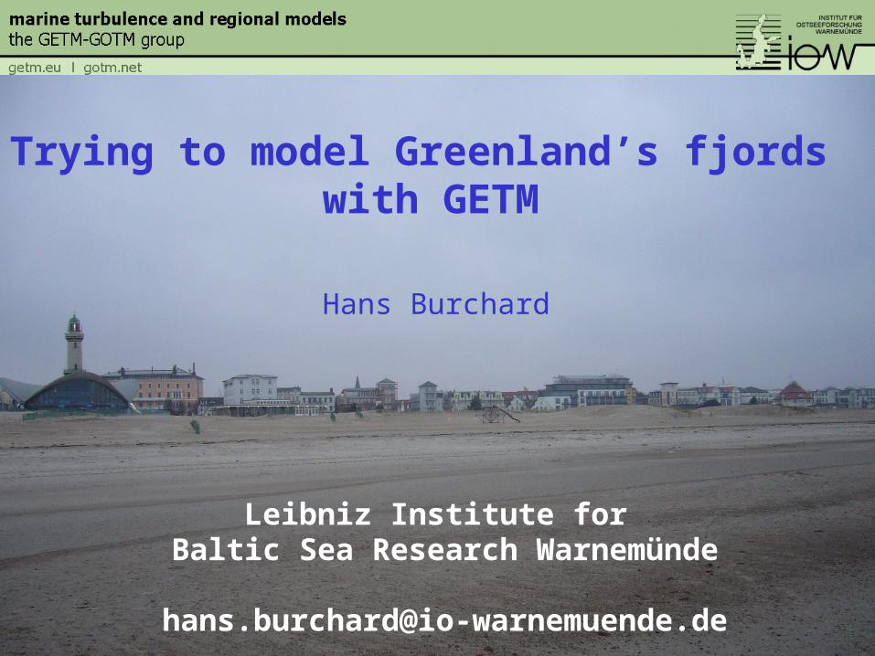
Aspects of fjord-type estuarine circulation
Reissmann et al., 2009
Exchange flow
Inflows
Boundary and internal mixing
www.getm.eu
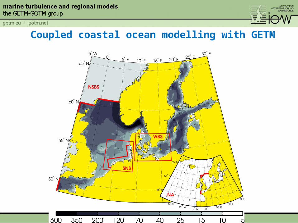
Coupled coastal ocean modelling with GETM
Gräwe et al. (in prep.)
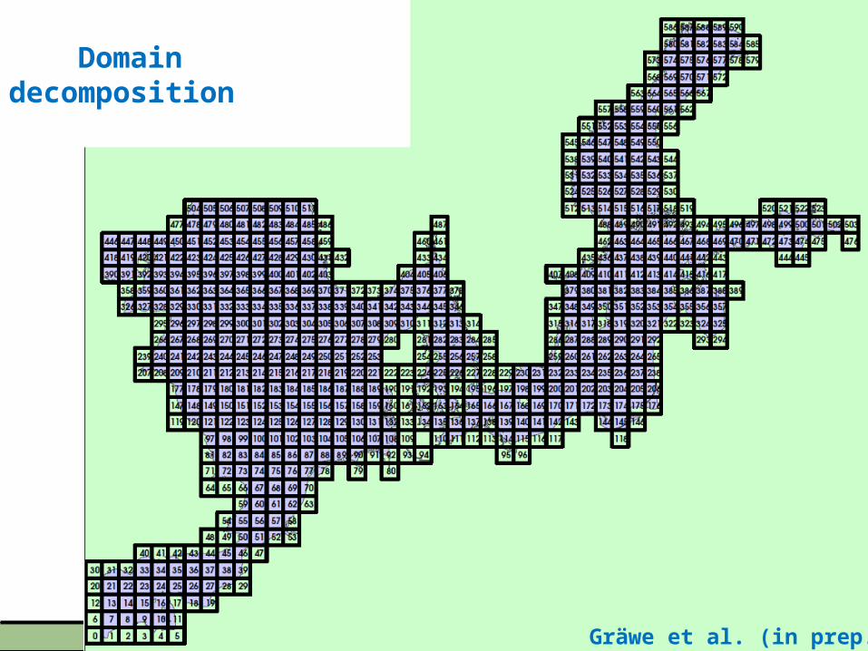
Domain decomposition
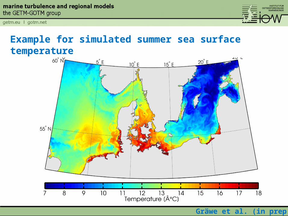
Example for simulated summer sea surface temperature
Gräwe et al. (in prep.)
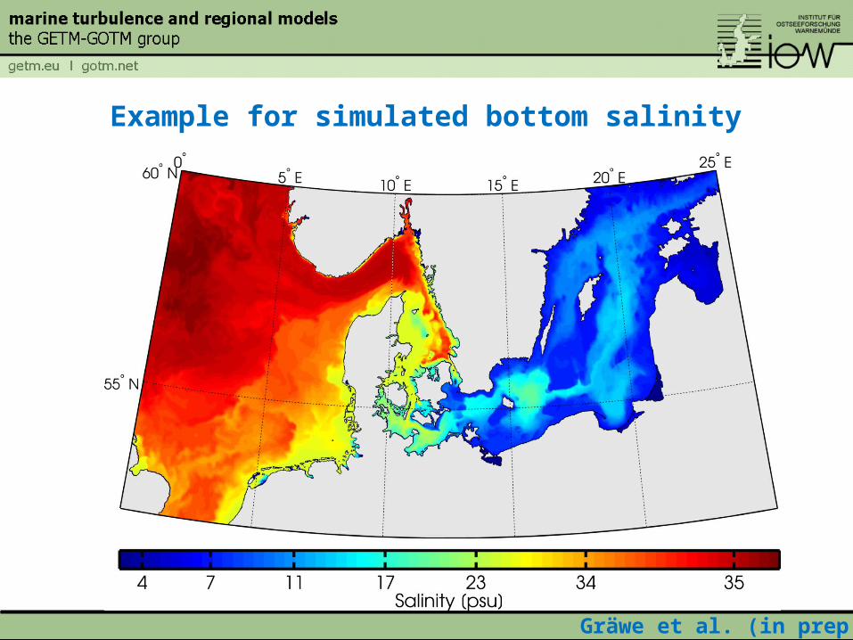
Example for simulated bottom salinity
Gräwe et al. (in prep.)
Adaptive coordinates in Bornholm Sea
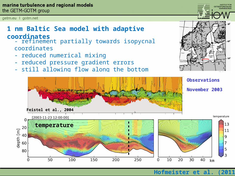
1 nm Baltic Sea model with adaptive coordinates
- refinement partially towards isopycnal coordinates- reduced numerical mixing- reduced pressure gradient errors- still allowing flow along the bottom
salinity
temperature
km
Hofmeister et al. (2011)
Feistel et al., 2004
Observations
November 2003
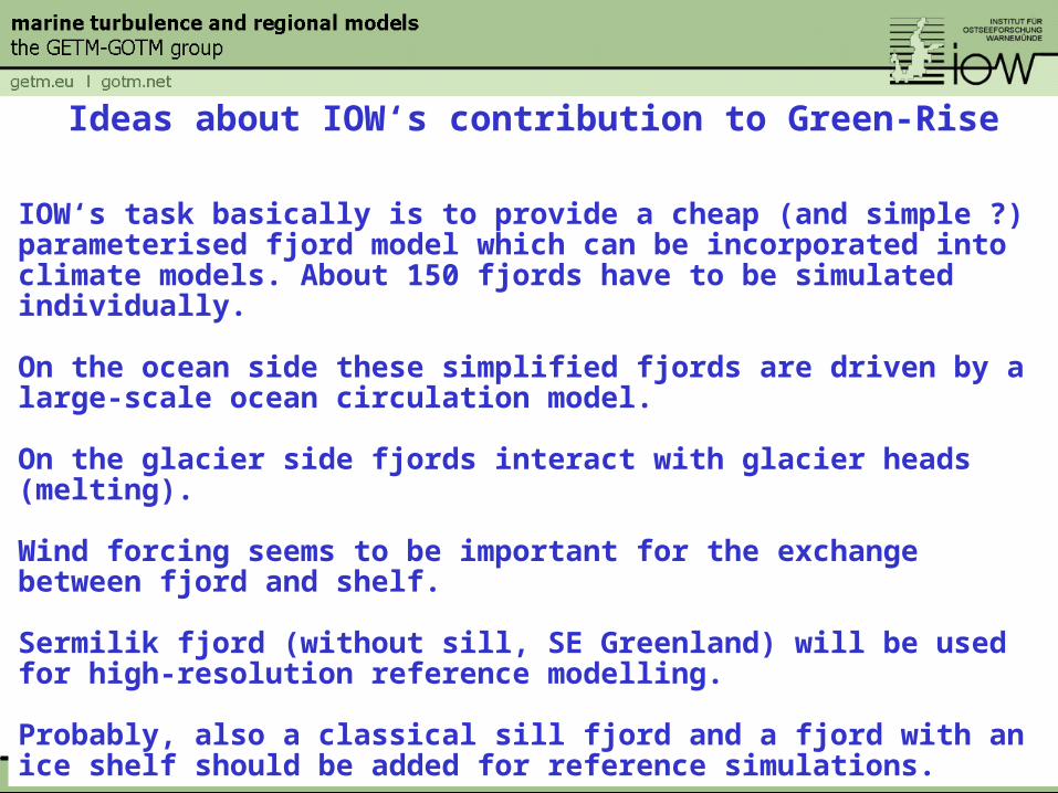
Ideas about IOW‘s contribution to Green-Rise
IOW‘s task basically is to provide a cheap (and simple ?) parameterised fjord model which can be incorporated into climate models. About 150 fjords have to be simulated individually.
On the ocean side these simplified fjords are driven by a large-scale ocean circulation model.
On the glacier side fjords interact with glacier heads (melting).
Wind forcing seems to be important for the exchange between fjord and shelf.
Sermilik fjord (without sill, SE Greenland) will be used for high-resolution reference modelling.
Probably, also a classical sill fjord and a fjord with an ice shelf should be added for reference simulations.
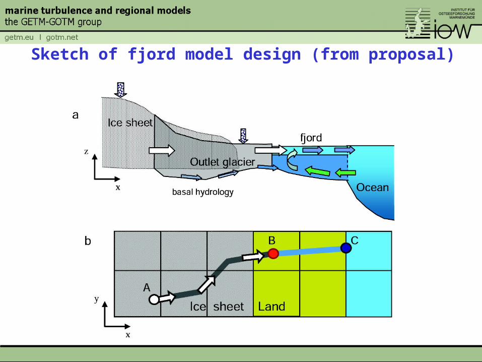
Sketch of fjord model design (from proposal)
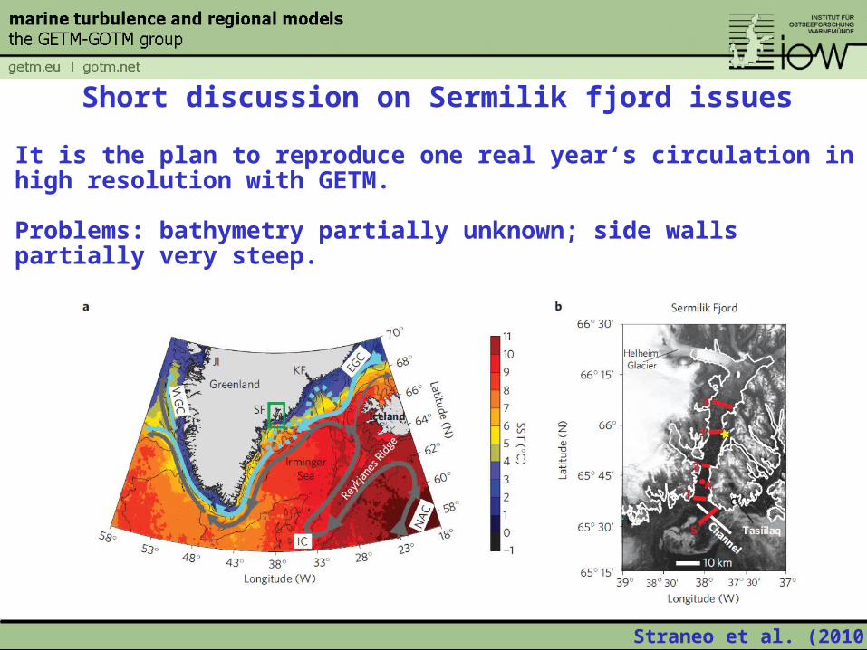
Short discussion on Sermilik fjord issues
It is the plan to reproduce one real year‘s circulation in high resolution with GETM.
Problems: bathymetry partially unknown; side walls partially very steep.
Straneo et al. (2010)
Straneo et al. (2010)
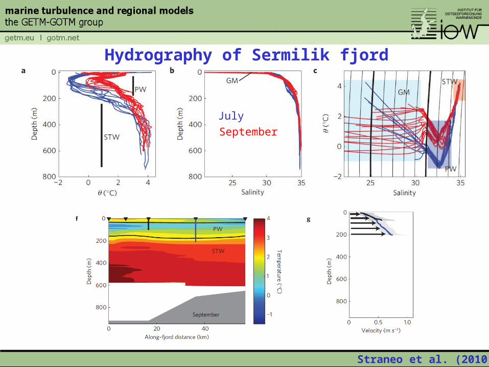
Hydrography of Sermilik fjord
July
September
Sciascia et al. (2013)
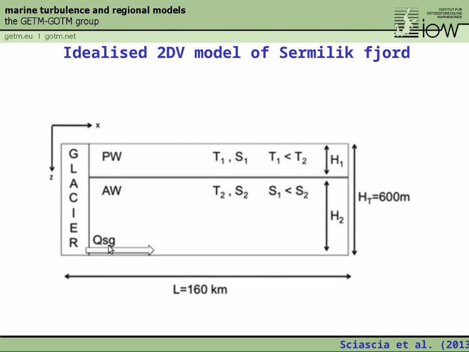
Idealised 2DV model of Sermilik fjord
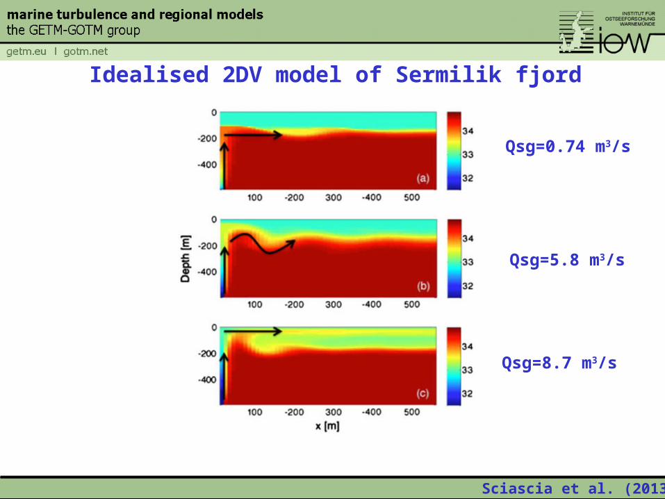
Sciascia et al. (2013)
Idealised 2DV model of Sermilik fjord
Qsg=0.74 m3/s
Qsg=5.8 m3/s
Qsg=8.7 m3/s
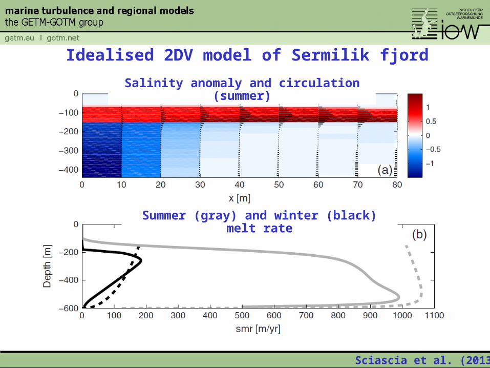
Sciascia et al. (2013)
Idealised 2DV model of Sermilik fjord
Salinity anomaly and circulation (summer)
Summer (gray) and winter (black) melt rate
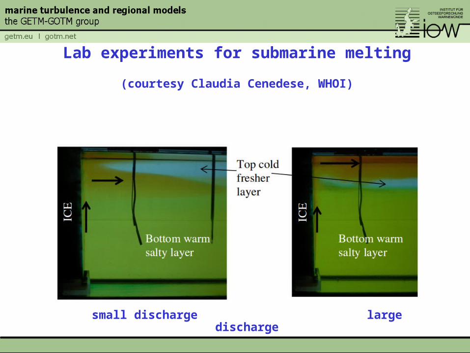
Lab experiments for submarine melting
(courtesy Claudia Cenedese, WHOI)
small discharge large discharge
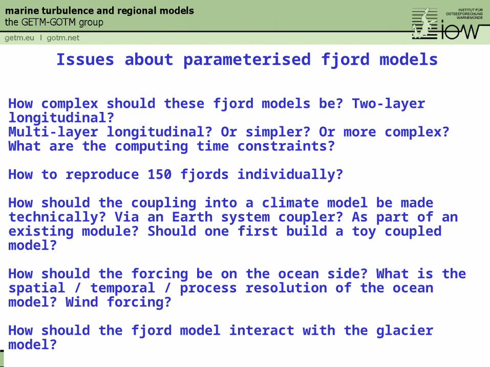
Issues about parameterised fjord models
How complex should these fjord models be? Two-layer longitudinal?Multi-layer longitudinal? Or simpler? Or more complex? What are the computing time constraints?
How to reproduce 150 fjords individually?
How should the coupling into a climate model be made technically? Via an Earth system coupler? As part of an existing module? Should one first build a toy coupled model?
How should the forcing be on the ocean side? What is the spatial / temporal / process resolution of the ocean model? Wind forcing?
How should the fjord model interact with the glacier model?
How does actually submarine glacial melt increase ice export to the ocean? How to incorporate this into the coupled model system?