Embed Size (px)
Citation preview
Harnessing the Wind of the South Texas Gulf Coast
2
Agenda
• Background on Babcock & Brown
• Why We Chose The Kenedy Ranch Location
• Environmental Benefits
• Economic Regional Benefits
• Overview of Project Environmental Work
3
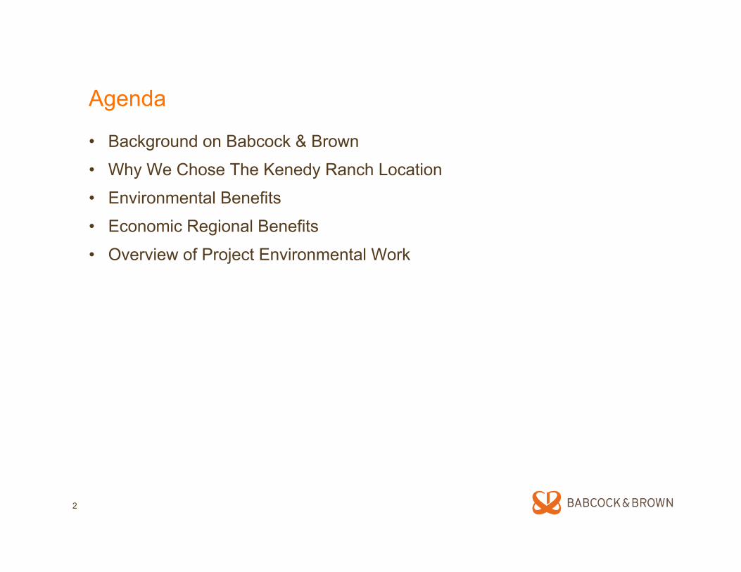
Babcock & Brown: A Leader in Wind Energy
• One of the largest owners and operators of wind projects in the world
• Founded in 1977 in California
• 20 years of experience in wind energy
• Strong reputation for developing successful wind farms
• Partner for the long term - we develop, own, operate, and manage
Photo courtesy of Mortenson Photo courtesy of Mortenson
4
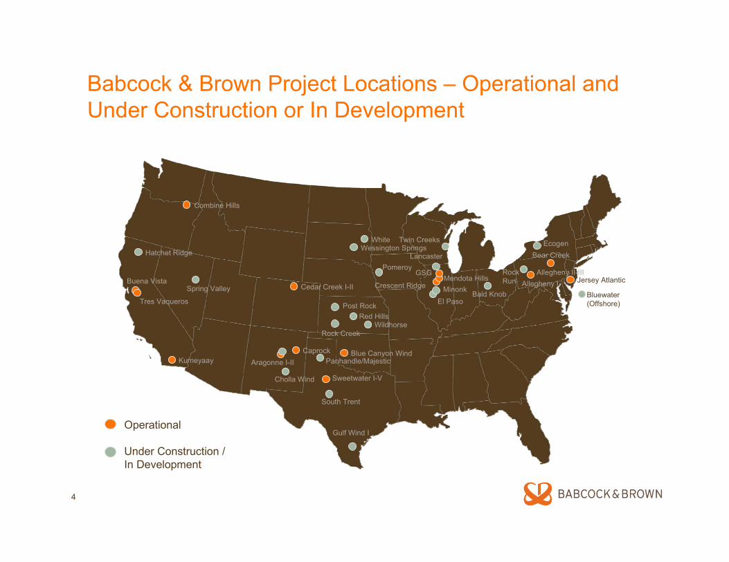
Babcock & Brown Project Locations – Operational and Under Construction or In Development
Crescent Ridge
Operational
Under Construction /In Development
Caprock
Buena Vista
Blue Canyon Wind
Bear Creek
Aragonne I-II
Sweetwater I-V
Jersey Atlantic
Kumeyaay
Mendota HillsGSG
Tres Vaqueros
Allegheny ICedar Creek I-II
Allegheny II-III
Gulf Wind I
Hatchet RidgeEcogenWessington Springs
Cholla Wind
Bald Knob
RockRun
Spring Valley
South Trent
Panhandle/Majestic
Bluewater (Offshore)Post Rock
Rock CreekWildhorse
Red Hills
Combine Hills
White
PomeroyLancaster
Twin Creeks
El PasoMinonk
Why the Kenedy Ranch?
6
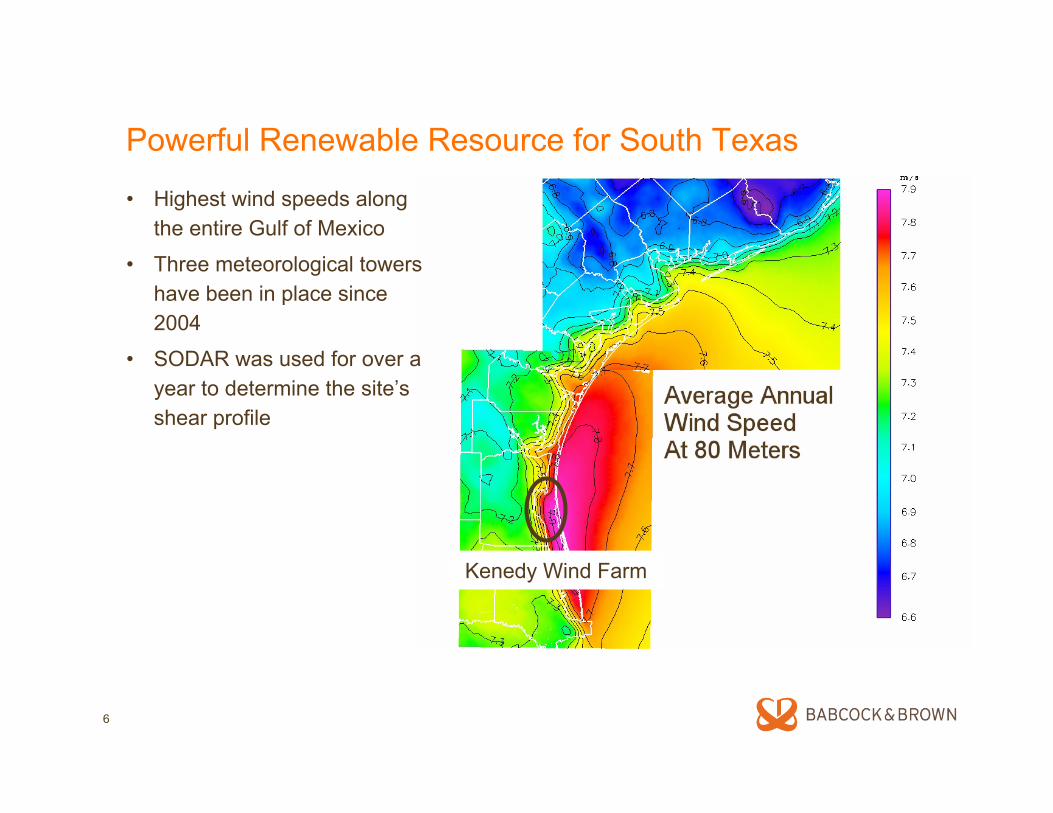
Powerful Renewable Resource for South Texas
• Highest wind speeds along the entire Gulf of Mexico
• Three meteorological towers have been in place since 2004
• SODAR was used for over a year to determine the site’s shear profile
Kenedy Wind Farm
7
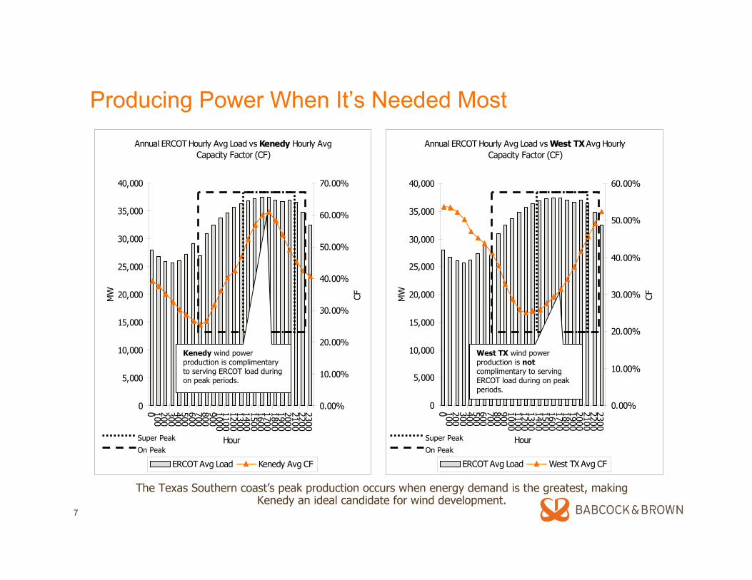
Producing Power When It’s Needed Most
Annual ERCOT Hourly Avg Load vs Kenedy Hourly Avg Capacity Factor (CF)
0
5,000
10,000
15,000
20,000
25,000
30,000
35,000
40,000
0 10020030040050060070080090010001100120013001400150016001700180019002000210022002300
Hour
MW
0.00%
10.00%
20.00%
30.00%
40.00%
50.00%
60.00%
70.00%
CF
ERCOT Avg Load Kenedy Avg CF
Annual ERCOT Hourly Avg Load vs West TX Avg Hourly Capacity Factor (CF)
0
5,000
10,000
15,000
20,000
25,000
30,000
35,000
40,000
0 10020030040050060070080090010001100120013001400150016001700180019002000210022002300
Hour
MW
0.00%
10.00%
20.00%
30.00%
40.00%
50.00%
60.00%
CF
ERCOT Avg Load West TX Avg CF
On Peak
Super Peak
On Peak
Super Peak
Kenedy wind power production is complimentary to serving ERCOT load during on peak periods.
West TX wind power production is notcomplimentary to serving ERCOT load during on peak periods.
The Texas Southern coast’s peak production occurs when energy demand is the greatest, making Kenedy an ideal candidate for wind development.
8
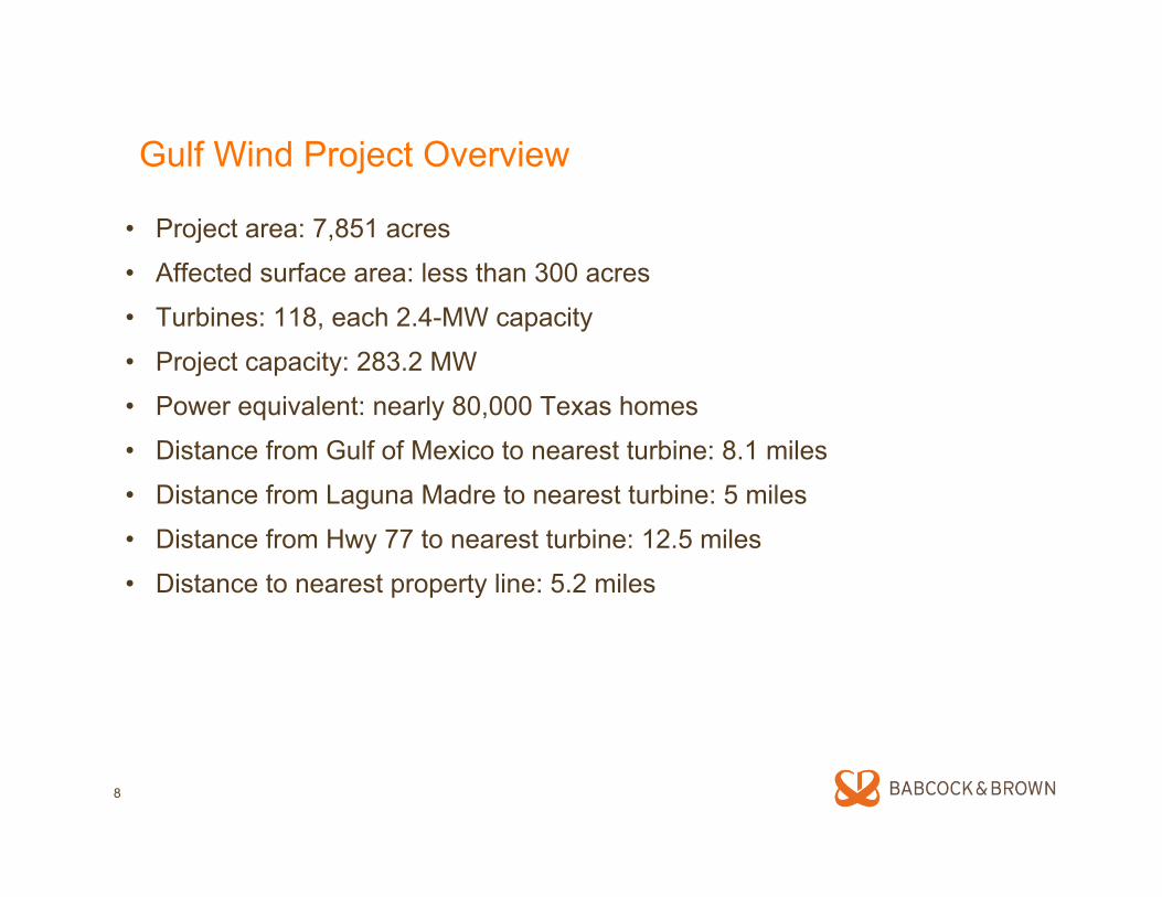
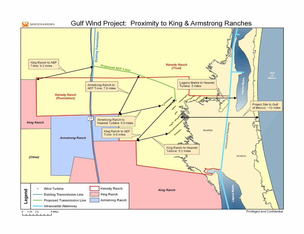
Gulf Wind Project Overview
• Project area: 7,851 acres
• Affected surface area: less than 300 acres
• Turbines: 118, each 2.4-MW capacity
• Project capacity: 283.2 MW
• Power equivalent: nearly 80,000 Texas homes
• Distance from Gulf of Mexico to nearest turbine: 8.1 miles
• Distance from Laguna Madre to nearest turbine: 5 miles
• Distance from Hwy 77 to nearest turbine: 12.5 miles
• Distance to nearest property line: 5.2 miles
9
Environmental Benefits of Gulf Wind Project
11
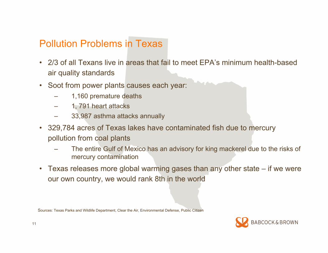
Pollution Problems in Texas
• 2/3 of all Texans live in areas that fail to meet EPA’s minimum health-based air quality standards
• Soot from power plants causes each year:– 1,160 premature deaths – 1, 791 heart attacks – 33,987 asthma attacks annually
• 329,784 acres of Texas lakes have contaminated fish due to mercury pollution from coal plants
– The entire Gulf of Mexico has an advisory for king mackerel due to the risks of mercury contamination
• Texas releases more global warming gases than any other state – if we were our own country, we would rank 8th in the world
Sources: Texas Parks and Wildlife Department, Clear the Air, Environmental Defense, Public Citizen
12
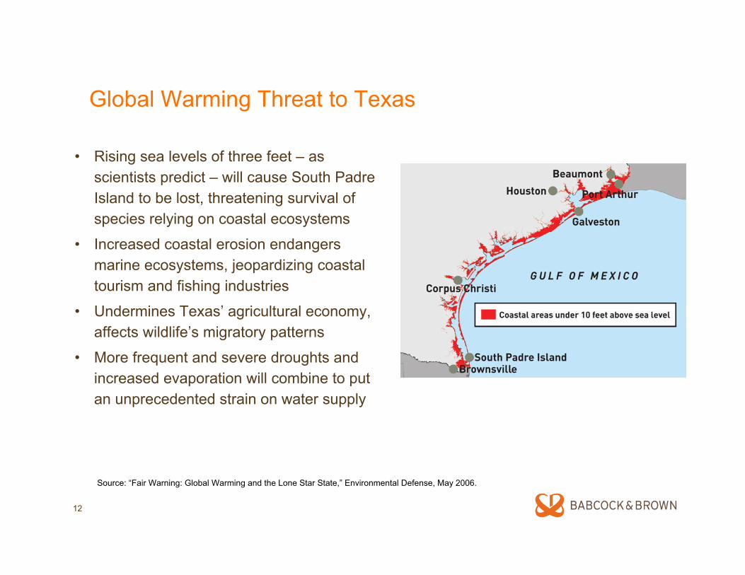
Global Warming Threat to Texas
• Rising sea levels of three feet – as scientists predict – will cause South Padre Island to be lost, threatening survival of species relying on coastal ecosystems
• Increased coastal erosion endangers marine ecosystems, jeopardizing coastal tourism and fishing industries
• Undermines Texas’ agricultural economy, affects wildlife’s migratory patterns
• More frequent and severe droughts and increased evaporation will combine to put an unprecedented strain on water supply
Source: “Fair Warning: Global Warming and the Lone Star State,” Environmental Defense, May 2006.
13
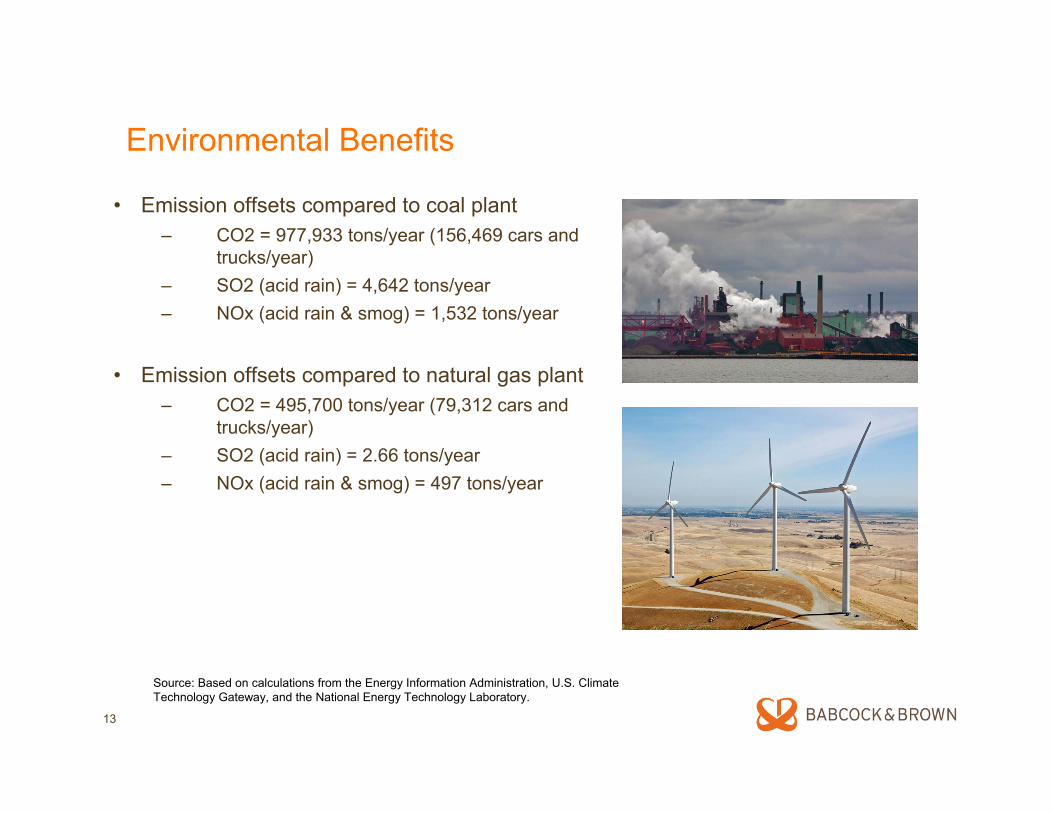
Environmental Benefits
• Emission offsets compared to coal plant– CO2 = 977,933 tons/year (156,469 cars and
trucks/year)– SO2 (acid rain) = 4,642 tons/year– NOx (acid rain & smog) = 1,532 tons/year
• Emission offsets compared to natural gas plant– CO2 = 495,700 tons/year (79,312 cars and
trucks/year)– SO2 (acid rain) = 2.66 tons/year– NOx (acid rain & smog) = 497 tons/year
Source: Based on calculations from the Energy Information Administration, U.S. Climate Technology Gateway, and the National Energy Technology Laboratory.
14
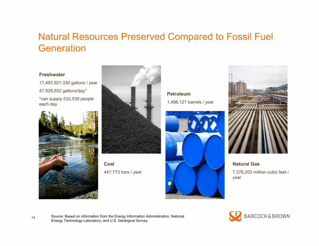
Natural Resources Preserved Compared to Fossil Fuel Generation
Freshwater17,493,921,330 gallons / year
47,928,552 gallons/day*
*can supply 532,539 people each day
Coal447,773 tons / year
Natural Gas7,376,203 million cubic feet / year
Petroleum1,486,121 barrels / year
Source: Based on information from the Energy Information Administration, National Energy Technology Laboratory, and U.S. Geological Survey.
Local Economic Benefits of Gulf Wind Project
16
Benefits to South Texas
• Creates job opportunities for local residents– 250 – 300 jobs during peak construction period,
9 months– 15 - 20 permanent jobs
• Supports local economy by:– Purchasing goods and services during
construction and operation– Significantly increasing revenue for all service
businesses, i.e. local restaurants and hotels during construction and operation
• Significantly contributes to tax base annually, benefiting:
– Kenedy County– Kenedy County-Wide Central School District

17
John G. and Marie Stella Kenedy Memorial Foundation
• One of the largest philanthropic entities in South Texas
• Donates millions of dollars every year to causes that benefit South Texas
– Catholic Church– Education– Poverty
• Royalties from the Gulf Wind project will allow the Foundation to increase charitable giving in South Texas
Protecting Wildlife
19
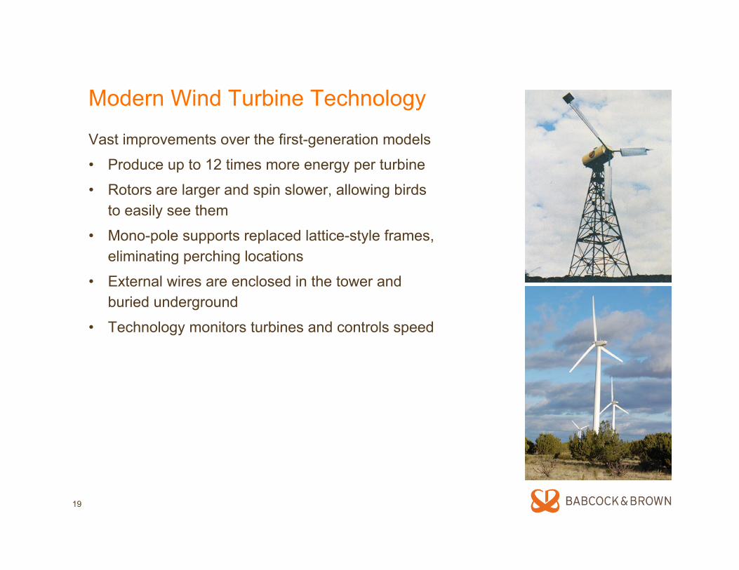
Modern Wind Turbine Technology
Vast improvements over the first-generation models
• Produce up to 12 times more energy per turbine
• Rotors are larger and spin slower, allowing birds to easily see them
• Mono-pole supports replaced lattice-style frames, eliminating perching locations
• External wires are enclosed in the tower and buried underground
• Technology monitors turbines and controls speed
20
Government Consultations• Met with the U.S. Fish and Wildlife Service (USFWS) Director Dale Hall and
the Southwest Regional Director Dr. Benjamin Tuggle• Met with numerous USFWS biologists and other USFWS personnel • Conducted 2 site visits for USFWS • Conducted 2 site visits for U.S. Army Corp of Engineers • Consulted with Army Corp of Engineers, used LIDAR technology
USFWS April 9, 2008 Letter • “The piping power, interior least tern, and brown pelican are listed species
known from Kenedy County that are not predicted to be impacted by the project. Interior least terns and piping plovers are not anticipated in the project area, and brown pelicans are not expected to regularly occur in the project area and are being delisted.”
• “….Based on our meetings, conversations, the April 9 report, and the measures being implemented, we believe the potential for taking a listed species has been minimized.”
21
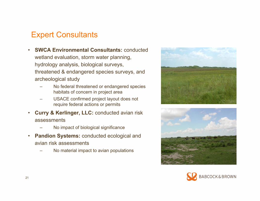
Expert Consultants
• SWCA Environmental Consultants: conductedwetland evaluation, storm water planning, hydrology analysis, biological surveys, threatened & endangered species surveys, and archeological study
– No federal threatened or endangered species habitats of concern in project area
– USACE confirmed project layout does not require federal actions or permits
• Curry & Kerlinger, LLC: conducted avian risk assessments
– No impact of biological significance
• Pandion Systems: conducted ecological and avian risk assessments
– No material impact to avian populations
22
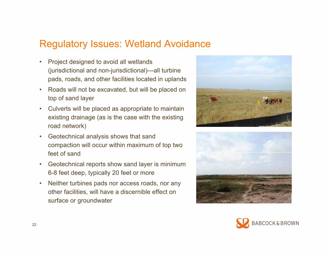
Regulatory Issues: Wetland Avoidance
• Project designed to avoid all wetlands (jurisdictional and non-jurisdictional)—all turbine pads, roads, and other facilities located in uplands
• Roads will not be excavated, but will be placed on top of sand layer
• Culverts will be placed as appropriate to maintain existing drainage (as is the case with the existing road network)
• Geotechnical analysis shows that sand compaction will occur within maximum of top two feet of sand
• Geotechnical reports show sand layer is minimum 6-8 feet deep, typically 20 feet or more
• Neither turbines pads nor access roads, nor any other facilities, will have a discernible effect on surface or groundwater
23
Regulatory Issues: Project Site Environmental Studies• Archaeological Background Review of 16,000-Acre Tract of Kenedy Ranch for the Kenedy Wind
Energy Project. SWCA Environmental Consultants, May 25, 2005.
• Radar-based Study of Migratory Bird Movements at Proposed Kenedy Wind Facility Project Site, Texas, Fall 2004 and Spring 2005. ABR, Inc. Environmental Research & Services, October 2005.
• Jurisdictional Waters Delineation Report for the Approximately 10,000-acre Gulf Wind Project, Kenedy County Texas. November 2005.
• Avian Risk Assessment for the Kenedy Wind Project, Kenedy County, Texas. Curry & Kerlinger, LLC, November 2005.
• Results of an Evaluation of the Potential For Occurrence of Special-Interest Species on the Approximately 9,800-acre Gulf Wind project, Kenedy County, Texas. SWCA EnvironmentalConsultants, Jan. 18, 2006.
• MERLIN Avian Radar Survey Data Report & Mortality Risk Assessment for the Proposed Gulf Wind I, Kenedy County, TX, Data Period October 2006 through September 2007. Detect, Inc. February 11, 2008.
• The Effects of South Texas Weather Patterns on Avian Movements at the Proposed Gulf Wind I Wind Farm Site. Patrick Pyle, Babcock & Brown, Houston, Feb. 2008.
• Analysis of the Potential For Impact to Federally Listed Species on the Gulf Wind Energy Development, Kenedy County, Texas. SWCA Environmental Consultants, April 2008.
24
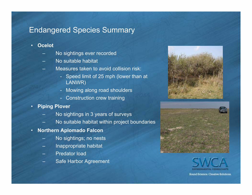
Endangered Species Summary
• Ocelot– No sightings ever recorded– No suitable habitat– Measures taken to avoid collision risk:
- Speed limit of 25 mph (lower than at LANWR)
- Mowing along road shoulders- Construction crew training
• Piping Plover– No sightings in 3 years of surveys– No suitable habitat within project boundaries
• Northern Aplomado Falcon– No sightings; no nests– Inappropriate habitat– Predator load– Safe Harbor Agreement
25
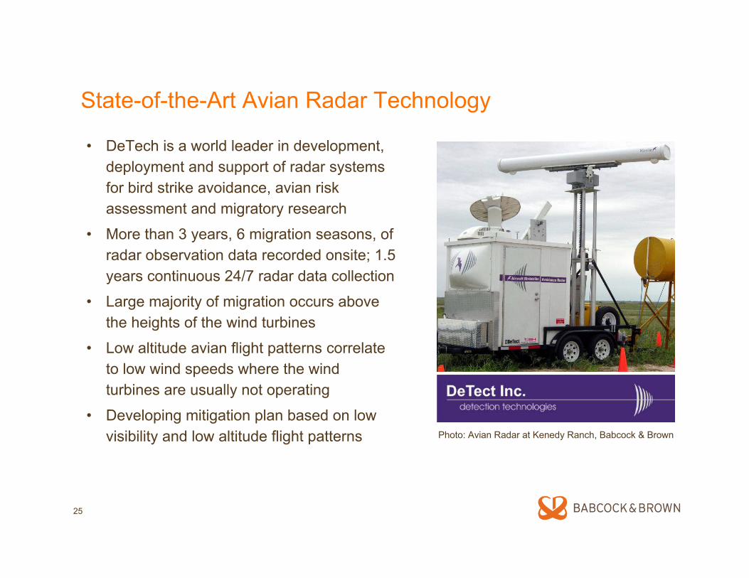
State-of-the-Art Avian Radar Technology
• DeTech is a world leader in development, deployment and support of radar systems for bird strike avoidance, avian risk assessment and migratory research
• More than 3 years, 6 migration seasons, of radar observation data recorded onsite; 1.5 years continuous 24/7 radar data collection
• Large majority of migration occurs above the heights of the wind turbines
• Low altitude avian flight patterns correlate to low wind speeds where the wind turbines are usually not operating
• Developing mitigation plan based on low visibility and low altitude flight patterns Photo: Avian Radar at Kenedy Ranch, Babcock & Brown
Copyright 2007 DeTect, Inc. All Rights Reserved; Specifications & features are subject to change without notice; this document contains DeTect Confidential materials & distribution is limited to DeTect authorized recipients only© 2008, DeTect, Inc., All Rights Reserved
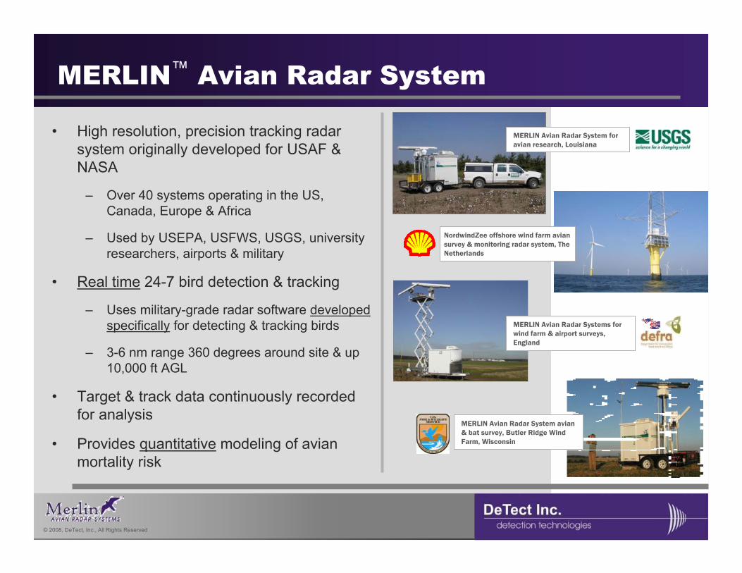
• High resolution, precision tracking radar system originally developed for USAF & NASA
– Over 40 systems operating in the US, Canada, Europe & Africa
– Used by USEPA, USFWS, USGS, university researchers, airports & military
• Real time 24-7 bird detection & tracking
– Uses military-grade radar software developed specifically for detecting & tracking birds
– 3-6 nm range 360 degrees around site & up 10,000 ft AGL
• Target & track data continuously recorded for analysis
• Provides quantitative modeling of avian mortality risk
MERLIN™ Avian Radar System
NordwindZee offshore wind farm avian survey & monitoring radar system, The Netherlands
MERLIN Avian Radar Systems for wind farm & airport surveys, England
MERLIN Avian Radar System for avian research, Louisiana
MERLIN Avian Radar System avian & bat survey, Butler Ridge Wind Farm, Wisconsin
Copyright 2007 DeTect, Inc. All Rights Reserved; Specifications & features are subject to change without notice; this document contains DeTect Confidential materials & distribution is limited to DeTect authorized recipients only© 2008, DeTect, Inc., All Rights Reserved
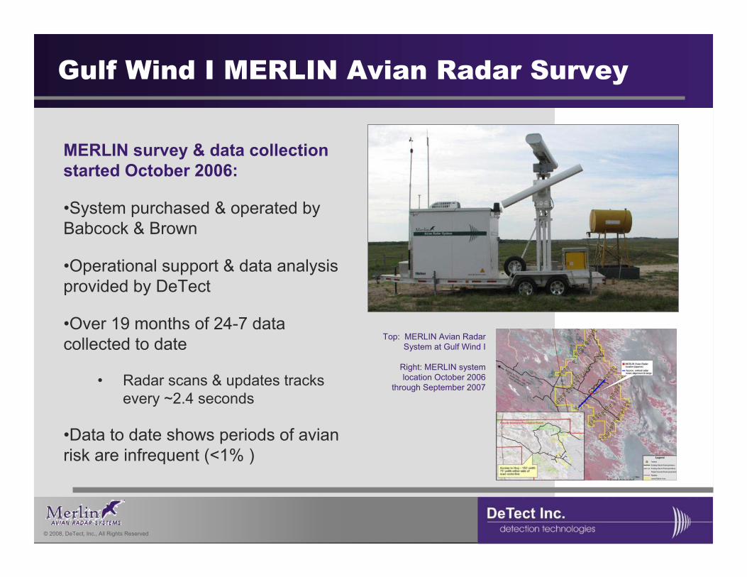
Gulf Wind I MERLIN Avian Radar Survey
MERLIN survey & data collection started October 2006:
•System purchased & operated by Babcock & Brown
•Operational support & data analysis provided by DeTect
•Over 19 months of 24-7 data collected to date
• Radar scans & updates tracks every ~2.4 seconds
•Data to date shows periods of avian risk are infrequent (<1% )
Top: MERLIN Avian Radar System at Gulf Wind I
Right: MERLIN system location October 2006
through September 2007
Copyright 2007 DeTect, Inc. All Rights Reserved; Specifications & features are subject to change without notice; this document contains DeTect Confidential materials & distribution is limited to DeTect authorized recipients only© 2008, DeTect, Inc., All Rights Reserved
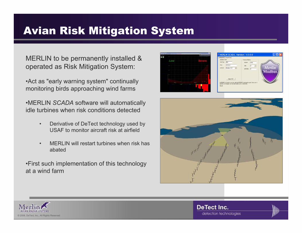
Avian Risk Mitigation System
MERLIN to be permanently installed & operated as Risk Mitigation System:
•Act as "early warning system" continually monitoring birds approaching wind farms
•MERLIN SCADA software will automatically idle turbines when risk conditions detected
• Derivative of DeTect technology used by USAF to monitor aircraft risk at airfield
• MERLIN will restart turbines when risk has abated
•First such implementation of this technology at a wind farm
29
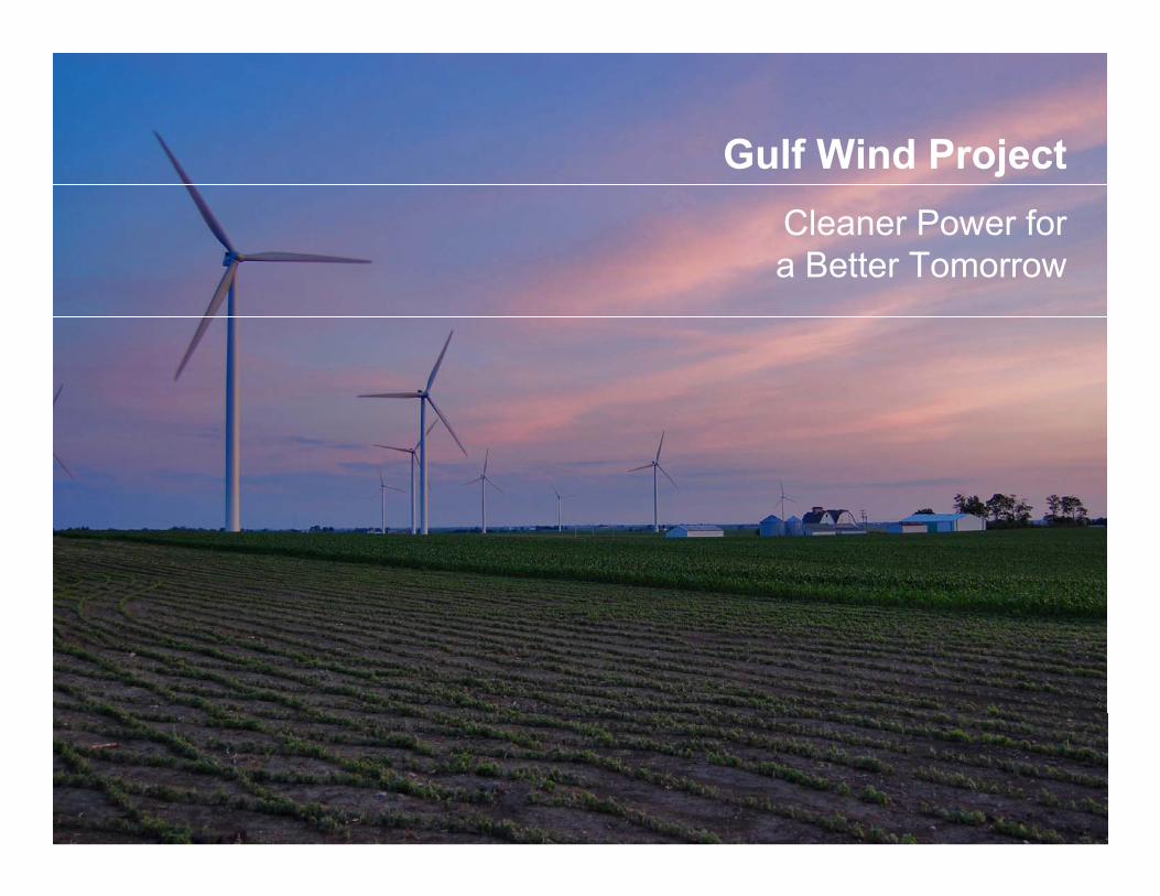
Gulf Wind ProjectCleaner Power for a Better Tomorrow