Embed Size (px)
Citation preview
US Army Corpsof EngineersChicago District
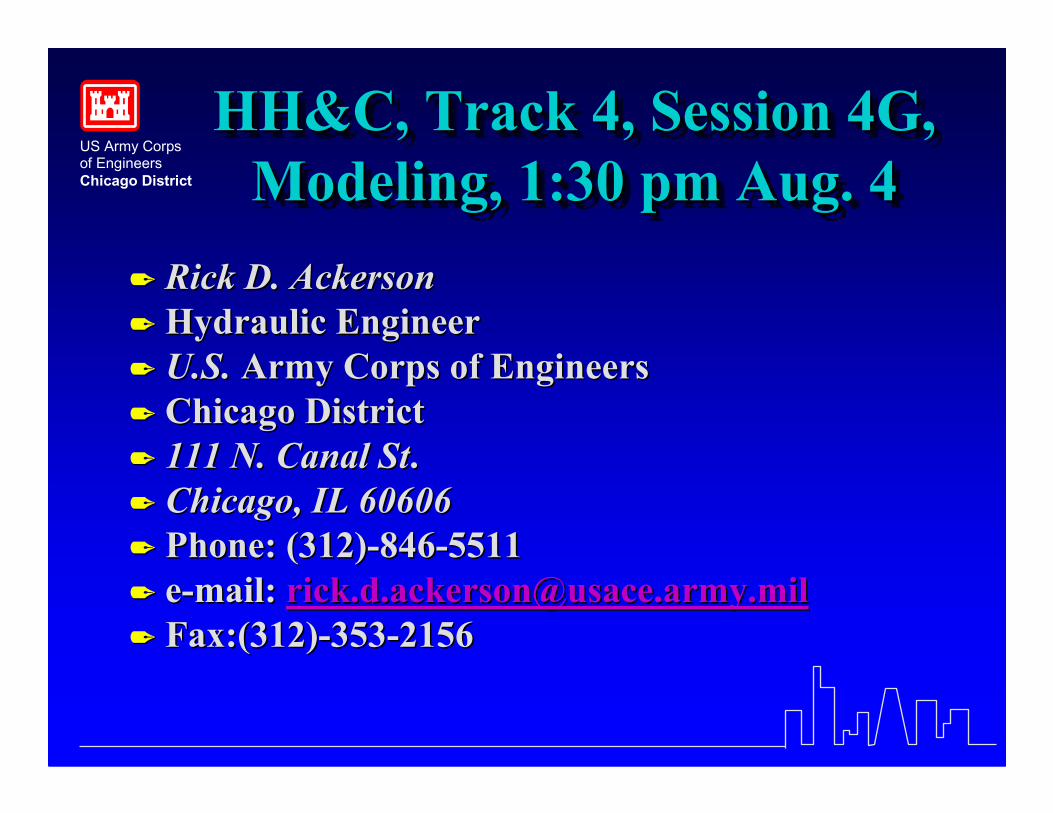
HH&C, Track 4, Session 4G,Modeling, 1:30 pm Aug. 4
HH&C, Track 4, Session 4G,HH&C, Track 4, Session 4G,Modeling, 1:30 pm Aug. 4Modeling, 1:30 pm Aug. 4
�� Rick D. AckersonRick D. Ackerson�� Hydraulic EngineerHydraulic Engineer�� U.S.U.S. Army Corps of EngineersArmy Corps of Engineers�� Chicago DistrictChicago District�� 111 N. Canal St111 N. Canal St..�� Chicago, IL 60606Chicago, IL 60606�� Phone: (312)Phone: (312)--846846--55115511�� ee--mail:mail: [email protected]@usace.army.mil�� Fax:(312)Fax:(312)--353353--21562156
US Army Corpsof EngineersChicago District
Little Calumet River UnsteadyFlow Model Conversion
UNET to HEC-RAS
Little Calumet River UnsteadyLittle Calumet River UnsteadyFlow Model ConversionFlow Model Conversion
UNET to HECUNET to HEC--RASRAS
��Rick D. AckersonRick D. Ackerson��Hydraulic EngineerHydraulic Engineer��U.S. Army Corps of EngineersU.S. Army Corps of Engineers��Chicago DistrictChicago District
US Army Corpsof EngineersChicago District
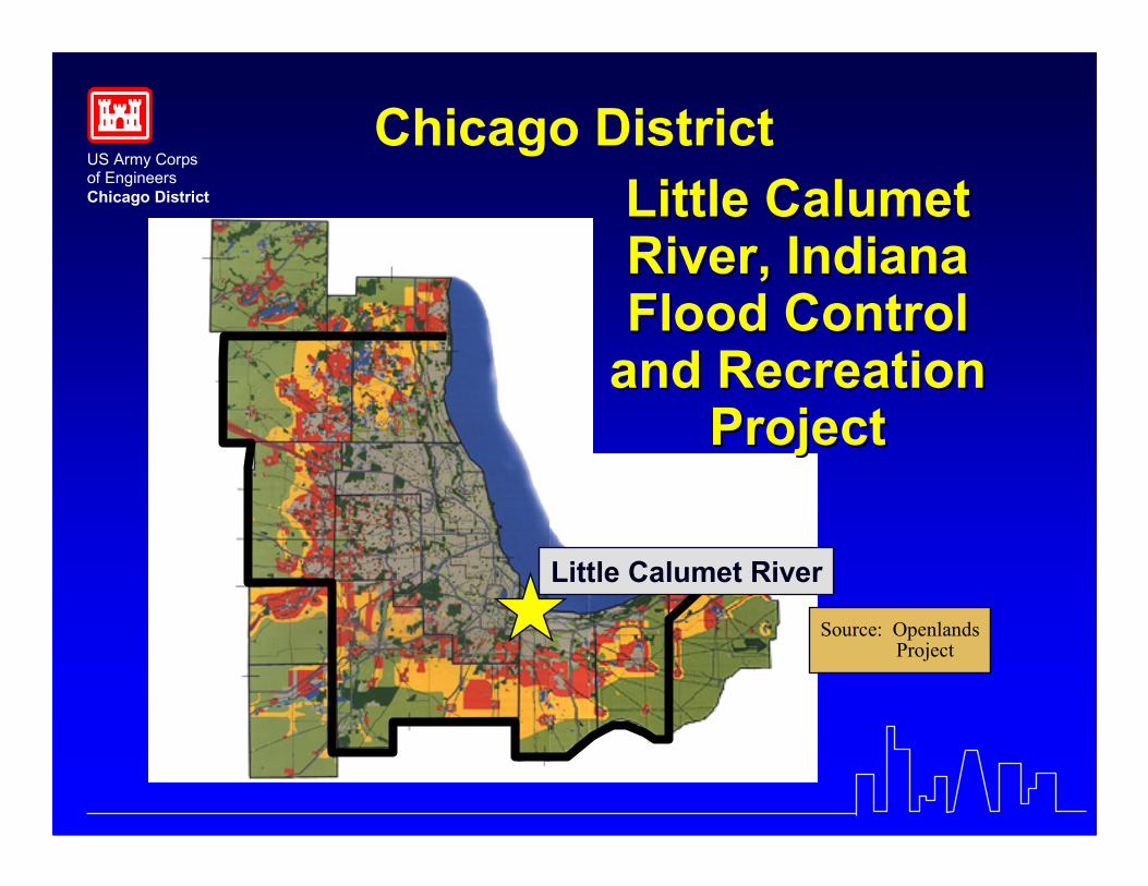
Source: OpenlandsProject
Chicago District
Little Calumet River
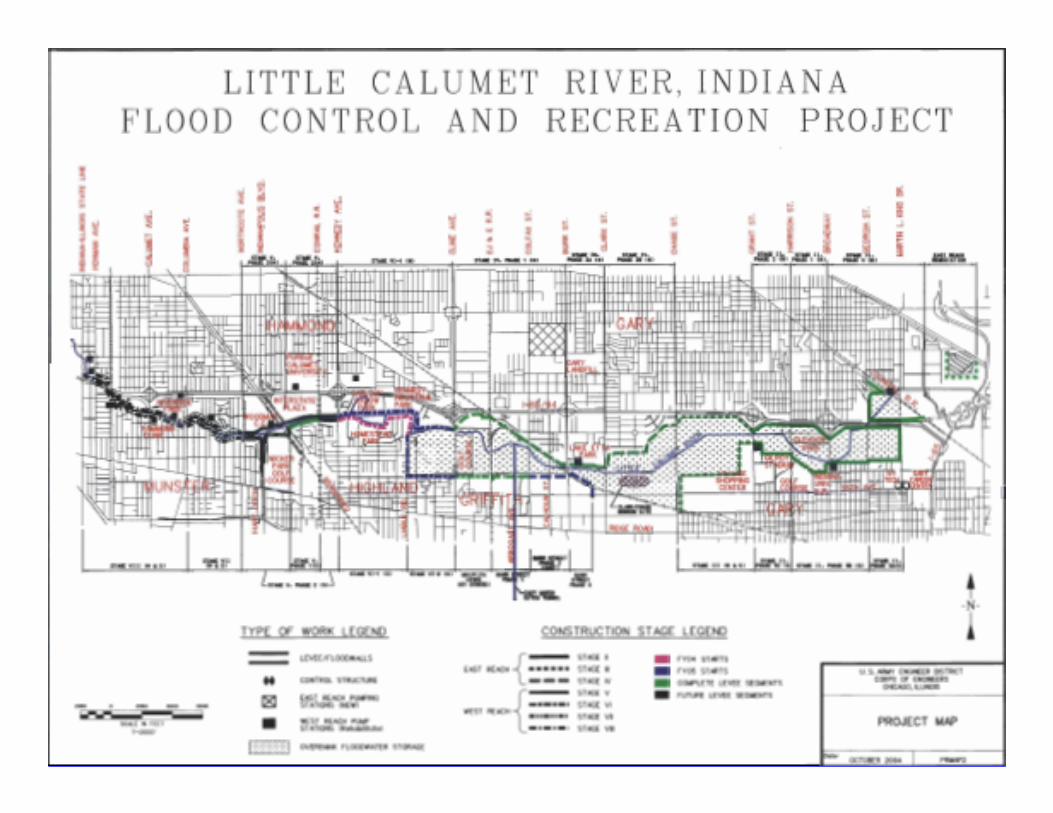
Little CalumetLittle CalumetRiver, IndianaRiver, IndianaFlood ControlFlood Control
and Recreationand RecreationProjectProject
US Army Corpsof EngineersChicago District
Project DescriptionProject DescriptionLittle Calumet River, IndianaLittle Calumet River, Indiana
•• Construct 22 miles of new urban leveesConstruct 22 miles of new urban levees
•• Provides 200 year level of flood protectionProvides 200 year level of flood protection
•• Construct 17 miles of hiking trailsConstruct 17 miles of hiking trails
•• Fish and Wildlife mitigationFish and Wildlife mitigation -- 550 acres of550 acres ofwetlandwetland
•• Local Sponsor: Little Calumet River BasinLocal Sponsor: Little Calumet River BasinDevelopment CommissionDevelopment Commission
•• Authorization: WRDA 1986Authorization: WRDA 1986
US Army Corpsof EngineersChicago District
History of the Little Cal ModelsHistory of the Little Cal ModelsHistory of the Little Cal Models�� 19911991 –– Little Cal UNET model constructed fromLittle Cal UNET model constructed from
existing 1970’s vintage HECexisting 1970’s vintage HEC--2 and WSP2 and WSP--2 models2 modelsHECHEC--1 was used to develop inflows1 was used to develop inflows
�� 19951995 –– Deep River reach extended. ModelDeep River reach extended. Modelrecalibratedrecalibrated
�� 20022002 –– Model converted from specialized Dr.Model converted from specialized Dr.BarkauBarkau version to the HEC version of UNETversion to the HEC version of UNETUpdated to Bulletin 70/71 precipitation from TPUpdated to Bulletin 70/71 precipitation from TP--4040and recalibratedand recalibrated
�� 20052005 –– HECHEC--UNET converted to HECUNET converted to HEC--RASRASUpdated special bridges to more detailed bridgesUpdated special bridges to more detailed bridges
US Army Corpsof EngineersChicago District
Reasons for Model ConversionsReasons for Model Conversions
•• 2002 specialized UNET to HEC2002 specialized UNET to HEC--UNETUNET•• To update to the more standard Bulletin 70/71 precipitationTo update to the more standard Bulletin 70/71 precipitation•• To update to the more accepted standard HECTo update to the more accepted standard HEC--UNETUNET
(specialized version did not run on the Windows platform)(specialized version did not run on the Windows platform)
•• 20052005 -- HECHEC--UNET to HECUNET to HEC--RASRAS•• City of Gary requested new floodway mapping to reflect the CorpsCity of Gary requested new floodway mapping to reflect the Corps
levee construction to datelevee construction to date•• FEMA requested conversion for ease of review andFEMA requested conversion for ease of review and
ease of floodway determinationease of floodway determination•• State of Illinois showed interest in new floodway mappingState of Illinois showed interest in new floodway mapping
to reflect the impacts of the new Thornton reservoirto reflect the impacts of the new Thornton reservoir
US Army Corpsof EngineersChicago District
Various Uses forVarious Uses forLittle Calumet River ModelLittle Calumet River Model
•• Design Levee Height Superiority AnalysisDesign Levee Height Superiority Analysis
•• To determine impacts of various project featuresTo determine impacts of various project features
•• To develop the flood warning planTo develop the flood warning plan
•• To determine the impact of staged constructionTo determine the impact of staged construction
•• To develop updated floodplain mapping for the city of GaryTo develop updated floodplain mapping for the city of Gary
•• To develop updated floodplain mapping in IllinoisTo develop updated floodplain mapping in Illinois
US Army Corpsof EngineersChicago District
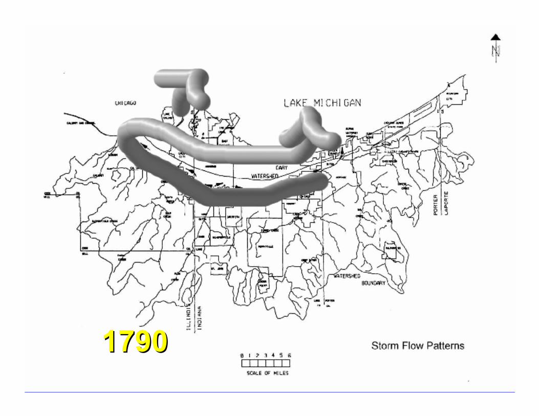
17901790
US Army Corpsof EngineersChicago District
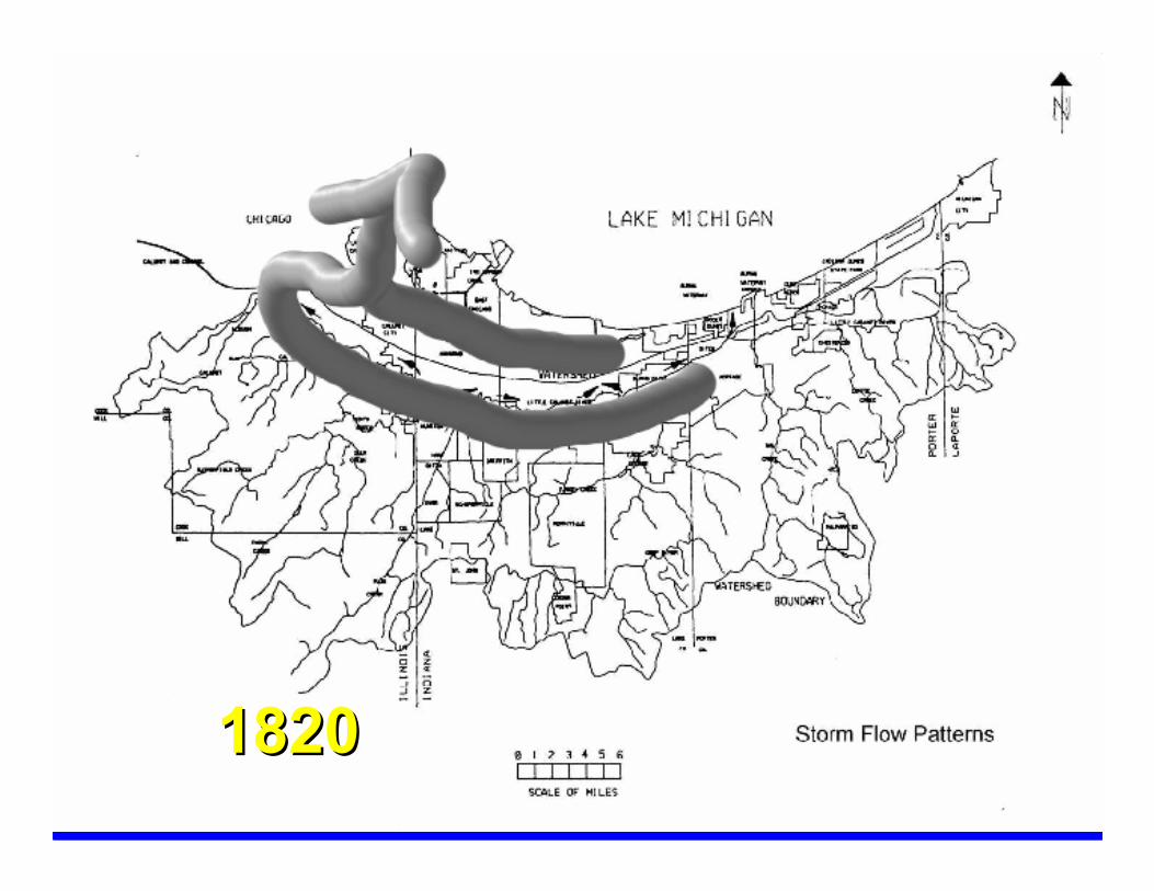
18201820
US Army Corpsof EngineersChicago District
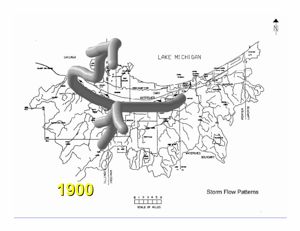
19001900
US Army Corpsof EngineersChicago District
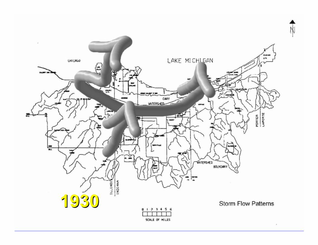
19301930
US Army Corpsof EngineersChicago District
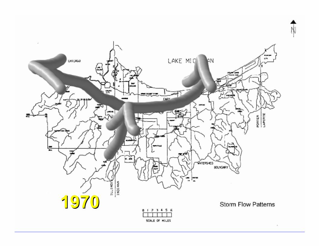
19701970
US Army Corpsof EngineersChicago District
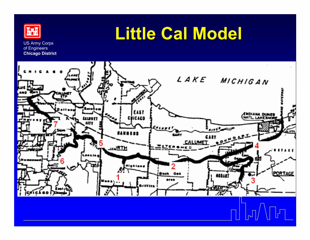
Little Cal ModelLittle Cal Model
US Army Corpsof EngineersChicago District
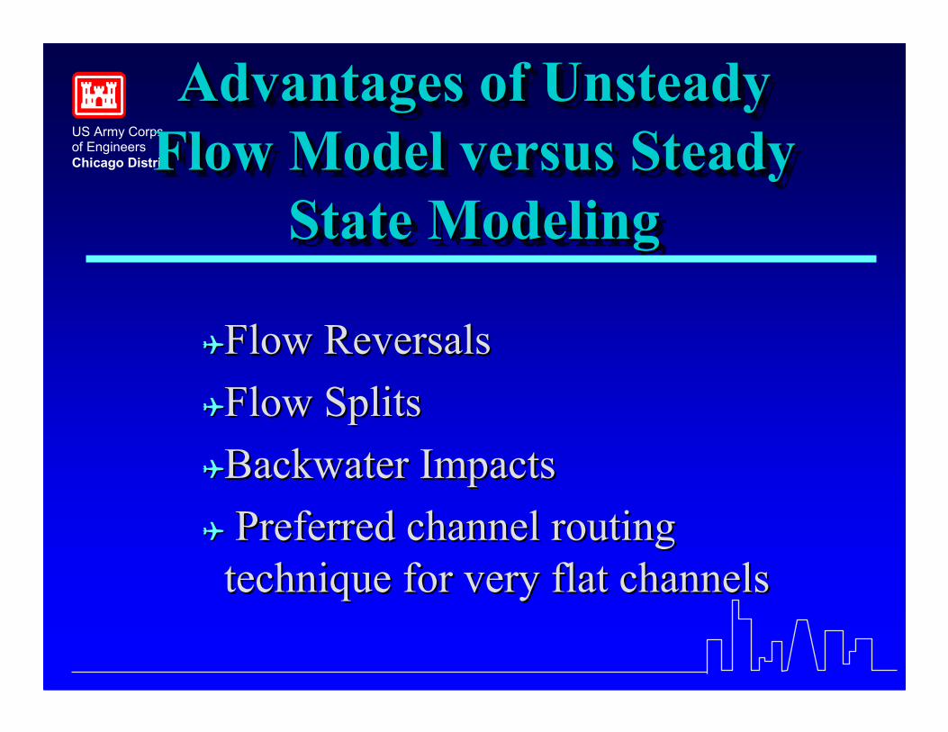
Advantages of UnsteadyFlow Model versus Steady
State Modeling
Advantages of UnsteadyAdvantages of UnsteadyFlow Model versus SteadyFlow Model versus Steady
State ModelingState Modeling
��Flow ReversalsFlow Reversals��Flow SplitsFlow Splits��Backwater ImpactsBackwater Impacts�� Preferred channel routingPreferred channel routing
technique for very flat channelstechnique for very flat channels
US Army Corpsof EngineersChicago District
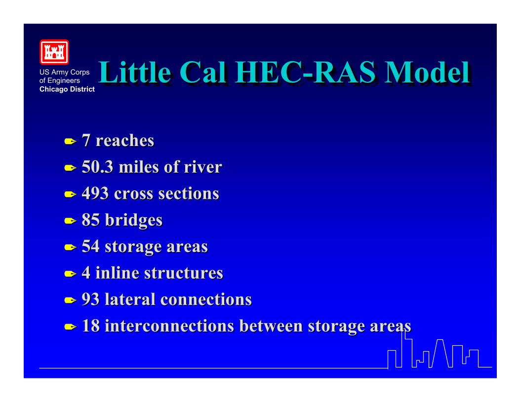
Little Cal HEC-RAS ModelLittle Cal HECLittle Cal HEC--RAS ModelRAS Model
�� 7 reaches7 reaches�� 50.3 miles of river50.3 miles of river�� 493 cross sections493 cross sections�� 85 bridges85 bridges�� 54 storage areas54 storage areas�� 4 inline structures4 inline structures�� 93 lateral connections93 lateral connections�� 18 interconnections between storage areas18 interconnections between storage areas
US Army Corpsof EngineersChicago District
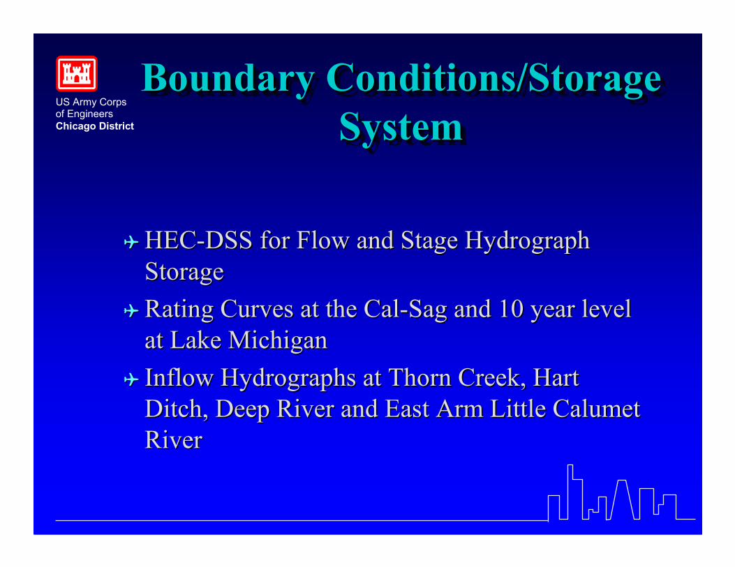
Boundary Conditions/StorageSystem
Boundary Conditions/StorageBoundary Conditions/StorageSystemSystem
�� HECHEC--DSS for Flow and Stage HydrographDSS for Flow and Stage HydrographStorageStorage
�� Rating Curves at the CalRating Curves at the Cal--Sag and 10 year levelSag and 10 year levelat Lake Michiganat Lake Michigan
�� Inflow Hydrographs at Thorn Creek, HartInflow Hydrographs at Thorn Creek, HartDitch, Deep River and East Arm Little CalumetDitch, Deep River and East Arm Little CalumetRiverRiver
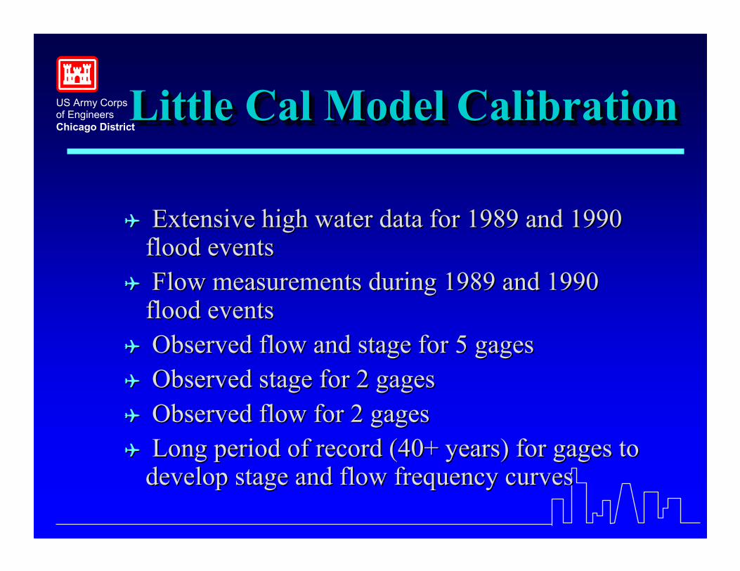
US Army Corpsof EngineersChicago DistrictLittle Cal Model CalibrationLittle Cal Model CalibrationLittle Cal Model Calibration
�� Extensive high water data for 1989 and 1990Extensive high water data for 1989 and 1990flood eventsflood events
�� Flow measurements during 1989 and 1990Flow measurements during 1989 and 1990flood eventsflood events
�� Observed flow and stage for 5 gagesObserved flow and stage for 5 gages�� Observed stage for 2 gagesObserved stage for 2 gages�� Observed flow for 2 gagesObserved flow for 2 gages�� Long period of record (40+ years) for gages toLong period of record (40+ years) for gages to
develop stage and flow frequency curvesdevelop stage and flow frequency curves
US Army Corpsof EngineersChicago District
US Army Corpsof EngineersChicago District
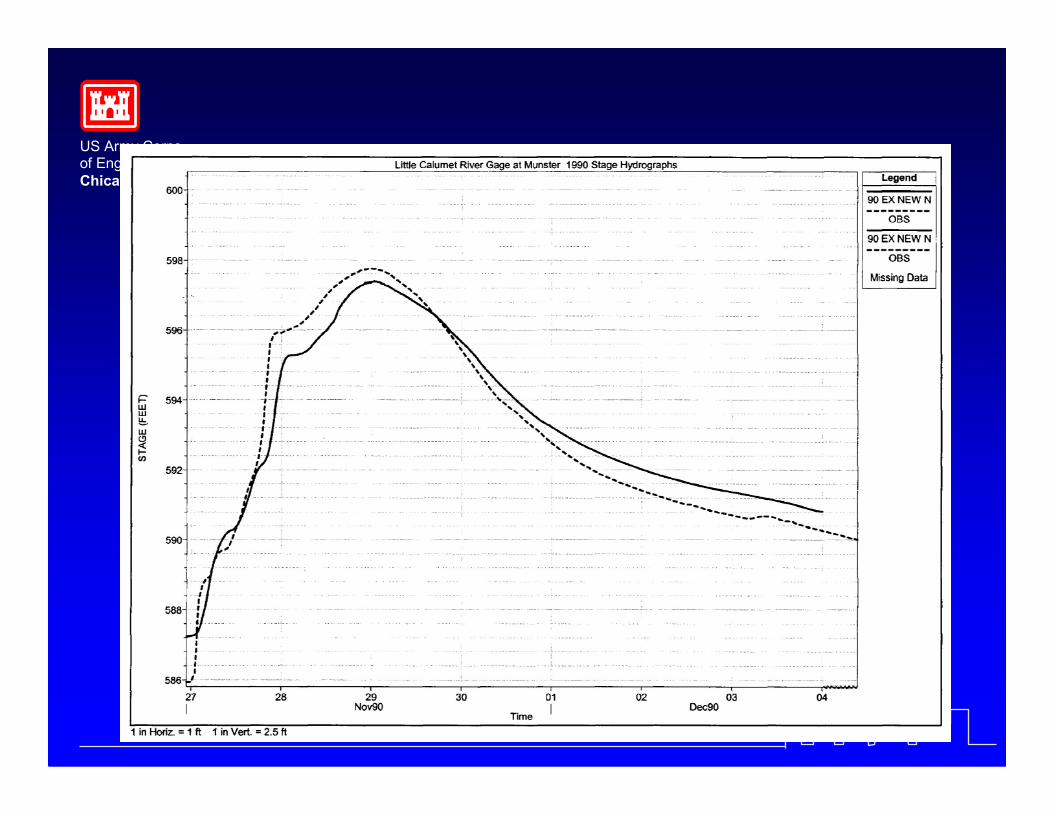
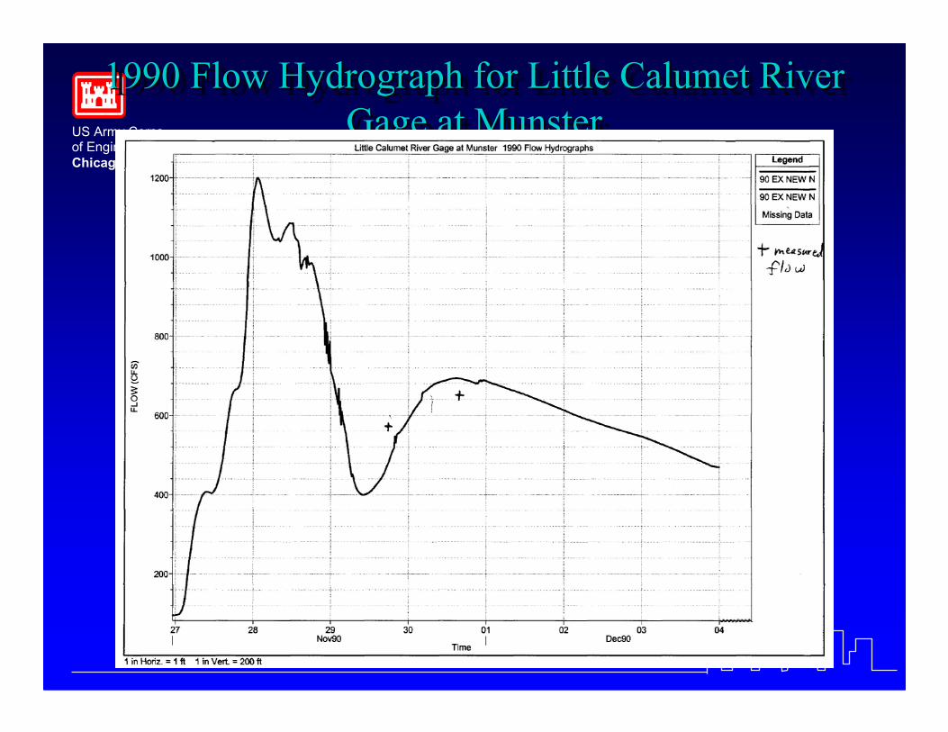
1990 Flow Hydrograph for Little Calumet RiverGage at Munster
1990 Flow Hydrograph for Little Calumet River1990 Flow Hydrograph for Little Calumet RiverGage at MunsterGage at Munster
US Army Corpsof EngineersChicago District
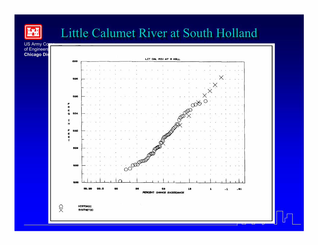
Little Calumet River at South HollandLittle Calumet River at South HollandLittle Calumet River at South Holland
US Army Corpsof EngineersChicago District
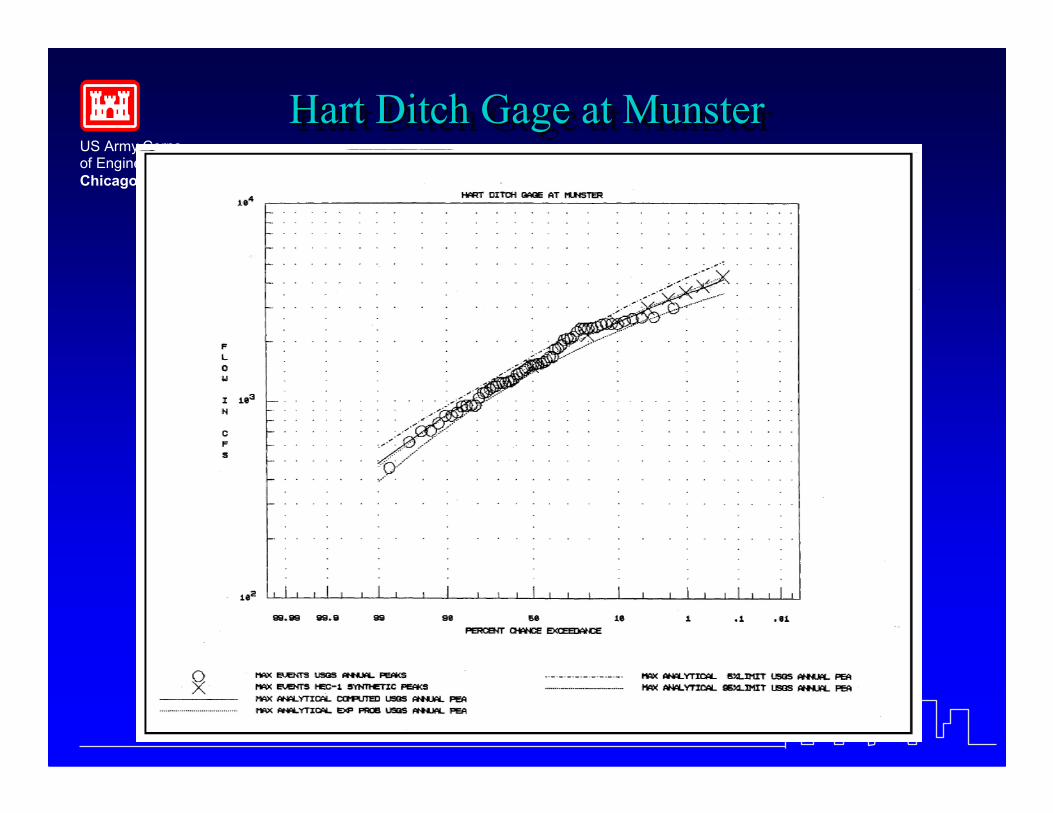
Hart Ditch Gage at MunsterHart Ditch Gage at MunsterHart Ditch Gage at Munster
US Army Corpsof EngineersChicago District
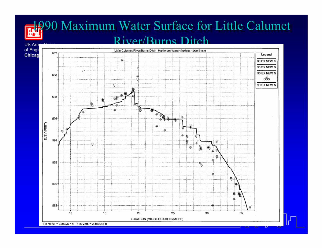
1990 Maximum Water Surface for Little CalumetRiver/Burns Ditch
1990 Maximum Water Surface for Little Calumet1990 Maximum Water Surface for Little CalumetRiver/Burns DitchRiver/Burns Ditch
US Army Corpsof EngineersChicago District
US Army Corpsof EngineersChicago District
Project ConditionsProject ConditionsProject Conditions
�� Bridge improvementsBridge improvements��Corps LeveesCorps Levees��Hart Ditch Control StructureHart Ditch Control Structure�� Thorn Creek ReservoirThorn Creek Reservoir��Cady Marsh Ditch Diversion TunnelCady Marsh Ditch Diversion Tunnel
US Army Corpsof EngineersChicago District
US Army Corpsof EngineersChicago District
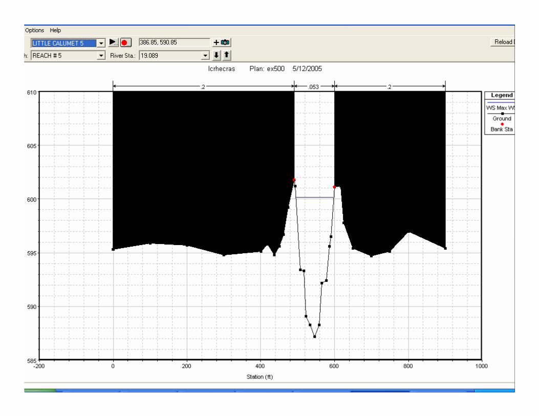
Typical X-Section in Levee ReachTypical XTypical X--Section in Levee ReachSection in Levee Reach
9800 9900 10000 10100 10200 10300585
590
595
600
605
610
River = LITTLE CALUMET 5 Reach = REACH # 5 RS = 19.079
Station (ft)
Ele
vatio
n (ft
)
Legend
WS Max WS
Ground
Bank Sta
.2 .053 .2
US Army Corpsof EngineersChicago District
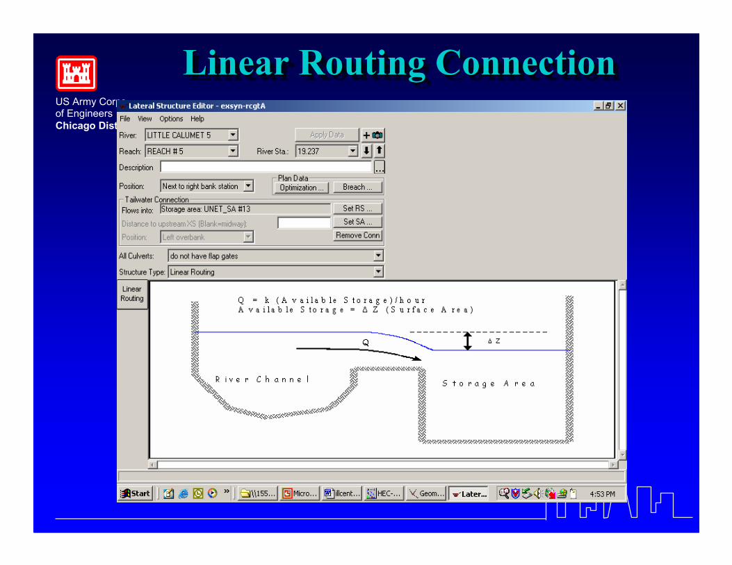
Linear Routing ConnectionLinear Routing ConnectionLinear Routing Connection
US Army Corpsof EngineersChicago District
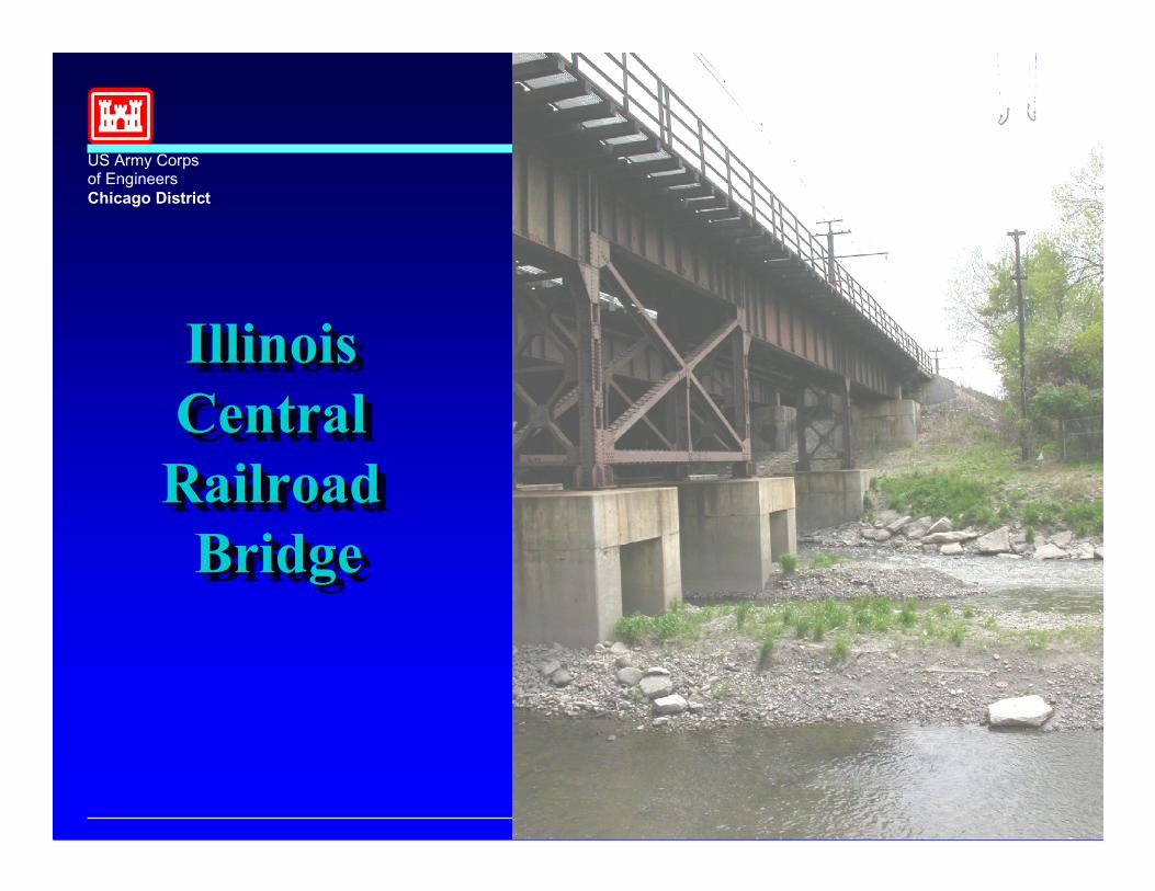
IllinoisCentralRailroad
Bridge
IllinoisIllinoisCentralCentralRailroadRailroad
BridgeBridge

US Army Corpsof EngineersChicago District
Illinois Central Bridge (UNET)IllinoisIllinois Central Bridge (UNET)(UNET)
17100 17150 17200 17250 17300 17350
580
590
600
610
RS=7.0435 Upstream (Bridge)
Ele
vatio
n (ft
)
Legend
Ground
Bank Sta
17100 17150 17200 17250 17300 17350
580
590
600
610
RS=7.0435 Downstream (Bridge)
Station (ft)
Ele
vatio
n (ft
)
US Army Corpsof EngineersChicago District
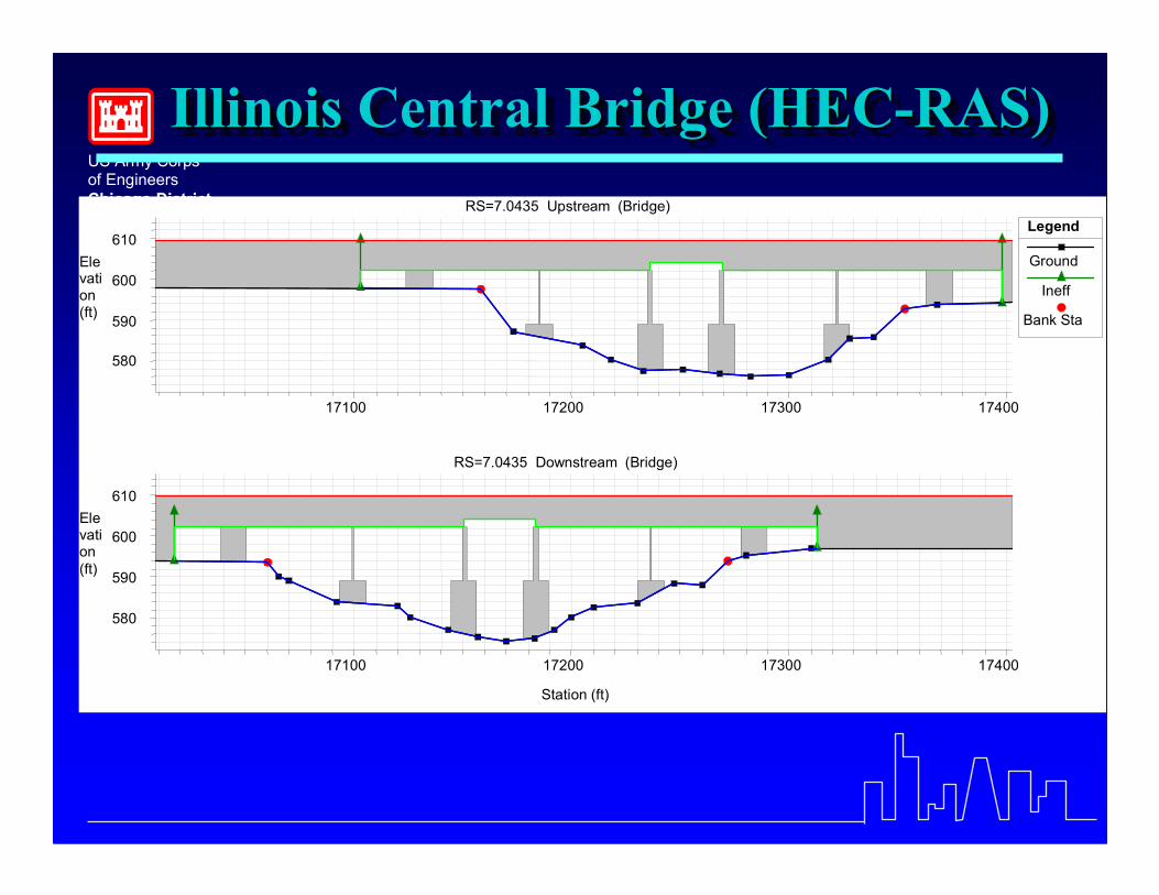
Illinois Central Bridge (HEC-RAS)IllinoisIllinois Central Bridge (HECBridge (HEC--RAS)RAS)
17100 17200 17300 17400
580
590
600
610
RS=7.0435 Upstream (Bridge)
Elevation(ft)
Legend
Ground
Ineff
Bank Sta
17100 17200 17300 17400
580
590
600
610
RS=7.0435 Downstream (Bridge)
Station (ft)
Elevation(ft)

US Army Corpsof EngineersChicago District
Calumet Expressway (UNET)Calumet Expressway (UNET)Calumet Expressway (UNET)
12800 12900 13000 13100
580
590
600
610
RS=10.8285 Upstream (Bridge)
Ele
vatio
n (ft
)
Legend
Ground
Ineff
Bank Sta
12800 12900 13000 13100
580
590
600
610
RS=10.8285 Downstream (Bridge)
Station (ft)
Ele
vatio
n (ft
)
US Army Corpsof EngineersChicago District
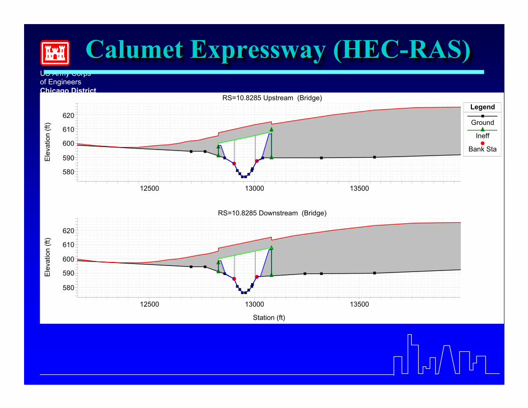
Calumet Expressway (HEC-RAS)Calumet Expressway (HECCalumet Expressway (HEC--RAS)RAS)
12500 13000 13500
580
590
600
610
620
RS=10.8285 Upstream (Bridge)
Ele
vatio
n (ft
)
Legend
Ground
Ineff
Bank Sta
12500 13000 13500
580
590
600
610
620
RS=10.8285 Downstream (Bridge)
Station (ft)
Ele
vatio
n (ft
)
US Army Corpsof EngineersChicago District
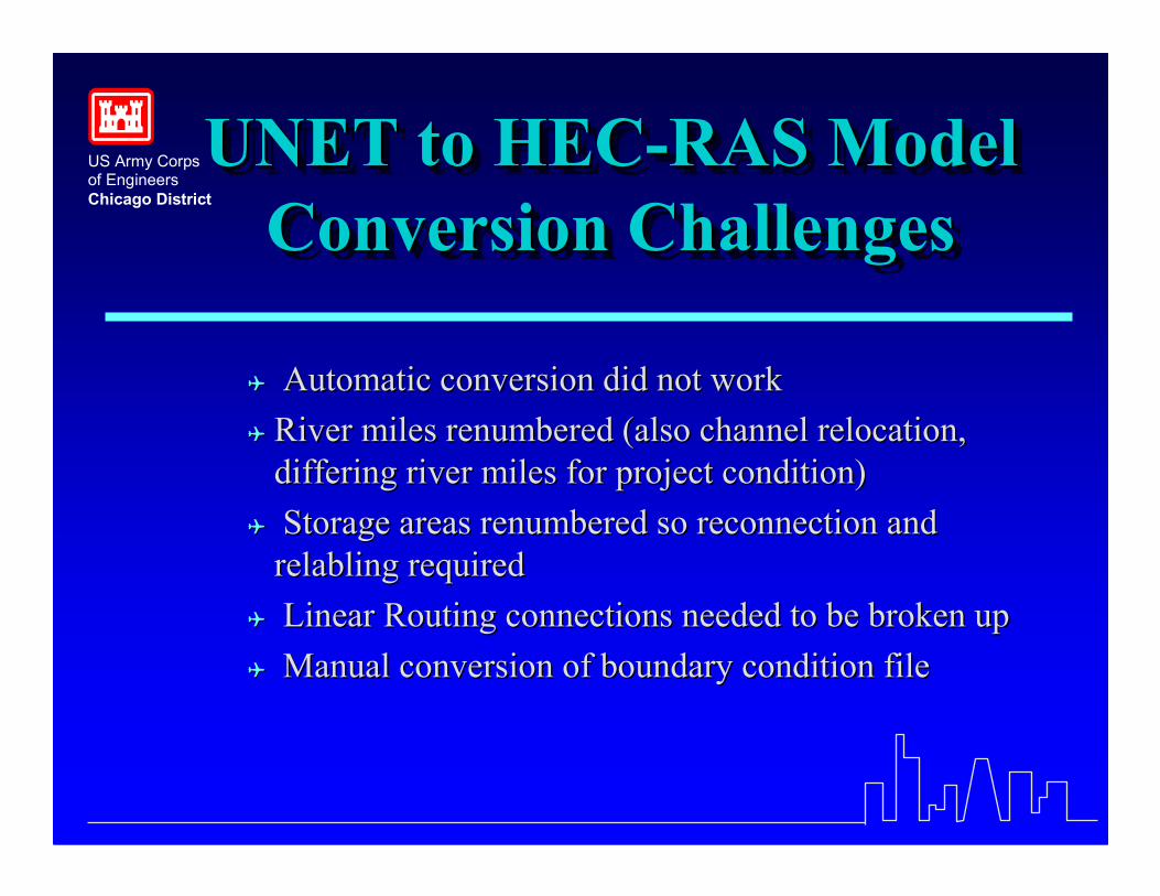
UNET to HEC-RAS ModelConversion Challenges
UNET to HECUNET to HEC--RAS ModelRAS ModelConversion ChallengesConversion Challenges
�� Automatic conversion did not workAutomatic conversion did not work�� River miles renumbered (also channel relocation,River miles renumbered (also channel relocation,
differing river miles for project condition)differing river miles for project condition)�� Storage areas renumbered so reconnection andStorage areas renumbered so reconnection and
relablingrelabling requiredrequired�� Linear Routing connections needed to be broken upLinear Routing connections needed to be broken up�� Manual conversion of boundary condition fileManual conversion of boundary condition file


![B C&% % 1 % 8 : G ':&% I G J & D %7L% . 3 · [ $3 hh hh$#hh 1 [hhh hh hh dhhphh #hhm#hhbhh hh&lhh < w) d?. {lhh hh$ @b#-p 3 c 3:;hhh $# #" )j p d] #hhm#hhbhh hh&x %hh | x4 3 hh?hh](https://img.pdfslide.net/doc/110x75/5ea61d5cbec94348cc54f9a5/b-c-1-8-g-i-g-j-d-7l-3-3-hh-hhhh-1-hhh-hh-hh.jpg)