Embed Size (px)
Citation preview
Historical background
Jean-Pierre Carmouze
The first available data about the hydrography of Central Africa date backto the 14th century. At that time, a Moor born at Granada in 1483and knownby the name of Leo Africanus, first spoke of a great lake situated in a desertregion and fed by underground water coming from an arm of the Nile. Hesuggested that the River Niger originated from this lake.
In 1632, a map drawn by a Dutch geographer, Guillaume Blavew, fromthe description made by Leo Africanus and new data, pointed out aBorno lacus, situated approximately at the site of present Lake Chad andfed by a river from the southern hemisphere, north of Lake Zaire. The Nigerhas its source in the western part of this lake and moves along an east-west line.In this document, the Shari, Yoobe and Niger rivers form a part of the NigerFluvius.
At the beginning of the 19th century, Ali Bey, the son of the Prince of theAbassides argued that a large inland sea must exist in the centre of Africa. Hethought that the Niger must disappear into this 'African Caspian' and hegathered numerous facts to support this hypothesis. For his part, the Englishman, Jackson, also noticed the observations made by travellers which corroborated the existence of a connection between the Nile from Egypt and the Nilefrom the Sudan (Niger). This connection took place in a region called BahrKulla. This name is comparable with that of Koulou 'great mass of water' bywhich the Kanembous describe present Lake Chad. The two authors came tothe same conclusion concerning the situation of this inland sea: it would besituated at a IS-day walk east of Tombouctou.
At the same time, a German, Frederic Hornemann, appears to be the firstEuropean who heard the name of Zad during his travels in Fezzan and Egypt(1797-1800). It was not a lake but a very wide river (at an 8-hour journey). Healso learnt about the existence of the Boudoumas, considered as primitivepeople and always found in the middle of this river. According to Hornemann,the Zad was nothing more than the name given to the Niger by the populationof Bornou, and flowed into the Nile south of Darfou.
So, at the beginning of the 19th century, the existence of a great lake in
J.-P. Carmouze et al. (eds.) Lake Chad© 1983, Dr W. Junk Publishers, The Hague/BostonlLancasterISBN 9061931061. Printed in the Netherlands
Central Africa was still not certain. On the other hand, there was the prevailingnotion of the Zad as a river connecting the Niger with the Nile.
But the idea of an 'African Caspian' aroused imagination and stirred upmuch enthusiasm.
Ritchie from England, and his colleague Lyon left Tripoli for Central Africain March 1819, but Ritchie died at Mourzouk and Lyon did not go muchfurther. His notes inform us that the Zad described by Hornemann had to be alake and not a river.
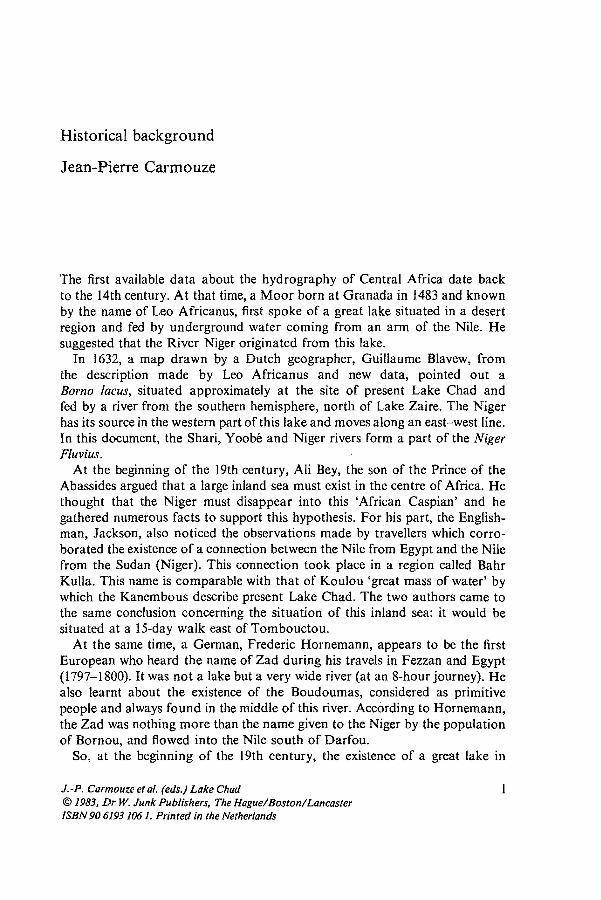
The nature of Lake Chad became more clear for geographers, but the firstEuropeans to reach Lake Chad from Tripoli in 1822, by following the westernside to Kouka, were three English travellers: Denham, Clapperton, andOudney. Denham passed around the southern part of the lake, crossing theShari downstream at Showy (Fig. 1), passed the foot of Hadjer el Hamis andreached Tangalia in the dried up grooove of Bahr el Ghazal. He consideredLake Chad to be an overflow of the Nile. Then he went down the Shari to itsmouth, and entered the lake on February 3rd, 1824. Upset by strong waveswhich filled up the boats, he sought refuge in the delta after covering a distanceof about two miles, without even being able to see the nearest islands inhabited
___ 1--
Sk.·,,,hofthr
LAKE TCIlAD
. Thl'nanw'llndnY.lIIl'1/aJ'f"fw ,,1"'P0T'! or./y .
~~':!::~Z~'~~_~'~I_/~~~ :lil _. ~~. --.:~ _ ~ro _. ~o _I~
~',
Fig. J Map of Lake Chad according 10 Denham (1824).
2
by the Boudoumas, whose existence was known to him. After resting at Kouka,he again set out in May, with the aim of going around the lake, with aBornouan expedition army fighting against the Assalé Arabs in the region ofKanem. He was stopped at Tangalia near the mouth of Bahr el Ghazal arterBornouan troops suflered a defeat and he had to give up the pursuit of hisjourney northwards. He persisted in his determination to survey the peripheryof the lake and he again set out northwards on August 16th, 1824. At Woodie,he again met the Bornouan troops whom he had accompanied some monthsearlier, now on their way back from Kanem, tiled out and defeated 'l'et hepursued his journey, but he had to turn back at Kiskaoua (K uskowa) hecauseof lack of security in this area. rinally, he reached Tripoli on January 26th,1825. Despite a 19-month trip around Lake Chad, Denham could not draw amap of lhe whole contour. He left an unfinished mal' (Fig. 1). No offshoresUiveying was done and islands were not seen even in lhe distance.
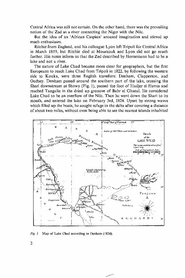
So, on March 30th, 1850, when the Englishman Richardson left Tripoli withthe Germans Barth and Overweg, he took a boat calkd 'The Lord Palmerston'which was specially inlended lo sail on Lake Chad. This boal was divided intofour parts in order to be carried on a came!. Richardson, exhausled by theclimate, died in Bornou befOie seeing lhe lake. Barlh took over and arrived atKouka on April2nd, 1851. When he set oul fOI Adamaoua, Ovel weg undertookto survey lhe lake aboard lhe 'Lord Palmerston'. He visited several islands after alwo-monlhjourney (Fig 2). Then he went wilh Barth, who wanled to survey theregions surrounding Lake Chad, up lo Bahr cl Ghazal in order to resumeDenham's projeet But lhey also encounlered the hoslilily oflhe population andrelurned to Kouka. Then, Overweg undertook lo study lhe Komadougou Yobéand he spccilicd lhat it was a tribulary and not an elllucnt. Complclcly exhausledhe relurned to KlHIka, and was laken to Madouari on lhe shore oflhe lake wherehe died on Seplembcr 27th, 1852 wilhoul being ahle to give a detailed reportahout his lravcls throllgh lhe lake. However, 'he ean boasl o1îlaving been the firstEtu opcan who sailed and visiled parl of the Arehipelago' (1ïlho 1910).
Barth continucd lo survey lhe western regions of Bomou alone. When herctumcd lo the shores of the lake two years latel, he noled thal lhe shore hadsllffered profound changes flOm Baroua to Nguigmi as a resull of the flood ofthe lake. lIe rctumed lo London on September 6th, 1855 after lravellingthlOugh the Black conlinenl for five and a hall" years, lwo of which were spentin the regions neal the lake without gOillg around il. As Overweg's noles couldnol be compleled, several aspecls of Lake Chad remained ullknov.n.
Vogel, who was sent to meel Barlh, reached Kouka in carly 1854 with thesole task of exploring the Jake. His astronomical observations made throughlhe sextant were the only hasic poinl tllal were used by lhe carlographers ofthese regions fOl fourteen years. He was mllrdered during a journey lhrough theOuadai in rebruary 1856.
Gerhard Rohlfs, also a German, went on a longjourney through Africa from
3
1:... 1
-----
Ir"
- __.__ -.L-__
Fig. 2 Map of Lake Chad according to Barth (1851).
1865 to 1867. He reached Nguigmi on July 14th, 1866. His observations relateonly to a small number of points on the northern and western sides. Accordingto him, at that time the lake had reached a level higher than those which werepreviously observed. He thought that part of the water which did not evaporateflowed underground through the Bahr el Ghazal.
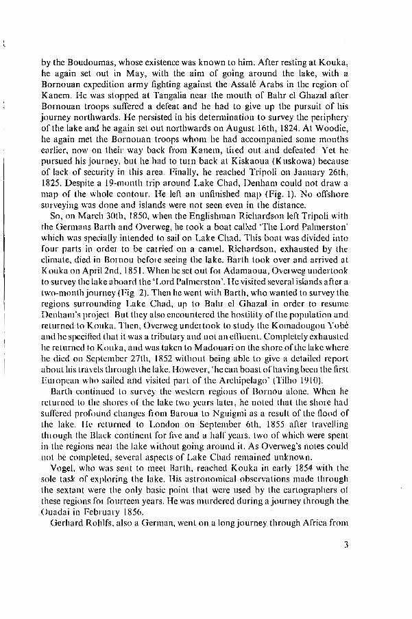
Nachtigal, a German doctor, undertook a journey through Central Africa in1869. He arrived at Nguigmi on June 28th, 1870 where he caught his firstglimpse of the lake. He stayed at Kouka for one year, then visited the northernside of the lake on his way to Kanem and Borkou. On a trip through Baguirmi,
4
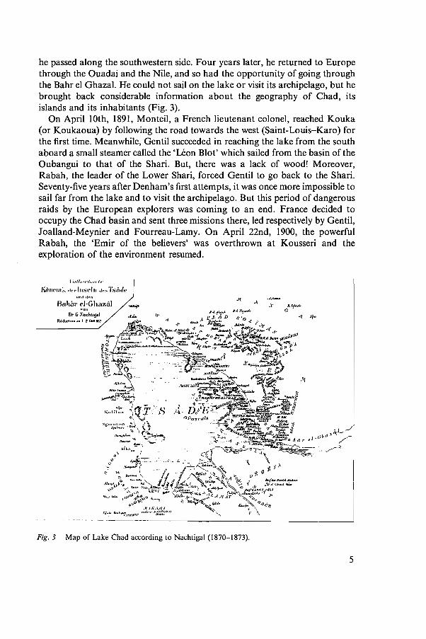
he passed along the southwestern side. Four years later, he returned to Europethrough the Ouadai and the Nile, and so had the opportunity of going throughthe Bahr el Ghazal. He could not sail on the lake or visit its archipelago, but hebrought back considerable information about the geography of Chad, itsislands and its inhabitants (Fig. 3).
On April IOth, 1891, Monteil, a French lieutenant colonel, reached Kouka(or Koukaoua) by following the road towards the west (Saint-Louis-Karo) forthe first time. Meanwhile, Gentil succeeded in reaching the lake from the southaboard a smaIl steamer called the 'Léon Blot' which sailed from the basin of theOubangui to that of the Shari. But, there was a lack of wood! Moreover,Rabah, the leader of the Lower Shari, forced Gentil to go back to the Shari.Seventy-five years after Denham's first attempts, it was once more impossible tosail far from the lake and to visit the archipelago. But this period of dangerousraids by the European explorers was coming to an end. France dt:cided tooccupy the Chad basin and sent three missions there, led respectively by Gentil,Joalland-Meynier and Fourreau-Lamy. On April 22nd, 1900, the powerfulRabah, the 'Emir of the believers' was overthrown at Kousseri and theexploration of the environment resumed.
KÙ'H'III":I, .Irr III:)t~11I Je'''' 'l'si..I,,und .lr~
Buh,;,' (')·Gh"zl\lDr (j :\nrhligel
RidllctoOft.1I 1 Z. 66e 661
'-...;0
.1{
Fig.3 Map of Lake Chad according to Nachtigal (1870-1873).
5
At that time, Lieutenant Colonel Destanave ordered scientific explorations tobe made in the whole archipelago, from the mouth of the Shari to the delta ofBahr el Ghazal and on the southwestern, western and northwestern sides of thelake which were still not well known. They showed the existence of anarchipelago including several hundred islands, occupied by about 45000inhabitants and many droves of oxen. Consequently, a fairly complete map ofthe archipelago was drawn for the first time.
Commander Largeau carried on similar explorations. A series of cross routesprovided information about the area and the depth of the open waters of thelake. The increasing dryness of this period and the resulting development ofvegetation led them to consider Lake Chad as more of an immense marshlandtl1an a lake.
At the end of 1903, Delevoye came from the mouth of the Shari sailing alonethrough the open waters aboard a big steel barge calied the 'Benoît Garnier',starting from the basin of the Oubangui (as was the case for the 'Léon Blot'twelve years earlier).
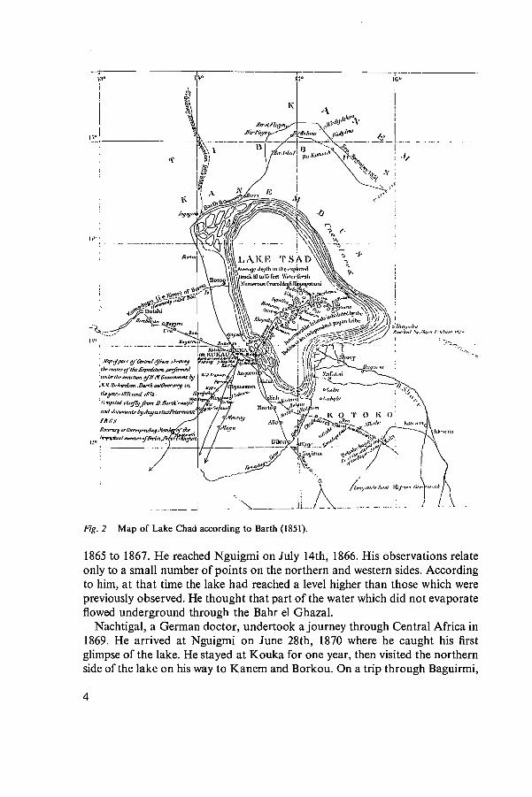
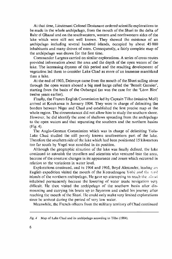
Finally, the Franco English Commission led hy Captain Tilho (mission Moll)arrived at Koukaoua in January 1904. They were in charge of delimiting theborders between Niger and Chad and established the first precise map of thewhole region. The circumstances did not allow him to study the southern shore.IIowever, he did identify the zone of shallows spreading from the archipelagoto the open waters and that separating the southern and the northern basins(Fig. 4).
The Anglo-German Commission which was in charge of delimiting YolaLake Chad studied the still ponrly known southwestern part of the lake.ThereCore the southern side of the lake which had been positioned 15 kilometerstao far south by Vogel was moddled in ils position.
Although the geographic situation of the lake was tinally delined, the lakecontinued to astonish the travellers and scientists who ventured into the area,because of the constant changes in its appearance and zones which oecurred inrelation to the variations in water level.
Explorations continued, and in 1904 and 1905, Royd Alexander, le<iding :l'l
English expedition visited the mouth of the Komadougou Yohé :111<1 tLl r,Tdislands oC thc northern archipelago. He gave up attempting to n:ach tlle '~:;'!Jl\
inhabited pennanently hecause the lowering of water made navigation verydillicult. He then visited the archipelago of the southern basin artcr dismounting and carrying his boats up to Seyorom and ended his journey arterreaching the mouth of the Shari. Ile could only make very lirnited explorationssince he arrived during the period of very low water.
Meanwhile, the French oflicers from the military territory of Chad continued
Fig. 4 Map of Lake Chad and ils archipclago according 10 Tilho (1904).
6
",'
1
~I
N"I f(1l."'~J'.
..... .ll>..",/"t"ftl'(i (N_"v"t/,,.; j\..u.'1~' JI,.,."
II~" ..::!" •.;:..~,...:::'..,.~,.,IJ 1., "It""'~ /.. •..,.11"',,
J'-ob"""'..... ,,"..r ...tr-""..,..-. ,__ "'" ,If .__ ,..,r".......·..._ .....
I"dÛ41O'll .,.jlngnl
,;::0 lIez/"""'''''''''1_1'IwIT....,,,i--;.;:f:::::::::::.. ~,,,,,~,,,,.,. .._r/,"""'r"" tH,·ü...r
--1 -
1
~ ~"'"--._--------------n<!----- .--~-~7------ --- - - - ----4;----_-_-_-_-__-_-_-_-_~r::_'._-_-- _
"T--,----~---,~~~.do '
1
1
1
1
0
•
1
1
to study the lake. In particular, Captain Freydenberg had the opportunity ofvisiting the whole northern basin of the lake, in 1905, when the lowering of thelake level was considerable. He made very important observations about theflora, the fauna and the inhabitants of the whole lake and its islands andpresented them in a thesis submitted to the Faculté des Sciences in Paris in1908.
Lake Chad which had remained mysterious for a long time was rather weIlknown when on August 26th, 1906, the second mission led by Tilho arrivedwith the aim of delimiting on land the frontier between French and Englishterritories in Central Africa. This delimitation was made in consultation with aBritish mission led by Commander in Chief R.P.O. Shee. The scientificdocuments from Tilho's mission, which were gathered over two years weredecisive elements in the knowledge of the lake and its entire basin. (Tilho 1910).The works included not only the survey of the lake and its eastern regions thatwere still poorly known but also studies on the variations in levels of the lakeand neighbouring depressions, the hydrology of the main tributaries of the lake,the climatology and the meteorology of the region, the magnetism, the historyand the ethnography of the populations. Numerous samples were gathered inail the scientific fields, especially malacology and ichthyology. The malacological fauna was then studied by L. Germain (Tilho 1910).
During this period of exploration, the explorers were generally puzzled bytwo problems: the role of Bahr el Ghazal in the hydrology of the lake andthe low salinity of the water in an environment situated in the sub-arid zone.
Sorne, such as Barth, thought that the Bahr et Ghazal was an effluent of LakeChad, while others, such as Nachtigal, thought that it was a tributary of thelake. During his second mission (1906-1909), Tilho confirmed that it was aneffluent after making surveys in the region under consideration.
As far as the Jow salinity of waters is concerned, the following twophenomena are often quoted:- a freshening of lake waters in outlying ponds containing natron (Huart in
Destenave 1903).- a seepage of water into the sands of Kanem and then an underground run
off in the old arm of Bahr el Ghazal (Truffert in Destenave 1903).Lahache and Marne (in Tilho 1910) confirmed the low salinity ofwater which
was revealed previousJy through the 'taste test'. But they were in favour of thesecond explanation. We shall see in Chapter 5 that these two phenomena playan important part in maintaining the low salinity of the water.
In fact, the main concern at the beginning of this century was elsewhere. Wasthe Jake not disappearing? As a matter of fact, explorers such as Denham,Barth, Rolfs and Nachtigal had observed a 'great lake' with swampy zonessituated on a coastal margin of 5 to 10 km since the discov.ery of the lake in1823 and throughout the 19th century. In 1854, Vogel saw a considerable floodinvading bordering towns such as Ngornou with 30000 inhabitants. On the
8
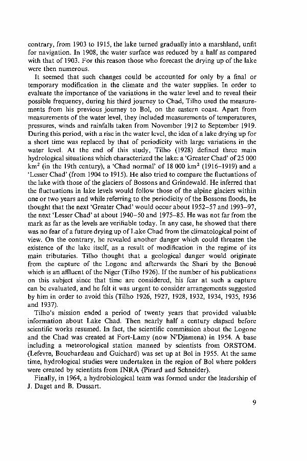
contrary, from 1903 to 1915, the lake turned gradually into a marshland, unfitfor navigation. In 1908, the water surface was reduced by a half as comparedwith that of 1903. For this reason those who forecast the drying up of the lakewere then numerous.
It seemed that such changes could be accounted for only by a final ortemporary modification in the c1imate and the water supplies. In order toevaluate the importance of the variations in the water level and to reveal theirpossible frequency, during his third journey to Chad, Tilho used the measurements from his previous journey to Bol, on the eastern coast. Apart frommeasurements of the water level, they inc1uded measurements of temperatures,pressures, winds and rainfalls taken from November 1912 to September 1919.During this period, with a rise in the water level, the idea of a lake drying up fora short time was replaced by that of periodicity with large variations in thewater level. At the end of this study, Tilho (1928) defined three mainhydrological situations which characterized the lake: a 'Greater Chad' of25 000km2 (in the 19th century), a 'Chad normal' of 18 000 km2 (1916-1919) and a'Lesser Chad' (from 1904 to 1915). He also tried to compare the fluctuations ofthe lake with those of the glaciers of Bossons and Grindewald. He inferred thatthe fluctuations in lake levels would fol1ow those of the alpine glaciers withinone or two years and while referring to the periodicity of the Bossons f1oods, hethought that the next 'Greater Chad' wouId occur about 1952-57 and 1993-97,the next 'Lesser Chad' at about 1940-50 and 1975-85. He was not far from themark as far as the leve1s are verifiable today. In any case, he showed that therewas no fear of a future drying up of Lake Chad from the c1imatological point ofview. On the contrary, he revealed another danger which could threaten theexistence of the lake itself, as a result of modification in the regime of itsmain tributaries. Tilho thought that a geological danger would originatefrom the capture of the Logone and afterwards the Shari by the Benouéwhich is an affluent of the Niger (Tilho 1926). If the number of his publicationson this subject since that time are considered, his fear at such a capturecan be evaluated, and he fe1t it was urgent to consider arrangements suggestedby him in order to avoid this (Tilho 1926, 1927, 1928, 1932, 1934, 1935, 1936and 1937).
Tilho's mission ended a period of twenty years that provided valuableinformation about Lake Chad. Then nearly half a century elapsed beforescientific works resumed. In fact, the scientific commission about the Logoneand the Chad was created at Fort-Lamy (now N'Djamena) in 1954. A baseincluding a meteorological station manned by scientists from ORSTOM.(Lefevre, Bouchardeau and Guichard) was set up at Bol in 1955. At the sametime, hydrological studies were undertaken in the region of Bol where polderswere created by scientists from INRA (Pirard and Schneider).
Finally, in 1964, a hydrobiological team was formed under the leadership ofJ. Daget and B. Dussart.
9
References
Destenave, L., 1903. Le lac Tchad. 10 partie: le lac, les ailluents, les archipels. Rev. gén. Sei., Paris:649-662.
Destenave, L., 1903. Le lac Tchad. 20 partie: les habitants, la faune, la flore. Rev. gén. Sci, Paris:717-727.
Freydenberg, L., 1908. Le Tchad et le bassin du Chari. Thèse, Paris, 187 pp.Lenfant, E. A., 1904. De l'Atlantique au lac Tchad par le Niger et la Bénoué. Géographie 9: 321.Tilho, J., 1910. Documents scientifiques de la Mission Tilho (1906-1908). Imp. Nat., Paris, 3 vols.,
1 atlas.Tilho, J., 1926. Sur une aggravation du danger de capture par le Niger des principaux ailluents du
Tchad. C. r. Ac. Sei. Paris 182: 1063-1065.Tilho, J., 1927. Devons-nous sauver le lac Tchad? Rev. sei. Paris 15: 454-463, 4 figs.Tilho, J., 1928. Variations et disparition possible du Tchad. Ann. Géogr. Paris 37: 238-260, 5 figs.Tilho, J., 1932. Le problème du déssèchement du Tchad. Dépêche col. Paris, 1er juill.Tilho, J., 1934. Sur l'éventualité de la capture du Logone, ailluent du lac Tchad, par le Niger,
C. r. Ac. Sei. Paris 199: 752-755.Tilho, J., 1935. Le Logone quittera-t-il le bassin du Tchad? Rev. gén. Sei., Paris 23: 652.Tilho, J., 1936. Sur l'état actuel de la zone de capture du Logone par la Bénoué. C. Sei. Paris 202:
2109-2113.Tilho, J., 1937. La capture du Logone par la Bénoué. Bull. Ass. Géogr. fr. Paris 000: 49-53.
10
LAKE Cl-JAI)Ecology and Productivity of a Shallow
Tropical Ecosystem
Edited by
J.-P. CARMOUZE, J.-R. DURAND and C. LEVEQUE
1983 Dr W. JUNK PUBLISHERS ....a member of the KLUWER ACADEMIC PUBLISHERS GROUP B'THE HAGUE I BOSTON I LANCASTER .,
Distributors
for the United States and Canada: Kluwer Boston, Inc., 190 Old Derby Street,Hingham, MA 02043, USAfor 011 other countries: Kluwer Academic Publishers Group, Distribution Center,P.O.Box 322, 3300 AH Dordrecht, The Netherlands
Library of Congress Cataloging in Publication Data
Main entry under title:
Lake Chad.
(Monographiae biologieae ; v. 53)Ineludes bibliographiea and index.1. Lake eeology--Chad, Lake. 2. Biologieal
produetivity--Chad, Lake. 3. Chad, Lake. ~. Carmouze,Jean-Pierre. II. Durand, Jean René. III. Levêque, C.IV. Series.QP1.P37 vol.53 574s [574.5'26322'096743J 83-4288[QH195.C46JISBN 90-6193-106-1
ISBN 90-6193-106-1 (this volume)
Cover design: Max Velthuijs
Copyright
© 1983 by Dr W. Junk Publishers, The Hague.
AlI rights reserved. No part of this publication may be reproduced, stored in aretrieval system, or transmitted in any form or by any means, mechanical,photocopying, recording, or otherwise, without the prior written permission ofthe publishers,Dr W. Junk Publishers, P.O. Box 13713, 2501 ES The Hague, The Netherlands.
PRINTED IN THE NETHERLANDS