Embed Size (px)
Citation preview
Whitepaper | June 2020
How Utility Companies Can Gain Enterprise-Wide Geographic Consistency
2
How Utility Companies Can Gain Enterprise-Wide Geographic Consistency
White Paper: June 2020
Table of ContentsExecutive Summary . . . . . . . . . . . . . . . . . . . . . . 3
CoreLogic Provides Solutions for Utilities . . . 3
CoreLogic – We Are Our Best Customer . . . . . 3Geocoding Accuracy . . . . . . . . . . . . . . . . . . . . . . 3
Spatial Analytics . . . . . . . . . . . . . . . . . . . . . . . . . . 4
Specialized Data . . . . . . . . . . . . . . . . . . . . . . . . . 4Parcel Boundary & Property Characteristics Data . . . . . . . . . . . . . . 4
Municipal Boundary Layers . . . . . . . . . . . . . . . . 4
Township Boundary Layer . . . . . . . . . . . . . . . . . 4
HERE Map Content . . . . . . . . . . . . . . . . . . . . . . . . 4
Tax Jurisdiction Layers . . . . . . . . . . . . . . . . . . . . 5Special Tax Districts Jurisdiction Layers . . . . . . 5
Natural Hazard Risk Layers . . . . . . . . . . . . . . . . 5
Improving Engineering/Construction Applications for Utilities . . . . . . . . . . . . . . . . . . . 5
Improving Financial Management for Utilities . 6Taxes and Fees . . . . . . . . . . . . . . . . . . . . . . . . . . . 6
Tax Compliance . . . . . . . . . . . . . . . . . . . . . . . . . . . 6
PAYROLL TAX . . . . . . . . . . . . . . . . . . . . . . . . . . . . . . . 6
FRANCHISE FEES . . . . . . . . . . . . . . . . . . . . . . . . . . . . 6
Municipal Audits . . . . . . . . . . . . . . . . . . . . . . . . . . 7
Customer Service and Refund Costs . . . . . . . . . 8
Improving Asset Management for Utilities . . . 8Asset Inventory and Cataloging . . . . . . . . . . . . . 8
STANDARDS SUPPORT AND INTEGRATION . . . . . 8
ASSET MAPPING . . . . . . . . . . . . . . . . . . . . . . . . . . . . 9
CALL BEFORE DIGGING . . . . . . . . . . . . . . . . . . . . . . 9
SMART GRIDS . . . . . . . . . . . . . . . . . . . . . . . . . . . . . . . 9
IMPROVED OUTAGE RESPONSE . . . . . . . . . . . . . . . 9
Improving Emergency Management for Utilities . . . . . . . . . . . . . . . . . . . . . . . . . . . . . . 9
Emergency Preparedness . . . . . . . . . . . . . . . . . . 9
EMERGENCY RESPONSE . . . . . . . . . . . . . . . . . . . . 10
BUSINESS CONTINUITY PLANNING . . . . . . . . . . . 10
Experts Recommend Preparing for Geological and Meteorological Hazards . . . . . 10
Conclusion . . . . . . . . . . . . . . . . . . . . . . . . . . . . . 11Why Spatial Solutions are Necessary for Utilities . . . . . . . . . . . . . . . . . . . . . . . . . . . . . 11
Achieve a Quick Return on Investment . . . . . . 11
Deployment Options That Are Right for You . . 11
Esri® ArcGIS® Enterprise . . . . . . . . . . . . . . . . . . 11
Online Platform . . . . . . . . . . . . . . . . . . . . . . . . . 11
API’s and Web Mapping Service . . . . . . . . . . . . 11
How Fast Can a Utility Company Get Started? . . . . . . . . . . . . . . . . . . . . . . . . . . . . 11
3This material may not be reproduced in any form without the express written permission of CoreLogic.
Executive SummaryUtility companies face unique challenges . Their customers require reliable access to essential services, their shareholders expect a solid return on investment, and governments demand compliance with a myriad of environmental, compliance, and other regulatory complications, often complicated by overlapping jurisdictional complexities .
The practice of managing information is often undisciplined and unfocused, as there remains a complex integration of multiple software applications and data systems . Additionally, the need for precision-level geographic information crosses many departments throughout the enterprise . Yet, for most companies, much of this geographic data has remained siloed within each respective department and application . The result? No single consolidated geographic system exists at the enterprise level for applications which demand consistent geographic accuracy .
Location Information Solutions from CoreLogic® can help utilities meet the many challenges they face in this area . Precision geocoding and specialized spatial data allow these organizations to make smarter financial decisions, effectively manage their numerous assets and better prepare for and respond to emergencies . With comprehensive property characteristics and ParcelPoint®, the most complete national parcel boundary dataset, utilities can now implement the geographic building blocks that can be used to address all the geographic needs of the enterprise .
CoreLogic Provides Solutions for Utilities Accurate spatial technology delivers benefits to key areas of the enterprise:
� Economic Development � Geographic Information Systems
� Right of Way � Distribution � Engineering/Construction
� Tax Jurisdiction Determination/Assignment
� Asset Management � Emergency Management and Response
Utilities quickly benefit from best-of-breed CoreLogic PxPoint™ geocoding and spatial analytics . When combined with parcel boundaries, structure footprints, property characteristics, tax jurisdiction boundaries and hazard risk data from CoreLogic, a company can more readily overcome their operational, financial, preparedness and regulatory challenges . Customized geospatial solutions are available to serve electric power companies, natural gas distributors, water suppliers, sanitary service systems, pipeline providers and other utilities .
CoreLogic – We Are Our Best Customer CoreLogic is a leader in locational intelligence, databases and enterprise solutions . This leadership was gained by serving many utility companies, telecoms and cable providers, as well as the insurance, mortgage and real estate industries . In fact, we are our best customer, as we use our own internally developed solutions to run our flood zone determination and risk business.
CoreLogic is one of the nation’s largest data providers, assisting customers with long-term solutions that help them run their businesses more productively and with less risk . CoreLogic touches nearly 90 percent of all real estate transactions in the U .S . today .
Geocoding AccuracyThere is a critical need for consistent accuracy across the enterprise to effectively track and manage assets, determine tax jurisdictions and reporting, prepare for and respond to emergencies and other issues that utilities respond to daily .
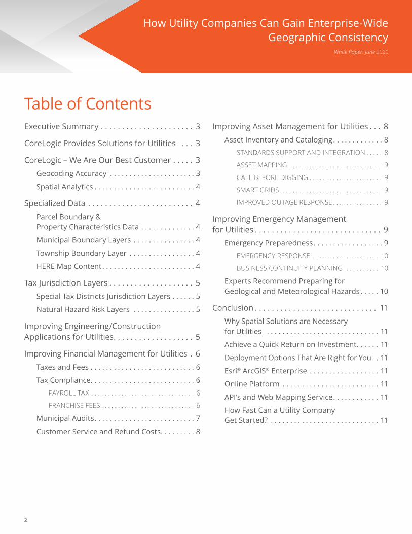
CoreLogic helps utilities with financial, asset and emergency management.
4 This material may not be reproduced in any form without the express written permission of CoreLogic.
Simply put geocoding converts address information into geographic coordinates . To provide the most accurate results, CoreLogic developed PxPoint—a high- precision, parcel- and structure-level geocoding and spatial analytic engine . It evaluates multiple data sets, including HERE map content, U .S . parcel boundaries and structure footprints, to deliver the best location match possible .
Spatial AnalyticsUtility companies have a need to understand geographic relationships near, or surrounding, a location . PxPoint allows organizations to perform many types of spatial analytics and answer question such as:
� Which tax jurisdictions are these customers in? � Where are lines buried in this area and what boundaries do they overlap?
� What is the risk of flooding or fire for this substation?
Specialized DataTo fully analyze the relationship between a location and its surroundings, current and accurate data is required . To complement PxPoint’s accuracy and spatial analytics capabilities, CoreLogic also provides geographic data layers and custom digitization services . This allows us to deliver a complete locational intelligence solution for each of its customers .
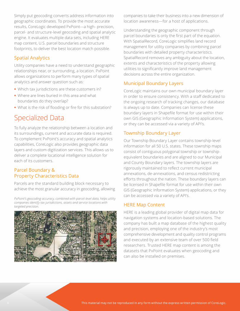
Parcel Boundary & Property Characteristics Data Parcels are the standard building block necessary to achieve the most granular accuracy in geocoding, allowing
companies to take their business into a new dimension of location awareness—for a host of applications .
Understanding the geographic component through parcel boundaries is only the first part of the equation. With SpatialRecord, CoreLogic simplifies land record management for utility companies by combining parcel boundaries with detailed property characteristics . SpatialRecord removes any ambiguity about the location, extents and characteristics of the property allowing utilities to significantly improve land management decisions across the entire organization .
Municipal Boundary LayersCoreLogic maintains our own municipal boundary layer in order to ensure consistency. With a staff dedicated to the ongoing research of tracking changes, our database is always up to date . Companies can license these boundary layers in Shapefile format for use within their own GIS (Geographic Information System) applications, or they can be accessed via a variety of API’s .
Township Boundary LayerOur Township Boundary Layer contains township-level information for all 50 U .S . states . These township maps consist of contiguous polygonal township or township- equivalent boundaries and are aligned to our Municipal and County Boundary layers . The township layers are rigorously maintained to reflect current municipal annexations, de-annexations, and census redistricting efforts throughout the nation. These boundary layers can be licensed in Shapefile format for use within their own GIS (Geographic Information System) applications, or they can be accessed via a variety of API’s .
HERE Map ContentHERE is a leading global provider of digital map data for navigation systems and location-based solutions . The company has built a map database of the highest quality and precision, employing one of the industry’s most comprehensive development and quality control programs and executed by an extensive team of over 500 field researchers . Trusted HERE map content is among the datasets that PxPoint evaluates when geocoding and can also be installed on premises .
PxPoint’s geocoding accuracy, combined with parcel-level data, helps utility companies identify tax jurisdictions, assets and service locations with targeted precision.

5This material may not be reproduced in any form without the express written permission of CoreLogic.
Tax Jurisdiction LayersThe accurate determination of taxes is burdensome for utilities . If taxes are not correctly assessed and properly remitted, companies can incur negative publicity, as well as costly penalties and other liabilities . CoreLogic tax jurisdiction layers provide access to municipality data, as well as enhanced tax data that identifies the lowest level taxing jurisdiction and remittance data for utility and other industry-specific taxes. Local school district information is provided as are many special tax district boundaries that provide detail on specific utility taxation at that level. Data provided in this layer also identifies whether or not the Special Tax District tax applies to industry specific services. CoreLogic has a staff dedicated to the collection and maintenance of its tax layers, helping utilities meet their tax obligations and determine:
� The lowest-level taxing authority
� The tax remittance authority
� Whether the location is subject to Special Tax District taxes
Special Tax Districts Jurisdiction LayersThere has been continued growth in the area of special tax districts in the U .S ., as many local municipalities look for more ways to increase waning revenue . Today, Special Tax Districts exist in 36 states and the District of Columbia, 756 counties and 2,593 municipalities . In Texas alone, there are about 836 special districts, up from 240 in previous years.
CoreLogic has built its Special Tax District layer for transaction taxes to help utilities identify taxes imposed by state and local governments, supporting the objectives of local public policy . These tax layers, available through PxPoint, Xiance® and our Spatial Web Services API to provide accurate tax jurisdiction assignment along with the Special Tax District ID, Type and Name, if applicable, for the submitted address or latitude and longitude .
Utilities now have access to accurate data about regional transit districts, police jurisdictions and school districts (boards), along with a variety of other special tax districts that impose transaction tax on industry specific services.
Natural Hazard Risk LayersAlthough generic hazard risk data is readily available, the degree of accuracy and usability of this information is suspect, at best. The CoreLogic staff of Ph.D.’s and geographic/hazard scientists has developed comprehensive data layers that enable companies to better analyze and manage risk, and plan for emergency response .
CoreLogic Natural Hazard Risk Layers are modeled at the most detailed level possible and risk levels are determined by the proximity to a hazard and by the hazard attributes . All data layers integrate into our geospatial solutions, as well as into a company’s own GIS applications, providing pinpoint accuracy when partnered with our PxPoint geocoder .
Improving Engineering/Construction Applications for UtilitiesAs utilities maintain and expand their service offerings throughout the U .S ., only the most accurate, current and precise geographic data is acceptable . This data is mission-critical to the success of infrastructure development operations . Until recently, most of this geographic data has been collected from a myriad of
CoreLogic Natural Hazard Risk Layers help utility companies analyze and manage risks and emergencies.
6 This material may not be reproduced in any form without the express written permission of CoreLogic.
sources and was not standardized, as every state and even local government differs in data availability and quality . Merger and acquisition activity has also created a multitude of disparate geographic systems and methodologies . Data collection has been sporadic and incomplete in most cases, and there is a need to consolidate land base data into one centralized GIS system across all regions of a utility’s construction and engineering groups .
Recognizing this need, CoreLogic created ParcelPoint—the first and largest nationwide digital parcel dataset. CoreLogic uses advanced technology to digitally and precisely map 99 percent of the U .S . to the parcel boundary level. With ParcelPoint, CoreLogic is the first entity to create a multi-purpose national cadastre that provides the digital fabric required to truly understand property attributes including unique identifiers such as house number, street name, owner name, city, state, ZIP Code and latitude/longitude .
Improving Financial Management for Utilities CoreLogic geocoding technology and data products enable utilities to manage and improve their operations in a variety of ways that positively impact financial growth and stability .
Taxes and FeesCoreLogic can help utilities drastically reduce their tax exposures and reporting costs . This is accomplished by combining geocoding accuracy with proprietary data available only from CoreLogic .
Utility companies can reduce tax exposures and reporting costs by:
� Fewer “false positives” and other incorrect address matches when precisely geocoding with PxPoint
� More accurate tax jurisdiction assignments to ease tax compliance and reduce costly errors
� State certified Tax Solutions that offer the comfort of eliminating unexpected penalties
Tax ComplianceUtilities are required to comply with complex, convoluted and overlapping tax jurisdictions and filing requirements. One problem these organizations face daily is how to correctly determine which of the many tax jurisdictions apply to a particular customer address or service location .
A “situs” is the address where a property is located for tax or legal purposes . With its high-precision PxPoint geocoding and well-maintained proprietary databases, CoreLogic returns more reliable results than systems that use common ZIP Codes, Census Blocks, or interpolated geocoding to determine taxes . With parcel-level data as the primary building block, CoreLogic allows companies to correctly locate addresses to comply with multiple, overlapping tax jurisdictions .
Tax compliance benefits include:
� Decreased tax exposure, penalties and tax reserves � Improved compliance for tax guidelines, requirements and deadlines
� Improved, accurate tax reporting
By correctly locating power plants, substations and even other infrastructure, a utility can more accurately manage property and other taxes . Accurate location information can also improve the allocation of linear assets, such as pipes and wires, to the proper jurisdictions .
PAYROLL TAXOur payroll tax layers can help companies in two ways . It accurately identifies withholding locations, and local business income taxes . It also allows for proper payroll withholding through special tax district information .
FRANCHISE FEESMany cities and counties charge a franchise fee to utility companies in exchange for the right to provide service in that location . Because these fees are typically based on gross revenues, it is important to correctly determine if a service location falls within the boundaries of a taxing jurisdiction .
7This material may not be reproduced in any form without the express written permission of CoreLogic.
Municipal AuditsUtilities are subject to periodic audits by the municipalities to which they remit taxes . If problems or discrepancies are discovered during an audit, companies are liable for the taxes due . In addition to the taxes due, the company will likely incur penalties and interest .
There is also a significant cost to the audits themselves. For large organizations, an audit may cost the company $50,000 .00 to $100,000 .00 or even more . That cost includes accounting personnel, management time, plus the IT (information technology) resources necessary to assemble the data and generate reports .
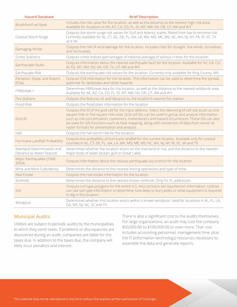
Hazard Database Brief Description
Brushfire/Fuel Rank Includes the risk value for the location, as well as the distance to the nearest high-risk area . Available for locations in AK, AZ, CA, CO, FL, ID, MT, NM, NV, OR, UT, WA and WY .
Coastal Storm SurgeOutputs the storm surge risk values for Gulf and Atlantic states . Rated from low to extreme risk . Currently available for AL, CT, DC, DE, FL, GA, LA, MA, MD, ME, MS, NC, NH, NJ, NY, PA, RI, SC, TX and VA .
Damaging Winds Outputs the risk of wind damage for the location . Includes risks for straight- line winds, tornadoes and hurricanes .
Crime Statistics Outputs crime indices (percentages of national average) of serious crimes for the location .
Earthquake Faults Outputs information about the nearest earthquake fault for the location . Available for AZ, CA, CO, ID, KS, MT, NM, NV, OK, OR, TX, UT, WA and WY .
Earthquake Risk Outputs the earthquake risk values for the location . Currently only available for King County, WA .
Elevation, Slope, and Aspect (ESA)
Outputs ESA information for the location. This information can be used to determine fire spread, potential for landslides and other hazards .
FIREbreak + Determines FIREbreak data for the location, as well as the distance to the nearest wildlands area . Available for AK, AZ, CA, CO, FL, ID, MT, NM, NV, OR, UT, WA and WY .
Fire Stations Outputs the features of, and distance to, the location’s nearest fire station.
Flood Risk Outputs the flood plain information for the location.
Grid ID
Outputs the ID of the grid cell for the input address . Select the desired grid cell size (such as one square mile or five square mile size). Grid cell IDs can be used to group and analyze information such as risk concentration, customers, homeowners and hazard occurrences . These IDs can also be used for GIS functions such as heat mapping, along with conversion of data from vector to raster formats for presentation and analysis .
Hail Outputs the hail storm risk for the location .
Hurricane Landfall Probability Outputs the probability of hurricane landfall for the current location . Available only for coastal counties in AL, CT, DE, FL, GA, LA, MA, MD, ME, MS, NC, NH, NJ, NY, RI, SC, VA and TX .
Mainland Determination and Distance to Water Feature
Determines whether the location exists on the mainland or not, and the distance to the nearest major body of water (ocean, gulf or Great Lake) .
Major Earthquakes (1568-2004) Outputs information about the nearest earthquake occurrence for the location .
Mine and Mine Subsidence Determines the distance to the nearest mining operations and type of mine .
Real Estate Outputs the real estate information for the location .
Sinkhole Determines the distance to the nearest known sinkhole . Only for FL addresses .
SoilOutputs soil type polygons for the entire U .S . Also contains soil liquefaction information . Utilities can use soil type information to determine how deep to bury poles or what equipment is required to dig in the location .
Windpool Determines whether this location exists within a known windpool . Valid for locations in AL, FL, LA, GA, MS, NJ, NC, SC and TX .

8 This material may not be reproduced in any form without the express written permission of CoreLogic.
With a robust spatial tax solution in place, a company can streamline and decrease the cost of the audit process, as subsequent reports will usually demonstrate close to full compliance . Organizations can also direct an auditor to the spatial system that was implemented for the purpose of tax jurisdiction assignments, which could help vastly reduce the cost of audits .
The combination of simplifying the audit process, decreasing the number of audits, and reducing exposure to interest and penalties can result in substantial savings for a typical utility company .
Customer Service and Refund CostsUtilities incur significant costs investigating tax complaints from customers . These investigations often result in having to issue refunds when customers have been incorrectly billed for taxes .
By correctly assigning tax jurisdictions—the first time— a company can reduce customer service and refund costs . By providing customer service operators access to real-time lookups using CoreLogic technology, utilities can further decrease labor costs while also improving customer service and satisfaction .
A CoreLogic geocoding and tax solution delivers savings in three ways:
1 . Reduce volume of complaints that require customer service
2 . Decrease amount of refunds issued to customers3 . Reduce labor costs for customer service episodes
Improving Asset Management for Utilities Asset management can be defined as a “best way” of managing physical assets to gain the greatest return . It blends best practices, best processes and best technology .
The purpose of physical asset management is to ensure that the means of production and operation are readily available . Better asset management allows companies to meet mission, yield, scheduling, quality and cost commitments to allow for optimum return .
Asset management includes these capabilities:
� Inventory and cataloging of assets � Mapping of assets � Improved outage response
Asset Inventory and CatalogingUsing the precise positioning capabilities of PxPoint, companies can accurately locate all their physical assets, allowing for more effective inventory and cataloging of all types of assets . In addition to location information, PxPoint can work with metadata, which is additional data about the data itself . Each dataset contains its own list of attribute fields, providing more detailed descriptive information about the data . Many datasets include numerous attribute fields that a utility company can utilize . For instance, some data provides nearly 100 fields for each street segment.
STANDARDS SUPPORT AND INTEGRATIONPxPoint also allows users to utilize ESRI Shapefiles. Shapefiles are a standard GIS file format for spatial data . Many companies have GIS groups that utilize and require spatial data .
Spatial data may be used for:
� Design
� Engineering/Construction
� Tax Jurisdiction Assignment
� Infrastructure
Because PxPoint supports industry-standard Shapefiles, a utility company can more readily leverage their existing spatial data . This capability also allows PxPoint to be integrated into comprehensive custom solutions .
CoreLogic helps utilities cut customer service and audit costs.

9This material may not be reproduced in any form without the express written permission of CoreLogic.
ASSET MAPPINGWhile it is useful to know where physical assets are located, it is often more beneficial to visualize the information . Spatial technology enables companies to display information visually, so that business users can easily make sense of the information by utilizing graphics, overlays and even satellite photography .
CALL BEFORE DIGGINGPrecise location information, along with parcel boundary data eases the process of call before digging . By mapping buried lines, a utility company has answers ready for many ‘call before digging’ inquiries . Not only saving time beforehand, this approach helps avoid the need to dispatch crews later to address problems .
SMART GRIDSDelivering electricity from suppliers to customers using digital technology, smart grids have gained popularity . Governments are also promoting smart grids as another way of achieving energy independence and combating global warming .
Advanced PxPoint geocoding, CoreLogic datasets and asset mapping capabilities can assist in the creation and management of smart power grids . By understanding the locational relationships between disparate, distributed power-generation assets, such as residential solar, utility companies can more easily integrate these assets into smart grids .
The benefits of smart grids include quantifiable cost savings, energy efficiency, energy storage and load balancing, preventive engineering and optimal allocation of maintenance resources, along with more effective failure management and containment .
IMPROVED OUTAGE RESPONSEWith readily available geolocation information, companies can reduce the number and duration of service interruptions . When interruptions do occur, precise location information and property/customer detail assists utilities improve their response to outages, which in turn, increases customer satisfaction .
CoreLogic locational intelligence can be integrated with a utility’s existing routing package . By utilizing CoreLogic parcel and structure data within PxPoint’s geocoding engine, a company can locate crew and service points more accurately. This precision results in more efficient and effective repair crew deployment. For example, by dispatching a crew already located nearby, a company can more rapidly repair dangerous gas leaks, water main breaks or downed electrical lines .
An improved response to problems like this reduces liability exposure for damages and injuries, decreases labor and transportation costs, and improves customer satisfaction .
Improving Emergency Management for UtilitiesSpatial technology allows utilities to improve their emergency management processes by allowing for more comprehensive and effective emergency preparedness, emergency response and business continuity planning .
Emergency PreparednessPreparedness is the first hurdle in emergency management that companies need to address . Companies that effectively plan and prepare can respond to emergencies more efficiently.
Accurate geocoding and data are key to effective preparation . This combination allows companies to correctly identify and rank risk zones throughout their entire service areas . Using parcel data, utilities can even return hazard risk information and ratings per parcel . That level of detail helps to proactively assess, manage and mitigate risks on dispersed assets ranging substations to storage facilities .
Specialized CoreLogic Natural Hazard Risk Layers address the most common risks that utility companies face . For example, the damaging winds layers allows companies to proactively prepare for the damage
CoreLogic helps utilities improve their response to outages.
10 This material may not be reproduced in any form without the express written permission of CoreLogic.
caused by winds, tornadoes and hurricanes . Other Natural Hazard Risk Layers include earthquake, fire, flood, hail, sinkhole and more.
EMERGENCY RESPONSEIn this day and age, it is imperative that every organization have current plans in place to deal with emergencies. And, how effectively a utility company responds to inevitable emergencies depends on the preparation . Plans should be developed with the cooperation of management, operations, IT and even other agencies . Contingency plans should locate risks and rank their consequences, followed by details about how to best recover from the various consequences .
CoreLogic products and services enable utilities to pinpoint risks and assets at the parcel and structure level . For example, companies can utilize the CoreLogic Brushfire/Fuel Rank layer to pinpoint certain fire risks to their facilities, as well as to their customers . Plans can then be developed to mitigate and recover from fires at the facilities, or to respond more quickly after fires affect customers. In this case, companies can better predict which assets may be affected, determine which remaining assets can be deployed and along which routes, with which employees and so on . Applying geospatial intelligence to identify risks and manage assets allows for quicker and more effective response.
BUSINESS CONTINUITY PLANNINGA business continuity plan (BCP) is a utility’s roadmap to recovery . Following a careful risk assessment, every company should develop and test a business continuity plan that:
� Identifies risks and their probability which could interrupt business and services to customers
� Assesses the impacts of the risks and each business operation and service
� Identifies and prioritizes critical services, operations, and employees
� Determines and documents the level of recovery that is necessary to begin conducting business and providing essential services following an emergency
With access to precise location data about all its assets, a utility company can improve the relevance and accuracy of a business continuity plan . In order to develop an
effective BCP, a utility company needs to fully understand the spatial relationships between assets, customers and geography throughout its entire service territory .
Because of its unique ability to evaluate multiple datasets and provide complex spatial analytics, PxPoint is the application framework that a company needs to underpin their planning . Only PxPoint and the specialized data that CoreLogic develops and maintains, can provide the detailed spatial insights required for business continuity planning .
Experts Recommend Preparing for Geological and Meteorological HazardsIn its Standard on Continuity, Emergency, and Crisis Management, 2019 Edition, section 5 .2 .2 .1, the National Fire Protection Association (NFPA) recommends:
The entity to conduct a risk assessment, identify hazards and monitor those hazards and the likelihood and severity of their occurrence overtime . Naturally occurring hazards that can occur without the influence of people and have potential direct or indirect impact on the entity (people, property, the environment), and should be evaluated include:
� Geological: (i) Earthquake (ii) Landslide, Mudslide, Subsidence (iii) Tsunami (iv) Volcano
� Meteorological: (i) Drought (ii) Extreme Temperatures (iii) Famine (iv) Flood, Flash Flood, Seiche, Tidal Surge (v) Geomagnetic Storm (vi) Lightning (vii) Snow, Ice, Hail, Sleet, Avalanche (viii) Wildland Fire (ix) Windstorm, Tropical Cyclone, Hurricane, Tornado, Water Spout, Dust Storm, Sand Storm
This list is not all-inclusive but reflects the general categories that should be assessed in the hazard identification.
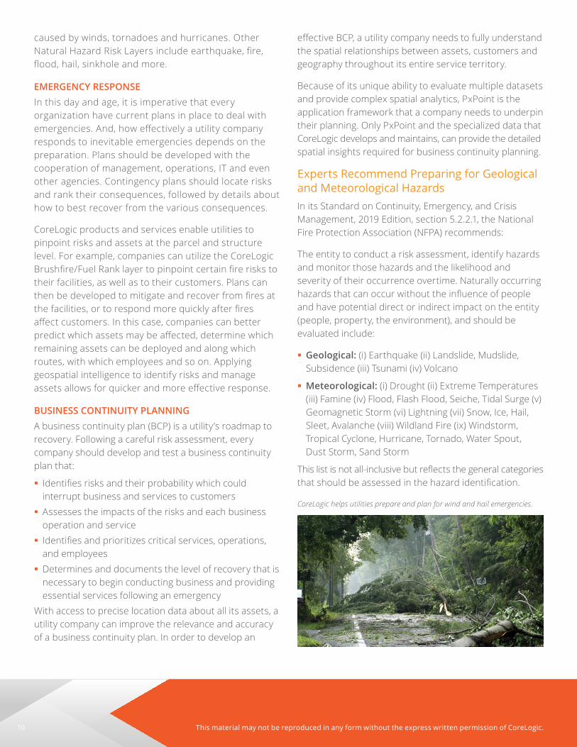
CoreLogic helps utilities prepare and plan for wind and hail emergencies.

11This material may not be reproduced in any form without the express written permission of CoreLogic.
ConclusionWhy Spatial Solutions are Necessary for Utilities Utilities require consistent geospatial intelligence across the enterprise to help with key areas of the business:
� Network Operations � Engineering/Construction � Financial Management/Tax
� Asset Management � Emergency Management
CoreLogic provides complete, customized geospatial solutions that are built upon the advanced geocoding and spatial analytics platform—PxPoint . When combined with specialized data, such as the largest U .S . parcel level dataset, tax jurisdiction and hazard risk layers, companies finally have access to the spatial insights they need—across the enterprise . This translates into a single geographic base from which all activities that require a geographic answer can reside to achieve maximum efficiency.
Achieve a Quick Return on InvestmentBecause of all the different integration options, along with the ability to license only the specialized spatial data required, CoreLogic delivers tailored solutions designed for each customer . A solution focused on the needs of each individual customer pays for itself very quickly .
Deployment Options That Are Right for You CoreLogic provides both licensed and hosted solutions . For example, PxPoint and Xiance are available online and can be accessed by anyone with a web browser . Alternatively, utilities can license the application for use in-house, where it can also be integrated with their
other GIS capabilities . Utilities can even combine licensed and hosted options . Utilities can choose the options that best integrate CoreLogic technology into their own existing infrastructure .
Esri® ArcGIS® EnterpriseThrough our integration with Esri ArcGIS Enterprise, we offer you an on-demand, web-based solution, giving you 24/7 access to your desired content within your existing Esri software deployment . By enabling both Map and Feature Services to suit your specific needs, you can gain access to our industry-leading parcel boundary products directly into your existing Esri tools such as ArcGIS Pro, Portal for ArcGIS and ArcGIS Online . We give you the same exceptionally accurate results, your way .
Online PlatformPxPoint and Xiance are an ordering and delivery platforms delivering positionally accurate tax jurisdiction and natural hazard risk reports through the web .
These tools can help utilities better understand their tax liabilities prior to making important digging or asset management decisions . No IT implementation is required, and information is delivered in real time .
API’s and Web Mapping ServiceCoreLogic provides several of its property and natural hazard layers via both JSON API’s and a Web Mapping Service (WMS) . WMS requests generate a visual response in one or more geo-registered map images (returned as JPEG, PNG, etc .) that can be displayed in a browser application, such as OpenLayers, Bing or Google Maps API . The interface also allows for the transparency of returned image layers from multiple servers .
How Fast Can a Utility Company Get Started? CoreLogic technology uses modern industry standards, such as XML/SOAP. This flexible technology is user-friendly and quickly integrated, typically providing companies with geospatial intelligence benefits in just a few short weeks.
CoreLogic helps utilities plan for emergencies and business continuity.

corelogic .com
©2020 CoreLogic, Inc . All rights reserved .CORELOGIC, PARCELPOINT, PXPOINT, XIANCE and the CoreLogic logo are trademarks of CoreLogic, Inc .
and/or its subsidiaries . All other trademarks are the property of their respective owners . Proprietary . This material may not be reproduced in any form without express written permission .
17-UTILITIES-0320-03
For more information, please call 512-977-3236 or visit corelogic .com/LocationInformationSolution .
About CoreLogic
CoreLogic (NYSE: CLGX), the leading provider of property insights and solutions, promotes a healthy housing market and thriving communities . Through its enhanced property data solutions, services and technologies, CoreLogic enables real estate professionals, financial institutions, insurance carriers, government agencies and other housing market participants to help millions of people find, acquire and protect their homes. For more information, please visit www .corelogic .com .