Embed Size (px)
Citation preview
©Ohio Sea Grant, The Ohio State University, 2014 1
HOW WELL DO YOU KNOW THE GREAT LAKES?GREAT LAKES CURRICULUM
Objectives: In this activity, learners will construct the five Great Lakes from stringand use paper “water” and “fish” to show comparisons between the lakes.
After completing this activity, students will be able to: • Compare and contrast the differences between the Great Lakes in water volumes, length of shoreline, human population distribution, and the amount of fish harvested from each lake.
Materials: Students will need a large working surface preferably on the ground so that all can gather around the lakes. 1 small area per group
Five strings, each tied into a circle, in the following lengths: 3.8 m, 3.0 m, 1.6 m, 0.9 m, 0.7 m (Add a piece of masking tape on each string with the length noted on it.) 1 set per base group
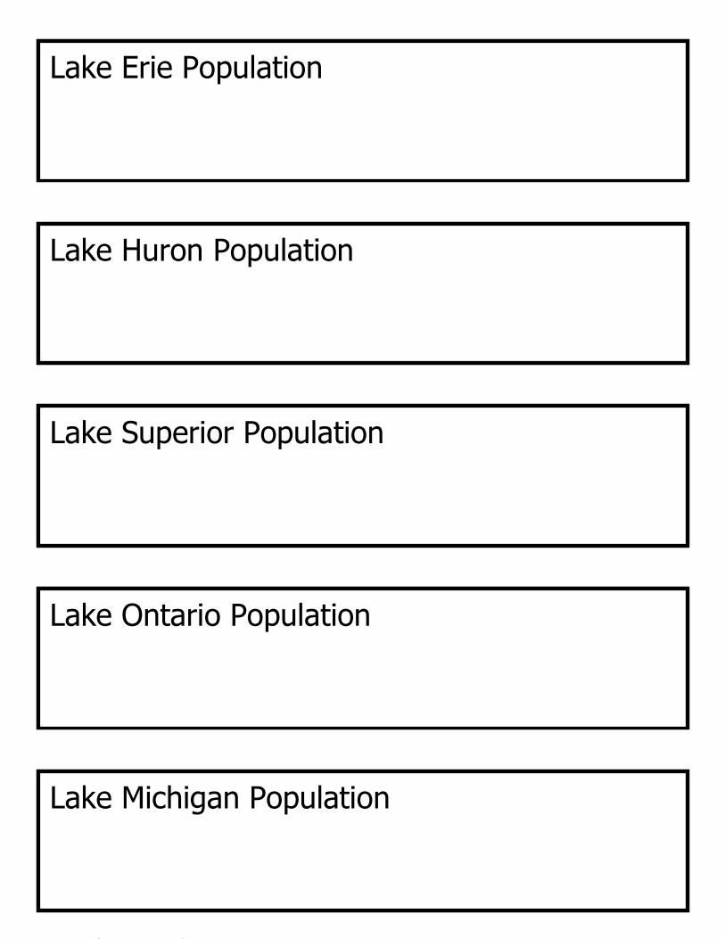
Lake labels Five lake population papers Pen or Pencil 1 set per base group 1 set per base group 1 per base group
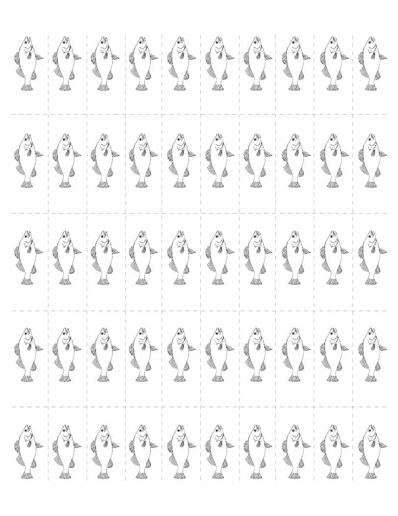
100 blue squares to represent water 100 fish papers Map of the Great Lakes 1 set per base group 1 set per base group 1 for each expert group
Copy of Great Lakes Data 1 for the teacherTemplates for materials are found at the end of the lesson instructions.
Subject/Grade Levels: GeographyAs written this activity is appropriate for students in grades 4-8, but can easily be adapted for high school students and adult learners.
ALIGNMENTNational Geography Standards:
#3: How to analyze the spatial organization of people, places and environments on Earth’s surface (grades 4, 8)
Great Lakes Literacy Principles:
#1a,b,d: The Great Lakes, bodies of fresh water with many features, are connected to each other and to the world ocean.#6b: The Great Lakes and humans in their watersheds are inextricably interconnected.
How well do you know the Great Lakes?(Background and Teacher Activity)
GREAT LAKES CURRICULUM
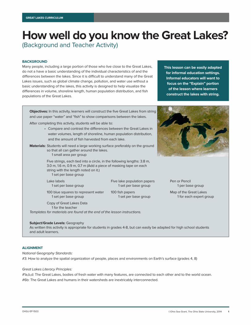
BACKGROUNDMany people, including a large portion of those who live close to the Great Lakes, do not a have a basic understanding of the individual characteristics of and the differences between the lakes. Since it is difficult to understand many of the Great Lakes issues, such as global climate change, pollution, and water use without a basic understanding of the lakes, this activity is designed to help visualize the differences in volume, shoreline length, human population distribution, and fish populations of the Great Lakes.
OHSU-EP-1503
This lesson can be easily adapted for informal education settings. Informal educators will want to focus on the “Explain” portion of the lesson where learners
construct the lakes with string.
©Ohio Sea Grant, The Ohio State University, 2014 2
HOW WELL DO YOU KNOW THE GREAT LAKES?GREAT LAKES CURRICULUM
TEACHER’S NOTESPrior to the activity, prepare bags for base groups that contain the five labeled strings, lake name cards and lake population papers, as well as 100 blue water squares and 100 fish squares. The template sheets have 25 water drops and 50 fish per page.
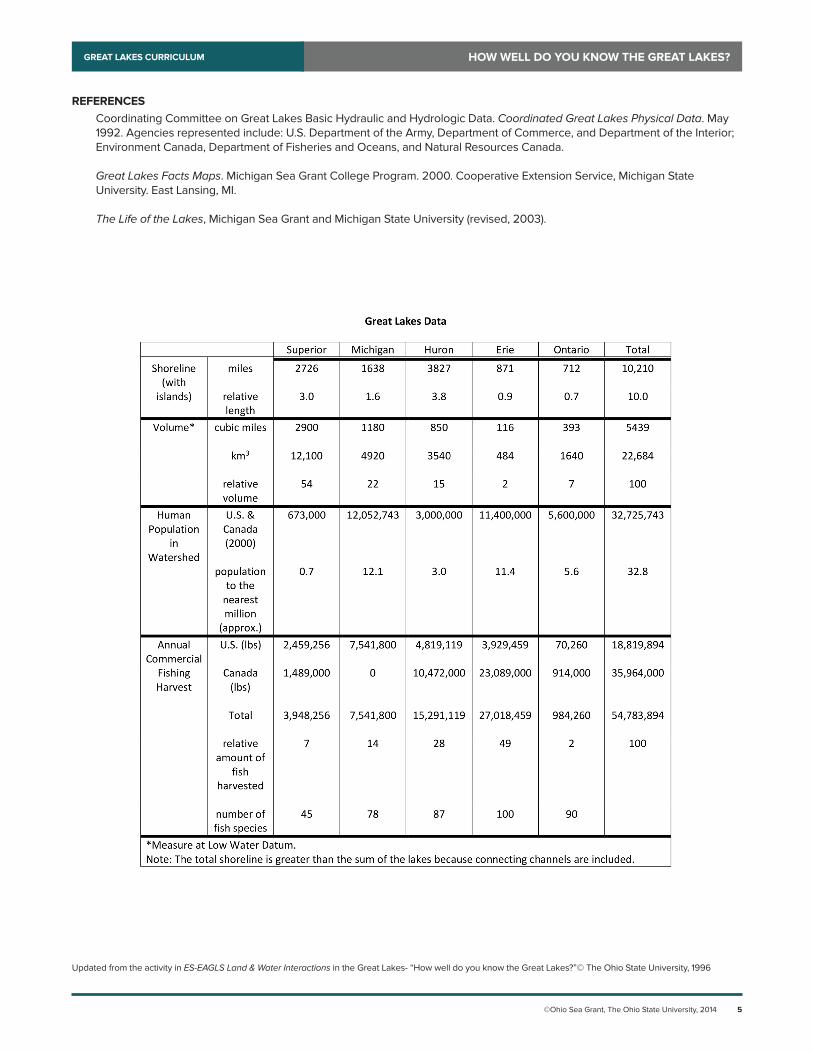
These notes should help with interpreting the Great Lakes Data chart and with setting up the activity.A. Shoreline: In order to make strings that depict the relative lengths of shoreline of the Great Lakes, use the relative length
data in the shoreline section. Any unit of measurement may be used as long as it is used consistently. The measurement units will depend on the amount of space available for the lesson. For instance, if the lesson will be taught outdoors, a large unit of measurement may be used, such as meters. In this case, the Lake Superior string would be 3.0 meters long. To stay organized, label each string with a small piece of tape with the relative length number on it.
B. Water Volume: The 100 blue squares represent all of the water in the Great Lakes combined. To find how 100 squares should be distributed, look at the relative volume data in the volume category. It lists 54 for Lake Superior; this mean that 54 of the squares should be in the Lakes Superior string model (over half of all the water in the Great Lakes is in Lake Superior).
C. Human Population: The total population data figures in the population section are rounded off to the nearest million. The students attempt to guess the numbers in this category. It is interesting to realize that Lake Superior has only approximately 0.6 million people living in its watershed. This is less than 2% of the total population of the Great Lakes watershed.
D. Commercial Fishing Harvest: The row labeled “relative amount of fish harvested” in the fishing section indicates the number of pounds of fish that would come from each lake if the total number of pounds from all the lakes was 100. As they did with water volume, students should distribute the 100 fish squares amongst the lakes.
ENGAGEThis lesson, as a whole, can be used as an engagement activity for an entire unit on Great Lakes science or geography. However, the following questions might be asked to specifically introduce this lesson:
• Do you know the names of the five Great Lakes?• Have you ever visited a Great Lake?• What Great Lake would you consider “your” lake?• What major cities are along the shores of the Great Lakes?• Why do people visit the Great Lakes?
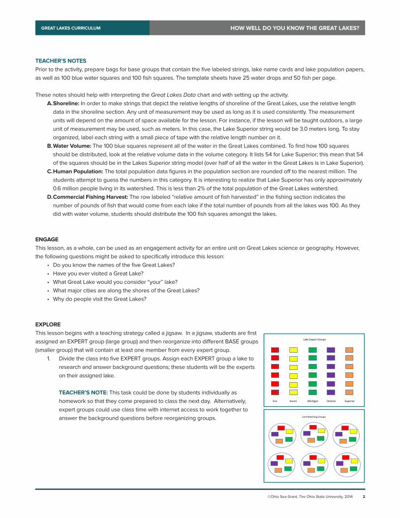
EXPLOREThis lesson begins with a teaching strategy called a jigsaw. In a jigsaw, students are first assigned an EXPERT group (large group) and then reorganize into different BASE groups (smaller group) that will contain at least one member from every expert group.
1. Divide the class into five EXPERT groups. Assign each EXPERT group a lake to research and answer background questions; these students will be the experts on their assigned lake.
TEACHER’S NOTE: This task could be done by students individually as
homework so that they come prepared to class the next day. Alternatively, expert groups could use class time with internet access to work together to answer the background questions before reorganizing groups.
Lake Expert Groups
Erie Huron Michigan Ontario Superior
Card Matching Groups
©Ohio Sea Grant, The Ohio State University, 2014 3
HOW WELL DO YOU KNOW THE GREAT LAKES?GREAT LAKES CURRICULUM
EXPLAIN2. Reorganize students so that each BASE group contains at least one
expert on each lake. These new groups should have at least five students in them. Students should have their completed worksheets with them.
3. Provide each group with a bag containing the five measured strings, lake names, 100 fish squares, 100 water squares and five strips of paper for lake populations.
4. Facilitate the activity by having students demonstrate their hypotheses about the shoreline length, volume, human populations and commercial fishing harvest in each lake. Here is a possible script:
A. Shoreline: Arrange the five strings to form a model of the outline of the Great Lakes. Add in your lake name cards once the strings are assembled. B. Volume: Distribute 100 squares of blue paper among the lakes to represent all of the water contained in the lakes. For example, if your group thinks that the water is divided equally among the lakes, then put 20 blue squares into each lake. C. Human Population: The total population of people living in the Great Lakes watershed is approximately 32.8 million. Divide that number among the Great Lakes. For example, if your group thinks that about half of the people in the Great Lakes live in the Lake Superior watershed, then write 16 million on the strip of paper labeled Lake Superior Population. Teachers - the goal is not necessarily to get the number correct, but to have students start
thinking about where people are located around the lakes. D. Commercial Fishing Harvest: Distribute 100 fish squares among the lakes to represent the amount of fish harvested from each lake for human food. If your group thinks, for example, that the same amount of fish is harvested from each lake, then put 20 fish squares into each lake.5. After base groups have assembled the “lakes,” have students share their hypotheses and then reveal the answers from
Great Lakes Data.
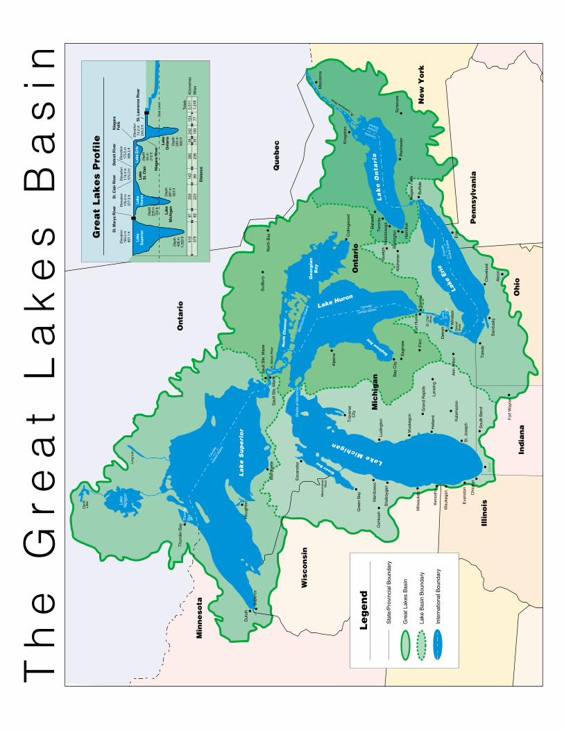
EXTENDStudents answer geography questions after completing the class activity. Some questions will require the use of a map of the Great Lakes basin such as the one provided here.
Answers to Student Worksheet1. Erie, Ontario, Huron, Michigan, Superior2. From Lake Superior, a water droplet may or may not travel through Lake Michigan, but will move through Lake Huron,
then Lake Erie and Lake Ontario before entering the St. Lawrence Seaway on a journey to the Atlantic Ocean.3. Lake Superior4. Illinois, Indiana, Michigan, Minnesota, New York, Ohio, Pennsylvania, Wisconsin5. Lakes Erie, Huron, Ontario and Superior6. St. Mary’s River7. St. Clair River and Detroit River8. No9. Lake Ontario10. St. Lawrence Seaway; to the Atlantic Ocean11. Lake Huron12. Lake Erie13. 64 m or 210 ft14. Deeper by 15 meters15. Niagara Falls16. a. between Lakes Huron and Erie b. Lake Erie c. Lake Michigan d. Lake Ontario17a. St. Lawrence Seaway17b. Niagara River
TEACHER’S NOTE:Instead of writing actual numbers on the strips of paper, the lakes
could be ranked from 1-5 for highest population to
lowest population.
©Ohio Sea Grant, The Ohio State University, 2014 4
HOW WELL DO YOU KNOW THE GREAT LAKES?GREAT LAKES CURRICULUM
17c. Detroit River17d. Lake St. Clair17e. St. Clair River17f. St. Mary’s River17g. Straights of Mackinac17h. Lake Erie17i. Lake Huron17j. Lake Ontario17k. Lake Michigan17l. Lake Superior17m. Lake Erie17n. Lake Michigan17o. Lake Superior17p. Lake Huron17q. Lake Erie17r. Lake Ontario17s. Lakes Michigan and Huron17t. Answers will vary
Alternatively, search for additional sets of data about the Great Lakes such as average depth, fish populations, average water retention time, level of pollution, etc. to use with learners in the same manner as the topics addressed here.
How big is a crowd? is an activity that can be done as extension of this one. Students again create the lakes from string, but this time, investigate the relationships between area, population, fish production and pollution. This lesson can be found under Principle 6 at greatlakesliteracy.net.
EVALUATEHave students rank the Great Lakes according to various characteristics. A half-sheet ranking table that can be used in a variety of ways (as an exit ticket, as a mini-quiz, or as an engagement activity used the day following the lesson) to formatively assess students is provided.
Other sample evaluation questions include:• What was the most surprising thing you learned from this activity? Why? [Students may find the amount of fish taken and
the amount of people living on Lake Erie surprising because of the lake’s relatively small size. Likewise, students may be surprised at the large volume of water contained in Lake Superior.]
• Which guesses were not close to the correct answers? What reasoning led your group to the wrong decisions? [Answers will vary.]
• Why do so many people live around Lake Erie? [There are several reasons. One is that Lake Erie has a somewhat milder climate. Additionally early trade routes were along its shores and large population centers developed early in America’s history.]
• Why don’t the length of coastline and the amount of water correspond? [The depths of the lakes are very different.]
ADDITIONAL RESOURCESA variety of resources (websites, fact sheets, data sets, presentations, and additional lessons) about general Great Lakes topics can be found at greatlakesliteracy.net. Resources are organized by literacy principle.
Jointly produced by the Government of Canada and the U.S. Environmental Protection Agency, the Great Lakes Atlas provides a wealth of background information, maps and fact sheets on the Great Lakes. It can be accessed at http://www.epa.gov/greatlakes/atlas/index.html.
The Great Lakes Information Network is an up-to-date, online resource for Great Lakes information and issues. It can be accessed at http://www.great-lakes.net/lakes/.
©Ohio Sea Grant, The Ohio State University, 2014 5
HOW WELL DO YOU KNOW THE GREAT LAKES?GREAT LAKES CURRICULUM
REFERENCESCoordinating Committee on Great Lakes Basic Hydraulic and Hydrologic Data. Coordinated Great Lakes Physical Data. May 1992. Agencies represented include: U.S. Department of the Army, Department of Commerce, and Department of the Interior; Environment Canada, Department of Fisheries and Oceans, and Natural Resources Canada.
Great Lakes Facts Maps. Michigan Sea Grant College Program. 2000. Cooperative Extension Service, Michigan State University. East Lansing, MI.
The Life of the Lakes, Michigan Sea Grant and Michigan State University (revised, 2003).
Updated from the activity in ES-EAGLS Land & Water Interactions in the Great Lakes- “How well do you know the Great Lakes?”© The Ohio State University, 1996
©Ohio Sea Grant, The Ohio State University, 2014 6
HOW WELL DO YOU KNOW THE GREAT LAKES?GREAT LAKES CURRICULUM
Lake Michigan
Lake
Erie
Ge
org
ian
Ba
y
Lake
Nip
igon
La
ke
On
tari
o
Lake Huron
CanadaUnited States
Can
ada
Uni
ted
Sta
tes
Canada
United States
Saginaw Bay
Can
ada
Uni
ted
Stat
es
Nort
h C
hannel
Green Bay
La
ke
Su
pe
rio
r
Mic
hig
an
Pe
nn
sylv
an
ia
Oh
io
Wis
co
nsi
n
Min
ne
sota
On
tari
o
Ind
ian
a
Ne
w Y
ork
Illin
ois
On
tari
o
Qu
eb
ec
Sau
lt S
te. M
arie
Lake
St.
Cla
ir
St.
Cla
irR
iver
Det
roit
Win
dsor
Sar
nia
Por
t Hur
onFl
int
Sag
inaw
Gra
nd R
apid
s
Lans
ing
Milw
auke
e
Gre
en B
ay
Trav
erse
City
Stra
its o
f Mac
kina
c
Mar
quet
teS
ault
Ste
. Mar
ieS
t. M
arys
Riv
er
Thun
der B
ay
Long
Lac
Toro
nto
Gue
lph
Kitc
hene
r
Ham
ilton
Nor
th B
ay
Mas
sena
Kin
gsto
n
Syr
acus
eR
oche
ster
Buf
falo
Nia
gara
Fal
ls
St.L
awrenceRiver
Erie
Cle
vela
nd
Akr
on
Tole
do
Kal
amaz
oo
Sou
th B
end
Gar
y
Chi
cago
Fort
Way
ne
Ann
Arb
or
Dul
uth
Ogo
kiLa
ke
Det
roit
Riv
er
Mus
kego
n
Ludi
ngto
n
Alp
ena
Man
itoul
in Is
land
San
dusk
y
Mis
siss
augaOsh
awa
Col
lingw
ood
Bur
lingt
on
Sud
bury
She
boyg
an
Man
itow
oc
Esc
anab
a
Hou
ghto
n
Sup
erio
r
Eva
nsto
n
Wau
kega
n
Ken
osha
Osh
kosh
St.
Jose
phHol
land
Bay
City
Thun
der
Bay
Men
omin
eeR
iver
Le
ge
nd
Sta
te/P
rovi
ncia
l Bou
ndar
y
Gre
at L
akes
Bas
in
Lake
Bas
in B
ound
ary
Inte
rnat
iona
l Bou
ndar
y
Th
e G
rea
t L
ak
es
Ba
sin
St. M
arys
Riv
er
Lake
Supe
rior
Lake
Hur
onLa
ke E
rie
Lake
Ont
ario
Lake
Mic
higa
n
Lake
St. C
lair
St. C
lair
Riv
erN
iaga
raFa
llsE
leva
tion
183.
2 m
601.
1 ft
Ele
vatio
n17
6.0
m57
7.5
ft
Ele
vatio
n17
3.5
m56
9.2
ft
Ele
vatio
n17
4.4
m57
2.3
ft
Ele
vatio
n74
.2 m
243.
3 ft
Dep
th40
6 m
1,33
3 ft
Dep
th28
1 m
923
ft
Dep
th22
9 m
750
ft
Dep
th64
m21
0 ft
Dep
th24
4 m
802
ft
Nia
gara
Riv
er
Det
roit
Riv
er
124
7724
215
056 35
380
236
143
8935
922
397 60
610
379
Tota
ls2,
011
1,24
9K
ilom
etre
sM
iles
Dis
tanc
e
Gre
at
La
ke
s P
rofi
le
Sea
Lev
el
St. L
awre
nce
Riv
er
©Ohio Sea Grant, The Ohio State University, 2014 7
HOW WELL DO YOU KNOW THE GREAT LAKES?GREAT LAKES CURRICULUM
LAKE SUPERIOR
LAKE HURON
©Ohio Sea Grant, The Ohio State University, 2014 8
HOW WELL DO YOU KNOW THE GREAT LAKES?GREAT LAKES CURRICULUM
LAKEMICHIGAN
LAKE ERIE

©Ohio Sea Grant, The Ohio State University, 2014 9
HOW WELL DO YOU KNOW THE GREAT LAKES?GREAT LAKES CURRICULUM
LAKE ONTARIO

©Ohio Sea Grant, The Ohio State University, 2014 10
HOW WELL DO YOU KNOW THE GREAT LAKES?GREAT LAKES CURRICULUM
©Ohio Sea Grant, The Ohio State University, 2014 11
HOW WELL DO YOU KNOW THE GREAT LAKES?GREAT LAKES CURRICULUM
©Ohio Sea Grant, The Ohio State University, 2014 12
HOW WELL DO YOU KNOW THE GREAT LAKES?GREAT LAKES CURRICULUM
Total Population: 32,800,000
Lake Michigan Population
Lake Ontario Population
Lake Superior Population
Lake Huron Population
Lake Erie Population
©Ohio Sea Grant, The Ohio State University, 2014 13
HOW WELL DO YOU KNOW THE GREAT LAKES?GREAT LAKES CURRICULUM
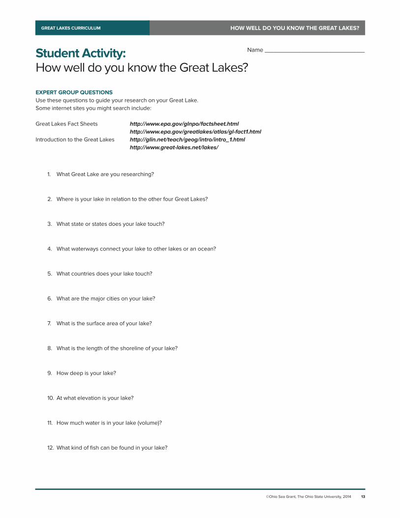
Student Activity:How well do you know the Great Lakes?
EXPERT GROUP QUESTIONSUse these questions to guide your research on your Great Lake.Some internet sites you might search include:
Great Lakes Fact Sheets http://www.epa.gov/glnpo/factsheet.html http://www.epa.gov/greatlakes/atlas/gl-fact1.htmlIntroduction to the Great Lakes http://glin.net/teach/geog/intro/intro_1.html http://www.great-lakes.net/lakes/
1. What Great Lake are you researching?
2. Where is your lake in relation to the other four Great Lakes?
3. What state or states does your lake touch?
4. What waterways connect your lake to other lakes or an ocean?
5. What countries does your lake touch?
6. What are the major cities on your lake?
7. What is the surface area of your lake?
8. What is the length of the shoreline of your lake?
9. How deep is your lake?
10. At what elevation is your lake?
11. How much water is in your lake (volume)?
12. What kind of fish can be found in your lake?
Name _____________________________
©Ohio Sea Grant, The Ohio State University, 2014 14
HOW WELL DO YOU KNOW THE GREAT LAKES?GREAT LAKES CURRICULUM
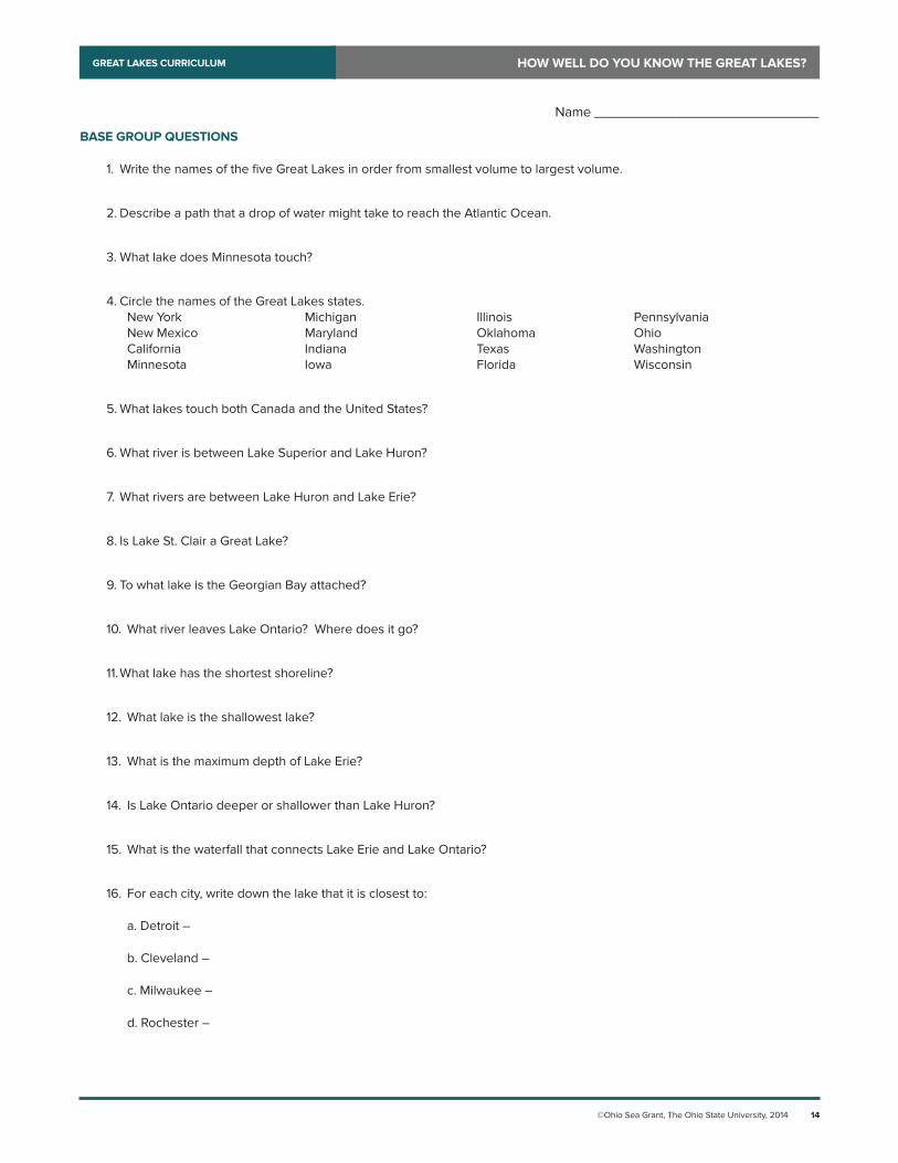
BASE GROUP QUESTIONS
1. Write the names of the five Great Lakes in order from smallest volume to largest volume.
2. Describe a path that a drop of water might take to reach the Atlantic Ocean.
3. What lake does Minnesota touch?
4. Circle the names of the Great Lakes states. New York Michigan Illinois Pennsylvania New Mexico Maryland Oklahoma Ohio California Indiana Texas Washington Minnesota Iowa Florida Wisconsin
5. What lakes touch both Canada and the United States?
6. What river is between Lake Superior and Lake Huron?
7. What rivers are between Lake Huron and Lake Erie?
8. Is Lake St. Clair a Great Lake?
9. To what lake is the Georgian Bay attached?
10. What river leaves Lake Ontario? Where does it go?
11. What lake has the shortest shoreline?
12. What lake is the shallowest lake?
13. What is the maximum depth of Lake Erie?
14. Is Lake Ontario deeper or shallower than Lake Huron?
15. What is the waterfall that connects Lake Erie and Lake Ontario?
16. For each city, write down the lake that it is closest to:
a. Detroit –
b. Cleveland –
c. Milwaukee –
d. Rochester –
Name _____________________________
©Ohio Sea Grant, The Ohio State University, 2014 15
HOW WELL DO YOU KNOW THE GREAT LAKES?GREAT LAKES CURRICULUM
BASE GROUP QUESTIONS (CONT’D.)
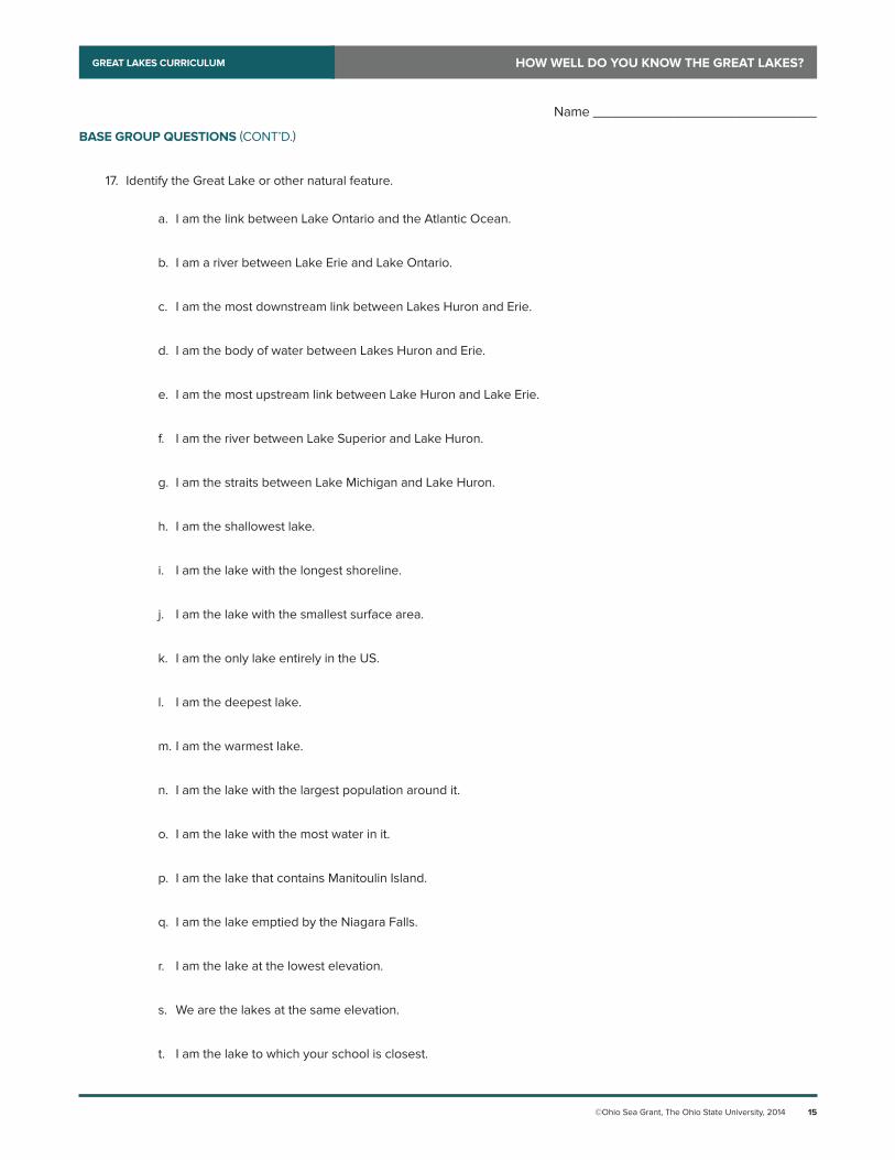
17. Identify the Great Lake or other natural feature.
a. I am the link between Lake Ontario and the Atlantic Ocean.
b. I am a river between Lake Erie and Lake Ontario.
c. I am the most downstream link between Lakes Huron and Erie.
d. I am the body of water between Lakes Huron and Erie.
e. I am the most upstream link between Lake Huron and Lake Erie.
f. I am the river between Lake Superior and Lake Huron.
g. I am the straits between Lake Michigan and Lake Huron.
h. I am the shallowest lake.
i. I am the lake with the longest shoreline.
j. I am the lake with the smallest surface area.
k. I am the only lake entirely in the US.
l. I am the deepest lake.
m. I am the warmest lake.
n. I am the lake with the largest population around it.
o. I am the lake with the most water in it.
p. I am the lake that contains Manitoulin Island.
q. I am the lake emptied by the Niagara Falls.
r. I am the lake at the lowest elevation.
s. We are the lakes at the same elevation.
t. I am the lake to which your school is closest.
Name _____________________________
©Ohio Sea Grant, The Ohio State University, 2014 16
HOW WELL DO YOU KNOW THE GREAT LAKES?GREAT LAKES CURRICULUM
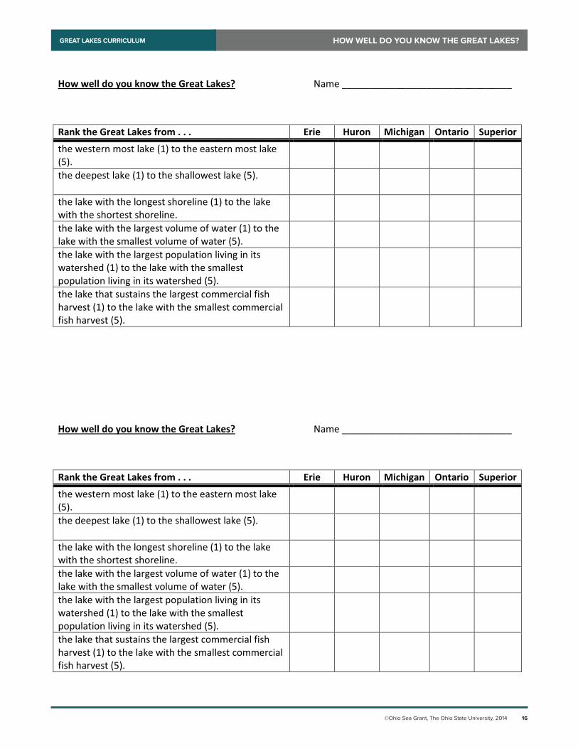
How well do you know the Great Lakes? Name ________________________________
Rank the Great Lakes from . . . Erie Huron Michigan Ontario Superior
the western most lake (1) to the eastern most lake (5).
the deepest lake (1) to the shallowest lake (5).
the lake with the longest shoreline (1) to the lake with the shortest shoreline.
the lake with the largest volume of water (1) to the lake with the smallest volume of water (5).
the lake with the largest population living in its watershed (1) to the lake with the smallest population living in its watershed (5).
the lake that sustains the largest commercial fish harvest (1) to the lake with the smallest commercial fish harvest (5).