Embed Size (px)
DESCRIPTION
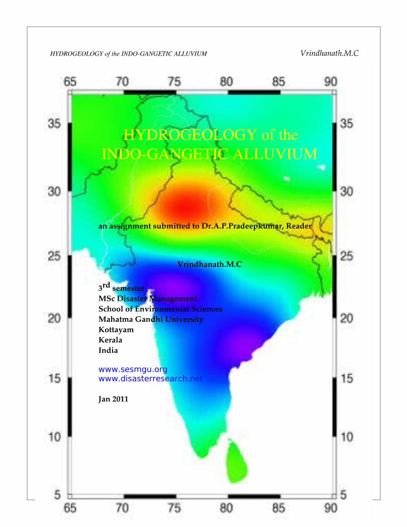
HYDROGEOLOGY of the INDOGANGETIC ALLUVIUM Vrindhanath.M.Can assignment submitted to Dr.A.P.Pradeepkumar, ReaderVrindhanath.M.C 3rd semester MSc Disaster Management School of Environmental Sciences Mahatma Gandhi University Kottayam Kerala India www.sesmgu.org www.disasterresearch.net Jan 20111HYDROGEOLOGY of the INDOGANGETIC ALLUVIUM
Citation preview
HYDROGEOLOGY of the INDOGANGETIC ALLUVIUM Vrindhanath.M.C
1
HYDROGEOLOGY of the INDOGANGETIC ALLUVIUM
an assignment submitted to Dr.A.P.Pradeepkumar, Reader
Vrindhanath.M.C
3rd semesterMSc Disaster Management School of Environmental SciencesMahatma Gandhi UniversityKottayamKeralaIndia
www.sesmgu.orgwww.disasterresearch.net
Jan 2011

HYDROGEOLOGY of the INDOGANGETIC ALLUVIUM Vrindhanath.M.C
INDOGANGETIC ALLUVIUM
The Indian landmass consists of three physiographic domains; the Himalayas, IndoGangetic Plain (IGP), and Peninsular Shield. The IndoGangetic Plain is a 400800 km wide, low relief, eastwest zone between the Himalaya in the north and the Peninsula in the south . It is a sinking basin that came into being about 50 Ma ago due to epiorogenic movements of Himalaya and was subsequently filled up by the sediments deposited by northerly and southerly drainage under the influence of climate changes, mainly from the Middle Miocene (Rowley 1996).
The Indus and Ganges river basins are among the world’s largest and most productive ecosystems. Home to three quarters of a billion people; the combined basin area extends over 2.25 million km2 from the mouth of the Ganges to that of the Indus. The basin provides water for the economic base of agriculture, forestry, fisheries, and livestock, as well as the urban and industrial water requirements of about one billion people. More than 90% of total water use is for agriculture, followed by 8% for domestic use (IGB Brochure, 2003). The IndusGanges plains form the largest consolidated area of irrigated food production on the globe with a net cropped area of 114 million ha. Groundwater development (i.e. the percentage of annual net draft to annual available groundwater resources), has been very rapid in the last two decades with development reaching 77.7% in the Indus and 33.5% in the Ganges part of the combined basin area (Sikka and Gichuki, 2006).
While agricultural technologies and the harnessing of water have proceeded apace, land and water degradation are taking an increasing toll on the basin economy. Future food security in this area, which is the key breadbasket for South Asia, is threatened by a combination of land and water degradation, stagnating productivity, reduced harvested area, and rapidly increasing populations and, concomitantly, food demand .Much of the groundwater use in the basin area is not sustainable. While past development of tube well irrigation was an important factor in increasing food production and reducing poverty, the basin is now being confronted with major groundwater management challenges: overexploitation of groundwater and declining water tables in the drier Indus and western Ganges part of the basin, water logging and secondary salinization in high intensity irrigation command areas, and rapidly growing pollution of water resources.
2

HYDROGEOLOGY of the INDOGANGETIC ALLUVIUM Vrindhanath.M.C
The IndoGangetic Basin, though blessed with a vast network of dams, canals, and strong irrigation bureaucracy, has lost its historical supremacy of the surface irrigation systems to the more informal, demandbased and equitable groundwater irrigation. Most canal commands in the region are shrinking with groundwater taking over the critical role of irrigation provisioning. In large parts of the IndoGangetic Basin finding a farmer who either does not have his own pump or does not purchase water from his neighboring pumpowner may be a difficult task (Shah, 2006). The present size of the groundwater economy in the region is substantial, and it is groundwater irrigation that largely account for the variations in the value of agricultural output per hectare. Groundwater irrigation is helping in catalyzing the spread of the green revolution into new areas that were not covered by surface irrigation in the 1970s. Despite this, the development, use, sharing and groundwater markets, and the agricultural production and large social benefits produced by the groundwater resource are not uniform and depend heavily upon the prevailing hydrology and socioecology of the given region/state in the vast basin, albeit with very interesting twists. Understanding sustainable groundwater management in the developing world requires blending of three distinct perspectives: (a) the resource, (b) the user, and (3) the institutional.
GROUND WATER IN SANSKRIT LITERATURE
The study of our scriptures reveals that ancient Indian thinkers such as Sarasvatu, Manu with scientific bent were not only interested in exploring the means of storing rainwater but also exploring the methods to locate ground water sources. Many Sanskrit works like Brihatsamhita of Varahamihira, Arthasastra of Kautilya etc., describe the interior of the earth to be full of water channels, like the veins in the human body, further subdividing into hundreds and thousands of streams at different levelscausing life of different plants and trees on the earth. These works claim that on the basis of certain plants and trees, ground water resources can be explored in the areas where surface water is not available. There are other methods like smell of soil and character of rocks using which it can also be assessed whether water is sweet, saline, acidic or bitter
The shastras warn that deep wells are foolish to dig. At eight armlengths depth, the well is manohar, or beautiful. At thirteen armlengths, it becomes rudrakupa, a well that causes fear. The excavations at MohenjoDaro have revealed bricklined dug wells existing as early as 3000 B.C. during the Indus Valley Civilization. The writings of Vishnu Kautilya (in the reign of Chandragupta Maurya—300 B.C.) indicate that ground
3

HYDROGEOLOGY of the INDOGANGETIC ALLUVIUM Vrindhanath.M.C
water was being used for irrigation purposes at that time. Sinking of wells and a variety of water devices were well known from Vedic times.
HYDROGEOLOGY OF THE COUNTRY
The ground water behavior in the Indian subcontinent is highly complicated due to the occurrence of diversified geological formations with considerable lithological and chronological variations, complex tectonic framework, climatological dissimilarities and various hydro chemical conditions. Studies carried out over the years have revealed that aquifer groups in alluvial / soft rocks even transcend the surface basin boundaries. Broadly two groups of rock formations have been identified depending on characteristically different hydraulics of ground water, Porous Formations and Fissured Formations. Porous formations have been further subdivided into Unconsolidated and Semi – consolidated formations.
POROUS FORMATIONS (UNCONSOLIDATED FORMATIONS)
The areas covered by alluvial sediments of river basins, coastal and deltaic tracts constitute the unconsolidated formations. These are by far the most significant ground water reservoirs for large scale and extensive development. The hydrogeological environment and ground water regime in the IndoGangaBrahmaputra basin indicate the existence of potential aquifers having enormous fresh ground water reserve. Bestowed with high incidence of rainfall and covered by a thick pile of porous sediments, these ground water reservoirs get replenished every year and are being used heavily. In these areas, in addition to the Annual Replenishable Ground Water resources available in the zone of water level fluctuation (Dynamic Ground Water Resource), there exists a huge ground water reserve in the deeper passive recharge zone below the zone of fluctuation as well as in the deeper confined aquifers which remains largely unexplored as yet. Although the mode of development of ground water is primarily through dug wells, dug cum bore well and cavity wells, thousands of tube wells have been constructed during last few decades.
POROUS (SEMI CONSOLIDATED)
The semiconsolidated formations normally occur in narrow valleys or structurally faulted basins. The Gondwanas, Lathis, Tipams, Cuddalore sandstones and their equivalents are the most extensive productive aquifers in this category. Under favorable situations, these formations give rise to free flowing wells. In selected tracts of
4

HYDROGEOLOGY of the INDOGANGETIC ALLUVIUM Vrindhanath.M.C
northeastern India, these waterbearing formations are quite productive. The Upper Gondwanas, which are generally arenaceous, in general, constitute prolific aquifers.
FISSURED FORMATIONS (CONSOLIDATED FORMATIONS)
The consolidated formations occupy almost twothirds of the country. These formations, except vesicular volcanic rocks have negligible primary porosity. From the hydrogeological point of view, fissured rocks are broadly classified into four types, Igneous and metamorphic rocks excluding volcanic and carbonate rocks, Volcanic rocks, Consolidated sedimentary rocks and Carbonate rocks.
IGNEOUS AND METAMORPHIC
The most common rock types under this category are granites, gneisses, charnockites, khondalites, quartzites, schists and associated phyllites, slates, etc. These rocks possess negligible primary porosity but attain porosity and permeability due to fracturing and weathering. Ground water yield also depends on rock type and grade of metamorphism. Generally, the Granites, Khondalites and Biotite gneisses have better yield potential as compared to Charnockites.
VOLCANIC ROCKS
The predominant types of volcanic rocks are the basaltic lava flows of Deccan Plateau. The highly variable water bearing properties of different flow units control ground water occurrence in Deccan Traps. The Deccan Traps have usually poor to moderate permeability depending on the presence of primary and secondary fractures.
CONSOLIDATED SEDIMENTARY ROCKS EXCLUDING CARBONATE ROCKS
Consolidated sedimentary rocks occur in Cuddapahs, Vindhyans and their equivalents. The formations consist of conglomerates, sandstones, shales, slates and quartzites. The presence of bedding planes, joints, contact zones and fractures controls the ground water occurrence, movement and yield potential.
CARBONATE ROCKS
Limestones in the Cuddapah, Vindhyan and Bijawar group of rocks dominates the carbonate rocks other than the marbles and dolomites. In carbonate rocks, the
5

HYDROGEOLOGY of the INDOGANGETIC ALLUVIUM Vrindhanath.M.C
circulation of water creates solution cavities thereby increasing the permeability of the aquifers. The solution activity leads to widely contrasting permeabilities within short distances.
HYDROGEOLOGY OF THE INDUSGANGES BASIN
The Great Indian Sedimentary Basin, drained by the Indus—Ganges Brahmaputra river system, is one of the largest and most productive groundwater provinces of the world. It is flanked by the Great Himalaya in the north and the Deccan Shield in the south . The history of development of this basin and its sedimentary units is closely related to the orogenic and geotectonic events of the late and post Himalayan times. The basin runs a length of over 2400 km from Punjab in the west to Assam in the east. Its width is variable, the maximum being over 400 km and the minimum as small as 25 km.
Quaternary alluvial deposits form a major component of the surface geology on nonpeninsular India, covering about half the land area. Alluvium occupies major parts of Gujarat and Rajasthan, most of Uttar Pradesh, Haryana, Punjab and West Bengal, as well as northern Bihar and northern Assam. Hydrogeologically, the IndoGangetic basin from north to south is divisible into six regions, namely, the Himalayan region, subHimalayan region, Bhabar zone, Tarai zone, Central Ganga Plains (CGP) and marginal alluvial plains. The Himalayan Region confined between the Siwalik range in the south and the Zaskar range in the north represents hilly and rugged terrain consisting of a variety of rock formations, which are continuously undergoing disintegration through glaciofluvial action. Larger part of this region remains under snow cover throughout the year. The Great Himalayas are the gathering grounds which feed a multitude of glaciers, some of which are among the largest in the world outside the Polar circles (Wadia, 1990). The Indus basin has the largest number of glaciers (3,538), followed by the Ganga basin (1,020) and the Brahmaputra (662) (WWF, 2005). The intergranular pore spaces, openings, fissures, fractures, Joints and bedding planes developed promote the infiltration of rainwater which reappears down slope as spring and seepage (Valdiya and Bartarya, 1989). Here groundwater occurs in the secondary porosity of the formation and is unconfined.
The subHimalayan region lies to the south of the Himalayan zone and is occupied by the Siwalik ranges. They forma system of low foothills with an average height of 900–1,500m (Wadia, 1990). The groundwater here mostly is unconfined and sometimes semiconfined. The depth to the water table ranges between 10 and 20 m below ground level (bgl). The tube wells are reported to be capable of yielding 50 to 80 m3/hr in
6

HYDROGEOLOGY of the INDOGANGETIC ALLUVIUM Vrindhanath.M.C
Siwaliks of Uttarakhand and 100 to 120 m3/hr in the intermontane valleys in Himachal Pradesh (CGWB, 2008). The coefficient of permeability varies between 15 and 250 m/day. The northern belt of the IndoGangetic alluvial tract (near the Himalayan foothills) is characterized by coarse materials (principally bouldergravel) forming the piedmont terrain. It is referred to as Bhabar in Uttar Pradesh and Kandi in Jammu & Kashmir and Punjab. This formation has been formed by lateral coalescence of alluvial cone and fan deposits brought down by innumerable streams (Wadia, 1990). The rivers crossing Bhabar lose large quantity of flow to the gravels. Groundwater is unconfined and the water table is deep (30mor more). The groundwater has a hydraulic gradient of around 3 m/km. The hydraulic conductivity ranges between 25 to 250 m/day. The Bhabars are capable of yielding about 100–300 m3/hr of water (CGWB, 2008).
The Bhabar belt is overlain by the Terai belt of stratified bands of dominantly coarsesediments with clay. This occupies a narrow belt and its contact with the Bhabar is wellmarked by a spring line. The presence of highly porous and permeable fan deposits ensures large supplies of groundwater from the Terai belt for agricultural and industrial use. The Terai has an upper unconfined aquifer and a lower interconnected system of confined aquifers. Between the Bhabar and the confined aquifers of the Terai belt is a vast zone where recharge is encouraged by high rainfall and hilly streams. The piezometric head of the aquifer ranges between 6 to 9 m above ground level. The coefficient of permeability ranges between 17 and 108 m/day. The yield of tubewells tapping the Terai zones ranges between 50–200 m3/hr (CGWB, 2008).
The Central Ganga plain forms one of the richest aquifers of the world. The typical channel deposit of the Ganga River, from the bottom upward, comprises coarse sand mixed with gravel, mediumto fine—grained sand to silt and a capping of thin clay. This clay cap and some fine sand layers are washed away during the flood period, and a fresh body of sand with a fining upward sequence is deposited again each year during the flood, thus building up a thick terrigenous clastic deposit until the river next changes its course. In the Central Ganga Plains, extensive exploratory studies have indicated the presence of four aquifer groups within a depth of 700 m bgl. The individual aquifers vary in thickness from a few meters up to 300 m. Although locally separated, aquifers are hydraulically connected at a regional scale (Karanth, 1987). The range of aquifer parameters in the Central Ganga Plains is shown in Table 1. Groundwater occurs under water table conditions in the shallow aquifers, and is semiconfined to confined in the deeper aquifers. The yield of tubewells in this area ranges between 90–200 m3/hr (CGWB, 2008).
7

HYDROGEOLOGY of the INDOGANGETIC ALLUVIUM Vrindhanath.M.C
Groundwater Availability
Groundwater resources can be classified as static and dynamic. The static resource is the amount of groundwater available in the permeable portion of the aquifer below the zone of water level fluctuation. The dynamic resource is the amount of groundwater available in the zone of water level fluctuation. Sustainable groundwater development requires that only the dynamic resources are tapped. Exploitation of static groundwater resources could be considered during extreme conditions, but only for essential purposes. The static fresh groundwater resource of the Indus and Ganga basin are listed below.
River basin Alluvium/ Unconsolidated rocks Hard rocks Total
Indus 1,334.9 3.3 1,338.2Ganga 7,769.1 65 7,834.1
Groundwater resources in the Ganga basin are nearly six times that of the Indus basin. The Ganga basin falls under ‘safe’ category on (GWdevelopment <70%) compared to the Indus basin (overexploited category) based their status of groundwater development. This implies that annual groundwater consumption is more than the annual groundwater available in the Indus basin.
The bestyielding aquifers of northern India are the Quaternary alluvial deposits of the Gangetic plain. These constitute a major source of water supply. Good groundwater yields are also found in many of the Tertiary sediments. Groundwater storage in crystalline basement rocks is restricted to the fractures and groundwater yields are determined by fracture density. This can be significant in some areas: groundwater yields of around 10–50 m3/day were reported from dug wells in fractured basement rocks of the Gambhir River Basin of Rajasthan for example (Umar and Absar, 2003).
In the arid regions of northern India, groundwater is often the only source of available drinking water. Overexploitation of aquifers in some areas has resulted in falling water levels. Singh and Singh (2002) reported decreases in groundwater levels of 1–2 m/year in some boreholes. At the same time as a result of irrigation, some canal levels have been rising at a rate of 1 m/year. Experiments in some areas are being conducted to assess the feasibility of aquifer storage and recovery to alleviate the water shortage problem.
Ground water exploration in IndoGangetic plains has shown existence of potential
8

HYDROGEOLOGY of the INDOGANGETIC ALLUVIUM Vrindhanath.M.C
aquifers down to 1000 m. or more. Annual replenishable ground water resources of this region are ~200 BCM which is more than 45% of the country. Besides, it also has vast instorage ground water resources down to the depth of 450 m. Deeper confined aquifers get their recharge from distant recharge zone and have ground water of varying ages. In some of the areas, the deeper aquifers are under autoflow conditions. The quality of ground water in these aquifers is also good. These aquifers can support large scale development through both shallow and deep tubewells. In the states of Punjab and Haryana, the stage of ground water development is very high ranges from 103 to 145 %. The eastern and north eastern parts of the country mainly in the states of Assam, Bihar, West Bengal and UP have huge ground water resources both in unconfined and confined aquifers. The annual replenishable resources of 165 BCM has been assessed in these states. The ground water draft is ~77 BCM and stage of ground water development is ~47 %.
STATE WISE DISTRIBUTION OF GROUND WATER
BIHARThe major part of the state is covered with indogangetic alluvium besides consolidated formations in the southern parts. Groundwater development in the phreatic zone is generally through dug wells and shallow tube wells. The yield of these wells generally ranges from 13lps. The annual replenishible ground water resource of the state has been estimated as 29.19 bcm and the net ground water availability is 27.42bcm. the annual ground water draft for all uses is 10.77bcm and stage of ground water development of the state is 39%. Besides the ground water of the phreatic zone, there exists a huge ground water potential at deeper depth. The wells tapping deeper aquifiers in alluvial areas yield between 3070 lps whereas in the consolidated formation, yield varies from 315 lps.HARYANAMajor part of the state is occupied by alluvium. The southern part of the state is underlain by consolidated formation of Delhi system and in the northern part, Siwaliks are present. The ground water development of the phreatic zone is mainly through shallow tube wells and dug wells in the alluvial areas, the yield of wells at places go upto 10 lps. Annual replenishible ground water resources of the state have been estimated as 9.31 bcm and the net ground water availability is 8.63 bcm. The annual ground water draft is 9.45 bcm and the stage of ground water development is 109 %. The dynamic fresh ground water resource is being exhaustively utilized. However the exploration carried out in the deeper aquifer indicate huge ground water potential. The tube wells tapping deeper aquifers have been found to yield between 1040 lps.
9

HYDROGEOLOGY of the INDOGANGETIC ALLUVIUM Vrindhanath.M.C
DELHIDelhi region is a part of Indo Gangetic plain. Geologically the Delhi state is occupied by quartzite of Delhi system and alluvial deposit classified into older and newer alluvium. In the flood plains of Yamuna, in general, fresh water aquifers exist down to 3045m. The phreatic aquifer is mainly exploited through shallow tube wells. The yield of wells in alluvial areas varies from 25 lps. Annual replenishible ground water resource of the state has been estimated as 0.30 bcm and net annual ground water availability is 0.28 bcm. The annual ground water draft is 0.48 bcm and the stage of ground water development is 170 %. The deeper aquifer explored through bore wells in the quartzite areas recorded yield of 15lps. The wells tapping deeper aquifer in the older alluvium yield from210 lps.
PUNJABThe state is mainly underlain by quarternary alluvium of considerable thickness which abuts against the semi consolidated formation of siwalik system towards northeast. The development of phreatic aquifer is through shallow tube wells, filter points and dug wells. The yield of these well goes upto 10 lps. The annual replenishible ground water resources of the state have been assessed as 23.78 bcm and the net annual ground water availability is 21.44 bcm. The annual ground water draft is 31.16 bcm and the stage of ground water development is 145% leaving little scope of further development of dynamic resource except a few pockets. The deeper aquifer are yet to be developed optimally, the exploration data indicates that the deeper aquifers are capable of sustaining heavy duty tube wells with yield of 1545 lps.
UTTAR PRADESHThe state of UP is characterized with three distinct hydrogeological units bhabar, terai and central ganga plains. Bhabar is mainly the recharge zone having the deeper water levels. The ground water development in the phreatic aquifer is through hand pumps, dug wells, dug cum bore wells and shallow tube wells. The yield from these wells has been found upto 40 lps. The annual replenishible ground water resource of the state has been assessed as 76.35 bcm and the net annual ground water availability is 70.18 bcm. The annual ground water draft is 48.78 bcm and the stage of ground water development is 70%. The exploration carried out in the deeper zones indicates the ample scope for ground water development. The tube wells tapping areas in bhabar and terai zones, the yield ranges from 3060 lps, whereas the tube wells tapping the central ganga plains, the yield ranges from 2575 lps.
10

HYDROGEOLOGY of the INDOGANGETIC ALLUVIUM Vrindhanath.M.C
WEST BENGALNearly two third of the state is occupied by unconsolidated sediments, the western part of the state is partly occupied by hard rocks. The phreatic aquifer is generally developed through dug well, dug cum bore well and shallow tube wells. The yield of these wells varies from 15 lps. The annual replenishible ground water resources of the state has been estimated as 30.36 bcm and the net annual ground water availability is 27.46 bcm. The annual ground water draft is 11.65 bcm and the stage of ground water development is 42%. The ground water exploration has indicated potential aquifers in the deeper zones. Wells tapping fracture zones in hard rock areas yield from 25 lps, whereas in unconsolidated sediments, the yield varies from 1030 lps.
ASSAMMajor area of the state is underlain by unconsolidated formations in Brahmaputra valley other than consolidated and semiconsolidated formations in the hilly areas. Shallow tube wells constructed in alluvial areas yield upto 25 lps. The annual replenishible ground water resources of the state has been estimated as 27.23 bcm and the net annual ground water availability is 24.89 bcm. The annual ground water draft is 5.44 bcm and the stage of ground water development is 22%. All the districts have been categorized as been safe. Besides the dynamic ground water resource, there is scope for ground water development from the deeper aquifers in bhramaputra valley. The deep wells tapping bhabar area yield fom 7 to 16 lps, in Terai and plain areas, the yield varies from 20 to 60 lps.
RAJASTHANNearly 40% of the state area is occupied by the hard rocks. Unconsolidated and semi consolidated formations occupy major part of the state. Windblown sands form moderately potential aquifer at places in the western Rajasthan. The dug wells tapping yield is upto 10 lps. The annual replenishible ground water resource in the state is 11.56 bcm and the net annual ground water availability is 10.38 bcm. Annual ground water drift is 12.99 bcm and stage of ground water development is 125 % leaving little scope for further development of dynamic ground water resources except in a few pockets. The Aeolian sediments form the potential deeper aquifers with yield of 2540 lps. Wells tapping the semi consolidated formation; yield varies from 1040 lps. The wells tapping the Deccan traps and carbonate rocks yield from 510 lps. Whereas in the wells tapping igneous and metamorphic formations, the yield is limited to 5 lps. GUJARATMajor part of the state is underlain by hard rocks comprising of gneisses, schists, phyllites, sandstones and basalts. Remaining area in north and central Gujarat is
11

HYDROGEOLOGY of the INDOGANGETIC ALLUVIUM Vrindhanath.M.C
occupied by soft rocks including coastal alluvium. The development of groundwater from phreatic zone is mainly through dug wells and shallow tube wells. The yield from dug wells varies from 15 lps. The annual replenishable ground water resource of the state has been estimated as 15.81 bcm and net annual ground water availability is 15.02 bcm. The annual ground water drift is 11.49 bcm and the stage of ground water development is 76%. Besides above, deeper aquifers have also been found as good water yielding. The yield of the well tapping the consolidated formations rages between 13 lps, and those tapping semiconsolidated and alluvium ranges between 1050 lps.
Groundwater Quality
Groundwater quality is highly dependent on the nature of the aquifers and on the ambient climatic conditions. Ground waters of calcium bicarbonate type with nearneutral pH values typify the wetter regions of the north and northeast of the region where alluvial sediments constitute the most important aquifer.
Salinity is a notable problem in the most arid areas, exacerbated by salinization related to irrigation. In many arid areas, evaporate salts are observed as surface encrustations (Umar and Absar, 2003). Soil and groundwater salinization as a result of irrigation has been documented in Haryana, Rajasthan and Punjab states in particular (Kamra et al., 2002; Khan, 2001). Salinity can also be a problem in some of the lowlying coastal areas as a result of saline intrusion.
Pollutant inputs related to farming, domestic wastes (including latrines) and industry have had an impact on water quality throughout many parts of northern India. Discussion of pollution impacts from organic compounds and pathogenic organisms is beyond the scope of this report, but of the inorganic constituents, nitrate is an important manifestation of such pollutant inputs. High concentrations of nitrate have been found in some ground waters.
In addition, fluoride and arsenic have become increasingly recognized as problem elements in a number of groundwater sources, though they rarely occur together in high concentrations under the hydrogeological conditions pertaining in the region. An estimated 62 million people nationwide are believed to suffer from problems with fluorosis (dental or skeletal) as a result of longterm exposure to highfluoride drinking water (Susheela, 1999). These are principally in the arid and semiarid regions though some have recently, somewhat surprisingly, also been identified in the wetter state of Assam (Chakraborti et al., 2000). An estimated 5 million people are likely to be drinking water with concentrations of arsenic greater than the national standard of 50 μg/l,
12

HYDROGEOLOGY of the INDOGANGETIC ALLUVIUM Vrindhanath.M.C
principally in West Bengal (PHED/UNICEF, 1999). The numbers diagnosed with arsenicosis problems have been estimated at around 200,000 (Das et al., 1996). A large amount of survey, patient identification and mitigation work has been going on in recent years in West Bengal to alleviate the arsenic problems.
NITROGEN SPECIES
Nitrate in groundwater may be produced by inputs from surface pollutants (e.g. fertilizers, domestic wastes). Concentrations may also be increased by evaporation under hot, arid conditions. Concentrations of nitrate in the range 0.5–29 mg/l (as NO3N) were reported by Umar and Absar (2003) for groundwater from alluvial sediments of the Gambhir River Basin of Rajasthan. The WHO guideline value of nitrate is 11.3 mg/l for drinking water. High concentrations of nitrate (up to 44 mg/l as NO3N) were also reported by Handa (1975) for ground waters from Rajasthan. The high concentrations were accompanied by high salinity and may reflect evaporative concentration processes rather than pollutant inputs. Low or undetectable concentrations of nitrate are expected in the anaerobic ground waters of the alluvial and deltaic aquifers of West Bengal, Assam and Bihar.
High concentrations of ammonium (>1 mg/l as NH4N) are a feature of the anaerobic groundwater conditions in West Bengal, but these are believed to be a natural phenomenon related to breakdown of organic matter in the aquifers rather than to pollution.
SALINITY
Arid regions of northcentral India (notably Rajasthan, Haryana) commonly have ground waters with high salinity values, affecting their acceptability for drinking and irrigation purposes. Kamra et al. (2002) reported variable electrical conductance values, in the range 100–3000 μS/cm (equivalent to a totaldissolvedsolids concentration of around 100–1800 mg/l), for groundwater from Haryana state in areas affected by irrigationinduced salinization.. Chloride concentrations were in the range 40–335 mg/l and sulphate in the range 53–256 mg/l. The high salinity reflects naturally high rates of evapotranspiration as well as salinity changes resulting from longterm irrigation. Uptake of surface evaporate salts contributes to the salinization process. Khan (2001) also found electrical conductance values of 1000–2000 μS/cm in groundwater from the Bandi River area of Rajasthan, though this was considered by the authors to be linked to industrial pollutants recharged to the aquifer via the river.
13

HYDROGEOLOGY of the INDOGANGETIC ALLUVIUM Vrindhanath.M.C
In the wetter regions of north and eastern India, salinity of groundwater is much lower, except in coastal regions (e.g. 24 North and South Parganas, West Bengal) where it is affected by saline intrusion. Adyalkar et al. (1981) for instance described ground waters of dominantly sodiumchloride type (electrical conductance values up to 4500 μS/cm) from alluvial aquifers in 24 South Parganas of West Bengal.
FLUORIDE
Fluoride has long been recognised as one of the most significant natural groundwaterquality problems affecting arid and semiarid regions of India.
High fluoride concentrations in groundwater have been reported in many states, the worstaffected northern states being Rajasthan, Haryana and Gujarat. Many exceed the WHO guideline value of 1.5 mg/l. Meenakshi et al. (2004) found fluoride concentrations in the range 0.3–6.9 mg/l in groundwater from Jind district, Haryana and reported that this area has unacceptably high fluoride concentrations for drinking purposes. Though many of the fluoride occurrences are linked to crystalline basement rocks including granites, some sedimentary aquifers also appear affected.
IRON & MANGANEESE
Surprisingly little information is available on the concentrations of iron and manganese in northern Indian groundwater. High concentrations are expected in anaerobic groundwater conditions and under strongly acidic conditions. Anaerobic conditions are known to be a feature of the confined and semiconfined alluvial and deltaic aquifers of West Bengal and concentrations of iron and manganese commonly exceed 1 mg/l in these ground waters (PHED, 1991; CGWB, 1999). Das et al. (2003) also reported high concentrations of iron (range 0.01–4.23 mg/l) in groundwater from Guwahati City, Assam in similar alluvial deposits. High concentrations of iron and manganese may be expected in other parts of the alluvial plain where anaerobic conditions exist. Although iron in drinking water is not considered a health hazard at the concentrations usually observed, it may give rise to acceptability problems through adverse taste and colour. High concentrations of manganese are believed to have detrimental health effects and may be problematic if present at concentrations significantly above the WHO guideline value of 0.5 mg/l.
ARSENIC
Problems with arsenic in groundwater are severe and most prevalent in the state of West Bengal. Arsenicrelated diseases were first identified there during the 1980s, although they have only been appreciated internationally since the mid 1990s (e.g. Das
14

HYDROGEOLOGY of the INDOGANGETIC ALLUVIUM Vrindhanath.M.C
et al., 1996). Concentrations of <10–3200 μg/l have been reported (CGWB, 1999). Arsenic occurs predominantly in groundwater from the youngest, Holocene, alluvial deposits. These aquifers have variable thicknesses but where high arsenic concentrations occur they tend to be in boreholes with depth ranges of around 10–80 m (CGWB, 1999). Groundwater from older (deeper) Pleistocene deposits appears to have low arsenic concentrations. Ground waters from the laterite upland of western Bangladesh and the older Barind and Ilambazar formations also tend to have low arsenic concentrations (PHED, 1991). Several studies have also reported generally low concentrations (<50 μg/l) in groundwater from dug wells, presumably because these are relatively oxic compared to groundwater from drilled boreholes.
Up to eight districts in West Bengal have recognised higharsenic groundwater, the worstaffected being Malda, Murshidabad, Nadia, 24 North Parganas and 24 South Paraganas . These lie to the east of the Bhagirathi–Hugli river system, along the border with Bangladesh. More than 100,000 arsenic analyses are said to have been carried out on groundwater samples from West Bengal, though maps of pointsource data showing the spatial distribution of arsenic are lacking. Arsenic concentrations are highly variable from well to well even within the same village, as is typical of higharsenic ground waters elsewhere. Prediction of arsenic concentrations at the village scale is therefore difficult or impossible. More recent reports have also documented arsenic problems in Quaternary aquifers in Bihar, Tripura, and eastern Uttar Pradesh (Mahalanobis, 2004). Arsenicrelated health problems in the village of Semria Ojha Patti in Bihar prompted a recent groundwater survey.. This showed a severe problem in the village but to date, the documentation for arsenic occurrence more widely in Bihar, as well as in Tripura and Uttar Pradesh, is poor and the scale of the problem in these states is therefore unclear.
Kamra et al. (2002) reported high concentrations of arsenic (along with lead, cadmium and nickel) in groundwater from the alluvial plains of Haryana state, although the quality of the chemical analyses from the study is uncertain and further investigation would be warranted to verify the concentrations reported.
IODINE
Few analyses are available for iodine in groundwater in northern India. Concentrations are likely to reflect climatic conditions, with higher concentrations likely in more saline ground waters from arid areas. In the wetter alluvial plains of northeastern India, iodinedeficient ground waters (typically containing just a few μg/l) may occur and may give an inadequate iodine intake to populations without supplementary iodine from food sources.
15

HYDROGEOLOGY of the INDOGANGETIC ALLUVIUM Vrindhanath.M.C
SELENIUM
High concentrations of selenium have been reported in some arid areas of northwestern India though this is not thought to be widespread. Selenium is toxic to humans and the WHO guideline value for selenium in drinking water is 10 μg/l. Some 1000 ha of seleniferous soils have been described in northeastern Punjab (Dhillon and Dhillon, 2003). High concentrations of groundwater selenium are commonly associated with high salinity and with water logging and soil salinization related to irrigation practices. Concentrations were found to be higher in the shallow boreholes (24–36 m) compared to deeper boreholes (up to 76 m). This is most likely related to evaporation processes, although if conditions become increasingly reducing with depth, this may also have an effect as selenium is typically most soluble under oxic conditions. The ground waters from the seleniferous region were alkaline (pH 7.8–8.8) with sodium and bicarbonate as the dominant ions.
OTHER TRACE ELEMENTS
URANIUM
The concentrations of uranium in groundwater of Indian aquifers are largely unknown. The current WHO guideline value for uranium in drinking water is 2 μg/l though this is likely to increase to 9 μg/l in the revised (3rd edition, 2004) guidelines. High concentrations of uranium (12–114 μg/l) were reported for groundwater in Bathinda district of Punjab state (Singh et al., 1995), with concentrations up to 20 μg/l in Amritsar. Singh et al. (1994) also found concentrations up to 21 μg/l in Himachal Pradesh. It is possible that uranium concentrations close to or above the new WHO guideline value occur elsewhere in the shallow ground waters from the Quaternary alluvial aquifers, although data are so far lacking to substantiate this. High uranium concentrations have been found in groundwater from geologically similar aquifers in neighbouring Bangladesh (BGS and DPHE, 2001), especially from dug wells where concentrations up to 42 μg/l were found.
RADON
There have also been a number of reports of the presence of dissolved radon in groundwater from northern India. Radon is a radioactive gas known to be a carcinogen. Despite its known health effects, no WHO guideline value exists for radon in drinking water because of the difficulties in defining a regionallyapplicable value given the relative importance of inhalation compared to ingestion from drinking water. Radon concentrations in groundwater also change significantly on abstraction, aeration, storage and boiling. Radon is a radioactive decay product of uranium and high radon
16

HYDROGEOLOGY of the INDOGANGETIC ALLUVIUM Vrindhanath.M.C
concentrations are frequently found in groundwater and air in buildings associated with uraniferous rocks. These include granites and some limestones. The concentrations of radon in groundwater can vary typically between around 3 and tens of thousands of Bq/l. Virk et al. (2001) found concentrations of radon in groundwater from tubewells in Bathinda and Gurdaspur districts of Punjab, India in the range 3.0–8.8 Bq/l. These are not unusually high though they are higher than values reported in the same study for surface waters. The concentrations were found to be slightly higher in Gurdapur where the geology comprises Siwalik Himalayan sediments compared to the alluvial Punjab plains of Batala. Although likely to be derived from uranium decay in the rocks, no association with dissolved uranium was observed in the water samples. This probably reflects the differing transport behaviour of the two elements in water, one (radon) being a dissolved gas and the other (uranium) a redoxsensitive solute. Relatively high concentrations of radon (25–92 Bq/l) were reported by Choubey et al. (2003) for groundwater from Quaternary alluvial gravels associated with uraniumrich sediments in the Doon Valley of the Outer Himalaya. Although probably not a health hazard at the observed concentrations, high concentrations of radon may be an indicator of possible high concentrations of uranium in groundwater, though for reasons outlined above, the correlations may be weak.Few data exist for the concentrations of other potentially detrimental trace elements such as lead, nickel, cadmium and chromium. Lack of information on such potentially toxic trace elements does not necessarily mean that these elements will be uniformly low and hence not problematic. However, there is likewise no evidence to suggest that they will be present in the groundwater in potentially detrimental concentrations. Water testing would be required to clarify the situation.
Ground water plays an important role in meeting the water requirements of agriculture, industrial and domestic sectors in our country. Its importance as a precious natural resource can be gauged for the fact that more than 85% of India’s rural sector water requirements, 50% of its urban sectors water requirements and more than 50% of its irrigation requirements are being met fromground water resources. It is also a key buffer against drought and abnormal variations in rainfall. The highly diversified occurrence and considerable variations in the availability and the use of ground water in the country makes its management a challenging task.
The Central Ground Water Board (CGWB) is entrusted with the responsibilities of scientific management studies, exploration monitoring, assessment, augmentation, and regulation of ground water resources of the country. The data generated from
17
HYDROGEOLOGY of the INDOGANGETIC ALLUVIUM Vrindhanath.M.C
various studies provide a scientific base for user agencies for water resources planning. CGWB has taken initiatives to identify various key issues for ground water management. In the demand side management, socioeconomic aspects play an important role to arrest the decline in ground levels. The measures for demand side management can be successfully implemented only with people’s participation. Therefore, the masses should be educated on the needs and ways for regulation, conservation and augmentation of ground water resources.
REFERRENCES
• Amrita Malik, Dinesh Mohan, Kunwar.P.Singh, Sarita Singh, Vinod K Singh, Evaluation of ground water quality in northern Indogangetic alluvium region. www.springerlink.com/index/f74632v2m6902137.pdf (accessed on 22102010)
• J.Hu, S.K.Jain, M.Jin, V.Kumar, Y.Luo, S.P. Rai, B.R.Sharma, D. Sharma, J.L. Shrestha, A.Zahid, A comparative analysis of the hydrogeology of the IndusGangetic and Yellow River basins.
• M.Bardhan, Evolution of the regional hydrogeologic units of the great Indian sedimentary basin in relation to prevailing tectonic movements.
www.iahs.info/redbooks/a120/iahs_120_0286.pdf (accessed on 18102010)
• Sanjay Kumar, Strategies for ground water management.
www.wbgov.com/BanglarMukh/Download?FilePath=/ (accessed on 22102010)
• CGWB, Dynamic ground water resources of India www .cgwb .gov.in/ GroundWater /GW_assessment.htm (accessed on 22102010)
18

HYDROGEOLOGY of the INDOGANGETIC ALLUVIUM Vrindhanath.M.C
• British Geological Survey, Water Aid, Ground water Quality: Northern India www.wateraid.org/other/startdownload.asp?DocumentID=54 (accessed on 22102010)
• CPCB, Status of ground water quality in India, Part1 &2 www.cpcb.nic.in/upload/.../NewItem_50_notification.pdf (accessed on 18102010)
• H.S, Saini, Climate Change and its Future Impact on the IndoGangetic Plain (IGP)www.earthscienceindia.info/PDF/ESI_Vol_I_08/.../Saini.pdf (accessed on 1810 2010)
• CGWB, Faridabad 2010, Ground water quality in shallow aquifers of India
www.cgwb .gov.in/ (accessed on 18102010)
• CGWB, Faridabad 2007, Ground water Scenario India
www.cgwb .gov.in/ (accessed on 18102010)
• Bharat.R.Sharma, Upali A Amarasinghe, Alok Sikka, IndoGangetic River Basins: Summary Situation Analysis
www. cpwfbfp.pbworks.com/f/IGB_ situation _ analysis .PDF (accessed on 22102010)
• B.M.Jha, S.K.Sinha CGWB, Towards Better Management of Ground Water Resources in Indiawww.cgwb.gov.in/documents/papers/.../Paper%201B.M.Jha.pdf (accessed on 22102010)
• Bharat Sharma, Aditi Mukherjee, Ravish Chandra, Adlul Islam, Bhaskar Dass,
Md. Razu Ahmed, Groundwater Governance in the IndoGangetic Basin: an Interplay of Hydrology and Socioecology
www.ifwf2.org/addons/download_presentation.php?fid=1003 (accessed on 22102010)
19

HYDROGEOLOGY of the INDOGANGETIC ALLUVIUM Vrindhanath.M.C
• Sunderrajan Krishnan, Tushaar Shah, IndoGangetic Basin in India: Groundwater Issues Groundwater Governance Project, February 2006
www.waterandfood.org/.../ India / india %20trip%20report_final %20_260406.pdf (accessed on 18102010)
20