Embed Size (px)
Citation preview
Bulgarian Geophysical Journal, 2010, Vol. 36 Geophysical Institute, Bulgarian Academy of Sciences
89
MAGNETIC REPEAT STATION SURVEY OF BULGARIА IN 2007 AND
2008
I. Cholakov 1, S. Mihovski 2
1 Geophysical Institute, Acad. G. Bonchev Str, bl. 3, Sofia 1113, Bulgaria, e-mail: [email protected] 2 Millitary Geographic Service, Hr. Tsonkovski Str 1, Troyan 5600, Bulgaria, e-mail: [email protected]
Abstract. During the summer months of 2007 and 2008 seven repeat stations and seven first class stations were measured in the eastern Bulgaria. The magnetic declination and inclination were determined by a DI-flux (theodolite Zeiss 020B and Mag-01H) while the total intensity was measured by a proton magnetometer PMP-5A. The geographic azimuths were determined by GPS. The observations were reduced by the diurnal variations of the geomagnetic field taken from the geomagnetic field records in the Panagyurishte geomagnetic observatory. The results are reduced to the epochs 2007.0 and 2008.0. Maps of the geomagnetic declination for the same epochs were drawn, as the measured points from the geomagnetic survey 1978-1980 were used as well.
Key words: repeat station, geomagnetic measurements, geodetic measurements, GPS, reference marks.
Introduction
Systematic investigations of the geomagnetic field (GMF) in Bulgaria began simultaneously with the setting up of the Geomagnetic Observatory – Panagyurishte (PAG) in 1937. Then the first stabilized repeat stations were measured nearby the towns of St. Zagora, Pleven, Varna and Blagoevgrad. During the period of 1949-1958 the repeat stations network was extended with points near the towns of Silistra and Vidin (1949), Michurin, now Tsarevo (1955), and Kardzali (1958).
For a more complete definition of the secular GMF changes in Bulgaria a new compression of the secular stations network was made in 1964 (Zidarov and Kostov, 1967) with eight new points: Slivnitsa, Petrich, Elhovo, Dospat, Nessebar (now Ravda), Popovo and Krapets (Fig. 1).

I.Cholakov, S.Mihovski.: Magnetic repeat station survey of Bulgaria in 2007 and 2008
90 Bulgarian Geophysical Journal, 2010, Vol. 36
Fig. 1 Sheme of the secular stations network in Bulgaria.
All primary stations were duplicated with secondary ones in 1973. With the choice of the secondary stations the same requirements as those for the primary stations were kept, i.e. as follows:
- to be situated at a large enough distance from any artificial disturbances of the GMF;
- to be stabilized on the field by a concreted granite stone (points from the State Geodetic Network);
- to be covered by long-lasting reference marks, like as church domes, TV and GSM antennas, water towers, poles for high voltage wires, etc.;
- to possess geographic coordinates (φ, λ) which are defined with 0.1' accuracy (Cholakov, 1989).
The secular measurements have been achieved every 3 years till 1980, and after that – every 5 years.
The field measurements have been suspended after 1990 due to changes in Bulgaria and consequent financial constraints in the budgetary sphere.
In 2006 the Act for Geodesy and Cartography was published under witch the Military Geographic Service (MGS) to the Ministry of Defense and the Geophysical Institute, BAS (GPhI-BAS) have been defined as responsible organizations for a scientific and applied provision of the geomagnetic measurements for the territory of Bulgaria.
Due to this Act and the change of the regulations affecting the activities on updating of the Bulgarian topographic maps, the secular measurements have been resumed since 2007. Unlike the past practice, when the whole secular network was measured for one

I.Cholakov, S.Mihovski.: Magnetic repeat station survey of Bulgaria in 2007 and 2008
Bulgarian Geophysical Journal, 2010, Vol. 36 91
season, now only points in regions where the topographic maps should be reissued are selected. Thus, in July 2007 only four secular and three first class stations were measured in the Northeast part of the country (north of φ = 42.40°N and east of λ = 26.00°E) and in August 2008 – three secular and four first class stations in the Southeast part (south of φ = 42.40°N and east of λ = 26.00°E). The first class stations were also points that belong to the State geodetic network and the measurements were used to supplement data from secular stations in updating the topographic maps.
Measurement methodology
Geomagnetic measurements
The secular measurements in Bulgaria have been carried out by the use of equipments and methods well known in many countries (Newitt et al., 1996, Korte and Fredow, 2001, Mandea, 2002). For each geomagnetic element the following equipments are used:
- the magnetic declination (D) was defined by a magnetic Schulze theodolite for the entire period between 1937 and 1990;
- the horizontal intensity (Н) - by quartz horizontal magnetometers QHM-71, QHM-14236, QHM-1, QHM-2 and QHM-57, as for the last three the horizontal circle of the magnetic theodolite Schulze was used;
- the inclination (I) - by an Earth’s inductor Schulze till 1970; - the vertical intensity (Z) – by a magnetic scale Fanzelau till 1970; - the total intensity (F) – by a proton magnetometers ELSEC (1970), PMP-2A
(1976) and PMP-5A (1988).
During the field work in 2007 and 2008 the measurements of the geomagnetic declination and inclination were made by a DI-flux (theodolite Zeiss 020B and Mag 01H), while the total intensity – by a proton magnetometer PMP-5A. The measurements were performed by a team of three specialists: two from the MGS and one from the Geomagnetic Observatory – Panagyurishte.
At each secular station for a period of three days six series of measurements were made by two observers using the following schedule: (i) after centering the tripod over the point and before installing the DI-flux, the proton magnetometer probe is placed at the height; (ii) when the theodolite telescope is put in horizontal plane the 10 records of F are performed; (iii) after arranging the DI-flux into precise horizontal plane the two of the observers consecutively measure D and I; and (iv) finally the procedure for F is repeated again.
As during these measurements the team did not posses a portable variation station in order to reduce the error from the difference of the diurnal variations of the GMF between PAG and the secular stations (Chekardzikov et al., 1986), the measurements were carried out mainly in the early morning and late afternoon hours. The series were alternating in a way that each station to have three morning and three evening observations.

I.Cholakov, S.Mihovski.: Magnetic repeat station survey of Bulgaria in 2007 and 2008
92 Bulgarian Geophysical Journal, 2010, Vol. 36
At first class stations two series of measurements under the described scheme were made.
Geodetic measurements
According to the so far imposed practice in Bulgaria, in order to determine the initial geographic azimuths of the reference marks of a station from the magnetic network, different techniques have been used: astronomical, gyroscopically or indirectly by the point coordinates and by solving the reverse geodetic problem.
It is worth noting that each method has its advantages and disadvantages. The geodetic method is the easiest and the fastest one, but there is no guarantee that with the calculation of the point coordinates and the azimuth between them an error is not made.
The gyroscopical method is not affected by the weather conditions, but is a time consuming method (Minchev, 1979; Minchev, 1981). The astronomical method can be considered as the most prolonged one that also requires good weather conditions and experienced observer as well.
Recently the GPS technology is coming more and more in many areas of our everyday life. The continuous improvement of this technology enables the GPS receivers to be used also in conducting high accurate geophysical measurements.
The azimuth determination with respect to local reference marks in the field measurements can be conditionally divided into two types:
- accomplishment of highly accurate assessments of the initial geographic azimuth by GPS observations;
- execution of angular measurements to determine the azimuths with respect to the reference marks.
For the GPS observations in 2007 and 2008 three geodetic type receivers Trimble 5700 were used, as the sketch shown in Fig. 2 has been as follows: a receiver, denoted by RM, was placed at a distance of 150 – 200 m from the repeat station (it is marked by RS). The other two receivers were placed at the measured point RS and at the nearest point from the State GPS network of Bulgaria. Subsequently it has been used as a basis for the determination of the RS and RM coordinates and the initial geographical azimuth At of the baseline RS-RM.

I.Cholakov, S.Mihovski.: Magnetic repeat station survey of Bulgaria in 2007 and 2008
Bulgarian Geophysical Journal, 2010, Vol. 36 93
Fig. 2 A scheme for the geodetic azimuth At determination.
In all GPS measurements the signals from 6-8 satellites were received which ensures high accuracy of the output data.
The angular measurements were carried out by using a theodilite THEO 010A from two experienced observers. 3-5 gyri were made in order to achieve the requirements for measuring the State geodetic network of Bulgaria (MoD, MGS, 1984).
For each point a reference marks scheme was made. A brief description of the reference marks was given as well (their location with respect to the point, the direction in which they are located, the approximate distance to them, etc.) (Fig. 3).
Fig. 3 A reference marks scheme of repeat station 6901IV.
As an example a brief description of the reference marks of the station 6901IV is as follow:
− RM-1 coincides with the reference mark one to RS 6901IV in south-easterly direction;

I.Cholakov, S.Mihovski.: Magnetic repeat station survey of Bulgaria in 2007 and 2008
94 Bulgarian Geophysical Journal, 2010, Vol. 36
− RM-2 is a metal power pole near to pumping station in the village Ezerovo, in south-westerly direction;
− RM-3 is a GSM re-transmitter mast in north-westerly direction.
Additionally, during the measurements for each station, its description has been updated, as well as it position in relation to local reference objects has been clarified, the access to it and etc. Subsequently, after aggregating all the data schemes of the stations were drawn up (Fig. 4), and for extra comfort parts of unclassified topographic maps for the area around each point were scanned (Fig. 5).
Fig. 4 A scheme of repeat station 6901.
Fig. 5 A scanned copy of the area around repeat station 6901.
v. Krapets
RP 6901
I.Cholakov, S.Mihovski.: Magnetic repeat station survey of Bulgaria in 2007 and 2008
Bulgarian Geophysical Journal, 2010, Vol. 36 95
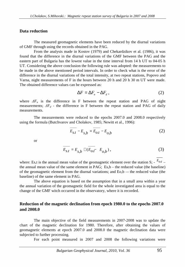
Data reduction
The measured geomagnetic elements have been reduced by the diurnal variations of GMF through using the records obtained in the PAG.
From the analysis made in Kostov (1979) and Chekardzikov et al. (1986), it was found that the difference in the diurnal variations of the GMF between the PAG and the eastern part of Bulgaria has the lowest value in the time interval from 14 h UT to 04-05 h UT. Considering the above conclusion the following rule was adopted: the measurements to be made in the above mentioned period intervals. In order to check what is the error of the difference in the diurnal variations of the total intensity, at two repeat stations, Popovo and Varna, night measurements of F in the hours between 20 h and 20 h 30 m UT were made. The obtained difference values can be expressed as:
n dF F F∆ = ∆ − ∆ , (2)
where ∆Fn is the difference in F between the repeat station and PAG of night measurements; ∆Fd - the difference in F between the repeat station and PAG of daily measurements.
The measurements were reduced to the epochs 2007.0 and 2008.0 respectively using the formula (Butchvarov and Cholakov, 1985; Newitt et al., 1996):
. ., ,E E E Es t o ts b o b− = − (2)
or
( ). ., ,E E E Es t o ts b o b= + − , (3)
where: Es,t is the annual mean value of the geomagnetic element over the station S; - .Eo t – the annual mean value of the same element in PAG; Es,b – the reduced value (the baseline) of the geomagnetic element from the diurnal variations; and Eo,b –- the reduced value (the baseline) of the same element in PAG.
The above equation is based on the assumption that in a small area within a year the annual variation of the geomagnetic field for the whole investigated area is equal to the change of the GMF witch occurred in the observatory, where it is recorded.
Reduction of the magnetic declination from epoch 1980.0 to the epochs 2007.0 and 2008.0
The main objective of the field measurements in 2007-2008 was to update the chart of the magnetic declination for 1980. Therefore, after obtaining the values of geomagnetic elements at epoch 2007.0 and 2008.0 the magnetic declination data were subjected to further processing.
For each point measured in 2007 and 2008 the following variations were

I.Cholakov, S.Mihovski.: Magnetic repeat station survey of Bulgaria in 2007 and 2008
96 Bulgarian Geophysical Journal, 2010, Vol. 36
determined:
80 07 1980.0 2007.0D D Dδ = −− (4)
and
80 08 1980.0 2008.0D D Dδ = −− (5)
The obtained values were marked on a map at scale M 1:200 000 and by using a linear interpolation method an isopor chart of δD80-07 and δD80-08 was drawn (Fig. 6).
Fig. 6 An isopor chart of δD80-07 and δD80-08.
On the same map all points measured easterly of the meridian λ = 25.5° in 1979 and reduced to the epoch 1980.0 were plotted. Then the difference δD80-07;08 for each point was calculated to the nearest 0.1'. Based on the reduced data models (charts) of the magnetic declination for the respective areas and epochs were drawn (Fig. 7):

I.Cholakov, S.Mihovski.: Magnetic repeat station survey of Bulgaria in 2007 and 2008
Bulgarian Geophysical Journal, 2010, Vol. 36 97
Fig. 7 Models of the geomagnetic declination for the epochs 2007.0 and 2008.0 .
Conclusion
By using the measurement results of the repeat stations and the first class stations for updating maps of the geomagnetic elements it saves a lot of money and time needed for the elaboration of a new general geomagnetic survey. In spite of the well-chosen time for the field measurements in order to completely eliminate the error from the difference in the diurnal variations between the measured point and the PAG, it is advisable to use portable variation station during the field measurements.

I.Cholakov, S.Mihovski.: Magnetic repeat station survey of Bulgaria in 2007 and 2008
98 Bulgarian Geophysical Journal, 2010, Vol. 36
Acknowledgments. The authors thank to eng. Savka Geshanova for her help in processing of the observation material.
References
Butchvarov, I., Cholakov, I. 1985. Reducing the absolute measurements of the components of Earth’s magnetic field to a common epoch using a basic point and field magnetic variation station, BAS, BGJ, Vol. ХI, No 1, Sofia.
Chekurdjikov, L., Cholakov, I., Kostov, K., Butchvarov, I. (1986): Comparison of the Diurnal Geomagnetic Variation in a Few Points on the Territory of Bulgaria, BGJ, Vol. XII, No 1, Sofia.
Cholakov, I. (1989): Improvement of the Geomagnetic Measurements Methods and Their Application on the General Geomagnetic Survey of Bulgaria - Epoch 1980.0. Dissertation, Geoph. Inst., Sofia.
Instruction for creation and maintenance of the state geodetic network of the Republic of Bulgaria, 1984, Sofia, Military Topographic Service
Korte. M., M. Fredow,(2001): Magnetic repeat station survey of Germany 1999/2000. Scientific Technical Report, STR01/04.
Kostov, K.(1979): Application of field variation station in the processing of magnetic measurements of the general geomagnetic survey of Bulgaria in the period 1978-1980, BAS, BGJ, Vol. V, No 4, Sofia.
Minchev, M. (1979): Analysis of azimuth measurements with gyrotheodolite, Geodesy, cartography and land regulation, X1X, 6
Minchev, M.(1981):Orientation of the Magnetic Measurements in Bulgaria. BGJ, Vol.VII, No 1, Sofia (in Russ.)
Newitt. L. R., Barton. C. E., Bitterli. J. (1996): Guide for magnetic repeat station surveys, International Assossiation of Geomagnetism and Aeronomy, Boulder, USA.
Zidarov, D., Kostov K., (1967): Secular changes in Earth’s magnetic field in Bulgaria in the period 1955-1964, Bulletin of Geoph. Inst. Vol XLG, Sofia
Магнитни измервания в България през 2007 и 2008 година
Ил. Чолаков, Ст. Миховски
Резюме: През летните месеци на 2007 и 2008 г. в Източна България са измерени 7 секуларни и 7 първокласни точки (станции). Наблюдавани са магнитната деклинация и инклинация с DI-flux (theodolite Zeiss 020B and Mag 01 H), а тоталният интензитет – с протонен магнитометър PMP-5A. Определянето на географските азимути е извършено с GPS. Наблюденията са редуцирани от денонощните вариации на геомагнитното поле по записите на геомагнитна обсерватория Панагюрище. Резултатите са приведени в епоха 2007.0 и 2008.0. За същите епохи са изработени карти на геомагнитната деклинация, като са използвани и точките от геомагнитната снимка 1980.