Embed Size (px)
Citation preview

I. Geological Formation of Oceanic Islands
Start March 11, 2013

I. Geological Formation of Oceanic Islands
A. What is an oceanic island?

Oceanic Island:
• No direct, terrestrial connection to continent (now or in the past);
• Usually separated from continent by deep ocean.
• Usually formed by volcanic activity;

I. Geological Formation of Oceanic Islands
A. What is an oceanic island? B. Lithosphere and Plate Tectonics

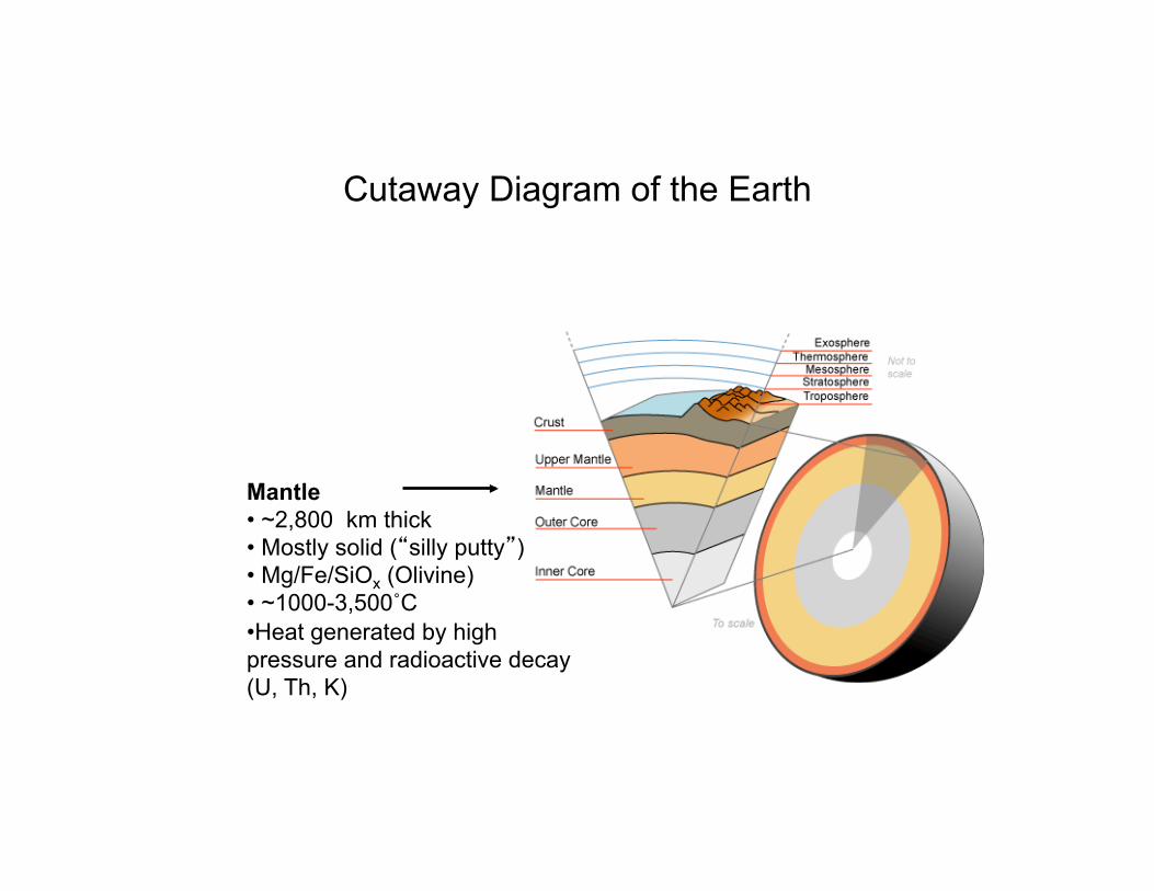
Cutaway Diagram of the Earth

Cutaway Diagram of the Earth
Inner Core • Radius ~1255 km • Solid Iron • ~ 4100˚C • Rotates W to E

Cutaway Diagram of the Earth
Outer Core • ~ 2,220 km thick • Liquid Iron-Nickel • ~ 4100˚C • Rotates E to W • Rotation generates earth’s magnetic field
Cutaway Diagram of the Earth
Mantle • ~2,800 km thick • Mostly solid (“silly putty”) • Mg/Fe/SiOx (Olivine) • ~1000-3,500˚C • Heat generated by high pressure and radioactive decay (U, Th, K)

Cutaway Diagram of the Earth
Upper Mantle Outer Mantle • ~ 30 to 70 km deep • Solid rock Asthenosphere* • ~70 to 300 km deep • soft - flows slowly • Outer mantle and crust “float” on asthenosphere
*Asthenosphere: From the Greek, asthenes = weak

Cutaway Diagram of the Earth
Crust • ~ 5-50 km thick • Solid, brittle rock

Two Types of Crust: • Continental crust
• Oceanic crust
Continental crust Oceanic crust Ocean

Continental Crust: • Forms the continents
• 20 - 70 km thick (average ~ 30 km)
• Granite (Al / SiOx) = metamorphic rock
• Relatively low density (~2.7 g/cc) = buoyant
• Surface averages ~ 125 m above sea level
• Old (up to 3.8 billion years old)
• Covers ~ 35% of earth’s surface
Continental crust Oceanic crust Ocean

Oceanic Crust: • Forms the deep sea floor
• 5 - 10 km thick (average ~ 7 km)
• Basalt (Fe / Mg / Al / Na / Ca / SiOx) = igneous rock
• Relatively dense (~ 3 g/cc) = negatively buoyant
• Surface averages ~ 4 km below sea level
• Young ( ≤ 160 - 190 million years old)
• Covers ~ 65% of earth’s surface
Continental crust Oceanic crust Ocean

• 70-250 km thick
• Thicker under continents
• Thinner under oceans
• Broken into many plates
• Lithospheric plates “float” on soft asthenosphere*
*Asthenosphere: From the Greek, asthenes = weak
Lithosphere = Crust + Solid Outer Mantle (from Greek: Lithos = rocky)


Tectonic Plates of the World
Source: Wikipedia http://en.wikipedia.org/wiki/Plate_tectonics

Continental Drift:
Continents have moved over the earth’s
surface during geological time.
• First proposed by German astronomer / meteorologist Alfred Wegener circa 1910-12. • Highly controversial; ridiculed, esp. in U.S. • Finally accepted by mainstream geology in 1960s.
Alfred Wegener 1880-1930
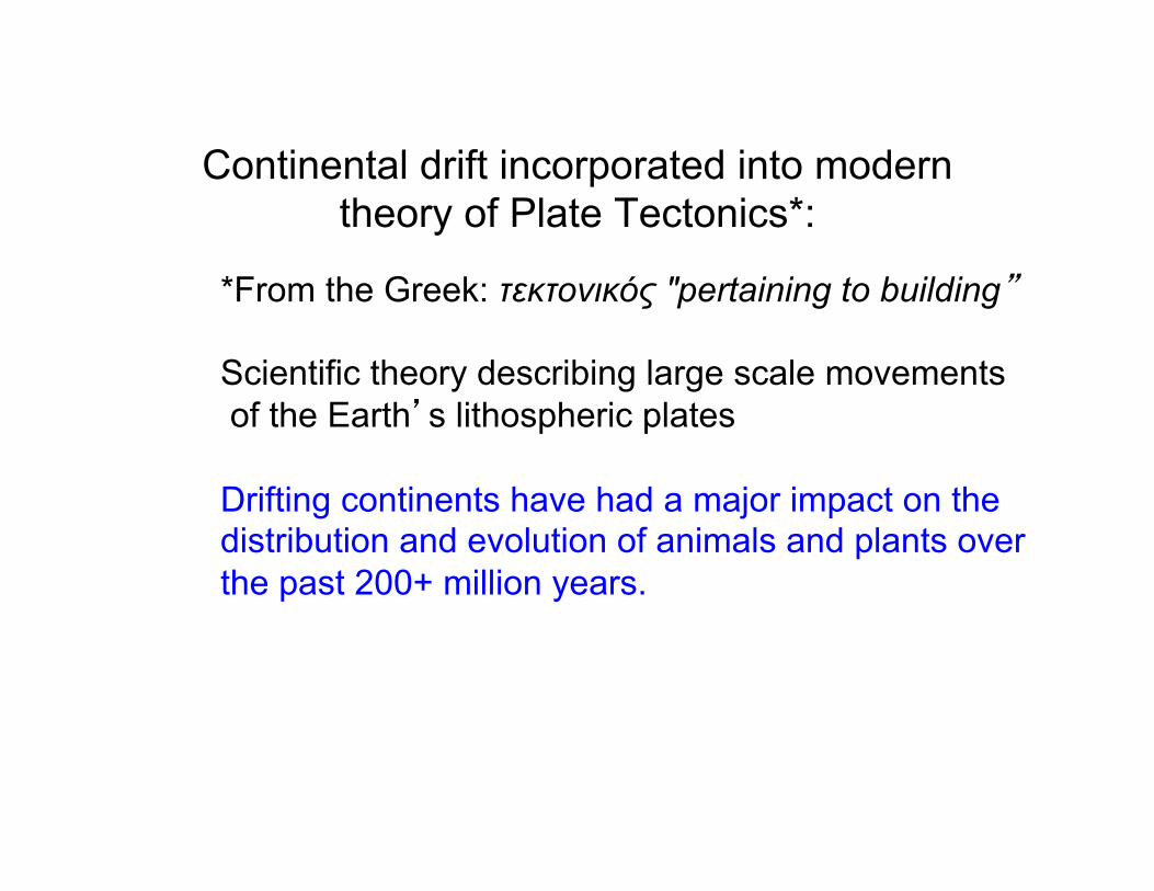
Continental drift incorporated into modern theory of Plate Tectonics*:
*From the Greek: τεκτονικός "pertaining to building” Scientific theory describing large scale movements of the Earth’s lithospheric plates Drifting continents have had a major impact on the distribution and evolution of animals and plants over the past 200+ million years.

Plate Tectonics and Oceanic Island Formation
(Highly simplified!)

Convection Currents in Mantle Bring Molten Rock (Magma) Toward Lithosphere.
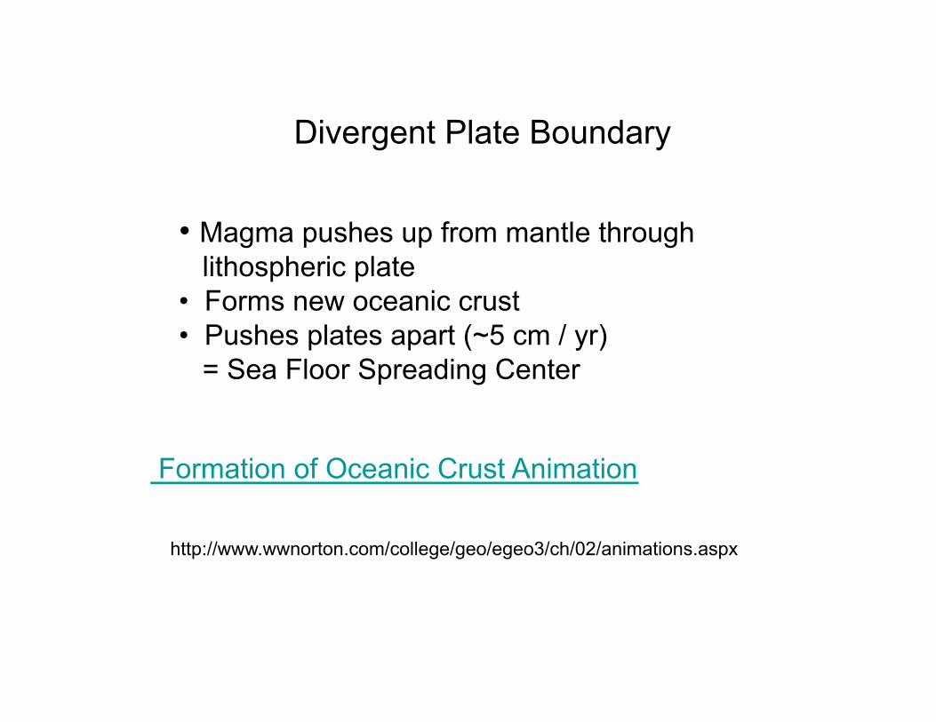
Divergent Plate Boundary
• Magma pushes up from mantle through lithospheric plate • Forms new oceanic crust • Pushes plates apart (~5 cm / yr) = Sea Floor Spreading Center
Formation of Oceanic Crust Animation
http://www.wwnorton.com/college/geo/egeo3/ch/02/animations.aspx

Mid-ocean ridge system develops where sea-floor spreading occurs.

Volcanic activity at mid-ocean ridge can form ocean islands (e.g., Iceland).

Movement of lithospheric plate that includes continental crust results in continental drift.
Click Here to Play Seafloor Spreading Animation
http://www.wwnorton.com/college/geo/egeo3/ch/02/animations.aspx
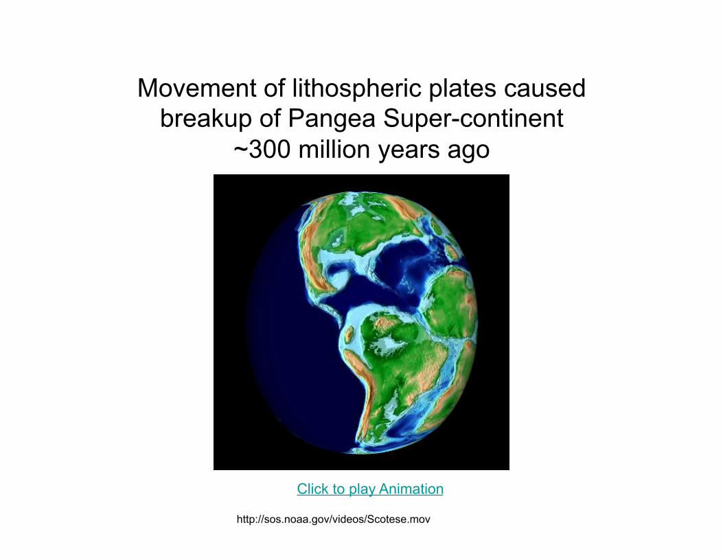
Movement of lithospheric plates caused breakup of Pangea Super-continent
~300 million years ago
http://sos.noaa.gov/videos/Scotese.mov
Click to play Animation

Convergent Plate Boundary
Convergence of two oceanic plates:
Denser plate sinks under lighter plate
= subduction zone.
Source: Wikipedia http://en.wikipedia.org/wiki/Plate_tectonics

Click Here to Play Subduction Animation
http://www.wwnorton.com/college/geo/egeo3/ch/02/animations.aspx

Convergence of Crustal Plates with Subduction zone results in earthquake and volcanic
activity (e.g., Pacific Rim of Fire).
Source: Wikipedia http://en.wikipedia.org/wiki/Plate_tectonics

Volcanic Activity at Tectonic Plate Boundaries
Source: USGS http://pubs.usgs.gov/gip/hawaii/page10.html

Volcanic activity at subduction zone can form oceanic islands: Aleutian Arc formed where Pacific Plate is sliding under N. American Plate
Sources: http://www.borough.kenai.ak.us/emergency/Volcano/active.gif http://www.nationalatlas.gov/articles/geology/features/aleutians.html

The Lesser Antilles (Eastern Caribbean) formed where the Caribbean Plate is sliding under the
North American Plate
http://www.caribbeanvolcanoes.com
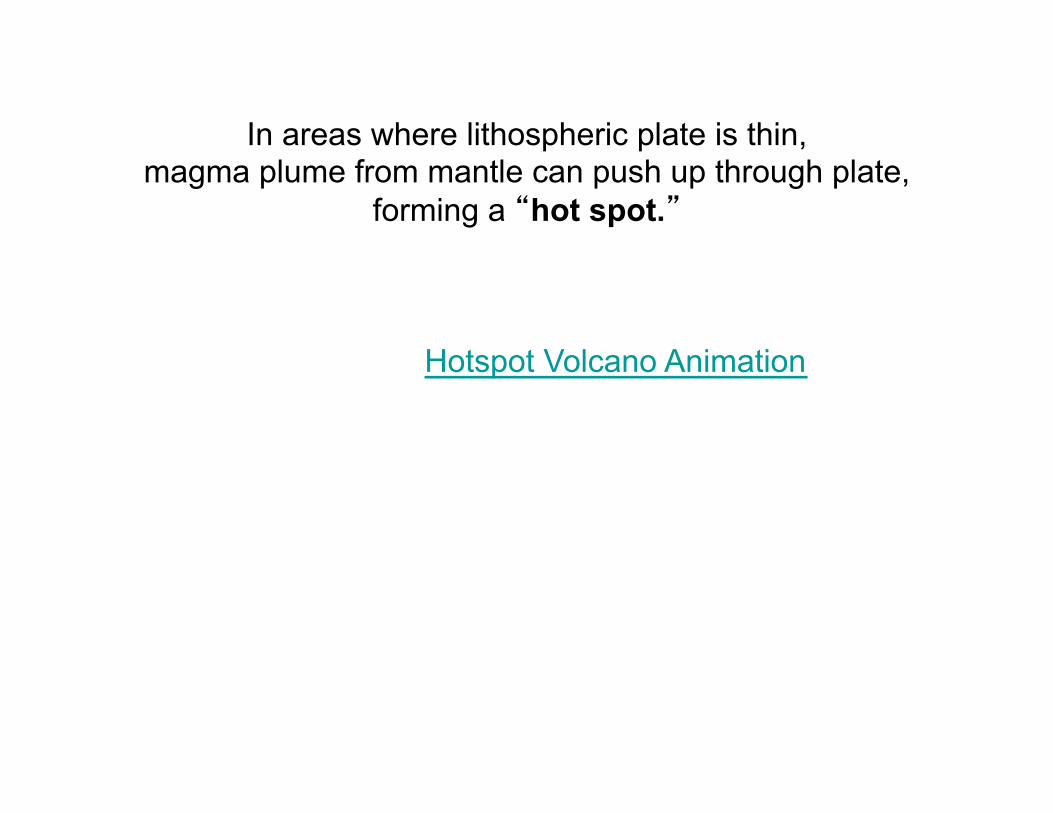
In areas where lithospheric plate is thin, magma plume from mantle can push up through plate,
forming a “hot spot.”
Hotspot Volcano Animation

Map of hot spots
http://www.math.montana.edu/~nmp/materials/ess/geosphere/advanced/activities/hotspots/index.html
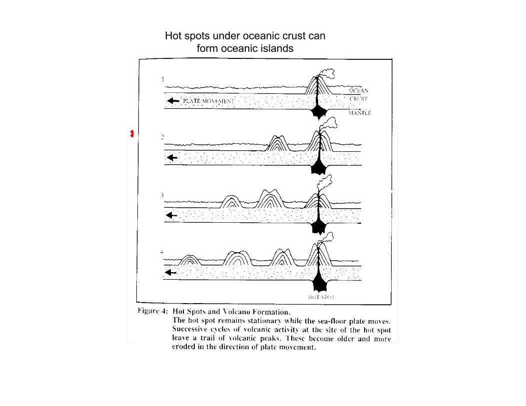
Hot spots under oceanic crust can form oceanic islands
The linked image cannot be displayed. The file may have been moved, renamed, or deleted. Verify that the link points to the correct file and location.

Review
Most oceanic islands formed by volcanic activity:
1. along mid-ocean ridge
2. along subduction zone at convergent boundary of two crustal plates
3. at “hot spot” in middle of crustal plate

• Eventually, as volcanic island erodes and aging oceanic crust becomes more dense, volcanic cone submerges to form undersea mountain = seamount (rounded top) or guyot (flat top);
• Oceanic islands estimated to last only 5-10 million years.

I. Geological Formation of Oceanic Islands
A. What is an oceanic island? B. Lithosphere and Plate Tectonics C. Formation of the Hawaiian Island Chain

Hawaiian Islands
Source: USGS http://pubs.usgs.gov/gip/hawaii/page05.html
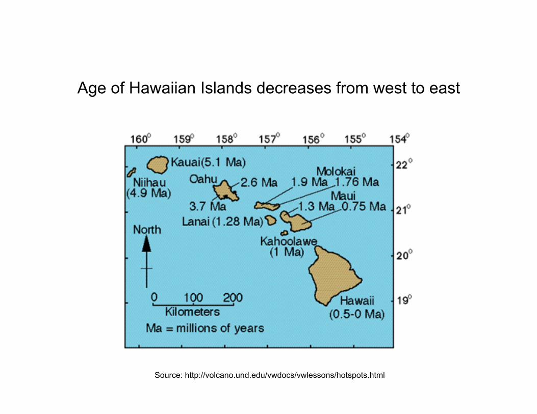
Age of Hawaiian Islands decreases from west to east
Source: http://volcano.und.edu/vwdocs/vwlessons/hotspots.html

Hawaiian islands: Volcanoes formed as Pacific Plate moved northwest over hot spot.
Source: USGS http://pubs.usgs.gov/gip/hawaii/page12.html

Conventional plate tectonic theory assumes that lithospheric plates move, while hotspots are stationary; as plate moves over hotspot, volcano goes inactive.
http://geology.com/usgs/hawaiian-hot-spot/

Hawaiian Island - Emperor Seamount Chain
Emperor Seamount chain extends north from Hawaiian islands
Sharp, W.D. and D.A. Clague (2006) Science Vol. 313 no. 5791 pp. 1281-1284

Hawaiian Island -Emperor Seamount Chain
Emperor Seamount chain extends north from Hawaiian islands

Hawaiian Island-Emperor Seamount Bend has been attributed to a change in the direction of plate movement from north to northwest about 47-50 million years ago.

However, recent evidence suggests that hotspots can move. Emperor Seamount chain may have formed by hotspot that moved south (~ 40 mm/yr) as Pacific plate moved northwest.
Refs: Tarduno, J.A. et al., Science 22 August 2003: vol. 301 no. 5636 1064-1069 Tarduno, J.A. et al., Science 3 April 2009: vol. 324 no. 5923 pp. 50-53

About 47-50 million years ago, hot spot stopped migrating. Hawaiian Island chain formed once hotspot became stationary.
Refs: Tarduno, J.A. et al., Science 22 August 2003: vol. 301 no. 5636 1064-1069 Tarduno, J.A. et al., Science 3 April 2009: vol. 324 no. 5923 pp. 50-53

I. Geological Formation of Oceanic Islands
A. What is an oceanic island? B. Lithosphere and Plate Tectonics C. Formation of the Hawaiian Island Chain D. Formation of Bermuda

Geological Formation of Bermuda (1)
• 110 Million Years Ago (MYA): Volcanoes along Mid-Atlantic Ridge;
• Seafloor spreading moved volcanic cones NW at 2 cm/year;
• 30-50 MYA: Second phase of volcanic activity – probably not due to hotspot -three volcanic cones formed Bermuda Rise.
• Bermuda Rise continued to migrate NW;
• One volcanic cone emerged above sea level (= 1,000 meter high mountain?);

Geological Formation of Bermuda (2)
• 30 MY to present: Bermuda Rise continued moving to present location, 32° 10-30’N
~ 1000 km east-southeast of Cape Hatteras, NC ~ 1000 km southeast of Connecticut coast
• Bermuda Rise comprises three seamounts (relicts of volcanic cones):
Argus Bank Challenger Bank Bermuda Seamount (= Bermuda Pedestal)

Bermuda Sea Mount
San Salvador Bahama Banks
http
://to
pex.
ucsd
.edu
/mar
ine_
topo
/gif_
topo
_tra
ck/to
po8.
gif

Bermuda Rise
http://hoopermuseum.earthsci.carleton.ca/Bermuda/Geology/BERM5-1A.HTML

Geological Formation of Bermuda (3)
• Top of Bermuda Seamount exposed (eroded) and submerged several times with rising and falling sea levels;
• Seamount capped with limestone precipitated from seawater (oolitic* limestone) and laid down by corals and other marine organisms (biogenic limestone) while submerged.
*Oolitic: “Egg-stone”- formed from ooids (spherical grains with concentric layers; 0.25-2mm in diameter)
Ooids

Satellite Image of Bermuda
Source: http://earthobservatory.nasa.gov/images/imagerecords/7000/7397/bermuda_l7_1999226_lrg.jpg

Geological Formation of Bermuda (4)
• Coral reefs form rim around the Bermuda Platform.
• Islands of Bermuda are primarily “fossilized” sand dunes (aeolian* limestone) rising above limestone platform.
*Aeolian: Wind-blown (From Aeolus, the Greek God of Wind) Reference: The Geology of Bermuda (Bermuda Zoological Society, GEO-01,
2006) http://www.gov.bm/portal/server.pt/gateway/PTARGS_0_2_11280_207_227543_43/http%3B/ptpublisher.gov.bm%3B7087/publishedcontent/publish/new_min_of_environment/environmental_protection___project_nature_fact_sheets/the_geology_of_bermuda_0.pdf

I. Geological Formation of Oceanic Islands
A. What is an oceanic island? B. Lithosphere and Plate Tectonics C. Formation of the Hawaiian Island Chain D. Formation of Bermuda E. Formation of the Bahamas
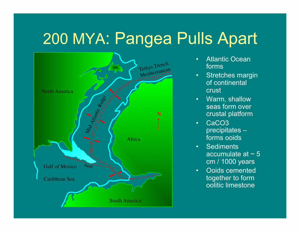
200 MYA: Pangea Pulls Apart • Atlantic Ocean
forms • Stretches margin
of continental crust
• Warm, shallow seas form over crustal platform
• CaCO3 precipitates – forms ooids
• Sediments accumulate at ~ 5 cm / 1000 years
• Ooids cemented together to form oolitic limestone
Gulf of Mexico Caribbean Sea
South America
Africa
Tethys Trench
Mediterranean
N
fault
North America

Bahamas Built on Limestone Platform
• Formed by precipitation of CaCO3 in warm, shallow seas over 120 MY • Ooids cemented together to form oolitic limestone • Continental crust subsided under weight of limestone • Cores to 6,100 meters (20,000 feet) are surface-cemented limestone!! • Crust NOT found in any cores to date
Period Age present
35 my 50 my
65 my
100 my
140 my
200 my
recent
Eocene Palaeocene Late Cretaceous
Early Cretaceous
Jurassic
Florida Straits Of
Florida
Cay Sal Santeren
Channel Andros
Tongue of the Ocean
Eleuthera
Atlantic Ocean
5000ft=1525m
10000ft=3050m
15000ft=4575m
20000ft=6100m
Pre- Jurassic Crust?

Bahamian Banks = Tops of Limestone Platform
• Channels cut through limestone platform (erosion; geological faults); • Deepest channel = Tongue of the Ocean (~ 3000 m deep) • Coral reefs formed around edges and on tops of platform • Inner lagoons accumulated sediments that formed banks and islands
Period Age present
35 my 50 my
65 my
100 my
140 my
200 my
recent
Eocene Palaeocene Late Cretaceous
Early Cretaceous
Jurassic
Florida Straits Of
Florida
Cay Sal Santeren
Channel Andros
Tongue of the Ocean
Eleuthera
Atlantic Ocean
5000ft=1525m
10000ft=3050m
15000ft=4575m
20000ft=6100m
Pre- Jurassic Crust?

Bahamas Banks

Bucket Theory for Formation of Bahamian Bank

LandSat Image of San Salvador Island
• San Salvador sits on isolated portion of Bahamas Platform
• Near-vertical wall of the platform drops off to depths of 2000-3000 meters (west) to 4000 meters (east).

San Salvador Bank is rimmed by coral reef = “bucket” walls Much of San Salvador’s terrestrial rock is “fossilized” sand dunes (aeolian* limestone) rising above limestone platform; Some rock is ancient coral reef formed when sea level was higher.
San Salvador Island San Salvador Bank

Bermuda and San Salvador: Similar processes at ocean surface
Very different geological origins
• Bermuda • San Salvador

Is San Salvador an oceanic island?
• No evidence of direct, terrestrial connection to continent (now or in the past); • Separated from continent by deep ocean.

End of Slide Show March 11, 2013
Next Week: Island Biogeography