Embed Size (px)
Citation preview
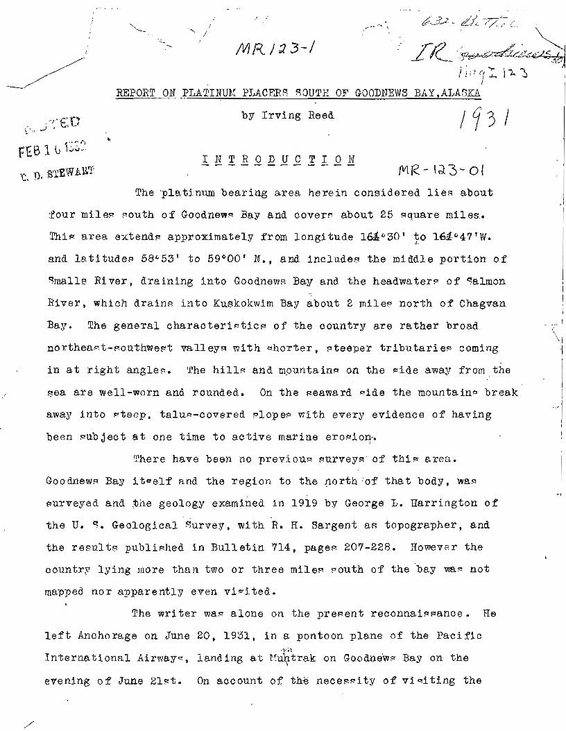
by I r v i n g Reed
The 'platinum bearing a r e a he re in considered l i e 3 about I :Your miles 7011th o f good new^ Bay and cover? about 25 aquare miles. I
T h i ~ a r e a extendn approximately from longi tude 16g030 ' t o -. 16d.047 'W.
and l a t i t u d e s 58=53' t o 59400' N., and include8 the middle p o r t i o n o f I Smalls River , dra in ing i n t o Goodnew2 Bay ana t h e headwatera of salmon I
I
River , which drain^ i n t o Ku~kokwim Bay about 2 mile9 nor th o f Chagvan I
> - 1 Bag. The genera l c h a r a c t e r i ~ t i c ~ o f t h e country a re r a t h e r broad I 1
nor thea- t -eouthwe~t ml leyc! wi th qhor ter , qteeper t r i b u t a r i e~ coming -1 I
i n a t r i g h t angle^. The h i l l - and mountain- on t h e nide awa:? from the I I
~ e a a r e well-worn and rounded. On t h e seaward qide the mountain9 break 1 - 1
away i n t o n teep , t a l u ~ - c o v e r e d ?lope@ wi th every eviaence of having I
been qub j e c t a t one time t o a c t i v e marine erogion. I
There have been no previoua surveyg'of t h i e a rea .
good new^ Bay i t - e l f and the region t o the nor th of t h a t body, wap - 1
~ u r v e y e d and t h e geology examined i n 1919 by George 5 . Rarrifigton o f , I
t he U. q. Geological gurvey, with R. R. Sargent as topographer, and I
the r e ~ u l t s publiwhea i n B u l l e t i n 714, pages 207-228. Rowevsr the I
I
I
c o u n t r ~ ly ing more than two or t h r e e mile3 aouth of the bay map n o t
mapped nor apparent ly even v i - i t ed . *
The w r i t e r w a s a lone on the preaent recon,n,ais~ance. He
l e f t Anchorage on June 20, 1931, i n a, pontoon plane o f the P a c i f i c . r i
I n t e r n a t i o n a l Airwag-, landing a t I q t r a k on good new^ Bay on the
evening o f June 219t. On account of the necess i ty o f v i s i t i n g the
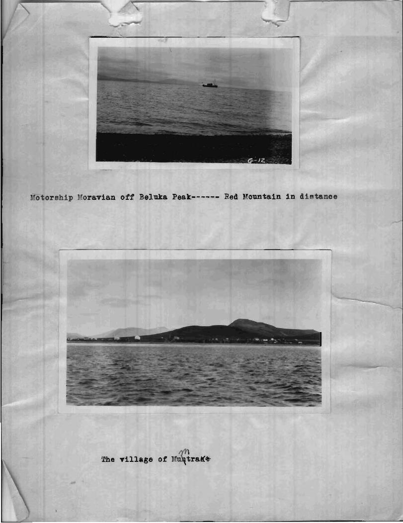
rship I an off Beluka Peak------ Red FTountain i n d i ~ t a n c e
The t i l l a g e o f ItTn$traI&
- gold p l a c e r - of t h e up?er Goodnews z i v e r , and becau-e t h e "oravian
!'is-ian b o a t , the s o l e rneane of t r a n ~ p o r t a t i o n t o and Bethe l ,
Wac due t o s r r i v e a t !&?trek on t h e one t r i p of t h e y e a r on Ju ly 4 t h ,
only u n t i l June 28 th cou ld be Ppent at t h e pla t inum p lece r - . ~e
p r e - e n t nap mede b.- mean- of cornpa-.., c l i nome te r , pedometer and
anero id . I t i- t h e r e f o r e necee -a r i l y q u i t e crude. Eowever, it i~
coord ina ted i n v i t h t h e p r e l i z i n a r g nap of t h e F. @. Geological "urvep
l y i n g t o t h e no r th and m i l l ce rve f o r r e c o n n a i ~ q a n c e purpocee u n t i l
more a c c u r a t e nape CF-n be made by t h a t o r g ~ n i z a t i o n . Yke miner^ st ,r '7. '
t k e pla t inum p l a c e r - and b o t h mhi t e - an6 n a t i v e c e t . $ t r ak , d i d t h e i r
u t m o ~ t t o he lp b~ ever:- r?eanc t h e ? could. Vithout t k i s a e e i s t a n c e
. r e v l i t t l e conld have been a c c o m p l i ~ h e d i n t h e ~ h o r t t h e avn, i lable .
G E 3 G ? * 4 F ' - I Y - - - - - - - - - DEAIIJkGE
The pla t inum bea r ing a r e a i c d ra ined by t h e two r i v e r - ,
"mall- z i v e r end C a l ~ o n .siver. ' n a l l ~ S ive r r i c e - i n t h e comparatively
high nounta inc ~ o u t h and ~ o u t h e a - t o f Goodnew 3e7 i n tplo fork-, the
fo rk f l m i n g from t h e n o r t h e a c t f r m t b e ? i r e c t i o n of C r ~ l t e r E i l l and
Pyramid ?lountain apqear ing from a d i e t a n c e t o be auch t h e l a r g e r . d f t e r
t h e conf luence of t he two f o r k - , %all? F i v e r flont9 a T i t t l e -outh of
we-t t o 7,lcCann Creek where i t tu rn@ almont due n o r t h f o r aho-at t h r e e
x i l e e to it- conf luence p i t h Tundra Creek. I t t h ~ n tu rn - wect a g a i n ,
m e a ~ d e r i n g i n e -hallow f l o o d v a l l e y a c r o c n a eligktl:; r o l l i n g g r a v e l
p l a i n t o the pouthwe-t cornerof Goodnew- Ba:7. salmon River r i ~ e - i n a
-mall l a k e about 3/4 m i l e couth o f the middle par t i o n and 1 mile w e d
of tr:e conf luence o f t h e two fork- of " m a l l 9 Eiver . It. then flow- a
l i t t l e we-t o f mouth t o ahout 2 mile- no r th o f Chacvsn 3ap i t
e n t e r - Xu-kokmir: Bey. The l a r g e a t t r i b u t a r y o f e m ~ l l - E iver i c i'undra
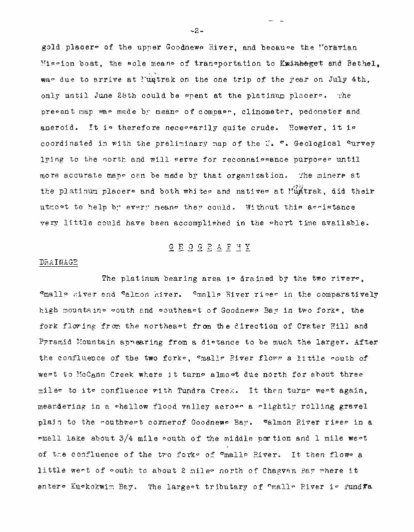
nu,a 1'10m~,,, rrom Platinum Cr--- eek
omtain from left limi Boulder C r e
Creek, a r i n i n g i n the g r a v e l p l a i n which bordern Goodnew- Bay on it-
pouth s i d e , and rece iv ing 'the drainage from the nor the r ly face o f
the h i l l - t o the ~ o u t h . The l a r g e s t t r i b u t a r y o f salmon ~ i v e r i 8
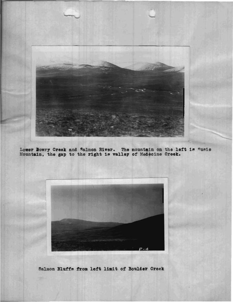
Idedicine Creek, r i ~ i n g i n the hill^ eant of Susie Mountain and flowing , - I
~ o u t h l . q e ~ t t o join Salmon Biver j u s t ~ o u t h o f salmon Bluff?.
RELIEF I
I
The r e l i e f i n t h e a r e a is dominated by two mountains, Red
Nountain and S u ~ i e Ilountain, both r i s i n g t o about 2,000 f e e t i n eleva-
t ion . On i t v m e ~ t e r n o r ~ e a w a r d nide, Red Mountain break? off ab rup t ly
i n a nteep t a l u - lope t o a f l a t marshy coa- t a l p l a i n about 3/4 mi le
wide and continuoun with the lowland p l a i n .rurrounding Goodnewa Bay.
The landward mide of Bed I'lountain and o the r mouritain~ and h i l l - i n t h e
a r e a , show well-worn and rounded out l inen. The main ~ t r e a m ~ f l o w i n
r a t h e r wide, mature v a l l e y s wi th very l i t t l e gradient .
GLACIATION
A t preqent t h e r e a r e no g l a c i e r a i n the area nor vli thin
t h i g par t o f Alaska 80 far an known. However, i n agea pac t a g l a c i e r
occupied a l l the upT3er v a l l e y of mall^ River. Bigh gravel bank? o f
ou-ha-h m a t e r i a l l i e a l l along the l e f t l i m i t o f the r i v e r below
IficC!~~n:i Creek and many m a l l lake- and potholen a r e high up on the
h i l l on the r i g h t l i m i t o p p o ~ i t e and above EJcCann Creek. What appears
from a d5atsnce t o be an old moraine l iec! jugt below the confluence
of the two forkn. qalmon River han n o t been g l a c i a t e d F O f a r ac
could b e t o l d . However it i- thought tha t , f rom t h e appearance of
o l d high channel9 leading mouth f r o m "malls River, p a r t o f the d ig-
charge water from the qrnallg Biver g l a c i e r flowed down salmon River.
E C O R O P 4 P C '3 .J - - - - - - - - - v
POPULATI 13N
The populat ion of the whole Goodnew3 Hay region nouth of
the A r o l i c River t o Ghagvan Bag c onsi of 1 7 whi te - ana approximately
5 0 ~ n a t i v e g . Of the white? 13 were working i n the p la t inumplace r - .
TRAVEL PiND TEAN9PORTATION
Airplane9 (with pontoons i n gummer and ~ k i i - i n win te r )
make regu la r m a i l t r i p 3 f r m Anchorage every week t o Bethex on the.
Eu~Bokmfim Hiver a l t e m a t e l y by may o f Hunhagak an& Tacotna. Arrangement wade f l
can be,with an a i r p l a n e e ompang f o r s t o ~ p i n g a t IIufltrak, a ~ r n a l l
n a t i g e villege w i t h 2 Frtore~,on the no r th ~ h o r e o f Goodnew~ Bag. A
mall ocean-going ~ t e a m e r makea 2 t r i p 9 every eummer from 4 e a t t l e t o * g,[!,,.,,2~f i t i 5
Bethel wi th f r e i g h t aria paPsengera. a t r a v e l l e r may g o down the
Tanana and Yukon f ron Nenana t o R u ~ s i a n htIfFrnion, t h e r e take pas-age on
the mail launch across the Yukon-Ku-kokwim portage and down the
Kuqkokwim t o Bethel. F rom Bethel , u n l e ~ ~ paPrage on gome p r i v a t e mil-
ing boat o f the n a t i v e s can be secured, the only meann of t ran-por ta-
t i o n i a the Moravian miqpion diegel-motor wchooner, Moravian, which
genera l ly make? a t r i p t o Goodnewr Bay once each mmner. In win te r ,
beside^ a i rp lane9 , the only means of t r a v e l i- by d~gkearn. There a r e *-*-*-.2'
no accomodation~ f o r t r a v e l l e r - a t E'Id+trak. &.rrangernentm have t o be
made with the n ine re o r na t ive9 f o r stopping i n p r i v a t e homes. /P J
7,foat o f the f r e i g h t i- brought from Bethel t o 7~Tuptrak "Jrfi a s .
by theAloravian . Be-ider t h i q many o f t h e miner- and native^ t r a n s -
p o r t i n good weather, e m s 1 1 amount- of f r e i g h t from Bethel i n
Columbia Hiver f i ~ h i n e boat-. Small l o t c o f f r e i g h t a r e a l n o brought -pA
t o M q t r a k by dogteam. F re igh t , w i th the exception hf p e r i - l l a b l e ~
i n ~umner , i n tran-portet! from Kuntrak t o t h e platinum p lace r s
a l t o g e t h e r by dogteam.
The cl imate o f the platinwn a rea i - raw and foggy i n
summer, though the a c t u a l r a i n - f a l l i n n o t great . Hm ever , d r iv ing /J
m i w t - and l i g h t showers a r e o f f requent occyence . Yven when weather (' 'p- condit ion9 are exce l l en t a t E.~u#trak, m i s t an& f o g o b ~ o u r e Red E'ountain.
The m i n t e r a G k i a r e d wi th I n t e r i o r Ale-ka, a r e f a i r l y mild. They \I
a l t e r n a t e between c o l d weather mi th mow, and warm period s when t h e
enow p a r t i a l l y o r e n t i r e l y r n e l t ~ . The i c e i n Gooilnew- Bay i~ extremely
u n r e l i a b l e , being l i a b l e t o be broken up a t any t ime by the t i d e and.
t o move up and domn i n t h e bay o r ou t t o Pea. he vea i c e r$arely
freeze^! ~ o l i d b u t movev up and down the coagt wi th the t i d e . Righ wind9
pirevail a t a l l timee and a t a l l eeagonr of t h e year, A l l of t h e above
condition9 make dogteaming ae ry hazardoufi and add g r e a t l y t o the d i f f i -
c u l t i e - o f t h e miner^ and p r o ~ - ~ j e c t o r ~ .
A t h i n b lanket of g a s 9 and moF- e w e r 9 t h e country couth
of Goodnew~ Bay. One r n i ~ a e ~ the deep layere o f m e - and decaged
vegeta t ion of the tunarap f u r t h e r north. N o t y p i c a l tundra wan peen.
Much bare rock and e l i d e a r e expo~ed on t h e mountain^. Emever good J
foot ing f o r man o r home9 seems t o p r e v a i l everywhere. There 1 4 no
ppruce o r cottonwood timber. On q m a l l ~ Eiaer above yundra Creek and
on salmon Hiver be lm Clara C ~ e e k i~ a narrovi d r i p of ~turmted .<--- .
willow- which.rnay t/ -. be ucedsa f t e r dryidp)l a s a poor s u b e t i t u t e f o r f ~ x e l . .- , - I
ANIE?AL LIE'E
Ptarmigan i n q u i t e c onqid e r a b l e nmbe rfi and a few hare9
a r e the only re- ident e d i b l e w i l d l i f e i n the region. Innumerable
duck-, geeae, gul l sand ~ h a r eb i rde n e ~ t i n the P m e r around. Goodnew
Bay o r pa9n through on t h e i r annual migration^. A c o n ~ t a n t q p p l y o f
f r e ~ h meat may be bought from the Eskimo!- owning the man;T r e i n d e ~ r
herd= aihich leoam all over the Goodnews Bag region. T i t h e r salmon,
?melt o r h e r r i n g , can be ta.ken a t a l m w t any time o r -capon i n
-6-
Goodnewa Bay. The Rrzkimoq hunt both s e a l and walrup i n the winter on
I(uskok~?im Bay, genera l ly from t h e south s p i t . O f t he f u r bearer^,
red fox a r e the mort numeraua. Vlhite fox a r e occar ional ly caught. Parka
~ q u i r r e l s a re r e l a t i v e l y Pcarce. A few mink and o t t e r a re a l - o taken
during t h e peapone Mo~qui to9 and f l i e ~ , b e c a u ~ e o f the high p reva i l ing
winda, a r e almwt non-existent.
G.ENEk(;L OUTLI itJE AND C HARPIC TER OF R OCX4
I n the platinurn bearing a r e a of Goodn~wq Bay the igneoug
rock-, lflith t h e exception o f one amall a r e s , range from bacic t o
u l t r abao ic . The o r i g i n a l magrri-a Peema t o have been of the u l t r a
ba-ic type , and t h e d i f f e r e n c e i n t , y p e ~ of the i g n e o u ~ rock9 =eems t o
be due t o magHl-tic pegregat ion and d i f f e r e n t i a t ion. The varioua tppeq
Peem t o have a rough zonal arrangement around Red lIountain and a r e n o t
due t o ~ e p a r a t e intrusion^. The:? become aery f i n e l y c r y d a l l i n e t o
alrnoct porphyr i t i c near what i~ conclude8 t o have been the o r i g i n a l
contac t with the overlying ~e f i imen ta r i e - , The - m a l l a r ea of g r a n i t i c
rock a,t the head o f PTcCann Creek seemq t o have been i n the na tu re of
a g a l i c border zone along the a fc resa id contact . The small block o f
~redimentary bed^ a t the head of Salmon Riser i g a n i a l a n d , penaant o r
inc lue ion i n t h e bas ic magmlia. It i~ highly metomorpho~ed on the
edges where cleen a t t h e one expogure i n t h e bed o f Clara Creek. The
bed- t h e m ~ e l v e a a r e wea,thered on t h e anrface and - 8 covered with - o i l
t h a t i t i a very har6 t o l o o a t e a c t u a l con tac t s o r even out- crop^.
The v a l l e y o f qmallq River i s l covered by g l a c i a l outma-h m a t e r i a l ,
g ravel bank9 75 f e e t h igh r i c i n g along t h e l e f t l i m i t of t he r i v e r
below McCann Creek. The f la t9 facing Goodnew- Bay geem t o be corn-
poged e n t i r e l y o f llunc oncolidated d e p o o i t ~ o f a l l u v i a l ,
, - .' 1
-7-
g l a c i o - f l u v i a t i l e , and marine or igin." P a r t of t h e unconaolidated
deposi ta i n the bed of salmon River may be a l ~ o of g l a c i a l outwaah
or ig in . No age determination^ were made nor were any f o w i l - found i n
the qedimenbry bed-. The age o f the ~ed imenta ry b e i ? ~ hag been
a--urned t o be t h e Pame a9 ~ i m i l a r bed- n o r t h o f Goodnew9 Bag, which
were thought by Zarrington t o be rnenozoic. The igneoug rocks a r e
younger than t h e sedirnerntaries, as t h e former were intruded i n t o the
l a t t e r , and a r e pw nib lg l a t e rnepozoic o r ear ly cenozoic. 1n t he nhort ... +
t i n e a v a i l a b l e i t wag irnpm q ib le t o t r a c e out a l l t h e boundariec of
the d i f f e r e n t igneoua rock^. Whereunknown, ~ u c h bounaariep are l e f t
a- blank npsces on t h e map.
qTRUC TU RE
The Fame northea-terly-~onthwe~terly t rend o f the rockn., ap
noted by Earr ington nor th o f Goodnew9 Bag, a l - o p r e v z i l s south of the
bay. Rbth nor th and -011th of the bag the g e n e r a l d i r e c t i o n of' t h e
val leyn geeme t o be northeasterly-~outhwec?ter1~7. For i n ~ t a n c e , the
va l l ey o f Qalmon River and part9 of the v a l l e y o f Qrnall~ River l i e
about N.15°FI. Earr ington c o n ~ i d e r e d the s t r u c t u r e o f Goodnew- Bar t o
be ~ y n c l i n a l , with the weatern ax ia e x p o ~ e d a l o r g the bay and the
ea- tern ax in , po-8 ib ly , a t Cape Newenham. Afi~uming t h i s very
r e a ~ o n a b l e hypotheqks t o be c o r r e c t , the m e ~ t e r n axie of the above
-$ncline must be much complicated by f a u l t i n g and minor fo ld ing along
the above n o r t h e a ~ t e r l g d i r e c t i o n . P r e ~ e n t drainage l i n e - vlou18 be
determined by t h i c f a u l t i n g and minor fo ld ing , The ~ u g g e c t i o n i ~ !
h e r e b ~ made t h a t the-e tvo l % ~ t movementc! curred dnring and a f t e r the
i n t r u e i o n and. probably, i n p laceq , e x t r u ~ i o n o f t h e b a ~ i c igneou-
rockn. Thup the valley^ of "almon and smal ls River? would l i e i n
zone- o f rnoeement which occurred a f t e r t h e i n t r u s i o n o f t h e ba-ic
r o c k i n t o thB over ly ing ~ed i rnen ta r i ea .
'?%El IF4FJT YAW K E K S
The small block of seeimentary rocks a t t h e head of qalmon
River and on t h e l e f t l i m i t of Clara Creek c o n ~ t i t u t e J a9 ~a i ib before, f
an i - land , pendant or inc lue ion ~ e t t l e d i n t o the o r i g i n a l magma. I t
wa- only Reen i n p lace i n two oatcrop-, one on the l e f t l i m i t of Clara
Creek nea r the top of P~TcCann Greek d iv ide a t an e levat ion of 540 f e e t .
Rere t h e rock wac a l i g h t grey t o blui-h green q u a r t z i t e , eani ly m i g -
taken i n hana specinen9 f o r an igneou- rock. The o the r outcrop wa@ on
or very near the contac t uncovered by mining i n the bed o f Clara Creek
on Diwovery Claim. 9e re the rock wa- a late o r a r g i l l i t e a l t e r e d t o
a l i g h t grey s c h i ~ t . No outcrops were ceen on top of t h e h i l l on the
l e f t l i m i t of Clara Creek, ac. i t wan covered with d e t r i t u q , b u t
f l o a t wap found t h a t could have t r ave led only a few f e e t . Yhe d i p of
these bed9 could n o t be a ~ c e r t a i n e d and i f i t had been, i t v~ould no t
n e c e s ~ a r i l y have had aqy r e l a t i o n t o the d i p of the o r i g i n a l beds
i n p lace , -o would have been o f no vslue, The age o f theqe bed9 i n
undoubtedly the %same ap t h a t of t h e eetlimentarp beds nor th of
Goodnew- Bay which Harrington as~urned, t enga t ive ly , t o be me~ozoic .
IGNEOUe ROCXS
The g r e a t maj'ority o f igneous rockfi on He& Ifountain ana
s u ~ i e Mountain a r e h o l o c r y ~ t a l l i n e and u l t r a b a s i c i n c h a r a c t e r , con-
s i s t i n g o f duni te , pyroxeni te , horn l e n d i t e and p e r i d o t i t e , i n -ome R, places a l t e r e d t o perpentine. The nor th s lope o f Boulder R i l l on
the r i g h t l i m i t o f Boulder Creek cons iq tc of a medium baaic rock
corre-ponding t o a d i o r i t e . Rock of the game kind outcrop.. a t t h e
heaG and- on t h e l e f t l i m i t o f Clara Creek, though i t apyarent lg doe9
n o t cro-8 t h e creek. On t h e l e f t l i m i t of Platintun Breek from i ts
, ,
-9-
head t o below E'ox Creek, i g ano the r narrow s t r i p of the same d i o r i t i c
rock. This apparent ly ha^ no connection wi th t h e d i o r i t e on Boulder
Creek as no d i o r i t e i n found i n the bedrock of Dry o r e q u i r r e l creek^.
k t the heads of Clara Creek end Boulder Creek, i n the
bed o f " q u i r r e l Creek above t h e ben6, above t h e head of Dry Creek and a t
the bend of Fox Creek, i p a dark b a ~ i c rock cor re~pond ing t o a gabbro.
North of Contact Creek and the ~edi rnentary bedg, d i o r i t e , gabbro and
p e r i d o t i t e occur but t h e i r t r u e r e l a t i o n c h i p i s hard t o work out be-
cauqe the purface i e covered with d e t r i t u c and g l a c i a l outwaeh mater ia l .
On t he a i v i d e betvleen McCann and Clara Creek i- a emall a r e a of a c i d i c
rock-, e i t h e r a g r a n i t e ( g r a n i t i t e ) o r q u a r t z d i m i t e . 'I'hi- l a 4 t p
of rock may be a neparate i n t r u ~ t i o n , complementary d ike , o r , more
probably, a more a c i d i c p a r t o f a a a l i c zone.
The bas ic rockg a l l belong t o the same i n t r u e ion. Dif fer - X i
ence i n c mpo- i t ion i a due t o magmatic segregat ion and d i f f e r e n t i a t i o n .
On t h e gteep denuded seaward e ide of the pass at t h e head o f B r a t i n u
Creek, t h e r e i s no sharp dernarkation p o i n t b u t a gradat ion from
d i o r i t e t o t h e much darker u l t r a b a c i c rock^. T h i ~ same gradat ion e m
be eeen on t h e r i g h t l i m i t o f Boulder Creek where d i o r i t e changee t o
p e r i d o t i t e on the -011th and t o gabbro on the wept. The gabbro then i n
tu rn change- t o p e r i d o t i t e a t i l l f a r t h e r t o the w e ~ t . The theorp i-
advanced t h a t t h i c arrangement is zonal; t h a t , originally, the leg-
baqic rock-, i n some place9 even a c i d i c , l ay next t o t h e con tac t vlith
t h e ~edimentar iem; t h a t t h e rock- became more ba-ic t w a r a - t h e
i n t e r i o r of the l a c c o l i t h due t o magmatic d i f f e r e n t i a t i o n ; a l -o , t h a t
the u l t r a b a ~ i c rock9 thernvelve- have a more o r leg9 zonal arrangement
due t o magmatic segregat ion of t h e bagic iron-magnepeum mizzeral~
themwelven. The r e l a t i o n ~ h i p o f t h e i g n e o u ~ rocks o f Red and %pie
180unhing t o t h e 'rmesozoic b a ~ a l t i c i n t r u c r i o n ~ , f l o w s , and tuff-'' of
Rarrington i s n o t c l e a r . The baqic rockg t o t h e north of good new^
Bay, which were examined i n t h e f i e l d , appeared Lo weather da rke r and t o
be f i n e r grained than t h o ~ e s i n the platinum bearing a r e a , I t i~
thought, however, t h a t they a l l belong t o the game per iod o f in t rue ion ,
but t h a t ma= t o f t h e b a s a l t i c rockg bordering and nor th o f Goodnewg
Bay, r ep resen t o r i g i n a l l y ~ u r f a c e o r near-purface f l o w n .
UBC OETqOL IDBTED DEPO CI TS
The 1zncon~ol2 a t e & aeposi t g of e m a l l ? Hiver c o n s i ~ t of
g l a c i a l o u t w a ~ h mater ia l . A9 mentioned befcr e bank- aa high as 75
f e e t of t h i p outwa-11 aye e q o c e d on the l e f t l i m i t of the r i v e r below
McCann Creek. The mate r i a l eeems t o b e g e l 1 mm.t er-worn an6 f a i r l y
wel l qorted. 140-t o f t h e gravel i n %lmorm Xiver appearF t o be ordfnarg
r i v e r w a ~ h , though i t i s thought t h a t Fome of i t mag be i n p a r t g l a c i a l
outwach mate r i a l . It i~ a11 r a t h e r f i n e and with few boulder-. The
gravel i n t h e creekq i q -urpr ip ingly f i n e even near t h e i r heada,
probably became the p e r i d o t i t i c rock- have a tendency t o d i e i n t e g r a t e
on weathering r a t h e r than t o .lab out i n t o boulders. Only towardc
t h e head7 of q ~ u i r r e l and B o u l d e r Creek9 are the re many l a r g e
bonlderg, The whole o f t h e Goodnews Bag c o m t r y i g coath o f t h e
f r e t - l i n e , and a l l uncon-012 ated depe-it- a r e unfrozen.
WATFRNARY RECEEJ'I' EI QT OEY
Following a geologica l hiptor:: ou t l ined by Barrington, and
i n which t h e w r i t e r concurp, a t t h e clo&e of t h e Pl iocene , a l l of t h e
Goodnewq Bay region waq ~ e v e r a l hundred f e e t h igher than i t i.! a t
preqent , The m e a n f r o n t of t h e mountain.! had by t h i s time been c u t
back t o a lmw t i tc p r e ~ e n t poeitiom? though the a c t u a l chore l ine mag
have been severa l mile.! t o the wegtward, Gocdnews Xitrer then ran i n a
wide v a l l e y where nm i 8 good new^ Ray. qalmon F ive r then headed about
where the main o r nor th f o r k of Smalls Eiver is a t p r e ~ e n t , aocounting
f o r t h e wiae f l a t v a l l e y of euch a mall stream a s t h e preaent "almon
River. The head o f s m a l l 9 River was approximately about where McCam
Creek nmr run-. A t the beginning of t h e P l e i ~ t o c e n e , e r o ~ i o n had
reduced the high r e l i e f t o a mature topography. There m a s a t t h a t
time a very low d iv ide betvieen the t h e n head of ernallp River and
qome y h o r t r i g h t l i m i t t r i b u t a r y o f t h e then middle p 8 r t of the upper
end of Salmon River. The g l a c i e r c oming d own C-tmall P River t o join the
main g l a c i e r i n Goodnews Bay e i t h e r c u t t h i - a i v i d e ou t o r a c t u a l
robbery had- occuted before g h c i ? t i o n and q m e l l ~ Xiver had p r a c t i c a l l y
i t 9 ?regent form. During the advanceq and r e t r e a t - of t%e g l a c i e r ,
t h i - va l ley o f o m a l l - x i v e r ma@ deepened and enlarged. salmon River
undoubtedly received p a r t o f the 2 i ~ c h a r g e water from the g l a c i e r and
may even have hstd a - m a l l tongue of i c e i n it 9 upper port ion. A t t he
pelriod o f maximum g l a c i a t i o n the land eeem- t o have ~ t o o d a t a lower
l e v e l than now, the c u b ~ i d e n c e being, according t o Earr ington, over
800 f e e t . Accepting the above figure^ a- ~ u b q t a n t i a l l y c o r r e c t , the
ba-e of the emall- Eiver g l a c i e r muwt have been we l l below gea-level
whi le an arm o f the gea extended from the v i c i n i t y of what i c now
Chagvan Bay f a r up "alrnon River. The d e e p ~ e a w a r d face of Red
Yountain mugt have been a flea c l i f f a g a i n ~ t which the nea c u t d i r e c t l y .
The g l a c i e r i n Goodnemc Bay must hnve been dig charging d i r e c t l y i n t o
the pen, very e h i l a r l g t o Muir Glacier a t t h e present time. Probably
a f t e r t h e end o f the period of maximum gla c i a t i o n , the re v a q a gradual
emergence up t o and incl-uding t h e preaent time. qmall- Xiver v a l l e y
wan a f t e r t h e r e t r e a t o f t he i c e f i l l e d with g l a c i a l outan~ssh and the
nfaterq o f the upper por t ion may have again aircharged down "almon
River an the f r e ~ h evidence^ of 018 r i v e r c b n n e l ~ a t its head would
ind ica te . However the much a teeper grade of "mall? n iver combined
v i t h more e a s i l y workei; m a t e r i a l i n it? bed, vtould have teaded -eon
again t o rob Qe,linon River of it F headwater?, and the drainage aeswne
i t c prec*ent l i n e s .
E C ONgclLG. GgO&IJg_Y - - - - - - BI'3TOEY 3E' IIIDINI: kID DISGOVi~BIES
Probably many men have been through the area south o f
good new^ Bay, Bowever as they were looking f o r gold and 8,- the general
-that u ~ u a l i n a gold-bearing country, type of rock i q - 0 d i f f e r e n t a
no prospecting mae done. If any hole^ were nunk o r g a ~ ~ n i n g done, the
platinum wan mietaken f o r i con pyrite^ an6 d i ~ c a r d e d . In t h e f a l l of
1 9 2 6 an .?~kimo named Walter s m i t h t o l d another na t ive named Renrg
Fbhuya, t h a t he had found white gold a t the mouth o f what i s naw '>'ox
Gulch. Eenry ?!huya i n h ip t u r n then t o l d C h a r l e ~ Thorsen, an old-
time hi te miner about t h i .! f i n d . Thomen, being cur iou- t o know
what th in v h i t e gold ma.., c r m ~ e d t o where IVhuya had. founC! i t and-
panned i n the creek bed. ~ h o u g h fami l i a r w i t h platinum f r o m t h e small -
amount^ o'btained i n gold mining operation5 on the P.rolic Kiver, he
dill n o t recognize the greyinh metal panned a t this p lace , p r i n c i p a l l y
becauce i t var rough and d e n d r i t i c incrtead of i n ~ r n a l l rounded -hot-.
However he found i t w a s malleable (and theref ore pre~umably m e t a l l i c )
by b i t i n g on a emell nugget. He t h e n gent h i 8 panning9 t o Paul
Hopkin-, Bureau o f Fine- a n a l y t i c a l cherniat and rninerologis t , a t
College, Ala-ka, who pronounced i t high-grade platinum.
Edward "t. C l a i r wag the f i r n t percon i n the ~ p r i n g of
1928 t o i h ivover platinum on s q u i r r e l Creek. C h a ~ . 'Ilfhor~en dircovered
platinum on Clara Creek i n 1928 , naming i t a f t e r h i p adopted daughter.
IlcCAlU?J CRF??P; ++($' (r
This creek i- a sml l l e f t l i m i t t r i b u t n r ? of s m a l l s
Biver heaciiing againgt t h e head of Clara Creek. ?!he four c l8 , im~ on i t
are omed by Edward McCann, Very good platinurn prospect9 have been
found on l!fcCanii Creek though i t i cl. n o t known whether t h e value9 aare i n
paying q u a n t i t i e ~ . The owner waF ill i n 1931 and unable t o continne
prospect ing, %'he creek i - a very small , gteep-graded mtream n i t h a
v a l l e y n o t over 50 f e e t wide between ria.=, mo the amount of yardage o f
workable p lace r ground would be l imi ted ,
C O J Y i i C T CHEEK a/
Thiq creek i q a srna.11 right l i m i t t r i b u t a r y st the %ad of
Salmon River. A 8 i t p ~ o b a b l y l i e 9 on the northern contac t o f the
igneous and ~ e d i m e n t a r y rock.?, i t probably c a r r i e ~ value^. N o one holdw
any c l a h s on t h i q creek n o r h a m i t been p r o ~ p e c t e d , The yardage would
be mal l .
SUSIE CKEEK
T h i s creek i~ a l e f t l i m i t t r i b u t a r y near the head. o f
Qalcnon Iiiver above the mouth of Clsra Creek. Eiair platinum p r o ~ p e c t a
have been fauna by panning the r i m - near t h e heaO of t h i - creek. Ro
f u r t h e r p r m p e c t i n g wa- done, nor doe^ anyone hold any claim-, *o far
ag known, on t h i s creGk.
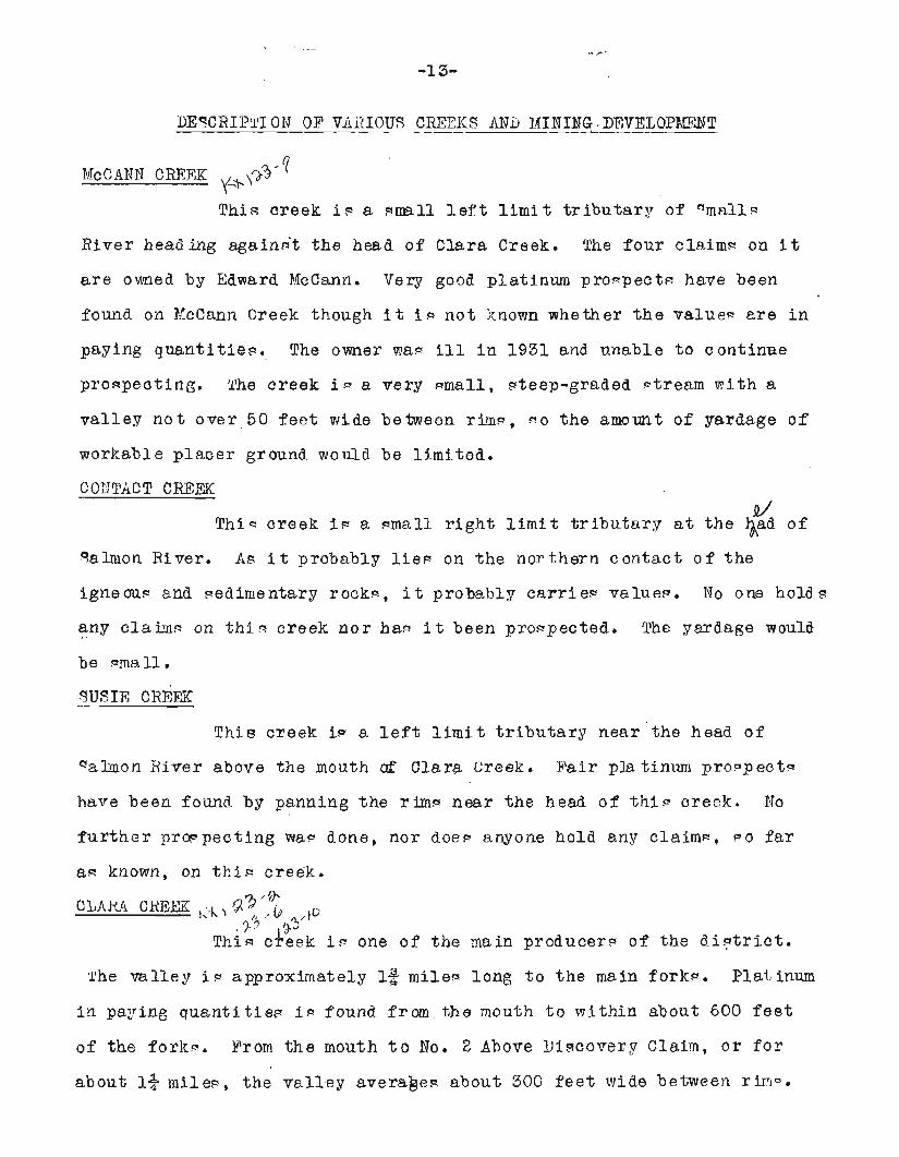
, 7-'i ' I Thin creek i - one of the main producer9 o f the d i s l t r i c t .
'l'he v a l l e y i.9 approximately 12 mile- long t o t h e main fork-. Plat,inum
in paying q u e n t i t i e ~ iq found from the mouth t o mi th in about 600 f e e t
of the fo rk - . Prom t h e mouth t o lfo, 2 Above iiiscovesg C l a i m , o r f o r
about 1% rnilec, the v a l l e y a v e r a a e ~ about 300 f e e t mide between r i r ? ~ .
Up Clara Creek from Haral~en and Wicklmd cabin
Down Clara Creek from Emral~en and Wicklnnd cabin
, b
-14-
The depth t o bedrock rangeg f r o m 5 f e e t on Di-covery Claim, 1 / 2 mi le
from t h e mouth of the creek , t o 9 f e e t on Wo. 2 Above Di-covers. Above
No. 2 Above Di!zeovery t h e r i g h t l i m i t r i m becornem Per27 poorly defined,
the creek hugging t h e l e f t l i m i t rim. 9n 110. 3 Above Discovery claim
the depth. t o bedrock i n c r e a ~ e ~ t o 10 f e e t , and on No. 4 Abav-e Di-covery
the depth t o becrock i - about 13 f e e t .
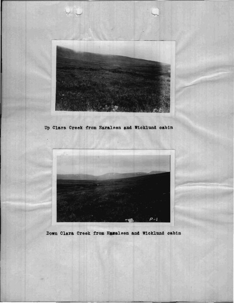
The only mining method u ~ e P on t h e creek ic ground-cluic-
i n g and -hovelling-in. On Discovery claim, Charles Thorpen and Andrew
Olson, - ince ~ t a r t i n g i n the aummer of 1928, have cleaned about 19,000
quar re f e e t of bearock. seven ord-inary 10 and 1 2 i n c h e ~ by 10 i n c h e ~
s l u i c e boxes with s tee l -chod vlooden r i fF le - a re u-ed, ae t on a grade
o f 7 inche- t o 1 2 f e e t . About 1* f e e t of decompo-ed ach i s tose bedrock
i- mined. A l m o ~ t a l l the platinum l i e ? i n t h f s bedrock. The gravel.
i s f a i r l y coarae and angular bu t with no boulder-.
On ?To, 1 Above D i ~ c o v e r y c%aj.m, l ik r t in Garthe ha.. cleaned
about 2000 square f e e t o f bedrock. Depth- t o bedrock range f r o m 6 f e e t
on the lower end of the claim t o 7 f e e t on upper end d claim, consist-
ing of 4 t o 5 f e e t of god and ? o i l anfi approximately 2 f e e t of g a v e I .
He groung -wluices off the -od and s o i l , -hovel l ing-in the gravel.
Ordinary s l u i c e boxea and r i f f l e - are uged on a grade of 7 i n c h e ~ t o
1 2 f e e t . The grade of t h e ~ u r f a c e f r o m Garthe'- open cu t t o Thorpen
and Olmonl= open cut i - 1.82 p e r cent ,
On No, 2 Above Di- cover:^ C l a b , 0. J. eamp~on hay cleaned
11,000 square f e e t of bedrock, being i n par tner -h ip during mo-t of t h e
yeasp 1929 a,n$ 1930 wi th Martin Garthe. The depths t o bedrock range
from 7 f e e t on the lcmer end a€ t h e claim t o 9 f e e t on t h e upper end,
c o n - i d i n g o f 7 f e e t o f pod and c o i l an8 2 f e e t o f gravel . Only g rave l
i~ hovell led-in, t h e ~ o d and m o i l being ground-~luice~ o f f . Ordinary
c lu ice boxec. and riffle^ are used, se t on a grade of 7 i n c h e ~ t o
--. - -16 -
1 2 f e e t . The grade o f t he gurface f r o m q a a p ~ o n ' p cut t o gar the'^ c u t
i s 1.94 pe r cent .
On Mo. 3 Above D i ~ c o v e r y Claim, John Earalgen and A u g u ~ t
li?icklund have cleane? 14,240 square f e e t o f bedrock. The c i ep th~ t o
bellrock range from 9 f e e t on the lower end o f the claim t o 11 f e e t on
the upner end. ?here the mining i s being done, the depth i~ 1 0 f e e t ,
conaie t ing of 13 f e e t of pod, 7 f e e t of gravel and 1$ f e e t of gravel
and heavy sediment ca r ry ing the p l a t inwn value?. Only the lower 1*
f e e t a r e nhovelled-in. The r e s t o f the overburden is boomed o f f . 'Phe
bedrock i- perpentine and p e r i d o t i t e and i q decompo8ed f o r a t l e a , ~ t 5
f e e t . The bedrock c a r r i e - no value? and i a n o t mined. Five o r d i n a r y
10 inches by 10 i n c h e ~ b lu ice b o x e ~ , w i t h 2-inch a t e e l ?hod vlooden
riffle.! a r e upec? , s e t on a grade of 8-if incher t o 1 2 f e e t . The grade of
the surface f r o m t h e Earalpen and Niclrlund c u t t o % m p ~ o n ' ~ c u t iq
2.94 per cent .
On No. 4 Above 9iscovery C l - a i m , t h e dep th t o bedrock
i n c r e a ~ e e t o about 13 f e e t a t the c e n t e r o f t h e claim t h e n begin9 t o
r ap id ly l e w e n . Haralsen and ?if cklund have deternined by dr i l l i n g
with a pipe t h a t ground h igh enough i n value9 t o mine extend^ about 2
one-third t h e l eng th of t he claim above it P lovrer bound?-ry. Boulder?
on the su r face and i n the creek bed become very numerous on the upper
half o f the claim.
The w i d t h o f t he p a y ~ t r e a k on Clara Creek ha- never been
a c t u a l l y determined. What mining ha- been done i - i n the creek be8
i t s e l f vrhere water f o r ground 9 lu ic ing coula be obtained ea- ie - t . The
amount o f water i n Clara Creek v a ~ i e - from 10 t o 40 miner- inches,
averaging about 20 miner- inchec.
The p h t i n ~ u n o f Clara Creek c s r r i e - with i t about 7' p e r
cent by weight of ogmiridim. About 1 p e r cent by weight of t he
Low Kon
er Bowry Creek and Salmon River. The motmt(lin on the l e f t ig Q n ~ i e n t a i n , the gap t o the right i. valley o f lfedhcine Creek.
Salmon Blnff~ from l e f t l i m i t of Boulder Creek
cleaned product i- gola. The miner9 rece ive no r e t u r n on th in gold from
the ~ m e l t e r ~ . The c o n o e n t r s t e i o o n ~ i ~ t ; j o f about 75 pe r cent p& magnetite
and 25 per cent # ohrornite. ,l.luoh f i n e platinum iq l e f t i n t h e concen-
t r a t e ~ , a l c o much i q l w t by the crude metho3 F of mining. It i- ~ a f e t o
pay t h a t Ofrom 25 t o 50 per cant o f a l l value? a r e l o ~ t i n b l m i n g t h e
clean-up, and i n mining. The m e l t e r e make a f i v e d o l l a r a n o m c e
melting charge i n paying f o r any l o t c g o l d t o them.
The o m e r ~ h i p n of Clara Creek a r e a9 f o l l o m ~ : , $3' Y'
No. 2 Belovr Discovery Claim - - - - - - - -Charlsr ihorsen?
No. 1 Below Dicccrerg C l a i m - - - - - - - - 0. J. Sampson y,'o \ 'd.
Digcopery C l a i m - - - - - - - - - - - - - - Charlev Thor gen ' . ,io \+ No. 1 Above D i w v e r y Claim- - - - - - - - Martin Garthe L + ~ ~
No. 2 Above D i ~ c o v e r y Claim- - - - - - - - %%I. B. Moeck and ~re2\. gilolter
No. 3 Above Digcovery Claim- - - - - - - - V?m. B. EZoeck and Fred.Wblters
No. 4 Above Dincover$ Claim- - - - - - - - Oddie E a l ~ o n
DOWRY CEEEX 897 \A
Thia creek i n a ~ m a . l l r i @ t l i m i t t r i b u t a r y o f salmon
River about 3/4 m i l e s belov? Clara Creek. The width of t h e v z l k g o f
Dowry Creek between rima i~ about 200 f e e t a t the mouth of t h e creek.
However t h i n width rap id ly narrows. The graae of the creek ia v e v
~ t e e p a t it^ upper end., bu t i p only about 2 p e r cen t near t.he mouth.
Workable value- i n platinum have been found on Dowry Creek. However,
due it i q said, t o l a c k of men i n t h e d i n t r i c t , no a c t u a l mining has
been done. The amount of water a v a i l a b l e f o r mining would be s m E 1 l , t h e
maximum probably n o t being w e r 30 miner-' inches. TIElo claim- a r e he ld
on Dowry Creek by Fred W o l t e r ~ and. Nei l Cmriga.1.
BOULI)ER @. ,? 3 /.?$ ,%,, '
Thip ' c reek i s a emall r i g h t l i m i t t r i b u t a r y of salmon
River about 12 mile?. below Dowry Creek. A t t h e mouth of ~ & l a e r
1
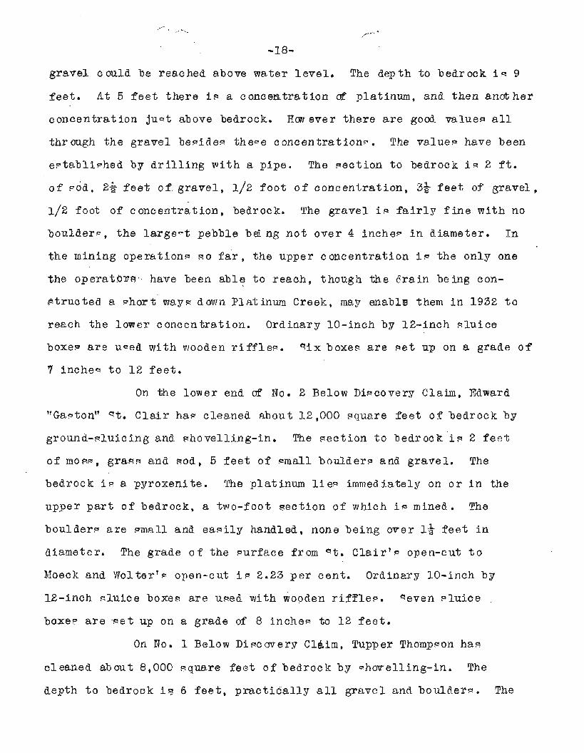
qnirrel Creek from month Looking
Looking up Bquirrel Creek from Thompson's cabin
-. ,-., 1 -17-
Creek, i t n ml ley %R about 9 5 f e e t wide between r i m s . The grade i n
very d e e p , the fall f ron the head o f t he creek t o t h e mouth being
about 360 f e e t . There a r e many boulder^ on t h e creek f r a m the d i o r i t e
outcrop3 on the r i g h t l i m i t , Norkable veluec! of pl-atinum a r e s a i d
t o have been found on Boulder Creek. %o c l a i r a ~ , Discovery Claim and
N o . 1 Above Digcovery, a re he ld on Boulder Creek, both by George
Ricker t ,
There a re th ree o t h e r unnamed mall creekn cr gulchel.! be-
tween Boulder and Clara Creeks. Though -mall, the-e a r e very favorably
- i tuEted f o r platinum mineaal i m t i o n . No work ha^ been done on then 9 0
far a- i~ knovm, nor C ~ O far a9 known, doe- anyone hold claim- on them.
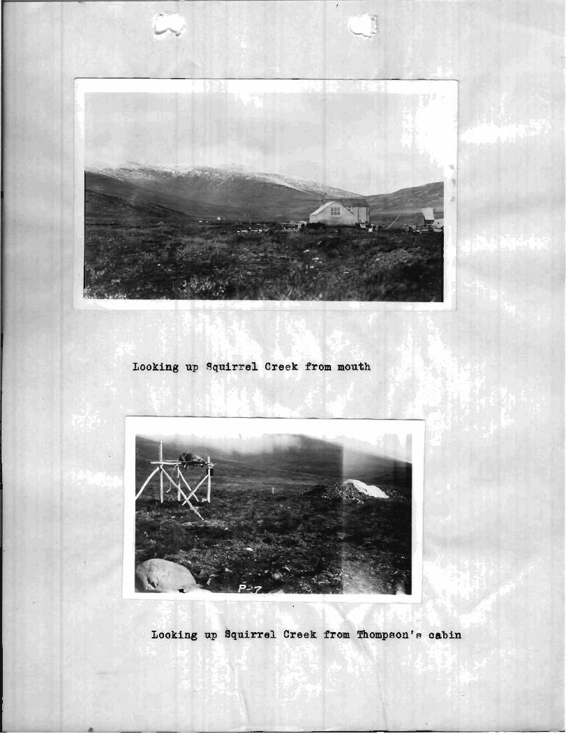
"QUIRRYL CREEK
T h i ~ creek i s r e a l l y t h e r i g h t fork o f Platinum Creek being
about the same l e n g t h asl the l e t t e r above t h e i r confluence. s q u i r r e l
Creek i s about 1% mile? long t o it 9 fork^. Of thin d i g b n c e about
0.9 mile hay been proven t o ca r ry s u f f i c i e n t platinum vnlue- t o be
norkable. I t i a - a i d , and f r o m a l l ind ica t ione it ~ h o u l d be t r u e ,
t h a t workable values cont inue up the creek f o r 1/4 mile f u r t h e r .
s a u i r r e l Creek roughly p a r a l l e l s Boulder Creek f o r t h e f i r - t 0.6 mi le
below t h e f o r k , then t h e v a l l e y .mingw t o t h e aouth,m*oughlg p a r a l l e l i n g
ralmon River f o r 0.9 mi le t o the mouth. A t t he up,Per en8 o f No, 3
Below Diqcoverg Claim, t h e w , l l e g o f q c u i r r e l Creek between rim^, i~
about 600 f e e t wide. Yhiw width narroa;ls abrnpt ly t o 300 f e e t a t
the bend on No, 1 Below Discovery claim, 0.9 m i l e f r o m the mouth,
S q u i r r e l Creek c a r r i e s from 40 t o 200 miners i n c h e ~ of mater, averaging
around 80 miner- inchea.
Near the mouth o f " n u i r r e l Creek on No. 3 Below ~ l i s c o v e r y
C l a i m , Bdm. B e Iloeck and Fred W o l t e r ~ have cleaned about 2200 muare
f e e t 0 9 beSrock by booming d f the cr erburaen and ~ h o v e l l j n g - i n what
-18-
gravel could be reached above tirater l e v e l , The depth t o bedrock i . r 9
fee t . A t 5 f e e t the re i s a concentrat ion af platinum, and then another
concent ra t ion juct above bedrock, Fm ever the re a r e goo3 values a l l
t h r mgh the gravel begideg theqe concent ra t ion@. The value? have been
e ~ t a b l i - h e d by d r i l l i n g wi th a pipe. The geet ion t o bedrock i~ 2 f t .
o f pod, 2& f e e t o f g r a v e l , 1/2 f o o t of concent ra t ion , 39 f e e t o f gravel ,
1 /2 foot of concent ra t ion , bedrock, The gravel is f a i r l y fine with no
boulder-, t he l a r g e - t pebble b& ng n o t over 4 inchei. i n diameter, In
the raining operationc. 90 f a r , the upper c oncentration i a the only one
the o p e r a t ~ r s have been ab le t o reach, though the ? r a i n being con-
~ t r u c t e a a phort mayq down Platinum Creek, may enabltg them i n 1932 t o
reach the lotver concentrat ion. Ordinary 10-inch by 12-inch q lu ice
boxey a r e uced with wooden r i f f l e - . s i x b o x e ~ a r e s e t up on a grade o f
7 inche- t o 1 2 f e e t .
On the lower end a f No. 2 Below D i ~ c o v e r y Claim, Eaward
"Ga~ton" st. C l a i r ha? cleaned about 12 ,000 pr;uz,re f e e t o f bedrock by
gro-and-gluicing and &ovePling-in. The s e c t i o n t o bedrock i s 2 f e s t
of mow, grasa and pod, 5 f e e t o f m a l l boulders and g rave l . The
bedrock i~ a pyroxenite. ??he platinum l i e 9 immediately on o r i n the
upper p a r t of bedrock, a two-foot sec t ion o f which i e mined. The
boulder- a r e emall and e a ~ i l y handled, none being o-eer 1* f e e t i n
diameter. The grade o f the ~ u r f a c e f r o m 4 t . Cla i r lc . open-cut t o
Moecl; and 'Jlolterl- open-cxt i~ 2.23 p e r cent . Ordinary 10-inch by
12-inch -1uice boxep are uged with wooden r i f ' f lea . seven ~ l u i c e
boxe? a r e ~ e t up on a grade of 8 inchee to 1 2 f e e t .
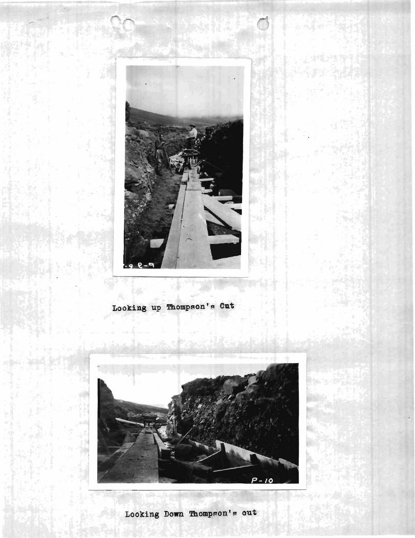
On No. 1 Below Diacovery C l a i m , Tupper Thornpeon hae
cleaner3 about 8,000 Rquare f e e t o f b e d r o c k b y e h w e l l i n g - i n . The
depth t o bedrock i s 6 f e e t , p r a c t i c a l l y a l l gravel and boulder-. The
Dnm Squirrel Creek from Squirrel-BoulLer Divide
Down Sqr h from Thorn
bedrock i q p e r i d o t i t e , pyroxeni te , pyroxen%te tending t o gabbrU and I
gabbro, alla i s much Becompo~ed i n place^. The platinum l i e 0 d i r e c t l y
on t h e bed-rock. About 1 f o o t of bedrock i 9 mined with t h e gravel . On
the lmrer en? of 1130. 1 Belov Discovery Cla in , the boulder^ become
l a r g e r and more numeroue, renging on the upper ena of t h e claim from
1 f o o t t o 4 f e e t i n diameter. The grade o f the surface f r o m Thomp~on~s
open-cut t o st. C l a i r ' ~ open-cut i.9 5.66 p e r cent . Ordinary 10-inch by
12-inch a l u i c e boxeq a r e used w i ~ h a t e e l qhod wooden r i f f l e q . Seven
boxes axe s e t up on a grade o f 9 i n c h e ~ t o 22 f e e t . . No mining hag been done on Discovery C l a i m o r No. 1 Aboee
D i gcoverg C l a i m . It i n s a i d , however, t h a t return^ from d r i l l i n g with
a pipe ha.^ i nd ica ted high enough platinum value? t o j u s t i f y nhovelling-
in . The boulderg decrease i n s i z e on No. 1 d b w e Di-covery C l a i m ,
though the n ize and a n g u l a r i t y of the pebble- i n the gravel show a
marked inereaye, s l ab? and e l i d e piece.. up t o 1 f o o t long being common.
The grade f r o m Thompnonrc open-cut t o the bend on q q u i r r e l Creek on
the lovfer end of Digcovery Claim i* 6.64 pe r cent. Firom the bend of
s q u i r r e l Creek t o t h e fork^, t h e grade i c 6.96 per cent .
PTwt o f t h e value^ on S q u i r r e l Creek a r e caught i n t h e
f i r ~ t two boxeg. 10 p e r cent by weight o f t h e valuea recovered on 1 I
q o u i r r e l Creek i g onrniridiwn. There i s about $10 i n gold t o 100 ~ ounces o f platinum metals i n the shipped product. The miner- g e t no
I I
return.! from the smeltera f o r t h i ~ g o l d .
The width o f t he p a y ~ t r e a l r on q q u i r r e l Creek i.9 unlcnown.
The main yay a9 indica ted by d r i l l i n g p robab ly followa i n t h e c e n t e r I ~
o f t h e v a l l e y , e spec ia l ly above st. C l a i r ' ~ open-cut, E % F ~ of the 1 mining han been done v!here water way most e a s i l y obtained i n the bed
of the ~ t r e a m , which hug9 t h e l e f t l i m i t o f t h e v a l l e y . Probably from
Looking n
25 t o 50 p e r cent of t h e platinum i g l o & by the miner9 a3 on Clara
Creek.
No. 1 Above Di-covery C l a i m i p he12 by G i l I k In ty re .
Discovery C l a i m i e h e l d by G i l TlcIntyre.
l?o. 1 Below D i ~ c o v e r y Claim i~ held by G i l FkIntyre.
No. 2 Belom Di-covery C l a i m i g he ld by Jog. Jean and Ed."mith.
y220-foot *action between No. 2 Below D i e covery snd\no. 3 Below i
1 Discovery Claim i held by Ydvlard "t. C l a i r . \&
No, 3 Below D i ~ c o v e r y C l a i m i~ held by Fred Woltera.
P U T 1 NU1.9 CREEK ,$x ?- ,!A '
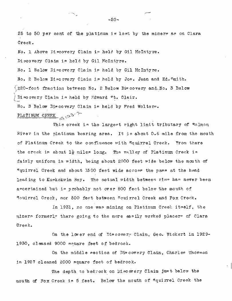
T h i ~ creek i~ the l a r g e - t r i g h t l i m i t t r i b u t a r y of '%lmon
E ive r i n t h e platinum bearing area . It is about 0.6 mi le f r o m the mouth
of Platinum Creek t o the confluence w i t h S q u i r r e l Creek. From t h e r e
the crcek is about 1% milea long. The v a l l e y of Platinum Creek i s
f a i r 1 7 uniform i n vlidth, being about 2000 f e e t v ide below t h e mouth of
"qu i r re l Creek and about 1500 f e e t wide aci-ow the pap7 a t t h e head
lead ing t o Eu-koknirn 3ay. The a c t u a l width between r i m - ha- never been
a-eer tained but i~ probably not over 800 f e e t below t h e mouth of
S n u i r r e l Creek, nor 500 f e e t between ecruirrel Creek and Pox Creek.
I n 1931, no nne way mining on Platinum Creel; i t a e l f , t h e
miner9 formerl.;7 t h e r e going t o the more e a - i l ~ vlorked placer* o f Clara
Creek.
On t h e l a v e r end of Di-cover-. Claim, Geo. Wickert i n 1929-
1930, cleaned 9000 gnuare f e e t o f bedrock.
On the middle pee t ion of Di-coverg blaim, Charlee IThomsn
i n 1927 cleaned 2000 square f e e t of bedrock.
The depth t o bedrock on U i sc mery C l a i m ju- t below the
mouth & Fox Creek i- 5 f e e t . Below the mouth o f s q u i r r e l Creek the
Up ~1rrtinfm.n Creek from month o f Squirrel Creek ---- cabin i n center ie on right l i m i t o f Dry Creek.
- - - -- -
Looking down Platinum Creek faom month o f qqnirrel Creek
depth t o bedfock i s 10 f e e t , 0 e ing too deep t o vrork by prepent methoda,
From the mouth of Platinum Creek t o the confluence pf i th e q u i r r e l
Creek, t h e grade i p 1.39 p e r cent , F r o m the mouth of p q u i m e l Creek t o
the mouth of Dry Creek the grade i c 2.16 p e r cent . From the m a t h of
Dry Creek t o the mouth of Pox Creek the grade is 1.55 pe r cent . From
the mouth of Fox Creek t o the h a d , the grade i d 6.96 per cen t ,
The g rave l i n Platinum Creek i g medium eoaree up t o the
mouth of s q u i r r e l Creek, the l a r g e s t stoneg i n i t p r o b ~ ~ b l g n o t being
over 3 i n c h e ~ i n diameter, Abave t h e mouth of q q u i r r e l creek , t h e s i z e > *-
and angu la r i ty of t h e s t o n e ~ i n t h e g rave l imzcreaqed u n t i l a t t h e
mou-th of Fox Creek, many of t h e tone^ and a lab- i n the g rave l range
from 6 t o 1 8 inchee i n g i z e . Abw e t h e mouth of s q u i r r e l Creek, the
water i n Platinum Creek range9 from 40 t o 300 miner- inche-, the
average being probably around 100 rninera i n c h e ~ .
Mo. 1 Above Di-covery Cla i rn ia held- by B i l PTcIntyre.
Discovery Claim i- h e l d b27 Chap. Thorpen.
Mob 1 Below Diqcovery Claim i- held. by Chae. Yhorsen.
No. 2 Below D i ~ c o v e r y Claim i n held by Chap. Thornen.
No. 3 Below B i ~ c o v e r y Claim i- held by Wm. B. IIoeck and Fred Wolters.
No. 4 Below Di-cover,r C l a i m i n he ld by Walter qmith.
No. 5 Below D i ~ c o v e r y Claim i s held by Henry qarnuel~on.
DRY CREFK ,$*q $+ '
This creek i~ a mall l e f t l i m i t t r i b u t a r y of Platinum
Creek above " q u i r r e l Creek. The creek l i e s a l m o - t e n t i r e l y wi th in t h e
v a l l e y of Platinum Creek and i g r e a l l y junt a run-off wale o r gulch. I t
hae a, s t e e p grade on it.* upper end but i q f a i r l y f l a t f o r t h e l n c t 1/4
x i l e above t h e mouth. The width of t h e paystreak i q unknovm on Dry
Creek b e c a u ~ e o f the s m a l l amount of work done on the creek. It appeara
f rom the su r face , hmever , t h a t t h e di- tance between r i m a cbnnot be
over 150 f e e t . ,
On the lower end of Diecovery C l a i m , Joe. Chanie and
Edward EilcCann cleaned, i n the summer of 1930, about 1200 square f e e t
of bedrock by qhovelling-in.
On No. 2 Below Bench Lef t L i m i t o f Platinum Creek Clainl,
C h a r l e ~ Tonietzko and John Bennett were building i n the Pummer of 1931
a d i t c h f r o m Platinum Creek, and were expecting t o have cleaned i n t h e I
combined Primmer- of 1980 and1931 about 8,000 qquare f e e t o f bedrock.
The 6epth to' bedrock on Brg Creek i s 5 f e e t , The g rave l i- angular and
medim coarve , the l a r g e c t s tone seen no t being over 10 i n c h e ~ i n
diameter. The pay l i e 9 a l l through the g r a v e l , t h o ~ g h the g r e a t e q t > I I
amount i s jus t above bedrock, About 1 p e r cen t of t h e f i n a l return^ on I
Dry Creek i p ogmiridium. I t i s reported t h a t t h e r e ia no gold i n t h e ~ e l eanup- . D i c c o ~ e r y C l a i m i s h e l d by Jo-. Chanie.
Mo. 2 Below Bench, L e f t L i m i t o f Platinum Creek C l a i m i n h e l d by
Chae . Yhorqen.
FOX C R E E ,,Lb,%7>--3." Thi- creek i s a - m a l l l e f t l i m i . t t r i b u t a r y of Platinum
Creek above Brg Creek. Fox Creek is a narroal ~ t e e p gulch , the pay-
p t reak being only 6 t o 10 f e e t v ide , 'l'he depth t o bedrock below the
bend i8 bout 6 f e e t , of which 3 t o 36 f e e t a r e ground-luiced off and
the lower 1& t o 2 f e e t s h o v e l l d - i n . The gravel o n Fox Creek i~ very
angular and coarse. PLIany boulder2 m c u r up to 3 f e e t i n diameter and
much bedrock i e expoped. The water i n Pox Creek probta,bly average9 40
miner9 i n c h e ~ . The grade o f ?'ox Creek f r o m t h e mouth t o the bend i g
5.22 per cent . $ram the bend t o the head t h e grade i- approximately
1 9 p e r cent . I
O n No. 2 Abave Diecoverg C l a i m , come nat iven i n 1927 t o I
1929, cleaned 500 quar re f e e t of bedrock. The depth t o bedrock ma
about 4 f e e t , a l l o f which Wac ~ho-se l led- in .
On Discovery C l a i m , Nei l H. Cur r iga l i n 1929 and 1930,
cleaned 3500 -quare f e e t of bedrock. qeven ord-inarg 10- and 12-inch by
10-inch ~ l u i c e boxen were used., pet on a grade of 8 and 10 i n c h e ~ t o
1 2 f e e t . About 33 1/3 per cent of the cleaned return^ ogmi ridium.
I t i s reported t h e r e i a no gold i n t h e cleanup^.
D i ~ c o v e r y C l a i m a t t h e mouth of *ox Creek i~ held by
Andrew Olson.
140. 1 Abope Dipcoverg C l a i m i- held by B i l EBcIntgre.
Eo. 2 k b w e Dincoeeq Clairn i a held by G i l FlcIntgre.
%4LX3i4 RI VEH d,,h!* b/
,$)' This r i v e r i q the main s t ream rece iv ing m w t of t h e
drainage o f t he Goodnewn Bay platinum bear ing area. No mining ha- besn
done on C ? a h o n x i v e r a? the a e ~ t h t o bedrock i- too g rea t t o mine o r
even p r o - p ~ c t a 7 i t h the pr ecent cruse implemenfb~ uned i n t h e country.
8n No. 1 6 Above Di.-coaer:~ Claim, o p p o ~ i t e " u ~ i e JTountai n ,
R a r a b e n and Wicklund d r i l l e r ! one h o l e wi th a p i p e i n the miadle of
the v5,lley. The depth t o bedrock wag 1 7 f e e t . IJo m l u e c were found.
On No. 7 Abm e Bench on t h e Lef t L i m i t Clairn, H a r a l ~ e n
and Wickltmd d r i l l e a 1 7 f e e t with a pipe. N o bedrock was found. It
i~ id t h e g round ~howed pro~pect . ! i n platinum a l l the way down.
On the l i n e between Bo. 3 Abme Discovery and IJo. 4 Abare
Discovurg Claimc, Rfoeck and Walter- d r i l l e d 6 hole^ with a pipe. In
the fir-t 3 holev on the l e f t l i m i t , bearock aa9 reached at 6 f e e t . In
the f o u r t h hole near the creek , bedrock wa- not reached a t 22 f e e t . I n
the f i f t h ho le t m n r d - t h e r i g h t l i m i t bedrock via9 n o t reached a t 33 f t .
I n t he 1 8 4 h01 e tm arda the r i g h t limit the re W E - no bedrock a t 18 f e e t
The g ravr l avac very f i n e et t h i c p l a c e , bu t very compact, donn t o 10
f e e t i n depth.
V e q good platinurn p r o q e c t s (up t o 1% gra inq) and a l i t t l e gold a r e
f a i d t o have been found i n t h i ~ upper 10 f e e t . Below 10 f e e t ae f a r ~ as d r i l l e d , We g r a v e l war very loose P O did not hold p l u e - . Nevm- ~ ~ thelews l i g h t platinum prospects a r e ~ s i d t o have been found. I
I
No p r m p e c t i n g ao far ag could be a s c e r t a i n e d , ha- been
done on Discoverp C l a i r r , on salmon River, a t the mouth of Platinum Creek.
On NO. 1 Below Bench on t h e Lef t Limit Gist. i m , Moeck and-
BVolters d r i l l e d one hole 11 f e e t deep but did not reach bedrock. I t i~
= a i d t h a t a f t e r 3 f e e t f r o m the su r face , f i n e platinum p r o q e c t e v i t h a
l i t t l e go ld were found i n t h i ~ d r i l l - h o l e .
On IJo. 4 Be low D i ~c ove rg Claim, l'loeck and 1Uol t e r f d r ill e?
one h o l e 10 f e e t deep wi th no bedrock. It i g ea id cmrce platinum
proepeeto plere found i n thiw hole.
salmon River hap been P %Bed from BJo. 1 6 Above D i ~ c w e r y
t o Do. 1 7 Below Diqcovery Claim. A l m a c c t a l l the ownere on t h e v a r i o u ~
o t h e r creek9 h o l d claim- on salmon Fiver , G i l EtIcIntsre being the
y r i n c i p a l w n e r . Salmoa River i p about 1000 f e e t wide between r i m 9 a t the
mouth of Platinum Greek. The ~ t r e a m i t p e l f a t t h i a p lace i n June was
about 30 f e e t wide and 1 / 2 f o o t deep.
A t qalmon B l u f f s , 8almon fii.ver between rims, n a r r o w t o
about 600 f e e t , t h e ~ t r e a m ~ e i n g about 15 f e e t wide.
A t t h e mouth of Dowry Creek, the r i v e r v a l l e p widen? t o
about 1000 f e e t between r i m 9 , then n a r r m P aga in r s p i d l g above t h e m m t h
of Cl8,ra Creek though st i l l about 500 f e e t vide at t h e h a d . The grade I
of salmon River V a l l e y from the mouth of P h t f num Creek t o t h e mouth' of
Boulder Cree?: i q 0.5 per cent. From the mouth of Boulder Creek t o the ~ I
mouth o f Clara Creek the grade i q 0.62 per cent . From the mouth o f
Clara Creek t o the head o f 'almon River t h e grade i s 0.93 per cent.
MEDIC I N Z CREEK
Thig m e e k 1 4 the l a r g e s t t r i b u t a r y on t h e l e f t l i m i t of
Salmon River i n the platinum bearing area. %'he a.mowt o f water i n
Nedicine Creek i s about 1/2 t h a t i n qa;lmon River a t t h e i r confluence.
The creek run7 i n a deeply i n c i ~ e d va l l ey , heetding e a q t o f s u ~ i e Moun-
t a i n , s g a i n ~ t a ~ t r e a m knomn t o the miners a9 Einikunok River
(pm ~ i b l y Balec Creek on the U.4.G.q. r e c o n n a i ~ s a n c e map).
T?o p r o ~ p e c t i n g ha.! been done on Medicine Creek, nor on any
of the unnamed. t r i b u t a r i e q on the l e f t l i m i t of qalmon Ziver.
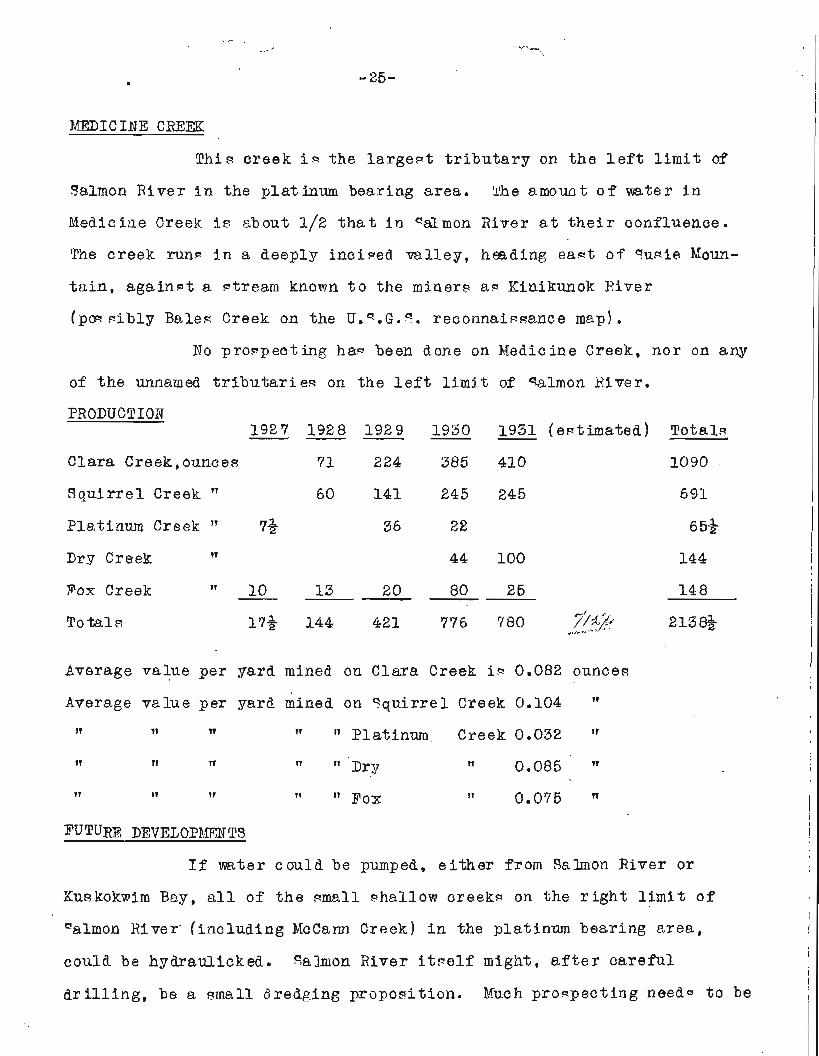
PRODUCTION
Clara Creek,ounces 71 224 385 410 1090
S q u i r r e l Creek l1 60 141 245 245 691
Platinum Creek " 7& 36 22 65*
Dry Creek I? 44 100 144
Fox Creek " - 10 13 20 80 25 148
total^ 1'7+ 144 421 776 780 ??+ex r - 213%
Average value per yard mlned on Clara Creek i~ 0.082 ounce8
Average v a l u e p e r yard mined on s q u i r r e l Creek 0.104 " f l 11 w " Platinum Creek 0.032 l1
TI n n Drp 11 0.085 " ~t IT 11 T r ~ 0 x 11 0.075 " I
FUTURE DEVELOPBlEId TS I
If water could be pumped, e i t h e r f r o m qaluon River o r
Kuskokmim Bay, a l l of t h e small ahallow creek= on the r i g h t l i m i t o f
ealmon River ( inc lud ing McCann Creek) i n the platinum bearing area, I
could be hydraulicked. salmon Xiver i t ~ e l f might, c a r e f u l 1
d r i l l i n g , be a mall dredging p r o p o ~ i t i o n . Much proqpect ing need9 t o be I
done i n the area. None of the ~ t r e a m ~ on the l e f t l i m i t o f " a h o n
River have been progpecteb, so far a@ could be a ~ c e r t a i n e d . There i s
no rea-on why the ~ t r e a m - running from Susie lyfountain ~ h o u l d not be
plat inwn bearing, a9 t h a t mountain i w apparent ly of t h e same formation
aa Red Mountain. If platinum i w found i n t h e ~ e stream-, it wou3.d in-
crea-e t h e pbtinum bearing area enormously. qevera l wmall gul l - ies ?-
run from Red Ibountain i n t o Ku~kokwim Bay, "o f a r as known, none of - 4 .,;&
thege kmT2 been p r o q e c t e d . Other ba- ic rock area9 nor theaqt of q u ~ i e
? Iounh in ~ h o u l d be inve- t iga ted a l s o f o r platinum mineral-. Some of
the platinum on Clara and S q u i r r e l creek^ g t i l l ha- W p i e c e c of the
matix i n which i t o r i g i n a l l y occurred, c l ing ing t o it. Thiq 1 9 duni te
and p e r i d o t i t e a l t e r e d t o serpent ine. If the rock9 on Red Mountain
have a zonal arrangement, i t i - p w ~ i b l e t h a t some ( o r one) o f the-e
zonev may have ehough platinum mineral9 i n them t o ~ U F t i f y lode
mining. I t i 9 claimed t h a t on the Rinikunok River t o the e a s t of the
head o f IIedicine Creek, the rock.! a re g r a n i t i c and t h a t proepect- of
gold have been found on t h i ~ r i v e r . North of Goodnewg Bag on
Sphinx Creek, two men mined enough gold t o upp port them u n t i l t h e i r
death i n about 1925. This creek should be iavewtigated t o wee if
t h e r e i~ no t a t t h i - p lace a large body of reconcentrated g l a c i a l
ou-twagh m a t e r i a l w i t a b l e f o r gold dredging.