Embed Size (px)
Citation preview
J Geod (2012) 86:373–374DOI 10.1007/s00190-012-0562-7
IAG NEWSLETTER
IAG Newsletter
Gyula Tóth
© Springer-Verlag 2012
The IAG Newsletter is under the editorial responsibilityof the Communication and Outreach Branch (COB) of theIAG. It is an open forum and contributors are welcome tosend material (preferably in electronic form) to the IAGCOB ([email protected]). These contributions shouldcomplement information sent by IAG officials or by IAGsymposia organizers (reports and announcements). The IAGNewsletter is published monthly. It is available in differentformats from the IAG new internet site: http://www.iag-aig.org.
Each IAG Newsletter includes several of the followingtopics:
I. general informationII. reports of IAG symposia
III. reports by commissions, special commissions or studygroups
IV. symposia announcementsV. book reviews
VI. fast bibliography
Books for review are the responsibility of:C.C. TscherningUniversity of CopenhagenDeptartment of GeophysicsCopenhagen, DenmarkFax: +45-35-365357E-mail: [email protected]
G. Tóth (B)IAG Communication and Outreach Branch,MTA-BME Research Group for Physical Geodesyand Geodynamics, Department of Geodesy and Surveying,Budapest University of Technology and Economics,1521 Budapest, Hungarye-mail: [email protected]: http://www.iag-aig.org/
General Announcements
150 Years International Association of Geodesy
The International Association of Geodesy (IAG) is celebrat-ing its 150th anniversary in 2012. At the invitation of thePrussian General Johann Jacob Baeyer (1794–1885), repre-sentatives of the states of Prussia, Austria and Saxony metfrom 24th to 26th April 1862 in Berlin to discuss Baeyer’s“Proposal for a Central European Arc Measurement” (“Ent-wurf zu einer mitteleuropäischen Gradmessung”), which hehad sent out in 1861 to all Central European states. By theend of 1862, 16 states had already agreed to participate in theproject: Austria, Belgium, Denmark, France, seven Germanstates (Baden, Bavaria, Hannover, Mecklenburg, Prussia,Saxony, Saxe-Gotha), Italy, The Netherlands, Poland, Swe-den and Norway (in personal union), and Switzerland. Thiswas a great success and the start of an organised internationalcollaboration in geodesy. The IAG counts this internationalscientific (governmental) initiative, and the organisation itspawned, as its origin.
The idea for the project had been submitted by Baeyerto the Prussian Ministry of War in his document “On thesize and figure of the Earth: a memorandum on the estab-lishment of a Central European arc measurement, alongwith a sketch map” (“Über die Größe und Figur der Erde:eine Denkschrift zur Begründung einer MitteleuropäischenGradmessung nebst einer Übersichtskarte”). The aim wasto connect the numerous Central European astronomicalobservatories by the existing or to be planned triangula-tion networks, in order to determine the regional and localanomalies of the curvature of the figure of the Earth (i.e.the deflections of the vertical and thus the relative struc-ture of the geoid). This was the basis for all precise pointpositioning in science and practice, and the beginning of
123
374 G. Tóth
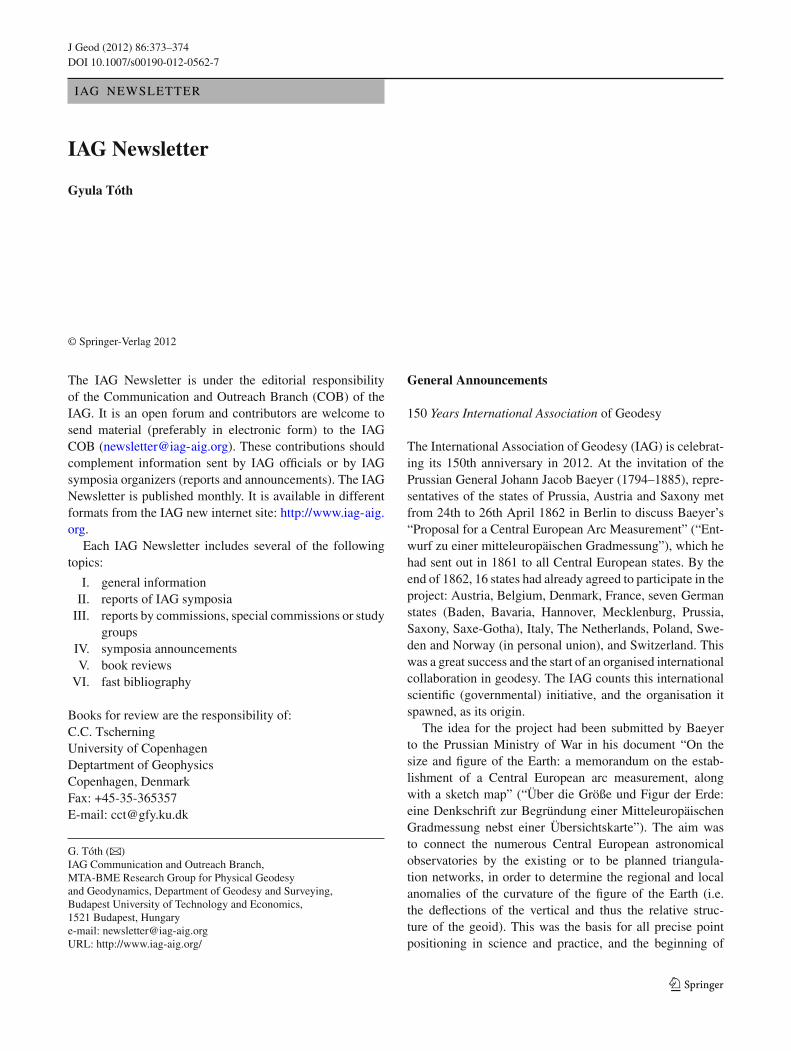
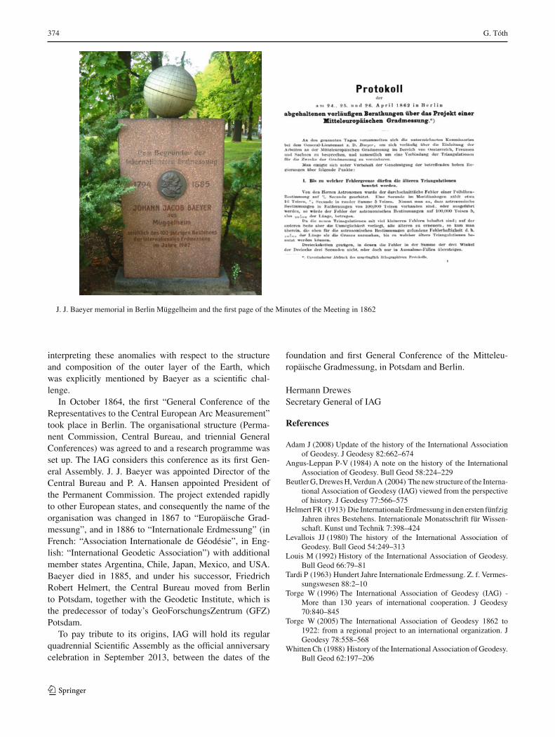
J. J. Baeyer memorial in Berlin Müggelheim and the first page of the Minutes of the Meeting in 1862
interpreting these anomalies with respect to the structureand composition of the outer layer of the Earth, whichwas explicitly mentioned by Baeyer as a scientific chal-lenge.
In October 1864, the first “General Conference of theRepresentatives to the Central European Arc Measurement”took place in Berlin. The organisational structure (Perma-nent Commission, Central Bureau, and triennial GeneralConferences) was agreed to and a research programme wasset up. The IAG considers this conference as its first Gen-eral Assembly. J. J. Baeyer was appointed Director of theCentral Bureau and P. A. Hansen appointed President ofthe Permanent Commission. The project extended rapidlyto other European states, and consequently the name of theorganisation was changed in 1867 to “Europäische Grad-messung”, and in 1886 to “Internationale Erdmessung” (inFrench: “Association Internationale de Géodésie”, in Eng-lish: “International Geodetic Association”) with additionalmember states Argentina, Chile, Japan, Mexico, and USA.Baeyer died in 1885, and under his successor, FriedrichRobert Helmert, the Central Bureau moved from Berlinto Potsdam, together with the Geodetic Institute, which isthe predecessor of today’s GeoForschungsZentrum (GFZ)Potsdam.
To pay tribute to its origins, IAG will hold its regularquadrennial Scientific Assembly as the official anniversarycelebration in September 2013, between the dates of the
foundation and first General Conference of the Mitteleu-ropäische Gradmessung, in Potsdam and Berlin.
Hermann DrewesSecretary General of IAG
References
Adam J (2008) Update of the history of the International Associationof Geodesy. J Geodesy 82:662–674
Angus-Leppan P-V (1984) A note on the history of the InternationalAssociation of Geodesy. Bull Geod 58:224–229
Beutler G, Drewes H, Verdun A (2004) The new structure of the Interna-tional Association of Geodesy (IAG) viewed from the perspectiveof history. J Geodesy 77:566–575
Helmert FR (1913) Die Internationale Erdmessung in den ersten fünfzigJahren ihres Bestehens. Internationale Monatsschrift für Wissen-schaft. Kunst und Technik 7:398–424
Levallois JJ (1980) The history of the International Association ofGeodesy. Bull Geod 54:249–313
Louis M (1992) History of the International Association of Geodesy.Bull Geod 66:79–81
Tardi P (1963) Hundert Jahre Internationale Erdmessung. Z. f. Vermes-sungswesen 88:2–10
Torge W (1996) The International Association of Geodesy (IAG) -More than 130 years of international cooperation. J Geodesy70:840–845
Torge W (2005) The International Association of Geodesy 1862 to1922: from a regional project to an international organization. JGeodesy 78:558–568
Whitten Ch (1988) History of the International Association of Geodesy.Bull Geod 62:197–206
123