Embed Size (px)
DESCRIPTION
ice atsea
Citation preview
ICE AT SEA
Sea Ice : Forms by freezing of sea water. Fresh water freezes at 0 deg C, whereas sea water of salinity 35ppt freezes at -2 deg C. Deep sea waters do-not freeze even if temperature is very low due to convection currents having to travel large distances to cool the entire body. In shallow waters like shoal banks, bays, estuaries etc. the depth is less & salinity is low. Therefore conditions are conducive for formation of Sea Ice. Sea ice may grow about 7 to 10 cms thick during the first 24 hours & about 5 to 7 cms in the next 24 hours. Thereafter, the growth is slower because the surface ice insulates the water from the cold air.
Icebergs : These are huge masses of floating ice, broken off from Glaciers & Ice Shelves. Relative density of icebergs is only about 0.9 ( as compared to 0.916 for fresh water ice because of pockets of air trapped in them.
Icebergs of glacier origin:Persistent snow falling on a mountainside freezes into ice. When this ice accretion reaches a critical weight, then the entire mass starts sliding down very slowly because of obstructions such as rocks, trees etc. This is called a glacier. Large chunks break off when they reach the sea & are carried away by current & winds.These icebergs have irregular shapes & do-not make good radar targets. Such an iceberg may be below the sea level by one to five times its visible height. Most of the icebergs in the N. Hemisphere are of the glacier origin. 90% of the ice in North Polar region is in Greenland.The International Ice Patrol advises shipmasters to keep at least 100 miles off from the last reported position of an iceberg.This may mean an eight-hour detour for a vessel bound for New york and twenty four-hour detour for a vessel bound for canadian or Great Lakes ports.On meeting the Gulf stream, whose temperature is as high as 16 deg C, the average sized iceberg melt in one or two weeks. The larger ones may take as long as two months.
Icebergs of ice-shelf origin:These are common in high latitudes of the southern Hemisphere. They are huge chunks broken off from large ice-shelves. Some -times, an entire shallow bay of water freezes and, later on, breaks off and floats free. Ice-bergs of ice-shelf origin are called tabular berg because of their vertical sides and smooth, horizontal tops. They are good radar targets. Many have been measured and found to be 20 to 30 miles long and 10 to 35 metres high. The longest on record was 90 miles long and 35 metres high, seen in 1927.
Diminution of icebergsIcebergs becomes smaller in size due to the following reasons:1)Calving (breaking off) into smaller pieces.2) Melting caused by warm ocean currents. Such underwater melting will result in frequent toppling and calving.3) Melting due to warm air and sunlight.
4) Erosive action of wind and waves
Visibility of an icebergDay-time:1 . On days with clear skies, about 18 M off from the masthead and about 12 to 15 M off from the bridge.2. On cloudy days with good visibility, about 2 M less than on clear days.3. Light fog/haze/drizzle/rain - 2 to 3 M.4. Dense fog - not detectable more than 100 metres.
Night-time:1. On nights with clear skies and good visibility, about ¼ M to the naked
eye. lf bearing is known, then 1M using night glasses.2. Difficult to detect in moderate or rough sea.3. Moonlight has very strong but variable effect on visual detection range, depending on the azimuth and altitude of Moon, bearing of the iceberg, etc.
Probable indication of the proximity of an iceberg.1. Possible detection by radar. lt should be borne in mind that sub-refraction usually
exists in the vicinity of icebergs. lcebergs may have smooth sloping sides making them poor radar targets.The low profile growler is the poorest form of ice target for radar – detection range not more than 4 M.
2. Thundering noises as growlers calve from icebergs.3. Ice-blink (whitish glare on low clouds near horizon).4. Presence of smaller pieces of ice which may have calved from the iceberg. The
iceberg would probably be to windward.5. Noise of sea breaking over edge of the iceberg.6. A sudden drop of wind speed accompanied by a severe drop of air temperature. These
are caused when the vessel comes into the lee of an iceberg.
Echoes of the ship's whistle from an iceberg or a drop of sea temperature are not considered reliable indications.
Classification of lcebergsIcebergs have been classified by the International lce Patrol as follows:
In case the length of an iceberg and its height fall into different categories, the larger of the two classes is used. for example,if the length was 70 metres and height was 10 mtrs, then iceberg should be classed as a medium berg.
Some Ice Terms
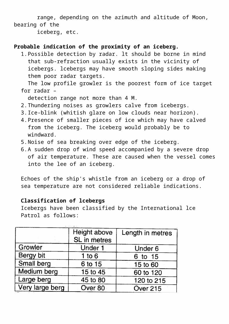
BRASH ICESmall pieces of floating ice (each less than 2 m in length), broken off from larger pieces.
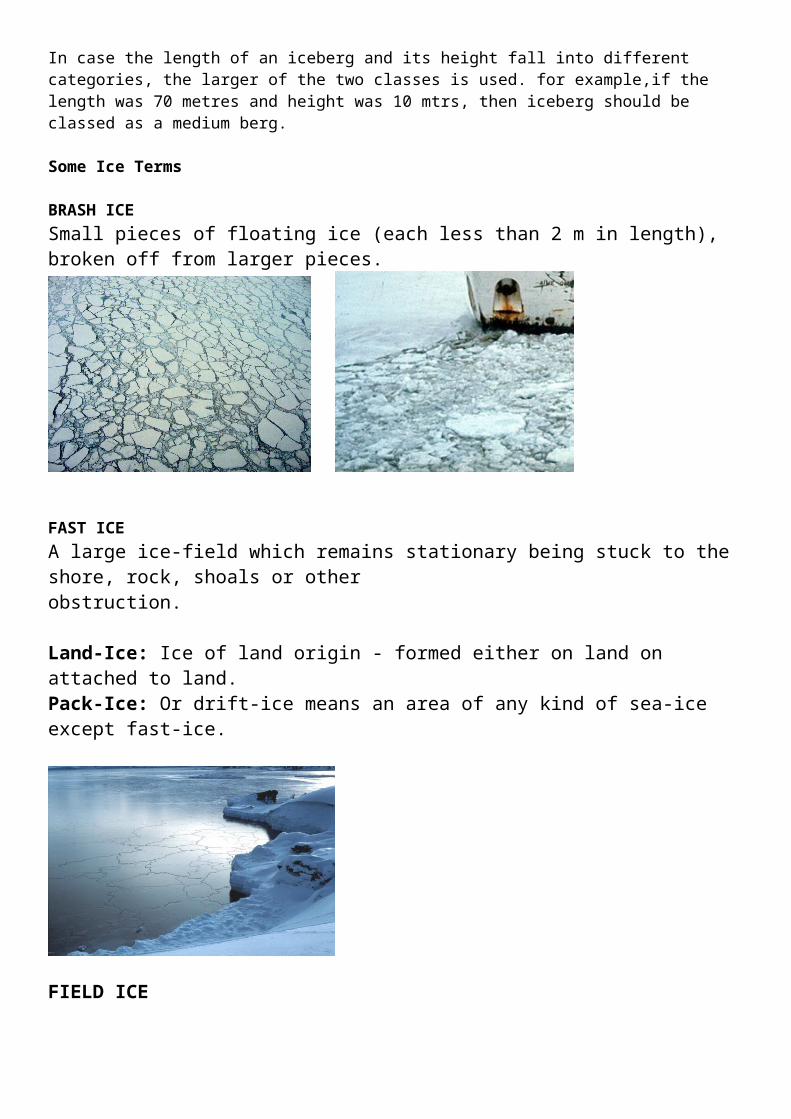
FAST ICEA large ice-field which remains stationary being stuck to the shore, rock, shoals or otherobstruction.
Land-Ice: Ice of land origin - formed either on land on attached to land.Pack-Ice: Or drift-ice means an area of any kind of sea-ice except fast-ice.
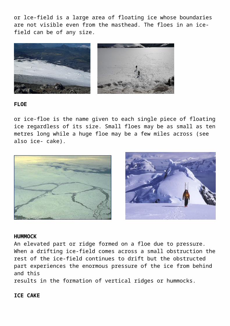
FIELD ICEor lce-field is a large area of floating ice whose boundaries are not visible even from the masthead. The floes in an ice-field can be of any size.
FLOE
or ice-floe is the name given to each single piece of floating ice regardless of its size. Small floes may be as small as ten metres long while a huge floe may be a few miles across (see also ice- cake).
HUMMOCKAn elevated part or ridge formed on a floe due to pressure. When a drifting ice-field comes across a small obstruction the rest of the ice-field continues to drift but the obstructed part experiences the enormous pressure of the ice from behind and thisresults in the formation of vertical ridges or hummocks.
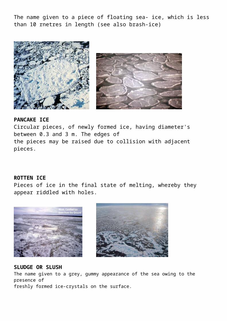
ICE CAKEThe name given to a piece of floating sea- ice, which is less than 10 rnetres in length (see also brash-ice)
PANCAKE ICECircular pieces, of newly formed ice, having diameter's between 0.3 and 3 m. The edges ofthe pieces may be raised due to collision with adjacent pieces.
ROTTEN ICEPieces of ice in the final state of melting, whereby they appear riddled with holes.
SLUDGE OR SLUSHThe name given to a grey, gummy appearance of the sea owing to the presence offreshly formed ice-crystals on the surface.
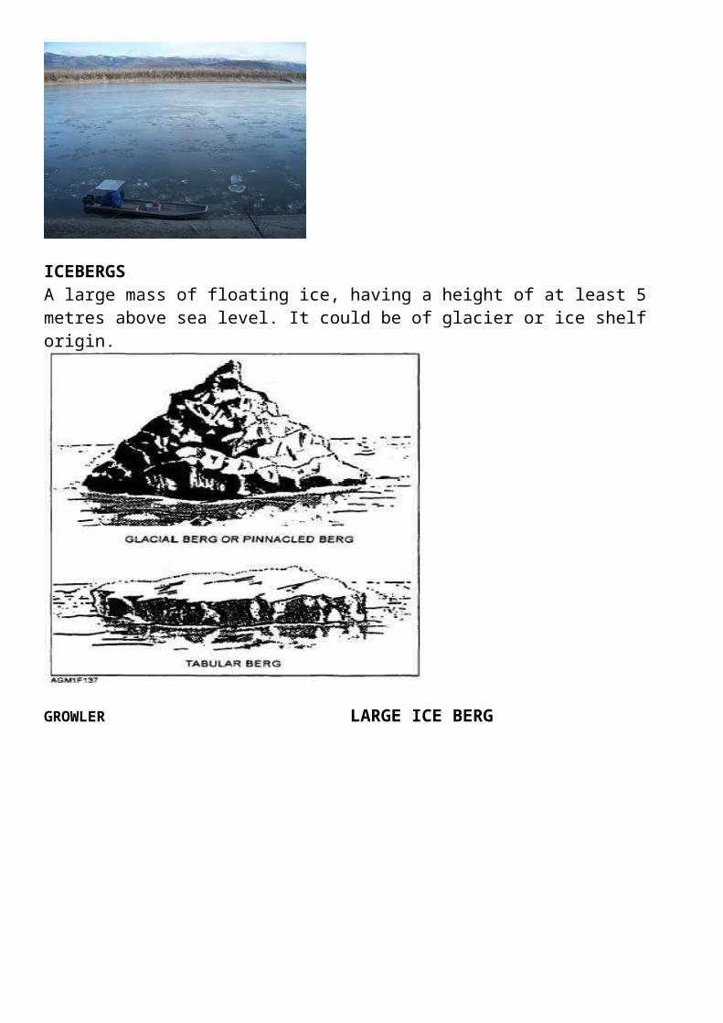
ICEBERGS
A large mass of floating ice, having a height of at least 5 metres above sea level. It could be of glacier or ice shelf origin.
GROWLER LARGE ICE BERG
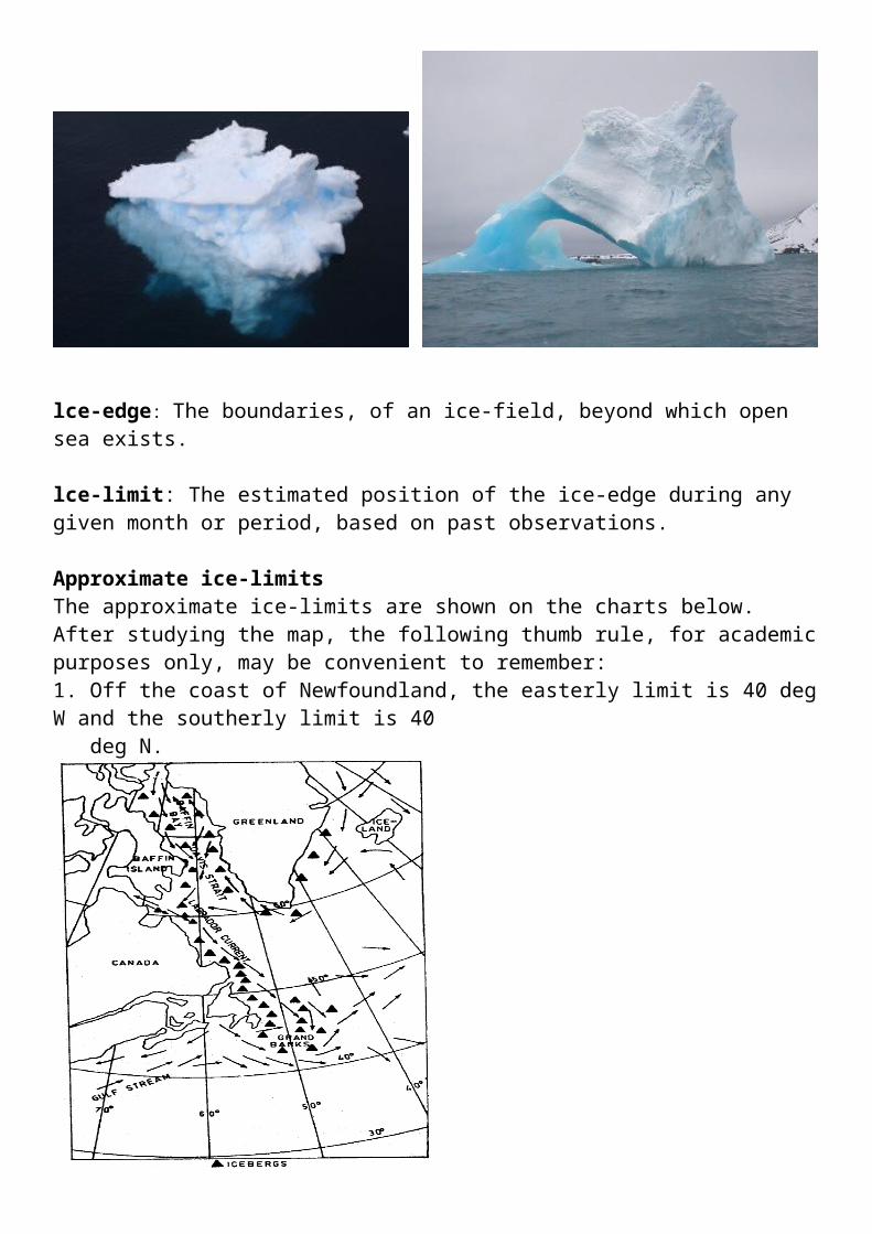
lce-edge: The boundaries, of an ice-field, beyond which open sea exists.
lce-limit: The estimated position of the ice-edge during any given month or period, based on past observations.
Approximate ice-limitsThe approximate ice-limits are shown on the charts below.After studying the map, the following thumb rule, for academic purposes only, may be convenient to remember:1. Off the coast of Newfoundland, the easterly limit is 40 deg W and the southerly limit is 40 deg N.
2. In the North Pacific, a line drawn from the NE tip of Japan, passing just north of the Aleutian lslands, to approximately 60N 160W.
3. In the Southern Hemisphere, roughly the parallel of 50S, except in longitude 20W, where it is about 40S. (Cape Horn, Tasmania & New Zealand are clear of the ice limits).