Embed Size (px)
Citation preview

ICMAM-PD

ICMAM-PD
Critical Habitat Information SystemCritical Habitat Information System
Kadmat IslandKadmat Island
Lakshadweep AtollLakshadweep Atoll
Satellite view of Kadmat Coral reefSatellite view of Kadmat Coral reef
About Kadmat IslandAbout Kadmat Island
About CoralsAbout Corals
Water Quality ParametersWater Quality Parameters
BathymetryBathymetry
ContentsContents
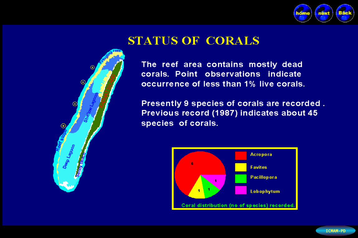
Status of CoralsStatus of Corals
Sea grass EcosystemSea grass Ecosystem
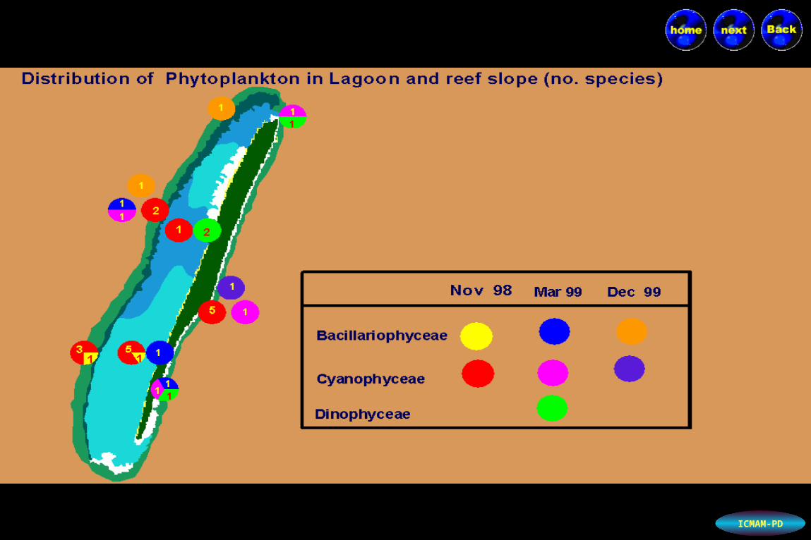
Phytoplankton Phytoplankton distributiondistribution
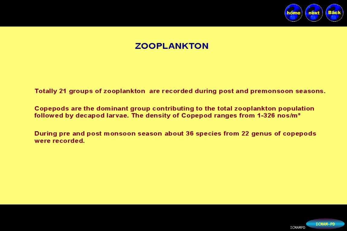
ZooplanktonZooplankton distributiondistribution
Benthos distributionBenthos distribution
Socio-EconomicsSocio-Economics
Fishery Fishery
TourismTourism
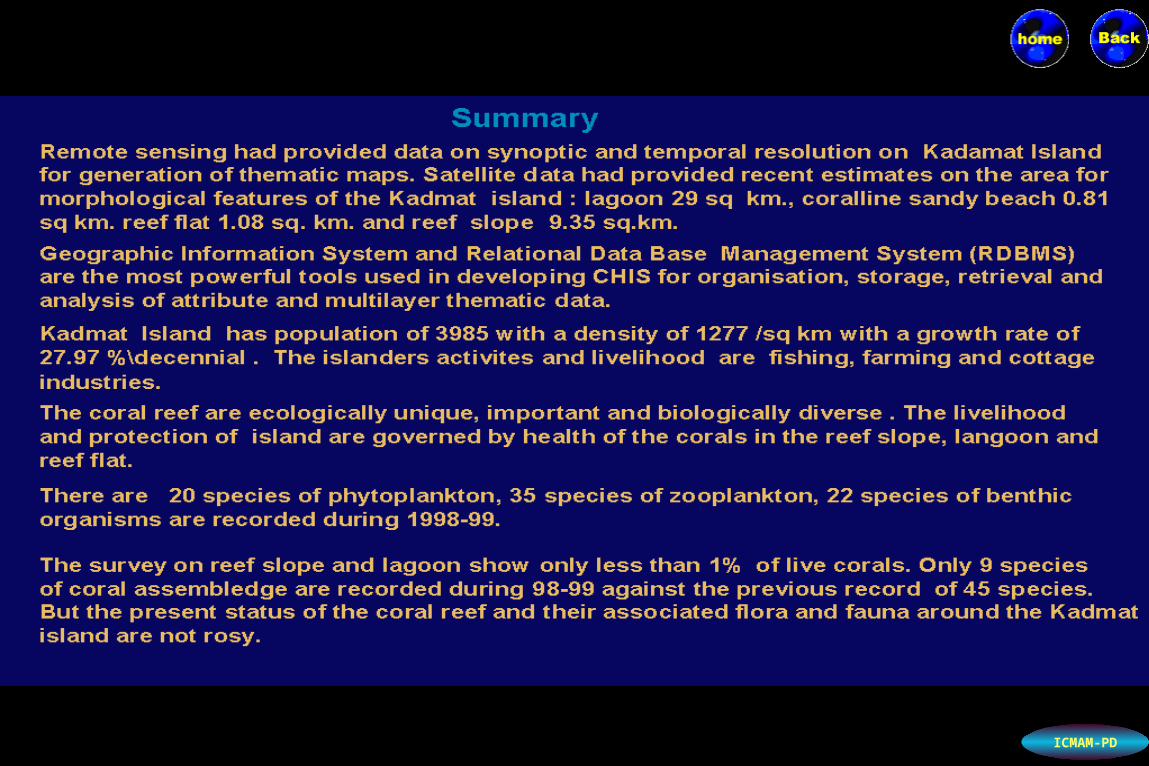
ConclusionsConclusions
Data TablesData Tables

ICMAM-PD

ICMAM-PD
294
km
320 km
407 km
Lakshadweep AtollLakshadweep Atoll
ICMAM-PD
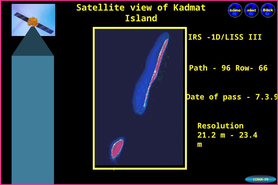
Path - 96 Row- 66Path - 96 Row- 66
Date of pass - 7.3.97Date of pass - 7.3.97
Resolution Resolution 21.2 m - 23.4 m21.2 m - 23.4 m
IRS -1D/LISS IIIIRS -1D/LISS III
Satellite view of Kadmat Satellite view of Kadmat IslandIsland
Kad
mat
Isla
nd
Am
ini I
slan
d

ICMAM-PD

ICMAM-PDICMAMPDICMAMPD

ICMAM-PD

ICMAM-PDICMAMPDICMAMPD
ICMAM-PD

ICMAM-PDICMAMPDICMAMPD

ICMAM-PD

ICMAM-PD
+ Present - Not present
ICMAM-PD
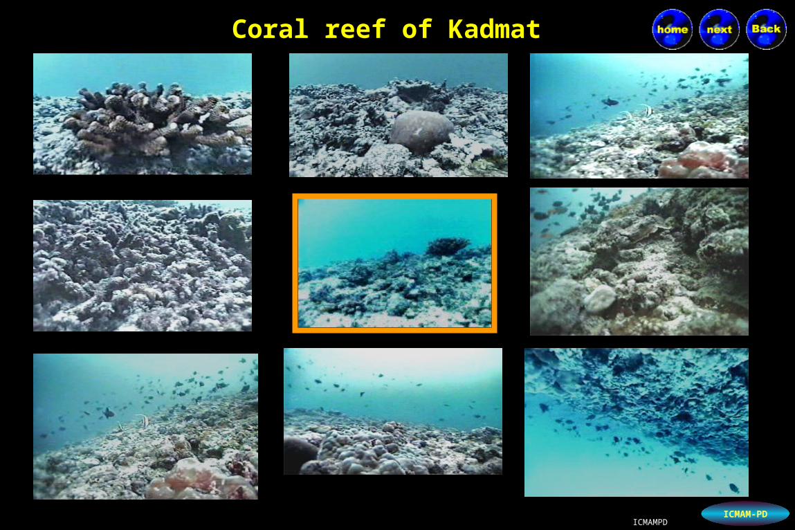
Coral reef of KadmatCoral reef of Kadmat
ICMAMPDICMAMPD

ICMAM-PD
Dead coralsDead corals
ICMAMPDICMAMPD
ICMAM-PD
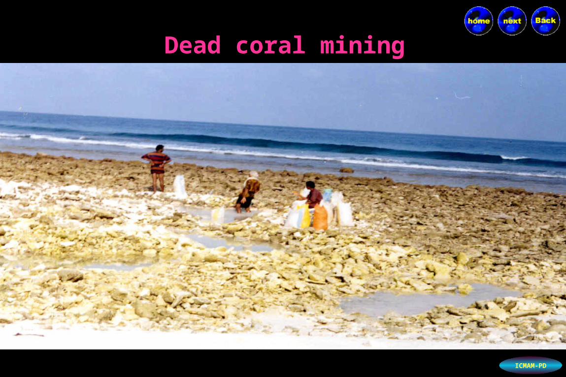
Dead coral miningDead coral mining
ICMAM-PD
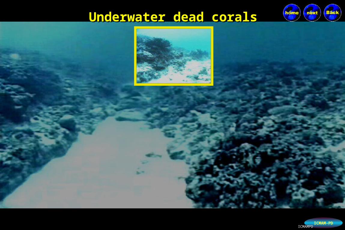
Underwater dead coralsUnderwater dead corals
ICMAMPDICMAMPD
ICMAM-PDICMAMPDICMAMPD

ICMAM-PDICMAMPDICMAMPD

ICMAM-PDICMAMPDICMAMPD

ICMAM-PD
Seagrass in LagoonSeagrass in Lagoon
ICMAMPDICMAMPD

ICMAM-PD
Lagoon with SeagrassLagoon with Seagrass
ICMAMPDICMAMPD

ICMAM-PDICMAMPDICMAMPD

ICMAM-PD
ICMAM-PD
ICMAM-PDICMAMPDICMAMPD

ICMAM-PD

ICMAM-PD
Nov 98 Mar 99 Dec 99

ICMAM-PD

ICMAM-PD

ICMAM-PDICMAMPDICMAMPD

ICMAM-PDICMAMPDICMAMPD

ICMAM-PD

ICMAM-PDICMAMPDICMAMPD

ICMAM-PD

ICMAM-PD
ICMAM-PD

ICMAM-PD

Conclusion :Conclusion :
Geographic Information system has provided a powerful Geographic Information system has provided a powerful tool in the tool in the integration of Environmental and biodiversity data with integration of Environmental and biodiversity data with reasonablereasonable positional accuracy. positional accuracy.
The CHIS can be used for long-term monitoring of coral reef The CHIS can be used for long-term monitoring of coral reef in the in the island.island.
Development of thematic maps using satellite data had Development of thematic maps using satellite data had providedprovided overall view of the island and coral reef morphology with overall view of the island and coral reef morphology with recent recent landuse and landcover changes.landuse and landcover changes.
ICMAM-PD