Embed Size (px)
Citation preview
IDENTIFICATION OF BLACK SPOTS OF TRAFFIC ACCIDENTS IN CASABLANCA CITY
KINGDOM OF MOROCCO
MINISTRY OF EQUIPMENT AND TRANSPORTNATIONAL COMMITTE OF PREVENTION OF TRAFFIC ACCIDENT
Benacer BOULAAJOUL
Permanent Secretary
SUMMARY
►Road safety in Morocco
►The Objectives
►The Missions
►The main results of the study
►The recommandations
►The guidelines for other cities
Traffic Safety management in Morocco
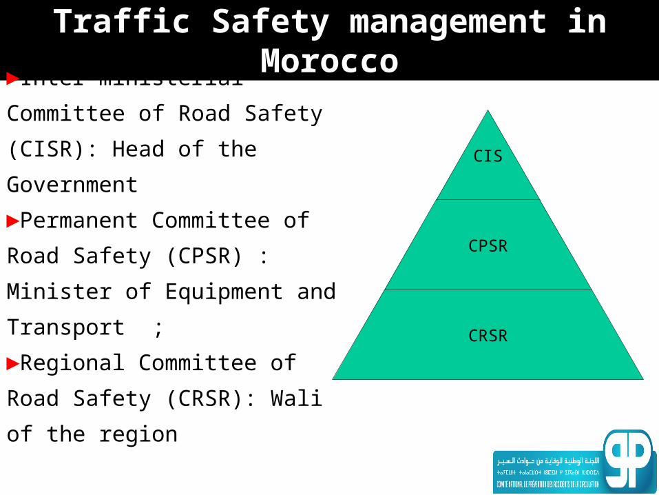
►Inter-ministerial Committee of
Road Safety (CISR): Head of the
Government
►Permanent Committee of Road
Safety (CPSR) : Minister of
Equipment and Transport ;
►Regional Committee of Road
Safety (CRSR): Wali of the region
CIS
CPSR
CRSR
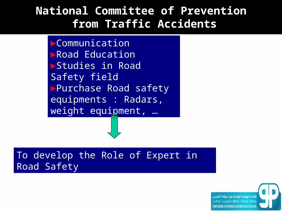
National Committee of Prevention from Traffic Accidents
►Communication►Road Education►Studies in Road Safety field►Purchase Road safety equipments : Radars, weight equipment, …
To develop the Role of Expert in Road Safety
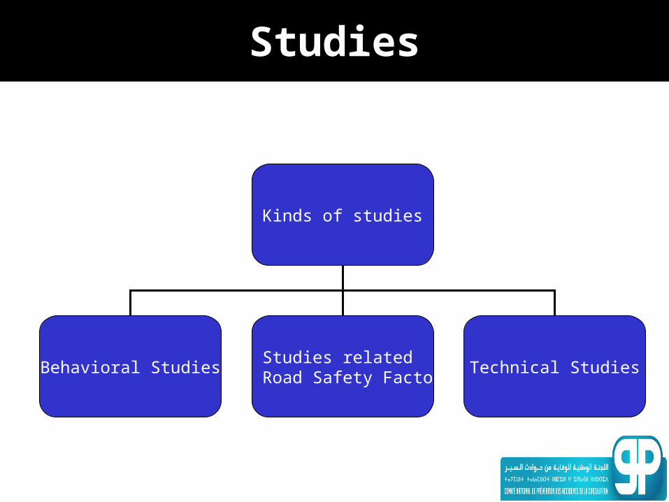
Studies
Kinds of studies
Behavioral StudiesStudies related
to Road Safety FactorsTechnical Studies
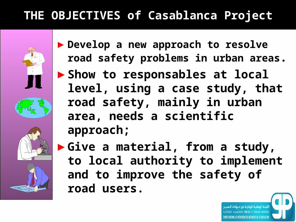
THE OBJECTIVES of Casablanca Project
►Develop a new approach to resolve road safety problems in urban areas.
►Show to responsables at local level, using a case study, that road safety, mainly in urban area, needs a scientific approach;
►Give a material, from a study, to local authority to implement and to improve the safety of road users.
THE MAIN RESULTS OF THE STUDY
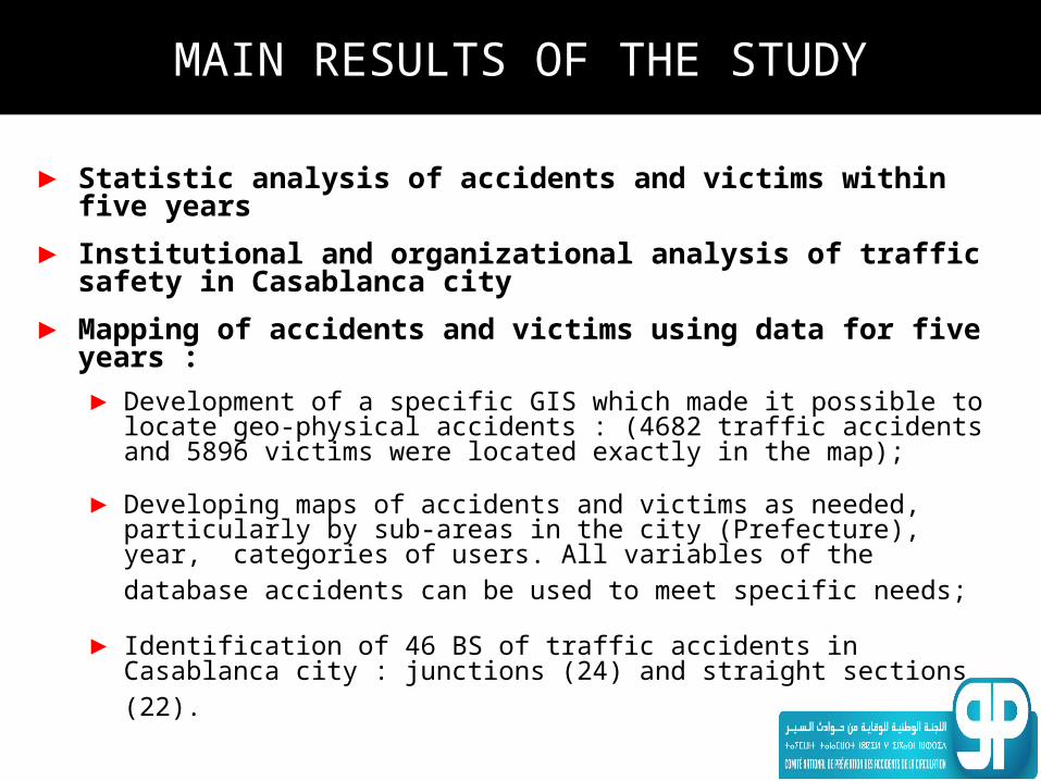
MAIN RESULTS OF THE STUDY
► Statistic analysis of accidents and victims within five years
► Institutional and organizational analysis of traffic safety in Casablanca city
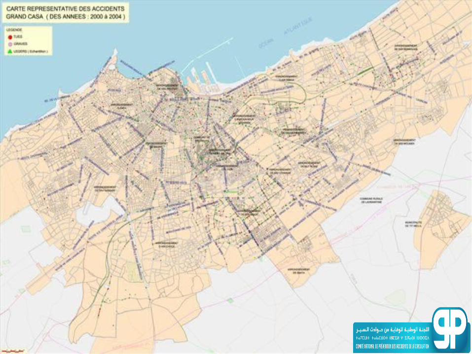
► Mapping of accidents and victims using data for five years :► Development of a specific GIS which made it possible to locate
geo-physical accidents : (4682 traffic accidents and 5896 victims were located exactly in the map);
► Developing maps of accidents and victims as needed, particularly by sub-areas in the city (Prefecture), year, categories of users. All variables of the database accidents can be used to meet specific needs;
► Identification of 46 BS of traffic accidents in Casablanca city : junctions (24) and straight sections (22).
MAIN RESULTS OF THE STUDY
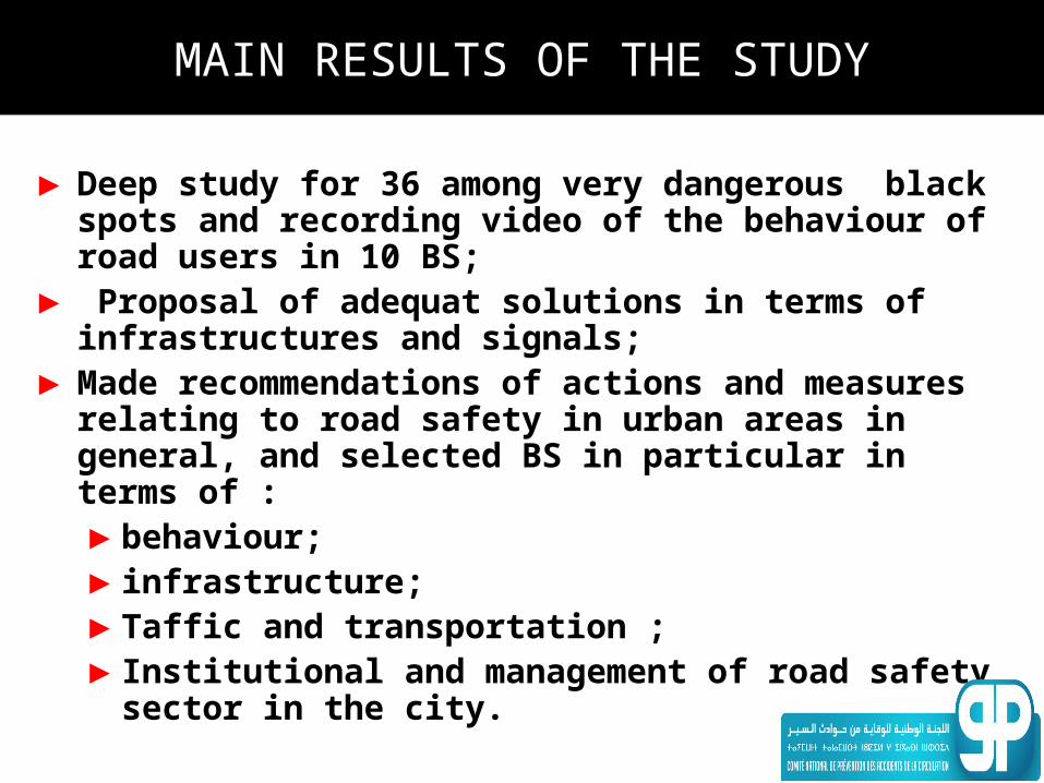
►Deep study for 36 among very dangerous black spots and recording video of the behaviour of road users in 10 BS;
► Proposal of adequat solutions in terms of infrastructures and signals;
►Made recommendations of actions and measures relating to road safety in urban areas in general, and selected BS in particular in terms of : ►behaviour;►infrastructure;►Taffic and transportation ;►Institutional and management of road safety
sector in the city.
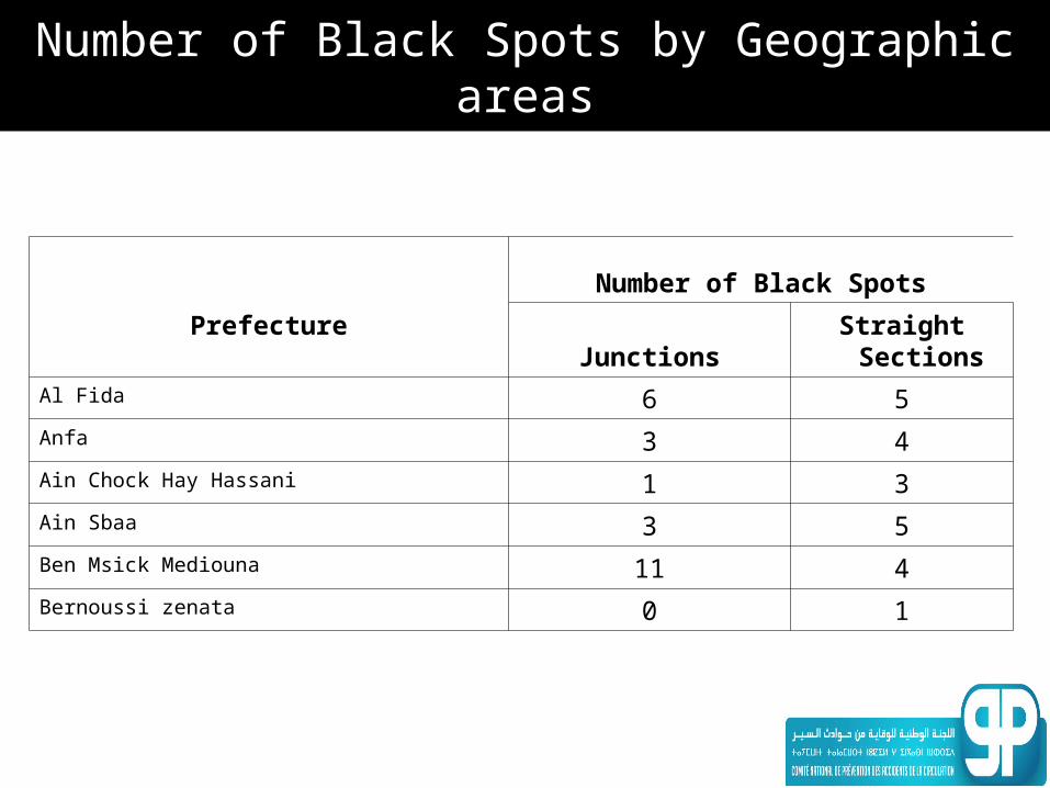
Number of Black Spots by Geographic areas
Prefecture
Number of Black Spots
JunctionsStraight
SectionsAl Fida 6 5Anfa 3 4Ain Chock Hay Hassani 1 3Ain Sbaa 3 5Ben Msick Mediouna 11 4Bernoussi zenata 0 1
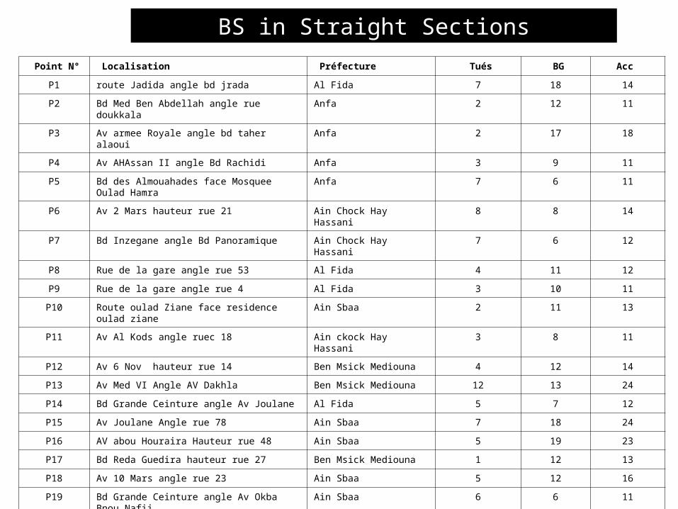
Point N° Localisation Préfecture Tués BG Acc
P1 route Jadida angle bd jrada Al Fida 7 18 14
P2 Bd Med Ben Abdellah angle rue doukkala Anfa 2 12 11
P3 Av armee Royale angle bd taher alaoui Anfa 2 17 18
P4 Av AHAssan II angle Bd Rachidi Anfa 3 9 11
P5 Bd des Almouahades face Mosquee Oulad Hamra
Anfa 7 6 11
P6 Av 2 Mars hauteur rue 21 Ain Chock Hay Hassani 8 8 14
P7 Bd Inzegane angle Bd Panoramique Ain Chock Hay Hassani 7 6 12
P8 Rue de la gare angle rue 53 Al Fida 4 11 12
P9 Rue de la gare angle rue 4 Al Fida 3 10 11
P10 Route oulad Ziane face residence oulad ziane Ain Sbaa 2 11 13
P11 Av Al Kods angle ruec 18 Ain ckock Hay Hassani 3 8 11
P12 Av 6 Nov hauteur rue 14 Ben Msick Mediouna 4 12 14
P13 Av Med VI Angle AV Dakhla Ben Msick Mediouna 12 13 24
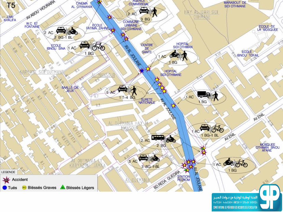
P14 Bd Grande Ceinture angle Av Joulane Al Fida 5 7 12
P15 Av Joulane Angle rue 78 Ain Sbaa 7 18 24
P16 AV abou Houraira Hauteur rue 48 Ain Sbaa 5 19 23
P17 Bd Reda Guedira hauteur rue 27 Ben Msick Mediouna 1 12 13
P18 Av 10 Mars angle rue 23 Ain Sbaa 5 12 16
P19 Bd Grande Ceinture angle Av Okba Bnou Nafii Ain Sbaa 6 6 11
P20 Av 10 Mars angle Av Driss Harti Ben Msick Mediouna 8 31 38
P21 Av Abi Dar Ghaffari anlge rue 39 bernoussi zenata 2 8 10
P22 Bd Fida face rue 21 Al Fida 4 8 12
BS in Straight Sections
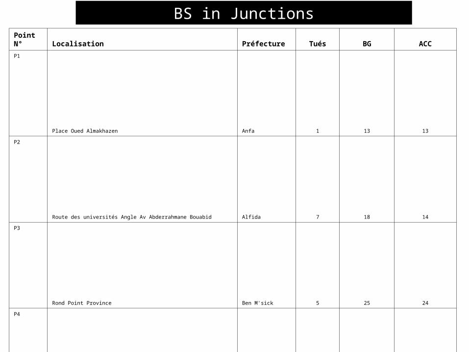
Point N° Localisation Préfecture Tués BG ACC
P1 Place Oued Almakhazen Anfa 1 13 13
P2 Route des universités Angle Av Abderrahmane Bouabid Alfida 7 18 14
P3 Rond Point Province Ben M'sick 5 25 24
P4 Av Al Joulane angle Av Abou Houraira Ben M'sick 5 20 22
P5 Autoroute Alfida 7 5 11
P6 Av Commandant Driss Alharti Ben M'sick 2 15 16
P7 Autoroute Ain chok 8 8 12
P8 AV.CHAHID ABDERRAHMANE LAMKHANET angle AV.10 MARS Ben M'sick 5 10 12
P9 Autoroute Ain Sbaa 6 5 11
P10 BD.DE LA GRANDE CEINTURE angle AV.EL JOULANE Alfida 2 9 11
P11 R.ANNOUSSOUR angle BD.MOHAMED ZERKTOUNI Alfida 3 9 12
P12 BD.LAHRAOUINE angle AV.DRISS EL HARTI Ben M'sick 6 6 11
P13 AV.10 MARS 1982 angle AV.ABOU HOURAIRA Ben M'sick 3 10 12
P14 AV.10 MARS 1982 angle AV.BOUZIANE Ben M'sick 2 10 11
P15 AV.AL JOULANE angle R.48 HAUTEUR SURTE NATIONAL Ben M'sick 1 10 11
P16 BD.AL MASSIRA ANGLE BD.FOUARATE Ain Sbaa 9 1 10
P17 AV.AL JOULANE ANGLE BD.REDA GUEDIRA Ben M'sick 2 9 10
P18 BD.MOHMED VI ( EX ROUTE MEDIOUNA ) ANGLE R.MANUTENTION Alfida 5 8 11
P19 AV.ABDELLAH SANHAJI ANLE AV.ABOU HORAIRA Ben M'sick 6 9 12
P20 BD.DE LA RESISTANCE ANGLE R.HAJJAJ IBNOU ARTAA Anfa 4 10 13
P21 RUE.C ANGLE ROUTE OULAD ZIANE Ain Sbaa 3 12 14
P22 R.DE LA GARE EX LA CROIX ANGLE R.53 & R.4 Alfida 2 10 11
P23 AV.AL JOULANE ANGLE R.1 Ben M'sick 1 10 11
P24 AV.HASSAN II ANGLE BD.MOHAMED ZERKTOUNI Anfa 4 7 10
BS in Junctions
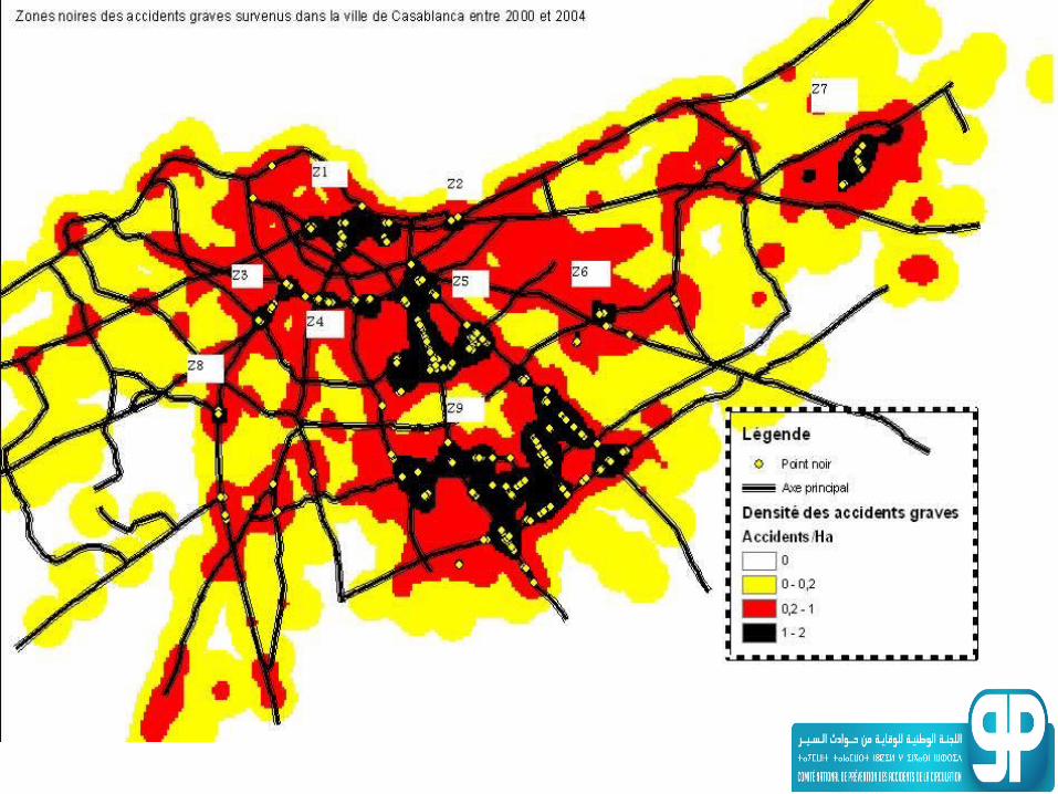
THE TYPOLOGY OF ACCUMULATION ZONES
• Areas examined can be grouped as follows: – Main roads (boulevards) in the city;– Streets with high pedestrian traffic
mainly near (rail stations, shopping centres, hospitals, schools,. ..);
– Junctions;– Highway interchanges;– Exits from tunnels.
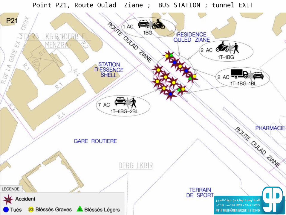
Point P21, Route Oulad Ziane ; BUS STATION ; tunnel EXIT
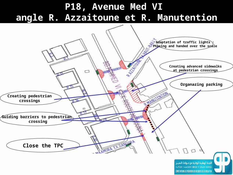
P18, Avenue Med VI angle R. Azzaitoune et R. Manutention
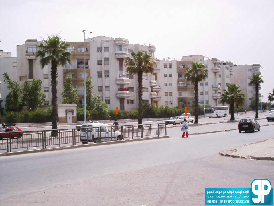
Creating advanced sidewalks at pedestrian crossings
Organazing parking
Creating pedestrian crossings
Close the TPC
Guiding barriers to pedestrian crossing
Adaptation of traffic lights :Phasing and handed over the scale
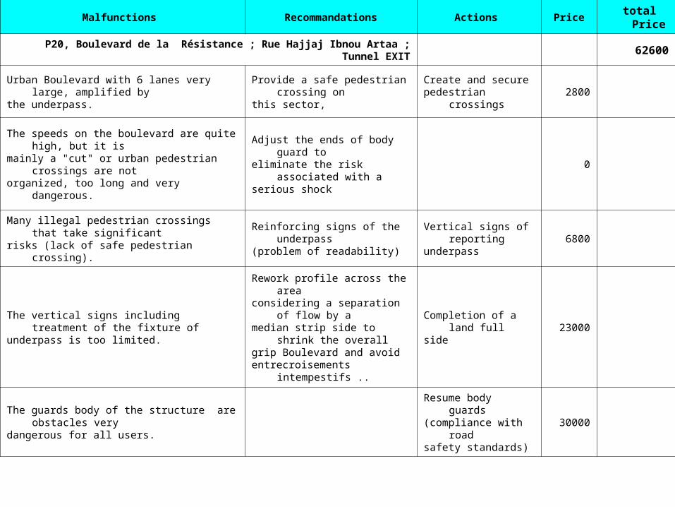
Malfunctions Recommandations Actions Price total
Price
P20, Boulevard de la Résistance ; Rue Hajjaj Ibnou Artaa ; Tunnel EXIT
62600
Urban Boulevard with 6 lanes very large, amplified bythe underpass.
Provide a safe pedestrian crossing onthis sector,
Create and securepedestrian crossings
2800
The speeds on the boulevard are quite high, but it ismainly a "cut" or urban pedestrian crossings are notorganized, too long and very dangerous.
Adjust the ends of body guard toeliminate the risk associated with aserious shock
0
Many illegal pedestrian crossings that take significantrisks (lack of safe pedestrian crossing).
Reinforcing signs of the underpass(problem of readability)
Vertical signs of reportingunderpass
6800
The vertical signs including treatment of the fixture ofunderpass is too limited.
Rework profile across the areaconsidering a separation of flow by amedian strip side to shrink the overallgrip Boulevard and avoidentrecroisements intempestifs ..
Completion of a land fullside
23000
The guards body of the structure are obstacles verydangerous for all users.
Resume body guards(compliance with roadsafety standards)
30000
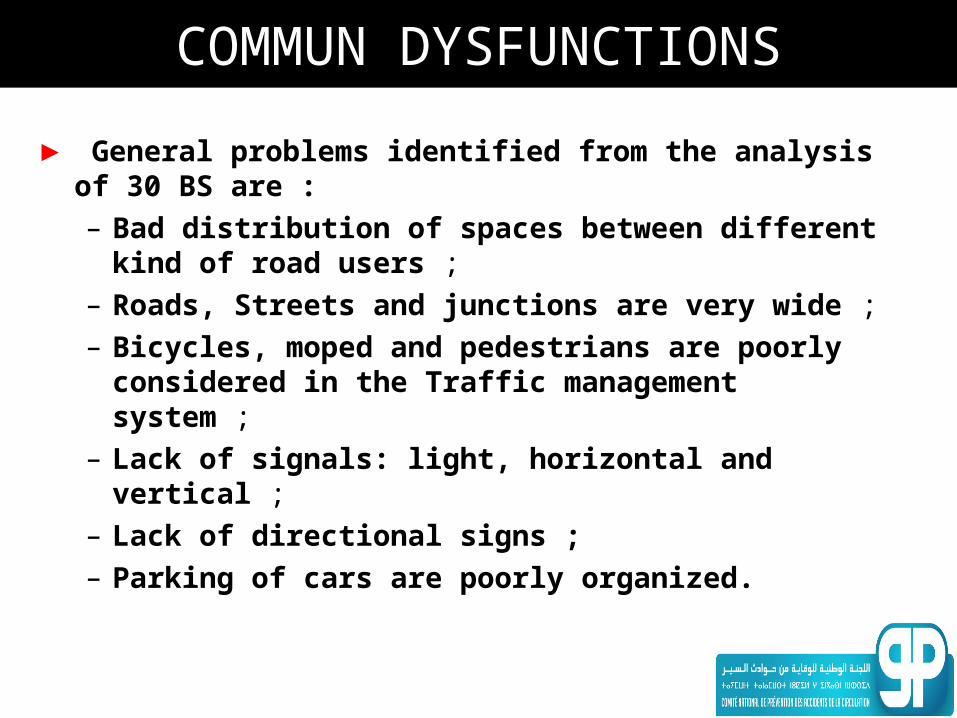
COMMUN DYSFUNCTIONS
► General problems identified from the analysis of 30 BS are :– Bad distribution of spaces between
different kind of road users ;– Roads, Streets and junctions are very wide ;– Bicycles, moped and pedestrians are poorly
considered in the Traffic management system ;
– Lack of signals: light, horizontal and vertical ;
– Lack of directional signs ;– Parking of cars are poorly organized.
RECOMMENDATIONS AND LESSONS FOR
INFRASTRUCTURE AND CONTROL IN URBAN AREAS
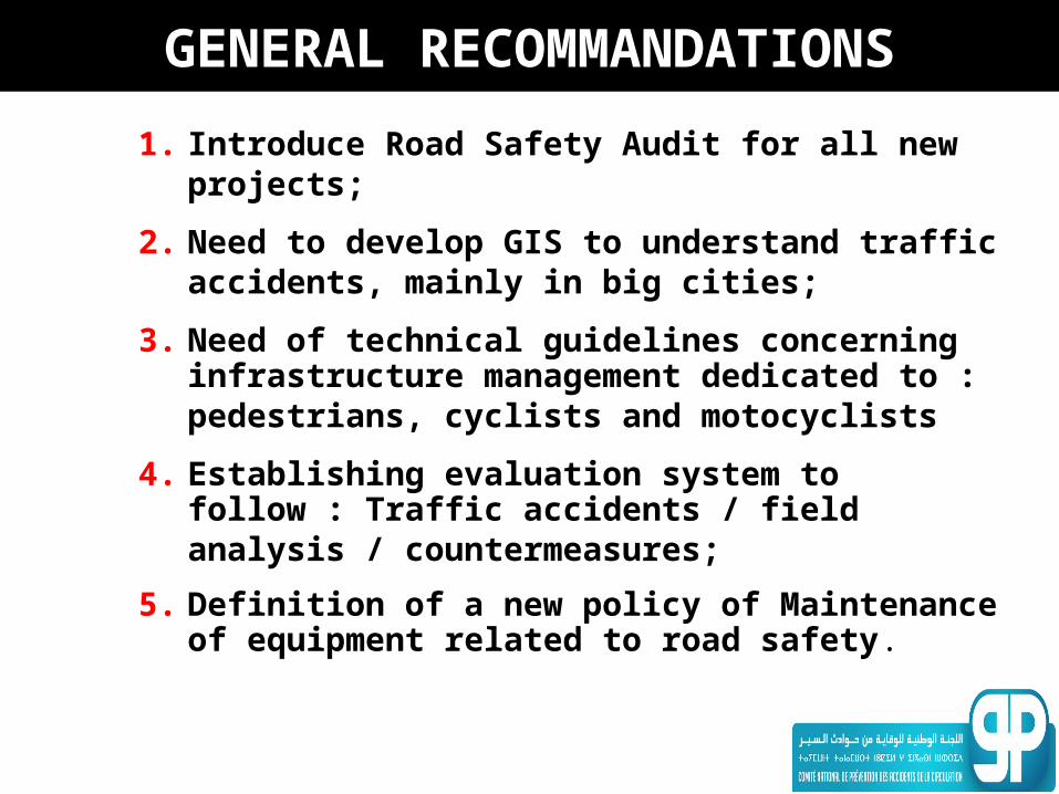
GENERAL RECOMMANDATIONS
1. Introduce Road Safety Audit for all new projects;
2. Need to develop GIS to understand traffic accidents, mainly in big cities;
3. Need of technical guidelines concerning infrastructure management dedicated to : pedestrians, cyclists and motocyclists
4. Establishing evaluation system to follow : Traffic accidents / field analysis / countermeasures;
5. Definition of a new policy of Maintenance of equipment related to road safety.
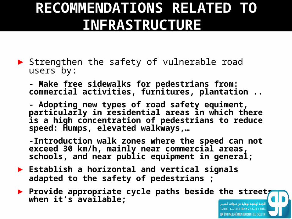
RECOMMENDATIONS RELATED TO INFRASTRUCTURE
► Strengthen the safety of vulnerable road users by:
- Make free sidewalks for pedestrians from: commercial activities, furnitures, plantation ..
- Adopting new types of road safety equiment, particularly in residential areas in which there is a high concentration of pedestrians to reduce speed: Humps, elevated walkways,…
-Introduction walk zones where the speed can not exceed 30 km/h, mainly near commercial areas, schools, and near public equipment in general;
► Establish a horizontal and vertical signals adapted to the safety of pedestrians ;
► Provide appropriate cycle paths beside the streets when it’s available;

RECOMMENDATIONS RELATED TO INFRASTRUCTURE
►Reduce the size of central crossroads in the main junctions with traffic signals, and create special lanes for "turn left"
►Introduce Smart Regulation Systems
for traffic, especially in big cities ;