Embed Size (px)
Citation preview
Don't you just love larch season?
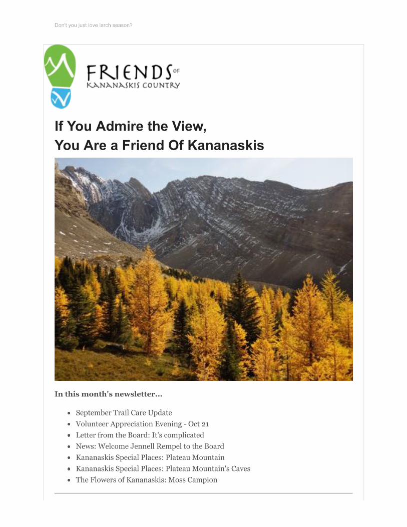
If You Admire the View,You Are a Friend Of Kananaskis
In this month's newsletter...
September Trail Care UpdateVolunteer Appreciation Evening - Oct 21Letter from the Board: It's complicatedNews: Welcome Jennell Rempel to the BoardKananaskis Special Places: Plateau MountainKananaskis Special Places: Plateau Mountain's CavesThe Flowers of Kananaskis: Moss Campion
September Trail Care Updateby Nancy Ouimet, Program Coordinator
We had the pleasure of working on the High Rockies Trail in September. This 80kmtrail is an addition to the Trans Canada Trail and will create a single, defined multi-useconnection, from the boundary of Banff National Park near the existing Goat CreekStaging Area to the provincial border with British Columbia at Elk Pass. The High RockiesTrail will provide additional linkages between many isolated trails and trail networks inKananaskis Country, primarily along the Smith-Dorrien corridor.
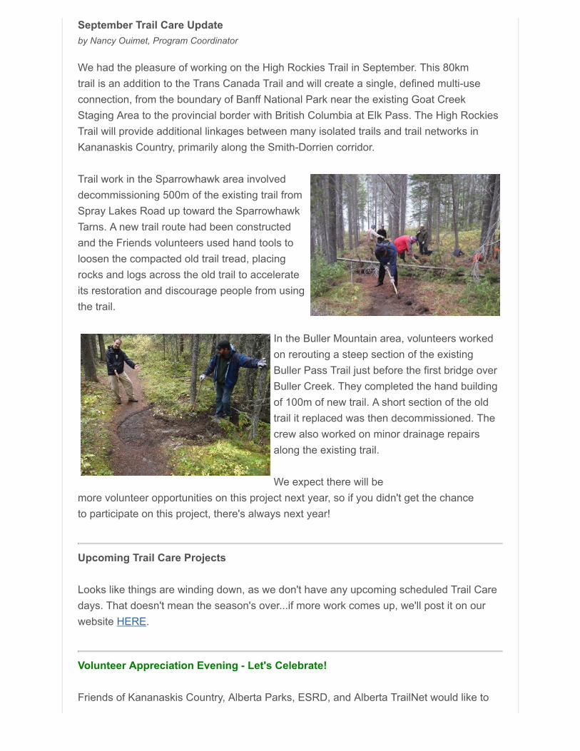
Trail work in the Sparrowhawk area involveddecommissioning 500m of the existing trail fromSpray Lakes Road up toward the SparrowhawkTarns. A new trail route had been constructedand the Friends volunteers used hand tools toloosen the compacted old trail tread, placingrocks and logs across the old trail to accelerateits restoration and discourage people from usingthe trail.
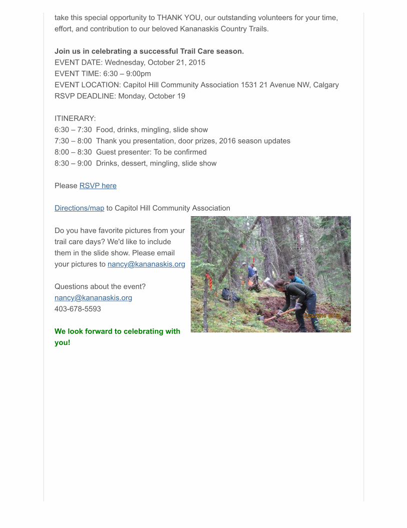
In the Buller Mountain area, volunteers workedon rerouting a steep section of the existingBuller Pass Trail just before the first bridge overBuller Creek. They completed the hand buildingof 100m of new trail. A short section of the oldtrail it replaced was then decommissioned. Thecrew also worked on minor drainage repairsalong the existing trail.
We expect there will bemore volunteer opportunities on this project next year, so if you didn't get the chanceto participate on this project, there's always next year!
Upcoming Trail Care Projects
Looks like things are winding down, as we don't have any upcoming scheduled Trail Caredays. That doesn't mean the season's over...if more work comes up, we'll post it on ourwebsite HERE.
Volunteer Appreciation Evening - Let's Celebrate!
Friends of Kananaskis Country, Alberta Parks, ESRD, and Alberta TrailNet would like to
take this special opportunity to THANK YOU, our outstanding volunteers for your time,effort, and contribution to our beloved Kananaskis Country Trails.
Join us in celebrating a successful Trail Care season.EVENT DATE: Wednesday, October 21, 2015EVENT TIME: 6:30 – 9:00pmEVENT LOCATION: Capitol Hill Community Association 1531 21 Avenue NW, CalgaryRSVP DEADLINE: Monday, October 19
ITINERARY:6:30 – 7:30 Food, drinks, mingling, slide show7:30 – 8:00 Thank you presentation, door prizes, 2016 season updates8:00 – 8:30 Guest presenter: To be confirmed8:30 – 9:00 Drinks, dessert, mingling, slide show
Please RSVP here
Directions/map to Capitol Hill Community Association
Do you have favorite pictures from yourtrail care days? We'd like to includethem in the slide show. Please emailyour pictures to [email protected]
Questions about the [email protected]
We look forward to celebrating withyou!
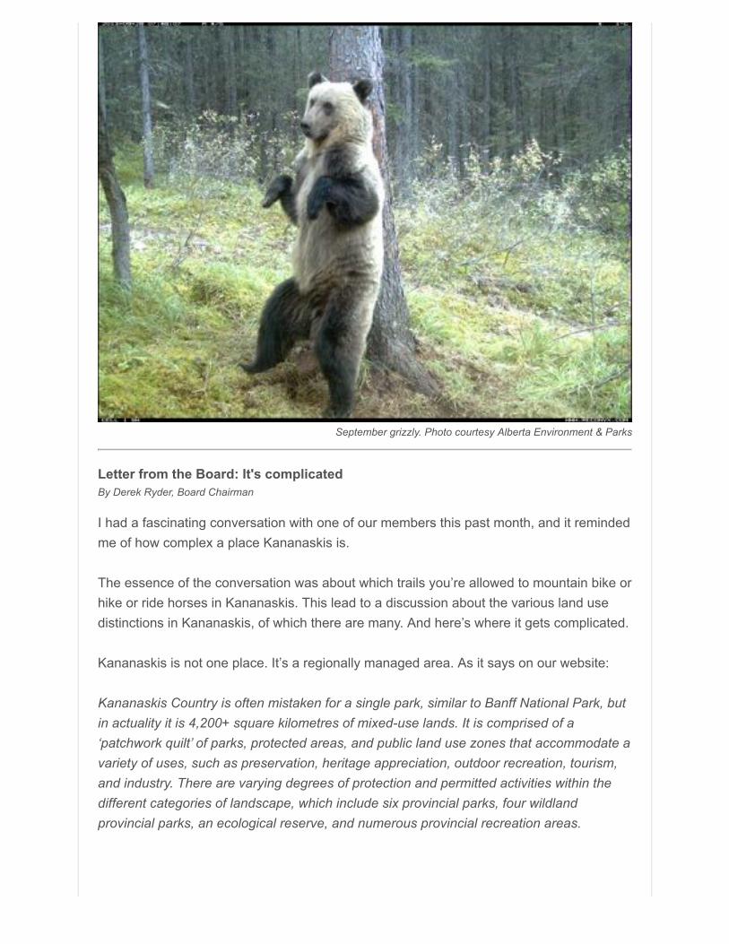
September grizzly. Photo courtesy Alberta Environment & Parks
Letter from the Board: It's complicatedBy Derek Ryder, Board Chairman
I had a fascinating conversation with one of our members this past month, and it remindedme of how complex a place Kananaskis is.
The essence of the conversation was about which trails you’re allowed to mountain bike orhike or ride horses in Kananaskis. This lead to a discussion about the various land usedistinctions in Kananaskis, of which there are many. And here’s where it gets complicated.
Kananaskis is not one place. It’s a regionally managed area. As it says on our website:
Kananaskis Country is often mistaken for a single park, similar to Banff National Park, butin actuality it is 4,200+ square kilometres of mixed-use lands. It is comprised of a‘patchwork quilt’ of parks, protected areas, and public land use zones that accommodate avariety of uses, such as preservation, heritage appreciation, outdoor recreation, tourism,and industry. There are varying degrees of protection and permitted activities within thedifferent categories of landscape, which include six provincial parks, four wildlandprovincial parks, an ecological reserve, and numerous provincial recreation areas.
The gentleman I spoke with was a hiker whowanted to avoid trails with non-hiking users. Andthe cool part about Kananaskis is that you can dothat, the same way there are mountain bikespecific trails that non-bike users won’t use.Because K-Country is a “patchwork quilt of parks,protected areas, and public land use zones thataccommodate a variety of uses” managed like abig Rubik's cube, there’s a space for everyone todo something they like. But it kinda helps to knowwhich spaces accommodate what. In keeping withour education mandate, our job is to help youunderstand that.
The best way I can think to do that is through – ta-dah! – this newsletter. So starting thismonth, we’re going to break down Kananaskis into its elemental pieces. Each month forthe next however-many-it-takes, we’ll look at each piece of the Kananaskis puzzle: what itit, why it was created, and most importantly what you can – and can’t – do there. It’s fittingthat this series will start with one of Kananaskis’ most special and unique places – PlateauMountain – which coincidentally was coming up in the continuing series of – ta-dah! –Kananaskis Special Places anyway. So far that series has covered rock glaciers, iceglaciers, sand dunes, springs and caves, plus other topics.
The Friends have to deal with Kananaskis’ complex nature every day, whether we areassisting on trails or helping with interpretation work. The complexity becomes secondnature to us. Here’s hoping it becomes second nature to you, too.
Welcome Jennell Rempel! We are pleased to welcome Jennell Rempel as a Alberta Parks representative the Board.As the Community and Partner Relations Team Lead for Alberta Park and Environment,Jennell plays an important role in helping communities and partners contribute to parksthrough meaningful collaboration toward mutual goals. This area primarily focuses ongroups or individuals who want to work with the Kananaskis Region and bring their ownabilities and resources to the table, such as volunteers and cooperating associations. She has worked with Alberta Parks in a variety of parks and roles. From Cypress HillsInterprovincial Park to Dinosaur Provincial Park, and then to Calgary as an educator at theFish Creek Environmental Learning Centre and ultimately the District Visitor ServicesCoordinator. Jennell holds a Masters Degree in Environmental Education focused onevaluating student learning in wetland programs.
Jennell will be serving on the board as a Liaison Officer, providing experience andperspective as it relates to Kananaskis Country, collaboration, volunteering, and muchmore.
Welcome Jennell!
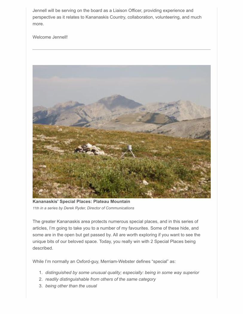
Kananaskis' Special Places: Plateau Mountain11th in a series by Derek Ryder, Director of Communications
The greater Kananaskis area protects numerous special places, and in this series ofarticles, I’m going to take you to a number of my favourites. Some of these hide, andsome are in the open but get passed by. All are worth exploring if you want to see theunique bits of our beloved space. Today, you really win with 2 Special Places beingdescribed.
While I’m normally an Oxford-guy, Merriam-Webster defines “special” as:
1. distinguished by some unusual quality; especially: being in some way superior2. readily distinguishable from others of the same category3. being other than the usual
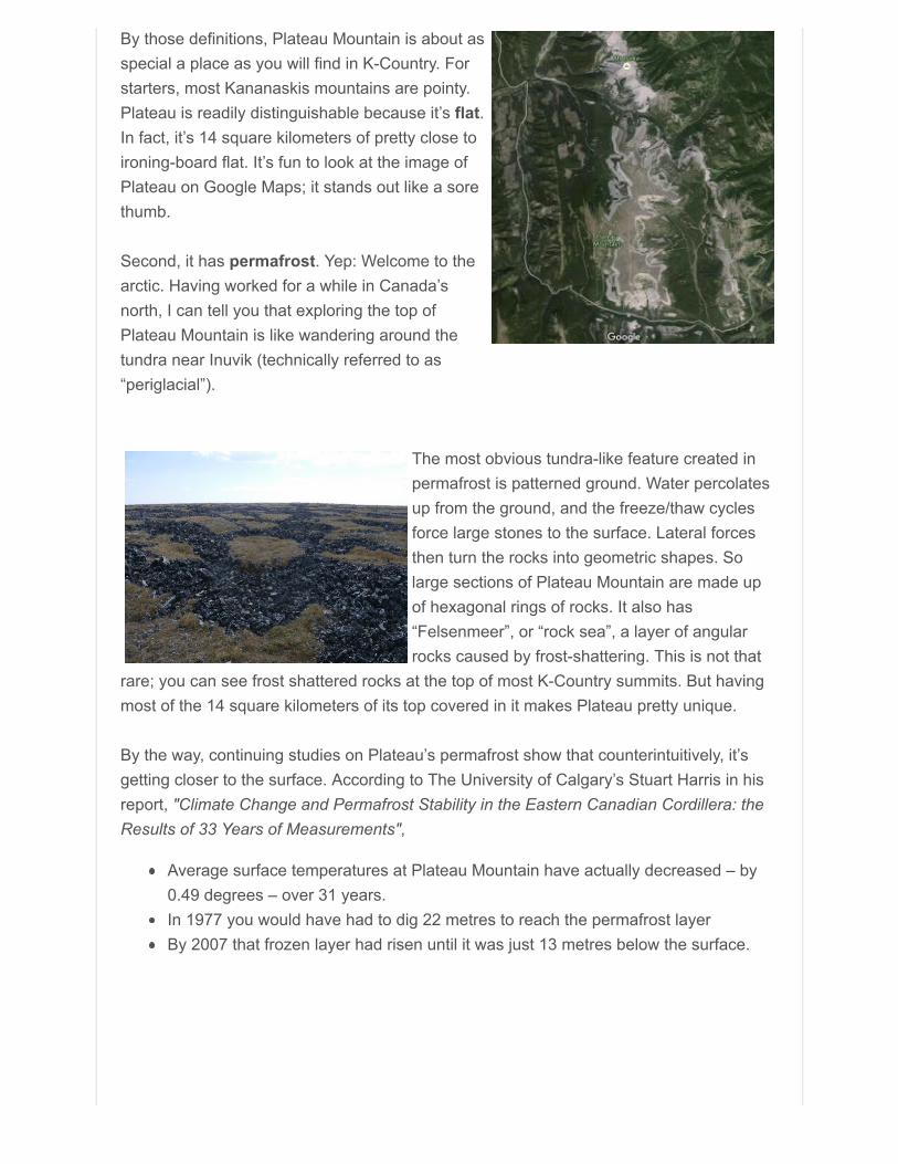
By those definitions, Plateau Mountain is about asspecial a place as you will find in K-Country. Forstarters, most Kananaskis mountains are pointy.Plateau is readily distinguishable because it’s flat.In fact, it’s 14 square kilometers of pretty close toironing-board flat. It’s fun to look at the image ofPlateau on Google Maps; it stands out like a sorethumb.
Second, it has permafrost. Yep: Welcome to thearctic. Having worked for a while in Canada’snorth, I can tell you that exploring the top ofPlateau Mountain is like wandering around thetundra near Inuvik (technically referred to as“periglacial”).
The most obvious tundra-like feature created inpermafrost is patterned ground. Water percolatesup from the ground, and the freeze/thaw cyclesforce large stones to the surface. Lateral forcesthen turn the rocks into geometric shapes. Solarge sections of Plateau Mountain are made upof hexagonal rings of rocks. It also has“Felsenmeer”, or “rock sea”, a layer of angularrocks caused by frost-shattering. This is not that
rare; you can see frost shattered rocks at the top of most K-Country summits. But havingmost of the 14 square kilometers of its top covered in it makes Plateau pretty unique.
By the way, continuing studies on Plateau’s permafrost show that counterintuitively, it’sgetting closer to the surface. According to The University of Calgary’s Stuart Harris in hisreport, "Climate Change and Permafrost Stability in the Eastern Canadian Cordillera: theResults of 33 Years of Measurements",
Average surface temperatures at Plateau Mountain have actually decreased – by0.49 degrees – over 31 years.In 1977 you would have had to dig 22 metres to reach the permafrost layerBy 2007 that frozen layer had risen until it was just 13 metres below the surface.
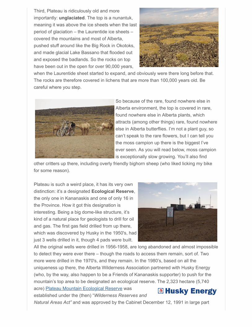
Third, Plateau is ridiculously old and moreimportantly: unglaciated. The top is a nunantuk,meaning it was above the ice sheets when the lastperiod of glaciation – the Laurentide ice sheets –covered the mountains and most of Alberta,pushed stuff around like the Big Rock in Okotoks,and made glacial Lake Bassano that flooded outand exposed the badlands. So the rocks on tophave been out in the open for over 90,000 years,when the Laurentide sheet started to expand, and obviously were there long before that.The rocks are therefore covered in lichens that are more than 100,000 years old. Becareful where you step.
So because of the rare, found nowhere else inAlberta environment, the top is covered in rare,found nowhere else in Alberta plants, whichattracts (among other things) rare, found nowhereelse in Alberta butterflies. I’m not a plant guy, socan’t speak to the rare flowers, but I can tell youthe moss campion up there is the biggest I’veever seen. As you will read below, moss campionis exceptionally slow growing. You’ll also find
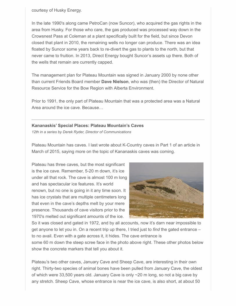
other critters up there, including overly friendly bighorn sheep (who liked licking my bikefor some reason).
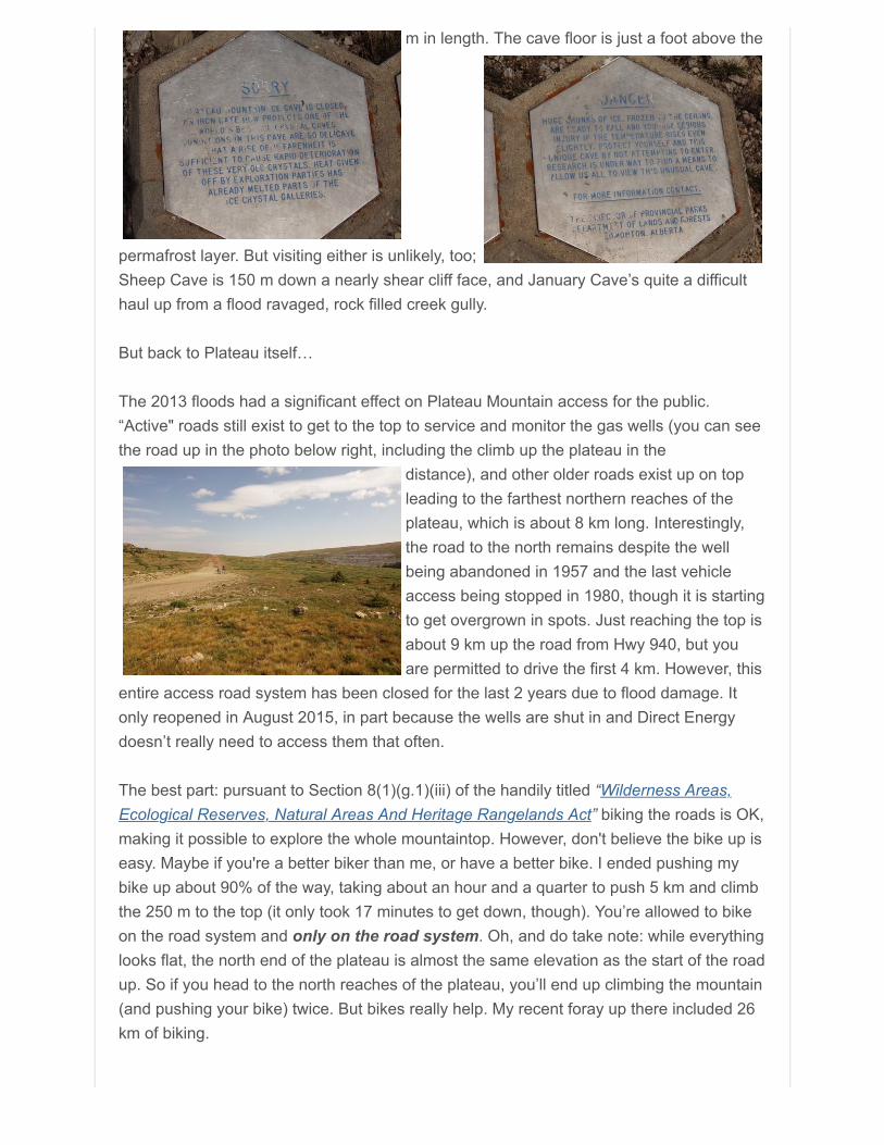
Plateau is such a weird place, it has its very owndistinction: it’s a designated Ecological Reserve,the only one in Kananaskis and one of only 16 inthe Province. How it got this designation isinteresting. Being a big dome-like structure, it’skind of a natural place for geologists to drill for oiland gas. The first gas field drilled from up there,which was discovered by Husky in the 1950's, hadjust 3 wells drilled in it, though 4 pads were built.All the original wells were drilled in 1956-1958, are long abandoned and almost impossibleto detect they were ever there – though the roads to access them remain, sort of. Twomore were drilled in the 1970's, and they remain. In the 1980’s, based on all theuniqueness up there, the Alberta Wilderness Association partnered with Husky Energy(who, by the way, also happen to be a Friends of Kananaskis supporter) to push for themountain’s top area to be designated an ecological reserve. The 2,323 hectare (5,740acre) Plateau Mountain Ecological Reserve wasestablished under the (then) “Wilderness Reserves andNatural Areas Act” and was approved by the Cabinet December 12, 1991 in large part
courtesy of Husky Energy.
In the late 1990's along came PetroCan (now Suncor), who acquired the gas rights in thearea from Husky. For those who care, the gas produced was processed way down in theCrowsnest Pass at Coleman at a plant specifically built for the field, but since Devonclosed that plant in 2010, the remaining wells no longer can produce. There was an ideafloated by Suncor some years back to re-divert the gas to plants to the north, but thatnever came to fruition. In 2013, Direct Energy bought Suncor’s assets up there. Both ofthe wells that remain are currently capped.
The management plan for Plateau Mountain was signed in January 2000 by none otherthan current Friends Board member Dave Nielson, who was (then) the Director of NaturalResource Service for the Bow Region with Alberta Environment.
Prior to 1991, the only part of Plateau Mountain that was a protected area was a NaturalArea around the ice cave. Because…
Kananaskis’ Special Places: Plateau Mountain’s Caves12th in a series by Derek Ryder, Director of Communications
Plateau Mountain has caves. I last wrote about K-Country caves in Part 1 of an article inMarch of 2015, saying more on the topic of Kananaskis caves was coming.
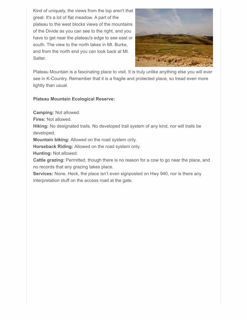
Plateau has three caves, but the most significantis the ice cave. Remember, 5-20 m down, it’s iceunder all that rock. The cave is almost 100 m longand has spectacular ice features. It’s worldrenown, but no one is going in it any time soon. Ithas ice crystals that are multiple centimeters longthat even in the cave’s depths melt by your merepresence. Thousands of cave visitors prior to the1970's melted out significant amounts of the ice.So it was closed and gated in 1972, and by all accounts, now it’s darn near impossible toget anyone to let you in. On a recent trip up there, I tried just to find the gated entrance –to no avail. Even with a gate across it, it hides. The cave entrance is some 60 m down the steep scree face in the photo above right. These other photos belowshow the concrete markers that tell you about it.
Plateau’s two other caves, January Cave and Sheep Cave, are interesting in their ownright. Thirty-two species of animal bones have been pulled from January Cave, the oldestof which were 33,500 years old. January Cave is only ~20 m long, so not a big cave byany stretch. Sheep Cave, whose entrance is near the ice cave, is also short, at about 50
m in length. The cave floor is just a foot above the
permafrost layer. But visiting either is unlikely, too;Sheep Cave is 150 m down a nearly shear cliff face, and January Cave’s quite a difficulthaul up from a flood ravaged, rock filled creek gully.
But back to Plateau itself…
The 2013 floods had a significant effect on Plateau Mountain access for the public.“Active" roads still exist to get to the top to service and monitor the gas wells (you can seethe road up in the photo below right, including the climb up the plateau in the
distance), and other older roads exist up on topleading to the farthest northern reaches of theplateau, which is about 8 km long. Interestingly,the road to the north remains despite the wellbeing abandoned in 1957 and the last vehicleaccess being stopped in 1980, though it is startingto get overgrown in spots. Just reaching the top isabout 9 km up the road from Hwy 940, but youare permitted to drive the first 4 km. However, this
entire access road system has been closed for the last 2 years due to flood damage. Itonly reopened in August 2015, in part because the wells are shut in and Direct Energydoesn’t really need to access them that often.
The best part: pursuant to Section 8(1)(g.1)(iii) of the handily titled “Wilderness Areas,Ecological Reserves, Natural Areas And Heritage Rangelands Act” biking the roads is OK,making it possible to explore the whole mountaintop. However, don't believe the bike up iseasy. Maybe if you're a better biker than me, or have a better bike. I ended pushing mybike up about 90% of the way, taking about an hour and a quarter to push 5 km and climbthe 250 m to the top (it only took 17 minutes to get down, though). You’re allowed to bikeon the road system and only on the road system. Oh, and do take note: while everythinglooks flat, the north end of the plateau is almost the same elevation as the start of the roadup. So if you head to the north reaches of the plateau, you’ll end up climbing the mountain(and pushing your bike) twice. But bikes really help. My recent foray up there included 26km of biking.
Kind of uniquely, the views from the top aren't thatgreat. It's a lot of flat meadow. A part of theplateau to the west blocks views of the mountainsof the Divide as you can see to the right, and youhave to get near the plateau's edge to see east orsouth. The view to the north takes in Mt. Burke,and from the north end you can look back at Mt.Salter.
Plateau Mountain is a fascinating place to visit. It is truly unlike anything else you will eversee in K-Country. Remember that it is a fragile and protected place, so tread even morelightly than usual.
Plateau Mountain Ecological Reserve:
Camping: Not allowed.Fires: Not allowed.Hiking: No designated trails. No developed trail system of any kind, nor will trails bedeveloped.Mountain biking: Allowed on the road system only.Horseback Riding: Allowed on the road system only.Hunting: Not allowed.Cattle grazing: Permitted, though there is no reason for a cow to go near the place, andno records that any grazing takes place.Services: None. Heck, the place isn’t even signposted on Hwy 940, nor is there anyinterpretation stuff on the access road at the gate.
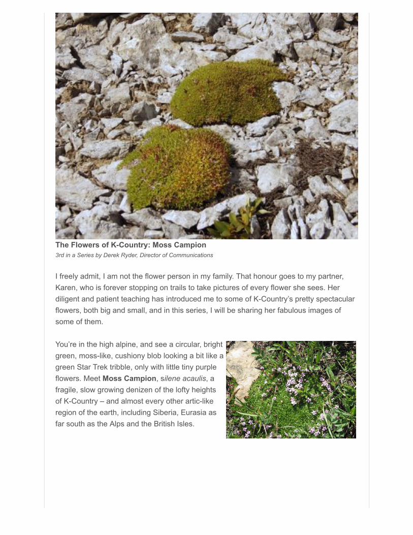
The Flowers of K-Country: Moss Campion3rd in a Series by Derek Ryder, Director of Communications
I freely admit, I am not the flower person in my family. That honour goes to my partner,Karen, who is forever stopping on trails to take pictures of every flower she sees. Herdiligent and patient teaching has introduced me to some of K-Country’s pretty spectacularflowers, both big and small, and in this series, I will be sharing her fabulous images ofsome of them.
You’re in the high alpine, and see a circular, brightgreen, moss-like, cushiony blob looking a bit like agreen Star Trek tribble, only with little tiny purpleflowers. Meet Moss Campion, silene acaulis, afragile, slow growing denizen of the lofty heightsof K-Country – and almost every other artic-likeregion of the earth, including Siberia, Eurasia asfar south as the Alps and the British Isles.
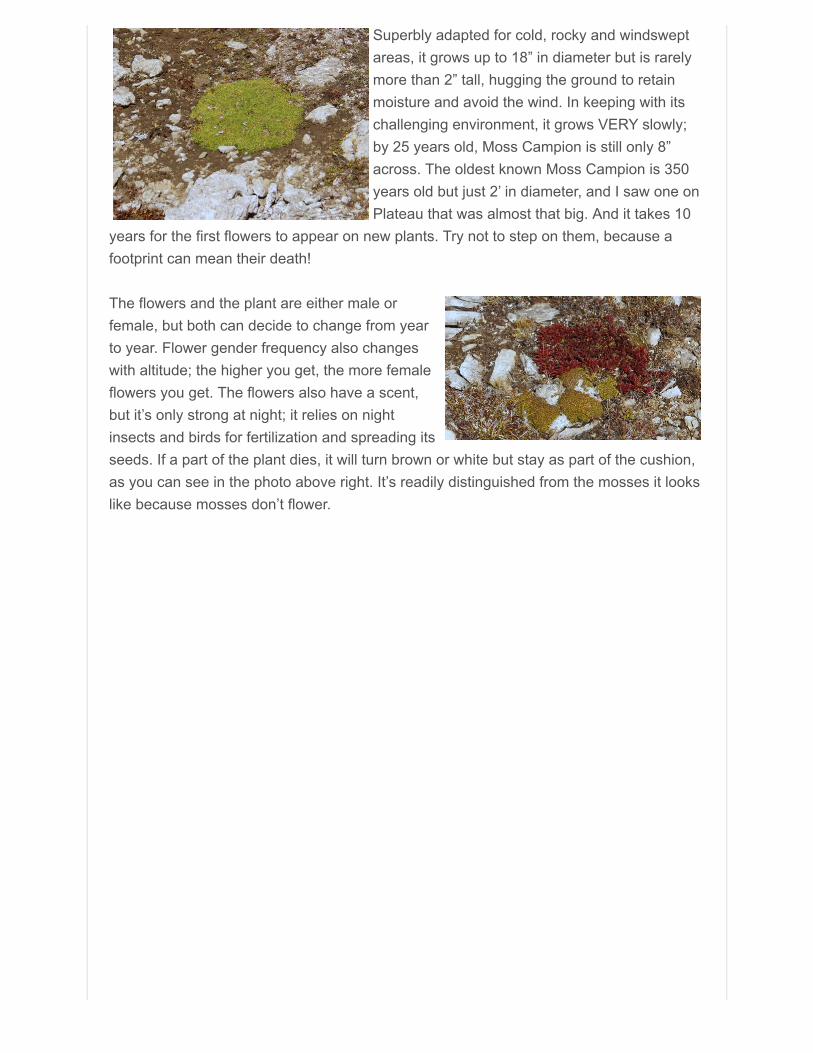
Superbly adapted for cold, rocky and windsweptareas, it grows up to 18” in diameter but is rarelymore than 2” tall, hugging the ground to retainmoisture and avoid the wind. In keeping with itschallenging environment, it grows VERY slowly;by 25 years old, Moss Campion is still only 8”across. The oldest known Moss Campion is 350years old but just 2’ in diameter, and I saw one onPlateau that was almost that big. And it takes 10
years for the first flowers to appear on new plants. Try not to step on them, because afootprint can mean their death!
The flowers and the plant are either male orfemale, but both can decide to change from yearto year. Flower gender frequency also changeswith altitude; the higher you get, the more femaleflowers you get. The flowers also have a scent,but it’s only strong at night; it relies on nightinsects and birds for fertilization and spreading itsseeds. If a part of the plant dies, it will turn brown or white but stay as part of the cushion,as you can see in the photo above right. It’s readily distinguished from the mosses it lookslike because mosses don’t flower.
Your Donations are Always Appreciated and Needed We are pleased to recognize the contributions ofthe Calgary Foundation, who in 2014, made a four-yearcommitment to support the Friends in flood recoveryefforts, and who continue to support our work with grants.
There are many ways to express your gratitude forKananaskis Country and we are always grateful forcontributions that help us maintain our programs, operations and restore flood damagedtrails. Friends of Kananaskis Country is a registered charity in good standing and weprovide charitable receipts for donations over $20.00. You can reach us directly by mail atthe address below, through the donations link on our website, through ATB Cares,or CanadaHelps. Thank you for your support!
Friends of Kananaskis Country201-800 Railway AvenueCanmore, AB T1W 1P1
follow on Twitter | like on Facebook | forward to a friend

Copyright © 2015 Friends of Kananaskis Country, All rightsreserved.
unsubscribe from this list | update subscription preferences