Embed Size (px)
Citation preview
IFC Alignment DeploymentLive Demonstration - Spanish Team
By Francisco Navarrete
Barcelona, April 5th 2017
INDEX
1. ABOUT APLITOP AND MDT SOFTWARE
2. ROADBIM PROJECT
3. IFC ALIGNMENT DEPLOYMENT
4. LIVE DEMONSTRATION
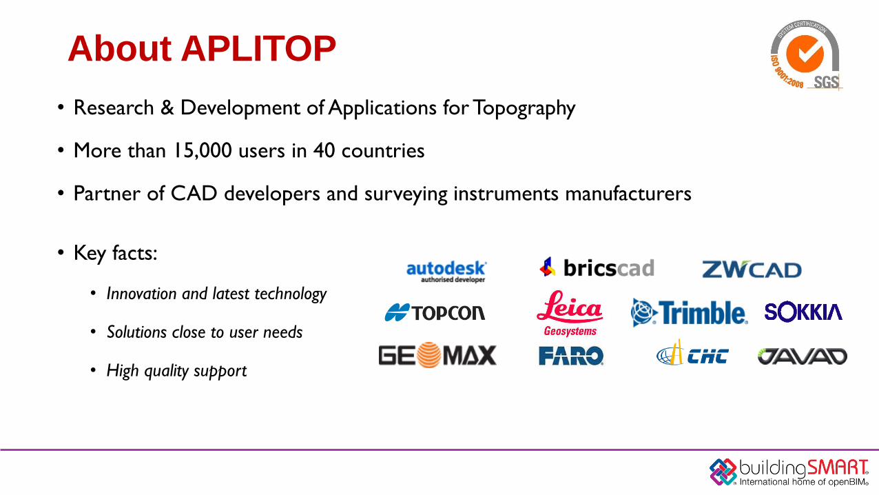
About APLITOP
• Research & Development of Applications for Topography
• More than 15,000 users in 40 countries
• Partner of CAD developers and surveying instruments manufacturers
• Key facts:
• Innovation and latest technology
• Solutions close to user needs
• High quality support
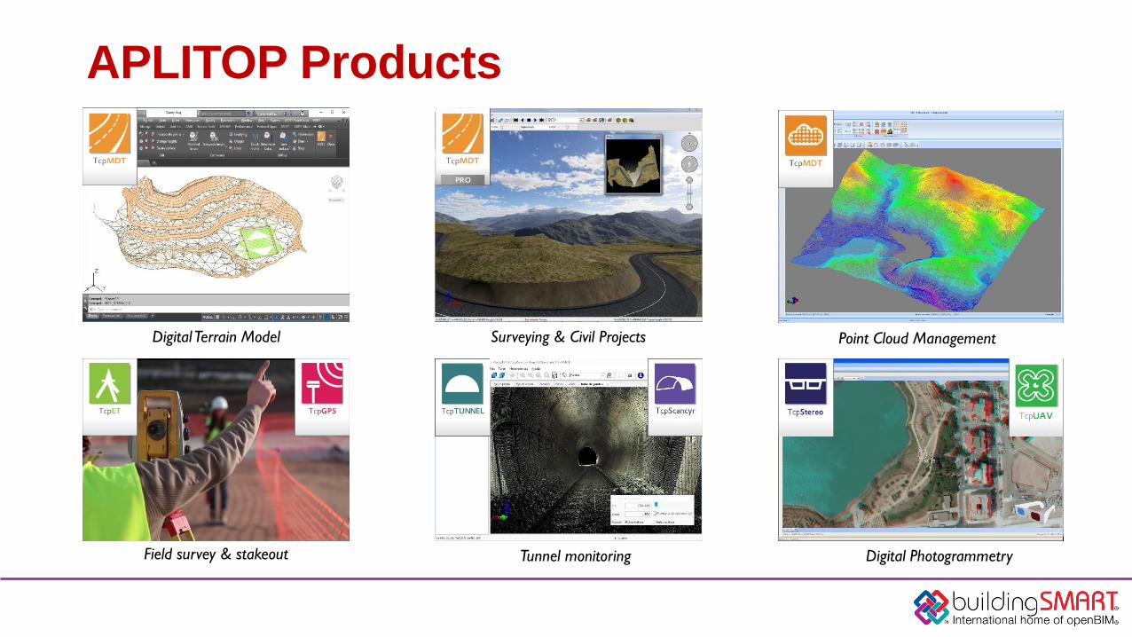
APLITOP Products
Surveying & Civil ProjectsDigital Terrain Model Point Cloud Management
Tunnel monitoringField survey & stakeout Digital Photogrammetry
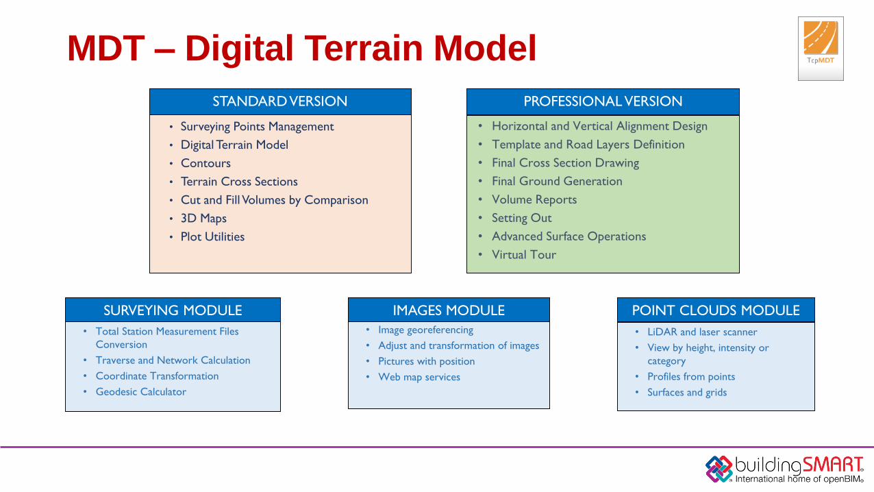
MDT – Digital Terrain Model
• Surveying Points Management
• Digital Terrain Model
• Contours
• Terrain Cross Sections
• Cut and Fill Volumes by Comparison
• 3D Maps
• Plot Utilities
STANDARD VERSION
• Horizontal and Vertical Alignment Design
• Template and Road Layers Definition
• Final Cross Section Drawing
• Final Ground Generation
• Volume Reports
• Setting Out
• Advanced Surface Operations
• Virtual Tour
PROFESSIONAL VERSION
• Total Station Measurement Files
Conversion
• Traverse and Network Calculation
• Coordinate Transformation
• Geodesic Calculator
SURVEYING MODULE
• Image georeferencing
• Adjust and transformation of images
• Pictures with position
• Web map services
IMAGES MODULE
• LiDAR and laser scanner
• View by height, intensity or
category
• Profiles from points
• Surfaces and grids
POINT CLOUDS MODULE

Design and development of BIM technologies for validation of road construction projects and safety management of
these infrastructures
www.roadbim.es
FEDER INNTERCONECTA 2016 PROGRAM
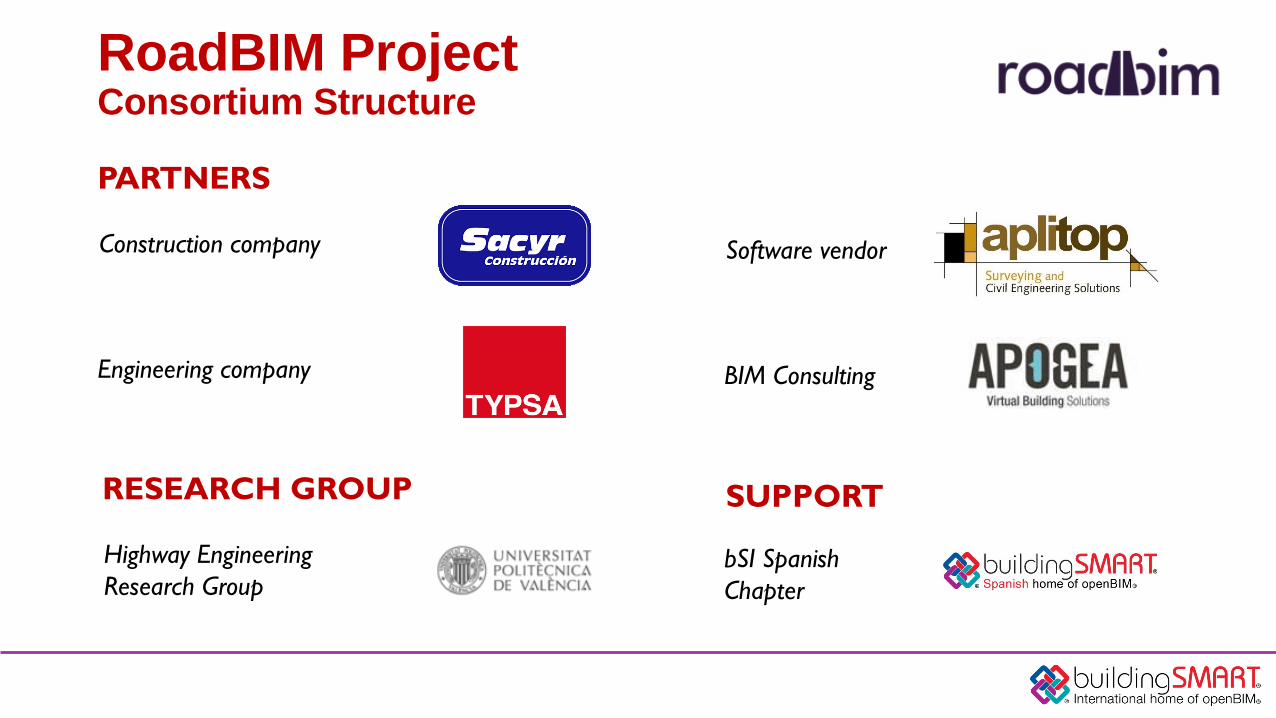
RoadBIM ProjectConsortium Structure
PARTNERS
Construction company
Engineering company
Software vendor
BIM Consulting
RESEARCH GROUP
Highway Engineering
Research Group
SUPPORT
bSI Spanish
Chapter
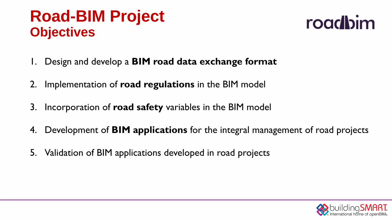
1. Design and develop a BIM road data exchange format
2. Implementation of road regulations in the BIM model
3. Incorporation of road safety variables in the BIM model
4. Development of BIM applications for the integral management of road projects
5. Validation of BIM applications developed in road projects
Road-BIM ProjectObjectives
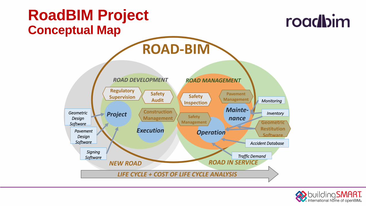
RoadBIM ProjectConceptual Map
LIFE CYCLE + COST OF LIFE CYCLE ANALYSIS
ROAD-BIM
ROAD IN SERVICENEW ROAD
ROAD DEVELOPMENT ROAD MANAGEMENT
Project
Execution Operation
Mainte-nance
Geometric Design
Software
SigningSoftware
Pavement Design
Software
Regulatory Supervision
Safety Audit
Safety Inspection Monitoring
InventoryConstruction Management
Pavement Management
Safety Management
Accident Database
Traffic Demand
Geometric Restitution Software
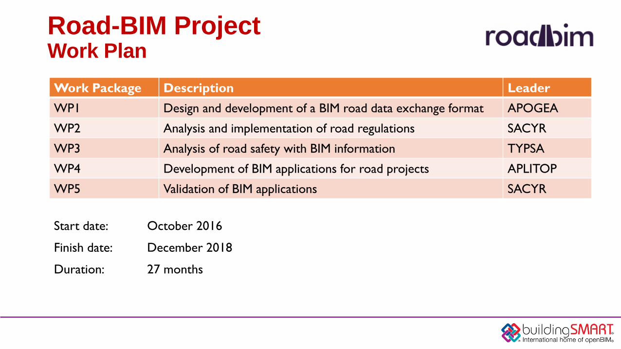
Road-BIM ProjectWork Plan
Start date: October 2016
Finish date: December 2018
Duration: 27 months
Work Package Description Leader
WP1 Design and development of a BIM road data exchange format APOGEA
WP2 Analysis and implementation of road regulations SACYR
WP3 Analysis of road safety with BIM information TYPSA
WP4 Development of BIM applications for road projects APLITOP
WP5 Validation of BIM applications SACYR
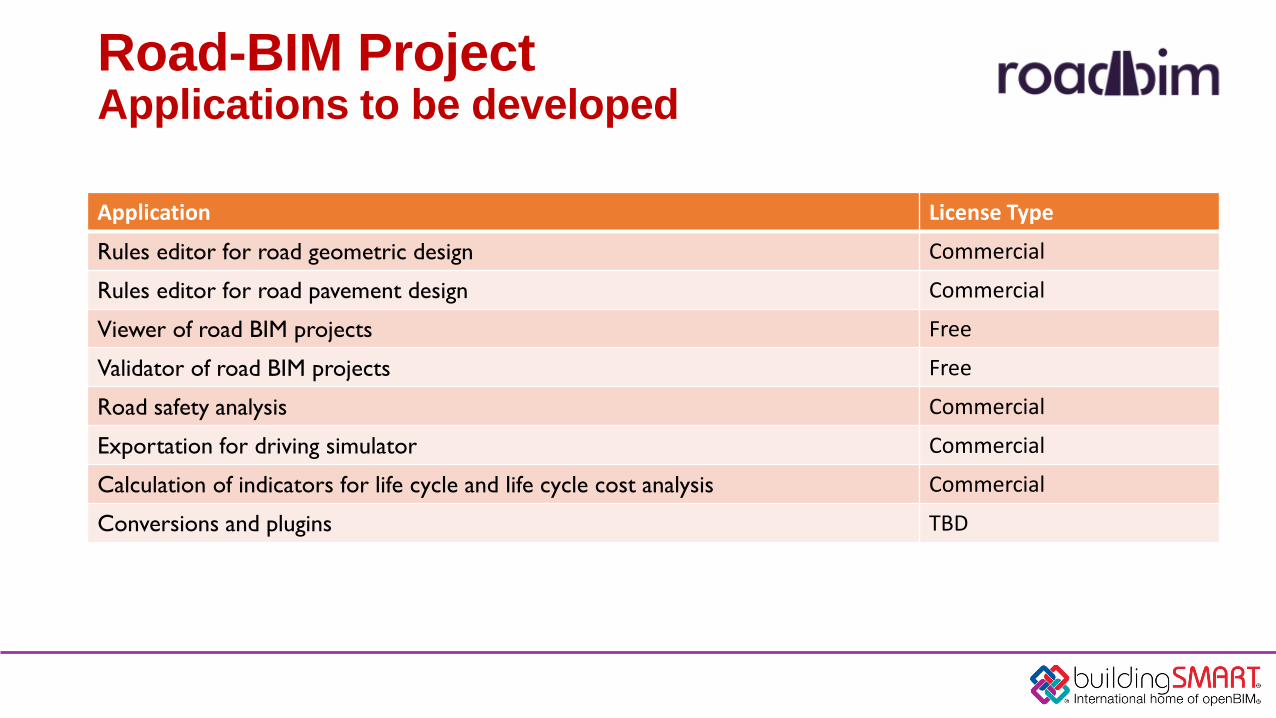
Road-BIM ProjectApplications to be developed
Application License Type
Rules editor for road geometric design Commercial
Rules editor for road pavement design Commercial
Viewer of road BIM projects Free
Validator of road BIM projects Free
Road safety analysis Commercial
Exportation for driving simulator Commercial
Calculation of indicators for life cycle and life cycle cost analysis Commercial
Conversions and plugins TBD
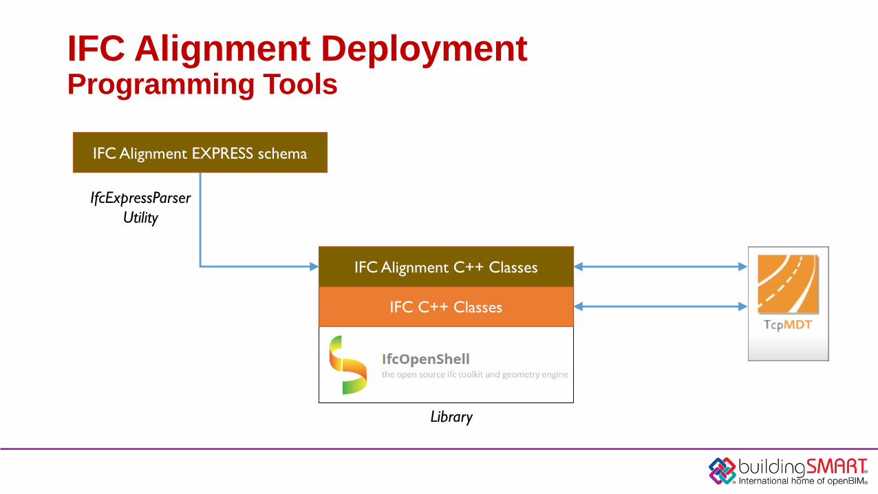
IFC Alignment DeploymentProgramming Tools
IFC C++ Classes
IFC Alignment C++ Classes
IFC Alignment EXPRESS schema
IfcExpressParser
Utility
Library
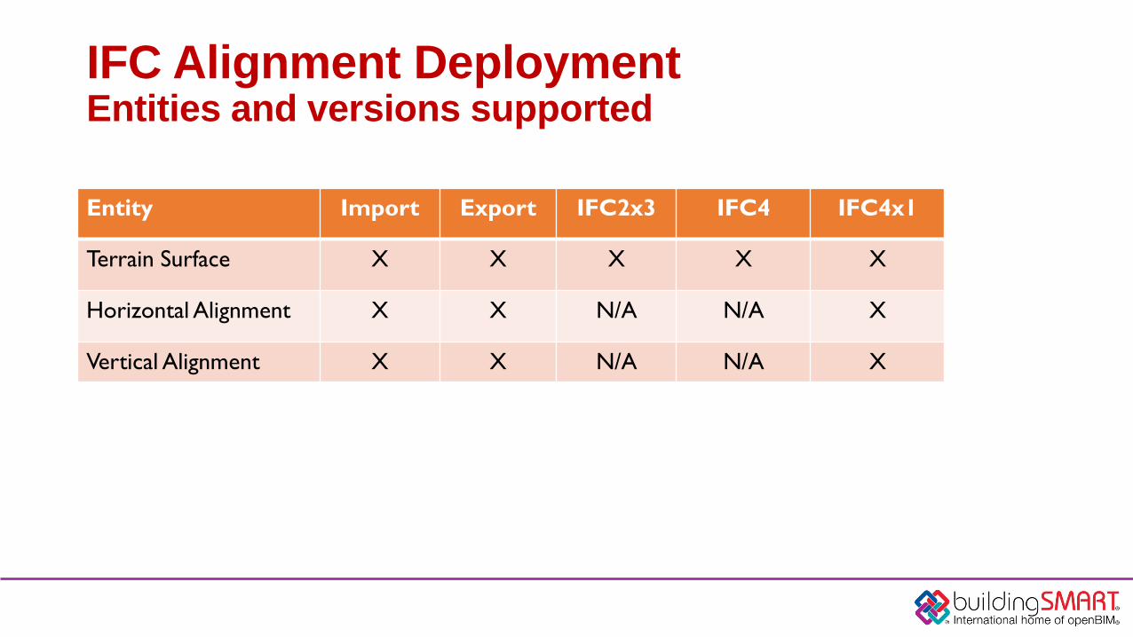
IFC Alignment DeploymentEntities and versions supported
Entity Import Export IFC2x3 IFC4 IFC4x1
Terrain Surface X X X X X
Horizontal Alignment X X N/A N/A X
Vertical Alignment X X N/A N/A X

IFC Alignment DeploymentExample files
Terrain Surfaces Horizontal AlignmentsVertical Alignments
File formats: IFC, LandXML, DWG, JPG, XLS
http://buildingsmart.org/standards/standards-process/standards-summit-program/Available after the event at

Live DemonstrationTcp-Digital Terrain Model
IFC Alignment DeploymentLive Demonstration - Spanish Team
Francisco NavarreteGeneral Manager
APLITOP
www.aplitop.com
Thank you for your attention