Embed Size (px)
Citation preview

Important information The Mount Magnet Water Reserve drinking water source protection plan (2005) has been reviewed. Please ensure you read the Mount Magnet Water Reserve drinking water source protection review (2019, WRP no.182) alongside this 2005 plan to obtain all of the information about this drinking water source. The 2019 review considers changes that have occurred in and around the Mount Magnet Water Reserve since the completion of the 2005 plan. Additional recommendations have been prepared to ensure the ongoing protection of this public drinking water source area:
amending the boundary under the Country Areas Water Supply Act 1947 (WA) to better reflect the recharge area for the current production bores.
You can find the 2019 Mount Magnet Water Reserve drinking water source protection review at www.dwer.wa.gov.au or by contacting the Department of Water and Environmental Regulation on +61 8 6364 7000 or [email protected].

Water Resource Protection Series
Mount Magnet Water ReserveDrinking Water Source Protection Plan
Mount Magnet Town Water Supply
Hyatt CentreLevel 2 3 Plain StreetEast Perth Western Australia 6004PO Box 6740 Hay Street East Perth Western Australia 6892Telephone (08) 9278 0300 Facsimile (08) 9278 0301 National Relay Service (Australian Communication Exchange) 132 544E-mail [email protected]
Westralia SquareLevel 8 141 St Georges TerracePerth Western Australia 6000PO Box K822 Perth Western Australia 6842Telephone (08) 9222 7000 Facsimile (08) 9322 1598 E-mail [email protected]
WRP 38 2005
WRP38 MtMagnetCover_1.qxp 21/06/2005 10:40 AM Page 1


Mount Magnet Water Reserve Drinking Water Source Protection Plan Water Source Protection Series WRP 38
Department of Environment i
MOUNT MAGNET WATER RESERVE DRINKING WATER SOURCE PROTECTION PLAN
MOUNT MAGNET TOWN WATER SUPPLY
Prepared in accordance with the Operational Agreement between the Department of Environment and Water Corporation
DEPARTMENT OF ENVIRONMENT
WATER RESOURCE PROTECTION SERIES
WRP 38
JULY 2005

Water Source Protection Series WRP 38 Mount Magnet Water Reserve Drinking Water Source Protection Plan
ii Department of Environment
Acknowledgments
Contribution Personnel Title Organisation Program Direction Tony Laws Manager, Water Source Protection Department of Environment Supervision Stephen Watson Program Manager, Protection Planning Department of Environment Report Preparation Hydrogeology
George Foulsham Lisa Mazzella Seth Johnson
Environmental Officer Environmental Officer Senior Hydrogeologist
Department of Environment Department of Environment Department of Environment
Regional Advice Brett Hall Water Resources Officer Department of Environment Drafting Dianne Abbott Mapping Department of Environment
For more information contact: Program Manager, Protection Planning Water Source Protection Branch Department of Environment 3 Plain Street EAST PERTH WA 6004 Telephone: (08) 9278 0300 Facsimile: (08) 9278 0585
Recommended reference The recommended reference for this publication is Department of Environment 2005, Mt Magnet Water Reserve: Water Source Protection Plan, Mt Magnet Town Water Supply, Department of Environment, Water Resource Protection Series, WRP 38.
We welcome your feedback A publication feedback form can be found at the back of this publication ISBN 0-7309-7510 - X ISSN 1326-7442
Mount Magnet Water Reserve Drinking Water Source Protection Plan Water Source Protection Series WRP 38
Department of Environment iii
Purpose of this plan The Department of Environment (DoE) has prepared this Drinking Water Source Protection Plan (DWSPP) to report on the activities and risks to water quality within the Mt Magnet Water Reserve and to recommend management strategies to minimise the identified risks.
A safe drinking water supply is critical to the well-being of the community and catchment protection is necessary to help avoid, minimise or manage risks to water quality in Public Drinking Water Source Areas (PDWSA). The DoE is committed to protecting these areas to ensure the continued supply of ‘safe, good quality drinking water’ to consumers to protect public health now and in the future.
The Australian Drinking Water Guidelines 1996 (ADWG) recommend a multiple barrier ‘catchment to consumer’ approach to protect public drinking water. The protection and management of PDWSAs is the ‘first barrier’, with subsequent barriers implemented at the water storage, treatment and distribution stages of a water supply system. Catchment protection includes:
• understanding the catchment, the hazards and hazardous events that can compromise drinking water quality; and
• developing and implementing preventive strategies and operational controls necessary to ensure the safest possible raw water supply (i.e. before treatment).
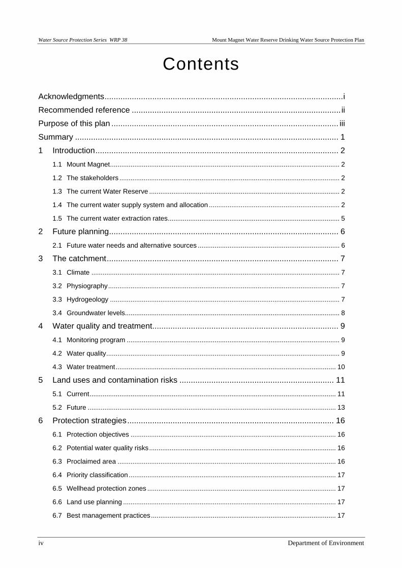
This Plan details the location and boundary of the drinking water catchment which provides potable water to the Mt Magnet Town Water Supply System. It discusses existing and future usage of the water source, describes the water supply system, identifies risks and recommends management approaches to maximise protection of the catchment. The Plan should be used to guide State and local government land use planning decisions in Western Australia. This DWSPP should be recognised in the Shire of Mt Magnet Town Planning Scheme and other local planning strategies and plans, consistent with the Western Australian Planning Commission’s Statement of Planning Policy No. 2.7 Public Drinking Water Source Policy. Other stakeholders should use this document as a guide for protecting the quality of water in the PDWSA. The process involved in the preparation of a DWSPP is as follows:
Stages in development of a DWSPP
Comment
1 Prepare Drinking Water Source Protection Assessment
Assessment document prepared following catchment survey and preliminary information gathering from State and local government agency stakeholders.
2 Conduct stakeholder consultation
Advice sought from key stakeholders using the Assessment as a tool for background information and discussion.
3 Prepare Draft DWSPP Draft DWSPP developed taking into account input from stakeholders and any additional advice received.
4 Release Draft DWSPP for public comment
Draft DWSPP released for a six week public consultation period.
5 Publish DWSPP Final DWSPP published after considering advice received in submissions on the Draft. Includes recommendations on how to protect the drinking water catchment.
Water Source Protection Series WRP 38 Mount Magnet Water Reserve Drinking Water Source Protection Plan
iv Department of Environment
Contents
Acknowledgments.........................................................................................................i
Recommended reference ............................................................................................ ii
Purpose of this plan .................................................................................................... iii
Summary .................................................................................................................... 1
1 Introduction........................................................................................................... 2
1.1 Mount Magnet........................................................................................................................... 2
1.2 The stakeholders ...................................................................................................................... 2
1.3 The current Water Reserve ...................................................................................................... 2
1.4 The current water supply system and allocation ...................................................................... 2
1.5 The current water extraction rates............................................................................................ 5
2 Future planning..................................................................................................... 6
2.1 Future water needs and alternative sources ............................................................................ 6
3 The catchment...................................................................................................... 7
3.1 Climate ..................................................................................................................................... 7
3.2 Physiography............................................................................................................................ 7
3.3 Hydrogeology ........................................................................................................................... 7
3.4 Groundwater levels................................................................................................................... 8
4 Water quality and treatment.................................................................................. 9
4.1 Monitoring program .................................................................................................................. 9
4.2 Water quality............................................................................................................................. 9
4.3 Water treatment...................................................................................................................... 10
5 Land uses and contamination risks .................................................................... 11
5.1 Current.................................................................................................................................... 11
5.2 Future ..................................................................................................................................... 13
6 Protection strategies........................................................................................... 16
6.1 Protection objectives .............................................................................................................. 16
6.2 Potential water quality risks.................................................................................................... 16
6.3 Proclaimed area ..................................................................................................................... 16
6.4 Priority classification............................................................................................................... 17
6.5 Wellhead protection zones ..................................................................................................... 17
6.6 Land use planning .................................................................................................................. 17
6.7 Best management practices................................................................................................... 17
Mount Magnet Water Reserve Drinking Water Source Protection Plan Water Source Protection Series WRP 38
Department of Environment v
6.8 Surveillance and By-law enforcement .................................................................................... 18
6.9 Emergency response.............................................................................................................. 18
7 The impact of water source protection planning ................................................. 19
7.1 New restrictions on existing land uses ................................................................................... 19
7.2 Compensation for development constraints........................................................................... 19
8 Review process .................................................................................................. 20
Recommendations.................................................................................................... 21
References ............................................................................................................... 24
Glossary.................................................................................................................... 25
Acronyms.................................................................................................................. 26
Appendices ............................................................................................................... 27
Appendix 1 Overview on protecting PDWSAs .......................................................... 28
Appendix 2 Water quality analysis results................................................................. 37
Appendix 3 Land use compatibility in public drinking water source areas ................ 42
Appendix 4 Best management practices documents foractivities in PDWSAs.......... 59
Photographs
Photo 1. Cover photograph, Genga bore No. 7/74 and surrounding mallee vegetation
Figures
Figure 1. Mount Magnet water reserve locality map ................................................... 3
Figure 2. Mount Magnet town water supply system
(data courtesy Water Corporation) ............................................................................. 4
Figure 3. Mount Magnet Water Reserve……………………………………………….…22
Figure 4. Location of mining operations around Mount Magnet
(data courtesy DoIR) ................................................................................................ 23
Tables
Table 1. Potential risks to the Mount Magnet Water Reserve and suggested
protection measures ................................................................................................. 14
The former State Government agencies Department of Environmental Protection and the Water and Rivers Commission are presently combining to form the Department of Environment (DoE). This process will not be complete until enabling legislation has been passed by Parliament and proclaimed. This document reflects a generic ‘combined agency’ position.

Water Source Protection Series WRP 38 Mount Magnet Water Reserve Drinking Water Source Protection Plan
vi Department of Environment

Mount Magnet Water Reserve Drinking Water Source Protection Plan Water Source Protection Series WRP 38
Department of Environment 1
Summary This Plan provides a basis for establishing planning and land use management strategies within the Water Reserve at Mt Magnet. Proclaiming water reserves under the Country Areas Water Supply Act 1947 (CAWSA) enables DoE to control potentially polluting activities, regulate land use, inspect premises and take steps to prevent or clean up pollution in accordance with the CAWSA By-laws.
The production bores for Mt Magnet are managed by the Water Corporation. Water abstraction is primarily from unconfined alluvial formations and the water is of good quality. The water source has the potential to be contaminated from activities within the recharge area. A range of activities, including road traffic and mining, pose a potential water quality risk to this source if not properly managed.
The existing Genga borefield area of the Water Reserve has been amended to reflect the recharge area based on topographical and hydrogeological information. The key recharge area should be managed for Priority 1 source protection. The wider Reserve representing the surface water catchment area of the Genga borefield should be managed for Priority 2 source protection.
The Lennonville part of the Water Reserve should remain and be managed for Priority 1 source protection as a potential water supply. However, if Lennonville is not required as a source for the proposed reverse osmosis plant then an assessment of its value should be made with a view to possibly de-proclaiming the area and thus removing it from the Water Reserve.
The Mt Magnet town dam is no longer used to supplement the borefield supply due to water quality issues so the Reserve around this area should be abolished.
A range of recommendations are put forward in this Plan to help reduce the potential for contamination. Any major development proposals that may affect the quality of this drinking water source should be referred to DoE for comment. The Plan should also be reflected in all land use planning strategies for the area, such as the local Town Planning Scheme.
The Water Corporation has made a commitment to improve drinking water quality through the Mt Magnet aesthetic water quality project. As part of this project investigations are being undertaken into the value of establishing a reverse osmosis plant in Mt Magnet. If this is to occur, a new source of water will most likely need to be identified and appropriate management for this source put in place. This may include additional areas being added to the Water Reserve at a later date.

Water Source Protection Series WRP 38 Mount Magnet Water Reserve Drinking Water Source Protection Plan
2 Department of Environment
1 Introduction
1.1 Mount Magnet
Mt Magnet township is located about 600 km north-east of Perth in the Shire of Mt Magnet (Figure 1). It is a gold mining and pastoral support centre for the surrounding region.
The Shire population of Mt Magnet is about 1200 and the town population is about 800, although this fluctuates with activity in the mining operations. The total number of services in town as of January 2004 was 387.
1.2 The stakeholders
This Plan has previously been released for comment to stakeholders including the Water Corporation, Department for Planning and Infrastructure, Department of Land Information, Department of Industry and Resources (DoIR), Midwest Development Commission, Shire of Mt Magnet, Main Roads, Harmony Gold, Aboriginal interests and other affected mining tenement owners and landowners. The comments received were considered and all have been addressed in the preparation of this Plan.
1.3 The current water reserve
The Mt Magnet Water Reserve and town dam catchment have previously been proclaimed for the purpose of water source protection. The groundwater portion of the current Water Reserve consists of two areas, Genga and Lennonville, which were proclaimed under CAWSA in August 1991. The town dam surface water catchment was proclaimed as a surface water catchment area under the same Act in March 1985.
1.4 The current water supply system and allocation
Surface water and groundwater resource use and conservation in Western Australia is administered by DoE in accordance with the Rights in Water and Irrigation Act 1914. This Act requires a licence to draw water from surface water and groundwater areas proclaimed under the Act (except for domestic and stock use) and all artesian wells throughout the State. Mt Magnet is proclaimed within the East Murchison Groundwater Area. As yet, no groundwater allocation plan has been completed for the area.
The Water Corporation supplies water to the township of Mt Magnet from seven bores (7/74, 1/75, 7/82, 35/86, 36/86, 38/86 and 40/86) in the Genga borefield, located approximately 8 km south-west of town. The water supply system is outlined in Figure 2. Bore 1/64 has been out of service for the last three years and will be decommissioned. Bore 8/74 and the catchment dam have been abandoned as sources for water supply, the former due to low flow rates and the latter as a result of water quality concerns. Bores 8/86 and 9/86 are monitoring bores. The bore heads are adequately sealed against surface water penetration and are checked on a weekly basis.
The Genga borefield pumps water to the Genga transfer tank. From the transfer tank water is pumped to the four ground tanks in Mt Magnet from where it gravitates to supply the reticulation.

Mount Magnet Water Reserve Drinking Water Source Protection Plan Water Source Protection Series WRP 38
Department of Environment 3
The Genga borefield is operated under Groundwater Well Licence No. 00098439, which has an expiry date of December 31, 2005. The licensed allocation is for 350 megalitres (ML) per annum. This is based on estimates of annual safe yield
Drawn by D.R.A. Date 09/05/20052342
2341
2442 2542
2441 2541
2340 2440 2540
LEGEND: INDEX TO ADJOINING1:100000
MAPSFIGURE 1.
MOUNT MAGNET WATER RESERVELOCALITY PLAN
Water Resources DivisionWater Source Protection Branch
LOCATION PLAN
J:/pp/wp/59015/0063/mt_magnet_protection_plan.apr
#
#
##
##
LAKE BARLEE
LAKE AUSTIN
LAKE MOORE
LAKE NOONDIE
LAKE ANNEAN
LAKE MASON
MONGERS LAKE
LAKE GILES
RAE
CUE
MEEKATHARRA
MOUNT MAGNET
WILUNA
SANDSTONE
YALGOO
Shire of Meekatharra
Shire of Wiluna
Shire of Yalgoo
Shire of Sandstone
Shire of Murchison
Shire of Menzies
Shire of Cue
Shire ofLeonora
Shire of Mount Magnet
Shire of Upper Gascoyne
Shire ofPerenjori
Shire of Mount Marshall
River
Wooramel Rive
r
Yalgar
Warn
e
Roderick
Sanford River
River
Gascoyne River
River
Salt
Hope
Hope
YalgarRiver
River
River
Murchison
RiverR
ive r
MEEKATHARRA RD
GREAT NORTHERN
GO
L
GR
EA
T
LANDOR -
NORTHERN
HW
Y
CUE ROAD
BERINGARRA -
YOUANMI RD
GERALDTON -
MOUNT MAGNET ROADYOUANMI RD
WESTERNAUSTRALIA
Zone50Hydrography
# Towns
Local Government AuthoritiesLakesRoads
0 10 20 30 40 50 Kilometres

Water Source Protection Series WRP 38 Mount Magnet Water Reserve Drinking Water Source Protection Plan
4 Department of Environment
WESTERNAUSTRALIA
Zone50
J:/pp/wp/59015/0063/mt_magnet_protection_plan.aprLOCATION PLAN
Water Resources DivisionWater Source Protection Branch
FIGURE 2.MOUNT MAGNET WATER SUPPLYSYSTEM - WATER CORPORATION
INDEX TO ADJOINING1:100000
MAPS
LEGEND:
254024402340
25412441
25422442
2341
2342
Date 09/05/2005Drawn by D.R.A.
#Y#Y
#Y
#Y #Y
#Y
#Y#Y
#Y
#Y
%U
Ë Ë
Ë
Mount MagnetTank Compound
Town Tank
Genga Transfer P S
8/74
9/86
8/86
40/86
7/74
1/75
7/82
36/86
35/86
38/86
Genga Transfer Tank
DALGARANGA-MOUNT MAGNET RD
GR
EA
T N
OR
TH
ER
N H
WY
PA
LME
R W
ELL R
D
MO
UNT
MAG
NET
-
YO
WE
RAG
ABB
IE R
D
MOUNT MAGNETTOWNSITE
Cadastre
Pipeline
Production Bore
Monitoring Bore
Pumping Station
TankRoad Centrelines
Ë%U
#Y#
Water Corporation Water Supply System
0 1 2 Kilometres

Mount Magnet Water Reserve Drinking Water Source Protection Plan Water Source Protection Series WRP 38
Department of Environment 5
1.5 The current water extraction rates
Total borefield production has ranged from 254 ML to 305 ML since 1999, which is lower than the licensed allocation of 350 ML. Bores 36/86 and 38/86 have been the biggest producers and are located on the western portion of the Genga borefield. During peak demand all bores are operated almost constantly, with demand balanced by tank storage. The current yield of the bores is estimated at 1624 kL/day, based on flow rates calculated from pumping hours and flow data in 2003 (Water Corporation, 2004)
Water Source Protection Series WRP 38 Mount Magnet Water Reserve Drinking Water Source Protection Plan
6 Department of Environment
2 Future planning
2.1 Future water needs and alternative sources
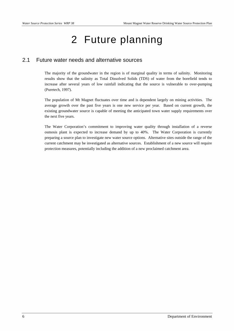
The majority of the groundwater in the region is of marginal quality in terms of salinity. Monitoring results show that the salinity as Total Dissolved Solids (TDS) of water from the borefield tends to increase after several years of low rainfall indicating that the source is vulnerable to over-pumping (Puretech, 1997).
The population of Mt Magnet fluctuates over time and is dependent largely on mining activities. The average growth over the past five years is one new service per year. Based on current growth, the existing groundwater source is capable of meeting the anticipated town water supply requirements over the next five years.
The Water Corporation’s commitment to improving water quality through installation of a reverse osmosis plant is expected to increase demand by up to 40%. The Water Corporation is currently preparing a source plan to investigate new water source options. Alternative sites outside the range of the current catchment may be investigated as alternative sources. Establishment of a new source will require protection measures, potentially including the addition of a new proclaimed catchment area.
Mount Magnet Water Reserve Drinking Water Source Protection Plan Water Source Protection Series WRP 38
Department of Environment 7
3 The catchment
3.1 Climate
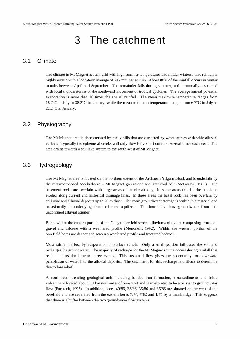
The climate in Mt Magnet is semi-arid with high summer temperatures and milder winters. The rainfall is highly erratic with a long-term average of 247 mm per annum. About 80% of the rainfall occurs in winter months between April and September. The remainder falls during summer, and is normally associated with local thunderstorms or the southward movement of tropical cyclones. The average annual potential evaporation is more than 10 times the annual rainfall. The mean maximum temperature ranges from 18.7°C in July to 38.2°C in January, while the mean minimum temperature ranges from 6.7°C in July to 22.2°C in January.
3.2 Physiography
The Mt Magnet area is characterised by rocky hills that are dissected by watercourses with wide alluvial valleys. Typically the ephemeral creeks will only flow for a short duration several times each year. The area drains towards a salt lake system to the south-west of Mt Magnet.
3.3 Hydrogeology
The Mt Magnet area is located on the northern extent of the Archaean Yilgarn Block and is underlain by the metamorphosed Meekatharra – Mt Magnet greenstone and granitoid belt (McGowan, 1989). The basement rocks are overlain with large areas of laterite although in some areas this laterite has been eroded along current and historical drainage lines. In these areas the basal rock has been overlain by colluvial and alluvial deposits up to 20 m thick. The main groundwater storage is within this material and occasionally in underlying fractured rock aquifers. The borefields draw groundwater from this unconfined alluvial aquifer.
Bores within the eastern portion of the Genga borefield screen alluvium/colluvium comprising ironstone gravel and calcrete with a weathered profile (Moncrieff, 1992). Within the western portion of the borefield bores are deeper and screen a weathered profile and fractured bedrock.
Most rainfall is lost by evaporation or surface runoff. Only a small portion infiltrates the soil and recharges the groundwater. The majority of recharge for the Mt Magnet source occurs during rainfall that results in sustained surface flow events. This sustained flow gives the opportunity for downward percolation of water into the alluvial deposits. The catchment for this recharge is difficult to determine due to low relief.
A north-south trending geological unit including banded iron formation, meta-sediments and felsic volcanics is located about 1.3 km north-east of bore 7/74 and is interpreted to be a barrier to groundwater flow (Puretech, 1997). In addition, bores 40/86, 38/86, 35/86 and 36/86 are situated on the west of the borefield and are separated from the eastern bores 7/74, 7/82 and 1/75 by a basalt ridge. This suggests that there is a buffer between the two groundwater flow systems.
Water Source Protection Series WRP 38 Mount Magnet Water Reserve Drinking Water Source Protection Plan
8 Department of Environment
3.4 Groundwater levels
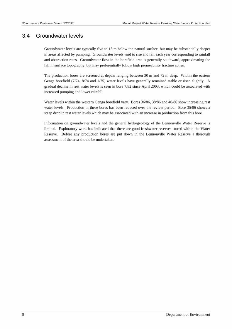
Groundwater levels are typically five to 15 m below the natural surface, but may be substantially deeper in areas affected by pumping. Groundwater levels tend to rise and fall each year corresponding to rainfall and abstraction rates. Groundwater flow in the borefield area is generally southward, approximating the fall in surface topography, but may preferentially follow high permeability fracture zones.
The production bores are screened at depths ranging between 30 m and 72 m deep. Within the eastern Genga borefield (7/74, 8/74 and 1/75) water levels have generally remained stable or risen slightly. A gradual decline in rest water levels is seen in bore 7/82 since April 2003, which could be associated with increased pumping and lower rainfall.
Water levels within the western Genga borefield vary. Bores 36/86, 38/86 and 40/86 show increasing rest water levels. Production in these bores has been reduced over the review period. Bore 35/86 shows a steep drop in rest water levels which may be associated with an increase in production from this bore.
Information on groundwater levels and the general hydrogeology of the Lennonville Water Reserve is limited. Exploratory work has indicated that there are good freshwater reserves stored within the Water Reserve. Before any production bores are put down in the Lennonville Water Reserve a thorough assessment of the area should be undertaken.

Mount Magnet Water Reserve Drinking Water Source Protection Plan Water Source Protection Series WRP 38
Department of Environment 9
4 Water quality and treatment
4.1 Monitoring program
Monitoring of production bores is undertaken by the Water Corporation through the Mt Magnet Water Resource Management Operation Strategy (Water Corporation, 1998). The quality of water is assessed in accordance with the ADWG (issued in 1987 and 1996). These Guidelines are used in Western Australia by the Department of Health (DoH), DoE and the Water Corporation to assess the quality of drinking water.
The water is regularly monitored for microbiological contamination, health related chemicals and aesthetic chemicals and parameters. Bore pumpage is tested monthly; water levels, conductivity and temperature are tested quarterly (monthly for 40/86 and 1/64 as TDS is greater than 1000 mg/L in these bores), and major components are tested annually. The water levels in observation bores 6/69, 8/74, 8/86 and 9/86 are tested quarterly.
DOH regulates water quality from the borefield through to the tap and also oversees monitoring to ensure water quality meets the ADWG.
4.2 Water quality
A wide range of chemical, physical and microbiological properties can affect the health values and aesthetic quality of drinking water. The groundwater quality within the Mt Magnet area is generally good. However, some bores yield marginal quality water in terms of salinity. A water quality analysis for Mt Magnet was undertaken by the Water Corporation for the period 1994 to 2003 and a summary of results is shown in Appendix 2.
Microbiological contaminants
Positive thermotolerant coliform counts were recorded in 12% of the raw water samples from the Genga borefield. Only one of these samples returned a thermotolerant coliform count greater than 20 colony forming units (cfu) per 100 mL with a value of 39 cfu/100 mL. A count less than 20 cfu/100 mL is typically associated with low levels of faecal contamination from indigenous animals and is used as a microbiological contamination benchmark (WHO, 1996). This should be investigated further to determine the possible causes of the counts, and an appropriate management strategy developed.
Salinity
Groundwater salinity from the bores has remained stable since 1999. Salinity has remained below 1000 mg/L except at bore 40/86, which is about 1100 mg/L and has a long-term trend of increasing salinity. Production from this bore has been reduced over time due to the high salinity levels. Salinity has also exceeded the guideline value in bore 38/86 in some samples. Bore 1/64 shows large seasonal variation in salinity and the trend continues to decline as groundwater abstraction from this bore decreases. The bore has not been fed into the reticulation for the last few years due to the high salinity levels and is due to be decommissioned.

Water Source Protection Series WRP 38 Mount Magnet Water Reserve Drinking Water Source Protection Plan
10 Department of Environment
Chemical Parameters
The composite raw water indicates that the majority of health related parameters, with the exception of nitrate and nitrite as N, are within their respective guideline values and pose no risk to water quality.
Nitrate levels are naturally high in the area possibly due to nitrogen fixing vegetation. The guideline value of 11.3 mg/L is set to protect infants under six months of age. The Water Corporation has been granted an exemption from the Department of Health for meeting this ADWG guideline. The DOH recommends that bottled water is used by pregnant and breast feeding mothers and by bottle fed babies. Local health authorities are aware of the nitrate levels and measures are in place to inform the local community and tourists.
Manganese exceeded the guideline value in bore 1/64 which is no longer used to supply the reticulation.
Arsenic has exceeded the guideline value in bore 38/86 in several samples. Arsenic is a naturally occurring element which can be introduced to water through the dissolution of minerals and ores (NHMRC & ARMCANZ, 1996). Shandying the water ensures that the composite raw water is well below the guideline value.
Hardness also exceeded the guidelines in all bores and the reticulation. Hardness as CaCO3 ranged between 229 and 322 mg/L. There is a calgon dosing plant at Mt Magnet to mitigate water hardness. The ADWG indicates that CaCO3 between 200 and 500 mg/L could increase scaling problems in piping and heating appliances.
The Mt Magnet aesthetic water quality project is aiming to reduce elevated levels of TDS and nitrates at Mt Magnet. The Water Corporation is planning to have the nitrates reduced to below the ADWG levels by the end of 2005.
4.3 Water treatment
Raw water from the Genga borefield is treated by means of clarification, and calgon dosing, and is then disinfected by chlorination prior to supply as drinking water. It should be recognised that although disinfection by chlorination generally removes microbiological contamination, treatment processes alone cannot be relied upon. This is why the ADWG ‘catchment to consumer’ multiple barrier approach is important for the provision of safe drinking water to consumers.
Mount Magnet Water Reserve Drinking Water Source Protection Plan Water Source Protection Series WRP 38
Department of Environment 11
5 Land uses and contamination risks
5.1 Current
Table 1 identifies the potential water quality risks associated with existing land uses in the Mt Magnet Water Reserve and recommends protection strategies to manage these risks. The potential water quality hazards were identified and a management priority of High, Medium or Low assigned. The priority levels assigned to identified hazards were determined by assessing the likelihood and consequence of the source being contaminated, taking into account current preventive and management strategies for the catchment.
Strategies for managing the risks have been developed in line with ADWG recommendations. The discussion and recommended strategies balance the need to protect water quality now and in the long term with the rights of land holders to continue to utilise their land for approved purposes.
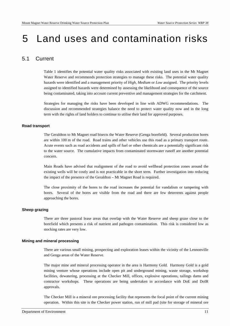
Road transport
The Geraldton to Mt Magnet road bisects the Water Reserve (Genga borefield). Several production bores are within 100 m of the road. Road trains and other vehicles use this road as a primary transport route. Acute events such as road accidents and spills of fuel or other chemicals are a potentially significant risk to the water source. The cumulative impacts from contaminated stormwater runoff are another potential concern.
Main Roads have advised that realignment of the road to avoid wellhead protection zones around the existing wells will be costly and is not practicable in the short term. Further investigation into reducing the impact of the presence of the Geraldton – Mt Magnet Road is required.
The close proximity of the bores to the road increases the potential for vandalism or tampering with bores. Several of the bores are visible from the road and there are few deterrents against people approaching the bores.
Sheep grazing
There are three pastoral lease areas that overlap with the Water Reserve and sheep graze close to the borefield which presents a risk of nutrient and pathogen contamination. This risk is considered low as stocking rates are very low.
Mining and mineral processing
There are various small mining, prospecting and exploration leases within the vicinity of the Lennonville and Genga areas of the Water Reserve.
The major mine and mineral processing operator in the area is Harmony Gold. Harmony Gold is a gold mining venture whose operations include open pit and underground mining, waste storage, workshop facilities, dewatering, processing at the Checker Mill, offices, explosive operations, tailings dams and contractor workshops. These operations are being undertaken in accordance with DoE and DoIR approvals.
The Checker Mill is a mineral ore processing facility that represents the focal point of the current mining operation. Within this site is the Checker power station, run of mill pad (site for storage of mineral ore
Water Source Protection Series WRP 38 Mount Magnet Water Reserve Drinking Water Source Protection Plan
12 Department of Environment
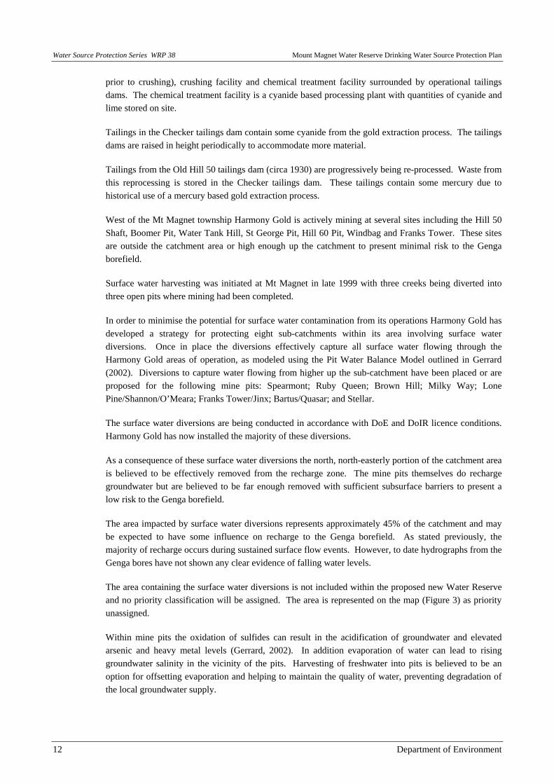
prior to crushing), crushing facility and chemical treatment facility surrounded by operational tailings dams. The chemical treatment facility is a cyanide based processing plant with quantities of cyanide and lime stored on site.
Tailings in the Checker tailings dam contain some cyanide from the gold extraction process. The tailings dams are raised in height periodically to accommodate more material.
Tailings from the Old Hill 50 tailings dam (circa 1930) are progressively being re-processed. Waste from this reprocessing is stored in the Checker tailings dam. These tailings contain some mercury due to historical use of a mercury based gold extraction process.
West of the Mt Magnet township Harmony Gold is actively mining at several sites including the Hill 50 Shaft, Boomer Pit, Water Tank Hill, St George Pit, Hill 60 Pit, Windbag and Franks Tower. These sites are outside the catchment area or high enough up the catchment to present minimal risk to the Genga borefield.
Surface water harvesting was initiated at Mt Magnet in late 1999 with three creeks being diverted into three open pits where mining had been completed.
In order to minimise the potential for surface water contamination from its operations Harmony Gold has developed a strategy for protecting eight sub-catchments within its area involving surface water diversions. Once in place the diversions effectively capture all surface water flowing through the Harmony Gold areas of operation, as modeled using the Pit Water Balance Model outlined in Gerrard (2002). Diversions to capture water flowing from higher up the sub-catchment have been placed or are proposed for the following mine pits: Spearmont; Ruby Queen; Brown Hill; Milky Way; Lone Pine/Shannon/O’Meara; Franks Tower/Jinx; Bartus/Quasar; and Stellar.
The surface water diversions are being conducted in accordance with DoE and DoIR licence conditions. Harmony Gold has now installed the majority of these diversions.
As a consequence of these surface water diversions the north, north-easterly portion of the catchment area is believed to be effectively removed from the recharge zone. The mine pits themselves do recharge groundwater but are believed to be far enough removed with sufficient subsurface barriers to present a low risk to the Genga borefield.
The area impacted by surface water diversions represents approximately 45% of the catchment and may be expected to have some influence on recharge to the Genga borefield. As stated previously, the majority of recharge occurs during sustained surface flow events. However, to date hydrographs from the Genga bores have not shown any clear evidence of falling water levels.
The area containing the surface water diversions is not included within the proposed new Water Reserve and no priority classification will be assigned. The area is represented on the map (Figure 3) as priority unassigned.
Within mine pits the oxidation of sulfides can result in the acidification of groundwater and elevated arsenic and heavy metal levels (Gerrard, 2002). In addition evaporation of water can lead to rising groundwater salinity in the vicinity of the pits. Harvesting of freshwater into pits is believed to be an option for offsetting evaporation and helping to maintain the quality of water, preventing degradation of the local groundwater supply.

Mount Magnet Water Reserve Drinking Water Source Protection Plan Water Source Protection Series WRP 38
Department of Environment 13
Flora monitoring stations downstream of stormwater diversions have been established by Harmony Gold to monitor potential effects of the diversions on down stream vegetation. Evidence to date suggests that the effects on vegetation are minimal.
5.2 Future
Mining activity in the area is dynamic and new sites are constantly being investigated. Focus for mining is likely to be outside the proposed Water Reserve in the immediate future but this may change.
Water Source Protection Series WRP 38 Mount Magnet Water Reserve Drinking Water Source Protection Plan
Department of Environment 14
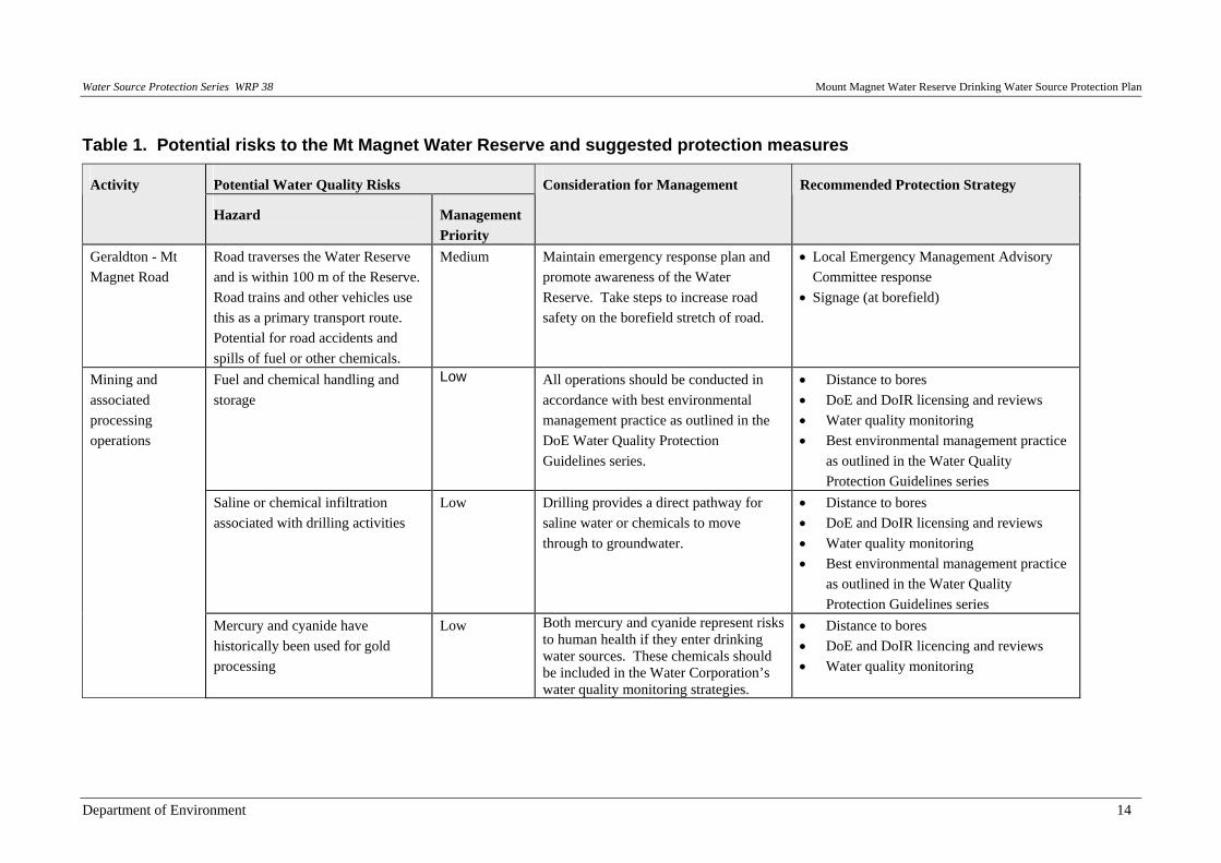
Table 1. Potential risks to the Mt Magnet Water Reserve and suggested protection measures
Potential Water Quality Risks Activity
Hazard Management Priority
Consideration for Management Recommended Protection Strategy
Geraldton - Mt Magnet Road
Road traverses the Water Reserve and is within 100 m of the Reserve. Road trains and other vehicles use this as a primary transport route. Potential for road accidents and spills of fuel or other chemicals.
Medium Maintain emergency response plan and promote awareness of the Water Reserve. Take steps to increase road safety on the borefield stretch of road.
• Local Emergency Management Advisory Committee response
• Signage (at borefield)
Fuel and chemical handling and storage
Low All operations should be conducted in accordance with best environmental management practice as outlined in the DoE Water Quality Protection Guidelines series.
• Distance to bores • DoE and DoIR licensing and reviews • Water quality monitoring • Best environmental management practice
as outlined in the Water Quality Protection Guidelines series
Saline or chemical infiltration associated with drilling activities
Low Drilling provides a direct pathway for saline water or chemicals to move through to groundwater.
• Distance to bores • DoE and DoIR licensing and reviews • Water quality monitoring • Best environmental management practice
as outlined in the Water Quality Protection Guidelines series
Mining and associated processing operations
Mercury and cyanide have historically been used for gold processing
Low Both mercury and cyanide represent risks to human health if they enter drinking water sources. These chemicals should be included in the Water Corporation’s water quality monitoring strategies.
• Distance to bores • DoE and DoIR licencing and reviews • Water quality monitoring

Mount Magnet Water Reserve Drinking Water Source Protection Plan Water Source Protection Series WRP 38
15 Department of Environment
Potential Water Quality Risks Activity
Hazard Management Priority
Consideration for Management Recommended Protection Strategy
Open mine pits allow evaporation, which concentrates salts, and infiltration
Low Distance and the local hydrogeology, including the presence of an iron banding barrier, are thought to limit the ability of open pit water infiltrating and reaching the borefield.
• Distance to bores • DoE and DoIR licensing and reviews • Water quality monitoring
Open mining pits (largely disused) including Quasar, Bartus, Lone Pine, Theakston, and Black Hole Oxidation of sulfides in open
mining pits Low Distance and the local hydrogeology,
including the presence of an iron banding barrier, are thought to limit the ability of open pit water infiltrating and reaching the borefield.
• Distance to bores • DoE and DoIR licensing and reviews • Water quality monitoring
Various minor exploration, prospecting and mining leases
• Temporary fuel handling and storage
• Temporary chemical handling and storage
• Saline or chemical infiltration of groundwater associated with drilling activities
• Chemical handling, storage and disposal associated with mineral processing
Low Any exploratory drilling programs within the Water Reserve require a Notice of Intent to be referred to DoE in accordance with the DoE and DoIR Memorandum of Understanding. In general DoIR will refer exploration proposals that impact on water resource areas to the DoE, who will then advise if an EPA referral is required. DoIR will also generally refer mining proposals that occur on or within 2 km of a water resource area to the EPA.
• Distance to bores • DoE and DoIR licensing and reviews • Best environmental management practice
as outlined in the Water Quality Protection Guidelines series
Pastoral stations Sheep grazing and potential nutrient and pathogen inputs
Low Sheep graze in the Water Reserve but in very low numbers. Pathogens from stock have not been considered a risk due to distance to groundwater (typically 15 m) and residence time in the soil.
• Distance to bores • Low stocking rates • Appropriate fencing around each bore
Water Source Protection Series WRP 38 Mount Magnet Water Reserve Drinking Water Source Protection Plan
16 Department of Environment
6 Protection strategies
6.1 Protection objectives
The objective of this Plan is to protect drinking water quality for public health, while recognising current land use rights.
The Priority 1 classification proposed for the southern portion of the Water Reserve has the fundamental water quality objective of risk avoidance. The Priority 2 classification proposed for the remainder of the Water Reserve has the objective of risk minimisation.
6.2 Potential water quality risks
The potential risks to groundwater quality associated with activities in the recharge areas include chemical or fuel spills, pathogens and nutrient contamination. Pathogens pose a significant risk to public health, and human and animal contact with water involves an immediate threat of pathogen contamination. However the risks are reduced in groundwater systems where residence time and filtering effects of the soil act to minimise the threat.
Table 1 summarises the water quality risks associated with existing land uses and activities within the catchment which have the potential to pose some risk to the quality of the water source.
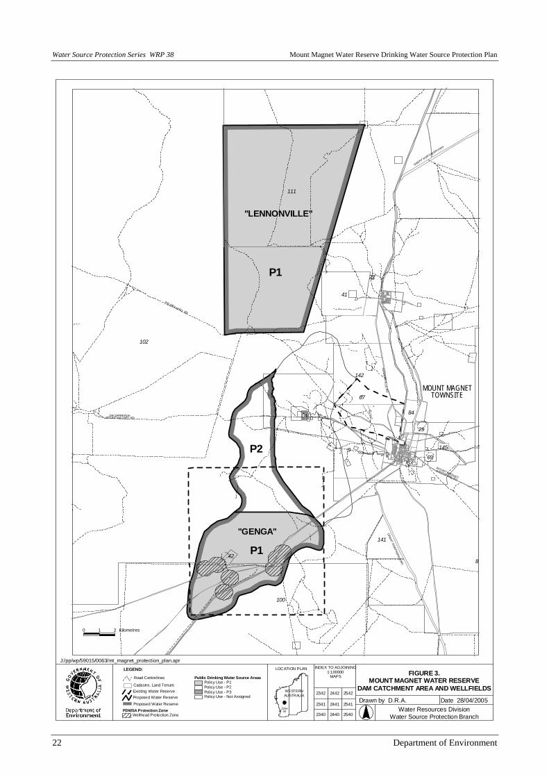
6.3 Proclaimed area
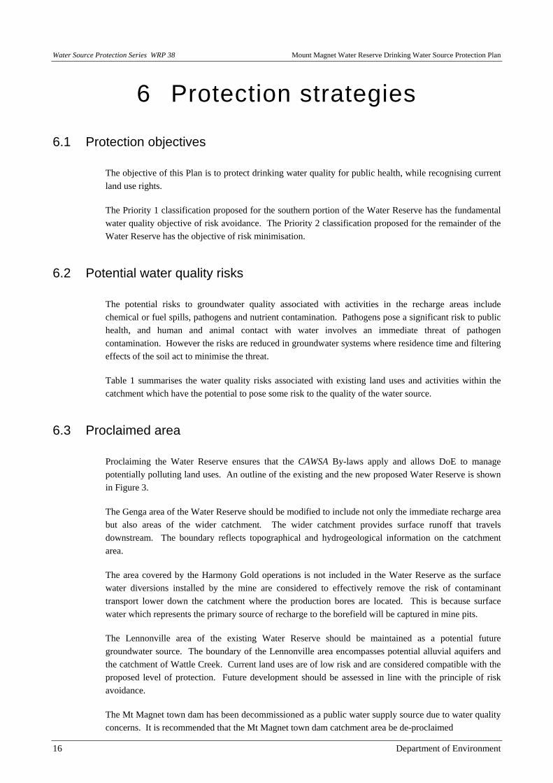
Proclaiming the Water Reserve ensures that the CAWSA By-laws apply and allows DoE to manage potentially polluting land uses. An outline of the existing and the new proposed Water Reserve is shown in Figure 3.
The Genga area of the Water Reserve should be modified to include not only the immediate recharge area but also areas of the wider catchment. The wider catchment provides surface runoff that travels downstream. The boundary reflects topographical and hydrogeological information on the catchment area.
The area covered by the Harmony Gold operations is not included in the Water Reserve as the surface water diversions installed by the mine are considered to effectively remove the risk of contaminant transport lower down the catchment where the production bores are located. This is because surface water which represents the primary source of recharge to the borefield will be captured in mine pits.
The Lennonville area of the existing Water Reserve should be maintained as a potential future groundwater source. The boundary of the Lennonville area encompasses potential alluvial aquifers and the catchment of Wattle Creek. Current land uses are of low risk and are considered compatible with the proposed level of protection. Future development should be assessed in line with the principle of risk avoidance.
The Mt Magnet town dam has been decommissioned as a public water supply source due to water quality concerns. It is recommended that the Mt Magnet town dam catchment area be de-proclaimed
Mount Magnet Water Reserve Drinking Water Source Protection Plan Water Source Protection Series WRP 38
Department of Environment 17
6.4 Priority classification
An explanation of the priority classification system and the detail of land use compatibility within each priority classification is provided in Appendix 3.
The Lennonville area should be managed for Priority 1 source protection as it represents an important future drinking water source and currently land uses are low impact and compatible with this classification.
The area recognised as recharging groundwater for the Genga borefield should be managed for Priority 1 source protection. This area is of strategic importance for the recharge of the aquifer. Current land uses are of low risk and are considered compatible with this classification. The highway poses the greatest risk and should be managed carefully as a medium management priority.
The wider Genga catchment area should be managed for Priority 2 source protection. P2 areas are declared over land where low risk development (such as low intensity rural activity) already exists. Some development defined as ‘Compatible with Conditions’ is allowed in P2 areas.
6.5 Wellhead protection zones
Wellhead protection zones (WPZ) provide specific protection zones which are defined to protect a drinking water source from contamination in the immediate vicinity of bores. Statutes define land uses that can take place within these zones. WPZ of 500 m radius should be established around each of the production bores within the P1 area. Development within these areas will be carefully assessed to address water quality risks. The WPZ is a key barrier in the ‘catchment to consumer’ multiple barrier approach for protecting the Water Reserve and its drinking water quality.
6.6 Land use planning
Establishing appropriate protection mechanisms in statutory land use planning processes is necessary to secure the long-term protection of drinking water sources. It is therefore appropriate that the Water Reserve and its Priority 1 and 2 classifications be recognised in land planning strategies, such as the local Town Planning Scheme. This approach is consistent with the WA Planning Commission Statement of Planning Policy 2.7 for Public Drinking Water Sources (WA Planning Commission, 2003).
DoE provides advice on the compatibility of land uses within the proposed priority classification areas based on the guidance document Land Use Compatibility in Public Drinking Water Source Areas (Appendix 3). Development and works proposals in the catchment that are likely to impact on water quality, or are inconsistent with the above land use table, should be referred to DoE’s Geraldton Office for assessment and approval.
6.7 Best management practices
Best management practices for land use activities are encouraged to protect water quality. These are often in the form of an industry code of practice or environmental guideline. They are usually developed in consultation with industry groups and State government agencies. Best management practices can be developed for an individual enterprise or have a local or regional focus and must consider the full range

Water Source Protection Series WRP 38 Mount Magnet Water Reserve Drinking Water Source Protection Plan
18 Department of Environment
of economic, social and environmental issues associated with land, water and vegetation use. Development of best management practices must also take into consideration the needs and concerns of users, consumers and the wider community.
The potential risks to water quality from existing land uses can be significantly reduced by the implementation of best management practices. Water Quality Protection Guidelines for Mining and Mineral Processing have been released by DoE. They have been produced in consultation with the DoIR and key industry representatives. Guidelines are available from <www.environment.wa.gov.au>.
A reference list of best management practice documents on a range of activities and land uses is included in Appendix 4.
6.8 Surveillance and By-law enforcement
On-ground surveillance of land uses and activities is an important mechanism in protecting the quality of drinking water sources. Water Corporation officers visiting the area as well as the local community should be aware of potential contamination risks and take appropriate actions where necessary. The use of signs and other informative materials is an important component of water quality protection to make visitors aware that they are in a PDWSA and that their activities could potentially affect the water quality. Once the Water Reserve is proclaimed under the CAWSA, the By-laws can be used to control potentially contaminating activities.
6.9 Emergency response
The escape of chemicals and fuels during unforeseen incidents and the use of chemicals during emergency response can cause groundwater contamination. The Shire of Mt Magnet Local Emergency Management Advisory Committee (LEMAC) through the Meekatharra Emergency Management District should be familiar with the location and purpose of the Mt Magnet Water Reserve.
A locality plan should be provided to the Fire and Rescue Services headquarters for the Hazardous Materials (HAZMAT) Emergency Advisory Team. The Regional Manager (Mid-West) Water Corporation should provide local advice to the HAZMAT Emergency Advisory Team during an incident in the Mt Magnet Water Reserve. The DoE Regional Manager (Mid-West Gascoyne) should have a broader advisory role.
Personnel who deal with Western Australian Plan for Hazardous Materials (WESTPLAN) - HAZMAT incidents within the area should be given ready access to a locality map of the Water Reserve. These personnel should receive training to ensure an understanding of the potential impacts of spills on the groundwater resource.

Mount Magnet Water Reserve Drinking Water Source Protection Plan Water Source Protection Series WRP 38
Department of Environment 19
7 The impact of water source protection planning
General issues raised throughout the State regarding the impact of water source protection planning are addressed below.
7.1 New restrictions on existing land uses
DoE’s water source protection planning recognises existing approvals and does not prohibit currently approved land use activities. This is also the case for activities that are considered incompatible with assigned priority classifications.
When a landowner applies to the Shire of Mt Magnet or DoIR to expand an existing operation or develop the land for a particular use, DoE will provide advice based on the activities that may be compatible with the relevant priority classification as outlined in the DoE’s Land Use Compatibility Table. Consequently project proponents should demonstrate that their activities will not increase the risk of contamination to the Water Reserve.
7.2 Compensation for development constraints
The issue of compensation is often raised through water source protection planning. The existing water source protection legislation (i.e. the CAWSA in this instance) does not contain any provision for compensation when a protection area is proclaimed and the associated By-laws become applicable.

Water Source Protection Series WRP 38 Mount Magnet Water Reserve Drinking Water Source Protection Plan
20 Department of Environment
8 Review process
This DWSPP will be reviewed periodically as resources permit and updated as standards change or new data becomes available.
Harmony Gold are continuing to implement the program of stream diversion and monitoring. DoE will review the results of this program annually through the mine’s mandatory Annual Environmental Report and take actions where required.
Mount Magnet Water Reserve Drinking Water Source Protection Plan Water Source Protection Series WRP 38
Department of Environment 21
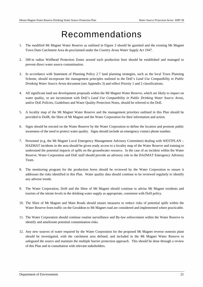
Recommendations 1. The modified Mt Magnet Water Reserve as outlined in Figure 3 should be gazetted and the existing Mt Magnet
Town Dam Catchment Area de-proclaimed under the Country Areas Water Supply Act 1947. 2. 500 m radius Wellhead Protection Zones around each production bore should be established and managed to
prevent direct water source contamination.
3. In accordance with Statement of Planning Policy 2.7 land planning strategies, such as the local Town Planning Scheme, should incorporate the management principles outlined in the DoE’s Land Use Compatibility in Public Drinking Water Source Areas document (see Appendix 3) and reflect Priority 1 and 2 classifications.
4. All significant land use development proposals within the Mt Magnet Water Reserve, which are likely to impact on water quality, or are inconsistent with DoE’s Land Use Compatibility in Public Drinking Water Source Areas, and/or DoE Policies, Guidelines and Water Quality Protection Notes, should be referred to the DoE.
5. A locality map of the Mt Magnet Water Reserve and the management priorities outlined in this Plan should be provided to DoIR, the Shire of Mt Magnet and the Water Corporation for their information and action.
6. Signs should be erected on the Water Reserve by the Water Corporation to define the location and promote public
awareness of the need to protect water quality. Signs should include an emergency contact phone number. 7. Personnel (e.g. the Mt Magnet Local Emergency Management Advisory Committee) dealing with WESTPLAN –
HAZMAT incidents in the area should be given ready access to a locality map of the Water Reserve and training to understand the potential impacts of spills on the groundwater resource. In the case of an incident within the Water Reserve, Water Corporation and DoE staff should provide an advisory role to the HAZMAT Emergency Advisory Team.
8. The monitoring program for the production bores should be reviewed by the Water Corporation to ensure it addresses the risks identified in this Plan. Water quality data should continue to be reviewed regularly to identify any adverse trends.
9. The Water Corporation, DoH and the Shire of Mt Magnet should continue to advise Mt Magnet residents and tourists of the nitrate levels in the drinking water supply as appropriate, consistent with DoH policy.
10. The Shire of Mt Magnet and Main Roads should ensure measures to reduce risks of potential spills within the Water Reserve from traffic on the Geraldton to Mt Magnet road are considered and implemented where practicable.
11. The Water Corporation should continue routine surveillance and By-law enforcement within the Water Reserve to identify and ameliorate potential contamination risks.
12. Any new sources of water required by the Water Corporation for the proposed Mt Magnet reverse osmosis plant
should be investigated, with the catchment area defined, and included in the Mt Magnet Water Reserve to safeguard the source and maintain the multiple barrier protection approach. This should be done through a review of this Plan and in consultation with relevant stakeholders.
Water Source Protection Series WRP 38 Mount Magnet Water Reserve Drinking Water Source Protection Plan
22 Department of Environment
DALGARANGA-MOUNT MAGNET RD
GR
EA
T NO
RTH
ER
N H
WY
MOUNT MAGNET-
SANDSTONE RD
GREAT NORTHERN H
WY
PALMER WELL RD
MOUNT MAGNETTOWNSITE
LE
NN
ON
VI LL
E RD
111
67
22
145
69
29
42
84
141
41
142
9
100
8
102
"LENNONVILLE"
"GENGA"
P1
P2
P1
Drawn by D.R.A. Date 28/04/20052342
2341
2442 2542
2441 2541
2340 2440 2540
LEGEND: INDEX TO ADJOINING1:100000
MAPS FIGURE 3.MOUNT MAGNET WATER RESERVE
DAM CATCHMENT AREA AND WELLFIELDS
Water Resources DivisionWater Source Protection Branch
LOCATION PLAN
J:/pp/wp/59015/0063/mt_magnet_protection_plan.apr
WESTERNAUSTRALIA
Zone50
0 1 2 Kilometres
Public Drinking Water Source AreasPolicy Use - P1Policy Use - P2Policy Use - P3Policy Use - Not Assigned
Proposed Water ReservePDWSA Protection Zone
Wellhead Protection Zone
Proposed Water ReserveExisting Water ReserveCadastre, Land Tenure
Road Centrelines

Mount Magnet Water Reserve Drinking Water Source Protection Plan Water Source Protection Series WRP 38
Department of Environment 23
Local Road - OtherTrack
Tenements%
Wellhead Protection ZonePDWSA Protection Zone
Public Drinking Water Source Areas
WESTERNAUSTRALIA
Zone50
J:/pp/wp/59015/0063/mt_magnet_protection_plan.aprLOCATION PLAN
Water Resources DivisionWater Source Protection Branch
FIGURE 4.MOUNT MAGNET
LOCATION OF MINING ACTIVITIES
INDEX TO ADJOINING1:100000
MAPS
LEGEND:
254024402340
25412441
25422442
2341
2342
Date 28/04/2005Drawn by D.R.A.
%
%
%
%
%
%
%
%
%
%%
%
%
%%
%%
%%
%
%
%%
%
MOUNT MAGNETTOWNSITE
MO
UNT M
AG
NET-
YOW
ERA
GAB
BIE
RD
102
88
100
9
142
41
141
84
42
29
69
83
145
22
67
218
111
"LENNONVILLE"
"GENGA"
P2
P1
P1
PALMER WELL RD
GREAT NORTHERN HWY
LE
NN
ON
VI LL
E RD
MOUNT MAGNET-
SANDSTONE RD
GR
EAT N
OR
THE
RN
HW
Y
DALGARANGA-MOUNT MAGNET RD
TSF1
TSF2
TSF3
Reno
Jinx
TSF3
TitanBoomer
Bartus
Empress
CheckerWindbag
Shannon
Souvenir
Tailings
Hill 50 UG
Elkplant/Flowtime
Yuletide North
Water Tank Hill
Elk/Flowtime
St George UG
Golden Treasure
Star-ParkinsonUG
Wheel Fortune South
0 1 2 Kilometres
Operating Gold Mines

Water Source Protection Series WRP 38 Mount Magnet Water Reserve Drinking Water Source Protection Plan
24 Department of Environment
References Baddock, L. (2000) Mount Magnet Water Source Review. Water Corporation, IPB Report No. A4-871.
Berry, K.A. (1993) Mt Magnet Gold Operations, Quasar and Black Hole Prospects Dewatering Investigations. Unpublished report to Western Mining Corporation Ltd.
Gerrard, J.P. (2002) Stormwater Harvesting in Open Pit Final Voids as a Means of Supplementing and Maintaining the Quality of Local Water Resources in the Northern Goldfields of WA. Proceedings Workshop on Environmental Management in Arid and Semi-Arid Areas.
Harmony (2003) Annual Environmental Report. Mount Magnet Gold Operations.
McGowan, R.J. (1989) Review of the Groundwater Resources of the Mount Magnet Area. Hydrogeological Report 1989/5, WA Geological Survey.
Moncrieff, J.S. (1992) Mount Magnet Proposed Groundwater Investigation 1992. Hydrogeological Report 1992/11, WA Geological Survey.
National Health and Medical Research Council and Agriculture and Resource Management Council of Australia and New Zealand (1996) Australian Drinking Water Guidelines.
Puretech (1997) Hill 50 Gold Mine Hydrogeological Assessment. Unpublished report to Hill 50 Gold Mine NL.
Water and Rivers Commission (2003) Land Use Compatibility in Public Drinking Water Source Areas. Water Quality Protection Note.
Water and Rivers Commission (2003) Overview on Protecting Public Drinking Water Source Areas. Water Quality Protection Note.
Water and Rivers Commission (2003) Mine Void Water Resource Issues in WA. Hydrogeological Record Series, HG 9.
Water Corporation (1998) Mt Magnet Water Resource Management Operation Strategy. IPB Report.
Water Corporation (2004) Mount Magnet Water Source Review. Infrastructure Planning Branch.
Western Australian Planning Commission (2003) Statement of Planning Policy 2.7 – Public Drinking Water Source Policy.
World Health Organisation (1996) Guidelines for Drinking-Water Quality Vol. 2: Health Criteria and Other Supporting Information (2nd edn). World Health Organisation, Geneva, Switzerland.

Mount Magnet Water Reserve Drinking Water Source Protection Plan Water Source Protection Series WRP 38
Department of Environment 25
Glossary Abstraction Pumping groundwater from an aquifer.
Allocation The quantity of groundwater permitted to be abstracted by a well licence, usually specified in kilolitres/year (kL/a).
Alluvium (Alluvial) Detrital material which is transported by streams and rivers and deposited.
Aquifer A geological formation or group of formations able to receive, store and transmit significant quantities of water.
Bore A narrow, lined hole drilled to monitor or withdraw groundwater.
Borefield A group of bores to monitor or withdraw groundwater.
Catchment The area of land which intercepts rainfall and contributes the collected water to surface water (streams, rivers, wetlands) or groundwater.
Groundwater Water which occupies the pores and crevices of rock or soil.
Hydrogeology The study of groundwater, especially relating to the distribution of aquifers, groundwater flow and groundwater quality.
Leaching / Leachate The process by which materials such as organic matter and mineral salts are washed out of a layer of soil or dumped material by being dissolved or suspended in percolating rainwater; the material washed out is known as leachate. Leachate can pollute groundwater and waterways.
m AHD Australian Height Datum. Height in metres above Mean Sea Level: +0.026 m at Fremantle.
Nutrients Minerals dissolved in water, particularly inorganic compounds of nitrogen (nitrate and ammonia) and phosphorus (phosphate) which provide nutrition (food) for plant growth. Total nutrient levels include the inorganic forms of an element plus any bound in organic molecules.
Pollution Water pollution occurs when waste products or other substances, e.g. effluent, litter, refuse, sewage or contaminated runoff, change the physical, chemical, biological or thermal properties of the water, adversely affecting water quality, living species and beneficial uses.
Public Drinking Water The collective term given to existing and future drinking water sources, identified Source Area by proclaiming Underground Water Pollution Control Areas, Water Reserves or
Catchment Areas under the CAWSA, or the MWSSDA.
Recharge Water infiltrating to replenish an aquifer.
Recharge Area An area through which water from a groundwater catchment percolates to replenish (recharge) an aquifer. An unconfined aquifer is recharged by rainfall throughout its distribution. Confined aquifers are recharged in specific areas where water leaks from overlying aquifers, or where the aquifer rises to meet the surface.
Scheme Supply Water diverted from a source (or sources) by a water authority or private company and supplied via a distribution network to customers for urban, industrial or irrigation use.
Stormwater Rainwater that has run off the ground surface, roads or paved areas and is usually carried away by drains.
Treatment Application of techniques such as settlement, filtration and chlorination to render water suitable for specific purposes including drinking and discharge to the environment.
Unconfined Aquifer An aquifer with no upper non-porous material to limit its volume or to exert pressure. The upper surface of the groundwater within the aquifer is called the watertable.
Water Reserve An area proclaimed under the Metropolitan Water Supply, Sewerage and Drainage Act or Country Areas Water Supply Act to allow the protection and use of water on or under the land for public water supplies.
Water Quality The physical, chemical and biological measures of water.
Watertable The upper saturated level of the unconfined groundwater.

Water Source Protection Series WRP 38 Mount Magnet Water Reserve Drinking Water Source Protection Plan
26 Department of Environment
Acronyms ADWG Australian Drinking Water Guidelines ANZECC Australia and New Zealand Environment and Conservation Council ARMCANZ Agriculture and Resource Management Council of Australia and New Zealand CAWSA Country Areas Water Supply Act 1947 DEP Department of Environmental Protection DoE Department of Environment, formerly the Water and Rivers Commission and the
Department of Environmental Protection DoH Department of Health DoIR Department of Industry and Resources DWSPP Drinking Water Source Protection Plan HAZMAT Hazardous materials LEMAC Local Emergency Management Advisory Committee ML Megalitres (one million litres) MWSSDA Metropolitan Water Supply, Sewerage and Drainage Act 1909 NHMRC National Health and Medical Research Council P1 Priority 1 – priority classification for land use P2 Priority 2 – priority classification for land use P3 Priority 3 – priority classification for land use PDWSA Public Drinking Water Source Area RIWI Act Rights in Water and Irrigation Act 1914 TDS Total dissolved solids WC Water Corporation WRC Water and Rivers Commission WPZ Wellhead Protection Zone

Mount Magnet Water Reserve Drinking Water Source Protection Plan Water Source Protection Series WRP 38
Department of Environment 27
Appendices Appendix 1 Overview on Protecting Public Drinking Water Source Areas Appendix 2 Water Quality Analysis Results (courtesy of the Water Corporation) Appendix 3 Land Use Compatibility in Public Drinking Water Source Areas Appendix 4 Best Management Practices Documents for Activities in PDWSAs

Water Source Protection Series WRP 38 Mount Magnet Water Reserve Drinking Water Source Protection Plan
28 Department of Environment
Appendix 1 Overview on Protecting PDWSAs

Mount Magnet Water Reserve Drinking Water Source Protection Plan Water Source Protection Series WRP 38
Department of Environment 29
Overview on Protecting Public Drinking Water Source Areas
INTRODUCTION
This agency is the custodian of all of the State’s water resources. Our role is to ensure the State’s water resources are managed to support sustainable development and conservation of the environment for the long-term benefit of the community.
Next to food, water is the most essential element for life, and our aim is to protect Public Drinking Water Source Areas (PDWSA) so that they consistently contain high quality water. This should yield reliably ‘safe, good quality drinking water’ to protect public health for now and into the future at a reasonable cost to consumers. This note provides an overview of the present strategy used to protect public drinking water supply sources in Western Australia. The former State Government agencies the Department of Environmental Protection and Water and Rivers Commission are presently being combined to form the Department of Environment. This process will not be complete until enabling legislation has been passed by Parliament and proclaimed. This note aims to present a generic ‘combined agency’ position on the nominated topic. WHO IS INVOLVED IN PROTECTING OUR DRINKING WATER SUPPLIES? Responsibility for the condition (quality) and availability (quantity) of our drinking water must be shared by the community, land owners/developers, industry, agriculture, local government, water service providers and the State government. All of these groups play a significant role in the development of Drinking Water Source Protection Plans (DWSPP) for PDWSAs (also called drinking water catchments in this note). They also may be involved in the implementation of the recommendations in those plans. Their direct and ongoing involvement in the protection of our drinking water catchments is essential to achieve a successful outcome. The Department of Environment (DOE), is primarily responsible for defining, proclaiming and protecting the catchments of Public Drinking Water Source Areas (PDWSAs). The PDWSAs are made up of any area proclaimed to protect public drinking water source catchments. These areas are proclaimed as Water Reserves, Catchment Areas or Underground Water Pollution Control Areas under the Metropolitan Water Supply, Sewerage and Drainage Act 1909, and Water Reserves or Catchment Areas under the Country Areas Water Supply Act 1947.
Water Source Protection Series WRP 38 Mount Magnet Water Reserve Drinking Water Source Protection Plan
30 Department of Environment
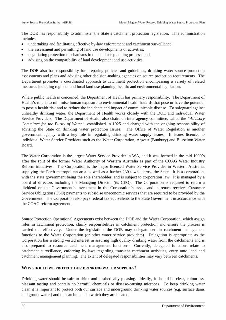
The DOE has responsibility to administer the State’s catchment protection legislation. This administration includes: • undertaking and facilitating effective by-law enforcement and catchment surveillance; • the assessment and permitting of land use developments or activities; • negotiating protection mechanisms in the land use planning process; and • advising on the compatibility of land development and use activities. The DOE also has responsibility for preparing policies and guidelines, drinking water source protection assessments and plans and advising other decision-making agencies on source protection requirements. The Department promotes a coordinated approach to catchment protection encompassing a variety of related measures including regional and local land use planning; health; and environmental legislation. Where public health is concerned, the Department of Health has primary responsibility. The Department of Health’s role is to minimise human exposure to environmental health hazards that pose or have the potential to pose a health risk and to reduce the incidents and impact of communicable disease. To safeguard against unhealthy drinking water, the Department of Health works closely with the DOE and individual Water Service Providers. The Department of Health also chairs an inter-agency committee, called the “Advisory Committee for the Purity of Water”, established in 1925 and charged with the ongoing responsibility of advising the State on drinking water protection issues. The Office of Water Regulation is another government agency with a key role in regulating drinking water supply issues. It issues licences to individual Water Service Providers such as the Water Corporation, Aqwest (Bunbury) and Busselton Water Board. The Water Corporation is the largest Water Service Provider in WA, and it was formed in the mid 1990’s after the split of the former Water Authority of Western Australia as part of the COAG Water Industry Reform initiatives. The Corporation is the major licensed Water Service Provider in Western Australia, supplying the Perth metropolitan area as well as a further 230 towns across the State. It is a corporation, with the state government being the sole shareholder, and is subject to corporation law. It is managed by a board of directors including the Managing Director (its CEO). The Corporation is required to return a dividend on the Government’s investment in the Corporation’s assets and in return receives Customer Service Obligation (CSO) payments to subsidise uneconomic services that are required to be provided by the Government. The Corporation also pays federal tax equivalents to the State Government in accordance with the COAG reform agreement.
Source Protection Operational Agreements exist between the DOE and the Water Corporation, which assign roles in catchment protection, clarify responsibilities in catchment protection and ensure the process is carried out effectively. Under the legislation, the DOE may delegate certain catchment management functions to the Water Corporation (or other water service providers). Delegation is appropriate as the Corporation has a strong vested interest in assuring high quality drinking water from the catchments and is also prepared to resource catchment management functions. Currently, delegated functions relate to catchment surveillance, enforcing by-laws regarding transient catchment activities, entry onto land and catchment management planning. The extent of delegated responsibilities may vary between catchments. WHY SHOULD WE PROTECT OUR DRINKING WATER SUPPLIES? Drinking water should be safe to drink and aesthetically pleasing. Ideally, it should be clear, colourless, pleasant tasting and contain no harmful chemicals or disease-causing microbes. To keep drinking water clean it is important to protect both our surface and underground drinking water sources (e.g. surface dams and groundwater ) and the catchments in which they are located.

Mount Magnet Water Reserve Drinking Water Source Protection Plan Water Source Protection Series WRP 38
Department of Environment 31
This advice deals with the water consumed in homes and provided by licensed Water Service Providers (often referred to as ‘scheme’ supplies). These WSP are responsible for water treatment (including disinfection) and distribution services to the community. Advice on alternative (potentially less safe) drinking water sources, such as private bores or rainwater tanks, is available in other documents. As a rule neither the Department of Health or DOE recommend the use of rainwater or private bore water for drinking water purposes where a scheme water source is available. This is because the catchments of these other sources are generally not protected from contamination and they are not analysed or treated to meet the relevant health guidelines for drinking water. Such sources can however be useful for non-potable uses such as in washing machines, toilets or for gardens. If a scheme supply is not available, then it is important that the consumer implements the necessary measures to ensure their drinking water source is safe to drink (i.e. arrange water analyses and treatment as required). In the mid 1990’s, the Council of Australian Government reforms process took an initiative to pursue the sustainable use of water resources by protecting and enhancing their quality, while maintaining economic and social development. This was achieved through the development of a National Water Quality Management Strategy (NWQMS) presently comprising 21 national guideline documents. Two of these focused on drinking water, the Australian Drinking Water Guidelines-Summary and the Australian Drinking Water Guidelines, 1996 (an update of the 1987 Guidelines for Drinking Water Quality in Australia). The Australian Drinking Water Guidelines, 1996 (ADWG) recognised water source protection through catchment management as an effective approach to preventing contamination of drinking water sources and undertook to investigate this issue further. In May 2001, Western Australia supported the NWQMS (including the ADWG) through the launch of its own State Water Quality Management Strategy (SWQMS). In late 2002, the ADWG were updated and released for public comment. The ADWG 2003 have now been finalised and are planned to be released in late 2003. A ‘consumer guide’ to the ADWG 2003 called Water made clear has also been developed to raise awareness of the need to protect drinking water catchments from ‘catchment to consumer’. Roughly half of Perth’s water supplies come from surface sources with the remainder harvested from groundwater. In 1994, a Parliamentary Select Committee reported on the issue of Perth’s development and groundwater supplies. The Select Committee considered experience from around the world and overwhelmingly concluded, “an ounce of prevention is worth a pound of cure”. In his foreword, the chairman of the Select Committee noted: “experts around the world expressed their envy of our relatively pristine water supply and advised us to protect our groundwater supply at all costs”. In 2000, the State Legislative Council’s Standing Committee on Ecologically Sustainable Development in relation to the Quality of Perth’s Water Supply expressed confidence in the system managing and operating Perth’s water supply. The Standing Committee noted, however, that various activities posed a contamination risk to water supplies. It found as a “first priority that water sources be protected through good land use planning. It also noted that “Using treatment to deal with contamination is a second-best option. The Committee found support for adopting catchment protection as the major weapon in preventing contamination of water supplies”. In November 2001, in support of this finding, the Western Australian Planning Commission (in consultation with the Water and Rivers Commission) released a Public Drinking Water Source Policy for public comment. The Policy was gazetted in June 2003. This policy will guide State and Local Government land use planning decisions in public drinking water catchments. Although the above committees were reporting on Perth’s water supplies, their findings apply to all public drinking water sources in Western Australia. This is especially true when a community is reliant upon a
Water Source Protection Series WRP 38 Mount Magnet Water Reserve Drinking Water Source Protection Plan
32 Department of Environment
single drinking water resource (such as the groundwater bore network in Kununurra or surface water dam in Quinninup) rather than an integrated series of sources (such as those that supply Perth). Contamination of a single resource from inappropriate land use planning or polluting activities within the catchment can have significant health and economic impacts, which should be avoided. In February 2003, the Western Australian Government released its State-wide water strategy. Although prepared in response to a number of forums around State focusing on drought, it did however make a significant statement about protecting our public drinking water sources. It stated unequivocally that recognition of the primacy of water quality in the management of drinking water catchments, to protect the long term sustainability of the resource, will be used to guide catchment management decisions. This is interpreted to mean, when managing and protecting any public drinking water source catchment, the dominant consideration must be maintenance of water resource quality and the prevention of contamination risk. This objective in most cases may prevent or constrain further land development. More recently in September 2003, the Western Australian Government also released its State-sustainability strategy document – “Hope for the future”. Drinking water catchments are now recognised as important ‘natural resources’ together with the other more common natural resources (eg. agriculture, fisheries, forestry, mining, tourism, aquatic systems, coastal and marine environments and rangelands). The ‘Vision’ in the Strategy is that “Drinking water sources are fully protected for future generations.”. The Strategy lists the following ‘Actions’: (number 3.48) that we “Work to ensure all present and future drinking water sources are protected.”; and (number 3.51) that we “Ensure the activities in catchments are actively managed and sustainable…” through “…investigation of the impact of active catchment management strategies that enhance water quality and quantity outcomes…”. WHAT ARE WE PROTECTING THE DRINKING WATER SUPPLIES FROM? Land use planning decisions and recreational or business activities occurring in drinking water catchments can impact on the quality and quantity of drinking water. Where catchments remain covered with native vegetation with little human activity, the risk of contamination is low. However, contamination risks increase with increased human activity. Potential contaminants may include: • physical contaminants e.g. colour, foaming agents and suspended solids; • chemical contaminants e.g. salts, heavy metals and poisons; or • microbiological contaminants e.g. bacteria, protozoa and pathogenic viruses. Although many contaminants can be removed by treatment processes, such treatment increases the cost of the water supply, and continuous effective removal of all contaminants is not considered technically or economically feasible. If contamination does occur, the opportunity to locate and develop a replacement source is often limited, and the provision of alternatives, e.g. bottled drinking water, is costly and can only be considered a short-term solution. Stopping contamination before it occurs prevents the need for costly treatment or the development of often more costly alternative sources. It should also be appreciated that there is a substantial ongoing financial cost to be borne in sampling and testing for contaminants if they become prevalent in drinking water sources. The benefits (environmental, social and economic) of avoiding contamination through best management decisions and practices are recognised in the ADWG 2003. Clearly drinking water quality and safety cannot be taken for granted. Appropriate State and Local Government controls are required in consultation with, and the support of the community and other stakeholders. These controls are needed to manage a number of threats to drinking water areas, including inappropriate:

Mount Magnet Water Reserve Drinking Water Source Protection Plan Water Source Protection Series WRP 38
Department of Environment 33
• land use planning processes and decisions resulting in high risk developments in catchments; • recreational activities where the impact of human wastes and damage to natural protective measures
associated with higher intensity land use is often underestimated; and • use and/or disposal of chemicals, animal and domestic wastes and pesticides. We should also appreciate that beyond the actual catchment and water storage area, drinking water that is not properly treated, or which travels through an inadequately maintained distribution system, also poses a serious public health risk. Several recent events that have occurred nationally and internationally that highlight the importance of protecting drinking water, especially at the source. The main finding of an inquiry into the well-publicised Sydney Water Crisis in 1998 was that the catchments were seriously compromised by many possible sources of contamination, and that there was insufficient regulatory control to guarantee safe drinking water. The Sydney Water Catchment Authority was set up in response to this event which transferred responsibility for land use decisions within the catchment from the Planning Authority to the new catchment Authority. In Walkerton (Canada), in 2000 a drinking water catchment related tragedy unfolded where a pathogenic E-coli outbreak resulted in over 2300 cases of illness amongst 4,800 residents, 70 people were hospitalised and 7 deaths were attributed to the outbreak. A judicial inquiry concluded that the likely initial cause of the outbreak was from manure application on farmland (a common practice even in WA) that resulted in bacterial contamination finding its way into the shallow underground water-body which was used to supply drinking water. Other contributing factors to the outbreak included a high rainfall event just prior to the contamination outbreak, and an inadequate disinfectant dose rate and monitoring issues related to the distribution system. It is important to appreciate that the drinking water system at Walkerton operated for more than 8 years without major incident up until the year 2000. The over-reliance on treatment to provide a safe drinking water supply was highlighted and a new approach adopted that considered both catchment protection and improved treatment (in combination) to provide a more reliably-safe supply to consumers. HOW DO WE PROTECT PUBLIC DRINKING WATER SOURCE AREAS IN WA? A ‘catchment to consumer’ multiple barrier approach is used in the management of drinking water quality in Western Australia. Catchment management for protection of the water source (held in storage in surface dams or underground aquifers) is considered the first important barrier. Historically, a heavy reliance was placed on treating water to achieve the desired level of safety, but it is now recognised that treatment alone does not remove all hazards to public health. Therefore, to maximise public health safety effective catchment protection is also essential. Other barriers include: • selection of an appropriate safe high quality source (where alternatives exist); • controls over land uses and high risk human activities in catchments underpinned by statutory measures; • protective undeveloped buffer zones to supply bores, reservoirs and feeder streams; • catchment protection strategies for education, surveillance, enforcement and monitoring/reporting; • pre-treatment of drinking water, for example use of detention and settling in reservoirs to induce
microbes to die off; • protection of water storage works, for example water tanks and reservoirs; • disinfection of drinking water before it enters the distribution system and provision to ensure an adequate
disinfectant residual throughout that system; • maintaining the distribution system as a whole including the pipe system, vermin-proofing of water tanks
and preventing back-flow; and

Water Source Protection Series WRP 38 Mount Magnet Water Reserve Drinking Water Source Protection Plan
34 Department of Environment
• Promotion of source protection measures in local government planning schemes using the WA Planning Commission’s Statement of Planning Policy– Public Drinking Water Source Policy (June 2003).
A key process employed by this agency to protect drinking water sources involves the preparation of Drinking Water Source Protection Plans (DWSPP) for the State’s PDWSAs. Drinking Water Source Protection Plans (and Drinking Water Source Protection Assessments) Drinking Water Source Protection Plans are a key component of the ‘catchment-to-consumer’ protection strategy for Western Australia’s drinking water supplies. This is reflected in the Government’s report “Securing our water future - A State Water Strategy for Western Australia (2003)” which states that water source protection plans should be completed for all public drinking water supply catchments throughout the State. A DWSPP aims to identify existing and potential threats to a drinking water source and to provide risk management strategies and programs for the ongoing management/protection of that source. They are prepared in consultation with the community, potentially affected stakeholders (especially landowners), local government and the State government. Stakeholders are strongly encouraged to consider the risks and potential consequences of inappropriate land-use planning or human activities in the catchment (e.g contamination of the resource and costs to clean-up or establish a new drinking water source). It should be noted that decisions made following consultation may result in some land use/activity restriction in order to achieve a safe, good quality drinking water supply. Providing a basis for establishing compatible land uses within PDWSAs, the DWSPP is only one of a suite of measures used by this agency to meet its drinking water protection responsibilities. As at June 2003, there were approximately 139 plans listed for completion. Of this number, 50 are complete and 89 are in production. While the full suite of DWSPPs await completion, land planners and developers need to be aware of the location of and risks to existing drinking water catchments. To this end the DOE is preparing Drinking Water Source Protection Assessments (DWSPA). These Assessments will provide a broad overview of catchment risks, planning and land uses; and a basic understanding of the drinking water catchment and supply system. They are not intended to include extensive data, but to characterise the drinking water system by providing useful information for decision makers. Generally, the DWSPA will be a desktop assessment followed by a site visit and discussions with local government. In some circumstances the DWSPA may be all that is required to achieve good land planning/activity controls (e.g. through planning schemes or strategies) for the protection of drinking water source areas. Otherwise, the DWSPA will be considered base information for development of the DWSPP described above.
PRIORITY CLASSIFICATION SYSTEM
This agency has also implemented policies to protect public drinking water source areas that includes a differential ‘priority classification area’ system that includes special ‘protection zones’ around bores and reservoirs. Through development of a DWSPP (or possibly the DWSPA), land in a PDWSA is identified as a mix of Priority 1 (P1), Priority 2 (P2) or Priority 3 (P3) classification areas, with appropriate protection zones. Priority 1 (P1) source protection areas are defined to ensure that there is no degradation of the water source. P1 areas are declared over land where the provision of high quality public drinking water is the prime beneficial land use. P1 areas would typically include land under public ownership but may in a limited number of cases include private land.

Mount Magnet Water Reserve Drinking Water Source Protection Plan Water Source Protection Series WRP 38
Department of Environment 35
P1 areas are managed in accordance with the principle of risk avoidance, and hence land development is generally not permitted. Where P1 land is in private ownership this agency may make an offer to the owner to sell their land at agreed market values subject to available funding and priority order purchasing rules. There is no obligation on the owner to sell their land. Priority 2 (P2) areas are defined to ensure that there is no increased risk of pollution to the water source. P2 areas are declared over land where low intensity development (such as rural) already exists. Protection of public water supply sources is a high priority relative to other land use values in these areas. P2 areas are managed in accordance with the principle of risk minimisation, and as such only limited conditional development is supported. Such development must be consistent with the protection of waters within the drinking water catchment. A proposed change in land use from a relatively low to a more intensive use may result in contamination of the PDWSA, and would not be supported. Priority 3 (P3) areas are defined where it is practical to manage the risk of pollution to the water source, and where water supply sources need to co-exist with other generally existing land uses such as residential, commercial and light industrial developments. Protection of P3 areas is achieved through management guidelines rather than restrictions on land use. Key elements in protection of P3 areas are the provision of deep sewerage and land users using best environmental management practices for their activities. In P3 areas, compared to P1 and P2 areas, it is likely that the direct cost of providing the drinking water to consumers is greater, given the need to monitor and treat the water more comprehensively due to the variety of existing and allowable land uses/risks. If water from P3 areas becomes contaminated, then that water may need to be further treated or an alternative water source found. In these priority areas there is a strong reliance on landowners, developers, regulators and other users to be acutely aware of the drinking water resource and risks, such that the adoption and implementation of best management practices will help protect the drinking water source . Existing lawfully established but non-conforming land uses in PDWSAs are allowed to continue, however land users will be encouraged to adopt environmentally responsible/best practice land use practices. This agency has prepared a “Water Quality Protection Note -Land Use Compatibility table in PDWSAs” that provides guidance on the type of land uses appropriate within P1, P2 and P3 areas.
RESERVOIR AND WELLHEAD PROTECTION ZONES
As noted above, reservoir protection zones (RPZ) are also defined to protect the surface water source from contamination in the immediate vicinity of reservoirs. Reservoir protection zones consist of up to a 2 kilometre buffer around the top water level of a reservoir and includes the reservoir itself. These zones do not extend outside the catchment area (i.e. downstream from a dam wall). This agency provides a high level of protection in these zones and does not support land uses or activities that may add to add to the risk of contamination of the water source. Generally conditions apply in these zones aimed at preventing people from entering the RPZ to avoid the risk of contamination (consistent with the P1 areas). For underground water sources, well-head protection zones are defined around the abstraction bores and allowable activities/ land uses in these areas are also restricted and subject to approval processes. Well-head protection zones in P1 areas are set at a 500 metre radius around a bore, and in P2 or P3 areas they are set at a 300 metre radius around a bore.
Water Source Protection Series WRP 38 Mount Magnet Water Reserve Drinking Water Source Protection Plan
36 Department of Environment
CONCLUSION We can improve the availability of ‘safe, good quality drinking water’ to protect public health if we continue to combine catchment protection and water treatment approaches. This ‘catchment to consumer’ approach to drinking water protection is the basis of the recently updated Australian Drinking Water Guidelines 2003. Many land uses and activities can pose a risk to water quality, so in undeveloped drinking water catchments strict management controls are proposed to ‘avoid the risk’ of contaminating the source. In catchments with some level of development, management controls recognise the existing development but may place restrictions on alternative land uses or expansion of existing land uses. This approach looks to ‘minimise’ or ‘manage the risk’ of contamination in the catchment. These management controls help protect public health, lower the costs of supplying drinking water to consumers and provide a long term source of safe, good quality drinking water. MORE INFORMATION We welcome your thoughts on this note. Feedback on this topic is retained our file No. 13256. The note will be updated from time to time as comments are received, or industry standards change. If you wish to comment on the note or require more information, please contact our Program Manager, Protection Planning (Stephen Watson) at the Water Source Protection Branch in our head office in the Hyatt Centre. Phone: (08) 9278 0454 (business hours), Fax: (08) 9278 0585.
Mount Magnet Water Reserve Drinking Water Source Protection Plan Water Source Protection Series WRP 38
Department of Environment 37
Appendix 2 Water Quality Analysis Results

Water Source Protection Series WRP 38 Mount Magnet Water Reserve Drinking Water Source Protection Plan
38 Department of Environment
Water Quality Analysis Results The Water Corporation has monitored the water quality (including baseline sampling of raw water) from Mt Magnet (Genga borefield) in accordance with the requirements of SG010 Drinking Water Quality Management Manual and SG097 Source Protection Operations Manual, ADWG and interpretations agreed to with the DoH. The water is regularly monitored for microbiological contamination, health related chemicals and aesthetic parameters. ADWG gives guidance on the quality of water that should be provided to consumers at the point of use. For more detail on the drinking water criteria that have been monitored together with ADWG guideline values contact the Water Corporation or download the Water Corporation annual drinking water quality report which can be viewed at the Water Corporation website <www.watercorporation.com.au/publications/13/DWQAR03.pdf>. The water quality analysis results have been broken down into the following sub-components consistent with ADWG: • Microbiological contaminants: are the most common and widespread health risk associated with
drinking water. Microbiological contaminants are generally monitored by testing for two indicator organisms: thermotolerant coliforms, or alternatively E. coli, and total coliforms.
• Chemical characteristics: a number of chemicals, both organic and inorganic, including some pesticides are toxic to humans or are suspected of causing cancer; some can also affect the aesthetic quality of water:
1. Inorganic chemicals: in drinking water usually occur as dissolved salts such as carbonates and chlorides, attached to suspended materials such as clay particles, or complexes with naturally occurring compounds. 2. Organic chemicals: are usually present in drinking water in very low concentrations and
may occur naturally or as a result of human activities. • Physical characteristics: are the appearance, taste, odour and ‘feel’ of the water. This determines what
people experience when they drink the water and how they rate its quality. In general physical characteristics are not a direct public health concern, but they do affect the aesthetic quality of the water, which largely determines whether or not people are prepared to drink it.
In the absence of specific guidelines for raw water quality, results have been compared with the ADWG values set for water that enters the distribution systems (after disinfection). Only health parameters that have been measured at detectable levels are listed, and all parameters that are higher than ADWG have been shaded to give an indication of the potential water quality risks posed in the catchment. It is important to appreciate that the data does not indicate the quality of water distributed to the public as it represents pre-treatment water quality results.

Mount Magnet Water Reserve Drinking Water Source Protection Plan Water Source Protection Series WRP 38
Department of Environment 39
MICROBIOLOGICAL CONTAMINANTS Microbiological testing of the raw water entering Genga Borefield Treatment Plant has been conducted on a monthly basis since December 2000. Thermotolerant coliform counts are used as an indicator of the degree of faecal contamination of the raw water from warm-blooded animals. A count less than 20 colony forming units (cfu) per 100 mL is typically associated with low levels of faecal contamination from indigenous animals and is used as a microbiological contamination benchmark (WHO, 1996). Positive thermotolerant coliform counts were recorded in 12% of the raw water from the Genga borefield (see Figure 1). Only one of these samples returned a thermotolerant coliform count greater than 20 cfu/100 mL with a value of 39 cfu/100 mL. However, as previously mentioned the raw water is treated prior to being supplied to consumers to ensure that it is safe to drink.
Figure 1: Thermotolerant coliforms at Mt Magnet - Genga borefield.
0
5
10
15
20
25
30
35
40
45
01/1
0/00
19/0
4/01
05/1
1/01
24/0
5/02
10/1
2/02
28/0
6/03
14/0
1/04
01/0
8/04
17/0
2/05
Date
Ther
mot
oler
ant c
olifo
rms
(cfu
/100
mL)
Genga Borefield Raw Source
>20cfu/100mL requires additional treatment

Water Source Protection Series WRP 38 Mount Magnet Water Reserve Drinking Water Source Protection Plan
40 Department of Environment
HEALTH RELATED CHEMICAL WATER QUALITY DATA Raw water from Genga borefield is analysed for health related chemicals. A health related guideline value is the concentration or measure of a water quality characteristic that, based on present value, does not result in any significant risk to the health of the consumer over a lifetime of consumption (NHMRC & ARMCANZ 1996). Health related chemicals include inorganics such as heavy metals, industrial hydrocarbons and pesticides, and organics such as bacteria and protozoa. Health related water quality parameters that have been measured at detectable levels in the sources between March 2000 and May 2004 are summarised in Table 1.
Table 1: Health Related Water Quality Data at Mt Magnet. Parameter Range of Monitored Values
Min-Max
Median
1996 ADWG
Health Value*
Genga Raw Bore 1/64 Bore 7/74 Bore 8/74 Bore 1/75 Inorganic
Arsenic <0.002 – 0.004
0.003
<0.002 – 0.006
0.004
<0.002 – 0.006
0.004 ND
<0.002 – 0.003
0.002 0.007 mg/L
Barium 0.025 – 0.05
0.03
0.004 – 0.014
0.008 0.05 0.04 0.02 0.7 mg/L
Boron 0.42 – 0.66
0.56
0.78 – 0.88
0.86 ND ND ND 4.0 mg/L
Fluoride 0.2 – 0.3
0.25
0.15 – 0.3
0.25 0.2 0.25 0.25 1.5 mg/L
Manganese (unfiltered) <0.01 – 0.1
0.02
<0.002 – 0.55
0.07
0.003 – 0.016
0.007 0.004
<0.002 – 0.046
0.02 0.5 mg/L
Molybdenum ND <0.002 – 0.004
0.002 ND ND ND 0.05 mg/L
Nitrite + Nitrate as N 12.5 – 19
15.5
11.5 – 15
14
13.5 – 16.5
14.5 13
13.5 – 16.5
14.5 11.3 mg/L
Bore 7/82 Bore 35/86 Bore 36/86 Bore 38/86 Bore 40/86
Inorganic
Arsenic <0.002 – 0.003
0.003
<0.002 – 0.003
0.002
<0.002 – 0.004
0.003
<0.002 – 0.01
0.007 ND 0.007 mg/L
Barium 0.03 0.045 0.015 0.02 0.045 0.7 mg/L
Fluoride 0.25 0.25 0.25 0.3 0.3 1.5 mg/L
Manganese (unfiltered) <0.002 – 0.012
0.007
<0.002 – 0.003
0.002 ND ND ND 0.5 mg/L
Nitrite + Nitrate as N 14.5 – 17.5
15.5
14.5 – 19
15.5
15 – 19.5
16
17.5 – 21.5
18.5
15.5 – 19.5
17 11.3 mg/L
*A health guideline value is the concentration or measure of a water quality characteristic that, based on present knowledge,
does not result in any significant risk to the health of the consumer over a lifetime of consumption.
Shaded – Exceeds ADWG 1996 Health Value
ND – Not Detected
- No samples collected
Manganese, fluoride, arsenic and barium have been detected in the raw water from the majority of the bores at Mt Magnet. Manganese exceeded the guideline value in bore 1/64, which is no longer used to supply the reticulation. Apart from arsenic in bore 38/86, all other detected concentrations were well below the health guideline and pose no risk to the water quality.

Mount Magnet Water Reserve Drinking Water Source Protection Plan Water Source Protection Series WRP 38
Department of Environment 41
Nitrite and nitrate as N concentrations have exceeded health guidelines in all the bores at Mt Magnet. The locality currently has a licence exception for high nitrate levels. The composite raw water, Genga Raw indicates that the health related parameters, with the exception of nitrate and nitrite as N, are within their respective guideline values and pose no risk to water quality. Health related parameters will continue to be monitored. NON-HEALTH RELATED WATER QUALITY DATA Raw water from Genga borefield is analysed against aesthetic water quality guidelines (non-health related characteristics). Non-health related characteristics include physical characteristics and some organic and inorganic components. Non-health related water quality parameters that have been measured at detectable levels in the sources between March 1999 and May 2004 are summarised in Table 2.
Table 2: Non-Health Related Water Quality Data at Mt Magnet. Parameter Range of Monitored Values
Min-Max Median
1996 ADWG Guideline Value
Physical Characteristics
Genga Raw
Hardness (CaCO3) 229 – 322
255.5 200 mg/L
pH 7.51 – 8.41
7.68 6.5 – 8.5
Total dissolved solids (TDS) 450 – 1700
705 1000 mg/L
True colour <1 – 2
1 15 HU
Turbidity <0.1 – 1
0.2 5 NTU
Inorganic
Chloride 180 – 260
197.5 250 mg/L
Iron <0.003 – 0.035
0.03 0.3 mg/L
Sodium 120 – 180
150 180 mg/L
# Aesthetic guideline value is a level which ensures good quality water; that is, water which is aesthetically
pleasing and safe and which will not harm fixtures and fittings.
Shaded – Maximum monitored values exceed ADWG 1996 Aesthetic Value Raw water from Mt Magnet is deemed to be hard with a median calcium carbonate concentration of 255 mg/L which exceeds aesthetic guidelines. Where hardness is greater than 200 mg/L water can cause increasing scaling problems. The TDS average is 705 mg/L and the chloride concentration in the raw water also exceeds aesthetic guidelines and is typical of groundwater sources as a result of dissolution of salt deposits. All other non-health parameters from Mt Magnet borefield were within aesthetic guidelines. These parameters will continue to be monitored.

Water Source Protection Series WRP 38 Mount Magnet Water Reserve Drinking Water Source Protection Plan
42 Department of Environment
Appendix 3 Land Use Compatibility in Public Drinking Water Source Areas

Mount Magnet Water Reserve Drinking Water Source Protection Plan Water Source Protection Series WRP 38
Department of Environment 43
Land Use Compatibility in Public Drinking Water Source Areas Purpose The Department of Environment (DOE) is responsible for managing and protecting the State’s water resources. This note provides advice on the acceptability of land uses and activities within specific catchments that are the water source for schemes supplying cities and towns. These are termed Public Drinking Water Source Areas (PDWSAs). These areas require comprehensive water resource quality and land planning protection measures to ensure the ongoing availability of a safe, good quality drinking water supply to protect the health of consumers. The note also forms an integral part of the Western Australian Planning Commission’s Statement of Planning Policy No. 2.7- Public Drinking Water Source Policy 2003 (relevant to approximately 140 existing PDWSAs in Western Australia) prepared by the Department for Planning and Infrastructure under Section 5AA of the Town Planning and Development Act 1928. It is also intended to support the proposed Statement of Planning Policy for Water Resources designed to guide planning decisions in future PDWSAs. This note should be used by Local Government when developing local planning strategies, structure plans and town planning schemes. It should also be used in the assessment of subdivision and other development applications. The note will also assist the development of formal guidelines on land use activities in PDWSA prepared in liaison with key stakeholders such as the Water Corporation, Department of Health, Department of Conservation and Land Management, Department of Agriculture, Department of Industry and Resources, Department for Planning and Infrastructure and local government. A review of this note may occur within 12 months (depending on feedback) to reflect DOE’s policy position (which is influenced by public consultation undertaken for PDWSAs), advances in technology or land use activity standards, and Government decisions made concerning drinking water quality protection. This note may not consider all the circumstances that exist for planning strategies, plans and schemes across the State. Accordingly, changes to this note will only be considered if they apply broadly across the State. Other means of addressing localised special circumstances may be employed and the DOE will assist in achieving this outcome provided those changes do not place the PDWSA at a higher contamination risk. Scope This note provides the DOE's position on a range of land uses assessed against the Department's water quality protection strategy and management objectives within PDWSAs. Where a specific land use has not been covered in the accompanying tables, it should be referred to the Department’s Water Source Protection Branch for assessment and a written response concerning its acceptability or any necessary water resource protection measures. Public Drinking Water Source Area in Western Australia is the collective description for: • Underground Water Pollution Control Areas, • Water Reserves, and • Catchment Areas,
JUNE 2004

Water Source Protection Series WRP 38 Mount Magnet Water Reserve Drinking Water Source Protection Plan
44 Department of Environment
declared under the Metropolitan Water Supply, Sewerage and Drainage Act 1909 or the Country Areas Water Supply Act 1947. This note is intended to complement the statutory role and policy of State and local government authorities, but it does not override Government policy or the need for proponents to fulfil their legal responsibilities for land use planning, and environmental, health, building or other necessary approvals. PDWSA protection framework The protection of PDWSAs relies on statutory measures available in water resource management and land use planning legislation. The DOE policy for the protection of PDWSAs includes three risk management based priority classification areas and two types of protection zones. The priority classification areas and protection zones are determined via specific Drinking Water Source Protection Plans (DWSPP) that are prepared in consultation with State government agencies, landowners, local government, and key industry and community stakeholders. Where a fully consulted DWSPP does not exist for a PDWSA, the DOE initially prepares Drinking Water Source Protection Assessment (DWSPA) documents to reflect readily available information for use in land use planning assessments and decision making. Priority classification areas Priority 1 (P1) classification areas are managed to ensure that there is no degradation of the drinking water source by preventing the development of potentially harmful activities in these areas. The guiding principle is risk avoidance. This is the most stringent priority classification for drinking water sources. P1 areas normally encompass land owned or managed by State agencies, but may include private land that is strategically significant to the protection of the drinking water source (e.g. land immediately adjacent to a reservoir). Most land uses create some risk to water quality and are therefore defined as “Incompatible” in P1 areas. Priority 2 (P2) classification areas are managed to ensure that there is no increased risk of water source contamination/ pollution. For P2 areas, the guiding principle is risk minimisation. These areas include established low-risk land development (e.g. low intensity rural activity). Some development is allowed within P2 areas for land uses that are defined as either “Compatible with conditions” or “Acceptable”. Priority 3 (P3) classification areas are defined to manage the risk of pollution to the water source from catchment activities. Protection of P3 areas is mainly achieved through guided or regulated environmental (risk) management for land use activities. P3 areas are declared over land where water supply sources co-exist with other land uses such as residential, commercial and light industrial development. Land uses considered to have significant pollution potential are nonetheless opposed or constrained. Wellhead and reservoir protection zones In addition to the three Priority Classification Areas, specific protection zones are defined to protect drinking water sources from contamination in the immediate vicinity of water extraction facilities. Within these zones by-laws may prohibit, restrict or approve defined land uses and activities to prevent water source contamination or pollution. Special conditions, such as restrictions on storage and use of chemicals, may apply within these zones. The legislation is currently being reviewed to simplify and enhance the protection of public drinking water sources.
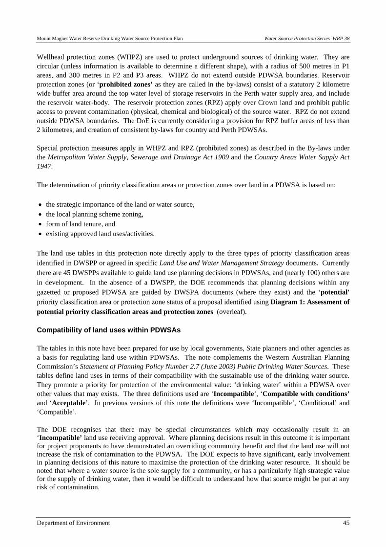
Mount Magnet Water Reserve Drinking Water Source Protection Plan Water Source Protection Series WRP 38
Department of Environment 45
Wellhead protection zones (WHPZ) are used to protect underground sources of drinking water. They are circular (unless information is available to determine a different shape), with a radius of 500 metres in P1 areas, and 300 metres in P2 and P3 areas. WHPZ do not extend outside PDWSA boundaries. Reservoir protection zones (or ‘prohibited zones’ as they are called in the by-laws) consist of a statutory 2 kilometre wide buffer area around the top water level of storage reservoirs in the Perth water supply area, and include the reservoir water-body. The reservoir protection zones (RPZ) apply over Crown land and prohibit public access to prevent contamination (physical, chemical and biological) of the source water. RPZ do not extend outside PDWSA boundaries. The DoE is currently considering a provision for RPZ buffer areas of less than 2 kilometres, and creation of consistent by-laws for country and Perth PDWSAs. Special protection measures apply in WHPZ and RPZ (prohibited zones) as described in the By-laws under the Metropolitan Water Supply, Sewerage and Drainage Act 1909 and the Country Areas Water Supply Act 1947. The determination of priority classification areas or protection zones over land in a PDWSA is based on: • the strategic importance of the land or water source, • the local planning scheme zoning, • form of land tenure, and • existing approved land uses/activities.
The land use tables in this protection note directly apply to the three types of priority classification areas identified in DWSPP or agreed in specific Land Use and Water Management Strategy documents. Currently there are 45 DWSPPs available to guide land use planning decisions in PDWSAs, and (nearly 100) others are in development. In the absence of a DWSPP, the DOE recommends that planning decisions within any gazetted or proposed PDWSA are guided by DWSPA documents (where they exist) and the ‘potential' priority classification area or protection zone status of a proposal identified using Diagram 1: Assessment of potential priority classification areas and protection zones (overleaf). Compatibility of land uses within PDWSAs The tables in this note have been prepared for use by local governments, State planners and other agencies as a basis for regulating land use within PDWSAs. The note complements the Western Australian Planning Commission’s Statement of Planning Policy Number 2.7 (June 2003) Public Drinking Water Sources. These tables define land uses in terms of their compatibility with the sustainable use of the drinking water source. They promote a priority for protection of the environmental value: ‘drinking water’ within a PDWSA over other values that may exists. The three definitions used are ‘Incompatible’, ‘Compatible with conditions’ and ‘Acceptable’. In previous versions of this note the definitions were ‘Incompatible’, ‘Conditional’ and ‘Compatible’. The DOE recognises that there may be special circumstances which may occasionally result in an ‘Incompatible’ land use receiving approval. Where planning decisions result in this outcome it is important for project proponents to have demonstrated an overriding community benefit and that the land use will not increase the risk of contamination to the PDWSA. The DOE expects to have significant, early involvement in planning decisions of this nature to maximise the protection of the drinking water resource. It should be noted that where a water source is the sole supply for a community, or has a particularly high strategic value for the supply of drinking water, then it would be difficult to understand how that source might be put at any risk of contamination.

Water Source Protection Series WRP 38 Mount Magnet Water Reserve Drinking Water Source Protection Plan
46 Department of Environment
Detailed information on water quality protection issues and recommended best management practices for ‘Compatible with conditions’ land uses are being developed in approved environmental policy, codes of practice, management guidelines and water quality protection notes. These documents, along with the most recent version of this note, can be found on the DOE Internet site <http://www.environment.wa.gov.au>. Information on land use and development regulation within PDWSAs can also be obtained from DOE’s regional offices. The DOE’s Water Source Protection Branch, presently located in East Perth, is custodian of this water quality protection note and will provide detailed advice on its application and coordinate any suggested amendments. Diagram 1: Assessment of potential priority classification areas and protection zones (See legend on page 47)
Is the proposal completely or partially within an existing or proposed
Public Drinking Water Source Area (PDWSA)?A
Potential ‘Reservoir Protection Zone’ and ‘Priority 1 Classification Area’.
Potential ‘Wellhead Protection Zone’. 500 metre radius for P1 areas or 300 metres for P2 and P3 areas.
What is the proposal’s existing or approved
zoning, ownership and land use?C
Other, including commercial, civic use,
industrial, urban or urban deferred?
Rural land (excluding intensive
agriculture)?
Existing or identified Government reserve? POTENTIAL
‘Priority 1 Classification Area’ D
POTENTIAL ‘Priority 2
Classification Area’
POTENTIAL ‘Priority 3
Classification Area’
Is the proposal within 2 kilometres of the top
water level of a public drinking water source
reservoir?B
Is the proposal within 500 metres of an
existing or proposed public drinking water
source bore?B
Priority Classification Areas and Protection
Zones are not applicable.
Yes
Yes
Is the source strategically important?B (e.g. sole source of drinking water for a Town)
NoYes

Mount Magnet Water Reserve Drinking Water Source Protection Plan Water Source Protection Series WRP 38
Department of Environment 47
LEGEND A. The location of PDWSAs can be found in DOE’s Drinking Water Source Protection Assessments and
Plans or through your regional DOE office, Local Government office, Water Corporation or from the Department for Planning and Infrastructure.
B. Strategically significant sources and potential contamination from land uses close to drinking water
reservoirs or abstraction bores are considered first, due to these involving the highest risk of contamination reaching consumers.
C. Current zoning or land use information is available from your Local Government office. D. Government land is protected to achieve the highest level of safety for drinking water in all parts of a
catchment through a Priority 1 classification, wherever this is reasonable and practicable. Existing approved land uses Many land uses covered in this note may have been legally established prior to establishment/ gazettal of the PDWSA or modern protection measures being required. The DOE policy is that existing approved land uses/ activities can continue at their presently approved level, provided they operate lawfully. Where necessary, negotiations may be arranged with land owners to acquire property rights in P1 source protection areas. Where practical, this agency will also negotiate with the operators of existing ‘Incompatible’, or ‘Compatible with conditions’ activities to implement environmental management practices that minimise risks to water sources. Proposed land uses After reading this protection note, please view the DOE Internet site and/ or contact your nearest DOE Regional Office for advice on the location of PDWSAs, priority classification areas, and reservoir or wellhead protection zones. You may discuss with DoE staff any proposed land use activities that may affect water resources. The early identification of water resource protection issues in development stages of land use planning proposals is recommended in both the June 2003 Statement of Planning Policy for Public Drinking Water Sources and proposed Water Resources Policy by the Western Australian Planning Commission. Definition of terms used in the following tables ‘Acceptable ’ (equivalent to ‘compatible’ in previous version of this note)- means the land use is accepted by DoE as not likely to harm the drinking water source, and is consistent with the management objectives of that priority classification. The adoption of best practice environmental management methods for new proposals to protect water quality is expected. Existing land users are also encouraged to adopt best practice environmental management methods to help protect water quality. These land uses generally do not need referral to the DOE. ‘Compatible with conditions’ (equivalent to ‘conditional’ in previous version of this note) - means the land use is likely to be accepted by DoE as not likely to harm the drinking water source, (and is consistent with the management objectives of the priority classification) provided best environmental management practices are used. This may result in the application of ‘specific conditions’ (via the planning or environmental approval processes) that must be complied with to ensure the water quality objective of the priority area is maintained. Land uses described as ‘Compatible with conditions’ need ONLY to be referred to DOE for assessment and a written response if the activity does not follow recommendations endorsed by DOE such as those made in
Water Source Protection Series WRP 38 Mount Magnet Water Reserve Drinking Water Source Protection Plan
48 Department of Environment
policy, environmental management guidelines, protection notes; Ministerial Conditions, Works Approvals, Licenses or agreements (e.g. a ‘Memorandum of Understanding’ developed between any Local Government and DOE). ‘Incompatible’- means the land use is UNACCEPTABLE to DOE as it does not meet the management objectives of the priority classification area. DOE will normally oppose approval of these land uses through the planning decision making process and under legislation administered by DOE. If planning decisions are made to approve these land uses (e.g. as a consequence of a planning appeals process), then DOE should be advised of that decision and have been directly involved in providing advice to the planning decision makers on water quality protection issues. It should be noted that contentious proposals may be referred to the EPA for Environmental Impact Assessment under the Environmental Protection Act 1986. ‘Extensive’- means limited additional inputs beyond those supplied by nature are required to support the land use, e.g. for agriculture- animal feed supplements only during seasonal dry periods, or during the final preparation of stock for the market. ‘Intensive’- means regular additional inputs are required to support the desired land use, e.g. for agriculture- irrigation, fertilisers, pesticides, or non-forage animal feeding dominates. Interpretation of land use recommendations for planning schemes and development approvals When using the following land use compatibility tables to guide planning schemes and development approval decisions, the following relationships should be used: a) Where the table identifies a land use as ‘Acceptable’, this use is permitted by DOE within that priority
classification area. It may be identified as a ‘P’ (permitted) use in a scheme, providing the use complies with the relevant development standards and requirements of the planning scheme.
b) Where the table identifies a use as ‘Compatible with conditions’, this use should be a discretionary use
within the priority classification area and should be identified as either a ‘D’ or ‘A’ (after special notice) use in the scheme. Proposals for ‘Compatible with conditions’ uses should ONLY be referred to DOE for assessment and response if they do not meet existing agency policy, guidelines or protection note measures, unless prior agreement has been made between a specific local government and DOE on alternative measures.
c) Relevant environmental management guidelines, codes of practice, water quality protection notes or
agreements should be used in the first instance to define DOE's position on any land-use and limit the need to refer proposals to the DOE. Where these do not exist, site specific advice may be provided by the DOE.
d) Where the table identifies a use as ‘Incompatible’, that use should not be permitted within that priority
source protection area, and should be identified as an ‘X’ (unacceptable use) in the scheme. Where the table does not include a proposed land use that could affect water quality, that use should be considered to be ‘Incompatible’ until the proponent can demonstrate that it meets the drinking water quality protection objective of the designated priority classification area . Specific advice on the proposed land use should be obtained from the DOE’s Water Source Protection Branch.
Mount Magnet Water Reserve Drinking Water Source Protection Plan Water Source Protection Series WRP 38
Department of Environment 49
If the land use planning approval process supports a proposal that is inconsistent with this water quality protection note, then DOE Water Source Protection Branch should be advised of this situation and the reasons for that decision. This advice will trigger DOE’s assessment of the significance/ consequence of that decision to the drinking water source and the outcome will be considered in future strategies for water quality protection, and in the periodic review and update of this note. A means to ensure the DOE’s effective early involvement with such cases is currently being developed.

Water Source Protection Series WRP 38 Mount Magnet Water Reserve Drinking Water Source Protection Plan
50 Department of Environment
Tables defining compatibility of various land uses within PDWSA It is important to note that this table provides the DOE’s recommended compatibility of land uses for the current zoning of land. It must not be used to support rezoning of land to provide for more intensive land uses. For example, although P3 areas provide for high density urban development when the land is already zoned Urban or Urban deferred, this Table must not be read to justify a zoning change within P3 areas to allow for high density urbanisation of rural zoned land. Model Scheme Text (MST) land uses are shown in bold in the first column. Definitions covered in the MST (see note 23) can also be found in the Town Planning Amendment Regulations 1999.
Model Scheme Text & interpreted type of land use P1 areas P2 areas P3 areas
Agriculture– extensive
- pastoral leases Compatible with conditions
Acceptable Acceptable
- floriculture (non irrigated), stock grazing (excluding
pastoral leases) and broad hectare cropping,
Incompatible
Compatible with conditions
(see notes 11, 12)
Acceptable
Agriculture- intensive
- aquaculture (fish, plants and crustaceans) Incompatible Compatible with conditions
Compatible with conditions
- orchards; production nurseries– potted plants; viticulture– wine and table grapes
Incompatible Compatible with conditions
Acceptable
- floriculture; market gardens (see note 24); turf farms Incompatible Incompatible Compatible with conditions
- hydroponic plant growing Incompatible Compatible with conditions
Compatible with conditions
- plant nurseries / garden centres Incompatible Compatible with conditions
(see note 2)
Acceptable
Agro-forestry Incompatible Compatible with conditions
Acceptable
Amusement parlour Incompatible Incompatible Acceptable
(see note 1)
Animal establishment
- animal saleyards and stockyards
(see note 13)
Incompatible Compatible with conditions
(see note 2)
Compatible with conditions
(see note 2)
- apiaries Compatible with conditions
Acceptable Acceptable
- catteries Incompatible Acceptable Acceptable
- dairy sheds Incompatible Compatible with conditions (see notes 2, 3, 12)
Compatible with conditions
(see note 3)

Mount Magnet Water Reserve Drinking Water Source Protection Plan Water Source Protection Series WRP 38
Department of Environment 51
Model Scheme Text & interpreted type of land use P1 areas P2 areas P3 areas
- dog kennels Incompatible Compatible with conditions
Compatible with conditions
- equestrian centres (see note 17) Incompatible Incompatible Acceptable
- feedlots, intensive outdoor livestock holding Incompatible Incompatible Compatible with conditions
- stables (see note 18) Incompatible Compatible with conditions
Acceptable
Animal husbandry- intensive
- piggeries Incompatible Incompatible Incompatible
- poultry farming - housed Incompatible Compatible with conditions
Compatible with conditions
Bed and breakfast (accommodating a maximum of 6 guests)
Compatible with conditions
(see notes 6, 16)
Acceptable (see note 23)
Acceptable
- farm stay accommodation, rural chalets) Compatible with conditions
(see notes 6, 16)
Compatible with conditions
(see note 4)
Acceptable
Betting agency Incompatible Compatible with conditions
(see note 2)
Acceptable
(see note 1)
Caravan park Incompatible Incompatible Compatible with conditions
(see note 1)
Caretakers dwelling Compatible with conditions
(see note 2)
Compatible with conditions
Acceptable
Car park Incompatible Compatible with conditions
(see note 2)
Acceptable
Cemeteries Incompatible Incompatible Compatible with conditions
Child care premises Incompatible Compatible with conditions
(see note 2)
Acceptable
(see note 1)
Cinema/ theatre Incompatible Incompatible Acceptable
(see note 1)
Civic use Incompatible Compatible with conditions
(see note 2)
Acceptable
(see note 1)
Club premises
- sporting or recreation clubs Incompatible Compatible with conditions
Acceptable
(see note 1)
- health centres Incompatible Incompatible Acceptable
(see note 1)

Water Source Protection Series WRP 38 Mount Magnet Water Reserve Drinking Water Source Protection Plan
52 Department of Environment
Model Scheme Text & interpreted type of land use P1 areas P2 areas P3 areas
Community purpose
- community halls Incompatible Compatible with conditions
(see note 2)
Acceptable
- irrigated golf courses or recreational parks Incompatible Incompatible Compatible with conditions
(see note 11)
- motor-sports (permanent racing facilities) Incompatible Incompatible Compatible with conditions
- public swimming pools/ aquatic centres Incompatible Incompatible Compatible with conditions
- rifle ranges Incompatible Compatible with conditions
Acceptable
Consulting rooms Incompatible Compatible with conditions
(see note 2)
Acceptable
(see note 1)
Convenience store Incompatible Compatible with conditions
(see note 2)
Acceptable
(see note 1)
Corrective institution Incompatible Incompatible Compatible with conditions
(see note 1)
Educational establishment
- community education centres, scientific research institution
Compatible with conditions
(see note 2)
Compatible with conditions
(see note 2)
Acceptable
(see note 1)
- primary / secondary schools, tertiary education facilities
Incompatible Incompatible Acceptable
(see note 1)
Exhibition centre Incompatible Incompatible Acceptable
(see note 1)
Family day care Incompatible Acceptable
(see note 19)
Acceptable
(see note 1)
Fast food outlet Incompatible Incompatible Acceptable
(see note 1)
Forestry (native forest/ silviculture/ tree farming) Compatible with conditions
(see note 11)
Compatible with conditions
(see note 11)
Acceptable
Fuel depot (storage/ transfer) Incompatible Incompatible Compatible with conditions
Funeral parlour Incompatible Incompatible Acceptable
(see note 1)
Home business Incompatible Acceptable (see note 20)
Acceptable
(see note 1)

Mount Magnet Water Reserve Drinking Water Source Protection Plan Water Source Protection Series WRP 38
Department of Environment 53
Model Scheme Text & interpreted type of land use P1 areas P2 areas P3 areas
Home occupation Compatible with conditions
(see note 15)
Acceptable
(see note 21)
Acceptable
(see note 1)
Home office Compatible with conditions
(see note 15)
Acceptable Acceptable
Home store Incompatible Compatible with conditions
Acceptable
(see note 1)
Hospital Incompatible Incompatible Compatible with conditions
(see note 1)
Hotel (includes hotels, hostels, resorts)
Incompatible Incompatible Acceptable
(see note 1)
Industry
- abattoirs Incompatible Incompatible Incompatible
- cottage Compatible with conditions
Compatible with conditions
Acceptable
- drinking water treatment plant Compatible with conditions
Compatible with conditions
Compatible with conditions
- extractive, includes construction/ mining camps
(see note 10)
Compatible with conditions
Compatible with conditions
Compatible with conditions
- food processing, dairy product factories, breweries Incompatible Incompatible Compatible with conditions
(see note 1)
- general (chemical manufacture/ formulation, dry cleaners, dye works, laboratories, photo-processors)
Incompatible Incompatible Compatible with conditions
(see note 1)
- general (metal production/ finishing, pesticide operator depots, heavy or energy industry, petroleum refineries)
Incompatible Incompatible Incompatible
- general (concrete batching, cement products, fertiliser manufacture/ bulk storage, wrecking)
Incompatible Incompatible Compatible with conditions
- general (mineral processing) Incompatible Incompatible Compatible with conditions
(see note 9)
- light industry Incompatible Incompatible Compatible with conditions
(see note 1)
- milk transfer depots Incompatible Incompatible Compatible with conditions
- mining (includes mineral and energy exploration, oil or gas extraction / decontamination for transport)
Compatible with conditions
(see note 9)
Compatible with conditions
(see note 9)
Compatible with conditions
(see note 9)
- mining (tailings dams) Incompatible Incompatible Compatible with conditions
(see note 9)

Water Source Protection Series WRP 38 Mount Magnet Water Reserve Drinking Water Source Protection Plan
54 Department of Environment
Model Scheme Text & interpreted type of land use P1 areas P2 areas P3 areas
- mining (includes construction/ mining camps),
(see note 10)
Compatible with conditions
Compatible with conditions
Compatible with conditions
- rural (animal product rendering works, tanneries,
wool scours)
Incompatible Incompatible Incompatible
- rural (farm supply centres, manure stockpiling/
processing facilities)
Incompatible Compatible with conditions
(see note 2)
Compatible with conditions
- rural (forestry products processing– chip mills, pulp/
paper, timber preservation, wood/ fibre works,
composting/ soil blending - commercial)
Incompatible Incompatible Compatible with conditions
- service industry Incompatible Incompatible Compatible with conditions
Landfill (solid waste disposal)
- class I (refer also to ‘Storage - used tyres’ advice) Incompatible Incompatible Compatible with conditions
- class II or III Incompatible Incompatible Incompatible - class IV or V Incompatible Incompatible Incompatible
Lunch bar Incompatible Compatible with conditions
(see note 2)
Acceptable
(see note 1)
Major transport infrastructure (roads, railways) Incompatible Compatible with conditions
(see note 14)
Acceptable
Marina (includes boat moorings and servicing) Incompatible Incompatible Compatible with conditions
Marine filling station (boat fuelling) Incompatible Incompatible Compatible with conditions
Market (food; general produce; second–hand goods) Incompatible Incompatible Acceptable
(see note 1)
Medical centre Incompatible Incompatible Acceptable
(see note 1)
Motel Incompatible Incompatible Acceptable
(see note 1)
Motor vehicle, boat or caravan sales (sales yards)
Incompatible Incompatible Acceptable
(see note 1)
Motor vehicle repair Incompatible Incompatible Compatible with conditions
Motor vehicle wash Incompatible Incompatible Compatible with conditions
National and regional parks and nature reserves Acceptable Acceptable Acceptable
Night club Incompatible Incompatible Acceptable
(see note 1)
Office Incompatible Compatible with conditions
Acceptable
(see note 1)

Mount Magnet Water Reserve Drinking Water Source Protection Plan Water Source Protection Series WRP 38
Department of Environment 55
Model Scheme Text & interpreted type of land use P1 areas P2 areas P3 areas
Park home park Incompatible Incompatible Compatible with conditions
(see note 1)
Place of worship Incompatible Incompatible Acceptable
(see note 1)
Plantation Compatible with conditions
(see note 11)
Compatible with conditions
(see note 11)
Acceptable
Reception centre Incompatible Incompatible Acceptable
(see note 1)
Recreation– private (within non-designated recreation areas on Crown land)
Incompatible Incompatible Acceptable
Residential building
- house Compatible with conditions
(see note 16)
Acceptable
(see note 4)
Acceptable
(see note 1)
- group dwellings (aged and dependent persons) Incompatible Incompatible Acceptable
(see note 1)
Restaurant Incompatible Incompatible Acceptable
(see note 1)
Restricted premises (adult interests) Incompatible Incompatible Acceptable
(see note 1)
Rural pursuit See Agriculture, Animal establishment or husbandry
Service station (includes aircraft, automotive repairs, boats, mechanical plant, service stations at transport and municipal works depots)
Incompatible Incompatible Compatible with conditions
(refer to note 1)
Shop Incompatible Compatible with conditions
(see note 2)
Acceptable
(see note 1)
Showroom Incompatible Incompatible Acceptable
(see note 1)
Storage
- used tyres (see note 22) Incompatible Incompatible Incompatible
- chemical storage in under ground tanks Incompatible Incompatible Compatible with conditions
- chemical storage in above ground tanks Incompatible Compatible with conditions
Compatible with conditions
Tavern Incompatible Incompatible Acceptable
(see note 1)
Telecommunications infrastructure Compatible with conditions
Compatible with conditions
Compatible with conditions

Water Source Protection Series WRP 38 Mount Magnet Water Reserve Drinking Water Source Protection Plan
56 Department of Environment
Model Scheme Text & interpreted type of land use P1 areas P2 areas P3 areas
Toilet blocks and change rooms Compatible with conditions
(see note 2)
Compatible with conditions
Acceptable
Trade display Incompatible Incompatible Acceptable
(see note 1)
Veterinary centre Incompatible Compatible with conditions
(see note 2)
Compatible with conditions
(see note 1)
Warehouse Incompatible Compatible with conditions
(see note 2)
Compatible with conditions
(see note 1)
Waste transfer station (includes recycling depots) Incompatible Incompatible Compatible with conditions
Wastewater infrastructure
- sewerage – gravity sewers Incompatible Incompatible Acceptable
- sewerage – pressure mains Incompatible Compatible with conditions
Acceptable
- sewer pump stations Incompatible Compatible with conditions
Compatible with conditions
- treatment plants, wastewater disposal to land Incompatible Incompatible Compatible with conditions
- wastewater injection into the ground (see note 25) Incompatible Incompatible Incompatible
Water treatment plants (drinking) See Industry
Winery (includes wine tasting facilities)
Incompatible Compatible with conditions
(see notes 3 & 5)
Compatible with conditions
(see note 3)
Table recommending compatibility of land subdivision within PDWSA: Note - This table reflects the recommended size of a subdivision based on the existing zoning and the priority classification area status of land. It should be noted that Town Planning Scheme provisions for specific zones and reserves will take precedent over the following recommended lot sizes.
Form of subdivision (specific to current zoning) P1 areas P2 areas P3 areas
Rural subdivision
- to a lot size of 4 hectares or greater Incompatible Acceptable Acceptable
- to a lot size less than 4 hectares Incompatible Incompatible Incompatible
Special rural subdivision
- to a lot size of 2 hectares or greater Incompatible Compatible with conditions
(see notes 7 & 8)
Compatible with conditions
(see note 8)
- to a lot size between 1 and 2 hectares Incompatible Incompatible Compatible with conditions
(see notes 7 & 8)
- to a lot size less than 1 hectare Incompatible Incompatible Compatible with conditions
(see note 7)

Mount Magnet Water Reserve Drinking Water Source Protection Plan Water Source Protection Series WRP 38
Department of Environment 57
Urban subdivision Incompatible Incompatible Acceptable
(see note 1)
Industrial subdivision Incompatible Incompatible Acceptable
(see note 1)
Explanatory notes related to land uses described the tables: The following notes provide interpretive information based on the scale or type of development described in the preceding tables. They do not list all the conditions that could apply to any activity or development. 1. Must be connected to deep sewerage, except where exemptions apply under State Government
Sewerage Policy. The Policy recognises that sewer connection may be impractical in some areas. Under these circumstances maximum wastewater loadings (based on people/ hectare) apply linked to the management Priority of the site.
2. The land use is normally incompatible, but may be conditionally approved where this facility is consistent with approved State and local government planning strategies or schemes.
3. The land use must incorporate best environmental management practices compatible with the management strategy for the designated priority area defined in the relevant source protection plan.
4. In Priority 2 areas: conditions may apply to density of dwellings (i.e. hectares per dwelling).
5. Size of the grape crush shall not exceed 500 tonnes per year.
6. May be approved if occupancy is of equivalent size to a single dwelling household (i.e. less than 10 people– defined by capacity of a septic tank based on-site wastewater treatment system).
7. An average, rather than minimum, lot size may be accepted if the proponent can demonstrate that the water quality objectives of the source protection area are met, and caveats/memorials are placed on titles of specified blocks stating that further subdivision shall not occur.
8. Lots should only be created where land capability assessment shows that effective on-site soakage of treated wastewater can be achieved. Conditions apply to siting of wastewater disposal systems in areas with poor land drainage and/ or a shallow depth to groundwater, animals are held or fertiliser is applied. Alternative wastewater treatment systems, where approved by the Department of Health, may be accepted with ongoing maintenance requirements.
9. Conditions are likely to be placed via a Department of Industry and Resources mineral tenement lease, and / or as a result of Minister for the Environment’s approval after an Environmental Impact Assessment.
10. Conditions apply to the storage of fuels and chemicals, the depth of excavation related to the water table and rehabilitation criteria. Underground fuel or chemical storage tanks are prohibited via DOE by-laws in Priority 1 and 2 areas within Underground Water Pollution Control Areas.
11. Conditions apply to regulate fertiliser and pesticide application.
12. Can be approved if animal stocking levels (animals per hectare, guided by the Department of Agriculture’s stocking rate guidelines) are consistent with the priority source protection area objectives.
13. This does not include stockyards occasionally used on farms or pastoral leases for animal husbandry.
14. Conditions may be imposed to cover design, construction of infrastructure and the types of goods.
15. May only be approved if Home Occupation relates to an existing residence.
16. Limited to one residential building per property.
Water Source Protection Series WRP 38 Mount Magnet Water Reserve Drinking Water Source Protection Plan
58 Department of Environment
17. Includes land or buildings dominantly used for the showing, competition or training of horses, and riding schools.
18. Includes any land, building or structure used for equine (e.g. horses, asses, mules and donkeys) housing, keeping and feeding and associated activities.
19. In accordance with Community Services (Child Care) Regulations 1988: A child care service provided to a child in a private dwelling in a family of or domestic environment. No more than 5 children of pre-school age and no more than 7 children under 12 years old, including the children of the licensee or permit holder.
20. No more than 2 employees, and the home business occupies an area up to 50 square metres. Compatible if only an office/ administrative business (i.e. overnight parking of only one commercial vehicle, no refuelling or repair/ maintenance of business vehicles, and no activities involving on-site use storage or disposal of chemicals or process wastewater).
21. Employees shall be members of the household, and the home business occupies an area of up to 20 square metres. No provision for refuelling, repair or maintenance of commercial/ business vehicles or on-site use or storage of chemicals.
22. Used tyre use, storage and disposal are subject to Used Tyre Regulations 1996, administered by this agency.
23. As defined in the Model Scheme Text (1997) or the Residential Design Codes of Western Australia (2002) prepared by the Western Australian Planning Commission, and covering local government planning schemes.
24. Applies to the commercial production of horticultural crops e.g. vegetables, flowers and fruit crops grown in contact with the ground. Does not apply to cereal or oil seed crops, perennials e.g. orchards, vineyards, nuts; or any crop grown separate from contact with soils in the natural environment e.g. hydroponics.
25. The use of recycled (reclaimed) water to address the diminishing level of scheme water supply in Western Australia is currently being investigated by Government. The social, environmental, health and economic issues related to this option are significant and need to be further progressed before its applicability in PDWSA is reconsidered.
More information or feedback More information about recommended best management practices is available in Environmental Management Guidelines and Water Quality Protection Notes for some of the listed land uses. These are available on DOE's Internet site <http://www.environment.wa.gov.au> or by contacting DOE regional offices. We welcome your comments on this note. The note will be updated from time to time as feedback is received or land-use activity standards change. If you wish to discuss this note, please contact DOE Water Source Protection Branch at the Hyatt Centre in East Perth. Phone: (08) 9278 0300 (business hours); Fax: (08) 9278 0585; or E-mail: use {feedback} section at DOE Internet address <http://www.environment.wa.gov.au>, citing the topic and version. The Department of Environmental Protection and Water and Rivers Commission are presently being combined to form the Department of Environment. This process will not be complete until enabling legislation has been passed by Parliament and proclaimed. This note aims to present a generic ‘combined agency’ position on the nominated topic.

Mount Magnet Water Reserve Drinking Water Source Protection Plan Water Source Protection Series WRP 38
Department of Environment 59
Appendix 4 Best Management Practices Documents for Activities in
PDWSAs

Water Source Protection Series WRP 38 Mount Magnet Water Reserve Drinking Water Source Protection Plan
60 Department of Environment
Best Management Practices Documents for Activities in PDWSAs Chemical and Fuel Storage • Water and Rivers Commission (May 2000) Water Quality Protection Guidelines: No. 10 Above-ground Fuel and
Chemical Storage, WRC, Perth. • Water and Rivers Commission (October 2002) Water Quality Protection Note: Guidance Notes on Dangerous
Goods Storage, WRC, Perth. • Water and Rivers Commission (March 1999) Water Quality Protection Note: Above-ground Chemical Storage
Tanks in Public Drinking Water Source Areas, WRC, Perth. • Water and Rivers Commission (September 2002) Water Quality Protection Note: Chemical Spills - Emergency
Response Planning, WRC, Perth. • Department of Industry and Resources (January 2004) GN S301 - 10 - Storage of Dangerous Goods - Licensing
and Exemptions, DoIR, Perth. Drainage • Gerrard, J.P. (January 2002) Stormwater Harvesting in Open Pit Final Voids as a Means of Supplementing and
Maintaining the Quality of Local Water Resources in the Northern Goldfields of WA. Workshop on environmental management in arid and semi-arid areas. Goldfields Environmental Management Group.
• Department of Environment (2005) Roads in Sensitive Environments. • Department of Environment (2004) River Restoration Manual – A Guide to the Nature, Protection, Rehabilitation
and Long-term Management of Waterways in Western Australia. • Department of Environment (2004) Stormwater Management Manual for WA. Buffers • NHMRC and ARMCANZ (June 1996) Australian Drinking Water Guidelines, National Health and Medical
Research Council and Agriculture and Resource Management Council of Australia and New Zealand <www.nhmrc.gov.au/publications/synopses/eh19syn.htm>.
• Water and Rivers Commission (2001) A Review of Stream and River Logging Buffers in WA to Ensure their Adequacy in Protecting Waterways from Salinity, Degradation and Turbidity, Water and Rivers Commission report to the Conservation Commission of WA.
Mining • Water and Rivers Commission (May 2000) Water Quality Protection Guidelines: No. 2 Tailings Facilities, WRC,
Perth. • Water and Rivers Commission (May 2000) Water Quality Protection Guidelines: No. 11 Mine Dewatering, WRC,
Perth. Mechanical Servicing and Workshops • Water and Rivers Commission (May 2000) Water Quality Protection Guidelines: No. 7 Mechanical Servicing and
Workshop Facilities, WRC, Perth. • Water and Rivers Commission (April 2002) Water Quality Protection Note: Mechanical Equipment Washdown,
WRC, Perth.

Mount Magnet Water Reserve Drinking Water Source Protection Plan Water Source Protection Series WRP 38
Department of Environment 61
Major Roads • Lloyd, B. and Van Delft, R. (January 2001) Erosion and Sediment Control Manual for the Darling Range, Perth
Western Australia. Upper Canning/South Wungong Catchment Team, Agriculture WA. Transport of Fuels and Explosives • Department of Industry and Resources (January 2003) GN X503 – 7 Vehicle Requirements for the Road Transport
of Explosives in Risk Category 3 Quantities, DoIR, Perth. • Department of Industry and Resources (January 2003) GN X511 – 6 Vehicle Requirements for the Road Transport
of Explosives in Risk Category 2 Quantities, DoIR, Perth. • Department of Industry and Resources (January 2003) GN T107 – 6 Requirements for Transport of Dangerous
Goods in Bulk, DoIR, Perth. Water Quality Management • Water and Rivers Commission (May 2000) Water Quality Protection Guidelines: No. 1 Water Quality Management
in Mining and Mineral Processing: An Overview, WRC, Perth. • Water and Rivers Commission (May 2000) Water Quality Protection Guidelines: No. 5 Mine Site Water Quality
Monitoring, WRC, Perth. • Water and Rivers Commission (June 1999) Water Quality Protection Note: Overview on Protecting Public
Drinking Water Source Areas, WRC, Perth. • Water and Rivers Commission (June 2003) Mine Void Water Resource Issues in Western Australia,
Hydrogeological Record Series, WRC, Perth. Waste Management • Health Department of Western Australia (June 1999), Understanding Septic Tank Systems. Environmental Health
Guide, Environmental Health Service EHS 29 <www.public.health.wa.gov.au/environ/wastewater/understa.pdf>. • Health Department of Western Australia (September 1998), Aerobic Treatment Units. Environmental Health
Guide, Environmental Health Service EHS 26 <www.public.health.wa.gov.au/environ/wastewater/aerobict.pdf>.

Water Source Protection Series WRP 38 Mount Magnet Water Reserve Drinking Water Source Protection Plan
62 Department of Environment
Publication Feedback Form
The Department of Environment welcomes feedback to help us improve the quality and effectiveness of our publications. Your assistance in completing this form would be greatly appreciated.
Please consider each question carefully and rate them on a 1 to 5 scale, where 1 is poor and 5 is excellent (please circle the appropriate number).
How did you rate the quality of information?
1 2 3 4 5
How did you rate the design and presentation of this publication?
1 2 3 4 5
How can it be improved?
.......................................................................................................................
How effective did you find the tables and figures in communicating the data?
1 2 3 4 5
How can they be improved?
.......................................................................................................................
.......................................................................................................................
.......................................................................................................................
If you would like to see this publication in other formats, please specify. (e.g. CD)
.......................................................................................................................
Please cut along the dotted line on the left and return your completed response to:
Publications Coordinator Department of Environment Level 2, Hyatt Centre 3 Plain Street East Perth WA 6004 Fax: (08) 9278 0639