Embed Size (px)
Citation preview
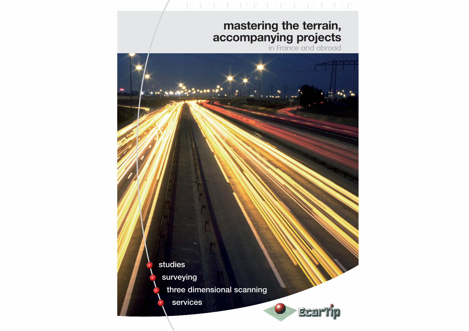
mastering the terrain,accompanying projects
in France and abroad
studies
surveying
three dimensional scanning
services

Ecartip : dynamic,skills and innovation…
G R O U P
A group large enoughto tackle the challengeof major projects
82employeesAverage number of personnel in 2009
(for all activities)
drive the group's activities inside
the 4 companies
Serving large-scale field develop-ment projects…
Ecartip’s vocation is to provide engineer-ing and surveying technical know-how from preliminary project studies toinfrastructure management, includingconstruction.Two thirds of company resourcesare involved in the heart of majorconstruction and developmentprojects, in France and abroad.A true service company of multiplecompetencies, today Ecartip isan innovative technical partner,recognized by the major actorsin territorial development.
An independent group, 100% FrenchThe two managing directors and founders,Dominique Oger and Stéphane Schaumburg sharecompany management since its inception in 1997.
The creation of Ecartip Management, the Group Holding,consolidates the governance and preserves an inde-pendence of activities, held 100% by the owners.
Company developmentsEcartip is a young company which bases its successon the high level of training of its personnel. It takesadvantage of its proximity to the client, the construc-tion sites, and to the personnel.
ITS manages the park of surveying equipment,develops its proposals of services, and used equipmentsales by targeting companies (construction andsurveying).
A pioneer in the techniques of 3-dimensionnel scan-ning, 3D Scan Services proposes innovative techni-cal solutions corresponding to the needs of the majorconstruction companies.
The involvement of ILS Indian Ocean confirms itsregional position and insures its presence in emergingmarkets: South Africa, the Red Sea, and the Persian Gulf.
Innovation, R & D Since the beginning, Ecartip has invested in thedevelopment of tools for measuring and mana-ging survey data, and through partnerships withequipment manufacturers, software editors, majorconstruction companies, infrastructure operators,research laboratories, and engineering schools.
Today, Ecartip is able to propose the latest techno-logies for static and dynamic use; on land, sea,or in the airs.
InternationalEcartip has had the opportunity to exercise itsvarious skills outside of France.
The specific development needs of
Madagascar justified the creation of a branch officefor the Indian Ocean region, at Tananarive.
In addition, our teams frequently intervene insupport of major offshore construction compa-nies in Europe, Africa, South America…
P r e s e n c ea n d i n t e r v e n t i o n s
Fieldengineeringstudies
Project coordination
The Group’sActivities
Ecartip (with ITS)3D Scan ServicesILS Indian Ocean
Surveyingwith Maintenance, Sales, Training
38%
37%
19%
6% 3-D surveyingGlobal positioning
OfficesMain office: LyonAgencies: Orange, Bordeaux, Reims, NantesILS Indian Ocean: Antananarivo, Madagascar
Recent and ongoing interventionsEurope: Tchernobyl, UkraineAfrica: Malabo, Equatorial Guinea
Mauritania, Morocco, Congo, ChadSouth America: Kourou, GuyanaIndian Ocean: La Reunion, Seychelles Islands,
Comores, Mayotte, South Africa,Mozambique2 l 3

G R O U P
Working hand in hand withthe major construction companies.
Ecartip is capable of interventions, with a uni-que project manager, as partner, starting atthe call for tenders.The group’s mastery of advanced technolo-gies, with research, development and training,guarantees the clients a full service, duringthe entire project.Naturally the construction phase will benefit bythe “in the field” experience of Ecartip,during execution, as well as, during verifica-tion. Infrastructure management structures, ofregions, of operations, of heritage sites…will fully benefit from Ecartip’s tools of diag-nosis and decision making.
Successfulprojectcompletion- Execution studies- Execution survey- Verification survey- Data acquisition- Positioning- Guiding equipment- Site verifications plans
…
Wincontracts- Surveying major projects- Preliminary studies, modelization,
variations and options- Precise quantitative studies- 3-D models
…
Dataanalysis- Plateform for survey data analysis
and 3-D measurement- High precision 3-D modelization- Ortho-photo
…
Projectoptimization- Studies and development design
and large-scale infrastructures(urban projects, transportation, industry,businesses, service industries, housing,hydraulic projects, environment…)
- Optional project designs of roads and hydraulic networks
- Project management…
Infrastructuremanagement- Verification surveys- Structural inspection- Database feeding- Volume certification (quarries, mines)
…
Heritage andterritorial management- Cartography, geodesy- Digitalization and 3-D modeling- Geographic information systems
and diagnosis systems…
Ecartip6 l 7
TheCompanies
3D ScanServices
8 l 9
InfraLogisticalSupportIndian Ocean
10 l 11
InfraTopoServices
114 l 5
In France, like abroad,
A group which cultivatesthe union between youthand experience.Ecartip draws its energy from the youth
of its personnel.
44.1yearsAverage age of management
33.5yearsAverage employee age
in the group (for all activities)
A global offerof skills and servicesin field engineeringand surveying…
Ecartip accompanies its clients to:
Mastering the cutting-edgetechnologies of surveying- Multiple brand specialized maintenance- Equipment rental- Sales of new and used equipment- Training
…
The value of the men, the skillsof the companies, the service of a group.

Ecartip is structured to respond to the demandsof the field engineering and projet management.Ability to react and availability are the keywords of Ecartip’s commitment to each project.
High level management, an integrated designoffice, and cutting-edge equipment; all contributeto producing a service in accord with thedemands and unknowns of any large developmentproject.
Ecartip has complete in house control overthe digital chain using dedicated servers therebyguaranteeing security of the data management;and to then generate the results (drawings, pho-tos, 3D views…) and decision-making materials.
Ecartip: surveying,engineering and much
more…
Studies - Surveying – Project management
A continual presenceon large developmentproject sitesEcartip draws its efficiency from its physi-
cal involvement next to the teams of
major territorial development companies.
The wide range of skills (surveying, engi-
neering, guiding...) and the fields of inter-
vention (roads, railroads, maritime, fluvial,
underground, irrigation, civil works…)
make the men of Ecartip efficient and
appreciated performers on all construc-
tion sites.
6 l 7
Guyana Space Center – Verification and control surveying during construction of the Soyuz launching plateform by Vinci Construction.
Cutting edge digitaltechnology
Whether it is in the design office or when sur-veying (execution and verification) Ecartip offersits clients the latest generation of digital equip-ment for which the maintenance and calibrationare carried out in house (by the specializedgroup subsidiary: ITS, see page 11).
A production of high quality data and a datamanagement capacity using all market softwareallows Ecartip to anticipate the needed informa-tion (verification diagrams, graphics stan-dards…) and to produce adaptable models (eg.towards a GIS).
Ecartip is also capable of using and supplyingdigital data for any type of format…
Services- Development studies and design
(urbanism, transportation, industries,environment, housing, maritime,mining, hydraulics…)
- Execution and verification surveying
- Data acquition, positioning, guidingequipment
- Cartography, geographic informationsystems (GIS, DIS)
- Study and project coordination
ResourcesSurveyingOur technicians are equipped withdigital work stations. They aremobile and autonomous. Onboardbathymetric equipment allows us towork in fluvial, marine or floodedzones.
Design officeState-of-the-art equipment, withexperienced personnel regularlytrained to stay abreast of speciali-zed software such as:
Microstation, MicropisteGéoconceptAutocad, AutopisteMensura, CovadisVianovaHypackCivil 3D…
Creating, optimizing and guaran-teeing the quality of execution…
Ecartip has combined skills in designengineering and constructionsurveying.This capacity to work in a transversalmanner on all the aspects of majordevelopment projects correspondsto the needs of large constructioncompanies and of public and pri-vate infrastructure managementcompanies.
Member of the French SurveyorsAssociationand CNSGT
Technical partnerships:
Partnership with INSA Strasbourgand ESGT Le Mans
Software partner of GéomédiaLyonnaise des Eaux certifiedRisk certification : DATR third level
Study and survey- LGV Perpignan Figueras (french high speed railway) Estate geographic information database - Muret (31)Highway rest area projet - A65
Wide scale pre-study - LGV Est (french high speed railway)
Marseille harbour Highway bridge - A65

8 l 9
3D Scan Services: The latest innovationand technology
3D measurement and modelization
At the heart ofinnovation3D Scan Services
Is a pioneer of static
and mobile scanner
technologies.Our engineers relentlessly
improve digitalmanagement to obtain
greater definition and
to associate positioning,
photo and videowith 3D data.
Nuclear Power Plant / Chernobyl (Ukraine) – Detailed 3-D photo modeling of the entire site for Novarka
Making data speakThe advantage of a scanner is to allow the glo-bal acquisition of geometric data (3D).
On large scales, this technique is preciseenough to measure detailed estimates (slopes,curves, line segments…) and to quickly answera call for projects.
For pure topographic purposes, also using pho-tos, allows drafting with a high degree of preci-sion.
The measurement of existing structures withdigital laser technology allows a high definition ofdetail for fatigue diagnosis (civil works, boat hulls…) of accidents, of digs and exploration… andwhich will show millimeter sized details.
Precision modelization
Today 3D Scan Services is a majorplayer for the acquisition andmanagement of 3-dimensional data.This activity, involving the use ofdynamic and static scanners,terrestrial, maritime or aerial, directlygains from research anddevelopment investments andby the commitment of the companyto highly technical projects withcomplicated environmentssuch as Chernobyl, or EquatorialGuinea…
3D Scan Services has developed solutions toacquire data rapidly and without disturbingthe operation of the infrastructures.
First rate managers, a specialized and integra-ted design office, state-of-the-art equipmentand investments in R & D together with themanufacturers… all contribute to producing aservice which corresponds to the complexityof major projects.
The digital chain is totally controlled by 3DScan Services who carries out, in house, dataprocessing on dedicated servers for completesecurity, then produces results (drawings,photos, 3D views) and decision-makingdocuments.
Services- Rapid acquisition of survey data from
large areas
- Cartography
- Inspection for all types of works andconstruction
- 3D imaging , positioning
- Infrastructure management (powerlines, roads, dams, rivers, ports,pipelines…)
- Resources management (extraction,hydraulic…)
- Digital analysis
ResourcesAcquisitionStationary ScannerDynamic ScannerCapture HD photo Capture video
Digital analysisTwo engineers carry out data analy-sis with the most recent generationof work stations, and using soft-ware such as:
CycloneCloud Worx3DReshaper, SpacEyesBuilderVianovaPhotomodeler Scanner…
INSA Strasbourg partnership
Hydro and Marine Experience, SHOM
FICOHT training
Marine, road, and aerial certifications
3D scanning - Tanger (Marocco)
3D modelization - Archelogy - Bordeaux Cathedral After damage boat hull 3D scanningWide scale aerial scanning - Equatorial Guinea

10 l 11
A specific offer, following Europeanstandards…From a mangrove to a dense forest, passingthrough mountains, deserts, coastal sites andriver banks; ILS OI provides technical andhuman resource solutions by studies andsurveying for many public and private, large ter-ritorial development companies, natural resourcesextraction companies and industry.
A specialized department “Mines andEnvironment” enforces this specific skill.
The company works with several engineeringorganizations and numerous construction compa-nies in order to supply “design-execution”solutions adapted to the local markets.
ILS OI is an especially recognized operator for theinstallation of geodesic markers.
Using the most recent generation of surveyingequipment and materials, as well as, onboardmarine equipment allows an efficient response toneeds in bathymetry, geodesic, positioning andcartography of territories in the developmentstage.
Taking advantage of French skills, ILS OI alsoworks on cases of environmental impactstudies.
Calibration, repair,adapted equipmentand also the develop-ment of specific pro-ducts.The daily experience ofconstruction sites, givesthe ITS technical team, thecapacity to act on veryshort notice (After-Sales-Service, exchange).The main components andparts are in stock, the ITSspecialists give goodadvice and know how todevelop specific solutions(portage, fixation, connec-tions…).ITS takes advantage of theregional presence ofEcartip to provide a closeservice.
Hotline and After-Sales-Service at Bordeaux
05 57 59 19 85(from France only)
Experience in the field,Customer confidence,manufacturers support…Deeply concerned by indepen-dence and the ability to act fast,since a long while, Ecartip hascreated a department to managethe surveying equipment.Our park management and trai-ning skills are now offered toconstruction companies.Offering multiple-brand After-Sales-Services, ITS has the sup-port of manufacturers in order towork efficiently in the field of majorconstruction sites.
Infra Logistical Support:the overseas Ecartip …
Indian Ocean
Confirmed regionalknowhowILS OI is partnering with companies who
have construction site experience on
Indian Ocean islands (Madagascar,
Reunion, Mauritius, Mayotte, Seychelles
…) and in South Africa (South Africa,
Tanzania, Chad, Mozambique…). The
equipment, conforming to European stan-
dards, and management by expatriates,
makes it easier to establish partnerships
with offshore subsidiaries of the major
international and territorial construction
companies.
All of Ecartip’s skillsin the Indian Ocean.
Taking advantage of expatriate managers,European standards, state-of-the-artequipment (surveying, 3-D positio-ning…), and integrated designoffices; ILS OI is the number-onefield development local partner.Ecartip is in the Indian Ocean region,and ILS OI created specific know-how in relation to the nature ofthe construction sites and their
physical constraints.
Infra Topo Services:equipment knowhow
After-Sales-Service - Rentals– Training
ESPA partnership (Antananarivo)
Hydro and Marine experience
Aerial and road certification
High speed digital connections
All guarantees
Services- Development studies and design
(urbanism, transportation, industries,environment, housing, maritime,mining, hydraulics…)
- Execution and verification surveying
- Data acquisition, bathymetric, positio-ning, guiding equipment
- Cartography, geographic informationsystems (GIS, DIS)
- Studies and project coordination andmanagement
ResourcesSurveyingOur technicians are equipped with digi-tal workstations. They are mobile andautonomous. Onboard bathymetricequipment allows us to work in fluvial,marine or flooded zones.
Design and drafting officeState-of-the-art equipment, with expe-rienced personnel regularly trained tostay abreast of specialized softwaresuch as:
Mensura, Microstation, Autopiste,Géoconcept, Autocad, Covadis,Hypack …
Bathymetric investigation - Nacala Bay - MozambiqueLongoni harbour - MayotteMahajanga - RN 12 - MadagascarNational highway - RN6 - MadagascarMangoro river
Tananarivo - MadagascarToamasina Harbour - Madagascar
Logoni harbour - Mayotte
Pangalanes canal - Madagascar
Ambotevy - Madagascar
Topcon, Leica and Trimble, and their logos are registered trade marks.

Orangesouth
Lyoneast
Reimsnorth
Bordeauxsouth-west
Nanteswest
MadagascarIndianOcean
w w w. e c a r t i p . f r
Main officesLyon - east Agency160, rue de Palverne
RN 83 - ZAC RosargeLes Echets - 01700 Miribel
FRANCETel. 33 478 22 34 72Fax 33 478 22 34 88
Agence sud-est ORANGE 82, rue d’EspagneZAC du Coudoulet
84100 OrangeFRANCE
Tel. 33 432 81 05 02Fax 33 432 81 03 48
Agence sud-ouest BORDEAUX322 Bd Jean-Jacques Bosc
33130 Bègles-BordeauxFRANCE
Tel. 33 557 35 99 51Fax 33 556 49 28 23
Agence ouest NANTEScontact Lyon
Agence nord REIMScontact Lyon
3D Scan Services160, rue de Palverne
RN 83 - ZAC RosargeLes Echets - 01700 Miribel
FRANCETel. 33 472 42 94 16Fax 33 478 22 34 88
Infra Topo Services322 Bd Jean-Jacques Bosc
33130 Bègles-BordeauxFRANCE
Tel. 33 557 59 19 85Fax 33 556 49 28 23
Infra Logistical SupportOcéan Indien
Lot II Y 53 FZ, Ampahibe101, Antananarivo
MADAGASCARTel. 261 20 24 247 65Fax 261 20 24 264 92
Pho
tos
: Eca
rtip
- N
ova
- P
hoto
dis
c -
Tra
nsla
tion
: Jac
que
s B
auer
Damage guarantee, before and after completionpollution and environmental threats
RC AXA n° 1489502704
Ambotavy pipeline - Madagascar Longoni harbour - Mayotte
The value of the men, the skillsof the companies, the service of a group.