Embed Size (px)
Citation preview
Independent Hearing and Assessment Panel| 7 March 2011
IHAP No. Item No. 4
DA No. RD-2009/1524/A
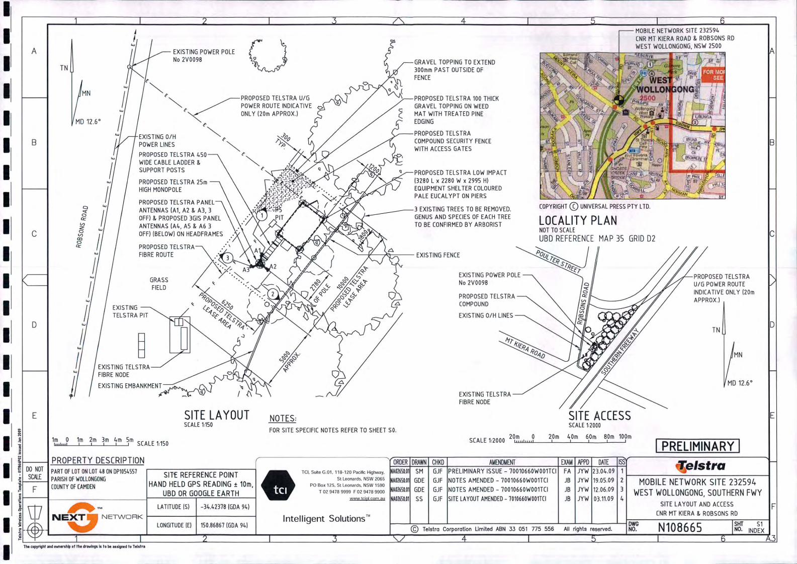
Proposal Installation of a 25 metre monopole, six panel antenna, equipment shelter and associated ancillary safety equipment v(F6 Freeway - Road Reserve at Junction of Robsons Road & Mt Keira Road, West Wollongong)
Property Lot 48 DP 1054557, Lot 48 F6 Freeway, WEST WOLLONGONG NSW 2500
Applicant CPS Global
Responsible Team City Planning East Team
EXECUTIVE SUMMARY
Reason for consideration by Independent Hearing and Assessment Panel
The proposal has been referred to IHAP pursuant to clause 1.8 as the original application was refused and the review of determination is also recommended for refusal.
Proposal
The proposal is a review of determination of the refusal of a 25m high telecommunications facility and associated equipment shelter. The review proposes a 20m high telecommunications tower and associated equipment shelter.
Permissibility
When the original application was lodged the site was zoned 5(c) Special Uses (Main Roads) pursuant to Wollongong Local Environmental Plan (WLEP) 1990. The proposal is categorised as a utility installation under this plan and is permissible with consent in the zone. Wollongong Local Environmental Plan 2009 was in draft form at the time of lodgement and proposed to zone the site R2 Low Density Residential. The proposal is categorised as a telecommunications facility pursuant to this plan and is not a permissible use in the zone. However, State Environmental Planning Policy (SEPP) (Infrastructure) 2007 also applies to the development and permits telecommunications facilities in any zone with development consent.
Consultation
The original application received 21 submissions apposing the development. The review of determination application was notified in accordance with the original application to properties within 300m of the site and also in the local Advertiser and received 17 submissions objecting to the proposal. The original and new submissions generally relate to visual impact, health risks and inappropriateness of the site with regards to nearby community sensitive sites (e.g. schools, child care centres etc). These matters are discussed at section 2.9 of the assessment report.
The application was also reviewed by Council’s Environment Officer and Landscape Architect, both of which did not object to the proposal.
Main Issues
The main concern is that the proposal is inappropriate with regards to the context and setting, specifically in relation to the height and proximity to community sensitive locations.
RECOMMENDATION
It is recommended that the application be refused.
Page 1
1. ASSESSMENT REPORT
1.1 SUMMARY The review of determination application has been lodged following refusal of the original application on 22 March 2010. The original reasons for refusal are outlined in section 1.3 of this report. The current application was notified in accordance with Council Policy and received 17 objections, largely relating to the visual impact and suitability of the site with regards to nearby residences, schools and child care facilities. These matters are discussed at section 2.9 of this report.
The review of determination has amended the proposal to address the matters raised in the refusal notice through reducing the height and bulk of the facility. Despite the alterations, it is considered that the proposed facility is not suitable with regards to the context and setting, particularly in respect of the height with regards to the proposed 9m height limit in WLEP 2009 and the low density character of the locality.
1.2 PLANNING CONTROLS The following planning controls apply to the development:
State Environmental Planning Policies:
− SEPP (Infrastructure) 2007 (telecommunications facilities are permitted on any land with consent)
− Illawarra REP No. 1 1986 (Deemed SEPP)
Local Environmental Planning Policies:
− Wollongong Local Environmental Plan (WLEP) 1990 – The site was zoned 5 (Special Uses) at the time of assessment and the proposed facility was categorised as a “utility installation” and was permissible with consent.
− Wollongong Local Environmental Plan (WLEP) 2009 (draft at the time of lodgement) – The site was proposed to be zoned R2 Low Density Residential at the time of determination of this application and the proposed use is categorised as a “telecommunications facility” and is not permissible within the zone.
Development Control Plans:
− Wollongong Section 94A Development Contributions Plan 2010
− Development Control Plan No. 6 – Commercial and Industrial Development
− Siting of Telecommunications and Radio communications Facilities Policy
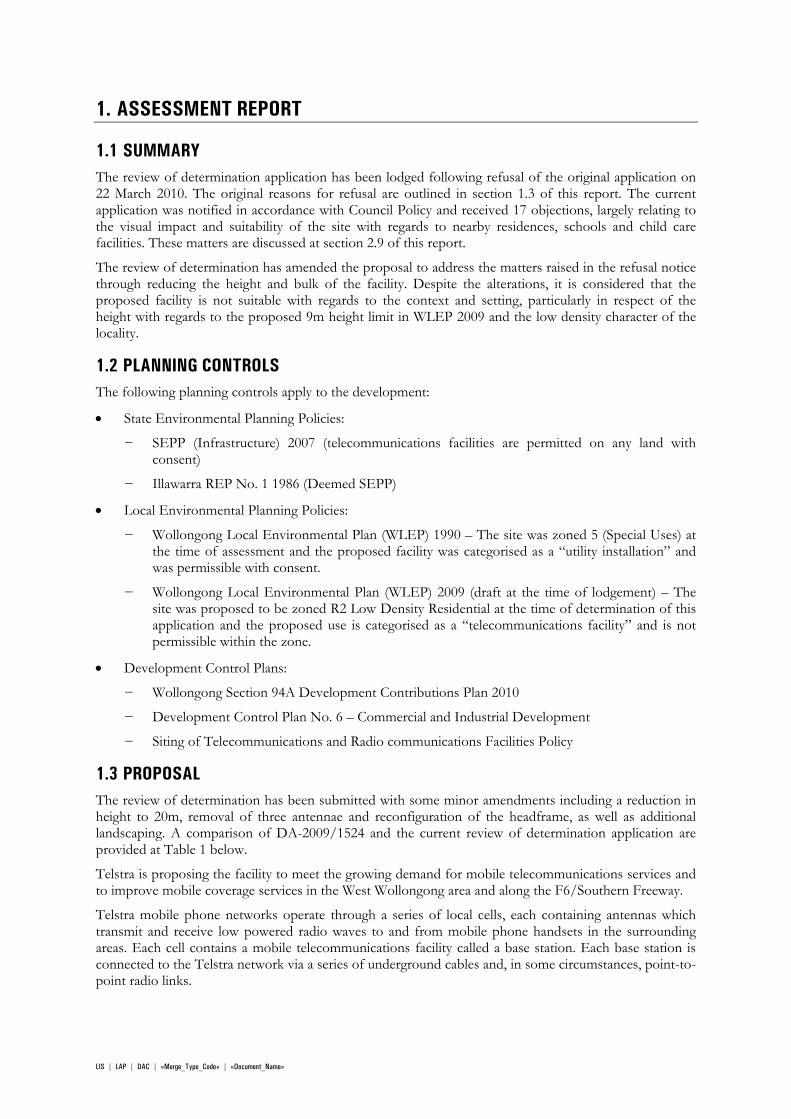
1.3 PROPOSAL The review of determination has been submitted with some minor amendments including a reduction in height to 20m, removal of three antennae and reconfiguration of the headframe, as well as additional landscaping. A comparison of DA-2009/1524 and the current review of determination application are provided at Table 1 below.
Telstra is proposing the facility to meet the growing demand for mobile telecommunications services and to improve mobile coverage services in the West Wollongong area and along the F6/Southern Freeway.
Telstra mobile phone networks operate through a series of local cells, each containing antennas which transmit and receive low powered radio waves to and from mobile phone handsets in the surrounding areas. Each cell contains a mobile telecommunications facility called a base station. Each base station is connected to the Telstra network via a series of underground cables and, in some circumstances, point-to- point radio links.
LIS | LAP | DAC | «Merge_Type_Code» | «Document_Name»
Currently, there are some mobile network problems in and around the West Wollongong area. These include some areas where Telstra has poor coverage or even no coverage due to the location and performance of existing sites and the inability of the radio signal to reach inside some buildings and houses as well as along the Southern Freeway. The proposed facility is intended to provide improved coverage, capacity and call quality to the area. The proposal would provide for additional wireless communication services. These additional services include wireless broadband Internet connections for use by residential and commercial customers from either fixed locations or fully mobile applications by utilising the cell handover capabilities available in a cellular network. The proposed facility would result in enhanced service as well as continuity of service quality for customers who may be travelling from cell-to-cell along the Southern Freeway.
Table 1: Comparison of revised and original
DA-2009/1524 RD-2009/1524/A
The installation of a 25 metre high monopole; The installation has been reduced to 20 metres high
The installation of three Argus CPX310R panel antennas 2630mm (H) x 300mm (W) x 110mm (D) at a height of 23.70 metres;
The installation of three Argus CNPX3I0R-4P panel antennas 2630mm (H) x 370mm (W) x 120mm (D) at a height of 20 metres;
The installation of three Argus NPX310R panel antennas 1330mm (H) x 160mm (W) x 120mm (D) at a height of 20.57 metres;
These antennas have been removed
The installation of a telecommunications equipment shelter adjacent to the pole; and
Unchanged
The installation of safety equipment and associated cabling.
Unchanged
DA-2009/1524 RD-2009/1524/A
Figure 1: Elevations
LIS | LAP | DAC | «Merge_Type_Code» | «Document_Name»
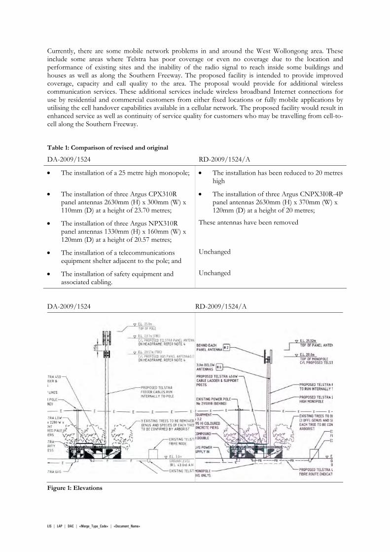
Existing view Proposed - DA-2009/1524 Proposed - RD-2009/1524/A
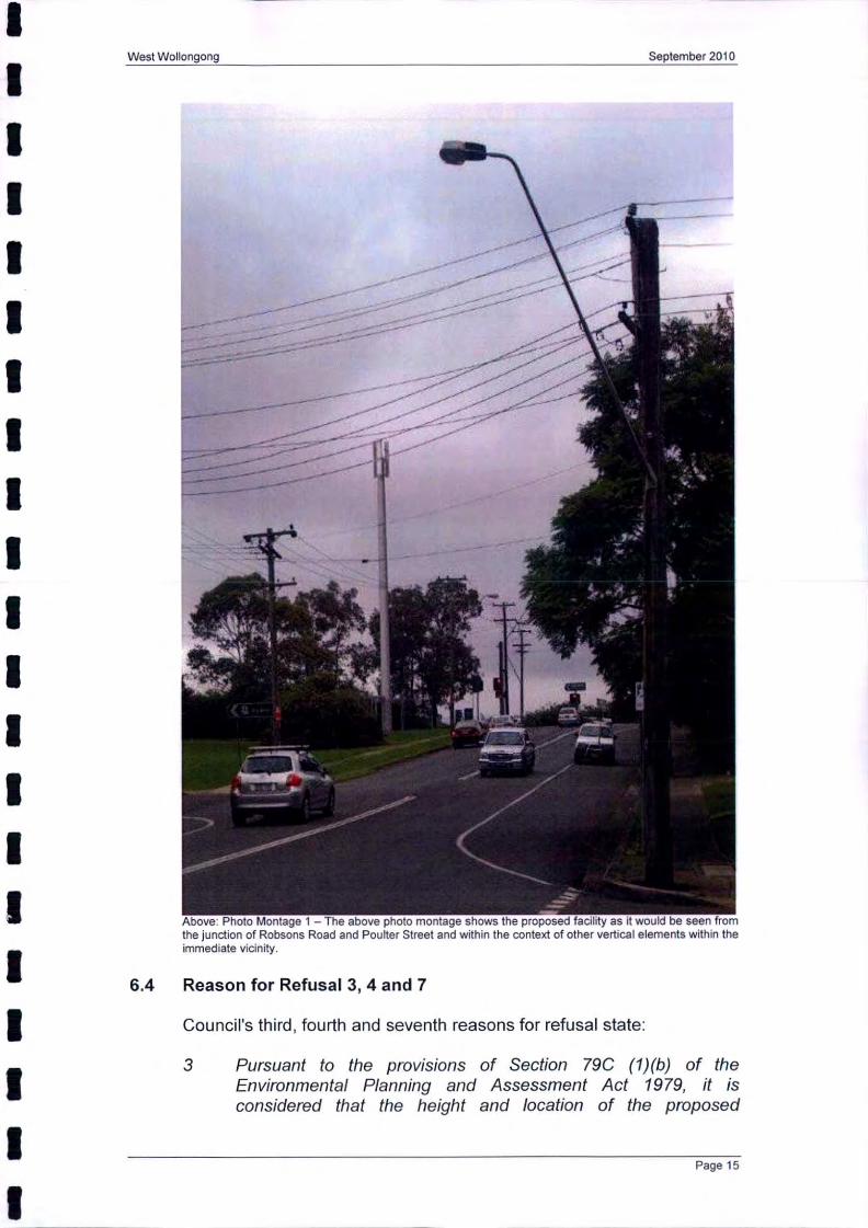
Figure 2: View south from Robsons Road - photo montage
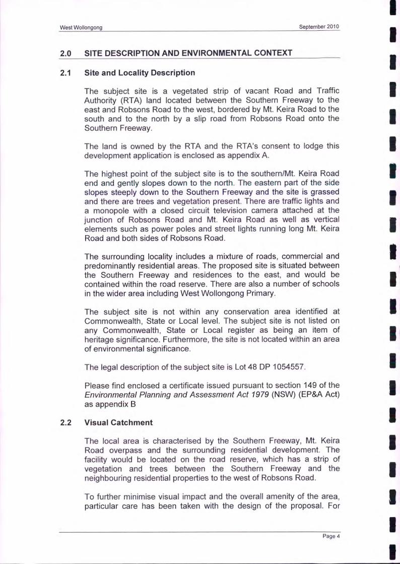
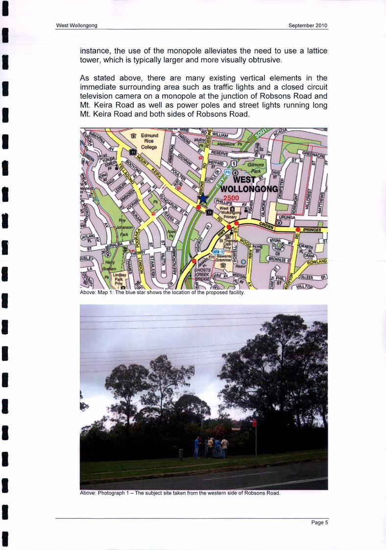
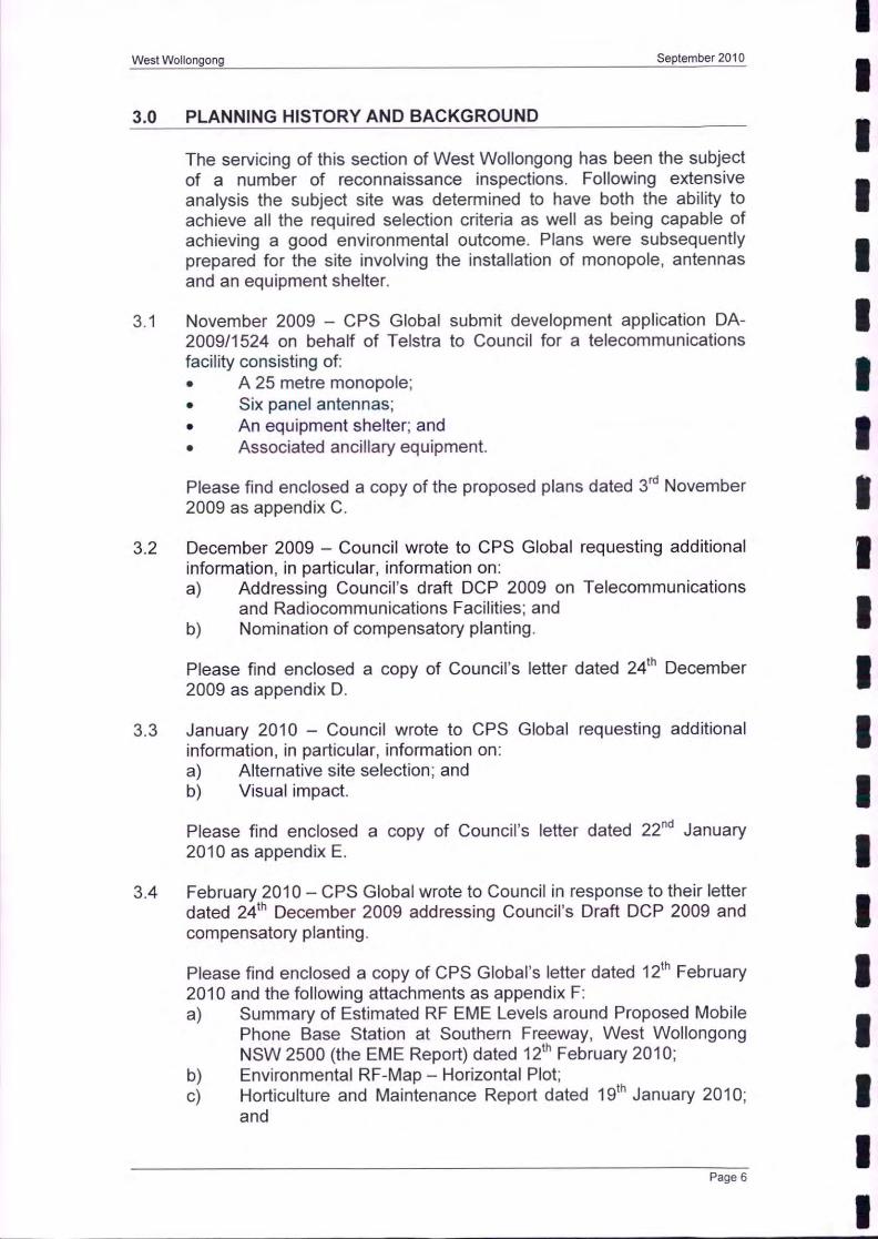
1.4 SITE DESCRIPTION The site is located at the intersection of Robsons Road and Mt Keira Road, West Wollongong and the title reference is Lot 48 DP 1054557. The land is vacant and owned by the RTA. The site is bound by the F6 Freeway to the east and Robsons Road to the west. It is also bound by Mt. Keira Road to the south and to the north by a slip road from Robsons Road onto the Southern Freeway. Adjacent to the site to the north, west and south are residential areas. Immediately to the east is the F6 Freeway and beyond that more residential areas.
The site itself generally slopes down from the south to the north with an approximate fall of 10m from the highest to lowest point. The site is vacant with a number of existing trees and small shrubs. There are a number of power poles on the street frontage.
Council records list the site as being affected by a RTA road widening proposal.
There are no restrictions on the title.
LIS | LAP | DAC | «Merge_Type_Code» | «Document_Name»
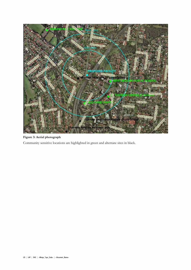
Figure 3: Aerial photograph
Community sensitive locations are highlighted in green and alternate sites in black.
LIS | LAP | DAC | «Merge_Type_Code» | «Document_Name»
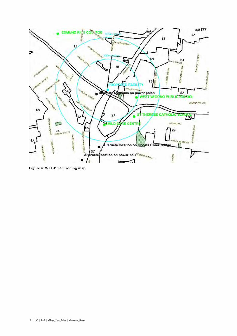
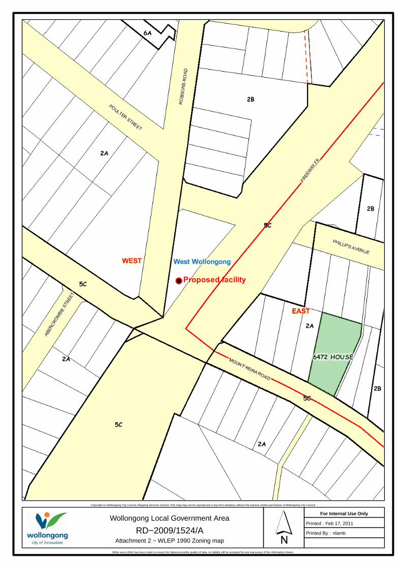
Figure 4: WLEP 1990 zoning map
LIS | LAP | DAC | «Merge_Type_Code» | «Document_Name»
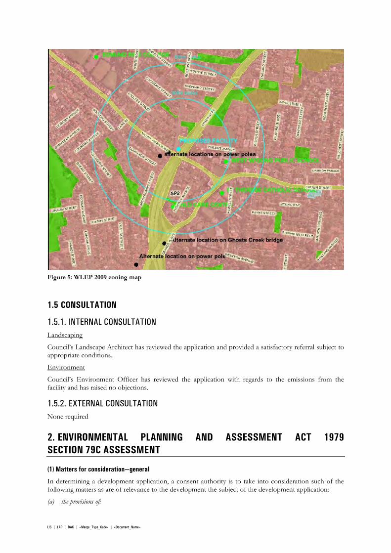
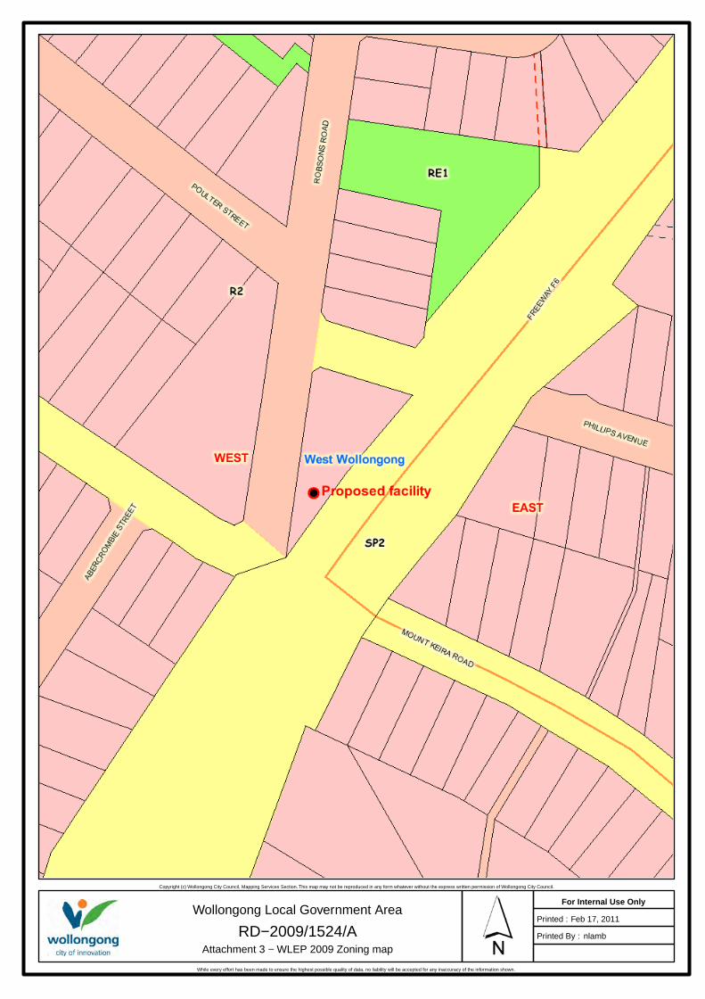
Figure 5: WLEP 2009 zoning map
1.5 CONSULTATION
1.5.1. INTERNAL CONSULTATION Landscaping
Council’s Landscape Architect has reviewed the application and provided a satisfactory referral subject to appropriate conditions.
Environment
Council’s Environment Officer has reviewed the application with regards to the emissions from the facility and has raised no objections.
1.5.2. EXTERNAL CONSULTATION None required
2. ENVIRONMENTAL PLANNING AND ASSESSMENT ACT 1979 SECTION 79C ASSESSMENT
(1) Matters for consideration—general
In determining a development application, a consent authority is to take into consideration such of the following matters as are of relevance to the development the subject of the development application:
(a) the provisions of:
LIS | LAP | DAC | «Merge_Type_Code» | «Document_Name»
(i) any environmental planning instrument, and
(ii) any proposed instrument that is or has been the subject of public consultation under this Act and that has been notified to the consent authority (unless the Director-General has notified the consent authority that the making of the proposed instrument has been deferred indefinitely or has not been approved), and
(iii) any development control plan, and
(iiia) any planning agreement that has been entered into under section 93F, or any draft planning agreement that a developer has offered to enter into under section 93F, and
(iv) the regulations (to the extent that they prescribe matters for the purposes of this paragraph),
that apply to the land to which the development application relates,(b) the likely impacts of that development, including environmental impacts on both the natural and built environments, and social and economic impacts in the locality,
(c) he suitability of the site for the development,
(d) any submissions made in accordance with this Act or the regulations,
(e) the public interest.
These matters are addressed below.
2.2 SECTION 79C 1(A)(I) ANY ENVIRONMENTAL PLANNING INSTRUMENT
2.2.1. STATE ENVIRONMENTAL PLANNING POLICY (INFRASTRUCTURE) 2007 Division 21 of Part 3 relates to Telecommunications and other communication facilities and covers development permitted without consent, development permitted with consent and exempt development (including compliance with Clause 20 – general exempt provisions). The proposal is not exempt under clause 114 as the proponent is not a public authority.
Therefore proposal falls within Clause 115, being development permitted only with consent;
115 Development permitted with consent
(1) Development for the purposes of telecommunications facilities, other than development in clause 114 or development that is exempt development under clause 20 or 116, may be carried out by any person with consent on any land.
(2) To the extent that the development under this clause involves the erection of an aerial cable, the erection of the cable must be consistent with the Cable Networks Code.
(3) Before determining a development application for development to which this clause applies, the consent authority must take into consideration any guidelines concerning site selection, design, construction or operating principles for telecommunications facilities that are issued by the Director-General for the purposes of this clause and published in the Gazette.
The Standard Instrument defines telecommunications facility as follows:
telecommunications facility means:
(a) any part of the infrastructure of a telecommunications network, or
(b) any line, equipment, apparatus, tower, mast, antenna, tunnel, duct, hole, pit, pole or other structure or thing used, or to be used, in or in connection with a telecommunications network.
telecommunications network means a system, or series of systems, that carries, or is capable of carrying, communications by means of guided or unguided electromagnetic energy, or both.
Clause 115 allows for development for the purposes of telecommunications facilities on any land therefore overriding the prohibition of the development pursuant to WLEP 2009.
LIS | LAP | DAC | «Merge_Type_Code» | «Document_Name»
2.2.2. ILLAWARRA REGIONAL ENVIRONMENTAL PLAN NO 1 (DEEMED SEPP) The aim of this plan is to maximise the opportunities for the people of the region and the State to meet their individual and community economic and social needs with particular reference to the way in which these needs are related to the allocation, availability, accessibility and management of the region’s land resources. The proposal is considered to be broadly consistent with the aims of the plan.
Clause 139 of IREP No. 1 requires concurrence from the Director General of the Department of Planning for buildings at a height greater than 11m. The definition of height under clause 139 of the IREP was only intended to apply to buildings which have ceilings. This was formally confirmed by the Department of Planning in correspondence to Council and accordingly, concurrence is not required for the proposed structure.
2.2.3. WOLLONGONG LOCAL ENVIRONMENT PLAN 1990 The site is ‘Zoned 5(c) Main roads pursuant to WLEP 1990. The following is permissible with consent: advertisements; car parking; community facilities; such buildings, works, places or land uses specified in the Table to clause 15 as are marked or lettered for the land on the map; utility installations.
The proposal falls within the definition of a ‘utility installation’ and is permissible in this zone with development consent.
Clause 6 – Definitions
"utility installation" means -
(a) a building or work used by a public utility undertaking or by a public or private communication undertaking (excluding buildings designed wholly or principally as administrative or business premises or as a showroom); or
(b) an accessway, road, conveyor or work for the drainage of water or the damming or filling of a watercourse; or
(c) a pipeline.
Clause 9 – Zone objectives and development control table
The objective of the zone is as follows:
The objective of the zone is to cater for the provision of community and public facilities and services.
The proposed facility provides improved telecommunications services to the West Wollongong area and to people driving along the F6 and is considered to be consistent with the zone objective.
12A Building heights
(1) A person must not, on land described in Column 1 of Schedule 2A, erect a building with a height that exceeds the height specified opposite the land in Column 2 of that Schedule. For the purpose of this subclause, height means the distance between the ceiling level of the uppermost floor, measured at the outside wall, and the natural ground level or finished ground level, whichever is the lower.
(2) A person must not, on land described in Column 1 of Schedule 2B, erect a building with a height that exceeds the height specified opposite the land in Column 2 of that Schedule. For the purposes of this subclause, height means the height of the highest point of the building or that part of the building specified in Column 2 of that Schedule as measured by a Relative Level in metres to Australian Height Datum.
The site is not located in the area specified by Schedule 2B.
Clause 15. Development in Zone No. 5
Development may be carried out only with development consent on land within Zone No. 5, being land specified in Column 1 of the Table to this clause and shown on the map, for the purpose specified opposite that land in Column 2 of that Table.
LIS | LAP | DAC | «Merge_Type_Code» | «Document_Name»
TABLE
Column 1 Column 2
(Special Uses) – lettered “5(a)”, together with the name of the Special Use, in black lettering on the map.
The purpose indicated in black lettering on the map.
(Special Uses) – lettered “5(b)” on the map. Railways.
(Special Uses) – lettered “5(c)” on the map. Main roads
The site is nominated as “5(c)” Main Roads. It is considered that this is an additional permitted land use as outlined in the applicable zoning table above: “land uses specified in the Table to clause 15 as are marked or lettered for the land on the map”.
2.2.4. WOLLONGONG LOCAL ENVIRONMENTAL PLAN 2009 WLEP 2009 was a draft instrument at the time of lodgement and was adopted on 26 February 2010. Wollongong LEP 2009 was adopted on 26 February 2010, and was a draft instrument at the time of lodgement of this development application. Clause 1.8A of WLEP 2009 provides a savings provision in relation to pending development applications:- “If a development application has been made before the commencement of this Plan in relation to land to which this Plan applies and the application has not finally been determined before that commencement, the application must be determined as if this Plan had not commenced.” Accordingly the proposed development has been assessed with regard to WLEP 1990 though consideration has been given to the provisions of the draft plan in the form it was immediately prior to its making. The relevant provisions are as follows:
The site is zoned R2 Low Density Residential pursuant to this plan and the proposal is categorised as a “telecommunications facility’ and is not permissible within the zone. However, telecommunications facilities are permitted in the zone pursuant to SEPP Infrastructure (2007) as outlined above.
Clause 1.4 – Definitions
telecommunications facility means:
(a) any part of the infrastructure of a telecommunications network, or
(b) any line, equipment, apparatus, tower, mast, antenna, tunnel, duct, hole, pit, pole or other structure or thing used, or to be used, in or in connection with a telecommunications network.
telecommunications network means a system, or series of systems, that carries, or is capable of carrying, communications by means of guided or unguided electromagnetic energy, or both.
Part 2 Permitted or prohibited development
Clause 2.3 – Zone objectives and land use table
The objectives of the zone are as follows:
To provide for the housing needs of the community within a low density residential environment.
To enable other land uses that provide facilities or services to meet the day to day needs of residents.
The proposal does not provide for the housing needs of the community within a low density residential environment. However, the proposal will be a facility that provides improved telecommunications services to the West Wollongong area.
LIS | LAP | DAC | «Merge_Type_Code» | «Document_Name»
Miscellaneous provisions
Clause 4.3 Height of Buildings
A 9m height limit is applicable to the site under this plan and the development will be 20m high. It is noted that the definition of building height under this plan is considered to encompass structures such as the proposed facility as described below.
building height (or height of building) means the vertical distance between ground level (existing) at any point to the highest point of the building, including plant and lift overruns, but excluding communication devices, antennae, satellite dishes, masts, flagpoles, chimneys, flues and the like.
building has the same meaning as in the Act.
EPA Act definition: building includes part of a building, and also includes any structure or part of a structure (including any temporary structure or part of a temporary structure), but does not include a manufactured home, moveable dwelling or associated structure or part of a manufactured home, moveable dwelling or associated structure.
The proposal far exceeds the current and likely future scale of development in the locality. It is not considered to be sympathetic to the context and setting and will have a significant negative visual impact on the streetscape
2.3 SECTION 79C 1(A)(II) ANY PROPOSED INSTRUMENT None applicable.
2.4 SECTION 79C 1(A)(III) ANY DEVELOPMENT CONTROL PLAN
2.4.1. DEVELOPMENT CONTROL PLAN NO. 6 COMMERCIAL AND INDUSTRIAL DEVELOPMENT DCP 6 was applicable at the time of assessment however it applies to commercial or industrial development and has no specific controls that relate to telecommunications facilities.
2.4.2. WOLLONGONG SECTION 94A DEVELOPMENT CONTRIBUTIONS PLAN (2010) It is noted that the 2009 version of this policy was in place at the time of determination, however this plan has since been updated to the 2010 version which replaces the previous version.
The proposed cost of development is $175,000 and a contribution of 1% of this value would be applicable if Council was to approve the application.
2.5 SECTION 79C 1(A)(IIIA) ANY PLANNING AGREEMENT THAT HAS BEEN ENTERED INTO UNDER SECTION 93F, OR ANY DRAFT PLANNING AGREEMENT THAT A DEVELOPER HAS OFFERED TO ENTER INTO UNDER SECTION 93F, There are no planning agreements entered into or any draft agreement offered to enter into under S93F which affect the development.
2.6 SECTION 79C 1(A)(IV) THE REGULATIONS (TO THE EXTENT THAT THEY PRESCRIBE MATTERS FOR THE PURPOSES OF THIS PARAGRAPH) 92 What additional matters must a consent authority take into consideration in determining a development application?
(1) For the purposes of section 79C (1) (a) (iv) of the Act, the following matters are prescribed as matters to be taken into consideration by a consent authority in determining a development application:
(a) in the case of a development application for the carrying out of development:
(i) in a local government area referred to in the Table to this clause, and
LIS | LAP | DAC | «Merge_Type_Code» | «Document_Name»
(ii) on land to which the Government Coastal Policy applies,
the provisions of that Policy,
(b) in the case of a development application for the demolition of a building, the provisions of AS 2601.
The application does not involve demolition.
The site is not located on land to which the Government Coastal Policy applies.
93 Fire safety and other considerations
(1) This clause applies to a development application for a change of building use for an existing building where the applicant does not seek the rebuilding, alteration, enlargement or extension of a building.
(2) In determining the development application, the consent authority is to take into consideration whether the fire protection and structural capacity of the building will be appropriate to the building’s proposed use.
(3) Consent to the change of building use sought by a development application to which this clause applies must not be granted unless the consent authority is satisfied that the building complies (or will, when completed, comply) with such of the Category 1 fire safety provisions as are applicable to the building’s proposed use.
Note. The obligation to comply with the Category 1 fire safety provisions may require building work to be carried out even though none is proposed or required in relation to the relevant development consent.
(4) Subclause (3) does not apply to the extent to which an exemption is in force under clause 187 or 188, subject to the terms of any condition or requirement referred to in clause 187 (6) or 188 (4).
(5) The matters prescribed by this clause are prescribed for the purposes of section 79C (1) (a) (iv) of the Act.
The application does not comprise habitable structures and is a significant distance from any other adjoining properties.
2.7 SECTION 79C 1(B) THE LIKELY IMPACTS OF DEVELOPMENT Context and Setting:
The proposal is not considered to be appropriate with regards to the context and setting. The locality is largely characterised by low to medium density residential developments generally 1 to 2 storey in height.
The largest existing structure is an approximately 15m high power pole opposite the site which will be far exceeded by the proposal. Further, the maximum building height permitted for the site pursuant to WLEP 2009 is 9m. As such, the proposal far exceeds the current and likely future scale of development in the locality and is not considered to be sympathetic to the context and setting and will have a significant negative visual impact on the streetscape.
Access, Transport and Traffic:
The proposal will not impact on existing traffic and access arrangements to or within the site or generate any significant traffic or parking demands.
Public Domain:
The proposed facility is highly visible from the public domain. The proposal is considered to contrast sharply with the streetscape and have a significant impact on the visual amenity of the locality.
Utilities:
The proposal is not envisaged to place an unreasonable demand on utilities supply. All service and utilities are available to the site.
Heritage:
No heritage items will be impacted by the proposal.
Other land resources:
The proposal is not envisaged to impact upon any valuable land resources.
LIS | LAP | DAC | «Merge_Type_Code» | «Document_Name»
Water:
The proposal is not envisaged to have unreasonable water consumption.
Soils:
The proposal would involve minor excavation works for the footings and pads and will have a minimal impact on soils.
Air and Microclimate:
The proposal is not expected to have any negative impact on air or microclimate.
Flora and Fauna:
Three (3) trees would be required to be removed to enable installation of the proposed facility. Five trees are proposed to be planted as replacements.
Council’s Landscape Architect has reviewed the application and has no objections subject to appropriate conditions of consent.
Waste:
No impact from waste is anticipated.
Energy:
The proposal is not envisaged to have unreasonable energy consumption.
Noise and vibration:
The only noise generated by the proposal beyond construction works, would be air-conditioning units that will be located within the proposed equipment shelter. The applicant has stated that the noise output will be similar to that of a domestic air conditioner.
These units will be required to comply with Australian Standards 1055-1997 Acoustics-Description and Measurement of Environmental Noise (parts 1-3). This standard sets out general procedures for the description and measurement of environmental noise.
Natural hazards:
There are no natural hazards affecting the site that would prevent the proposal.
Technological hazards:
Concern regarding the potential negative health impacts from Electromagnetic Radiation (RF EME) from the facility was the subject of many objections to the proposal.
The Australian Radiation Protection and Nuclear Safety Agency (ARPANSA) provide maximum exposure levels for these types of facilities. The facility will operate at a fraction of the limit imposed by these standards. The NSW Land & Environment Court (Telstra Corporation Limited v Hornsby Shire Council (2006) NSWLEC 133) has upheld these standards.
Safety, Security and Crime Prevention:
This application does not result in any opportunities for criminal or antisocial behaviour.
Social Impact:
The proposal is not considered to have a significant negative social impact.
Economic Impact:
The proposal would be expected to improve local communications infrastructure.
LIS | LAP | DAC | «Merge_Type_Code» | «Document_Name»
Site Design and Internal Design:
It is noted that the review of determination application reduced the height and bulk of the facility and provided compensatory landscaping. However, this is not considered to significantly reduce the magnitude of the impact on the streetscape. The facility remains well above the height of any other structures in the locality and is not considered appropriate with regards to the locality.
Construction:
The issue of possible interference with the local area during the construction phases was raised during the notification period. This could be conditioned if Council was of a mind to approve the application.
No significant negative impacts are anticipated during the construction phases of the proposal.
Cumulative Impacts:
The cumulative impact of exposure to RF EME was considered in the assessment and is discussed at technological hazards above. Otherwise, there are not expected to be any other cumulative impacts from the proposal.
2.8 SECTION 79C 1(C) THE SUITABILITY OF THE SITE FOR DEVELOPMENT Does the proposal fit in the locality?
As outlined at 2.7 Section 79C 1(B), Context and Setting above, the proposal is not considered to fit in the locality. It is not considered to be consistent with the zone objectives contained in WLEP 2009. Further it exceeds the draft height limit for the locality.
Are the site attributes conducive to development?
There are no site constraints that would prevent the proposal.
2.9 SECTION 79C 1(D) ANY SUBMISSIONS MADE IN ACCORDANCE WITH THIS ACT OR THE REGULATIONS The application was notified in accordance with WDCP 2009 Appendix 1: Public Notification and Advertising. Two submissions were received and the main issues identified are discussed below.
Review of determination
17 submissions were received apposing the proposal and the issues are outlined below.
Issue No.of submissions Comment
The proposal is inappropriate with regards to the proximity to schools and dwellings.
1 The proposal is located approximately 200m from Wollongong West Primary School and is not generally visible from this site. The applicant has provided EME readings expected at this location that are well below the maximum permitted levels.
LIS | LAP | DAC | «Merge_Type_Code» | «Document_Name»
No.of Issue submissions Comment
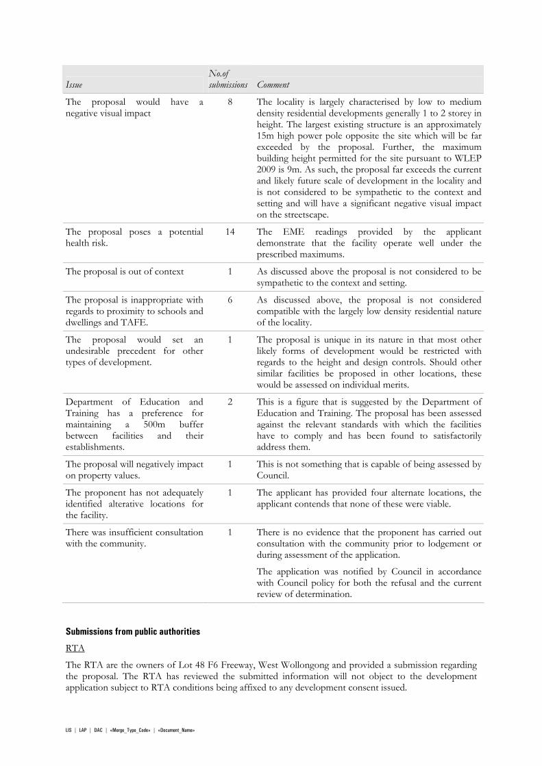
The proposal would have a negative visual impact
8 The locality is largely characterised by low to medium density residential developments generally 1 to 2 storey in height. The largest existing structure is an approximately 15m high power pole opposite the site which will be far exceeded by the proposal. Further, the maximum building height permitted for the site pursuant to WLEP 2009 is 9m. As such, the proposal far exceeds the current and likely future scale of development in the locality and is not considered to be sympathetic to the context and setting and will have a significant negative visual impact on the streetscape.
The proposal poses a potential health risk.
14 The EME readings provided by the applicant demonstrate that the facility operate well under the prescribed maximums.
The proposal is out of context 1 As discussed above the proposal is not considered to be sympathetic to the context and setting.
The proposal is inappropriate with regards to proximity to schools and dwellings and TAFE.
6 As discussed above, the proposal is not considered compatible with the largely low density residential nature of the locality.
The proposal would set an undesirable precedent for other types of development.
1 The proposal is unique in its nature in that most other likely forms of development would be restricted with regards to the height and design controls. Should other similar facilities be proposed in other locations, these would be assessed on individual merits.
Department of Education and Training has a preference for maintaining a 500m buffer between facilities and their establishments.
2 This is a figure that is suggested by the Department of Education and Training. The proposal has been assessed against the relevant standards with which the facilities have to comply and has been found to satisfactorily address them.
The proposal will negatively impact on property values.
1 This is not something that is capable of being assessed by Council.
The proponent has not adequately identified alterative locations for the facility.
1 The applicant has provided four alternate locations, the applicant contends that none of these were viable.
There was insufficient consultation with the community.
1 There is no evidence that the proponent has carried out consultation with the community prior to lodgement or during assessment of the application.
The application was notified by Council in accordance with Council policy for both the refusal and the current review of determination.
Submissions from public authorities
RTA
The RTA are the owners of Lot 48 F6 Freeway, West Wollongong and provided a submission regarding the proposal. The RTA has reviewed the submitted information will not object to the development application subject to RTA conditions being affixed to any development consent issued.
LIS | LAP | DAC | «Merge_Type_Code» | «Document_Name»
2.10 SECTION 79C 1(E) THE PUBLIC INTEREST As outlined at Context and Setting at section 2.7 above, the proposal is not considered to be in the public interest as it does not have due consideration for the context and impacts on the streetscape. There was significant local opposition to the proposal and the balance of local interests versus a broader benefit from the facility has not been demonstrated.
Telecommunications facilities are regulated by a range of Commonwealth, State and local legislation and policies. Particular reference is made to the Wollongong Council document “Siting of Telecommunications and Radiocommunications Facilities Policy” which was applicable at the time of lodgement of the original application. The proposal is not considered to satisfy the requirements of this policy as outlined below.
It is noted that Wollongong Development Control Plan 2009, Chapter C17: Telecommunications and Radiocommunications Facilities, has since been adopted and has similar criteria for assessing these facilities.
Siting of Telecommunications and Radiocommunications Facilities Policy
1 General
1.1 Introduction
Council’s Siting of Telecommunications and Radiocommunications Facilities Policy was adopted by Council on 4 June 2007. The Policy relates to the development of telecommunications and radio-communications infrastructure that are not low-impact facilities under the Commonwealth Telecommunications Act 1992 and require development consent under the EP&A Act 1979.
Objective
The relevant environmental objectives of this policy are as follows:
to provide infrastructure that is visually compatible with surrounding character and locality/visual context with particular regard to heritage buildings/areas and cultural icons;
The site is not heritage or iconic location as such but the proposal is not sympathetic to the visual amenity of the streetscape and locality.
to assess whether the proposed infrastructure is consistent with the amenity of the area;
The proposed facility is not considered to be consistent with the amenity of the area.
2 – Siting Guidelines
Control Comment Compliance
2.1 Visual Amenity
Carriers are to design antennas and supporting infrastructure in such a way as to minimise or reduce the visual and cumulative visual impact from the public domain and adjacent areas.
Whilst the slimline design of the facility does seek to mitigate impact on the locality, the facility will however still be significantly larger than any other nearby structures or buildings and is not sympathetic to the visual amenity of the locality.
N
Infrastructure design must be consistent with the character of the surrounding area.
The facility is not considered to be consistent with the small scale residential character of the surrounding area.
N
LIS | LAP | DAC | «Merge_Type_Code» | «Document_Name»
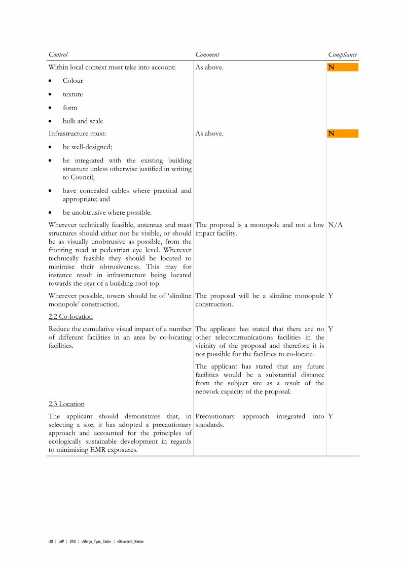
Control Comment Compliance
Within local context must take into account:
Colour
texture
form
bulk and scale
As above. N
Infrastructure must:
be well-designed;
be integrated with the existing building structure unless otherwise justified in writing to Council;
have concealed cables where practical and appropriate; and
be unobtrusive where possible.
As above. N
Wherever technically feasible, antennas and mast structures should either not be visible, or should be as visually unobtrusive as possible, from the fronting road at pedestrian eye level. Wherever technically feasible they should be located to minimise their obtrusiveness. This may for instance result in infrastructure being located towards the rear of a building roof top.
The proposal is a monopole and not a low impact facility.
N/A
Wherever possible, towers should be of ‘slimline monopole’ construction.
The proposal will be a slimline monopole construction.
Y
2.2 Co-location
Reduce the cumulative visual impact of a number of different facilities in an area by co-locating facilities.
The applicant has stated that there are no other telecommunications facilities in the vicinity of the proposal and therefore it is not possible for the facilities to co-locate.
The applicant has stated that any future facilities would be a substantial distance from the subject site as a result of the network capacity of the proposal.
Y
2.3 Location
The applicant should demonstrate that, in selecting a site, it has adopted a precautionary approach and accounted for the principles of ecologically sustainable development in regards to minimising EMR exposures.
Precautionary approach integrated into standards.
Y
LIS | LAP | DAC | «Merge_Type_Code» | «Document_Name»
Control Comment Compliance
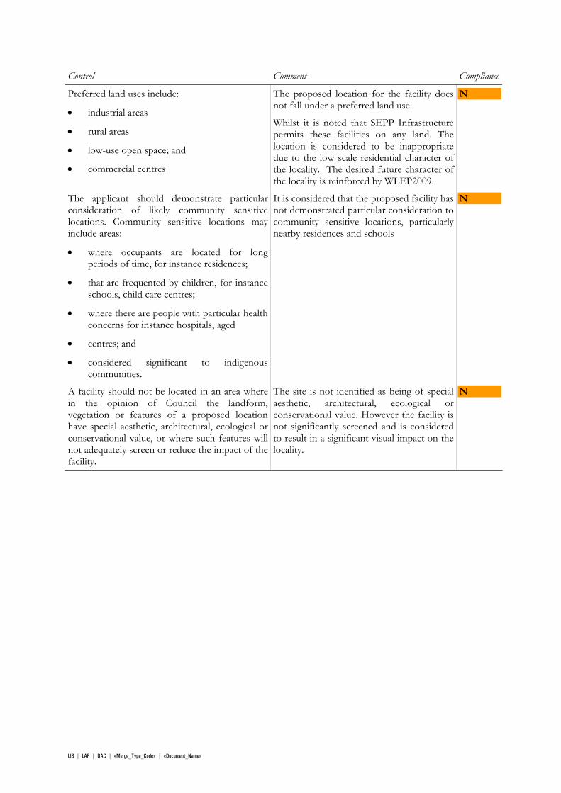
Preferred land uses include:
industrial areas
rural areas
low-use open space; and
commercial centres
The proposed location for the facility does not fall under a preferred land use.
Whilst it is noted that SEPP Infrastructure permits these facilities on any land. The location is considered to be inappropriate due to the low scale residential character of the locality. The desired future character of the locality is reinforced by WLEP2009.
N
The applicant should demonstrate particular consideration of likely community sensitive locations. Community sensitive locations may include areas:
where occupants are located for long periods of time, for instance residences;
that are frequented by children, for instance schools, child care centres;
where there are people with particular health concerns for instance hospitals, aged
centres; and
considered significant to indigenous communities.
It is considered that the proposed facility has not demonstrated particular consideration to community sensitive locations, particularly nearby residences and schools
N
A facility should not be located in an area where in the opinion of Council the landform, vegetation or features of a proposed location have special aesthetic, architectural, ecological or conservational value, or where such features will not adequately screen or reduce the impact of the facility.
The site is not identified as being of special aesthetic, architectural, ecological or conservational value. However the facility is not significantly screened and is considered to result in a significant visual impact on the locality.
N
LIS | LAP | DAC | «Merge_Type_Code» | «Document_Name»
Control Comment Compliance
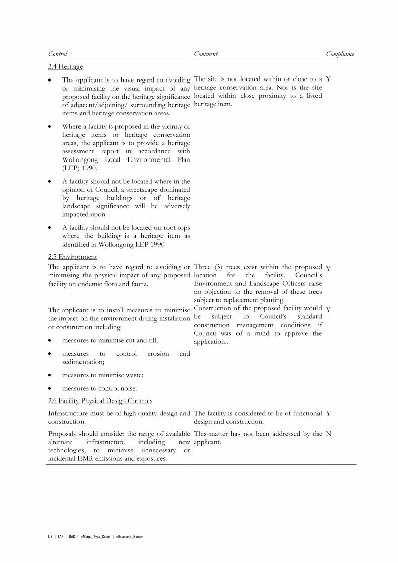
2.4 Heritage
The applicant is to have regard to avoiding or minimising the visual impact of anyproposed facility on the heritage significance of adjacent/adjoining/ surrounding heritageitems and heritage conservation areas.
Where a facility is proposed in the vicinity of heritage items or heritage conservationareas, the applicant is to provide a heritage assessment report in accordance withWollongong Local Environmental Plan (LEP) 1990.
A facility should not be located where in theopinion of Council, a streetscape dominatedby heritage buildings or of heritage landscape significance will be adversely impacted upon.
A facility should not be located on roof tops where the building is a heritage item asidentified in Wollongong LEP 1990
The site is not located within or close to a heritage conservation area. Nor is the site located within close proximity to a listed heritage item.
Y
2.5 Environment The applicant is to have regard to avoiding or minimising the physical impact of any proposed facility on endemic flora and fauna.
Three (3) trees exist within the proposed location for the facility. Council’s Environment and Landscape Officers raise no objection to the removal of these trees subject to replacement planting.
Y
The applicant is to install measures to minimise the impact on the environment during installation or construction including:
measures to minimise cut and fill;
measures to control erosion and sedimentation;
measures to minimise waste;
measures to control noise.
Construction of the proposed facility would be subject to Council’s standard construction management conditions if Council was of a mind to approve the application..
Y
2.6 Facility Physical Design Controls
Infrastructure must be of high quality design and construction.
The facility is considered to be of functional design and construction.
Y
Proposals should consider the range of available alternate infrastructure including new technologies, to minimise unnecessary or incidental EMR emissions and exposures.
This matter has not been addressed by the applicant.
N
LIS | LAP | DAC | «Merge_Type_Code» | «Document_Name»
Control Comment Compliance
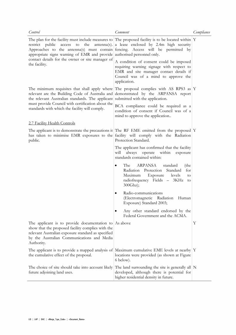
The plan for the facility must include measures to restrict public access to the antenna(s).Approaches to the antenna(s) must contain appropriate signs warning of EMR and provide contact details for the owner or site manager of the facility.
The proposed facility is to be located within a lease enclosed by 2.4m high security fencing. Access will be permitted by authorised personnel only.
A condition of consent could be imposed requiring warning signage with respect to EMR and site manager contact details if Council was of a mind to approve the application.
Y
The minimum requisites that shall apply where relevant are the Building Code of Australia and the relevant Australian standards. The applicant must provide Council with certification about the standards with which the facility will comply.
The proposal complies with AS RPS3 as demonstrated by the ARPANSA report submitted with the application.
BCA compliance could be required as a condition of consent if Council was of a mind to approve the application..
Y
2.7 Facility Health Controls
The applicant is to demonstrate the precautions it has taken to minimise EMR exposures to the public.
The RF EME emitted from the proposed facility will comply with the Radiation Protection Standard.
The applicant has confirmed that the facility will always operate within exposure standards contained within:
The ARPANSA standard (the Radiation Protection Standard for Maximum Exposure levels to radiofrequency Fields – 3KHz to 300Ghz);
Radio-communications (Electromagnetic Radiation Human Exposure) Standard 2003;
Any other standard endorsed by the Federal Government and the ACMA.
Y
The applicant is to provide documentation to show that the proposed facility complies with the relevant Australian exposure standard as specified by the Australian Communications and Media Authority.
As above Y
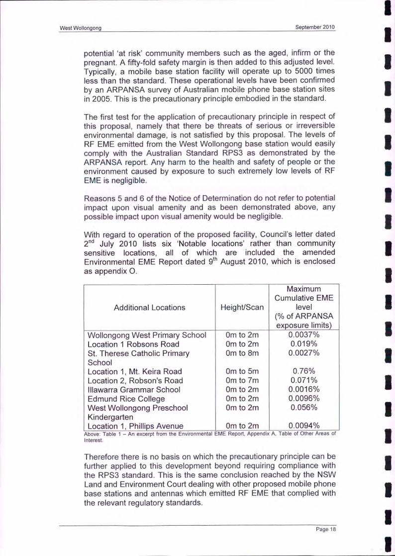
The applicant is to provide a mapped analysis of the cumulative effect of the proposal.
Maximum cumulative EME levels at nearby locations were provided (as shown at Figure 6 below).
Y
The choice of site should take into account likely future adjoining land uses.
The land surrounding the site is generally all developed, although there is potential for higher residential density in future.
N
LIS | LAP | DAC | «Merge_Type_Code» | «Document_Name»
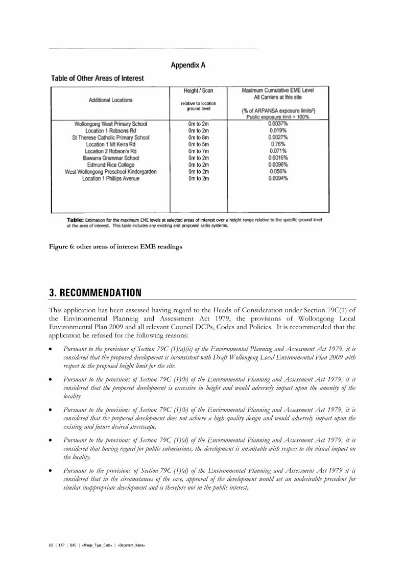
Figure 6: other areas of interest EME readings
3. RECOMMENDATION
This application has been assessed having regard to the Heads of Consideration under Section 79C(1) of the Environmental Planning and Assessment Act 1979, the provisions of Wollongong Local Environmental Plan 2009 and all relevant Council DCPs, Codes and Policies. It is recommended that the application be refused for the following reasons:
Pursuant to the provisions of Section 79C (1)(a)(ii) of the Environmental Planning and Assessment Act 1979, it is considered that the proposed development is inconsistent with Draft Wollongong Local Environmental Plan 2009 with respect to the proposed height limit for the site.
Pursuant to the provisions of Section 79C (1)(b) of the Environmental Planning and Assessment Act 1979, it is considered that the proposed development is excessive in height and would adversely impact upon the amenity of the locality.
Pursuant to the provisions of Section 79C (1)(b) of the Environmental Planning and Assessment Act 1979, it is considered that the proposed development does not achieve a high quality design and would adversely impact upon the existing and future desired streetscape.
Pursuant to the provisions of Section 79C (1)(d) of the Environmental Planning and Assessment Act 1979, it is considered that having regard for public submissions, the development is unsuitable with respect to the visual impact on the locality.
Pursuant to the provisions of Section 79C (1)(d) of the Environmental Planning and Assessment Act 1979 it is considered that in the circumstances of the case, approval of the development would set an undesirable precedent for similar inappropriate development and is therefore not in the public interest..
LIS | LAP | DAC | «Merge_Type_Code» | «Document_Name»
LIS | LAP | DAC | «Merge_Type_Code» | «Document_Name»
ATTACHMENTS 1. Aerial Photograph 2. Zoning Map – WLEP 1990
3. Zoning Map – WLEP 2009
4. Site Photos/Plans and Documents
5. Reason for Refusal

For Internal Use Onl yWollongong Local Government Area
While every effort has been made to ensure the highest possible quality of data, no liability will be accepted for any inaccuracy of the information shown.
Feb 17, 2011Printed :
nlambPrinted By :
Copyright (c) Wollongong City Council, Mapping Services Section. This map may not be reproduced in any form whatever without the express written permission of Wollongong City Council.
RD−2009/1524/AAttachment 1 − Aerial photograph (alternate locations in green)
For Internal Use Onl yWollongong Local Government Area
While every effort has been made to ensure the highest possible quality of data, no liability will be accepted for any inaccuracy of the information shown.
Feb 17, 2011Printed :
nlambPrinted By :
Copyright (c) Wollongong City Council, Mapping Services Section. This map may not be reproduced in any form whatever without the express written permission of Wollongong City Council.
RD−2009/1524/AAttachment 2 − WLEP 1990 Zoning map
For Internal Use Onl yWollongong Local Government Area
While every effort has been made to ensure the highest possible quality of data, no liability will be accepted for any inaccuracy of the information shown.
Feb 17, 2011Printed :
nlambPrinted By :
Copyright (c) Wollongong City Council, Mapping Services Section. This map may not be reproduced in any form whatever without the express written permission of Wollongong City Council.
RD−2009/1524/AAttachment 3 − WLEP 2009 Zoning map
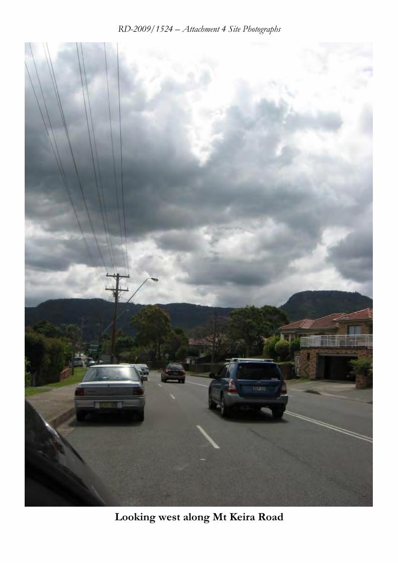
RD-2009/1524 – Attachment 4 Site Photographs
Looking west along Mt Keira Road
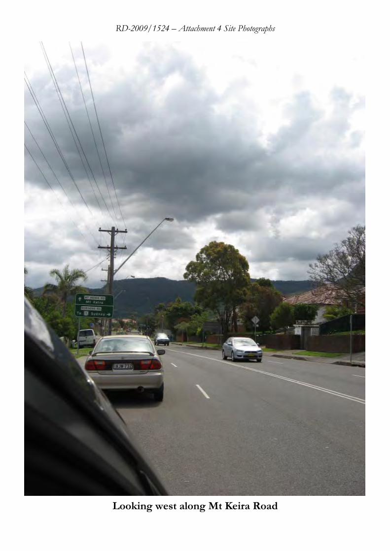
RD-2009/1524 – Attachment 4 Site Photographs
Looking west along Mt Keira Road
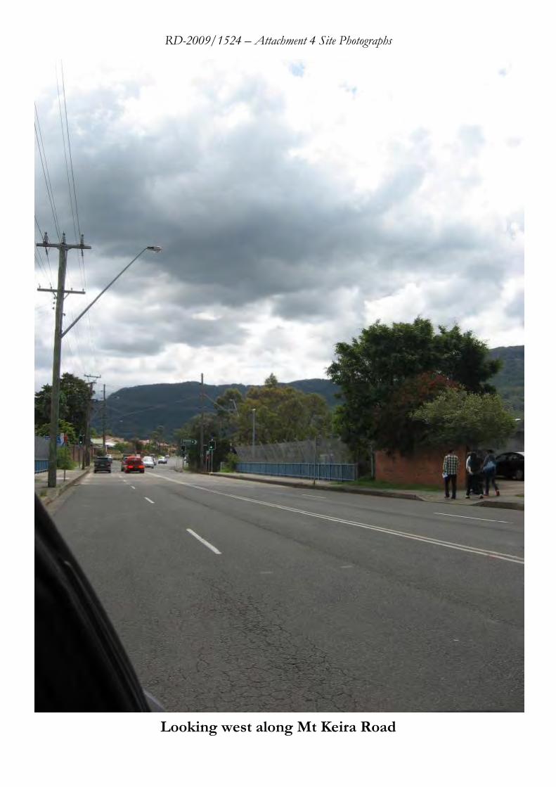
RD-2009/1524 – Attachment 4 Site Photographs
Looking west along Mt Keira Road
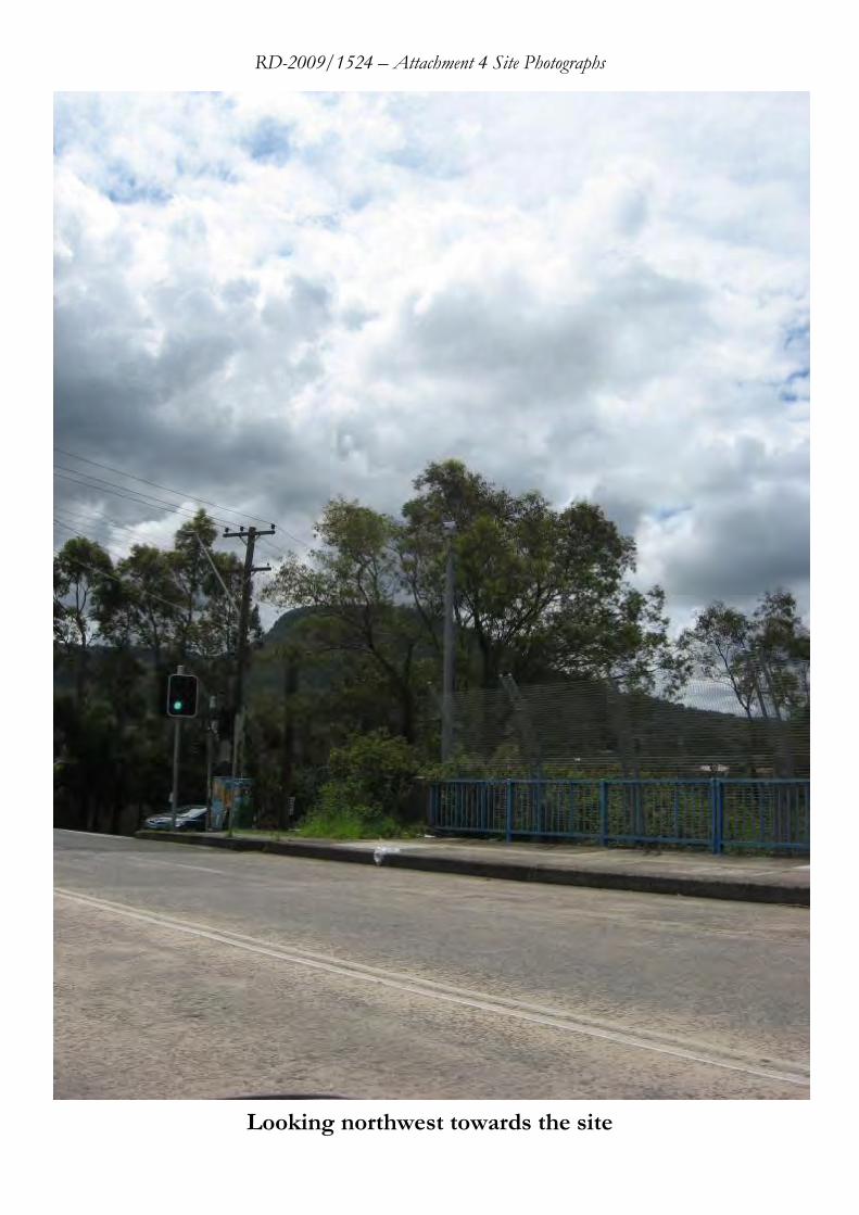
RD-2009/1524 – Attachment 4 Site Photographs
Looking northwest towards the site
RD-2009/1524 – Attachment 4 Site Photographs
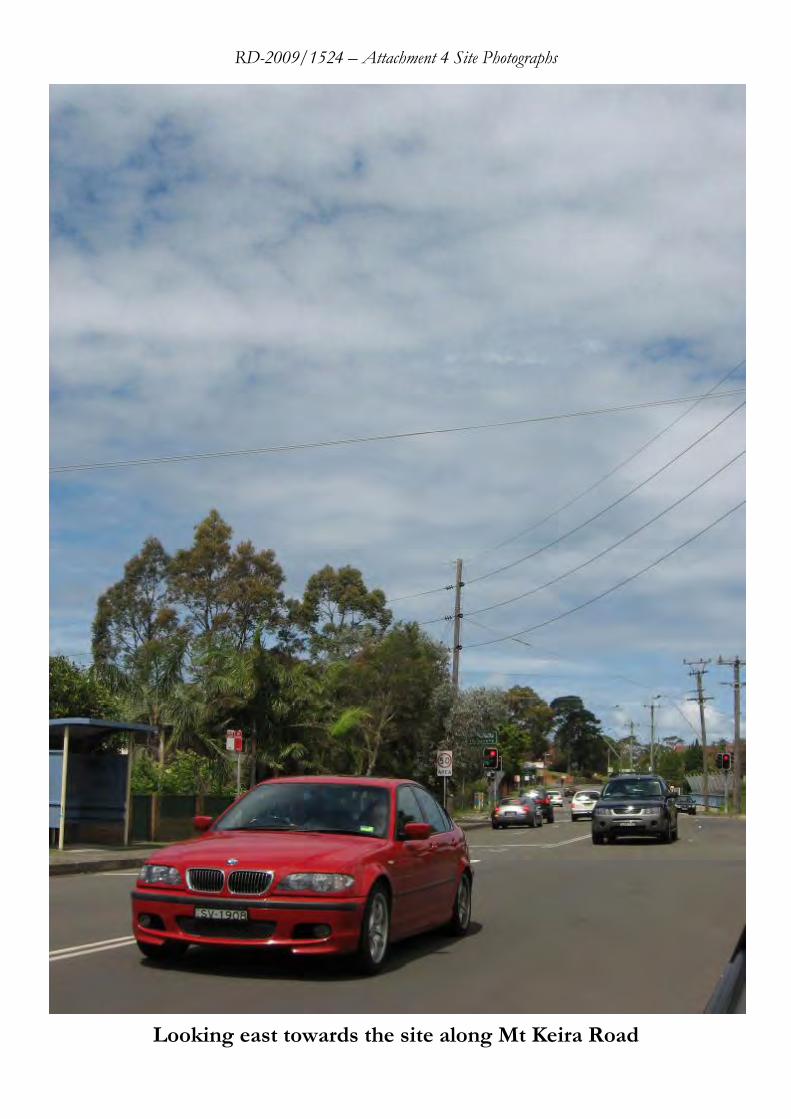
Looking east towards the site along Mt Keira Road
RD-2009/1524 – Attachment 4 Site Photographs
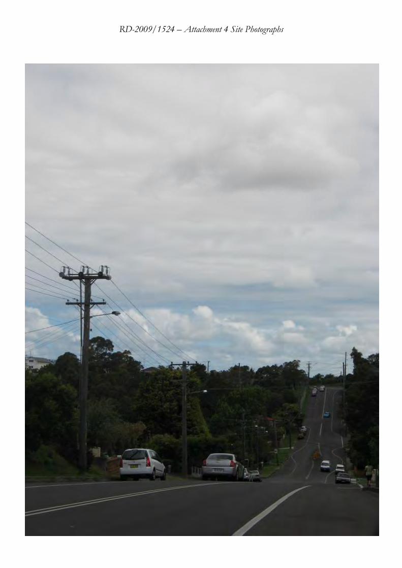
RD-2009/1524 – Attachment 4 Site Photographs
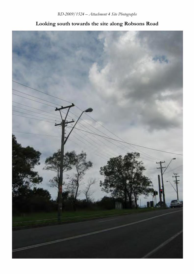
Looking south towards the site along Robsons Road
RD-2009/1524 – Attachment 4 Site Photographs
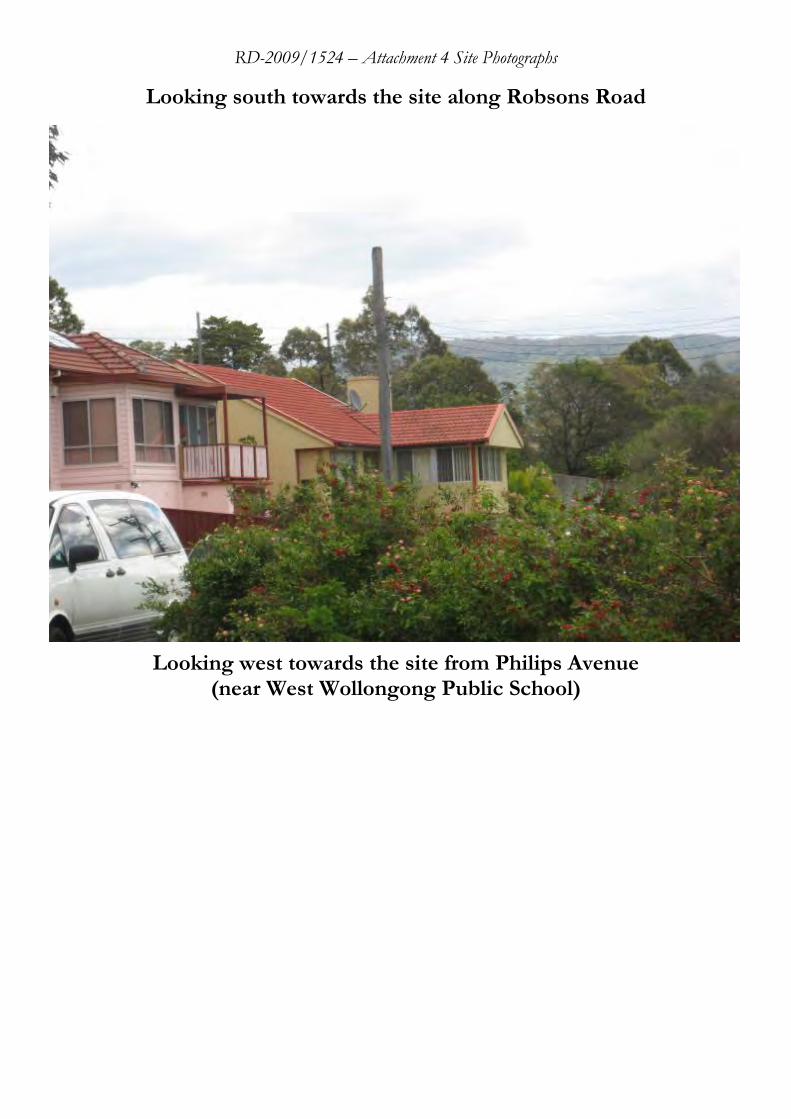
Looking south towards the site along Robsons Road
Looking west towards the site from Philips Avenue
(near West Wollongong Public School)