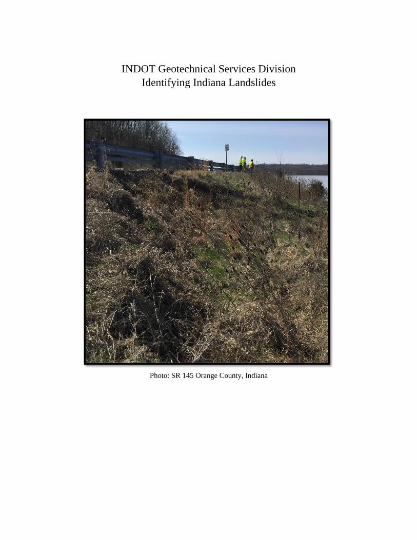
Embed Size (px)
Citation preview
INDOT Geotechnical Services Division
Identifying Indiana Landslides
Photo: SR 145 Orange County, Indiana
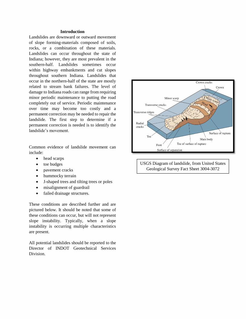
Introduction
Landslides are downward or outward movement
of slope forming-materials composed of soils,
rocks, or a combination of these materials.
Landslides can occur throughout the state of
Indiana; however, they are most prevalent in the
southern-half. Landslides sometimes occur
within highway embankments and cut slopes
throughout southern Indiana. Landslides that
occur in the northern-half of the state are mostly
related to stream bank failures. The level of
damage to Indiana roads can range from requiring
minor periodic maintenance to putting the road
completely out of service. Periodic maintenance
over time may become too costly and a
permanent correction may be needed to repair the
landslide. The first step to determine if a
permanent correction is needed is to identify the
landslide’s movement.
Common evidence of landslide movement can
include:
head scarps
toe budges
pavement cracks
hummocky terrain
J-shaped trees and tilting trees or poles
misalignment of guardrail
failed drainage structures.
These conditions are described further and are
pictured below. It should be noted that some of
these conditions can occur, but will not represent
slope instability. Typically, when a slope
instability is occurring multiple characteristics
are present.
All potential landslides should be reported to the
Director of INDOT Geotechnical Services
Division.
USGS Diagram of landslide, from United States
Geological Survey Fact Sheet 3004-3072
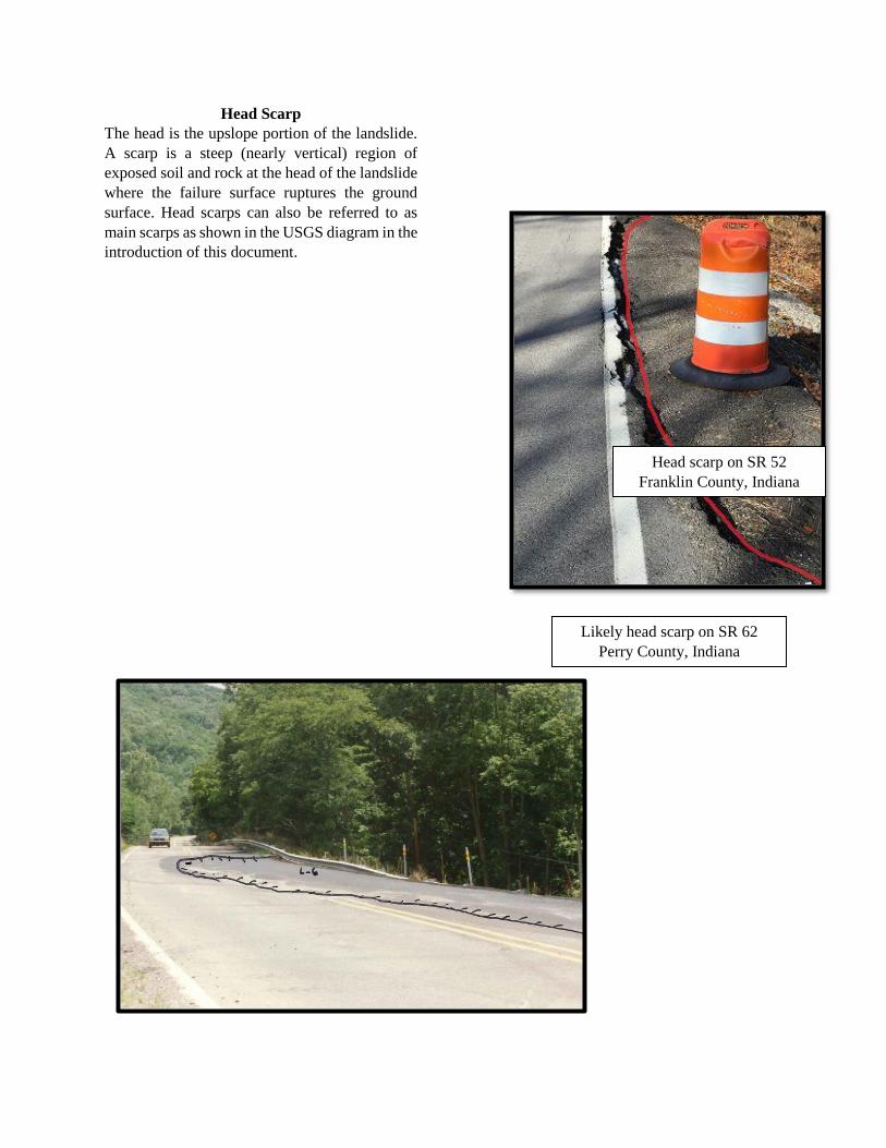
Likely head scarp on SR 62
Perry County, Indiana
Head scarp on SR 52
Franklin County, Indiana
Head Scarp
The head is the upslope portion of the landslide.
A scarp is a steep (nearly vertical) region of
exposed soil and rock at the head of the landslide
where the failure surface ruptures the ground
surface. Head scarps can also be referred to as
main scarps as shown in the USGS diagram in the
introduction of this document.
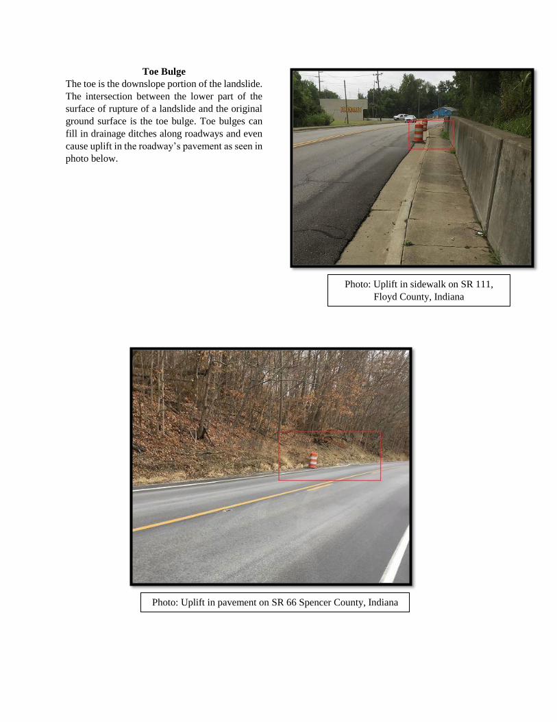
Photo: Uplift in sidewalk on SR 111,
Floyd County, Indiana
Photo: Uplift in pavement on SR 66 Spencer County, Indiana
Toe Bulge
The toe is the downslope portion of the landslide.
The intersection between the lower part of the
surface of rupture of a landslide and the original
ground surface is the toe bulge. Toe bulges can
fill in drainage ditches along roadways and even
cause uplift in the roadway’s pavement as seen in
photo below.
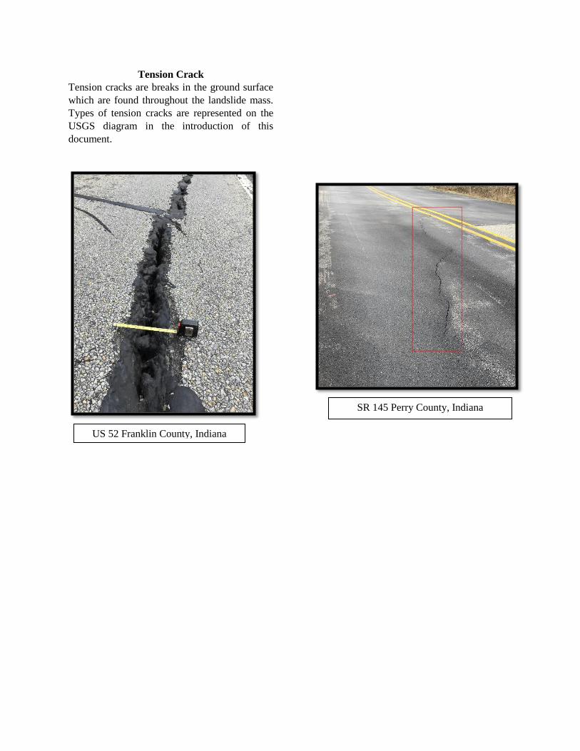
US 52 Franklin County, Indiana
SR 145 Perry County, Indiana
Tension Crack
Tension cracks are breaks in the ground surface
which are found throughout the landslide mass.
Types of tension cracks are represented on the
USGS diagram in the introduction of this
document.

Hummocky/bumpy surface near SR 64
Pike County, Indiana Uneven ground near SR 63
Vigo County, Indiana
Hummocky Terrain
Hummocky terrain is where the slope is bumpy
and uneven. Signs of hummocky terrain can
include water puddles on the slope, uneven
vegetation, grass appearing in large clumps, and
oddly-placed boulders.
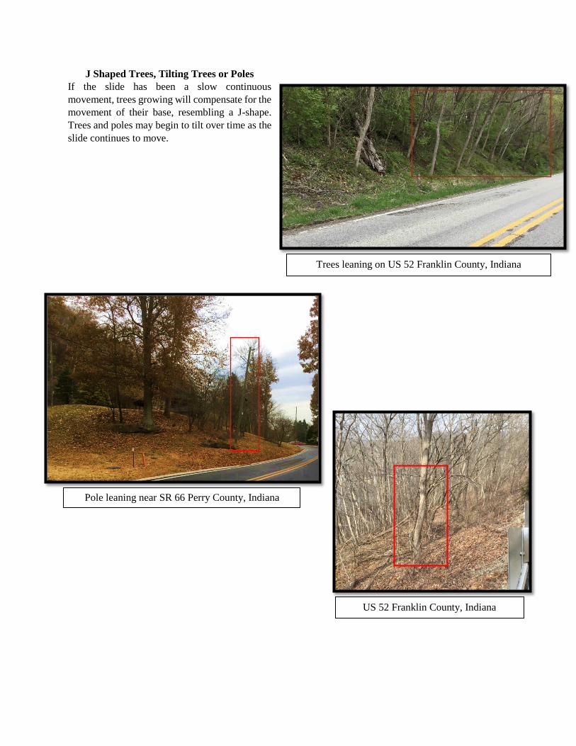
Trees leaning on US 52 Franklin County, Indiana
Pole leaning near SR 66 Perry County, Indiana
US 52 Franklin County, Indiana
J Shaped Trees, Tilting Trees or Poles
If the slide has been a slow continuous
movement, trees growing will compensate for the
movement of their base, resembling a J-shape.
Trees and poles may begin to tilt over time as the
slide continues to move.
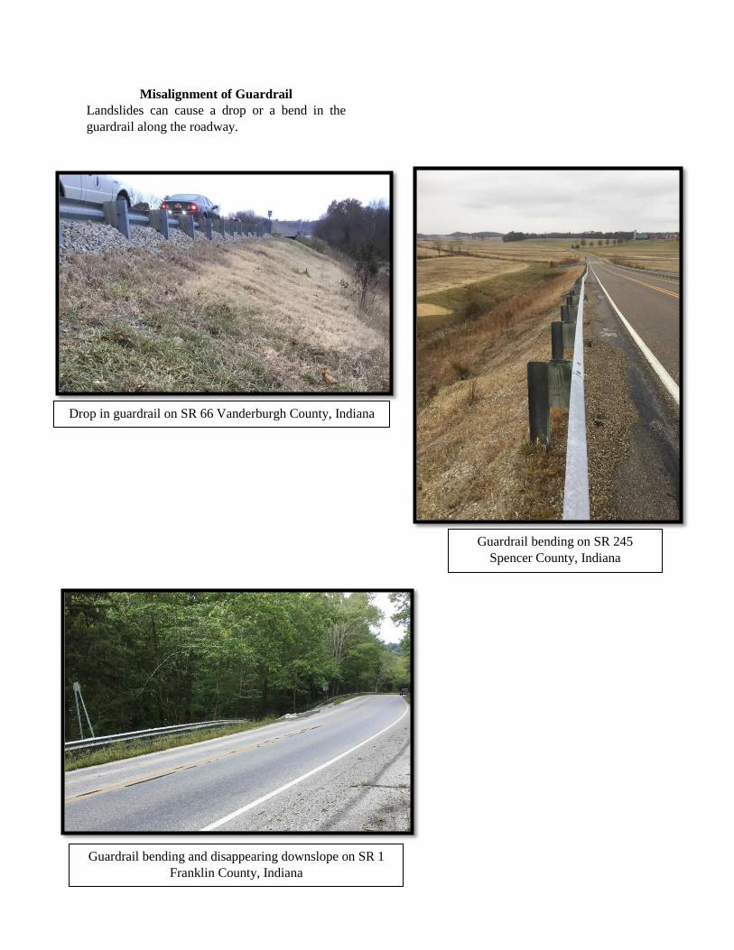
Drop in guardrail on SR 66 Vanderburgh County, Indiana
Guardrail bending and disappearing downslope on SR 1
Franklin County, Indiana
Guardrail bending on SR 245
Spencer County, Indiana
Misalignment of Guardrail
Landslides can cause a drop or a bend in the
guardrail along the roadway.
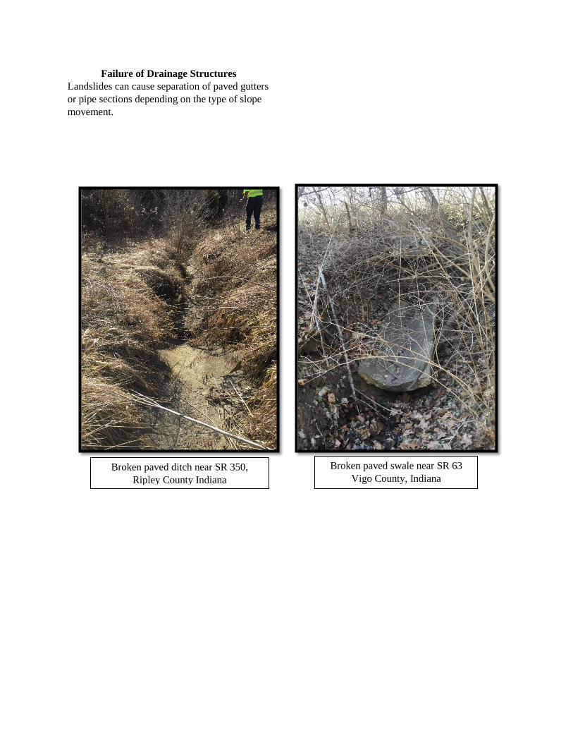
Broken paved ditch near SR 350,
Ripley County Indiana
Broken paved swale near SR 63
Vigo County, Indiana
Failure of Drainage Structures
Landslides can cause separation of paved gutters
or pipe sections depending on the type of slope
movement.
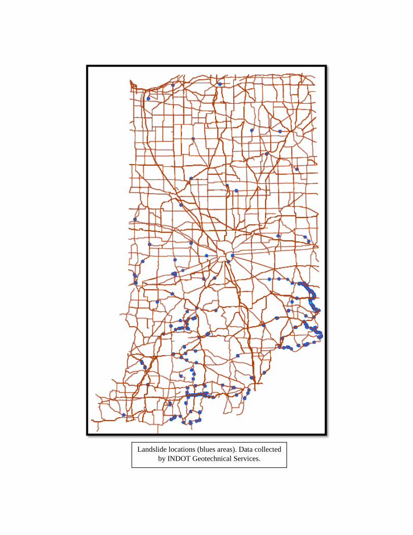
Landslide locations (blues areas). Data collected
by INDOT Geotechnical Services.