Embed Size (px)
Citation preview

Intelligent Transportation System Using GIS
By:
Dr. Praveen Kumar
Dhanunjaya Reddy
Varun Singh
Indian Institute of Technology,Roorkee

Agenda
What are Intelligent Transportation Systems (ITS)? ITS Benefits Types of ITS Implemented Objective of the Presentation What are Advanced Traveler Information Systems? ATIS Benefits Development of Package Applications of the Package Conclusions
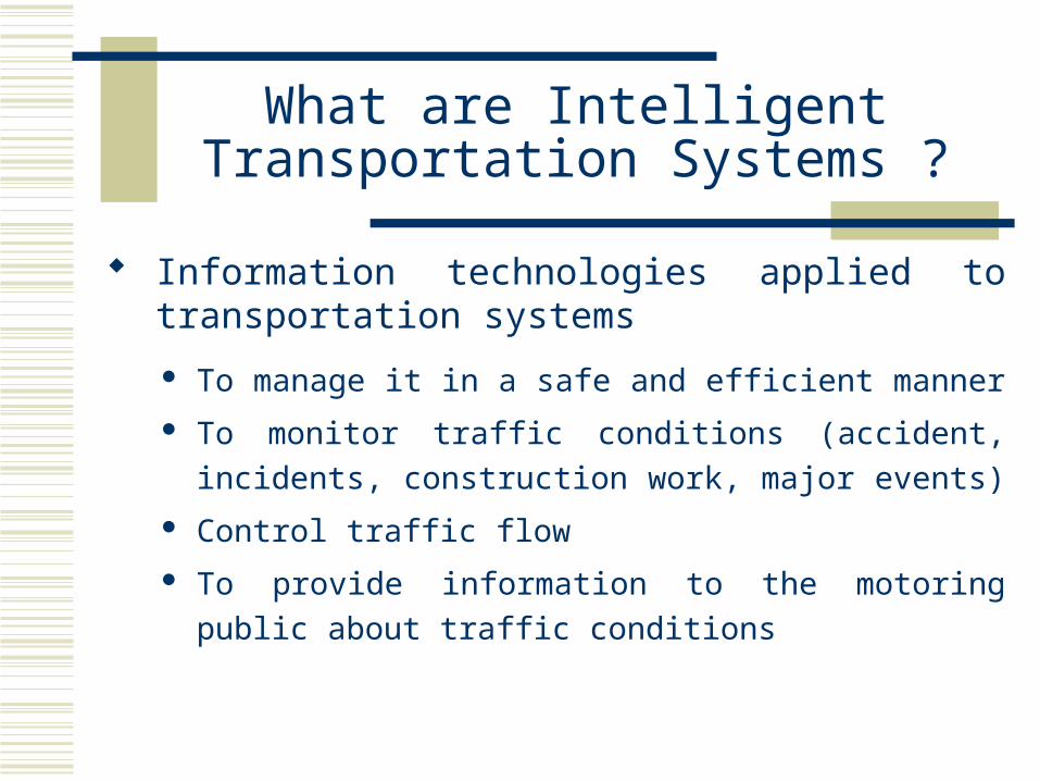
What are Intelligent Transportation Systems ?
Information technologies applied to transportation systems
To manage it in a safe and efficient manner
To monitor traffic conditions (accident, incidents,
construction work, major events)
Control traffic flow
To provide information to the motoring public about
traffic conditions

ITS Benefits
Improved safety to drivers
Improved traffic efficiency
Reduced traffic congestion
Improved environmental quality and energy efficiency
Improved economic productivity

Types of ITS implemented
• Advanced Traffic Management Systems
• Advanced Traveler Information Systems
• Advanced Vehicle Control Systems
• Electronic Toll Collection Systems
• Advanced Public Transportation Systems
• Commercial Vehicles Operations

Objective of the Presentation
Development of Advanced Traveler Information Systems for Hyderabad under GIS environment
Shortest path from origin to destination
Path to closest facility (Tourist Places, Hospitals, Govt. &
Private Offices,Stadiums, Bus & Railway Stations)
Information regarding arrival and departure timings with
services names of buses (Metro Liners, Metro Express
and Ordinary), trains and flights

What are Advanced Traveler Information Systems (ATIS)?
ATIS are type of ITS implementation, using emerging sensor, computer, communication, and information technologies in order to provide
Provides safety advisory and warning messages to the driver
Provides the information about the traffic regulation, guidance, and hazardous situations

ATIS Benefits
Reduction of travel time
Reduction of stress level
Reduction of traffic congestion
Avoidance of unsafe driving conditions

Development of Package (1)
Package for GIS based ATIS
•ArcView GIS Version 3.1 (Platform)
•Network Analyst Version 1.1b (Network Analysis)
•Avenue Programming Language (Script Language for ArcView Customization)

Development of Package (2)
Maps Collection Scanning of Maps Geo-Referencing of Scanned Maps On-line Digitization of Road Network Database Creation Software Development in ArcView GIS

Development of Package (3)
InputsFour topographical maps (NE, SE,NW & SW) Information of one-way road segmentsSpeed limits on roadsRoad namesCity bus routesTime tables of inter city bus, trains and air services

Fig.1 General View

Development of Package (4)
Data Base Creation Attribute table for the following features:
Road NetworkPlaces of tourist interestEducational institutionsHospitals and officesBus stations, railway stations and airportsLakes and rivers

Development of Package (5)
Themes FieldsRoad Network Name,One-Way,Speed Limits, Length,Drive
Time
Places of Tourist Interest
Name (Name of tourist place), Label of tourist place
Transport Name, Label ( of the transport station viz. airport , bus and railway station), Category key for local and main railway stations, bus stations and airport
Hospitals Name, label of the hospitals, Category key number for private and Govt. hospitals

Development of Package (6)
Themes FieldsEducational institutions
Name and Label of the educational institutions
Offices Name and Label of the offices

Applications of the package (1)
For viewing the area wise information of Hyderabad city
For searching features in Hyderabad For finding shortest path
With given origin and given destinationWith user given origin and given destinationWith given origin and user given destinationWith user given origin and user given
destination
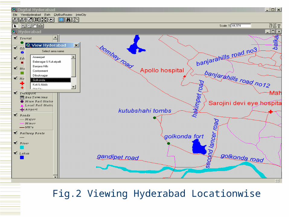
Fig.2 Viewing Hyderabad Locationwise

Fig.3 Searching for features in Hyderabad

Applications of the package (2)
For finding closest facility from any point on the road network
For site tour (for finding optimum path for given itinerary of tourist places)
Searching for city bus services,Inter city bus services, Inter city railway and Inter city airline services

Fig.4 Closest Facility Path

Fig.5 City Bus Services

Conclusions
This package is user friendly point-and-click graphical user interface
The developed package has following capabilities
• Finding shortest path based on distance and drive time
• Finding closest facility and its path based on distance and drive time
• City bus routes

Conclusions (Contd.)
The developed package has following capabilities
• Search Engine - which searches different facilities in Hyderabad City
• Provide intercity bus,train and airways information (timings, distance and service name)
• Site tour planning

Conclusions (Contd.)
The developed package can be used in the following areas
• Bus Stands
• Railway Stations
• Airports
• Tourist information centers
• In personal computers